Saving seeds, linking generations . . .

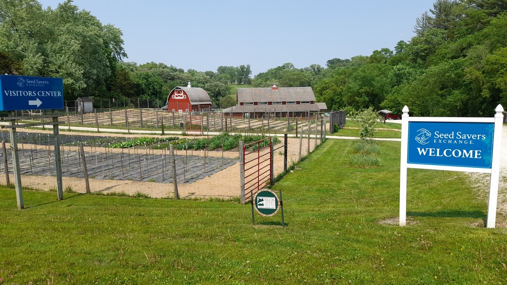
If you’ve never been to Seed Savers Exchange near Decorah in the lovely Bluff Country of northeast Iowa, then you should. Especially as it is celebrating its 50th anniversary this year.

Founded in 1975 (originally as True Seed Exchange) by Kent and Diane Ott Whealy in Missouri, Seed Savers Exchange is a tax-exempt 501(c)3 non-profit that conserves and promotes America’s culturally diverse but endangered garden and food crop heritage for future generations by collecting, growing, and sharing heirloom seeds and plants.

In this video, Diane Ott Whealy describes how it all began.

Seed Savers Exchange moved to Decorah in 1987, when the Whealys bought a parcel of land, which became Heritage Farm.

Over five decades, Seed Savers Exchange has built an impressive community (in reality a movement) of gardeners and seed stewards, sharing and swapping unique varieties you might not find anywhere else, combining in situ conservation in home gardens and ex situ in the seedbank at Decorah.

Varieties such as these (of the many thousands in the Exchange network and collection):

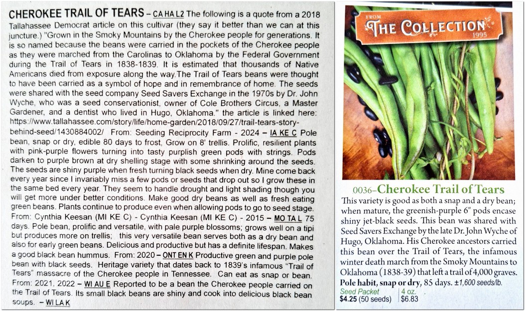
  • Cherokee Trail of Tears, a snap bean carried by the Cherokee over the Trail of Tears, the infamous death march from the Smoky Mountains to Oklahoma in 1838-39);
  • Bull Nose Bell, a sweet pepper introduced into North America in the 1700s, and grown by elder statesman and third POTUS, Thomas Jefferson, in his garden at Monticello in 1812);
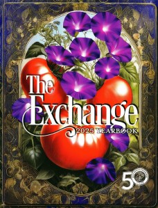
  • or the tomato variety German Pink (one of two varieties that started it all – the other being Grandpa Ott’s, a morning glory) introduced into the USA from Bavaria in the late 19th century. Both are featured on the covers of The Exchange 2025 Yearbook and The 2025 Seed Catalog.

There’s lots to see and do at Seed Savers Exchange (click on the image below – and others with a red border – to open a larger version) and visitors are encouraged to hike the trails, and explore the 890 acre farm.

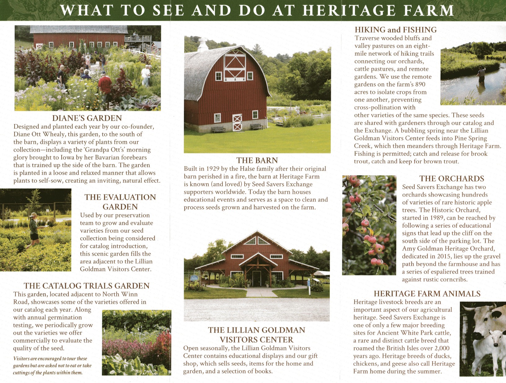
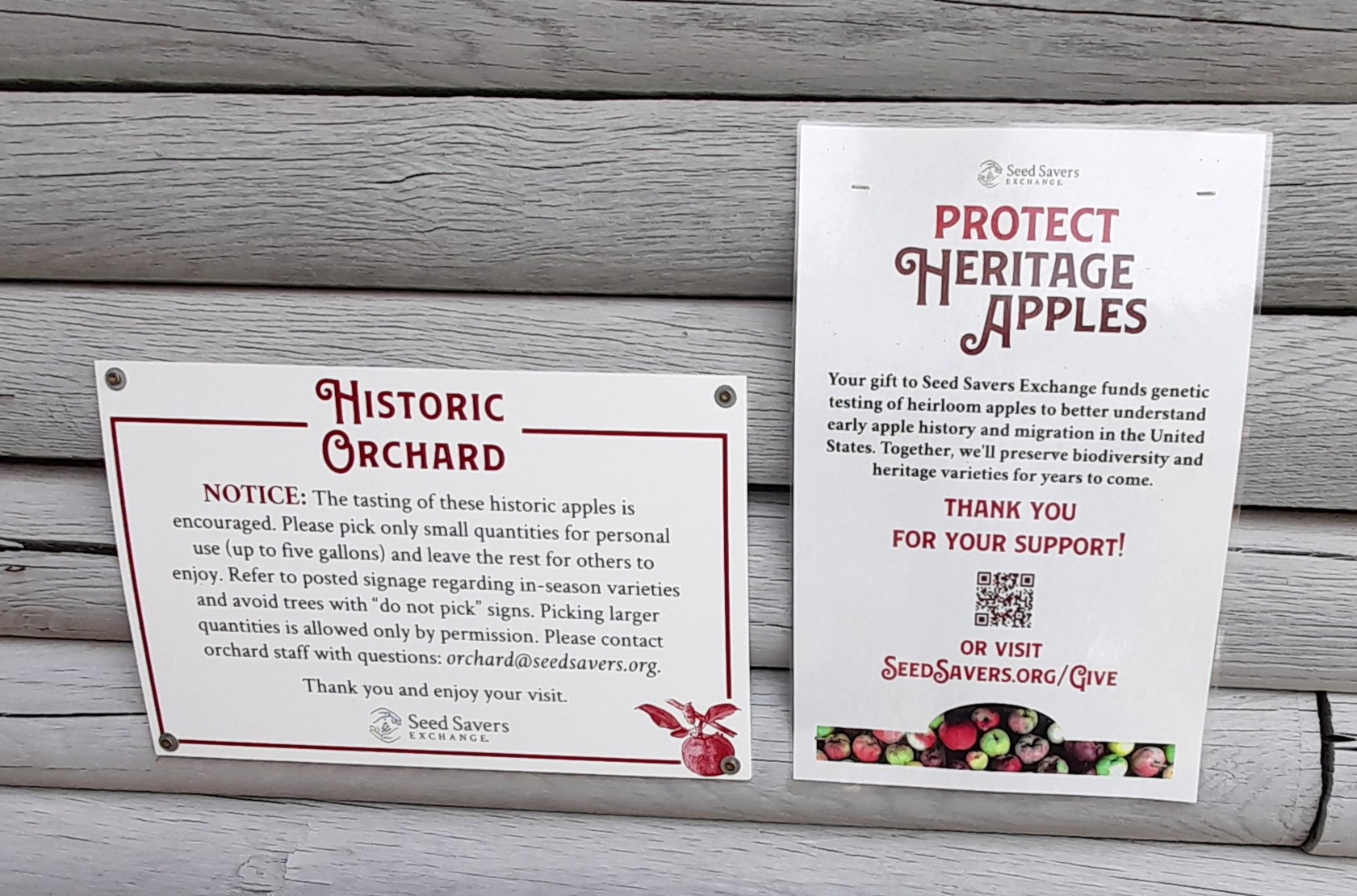
When the apples are ripe in the Historic Orchard, visitors may pick their own. Local cider producers make a beeline to harvest and collect windfalls.

But Seed Savers Exchange is not all plants. The Ancient White Park cattle were introduced into the USA from the UK during WWII as a safeguard against loss of this ancient breed. Several herds were established, two ending up in Decorah. Coincidentally, not far from where we are now living in the northeast of England, there is a completely feral (but enclosed) herd of these beautiful cattle at Chillingham.


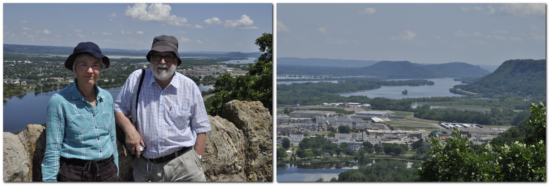
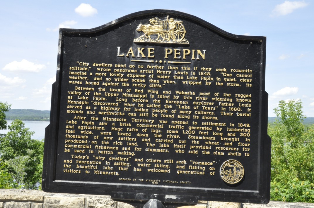
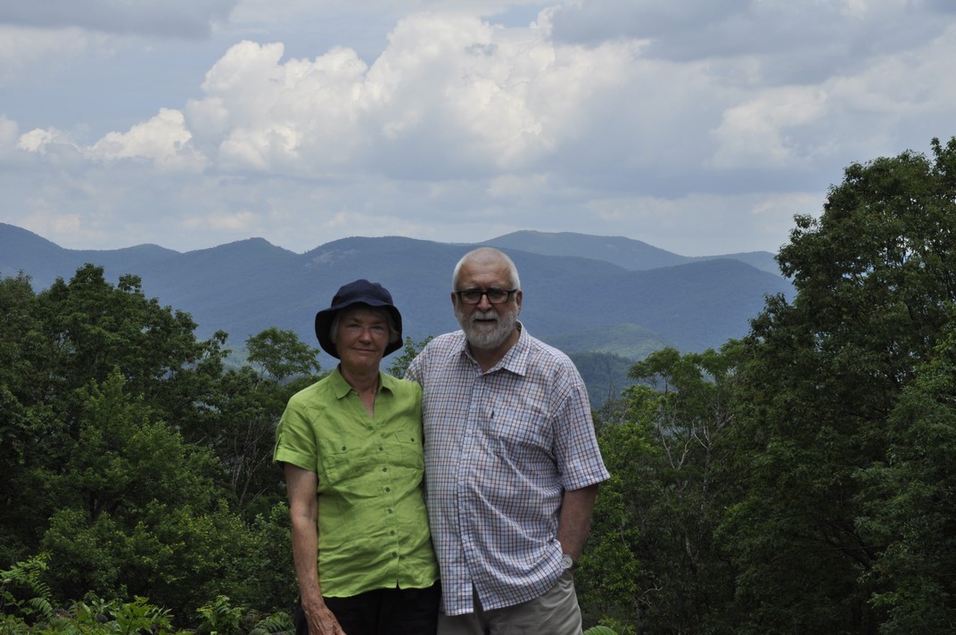
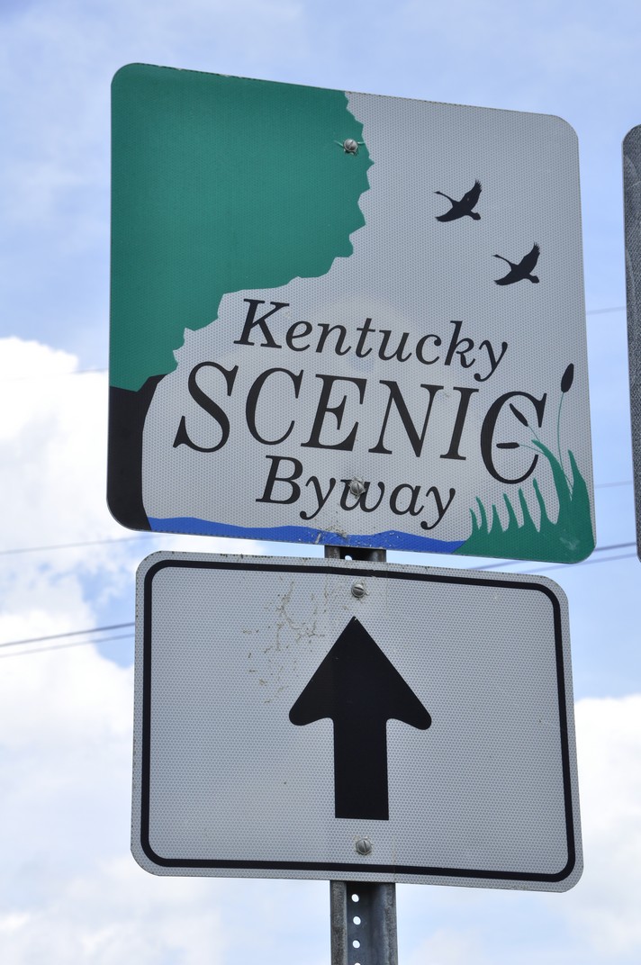
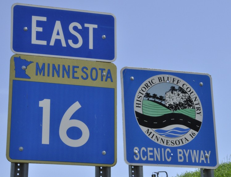
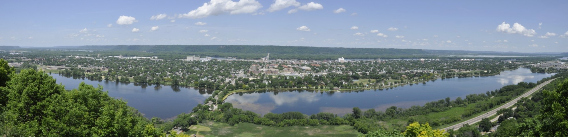
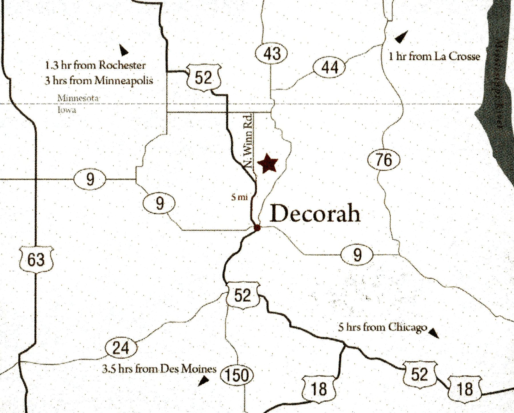
During our recent trip to the USA, Steph and I enjoyed a day-long visit to Seed Savers Exchange, staying a couple of nights in Decorah. It was an easy drive south from St Paul, MN (just under 160 miles, and about 3.5 hours on a sunny Sunday afternoon).

A visit to Seed Savers Exchange was first mooted in May 2024, but having just made a long road trip across Utah and Colorado, I really didn’t want to get behind the wheel again. However, we had no epic road trip plans this year, so I decided to contact Executive Director, Mike Bollinger (right) last February to set up a visit.

Regular readers of my blog will know that Steph and I first became part of the germplasm conservation movement in the early 1970s. I spent much of my career in international agricultural research and academia, collecting farmer varieties of potatoes across the Andes of Peru, and in the Philippines managing the world’s largest genebank for rice at the International Rice Research Institute.

So I asked Mike if we could have a ‘behind-the-scenes’ visit (not open to regular visitors), to learn about the organization in detail, and the management of such a large and diverse collection of plant species. He quickly agreed, and asked Director of Preservation, Michael Washburn (right) to set up a program for us.

In this post I’m not going to describe how Seed Savers Exchange works with its members, and how they share seeds among the community or from the seedbank. That information is available in detail on this section of its website.

Incidentally, Seed Savers Exchange also has a commercial arm (which supports its non-profit mission), selling seeds through an annual catalog of around 600 or so varieties of vegetables, herbs, and flowers, some of which come from the collection.

Michael introduced us to the preservation team (see below), and we spent time with each as well as having a very informative round table discussion where we shared our different perspectives and experiences in seed conservation.

Let me highlight some fundamental differences between managing (as I did) the rice collection at IRRI and the collection at Seed Savers Exchange.

IRRI’s collection of rice has its own complexities due to its size and the origin of the germplasm from many countries, with conservation and exchange subject to the rules of the International Treaty on Plant Genetic Resources for Food and Agriculture.

On the other hand, Seed Savers Exchange is a voluntary non-profit, operating within the USA, and not subject to the same bureaucratic constraints. However, its complexity lies with the number of species conserved (and their conservation needs), as well as catering to the needs of the many members in the Exchange network.

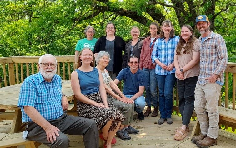
Standing (L-R): Heidi Betz (seed bank inventory technician), Maddison MacDonald (potato tissue culture lab manager), Briana Smorstad ( seed bank manager), Jamie Hanson (orchard manager), Sara Straate (seed historian), Natalie Aird (seed bank inventory coordinator), and Michael Washburn. Kneeling: Eduardo Fernandez (assistant seed historian). Seated (L-R): me, Josie Flatgrad (membership and exchange coordinator), and Steph.

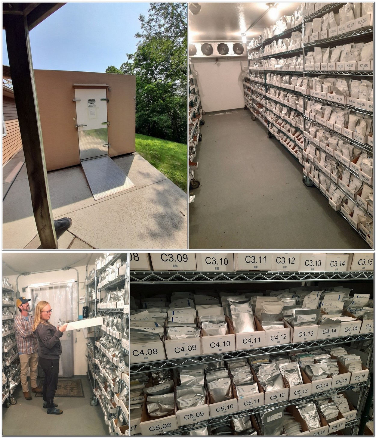
Seed bank manager Briana Smorstad explained that the Seed Savers Exchange Collection has around 20,000 accessions (although the database lists many more that are no longer available). About 6000 (about 30% of the collection) are distributable accessions.

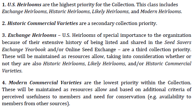
This is the scope of the collection, as defined in its 2013 Accessions Policy (updated in 2020):

As with any genebank, this one has its issues with ‘duplicate’ varieties (some with the same name but not necessarily the same variety, and others with different names) currently estimated at around 21% of the collection. Fortunately, and as we all agreed in our round table, Seed Savers Exchange does have a comprehensive database (developed in Microsoft Access) that keeps track of all the germplasm, its status, and where it actually sits in the cold stores (so can be quickly accessed). In the past year, some 4922 varieties were offered through the Exchange. However, if one of the members is listing any variety the Decorah team don’t list these for distribution.

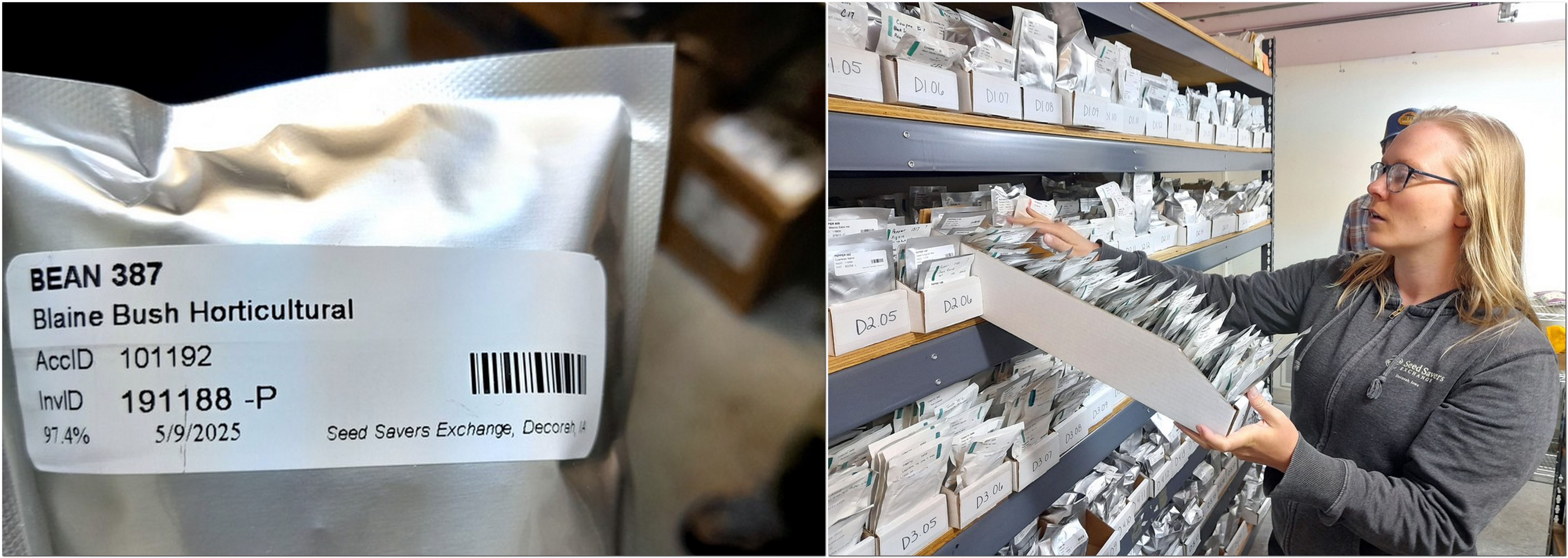
In the ‘active collection’ with seed bank manager Briana Smorstad.

Natalie Aird, the seed bank inventory coordinator (who showed us the database) handles the seed quality assessments, running routine germination tests according to well-established protocols. And these important data guide how and when seeds become available for distribution.

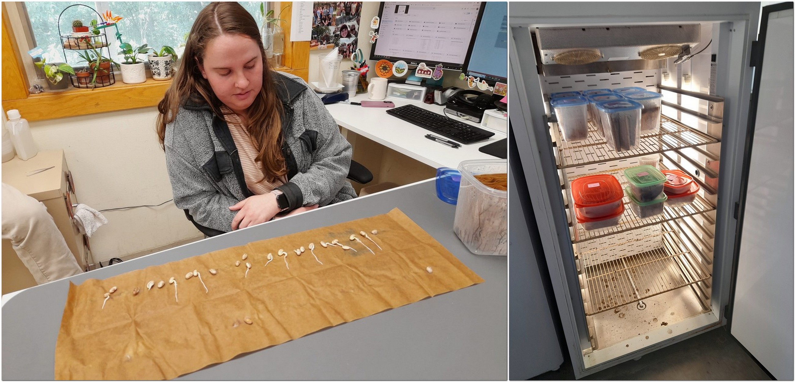
Natalie demonstrating the seed germination test for bean seeds, and the incubator for the tests.

We were especially privileged to be shown the base collection cold store (at around -18°C).

A recent initiative was launched, known as the L-to-D Project (Legacy to Distribution) which has moved 70 varieties in the collection into the Exchange.

The collection has Distributable or D varieties with sufficient seeds to meet regular requests through the Exchange. To have enough seeds means regeneration and multiplication on the Heritage Farm, which is time-, space, and labor-intensive. However, a whole series of seed packets or Legacy (L) accessions were identified in the collection, which were tested for quality and germination, and if reaching the desired standard were moved on to the D list, as was the case with the 70 varieties mentioned above. The project is described in more detail here.

And to safeguard the collection decades into the future, Seed Savers Exchange has sent seeds to the Svalbard Global Seed Vault every year since the vault was first opened in 2008. Here’s a brief report from a Crop Trust news article in early June.

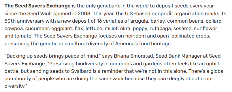
Here are the seedbank team (L-R, Natalie, Heidi, and Briana) preparing to send seeds to Svalbard earlier this year.

Seed Savers Exchange faces particular challenges with two components of its collection, namely the potato varieties, and the apple trees in the Heritage Orchard, which are maintained vegetatively.

In the case of potatoes, curated by Maddison MacDonald, there are 18 US heirloom varieties, 72 historic heirloom varieties, 10 exchange heirlooms. But the number of accessions is much higher. All maintained a virus-free tissue cultures. Potato varieties are distributed as tissue cultures, illustrated below.

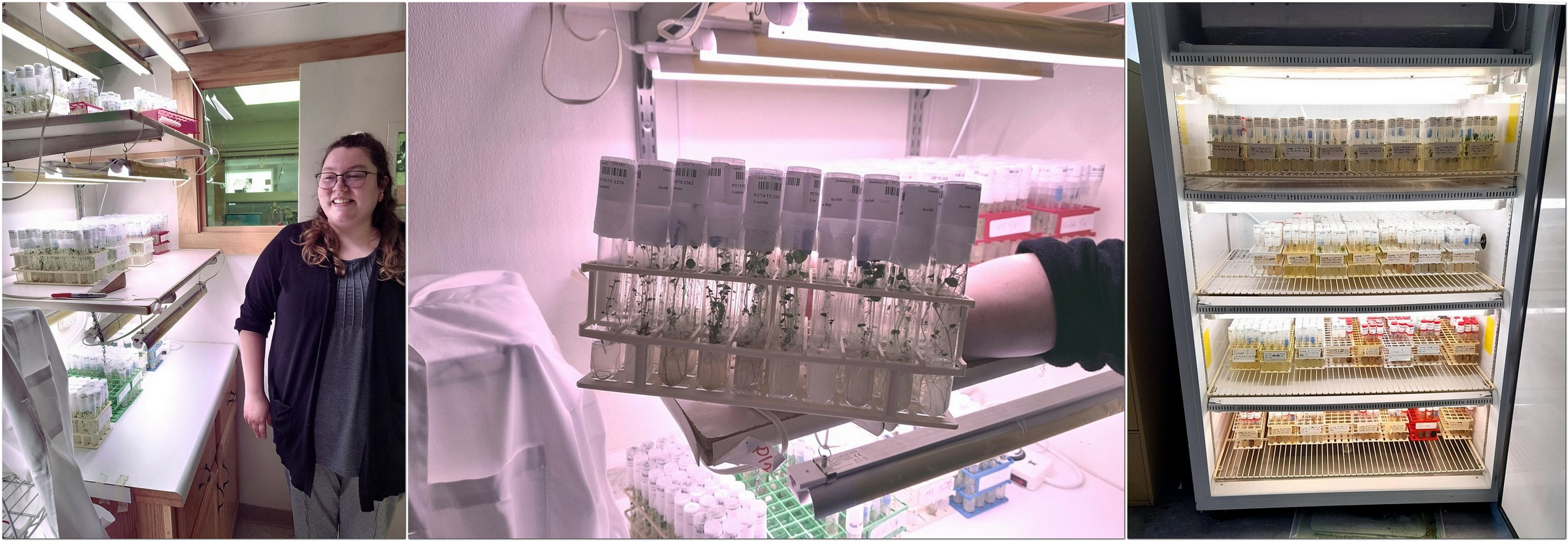
One of the collection advisers (and former head of the genebank at the International Potato Center) Dr David Ellis has identified a group of 53 varieties (a core, so-to-speak) that represent the genetic diversity of the whole potato collection. But there is almost no overlap with the heirloom varieties mentioned earlier. The heirloom varieties meet the strict acquisition criteria for the collection and therefore have the highest priority. Managing a smaller number of priority varieties would permit greater focus on those. And, quite independently from David Ellis, I did suggest that Maddison should consider converting many of the other varieties to true potato seed, and in this way conserving the genetic diversity of the collection if not the individual clones.

The collection has an apple orchard with 1042 trees, consisting of 337 unique named varieties, managed by Jamie Hanson (below) and an assistant.

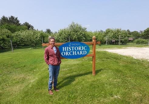
But there are duplicate trees, and these have been identified by DNA fingerprinting through Washington State University’s MyFruitTree initiative (at a cost of just $50 per sample). For example, fingerprinting has identified seven Bethel trees in the orchard, which will permit, in the future, removal of duplicate trees as part of orchard management. Jamie also curates a legacy grape breeding collection from the University of Minnesota.

I was particularly impressed by the outreach program involved in distributing apple varieties, whereby online tuition in grafting is given and the necessary tools also sent with the rootstocks and scions.

Besides conserving the seeds and vegetatively-propagated species at Seed Savers Exchange, there is also coordination of the membership and Exchange (the gardener-to-gardener seed swap) a role that falls to Josie Flatgrad (right).

Each year the Yearbook is published, a comprehensive tome of 474 pages! What a treasure trove of germplasm detail.

It has all the listings of varieties (this link explains how to read the listings) available from members, Seed Savers Exchange, details of the person offering seeds (some of whom have been listing seeds for more than 30 years), as well as a description of each variety. And to illustrate, here is the listing for Cherokee Trail of Tears (and also its catalog description) offered by members in California, Missouri, Oklahoma, Wisconsin, and Ontario.

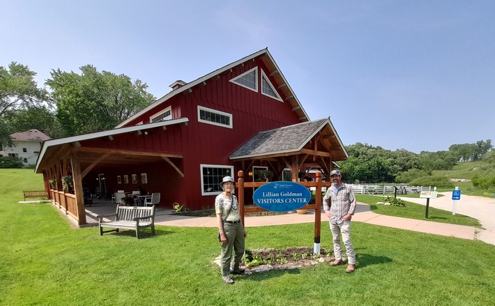
Following a lively round-table discussion with everyone who we met, Steph and I toured the Lillian Goldman Visitors Center (named after the philanthropist whose daughter Amy Goldman Fowler is a Special Advisor to Seed Savers Exchange Board of Directors), and the Iowa heritage barn (beside which Grandpa Ott’s morning glory were just beginning to climb), and the lovely garden in front that Diane Ott Whealy designed and looks after.

We are extremely grateful to Mike Bollinger and the whole Seed Savers Exchange team for their hospitality, their collegiality, and open discussions. We thoroughly enjoyed our six hours at Seed Savers Exchange, and hope to visit again in the future. And even though I spent most of my career in genetic conservation and use, I learned much that was new to me on this visit. It was an experience I shall cherish.

But let me finish this post by pointing you to this page on the Seed Savers Exchange website where there are numerous stories about a range of heirloom varieties and some of the stewards who make conservation of these varieties possible.

Inspirational indeed!


Ten days, eleven states (6): The mighty Mississippi, or is it?

It’s not even the longest river, as such, in North America. From its source at Lake Itasca in northern Minnesota (that we visited in 2016) until the Gulf of Mexico, the Mississippi is 2320 miles long.

The Missouri, on the other hand, which joins the Mississippi near St Louis, MO, flows eastwards for 2341 miles from its source high in the Rockies of western Montana before it reaches that confluence.

One of the other main tributaries of the Mississippi is the Ohio River, at a mere 981 miles, yet its flow is much greater than the Mississippi, and at its deepest point, near Louisville, KY, it is over 130 feet deep. That’s some river! The Mississippi and its tributaries drain almost half the land mass of the the United States.

The Ohio joins the Mississippi at the southernmost point of Illinois, Fort Defiance, just south of Cairo, an almost abandoned town that looks like it has suffered one flooding event too many over the years.

Cairo was, apparently, the prototype for Charles Dickens’ ‘City of Eden’ in his novel Martin Chuzzlewit (which I read recently as part of my 2017 Charles Dickens challenge) published serially between 1842 and 1844. Dickens visited the USA in 1842. He was not impressed with Cairo; neither were we.

We left Cave City, KY just before noon on the Wednesday (Day 8 of our road trip), heading to Troy, IL, and then to follow the Mississippi north through Missouri, Iowa, and southern Minnesota to St Paul. This is our route from Cave City to Iowa City.

Before reaching Fort Defiance, we had already crossed the Tennessee River, which joins the Ohio River near Paducah, KY. Just before Paducah, we turned west and reached the banks of the Mississippi at Wickliffe, just down river from the confluence.

There are two impressive bridges crossing the Ohio and Mississippi. Seeing the enormity of these constructions makes you really wonder at how much an obstacle these rivers were during the westward expansion of the settlers in the 18th and 19th centuries. Today the Mississippi alone boasts more than 130 bridges along its length.

The Cairo Ohio River bridge on the left (5863 feet) and the Cairo Mississippi River Bridge on the right (5175 feet)

Explorers Meriwether Lewis and William Clark camped here in 1803, and it was a strategic location during the Civil War, for obvious reasons commanding the approaches upriver to both the Ohio and Mississippi.

River selfies! We are standing at the tip of Fort Defiance, the southernmost tip of Illinois. Top: the Ohio River, with Kentucky on the far bank. Middle: the confluence of the the Ohio and Mississippi, looking south, with Kentucky on the left bank, and Missouri on the right. Bottom: the Mississippi River, with Missouri on the far bank over the Cairo Mississippi Road Bridge.

Leaving Fort Defiance, we headed north along the Mississippi, on IL3 until Red Bud, when we headed north and skirted around St Louis to the northeast to reach our next stop at Troy, IL.

The following day, the penultimate one of the trip, took us from Troy all the way north to Iowa City, mostly along the banks of the Mississippi. I can’t deny I faced the 43 miles from our hotel on I-270/70 around the north of St Louis with some trepidation. Although it wasn’t quite as busy as I had feared, there was some careful navigation and changing lanes constantly to ensure we headed out in the right direction. Eventually we reached our exit and headed north on MO79, having crossed the Mississippi to cross into Missouri, and then the Missouri River.

Just over 40 miles north from where we left I-70, the road ran parallel to the Mississippi, and just a few meters away. Having been on the road for a couple of hours, and looking for the inevitable comfort break, we stopped in the small community of Clarksville. There’s a lock and a dam at this point on the Mississippi, and just at that moment a large grain barge (probably empty) was moving through on its way north.

Clarksville has been flooded many times, and some of the riverside properties looked as though they wouldn’t be able to sustain yet another one.

At Louisiana, MO (about 36 miles north of Clarksville) we stopped to view the Champ Clark Bridge from a high vantage point. Built in 1928, this bridge no longer has the capacity for the traffic on US54. By the end of 2019 a new and wider bridge will be in place.

In southern Iowa, north of Montrose, we were reminded once again of the great migration westwards, of pioneers seeking a better life, in this case Mormons heading to Utah. In 1846, Mormons were hounded out of Illinois just across the river, at Nauvoo. The river is well over 1 mile wide here.

A bystander told us that the white building on the opposite bank in Illinois was a Mormon temple, now abandoned.

We turned inland at Muscatine, IA to spend our last night at Coralville, a suburb of Iowa City.

The following morning, we continued our route north across Iowa: flat, rather boring landscape, and mile upon mile of maize. Once we crossed into Minnesota, we turned northeast to Winona and the Mississippi once again. To the west of the town, there is access to Garvin Heights Lookout, some 500 feet above the river. What a view, north and south!

In this stretch of the river, it forms a series of wide lakes. North of Winona, we stopped briefly to view Lake Pepin.

Then it was time to push on, and complete the final 63 miles of our epic road trip via Red Wing and Hastings, MN. Leaving the Mississippi at Hastings and pushing westwards to wards St Paul, we finally arrived at the home of our elder daughter Hannah and her family alongside the Mississippi in the Highland area. The final three days were certainly a Mississippi adventure, although I never aspired to be a latter-day Huckleberry Finn.

The video below covers the final three days of our trip from Fort Defiance to the Twin Cities.


Ten days, eleven states (1): Almost 2800 miles from Georgia to Minnesota

Yes. That’s right. Eleven states in just ten days.

2764 miles to be precise. Ninety-four gallons of gasoline consumed. Almost 30 mpg at just USD209. That’s not bad considering we rented a Jeep Patriot SUV (with a Connecticut licence plate!).

I’d opted for a car rental through Rentalcars.com and chose Alamo as the best deal. Just USD357 for the actual rental, USD250 for the one way drop-off fee, and USD98 for roadside assistance cover and various taxes.

I had planned our route meticulously, taking in various sites and landscape features I thought would be interesting, and avoiding as much as possible any of the interstate highways. I bought Rand McNally road maps for all states except Virginia and Minnesota (we already had a DeLorme Atlas & Gazetteer for MN). I checked precise US and State Routes using Google maps since the scale of the Rand McNally didn’t always show the road name. I even used Google Streetview to check the various intersections, and before we traveled I already had an image in my mind of the entire route.

I prepared daily detailed route plans on cards, which Steph used to navigate us across country from Atlanta to Minnesota, with each map marked at decision points corresponding to the route card details (you can just make out a series of circles on the map below).

Fortunately, US roads are very well signposted and road signs (e.g. US61 or GA23, for example) are posted every few miles. It was hard to go wrong, but we did on three occasions; nothing major, however. My first mistake was leaving the car rental center at Atlanta Hartsfield-Jackson International Airport. I turned on to I-85N instead of I-85S, but was able to turn around within a mile. On two other occasions we made a turn too early, but realised almost immediately. Not bad really for such a long road trip. Nor did we encounter any road works that held us up, or any road accidents. We almost never saw a police car.

These four map links show the actual route we took over the ten days:

Atlanta – Savannah, GA – Greenwood, SC – Blairsville, GA
31 May – 3 June
Blairsville, GA – Cave City, KY
4 – 6 June
Cave City – Iowa City, IA
7 – 8 June
Iowa City – St Paul, MN
9 June

We stayed in ‘chain’ hotels like Best Western, Comfort Inn, Quality Inn and the like, about USD100 or so a night. In Savannah we stayed at The Planters Inn on Reynolds Square, close to the river and other historic attractions, and this was our most expensive at around USD230 including taxes and valet parking. Breakfast (if you can call it that) was provided in each hotel. For lunch, eaten by the roadside or at a scenic viewpoint, we picked up a freshly-made sandwich and with some fruit from the hotel, we had enough to keep us going until a substantial dinner in the evening. Surprisingly, we ate Mexican on three nights and had very good meals. There was even beer! Twice we ate at the nearby Cracker Barrel Old Country Store – reasonable food but no beer. Walking into our second Cracker Barrel in Troy, IL it was déjà vu; the layout of the restaurant and the store was identical to the one we patronised in Johnson City, TN.

Anyway, here is a summary of our epic road trip.

31 May, Atlanta, GA – Macon, GA, 82 miles
Our flight (DL73) from Amsterdam landed on time just after 14:15, and despite arriving at an E pier and having to walk the considerable distance over to the new F International Terminal for immigration and customs, then taking a 15 minute shuttle to the new car rentals center beyond the airport perimeter, we were on the road not long after 16:00. We were headed to Macon on I-75, some 82 miles southeast of Atlanta towards Savannah to spend our first night, and recover—to the extent possible—from our long day of travel from Birmingham (BHX), arriving to our hotel (Best Western on Riverside Drive) just around 18:00

Just arrived at Best Western in Macon

We had the room on the right of the balcony, overlooking Reynolds Square

1 June, Macon – Savannah, GA, 167 miles
Since we had only a relatively short journey to reach Savannah, and because I wanted us to get a good rest before setting off once again, we didn’t leave Macon until after 09:00. Our hotel in Savannah (Planter’s Inn on Reynolds Square) had contacted me that morning by SMS asking what time we expected to arrive and hoping to have a room ready then. Not only was our room ready at just after 11:00, but we’d been upgraded to a balcony room. Once we had settled in, we set off on a leisurely stroll around the historic riverside where the old cotton warehouses have been converted to restaurants and other retail outlets, as well as apartments.

Savannah oozes history (and Spanish moss) – a direct line of historical events from the early 18th century, when it was founded, through Colonial times, and the turmoil of the Revolutionary and Civil Wars.

2 June, Savannah – Greenwood, SC, 196 miles
We spent the morning in Savannah absorbing the Colonial, Revolutionary and Civil Wars history of this beautiful city. The weather didn’t look promising, with thunderstorms forecast, so we left the hotel by 07:30 and wandered through the various squares, parks and colonial streets for three hours, with just a small shower to bother us. After freshening up at the hotel and checking out, we were on the road again by 11:30, headed for Greenwood in the northwest of South Carolina.

The US17 route out of Savannah crosses the Savannah River over the fine-looking Talmadge Memorial Bridge, completed in 1991, 185 feet above the water.

We passed through a heavy rainstorm for the first 20 miles or so, but the weather brightened, and we stopped for a bite to eat beside the road in glorious sunshine. The road north was almost completely straight passing through small towns with names like Denmark, Sweden and Norway. There wasn’t much evidence of much agriculture, just some maize on this coastal plain with rather sandy soils. Communities seemed quite impoverished (according to the 2010 census it is the 7th poorest state). Nevertheless, the Southern Baptist (and some Presbyterian) churches and chapels stood in stark contrast. I’ve never seen so many places of worship so close together. There must be a lot of wicked souls need saving in South Carolina (and surrounding states) to require so many churches, often within just a few hundred yards of each other (or closer).

We were in Greenwood by 17:00, found our hotel, the Hampton Inn, and enjoyed steak and seafood meals at the Red Lobster outlet beside the hotel.

3 June, Greenwood – Blairsville, GA, 195 miles
Distance-wise this was never going to be one of the longest days, but I had planned our route climbing into the Appalachians through the Chatterhoochee National Forest on US60, a winding road among the trees.

We departed from Greenwood around 08:00 and made our first stop at the SC-GA state line to look over the Savannah River at Calhoun Falls. We had another stop at Cleveland, GA to tour the historic courthouse museum, and arrived in Blairsville by about 15:00.

Not wanting to go straight to our hotel, the Comfort Inn, so early in the day, we opted for a 55 mile round trip taking in some of the hills and forest to the north and east of Blairsville, arriving to Brasstown Bald, the highest point in Georgia at 4500 feet, around 16:30 just in time to take the last shuttle bus to the summit, and down again. I decided not to walk the 1 mile descent from the summit to the car park because the average gradient was more than 14%, and Steph and I were concerned that I might hurt my right leg, which is still giving me some grief 18 months after I broke it.

4 June, Blairsville – Johnson City, TN 282 miles
This was our opportunity of really traveling through the Appalachians. I’d chosen to travel east along the Cherohala Skyway in North Carolina. We had expected some poor weather this day, so set off as early as we could get away in order to enjoy the early morning brightness. The Cherohala offers some spectacular views along the way, and we were not disappointed at all.

Looking south from the Cherohala Skyway over North Carolina

But the further east we went, the more cloudy it became, and by the time we reached US441 to cross the Great Smoky Mountains National Park, it was raining quite hard and we didn’t really see very much at all. We took the side route of about seven miles to Clingman’s Dome, the highest point over 6600 feet. Couldn’t see a thing! But lower down on the north side, the weather improved and we did see something of the Smoky Mountains.

We then dropped down to Gatlinburg in Tennessee. If you’ve ever harbored the desire to visit Gatlinburg – don’t. What a tourist disaster! A narrow highway through the center of the town, tackiest tourist souvenir stores lining both sides, and even though this was early in the tourist season, there were throngs of people about. I’m glad we were only passing through. Then it was on to our hotel on the outskirts of Johnson City.

5 June, Johnson City – Charleston, WV, 380 miles
The focus early in the day was the Cumberland Gap, northwest of Johnson City by about 80 miles or so. Not long after leaving Johnson City, along US11, we passed through one of the heaviest rain storms I’ve ever experienced. I could hardly see in front of the car. But by the time we reached Cumberland Gap, the clouds had lifted somewhat, and the sun appeared.

The ‘Cumberland Gap’ is familiar to me from my skiffle days, as sung by Lonnie Donegan.

We went up to the Pinnacle Overlook, hoping to see the views over Tennessee, Virginia, and Kentucky – even as far as North Carolina on a good day. It was only a case of ‘now you see it, now you don’t’ as the clouds came rolling in, then dispersed. As a major pass through the Appalachians, the Cumberland Gap was strategically important for both the Union and Confederacy during the Civil War of the 1860s, and changed sides every so often. There is still evidence of military occupation high on the Overlook.

Looking north into Kentucky and the town of Middlesboro. The highway has just emerged from the tunnel through the Gap.

Then later in the day, heading east towards Charleston, the capital of West Virginia, we traveled along The Trail of the Lonesome Pine in Virginia. Until I was planning this trip, I wasn’t even aware that the Trail was a real entity, not after I’d heard Laurel and Hardy singing about it.

6 June, Charleston – Cave City, KY, 371 miles
Our destination this day was Cave City in central Kentucky where we planned to visit the Mammoth Cave National Park the following day. Heading west out of Charleston on I-64, we turned south at Morehead in Kentucky (about 110 miles west) to head south through the Daniel Boone National Forest.

We traveled some 125 miles along scenic highways and byways. Then we turned west on the Cumberland Parkway west of Somerset, KY for the rest of the day’s trip to make up some time and so as not to arrive to our hotel too late. However, Kentucky is divided into two time zones, so we gained an hour (from Eastern to Central Time) about 80 miles east of Cave City.

7 June, Cave City – Troy, IL, 367 miles
The Mammoth Cave National Park opened at 08:00, and we were at the Visitor Center not long afterwards. I had booked a tour of the Frozen Niagara cave some months back, at 09:20. This was a guided tour, the first of the day, and to a cave that was easily accessible. I didn’t want to contend with scrambling over rocks with my leg. In any case we planned to stay at the Park only until late morning as we still had the whole day’s trip of over 350 miles to make.

We enjoyed the cave, along with a group of fewer than 30 others. The caves are kept closed and it’s generally not possible to visit them alone. What amazed us is that the cave system, at over 440 mapped miles is the largest system in the world. The Park gets very busy during school holidays, and we were fortunate to have visited when we did.

Our next port of call was Fort Defiance at the confluence of the Ohio and Mississippi Rivers, and the southernmost point of Illinois. Most impressive.

Then we followed the Mississippi north towards St Louis and our hotel in Troy just northeast of the city, catching a glimpse of the famous Gateway Arch as we skirted the city center on the Illinois side of the river.

8 June, Troy – Iowa City, IA, 332 miles
Our plan was to follow the Mississippi north through Missouri into Iowa. Heading west around the north of St Louis we crossed both the Mississippi and Missouri Rivers close to their confluence. Heading north on MO79, we stopped at Clarksville to stretch our legs, and look at the dam and lock, where a very large combination of barges was being ferried northwards slowly against the current.

Further north we stopped also at Louisiana, MO to view the Champ Clark Bridge that connects MO and IL, from a vantage point high above the river.

Then it was on to our next, and last, overnight stop in Iowa City.

9 June, Iowa City – St Paul, MN, 333 miles
Our last day on the road, heading north on very straight roads, before crossing into southern Minnesota and crossing the Bluff Country eastwards to reach Winona on the Mississippi.

Just south of the Iowa-Minnesota state line we passed through Cresco, IA which proudly advertises itself as the birthplace of Dr Norman Borlaug, father of the Green Revolution in wheat and Nobel Peace Prize Laureate in 1970, who I had the honour of meeting when I worked at IRRI.

In Winona, we took a short diversion to a scenic overlook about 500 feet above the river valley and had a spectacular view north and south.

Then we set off with added determination to arrive to Hannah and Michael’s in the Highland Park area of St Paul by late afternoon, and the end of our enjoyable 2017 road trip adventure.

Here are the individual blog posts about the various places we visited: