The importance of being Ernest

Ernest Marples

Ernest who? Ernest Marples. Minister of Transport in the Harold Macmillan and Alec Douglas-Home Conservative governments between October 1959 and October 1964.

As Minister of Transport he introduced parking meters, the provisional driving licence, the MOT test, yellow parking lines, and traffic wardens. He also oversaw an expansion of the road network and the opening, in November 1959, of the first section (53½ miles) of the M1 motorway, between Luton and Crick (although it had been inaugurated a year earlier).

The M1 was not the country’s first motorway, however. That honor is given to an 8¼ mile section of the Preston by-pass, opened in November 1958, and which became part of the M6 motorway.

I remember the first time my father took us on the recently-opened first section of the M1. It must have been around 1960. What an experience on such wide carriageways, and very little traffic. That’s hardly the case today. More like Chris Rea’s The Road to Hell, released in 1989, supposedly about the London Orbital Motorway, the M25, although, to be fair, it could be about any of our motorways.

So much congestion, lines of juggernauts traveling nose-to-tail. I never relish having to take one of the motorways for my journeys, but they are a necessity. Many motorways were constructed with three lanes in each direction, but some like the M5 (opened in 1962 and connecting the West Midlands with the southwest of England) had only two for much of its length, but later widened to three.

From those humble beginnings more than 60 years ago, the motorway network in Great Britain (not including Northern Ireland) now extends over 2300 miles (out of a total of 247,500 total road miles). Another 29,500 miles are A roads, major routes connecting cities, but only about 18% are what we in the UK call dual carriageways (divided highways in the US).

Originally there was no speed limit on the motorways. In December 1965 a temporary speed limit of 70 mph was introduced and made permanent in 1967. That remains in force today on motorways and dual carriageways, with 60 mph the limit on other A and B roads. The limit in urban areas is generally 30 (maybe 20) mph.

But if you want to really explore the countryside, as Steph and I like to do, then you have to get off the main routes and take the B roads, as you can see in this video, which I made recently as we crossed Northumberland (in the northeast of England). In any case, for me it’s never about the trip itself but the many interesting places and sights along the way.

I passed my driving test (at the second attempt) in May 1966, six months after my 17th birthday, the earliest age when one can apply for a driving licence here in the UK. I got to drive my father’s car from time to time, but while away at university between 1967 and 1972 I didn’t have much opportunity to drive, until I had my own car (in October 1971), a rather battered Ford Anglia. In September 1972 I bought a new left-hand drive Volkswagen Variant to export to Peru, where I moved in January 1973.

Between 1973 and 1981 we lived in Peru and Costa Rica (in Central America), and from 1991 spent almost 19 years in the Philippines (from where we traveled to and down the east coast of Australia). We also made two road trips around Ireland in the 1990s while on home leave from the Philippines. Our road trip experiences were very different.

Since retiring in 2010, however, Steph and I have enjoyed several road trips around the UK. taking in Scotland in 2015, Northern Ireland in 2017, Cornwall in 2018, and Sussex and Kent in 2019.

And, since 2010, we have (until the Covid pandemic struck) visited the USA every year and made some epic road trips that are described briefly later on.


Touring Peru
A couple of months after I arrived in Peru, the ship carrying my Volkswagen finally docked at Callao, the port for Lima. It was just the right sort of vehicle for the rugged roads that Steph and I traveled exploring that fascinating country. Solid suspension (although I did add heavy-duty shock absorbers) and an air-cooled engine.

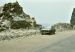
Almost five decades ago, there were few paved roads in Peru, the main one being the Panamerican Highway stretching the whole length of the country, just a single carriageway in each direction. And the Carretera Central from the coast to the central Andes at Huancayo, crossing the high pass at Ticlio on the way.

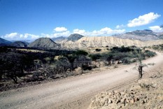
Most elsewhere, apart from in the towns and cities, the roads were unpaved. And through the Andes, these roads followed the contours of the valleys. Often you could see your destination in the valley below, but know there would be many kilometers to travel as the road snaked down the valley, as you can see in these photos.

Then there was the ever-present danger of landslides which might take hours if not days to clear, or precipitous drop-offs at the side of the road. I remember on one occasion driving along one road (in fog) in the north-central part of Peru, and afterwards checking the maps to discover that the drop was about 1000 m.

Three of the most interesting trips we made were to Arequipa and Puno on the shore of Lake Titicaca in the south of the country, to Cajamarca in the north, and to Ayacucho and the central Andes on another occasion.


In Costa Rica
Many of the roads in Costa Rica were paved when we lived there in the mid-70s, with some notorious exceptions. Turrialba, where we lived, lies 41 km due east from Cartago (San José lies a further 19 km beyond Cartago). From Turrialba to Cartago, there’s a climb of almost 800 m, passing through a cloud zone (zona de neblina) on a narrow and twisting road that was, back in the 1970s, unpaved for most part.

Further this was the main route from the Caribbean port of Limón on the east coast to San José, and was always busy with one juggernaut after another. Not to mention the tractors towing a dozen or more sugar cane carts along sections of the road, without any hazard lights whatsoever.


The Philippines
Mostly, the Philippines has good roads. It’s just the congestion and the lack of driver discipline that makes driving in that country stressful. Also, farmers drying their rice or maize harvest along one side of an already narrow road.

Drying maize along the highway in Nueva Ecija, north of Manila. The more numerous rice farmers do the same.

We lived in Los Baños, the Science City of the Philippines, location of the University of the Philippines-Los Baños, the Institute of Plant Breeding, a local office of PhilRice, as well as the headquarters of the International Rice Research Institute (IRRI) where I worked for almost 19 years.

Los Baños is sited along the shore of Laguna de Bay, and on the lower slopes of a dormant volcano, Mt Makiling. It’s almost 65 km south of Manila and, on a good day, a little under 90 minutes by road. Back in the day we used to joke that it took anywhere between 90 minutes and a lifetime to make the journey. Major road improvements took almost 15 years to complete and with traffic congestion (caused mainly by tricycles and jeepneys) the journey could take several hours. Here’s a short video of a trip to Tagaytay (a town that overlooks the Taal volcano), about 50 km west of Los Baños by the quickest route (map).

In 2009, my staff, Steph and I made a long-weekend trip to the world-famous rice terraces in the Ifugao-Mountain Province of northern Luzon. Staying in Banaue, we took a jeepney to the end of the trail leading to the Batad rice terraces.

From there we had to hike for well over an hour deep into the valley.

Steph and I would also spend about eight weekends a year on the coast at Anilao (map) where I scuba dived and she would snorkel.

When we first visited Arthur’s Place in March 1992, there was no passable road from Anilao to the resort, and we had to take a 30 minute outrigger or banca ride. By 2009, the road had been paved.


Touring the USA
I really enjoy driving in the USA, once I’d become familiar with a number of the driving norms and the various road signs. Our elder daughter lives in Minnesota so our trips have begun or ended there. Thank goodness for the interstate highways whose construction was begun under President Eisenhower in the 1950s. We prefer to follow the US or state highways mostly if we can, even county roads.

These are the trips we have taken:

  • 2011 – the southwest states of Arizona and New Mexico, taking in the Grand Canyon, Monument Valley, Canyon de Chelly, among other wondrous sights.

Monument Valley, AZ

  • 2015 – since we had already traveled round Scotland earlier that year, we visited Chicago by train instead.
  • 2016 – I’d broken my leg in January, so when we visited in September, we spent a few days seeking out the source of the mighty Mississippi in Minnesota.

Mt Washington, NH


And, along these travels, one thing that caught my attention. In the UK, road construction has involved the building of just a few major bridges, over river estuaries, the most recent being a second bridge crossing the Firth of Forth west of Edinburgh in Scotland.

Not so in the USA. East-west or north-south, immense bridges had to be constructed across the many rivers that criss-cross that vast country. Some of the most impressive have been along the Mississippi, Missouri, and Ohio Rivers.

Here are a few more over which we drove.

A few weeks ago I read a novel that was set on the Lincoln Highway, the first to connect the east and west coasts from New York to San Francisco. I have traveled parts of the highway during the trips I’ve already outlined, but wasn’t aware of that at the time.


Oh, I do like to be beside the seaside . . .

. . . Oh, I do like to be beside the sea.

So sang Florrie Forde in her November 1909 recording of the popular 1907 British music hall song of the same title.

A few days back, the weather being the warmest and sunniest of the year so far, Steph and I took a walk along the coast south of the River Tyne here in the northeast of England, and about 11 miles from home. And as we sat down on Marsden Beach to enjoy our picnic lunch, I told Steph that I still had to pinch myself that we now lived so close to the coast.

The magnesian limestone cliffs at Marsden Bay.

We moved to North Tyneside (just east of Newcastle upon Tyne city center) 18 months ago, and whenever we get chance, we head off to the coast to enjoy a bracing walk along the beach, the dunes, or cliffs. At its closest, the coast is less than 4 miles as the crow flies.


I hail originally from Staffordshire in the north Midlands, which is almost equidistant from the west and east coasts. So, when I was growing up, a trip to the seaside was always a treat, and holidays with parents were almost always spent camping at or near the coast.

Steph, on the other hand, comes from Southend-on-Sea and the closest beach to her family home was just 5 minutes walk.

Moving away to university in 1967, I chose Southampton on the south coast in Hampshire. However, apart from the odd day trip or field excursion connected with my botany and geography degree, I didn’t see much of the coast at all. Not so a decade earlier. Southampton is a major seaport, from where my father sailed when he worked for the Cunard company in the 1930s. And he took us visit the docks in the late 1950s/early 1960s just when both of Cunard’s Queens were in port.


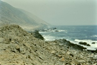
When Steph and I moved to Peru in 1973, we lived just a few hundred meters inland from the cliffs overlooking the Pacific Ocean in the Lima suburb of Miraflores. During the ‘summer’ months between January and March, we’d spend at least one day each weekend on the beach at one of the resorts about 50 km south of Lima.

Moving to Costa Rica in 1976, we made only two trips to the beach in the northwest of the country to Playa Tamarindo on the Pacific coast of the Guanacaste peninsula (map). It was about 350 km (almost 7 hours) by road, but new routes have probably made the journey quicker since then. And just one trip to the Caribbean coast at Limón.


In the Philippines, we made about eight or nine weekend visits each year (over almost 19 years) to Arthur’s Place, a dive resort at Anilao on the Mabini Peninsula (map), a drive of just under 100 km south from Los Baños that, in 1992 (until about 2005), used to take about 3 hours. I’d go diving and Steph would snorkel.

In December 2003 we traveled to Australia and drove down the east coast from Sydney to Melbourne, around 1000 miles, enjoying each stretch of coastline every day. At Wilson’s Promontory in Victoria we stopped off at Tidal River, the furthest south (at almost 39°S) I’ve ever traveled. Antarctica next stop! And that same evening, New Year’s Eve, we sat on the beach near Wonthaggi and watched the sunset over the Indian Ocean (map).


Since retiring, we’ve visited the west and east coasts of the USA in Oregon and California, and Massachusetts and Maine, the coast roads right round Scotland, the coast of Northern Ireland, as well as Cornwall, and the southeast of England in East Sussex and Kent.


While here in England’s northeast (North Yorkshire, County Durham, and Northumberland) we don’t enjoy tropical temperatures, the region does boast some of the finest stretches of coastline and beaches in the country.

Dunstanburgh Castle and Craster
This is a rocky coast and the castle itself was built in the early 14th century on the Whin Sill, an outcrop of igneous dolerite that cuts across Northumberland. The castle is a walk of about 1¼ miles from the fishing village of Craster; there’s no road into the castle.

Craster itself has ample parking away from the harbor. The village is also famous for its smoked fish, especially kippers.

At Dunstanburgh a healthy population of kittiwakes nest on the cliffs.

To the north there are excellent views of Embleton Bay that we have yet to visit.

View north from the Great Gatehouse

Alnmouth
A tricky pronunciation. Some say ‘Aln-muth’, others ‘Allen-mouth’. I have no idea which is correct. It’s a pretty village at the mouth of the river of the same name. There’s good paid parking behind the beach for a couple of hundred cars.

Warkworth
We’ve only visited the beach once, back in April 2018. It’s a nice long stretch of beach accessed from the north side of the town, which is more famous for its 12th century castle.

Looking north along Warkworth beach towards Alnmouth.

Warkworth Castle

Amble
Standing at the mouth of the River Coquet, we’ve found the beaches very pleasant on the south side of the town (where there is free parking), and facing Coquet Island which is now a bird reserve with an internationally important colony of roseate terns in the breeding season.

The view south along the Amble beach with the Lynemouth power station in the far distance.

Coquet Island.

Druridge Bay and Hauxley Nature Reserve
This must be one of the longest beaches in Northumberland, with massive dunes at the rear of the beach in its southern portion.

At the northern end, and just inland is Hauxley Nature Reserve, owned by Northumberland Wildlife Trust. When we visited last week, we observed 37 different bird species in the space of two hours. It really is a wonderful site, and we must go back there on a regular basis. There’s no entrance fee, but parking costs £2 all day. There’s also footpath access on to the dunes and beach, which lie just beyond the reserve’s perimeter fence.

The Tern Hide from the West Hide at Hauxley Nature Reserve.

The North Sea can be seen in the middle distance beyond the dunes and reserve perimeter fence.

Cresswell Bay
This was one of the first ‘northern’ beaches that we viisted in 2021, just 17 miles from home. It’s both sandy and rocky, and we saw somone collecting sea coal that had been washed up on the shore. All along the Northumberland and Durham coast there were once extensive coal mines. Waste from the pits was dumped in the sea. In places the beaches look quite black.

Blyth and Seaton Sluice Beaches
These are the closest to home, but are in effect a singe beach. Both are very popular with dog walkers, and we enjoy often heading there on a Sunday morning, weather permitting, for a late morning stroll.

At the Seaton Sluice southern end of the beach, there is a small harbor, that had originally been constructed in the 17th and refurbished in the 18th century to handle coal shipments from local mines.

Seaton Sluice harbor, showing ‘The Cut’ in the middle distance.

St Mary’s Lighthouse and Whitley Bay
The lighthouse was built in 1898, but there had been lighthouses on the island for centuries. This lighthouse was decommissioned in 1984. The island lies at the north end of Whitley Bay, a popular resort.

The island is approached across a causeway that is submerged at high tide. On the visits we have made we’ve often seen the grey seals that bask on the rocks.

King Edward’s Bay, Tynemouth
This is a small bay that lies beneath the headland on which Tynemouth castle and priory (now owned by English Heritage) were built.

From the headland there are magnificent views north along the Northumberland coast.

To the immediate south is the mouth of the River Tyne, and beyond the shore at South Shields and the coast south into County Durham.

Souter Lighthouse and the Whitburn coast
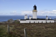
The lighthouse was decommissioned in 1988. It stands on the edge of magnesian limestone cliffs, that stretch both north and south.

To the south of the lighthouse, there was a colliery and this area has been reclaimed and opened (under the National Trust) as a recreational area.

Immediately outside the walls of the lighthouse to the north is the site of a former mining village, Marsden, that was demolished soon after Whitburn Colliery closed in 1968.

The longer grass indicates where the two lines of terraced cottages once stood.

Marsden beach was very popular holiday or day-out destination in the early 20th century.

The cliffs are home to colonies of cormorants (one of the largest in the UK), herring gulls, kittiwakes, and fulmar petrels.

Whitby Abbey
The abbey, built in the 13th century, occupies a headland that juts out into the North Sea above the town of Whitby. It’s the furthest south we have ventured over the past 18 months.

The approach from the north along the A174 high above the coast affords the most spectacular views over the town and right along the North Yorkshire coast. Most impressive.


I don’t think I’ll ever tire of visiting the seaside. There’s something magical, inspirational about the interface between land and sea. Solid and liquid.

Life goes on . . . taken too soon

Do you remember the first 45 single or album (LP or CD) that you bought? I bought the single Keep on Running by The Spencer Davis Group in late 1965.

I also remember precisely when and where I bought these albums: Rubber Soul, Sgt. Pepper’s Lonely Hearts Club Band, and the White Album by The Beatles. My first CD (in 1991 just before I headed to the Philippines) was Fleetwood Mac’s Greatest Hits, and I’ve been a massive Mac fan ever since. And in the intervening years, I went on to expand my CD collection, although with streaming now available I’ve not added to it for at least a decade.

In my CD collection, several artists or groups are represented by multiple discs: The Beatles, Fleetwood Mac, Dire Straits/Mark Knopfler, R.E.M., Eric Clapton, Crowded House, and Alison Krauss & Union Station, to name just a few.

For others, I have maybe a couple of CDs or just a single one. Among these is one artist whose work I have come to relish over the decades, but it wasn’t until just a few weeks ago (through Spotify) did I finally appreciate just what an incredible singer/songwriter he was. I have only two of his ten albums. I don’t know why it took me so long to find out.

I’m referring to Gerry Rafferty (1947-2011). So, how and when did I first encounter this brilliant musician?

It was late 1978. I was living in Costa Rica, and had just returned from home leave in the UK. During that leave, my brother-in-law Derek recorded a tape for me, Rafferty’s City to City (his second solo album) released earlier that year. However, I didn’t have a tape deck because we’d had a burglary during our home leave, and my hi-fi had been stolen.

Discovering City to City had to wait until a few weeks later when I was in San José (the capital city) to take delivery of a new car, and have a stereo system installed, including a tape deck.

Ready for the return journey to Turrialba where we lived (about 70 km east of San José, and at least a couple of hours on the road) I eagerly anticipated listening to City to City, and was instantly enthralled by the first track, The Ark, enjoying the blend throughout the album of folk and soft rock. The Ark has remained a favorite of mine all these years.

But ask anyone to name any Gerry Rafferty song, and I’m pretty sure that Baker Street (with its iconic saxophone riff [1] by Raphael Ravenscroft) would be top of their list. It quickly rose in the charts. Rafferty always surrounded himself with so many accomplished musicians.

The title track from the album is pretty damn good as well, inspired by Rafferty’s long-distance commuting apparently.

The fifth track on City to City is particularly poignant. My late elder brother Ed (who lived in Canada) was also a Gerry Rafferty fan. When his wife Linda passed away after a battle with cancer in 2007, Ed chose Stealin’ Time as one of the pieces of music played at her funeral. A poignant tribute to a lovely lady.

A year after City to City, Rafferty released Night Owl in 1979. The title track is my favorite with Already Gone coming a close second.

So, what about all the other wonderful music that I’d not been exposed to? Well, working through that first Spotify playlist of so many great songs, two in particular caught my ear. The first, Don’t Give Up On Me was the seventh track on his seventh studio album, On a Wing & a Prayer released in 1992.

And the other, which I believe is one of Rafferty’s finest (and ‘undiscovered’) songs is Tired of Talking, released as the third track on his sixth studio album, North and South, in 1988.

This track, Don’t Speak of My Heart, is the third track from Rafferty’s tenth and final album, Life Goes On, released in November 2009. An alcoholic for much of his life, Rafferty died of liver failure in January 2011. Taken too soon, at just 63.

For an even greater appreciation of the genius of Gerry Rafferty, watch this hour long documentary broadcast by BBC Scotland in 2011. Maybe even shed a tear . . .


[1] The saxophone break on “Baker Street” has been described as “the most famous saxophone solo of all time”, “the most recognizable sax riff in pop music history”, and “one of the most recognisable saxophone solos of all time”. (Source: Wikipedia)

It’s all NEWS to me. Definitely not fake!

Cornwall

Over the past two weeks, Steph and I have been enjoying a BBC2 TV series about Cornwall by the Padstow-based chef, Rick Stein. For my non-UK readers, Cornwall lies at the southwest extremity of mainland Britain. In fact, the Lizard is the southernmost point.

Stein has made many other TV series, from locations all around the world, and they are primarily concerned with the food and dishes of those places. In his Cornwall series, however, Stein sets out to show what the county means to him, his home for more than five decades. Cheffing is just one aspect of the programs, as he also covers the beautiful landscapes, the people, as well as the excellent produce from land and sea for which Cornwall is renowned.

I’ve been to Cornwall just twice. In the late 1990s, while I was Head of the Genetic Resources Center at International Rice Research Institute (IRRI) in the Philippines, and managing the world’s largest genebank for rice, I was contacted by someone from the Eden Project near St Austell, requesting samples of some rice varieties they might display in the tropical biome (in one of the original three geodesic domes).

As a special treat, Steph and I were invited to visit to the Eden Project in the summer of 2001 to have a behind-the scenes look at the project that had only just opened its doors to the public. It’s now a major world visitor attraction.

It took another sixteen years in September 2017 before we returned to Cornwall, to spend a glorious week touring the county, primarily to visit a plethora of National Trust and English Heritage sites. And among the places we visited was Lizard Point. You can’t get more southerly than here (49.9593° N, 5.2065° W). It was a glorious day when we visited, and we took advantage of the weather to walk along the cliffs and enjoy the vistas that opened up before us.

The map below shows where these photos were taken. Just check the partial vista symbols.

As we approached the view over Housel Bay and a collapsed cliff, I saw these black birds suddenly fly up from a nearby pasture. A few minutes later we were watching a pair of choughs (which feature on the Cornish coat of arms) on the rocks below. What a joy, since choughs are no longer common in Cornwall, and have only recently begun to re-establish themselves once cattle grazing practices had reverted to what was common before the chough decline. There are now about 100 breeding pairs of choughs in the county. A success story.

Having reflected on this visit to the southernmost point of mainland Britain, I remembered that, on 30 May 2015 during our 2250 mile tour of Scotland, we had visited the northernmost point of the mainland, at Dunnet Head (58.6719° N, 3.3760° W) in Caithness.

There are splendid views across the Pentland Firth to Orkney, and we were fortunate that during our visit (and John o’ Groats the day before) the views were clear. The day after you could hardly see 50m down the fog-bound road.

So as a keen geographer (I took a degree in environmental botany and geography at the University of Southampton at the end of the 1960s), I’ve always had an interest in the spaces around me; my internal GPS. That’s the N and S covered. How about E and W?

In terms of the British mainland, I’ve not visited either of the two locations with claim to E and W fame: Ness Point (52.4812° N, 1.7628° E) at Lowestoft on the coast of Suffolk in East Anglia, and Ardnamuchan Point in Scotland. I’ve been close to both but never actually visited.

What about my other NEWS around the world? Check out this map:


Outside the EU . . . even before Brexit

Imagine a little corner of Birmingham, just a couple of miles southwest of the city center. Edgbaston, B15 to be precise. The campus of The University of Birmingham; actually Winterbourne Gardens that were for many decades managed as the botanic garden of the Department of Botany / Plant Biology.

As a graduate student there in the early 1970s I was assigned laboratory space at Winterbourne, and grew experimental plants in the greenhouses and field. Then for a decade from 1981, I taught in the same department, and for a short while had an office at Winterbourne. And for several years continued to teach graduate students there about the conservation and use of plant genetic resources, the very reason why I had ended up in Birmingham originally in September 1970.

Potatoes at Birmingham
It was at Birmingham that I first became involved with potatoes, a crop I researched for the next 20 years, completing my PhD (as did many others) under the supervision of Professor Jack Hawkes, a world-renowned expert on the genetic resources and taxonomy of the various cultivated potatoes and related wild species from the Americas. Jack began his potato career in 1939, joining Empire Potato Collecting Expedition to South America, led by Edward Balls. Jack recounted his memories of that expedition in Hunting the Wild Potato in the South American Andes, published in 2003.

29 March 1939: Bolivia, dept. La Paz, near Lake Titicaca, Tiahuanaco. L to R: boy, Edward Balls, Jack Hawkes, driver.

The origins of the Commonwealth Potato Collection
Returning to Cambridge, just as the Second World War broke out, Jack completed his PhD under the renowned potato breeder Sir Redcliffe Salaman, who had established the Potato Virus Research Institute, where the Empire Potato Collection was set up, and after its transfer to the John Innes Centre in Hertfordshire, it became the Commonwealth Potato Collection (CPC) under the management of institute director Kenneth S Dodds (who published several keys papers on the genetics of potatoes).

Bolivian botanist Prof Martin Cardenas (left) and Kenneth Dodds (right). Jack Hawkes named the diploid potato Solanum cardenasii after his good friend Martin Cardenas. It is now regarded simply as a form of the cultivated species S. phureja.

Hawkes’ taxonomic studies led to revisions of the tuber-bearing Solanums, first in 1963 and in a later book published in 1990 almost a decade after he had retired. You can see my battered copy of the 1963 publication below.

Dalton Glendinning

The CPC was transferred to the Scottish Plant Breeding Station (SPBS) at Pentlandfield just south of Edinburgh in the 1960s under the direction of Professor Norman Simmonds (who examined my MSc thesis). In the early 1970s the CPC was managed by Dalton Glendinning, and between November 1972 and July 1973 my wife Steph was a research assistant with the CPC at Pentlandfield. When the SPBS merged with the Scottish Horticultural Research Institute in 1981 to form the Scottish Crops Research Institute (SCRI) the CPC moved to Invergowrie, just west of Dundee on Tayside. The CPC is still held at Invergowrie, but now under the auspices of the James Hutton Institute following the merger in 2011 of SCRI with Aberdeen’s Macaulay Land Use Research Institute.

Today, the CPC is one of the most important and active genetic resources collections in the UK. In importance, it stands alongside the United States Potato Genebank at Sturgeon Bay in Wisconsin, and the International Potato Center (CIP) in Peru, where I worked for more than eight years from January 1973.

Hawkes continued in retirement to visit the CPC (and Sturgeon Bay) to lend his expertise for the identification of wild potato species. His 1990 revision is the taxonomy still used at the CPC.

So what has this got to do with the EU?
For more than a decade after the UK joined the EU (EEC as it was then in 1973) until that late 1980s, that corner of Birmingham was effectively outside the EU with regard to some plant quarantine regulations. In order to continue studying potatoes from living plants, Jack Hawkes was given permission by the Ministry of Agriculture, Fisheries and Food (MAFF, now DEFRA) to import potatoes—as botanical or true seeds (TPS)—from South America, without them passing through a centralised quarantine facility in the UK. However, the plants had to be raised in a specially-designated greenhouse, with limited personnel access, and subject to unannounced inspections. In granting permission to grow these potatoes in Birmingham, in the heart of a major industrial conurbation, MAFF officials deemed the risk very slight indeed that any nasty diseases (mainly viruses) that potato seeds might harbour would escape into the environment, and contaminate commercial potato fields.

Jack retired in 1982, and I took up the potato research baton, so to speak, having been appointed lecturer in the Department of Plant Biology at Birmingham after leaving CIP in April 1981. One of my research projects, funded quite handsomely—by 1980s standards—by the Overseas Development Administration (now the Department for International Development, DFID) in 1984, investigated the potential of growing potatoes from TPS developed through single seed descent in diploid potatoes (that have 24 chromosomes compared with the 48 of the commercial varieties we buy in the supermarket). To cut a long story short, we were not able to establish this project at Winterbourne, even though there was space. That was because of the quarantine restrictions related to the wild species collections were held and were growing on a regular basis. So we reached an agreement with the Plant Breeding Institute (PBI) at Trumpington, Cambridge to set up the project there, building a very fine glasshouse for our work.

Then Margaret Thatcher’s government intervened! In 1987, the PBI was sold to Unilever plc, although the basic research on cytogenetics, molecular genetics, and plant pathology were not privatised, but transferred to the John Innes Centre in Norwich. Consequently our TPS project had to vacate the Cambridge site. But to where could it go, as ODA had agreed a second three-year phase? The only solution was to bring it back to Birmingham, but that meant divesting ourselves of the Hawkes collection. And that is what we did. However, we didn’t just put the seed packets in the incinerator. I contacted the folks at the CPC and asked them if they would accept the Hawkes collection. Which is exactly what happened, and this valuable germplasm found a worthy home in Scotland.

In any case, I had not been able to secure any research funds to work with the Hawkes collection, although I did supervise some MSc dissertations looking at resistance to potato cyst nematode in Bolivian wild species. And Jack and I published an important paper together on the taxonomy and evolution of potatoes based on our biosystematics research.

A dynamic germplasm collection
It really is gratifying to see a collection like the CPC being actively worked on by geneticists and breeders. Especially as I do have sort of a connection with the collection. It currently comprises about 1500 accessions of 80 wild and cultivated species.

Sources of resistance to potato cyst nematode in wild potatoes, particularly Solanum vernei from Argentina, have been transferred into commercial varieties and made a major impact in potato agriculture in this country.

Safeguarded at Svalbard
Just a couple of weeks ago, seed samples of the CPC were sent to the Svalbard Global Seed Vault (SGSV) for long-term conservation. CPC manager Gaynor McKenzie (in red) and CPC staff Jane Robertson made the long trek north to carry the precious potato seeds to the vault.

Potato reproduces vegetatively through tubers, but also sexually and produces berries like small tomatoes – although they always remain green and are very bitter, non-edible.

We rarely see berries after flowering on potatoes in this country. But they are commonly formed on wild potatoes and the varieties cultivated by farmers throughout the Andes. Just to give an indication of just how prolific they are let me recount a small piece of research that one of my former colleagues carried out at CIP in the 1970s. Noting that many cultivated varieties produced an abundance of berries, he was interested to know if tuber yields could be increased if flowers were removed from potato plants before they formed berries. Using the Peruvian variety Renacimiento (which means rebirth) he showed that yields did indeed increase in plots where the flowers were removed. In contrast, potatoes that developed berries produced the equivalent of 20 tons of berries per hectare! Some fertility. And we can take advantage of that fertility to breed new varieties by transferring genes between different strains, but also storing them at low temperature for long-term conservation in genebanks like Svalbard. It’s not possible to store tubers at low temperature.

Here are a few more photos from the deposit of the CPC in the SGSV.

I am grateful to the James Hutton Institute for permission to use these photos in my blog, and many of the other potato photographs displayed in this post.

2015: a great year for National Trust and English Heritage visits

Steph and I have been members of the National Trust for five years now. We even qualify for the Seniors discount from January! And we’ve been members of English Heritage for just a year.

But we will be renewing our membership of both organizations in 2016. Why? Because they both offer excellent value for money, and certainly give purpose to our trips out, whatever the weather. Be it a visit to a stately home, a ruined castle, a country park, or a beautiful garden, there are so many properties to visit and experience so many aspects of our cultural heritage.

Looking back on our 2015 visits we have certainly had our money’s worth, and annual membership has more than paid for all the entrance fees we would have had to pay in any case. And much more!

So here is a pictorial summary of our great visits this past year, beginning in early April and ending just last week when we visited Charlecote Park to see the Christmas decorations. And there are links to individual posts about each visit.

NATIONAL TRUST

Lyveden New Bield (9 April)

20150409 092 Lyveden

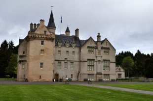
Brodie Castle (National Trust for Scotland – 29 May)

Brodie Castle

Culloden Battlefield (National Trust for Scotland – 29 May)

Scotland 082

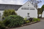
Inverewe Garden (National Trust for Scotland – 1 June)

Scotland 312

Arduaine Garden (National Trust for Scotland – 7 June)

Scotland 877

Rufford Old Hall (8 June)

The main entrance in the seventeenth century wing.

Tredegar House (18 June)

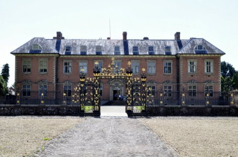
Tredegar House, near Newport in South Wales

Chirk Castle (1 July)

20150701 147 Chirk Castle

Hawford Dovecote (9 July)

20150709 010 Hawford dovecote

Wichenden Dovecote (9 July)

20150709 022 Wichenford dovecote

Hardwick Hall (12 August)

Hardwick Hall, Derbyshire

Newark Park (28 August)

20150828 031 Newark Park

Croome Park (12 October)

20110328046 Croome Court

Charlecote Park (16 December)

The entrance hall.

ENGLISH HERITAGE

Rushton Triangular Lodge (9 April)

Rushton Triangular Lodge, Northamptonshire

Stokesay Castle (14 April)

Stokesay Castle, Shropshire

Wroxeter Roman City (14 April)

20150414 130 Wroxeter Roman city

Kenilworth Castle (21 April)

cropped-20150421-023-kenilworth-castle.jpg

Goodrich Castle (21 May)

Goodrich Castle, Herefordshire

St Mary’s Church, Kempley (21 May)

20150521 135 St Marys Kempley

Witley Court (9 July)

20150709 091 Witley Court

Hardwick Old Hall (12 August)

Looking down six floors in the Old Hall. And the magnificent plasterwork on the walls.

Wenlock Priory (18 August)

20150818 043 Wenlock Priory

Ironbridge (18 August)

From: http://en.wikipedia.org/wiki/File:Ironbridge

The end of the road . . .

I’ve been deceived all these years!

Scotland 123I have to admit being disappointed—but only ever so slightly—to discover that John o’ Groats is NOT the northernmost point on the British mainland (although apparently it is the spot where the ‘last house’ is situated.

Since everyone who undertakes a marathon walk, run or bike-ride the whole length of the country, usually for charity, starts or ends their journey in John o’ Groats (to or from Land’s End in Cornwall, with more than 800 miles between them). I don’t know why, but I’d always wanted to visit John o’ Groats. I guess because it appears in the news on a regular basis, an iconic location in our nation’s geography. So it was one of the places we included on our itinerary during our recent Scottish Highlands and Island road trip.

The actual most northern spot on the mainland is Dunnet Head, about 15 miles to west of John o’ Groats. Turns out that Land’s End is not the most southerly point either. That would be the Lizard Point, but which is actually closer to John o’ Groats by less than 10 miles.

We arrived in John o’ Groats under brilliant blue skies on the Saturday afternoon, and enjoyed clear views over the Pentland Firth, the stretch of what can be perilous waters between the mainland and the Orkney Islands, less than a dozen miles north. After wandering around the harbour, we than drove the couple of miles east to Duncansby Head, lighthouse and Stacks, enjoying even more spectacular views over the cliffs.

Since our B&B accommodation for the night was in Thurso we drove there via Dunnet Head and its lighthouse to see the most northern point of the mainland for ourselves.

In the late afternoon sun we could even see the tip of the Old Man of Hoy sea stack above a headland on the northeast coast of the large island of Hoy immediately north.


Returning to Hogha Gearraidh after 49 years

It was summer 1966. I was seventeen, and decided to visit the Outer Hebrides, more specifically North Uist, where the Royal Society for the Protection of Birds (RSPB) had just established a new reserve at Balranald near the village of Hougharry (Hogha Gearraidh in Scots Gaelic) on the west coast. Originally the reserve was aimed at protecting breeding populations of two special summer visitors: the corncrake and the red-necked phalarope.  Sadly, the phalarope no longer breeds at Balranald.

So, with rucksack on my back, including a one-man tent and all the paraphernalia necessary to support me for a couple of weeks, I set off for Glasgow (where I spent a few nights with my eldest brother Martin and his wife, Pauline) before taking my first ever flight on a Vickers Viscount from Glasgow International Airport (formerly known as Abbotsinch) to Benbecula airport at Balivanich.

I pitched my tent in front of the small cluster of houses in Hougharry, and was invited in for several meals by the old lady with whom the recently-appointed (and temporary) reserve warden was lodged. If I remember, her name was Mrs MacDonald, and she was very kind and hospitable. I don’t remember the name of the young warden. He had just graduated in geography from the University of Hull. Well, I didn’t get to see the corncrake nor the red-necked phalarope, and when I visited again in 1967 I was also unlucky. But the experience was wonderful, and I fell in love with the Outer Hebrides, particularly North and South Uist. What a combination of nature! The machair and all its plant and animal diversity, the lochs and mountains, not to mention the sea life such as grey seals and killer whales. Pure air, no pollution!

I must have been almost the first visitor ever to Balranald in 1966. And I have just returned from a trip to North Uist—a walk down memory lane after 49 years. Still no corncrakes, however, though we did hear them.

Of course the islands have changed a great deal over the past five decades. Almost all of the old whitewashed and thatched croft cottages have disappeared, once so typical of the Uist landscape. Many cottages are now roofless shells, the roofs presumably deliberately removed to remove any property tax liability. There has been an enormous house building boom in the past 20 years or so, I guess. I was told that with government grants it was cheaper to build new, energy-efficient housing (necessary against the icy blasts that pour in from the North Atlantic) than to renovate.

I wasn’t able to work out where I had camped in Hougharry nor which was Mrs MacDonald’s house. But I was pleased that I had been able to return and revive good memories from my youth. We stayed a couple of nights at a B&B at Balranald, overlooking the reserve, with Hougharry on the horizon. Run by Mrs Julie Ferguson, Balranald View was excellent. Julie was extremely welcoming, and her scones (with butter and mixed fruit jam) melted in the mouth.

North Uist towards Lochmaddy

Looking southeast and southwest from South Clettraval, east of Hosta on North Uist.

Scotland 628

Looking south towards Kirkibost Island from South Clettraval

Scotland 631

The bay at Hougharry with the village in the background.

Scotland 632

Along the machair around the bay at Hougharry.

Scotland 635

Kilmuir Cemetery, from Hougharry village.

Scotland 640

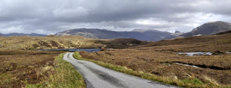
A typical North Uist landscape, south of Hougharry.

Scotland 746

Red deer on the B894 to Loch Euport, near Sidinish.

Road to Lochmaddy North Uist

The mountains of North Uist with Eabhal on the right, taken from the A867 to Lochmaddy.

waiting for the ferry at Lochmaddy

A dreek morning wait for the ferry from Lochmaddy to Uig on the Isle of Skye.

Scotland 652

Our B&B accommodation at Balranald, where hostess Julie Ferguson and her husband Roddy made us very welcome. Roddy was born in Hougharry.

Julie-Fowlis-julie-fowlis-33186472-794-800

Julie Fowlis

As a fan of the BBC series Transatlantic Sessions, I have increasingly become a fan of singer and TV presenter Julie Fowlis who has appeared regularly on that programme, and who I see from time-to-time whenever I tune into BBC Alba on catch-up TV. Well, she hails from North Uist—from Hougharry, in fact (so Julie Ferguson told me).

Here she is talking about her Hebridean roots and music. It’s a six minute film.

This song seems to have almost become her signature tune now: Hùg Air A’ Bhonaid Mhòir (Celebrate the Great Bonnet).

And in this song, she sings about The Dun-Coloured Old Men of Hoghaigearraidh (Bodaich Odhar Hoghaigearraidh)


Gardens, lochs and castles

Steph and I have been members of the National Trust since 2011, and so we took advantage of reciprocal membership to visit several National Trust for Scotland properties during our recent Highlands and Islands holiday.

Gardens always feature high on our list of National Trust “to do’s”. Steph’s the gardener at home however. I’m just the admirer and mow the grass. But when we found that we’d be quite close to one of Scotland’s most important gardens, Inverewe in Wester Ross, we made plans to visit before crossing to the Outer Hebrides. We came across the other big garden, Arduaine in Argyll & Bute, quite by chance. It was just a few miles from our accommodation on the penultimate night of the holiday. The third garden was attached to Brodie castle just east of Inverness that we visited on Day 3. We turned up at Brodie only to find that the castle was not open to the public on a Friday, so we spent an hour wandering around the small garden and learning more about daffodils! More of that later on.

Inverewe Garden
This is an oasis of almost tropical splendour on the banks of Loch Ewe in northwest Scotland, about 50 miles southwest of Ullapool.

We spent the night of Day 5 of our holiday at Braemore about 12 miles south of Ullapool at the southern end of Loch Broom.

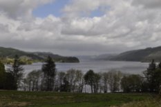
Loch Broom from the south.

Loch Broom from the south.

Having booked passage on the 17:30 ferry to cross over to Stornaway on the Isle of Lewis from Ullapool, we had the whole day to visit Inverewe. The weather was not promising when we started out for Inverewe, with low cloud and spitting rain. Typical Scottish weather you might think. However, within just a few miles, the clouds lifted and we were treated to a bright sunny day for the rest of our journey and the two to three hours we spent walking around the garden before heading back to Ullapool for the ferry. Given that a major storm was expected later that evening, and as ferry crossings had been disrupted in previous days we did try to change our booking to the morning crossing at 10:30. No such luck as it was already fully booked. So we just went ahead with the plan we’d already made—and thoroughly enjoyed our visit to Inverewe Garden.

Scotland 373Opened in 1862, the garden was the brainchild of one Osgood Mackenzie who, having planted 100 acres of woodland to protect the garden, set about creating a sub-tropical paradise at almost 58°N, and nurtured by the warm waters of the North Atlantic Drift, full of exotic plant species.

Inverewe map

It was taken into ownership by the National Trust for Scotland in 1952. Inverewe is famous for its rhododendrons and azaleas (some of which were damaged in gales in early 2015, especially some very old and large specimens), and is laid out in informal blocks representing different parts of the world, such as China, Tibet, Japan, New Zealand and the like. There are even tree ferns and several specimens of the very rare Wollemi pine from Australia.

Arduaine Garden
Just 20 miles south of Oban beside the A816 (and 12 miles short of the village of Ford where we had a room booked) Arduaine Garden was a complete surprise. We originally passed it at about 17:30. It was already overcast, windy and drizzly, but we pulled in anyway to get our bearings and see when the garden was open. 09:00 to sunset! So we decide that if the weather was fine the following morning we would retrace our steps and spend a couple of hours there before re-retracing our steps to Ford, Loch Awe and on to Loch Lomond.

Scotland 877Established in 1898 by James Arthur Campbell on a peninsula jutting out into Loch Melfort (and with views from the headland all the way to the mountains on the Isle of Mull to the northwest), Arduaine lies at 56°N. It is full of rhododendrons and azaleas that were still in full bloom compared to what we had encountered at Inverewe. The garden was gifted to the National Trust for Scotland in 1992.

Arduaine has a more intimate feel about it than Inverewe, and perhaps for that reason I enjoyed my visit here more than to Inverewe.

Scotland 869

Or was it because there were far fewer visitors at Arduaine? Afterall, we did arrive just a short while after garden opened and we had it almost to ourselves for the duration of our visit.

Brodie Castle
Lying just to the west of Forres on the north coast of Scotland, Brodie Castle has been home to generations of the Clan Brodie, and the last clan chief lived there until 2003.

Scotland 065

The castle was built in the 16th century. Major Ian Brodie, the 24th Brodie of Brodie, began assembling a collection and breeding daffodils in 1899, and eventually there were more than 400 different varieties grown. Some have been lost, but the National Trust for Scotland is attempting to re-establish this important collection. I never knew there was so much to daffodils.

Fàilte gu Alba – expansive landscapes and big skies

During our recent tour of Scotland’s Highlands and Islands we traveled from Fife (where we had stopped the first night after traveling up from the English Midlands) up through Perthshire and Aberdeenshire, Speyside and the north coast and over to Inverness. From there we worked our way up the northeast coast to John o’ Groats and across the top of Scotland and down through Sutherland. We crossed over to the Outer Hebrides (Lewis, Harris, North and South Uist, Benbecula, and Eriskay) from Ullapool, then came back to the mainland via Skye. From there, via the Kyle of Lochalsh, we traveled down the west coast to Argyll & Bute, and over to Loch Lomond on our last day.

I took over 1000 photos on my Nikon D5000. On many occasions I felt I could only do justice to the landscapes we saw by taking a panorama of individual shots and combining them into stitches. The result for some is more than acceptable. For others, the blending between the individual frames is not even, but they nevertheless allow you to appreciate the beauty of these outstanding Scottish landscapes. Click on each of the photo below to open a full size version. I hope you enjoy these photos as much I did taking and editing them.

A939 towards Ladder Hills

Taken from the A920 between Huntly and Dufftown, looking southwest.

1746 Culloden battlefield, east of Inverness.

The last battle fought on British soil was fought at Culloden (just east of Inverness) 0n 16 April 1746, when the Jacobite forces of Bonnie Prince Charlie were defeated by the Hanoverian ‘Butcher Cumberland’.

This bridge, west of Inverness, carries the A( across the Moray Firth into Ross and Cromarty

This bridge, west of Inverness, carries the A9 across the Moray Firth on to the Black Isle of Ross and Cromarty. Taken from North Kessock on the north shore, looking east.

Dunnett Head looking eastwards Thurso

From Dunnet Head – the most northerly point in mainland Britain – looking east towards Thurso and John o’ Groats.

On A836 westwards

On the A836 westwards from Thurso.

Coldbackie

At Coldbackie, near the Kyle of Tongue, on the A836.

Kyle of Tongue

Crossing the causeway at the Kyle of Tongue on the A838, west of Thurso.

Loch Eriboll

Loch Eriboll, on the A838, looking southwest from near the mouth of this sea loch on the north coast of Scotland just east of Durness.

Nr Rhiconich

Looking westwards along Loch Inchard, near Rhiconich on the A838 in northwest Sutherland.

Above Laxford Bridge

Loch Laxford, on the A838 in northwest Sutherland.

Laxford Bridge

Approaching Laxford Bridge, looking southwest , on the A838.

Above Loch a' Chairn Bhain

Loch a’ Chairn Bhain, on the B869 heading west after Unapool.

Towards Drumbeg

Near Drumbeg, on the B869, heading west.

Drumbeg Viewpoint

Drumbeg viewpoint, on the B869.

South on A837 Lochinver to Loch Assynt

Heading east on the A837 between Lochinver and the junction with the A894.

Strathcanaird

At Strathcanaird on the A835, looking west towards Ben More Coigach, Stac Pollaidh and Cul Mor.

Towards Inverewe

Little Loch Broom on the A832 towards Inverewe (from Ullapool).

Gruinard Bay

Gruinard Bay along the A832 towards Inverewe Garden.

Near Inverewe

Looking north across Gruinard Bay (on the A832) to the mountains of the Coigach beyond Ullapool.

Inverewe foreshore

The foreshore at Inverewe Garden, looking south at the southern end of Loch Ewe.

Inverewe walled garden

The walled garden at Inverewe and the southern end of Loch Ewe.

Lewis landscape north of Stornaway

The landscape of Lewis north of Stornaway.

Butt of Lewis

The Butt of Lewis, almost 59°N. Next stop: North America. Cliffs covered with fulmars, shags, and kittiwakes. And sea pinks, of course.

South Harris

The mountains of South Harris.

Sound of Harris

Crossing the Sound of Harris (with Harris on the horizon) to Berneray and North Uist.

Road to Lochmaddy North Uist

On the A865 heading east towards Lochmaddy from Bayhead in North Uist.

North Uist towards Lochmaddy

Looking southeast over North Uist with the mountain Eaval near Lochmaddy on the left, and the mountains on the right in the distance on South Uist.

Mtns of South Uist

The mountains of South Uist (looking east) with Ben Mhor on the right.

Machair and mountains at Garrynamonie South Uist

Machair and mountains at Garrynamonie, South Uist (looking east).

Machair at Mhalacleit

Machair at Mhalacleit, South Uist.

Ben Mhor - South Uist

Ben Mhor on South Uist, looking west from Loch Eyenort.

Eriskay

Houses on Eriskay, looking southwest towards Barra.

Skye

The hills of north Skye looking south towards Staffin.

The Cuillins from the west

The Cuillins of Skye, looking southeast along the A863 near Drynoch.

Eilean Donan Castle

Looking southwest along Loch Long at Conchra (near Dornie on the A87) towards Eilean Donan castle.

Loch Awe

Looking northeast from the southern end of Loch Awe in Argyll & Bute towards the mountains of Glencoe.

Loch Lomond

Looking north along Loch Lomond at Inverbeg.

In due course, I’ll be adding more photos to individual posts I am drafting about particular places we visited on our 2,260 mile trip.

O ye’ll tak’ the high road and I’ll tak the low road . . . Fàilte gu Alba!

scotlandWell, we took the high road and the low road, and have just returned from a thoroughly enjoyable road trip road Scotland.

Over 2,250 miles in 13 days!

While I’ll be posting individual stories about the many things we did and saw during this trip, here are some of the highlights.

The decision to tour Scotland this year was almost a ‘spur of the moment’ one. Our daughter in Minnesota and her family had originally planned to come over to the UK later in the summer. But for various reasons this hasn’t worked out. But we had already decided that if they visited us this year, we would not travel to the USA as we have been doing annually for the past five years. So I suggested to Steph that we should make a road trip right round Scotland – to the Highlands and Islands. And that is what I began planning in about mid-February. By the beginning of April Hannah had told us that they would not be able to travel to the UK this year. So we have decided to visit Minnesota in any case, in September, just in time to see Callum begin school.

I’ve visited many different parts of Scotland on other trips, and have even been to the Outer Hebrides twice—almost 50 years ago! While Steph lived in Edinburgh for about 8 months in 1972-73, she never traveled further north. Neither of us had been ‘right round the top’. So we anticipated quite an adventure as we planned each stage of the trip. We had booked all our Bed & Breakfast (B&B) stops ahead of travelling, and the ferries, so it was just a case of enjoying the route and wherever our fancy took us each day. I have provided links to all the routes we took.

Day 1: 27 May (326 miles) Home to Comrie (Fife)
Route

This was a ‘getting to Scotland’ day from our home in Worcestershire. Just a long drive up the M6/M74 motorways, and to visit with my sister Margaret and her husband Trevor in Fife for one night.

Day 2: 28 May (163 miles) Comrie to Huntly (Aberdeenshire)
Route

Our destination was Huntly in north Aberdeenshire, which is the home town of my sister-in-law Pauline. I first visited there in November 1965 for Martin and Pauline’s wedding. Crossing the rolling hills north of Fife, we headed to Blairgowrie in Perthshire (where we spotted a couple of red squirrels in the woodland beside the River Ericht), and then into the Cairngorms National Park through Glen Shee. We also passed by Balmoral. No, Her Majesty was not at home.

Day 3: 29 May (143 miles) Huntly to Braes of Kinkell (Ross & Cromarty)
Route

From Huntly we headed west through Speyside, and then up to the coast just west of Inverness, visiting two National Trust for Scotland properties at Brodie Castle (which was unfortunately closed) and the site of the 1746 Battle of Culloden.

Day 4: 30 May (172 miles) Braes of Kinkell to Thurso (Caithness)
Route
This was totally new territory for me. Although the day started cloudy the sun soon broke through. And by the time we reached John o’ Groats it was a beautiful late afternoon, and there were clear views across the Pentland Firth to the Orkney Islands. We could even see the Old Man of Hoy. After a visit to Duncansby Head lighthouse, we stopped off at Dunnet Head (the most northerly point on mainland Britain) before heading to our B&B in Thurso.

Day 5: 31 May (182 miles) Thurso to Ullapool (Ross & Cromarty)
Route
Sunday morning dawned drab and drearydreek as they say in Scotland. The day did not look promising as we headed west out of Thurso, past the former nuclear power plant at Dounreay (in the long process of decommissioning), towards Durness and down the coast of northwest Sutherland to Ullapool where we would take the ferry over to the Isle of Lewis on the following day. The weather forecast was not promising, with strong storms expected for the next 48 hours or so. But we were determined to take in as much of the journey as the low clouds would permit. However, by about 2 pm, the clouds had lifted, the sun had come out, and we were treated to magnificent views of some of the most impressive mountains in Scotland. A side excursion around a peninsula near Lochinver was certainly the highlight of today’s journey, along a very narrow, twisty, and at times very steep road with multiple passing places. It was along this road that I’m sure I saw an osprey hovering above the loch to the side of the road.

Day 6: 1 June (91 miles) Ullapool (via Inverewe Garden) to Stornaway (Isle of Lewis, by ferry)
Route
With a major storm due to hit later that day, we did contact the ferry operator about transferring to a morning crossing to Stornaway. But to no avail. The boat was fully booked. Not to worry. We just got on with our day as planned, and that was a side trip to the National Trust for Scotland’s Inverewe Garden, about 40 miles from our overnight B&B south of Ullapool. Although we started our journey in the rain, the clouds soon parted and it was bright and sunny by the time we reached the garden, and then spent more than a couple of hours wandering around this fascinating site. It’s special because plants flourish here so far north because of the influence of the warm waters of the Gulf Stream (more correctly the Northern Atlantic Drift).


We were back in Ullapool in time to catch the ferry at 17:30 to Ullapool, and departed under increasingly threatening skies. It was pouring with rain by the time we docked in Stornaway at 21:00. While the sea was definitely choppy, the crossing was smooth on the new and larger ferry, Loch Seaforth that entered service with Caledonian MacBrayne only a couple of months earlier.

Day 7: 2 June (150 miles) Stornaway to Tarbert (Isle of Harris)
Route
We had three targets for today’s trip around Lewis: the Butt of Lewis at the northern tip; the Calanais Stones, and the iron age village at Bostadh on Great Bernera. It was heavily overcast as we headed north, and the skies became even more lowering as we approached the Butt of Lewis. In fact, it was raining very heavily when we arrived, and blowing a gale. The winds didn’t die down, but the rain did stop for a while allowing us to have a walk around, and take care not to be blown over the cliff.

The standing stones at Calanais are indeed impressive—mystical even, and I’ll be writing a special blog post about these in due course. With some due diligence, bobbing and weaving I was able to take all the photos I wanted, and hide any other visitors behind the various stones, so it seems as though Steph and I were the only visitors. The camera never lies!

We had to cross the Atlantic Ocean to reach Great Bernera. Well, cross the Atlantic is a bit of an exaggeration. Great Bernera is an island just 100 m across a channel from Lewis, connected by a bridge through which the Atlantic flows.

While three or four Iron Age houses have been found in a shallow valley close to the beach at Bostadh, only one has been reconstructed. The others were filled in with sand after excavation because of the fragile nature of the substrate on which they had been constructed. In seeing this site of early settlement and others around Lewis and the other islands, one can’t help imagining what survival must have been like thousands of years ago, how agriculture developed, and how these early people survived from farming and gathering shellfish along the shore.

Steinacleit stone circle

Steinacleit stone circle

We then headed south into Harris, and our B&B just south of Tarbert.

Day 8: 3 June (105 miles) Tarbert to Balranald (North Uist, by ferry)
Route on Harris / Route on North Uist
We took the A859 as far south as possible to Rodel where there is an impressive early sixteenth century church, St Clement’s (apparently dedicated to Pope Clement I), the church of Clan MacLeod. There is a fine tomb of Alasdair Crotach MacLeod of Dunvegan and Harris, 8th Chief of MacLeod.

Then it was on to the Sound of Harris ferry from Leverburgh to Berneray, and over the causeway on to the island of North Uist. I had first visited North Uist in the summer of 1966 at the age of 17, just after the Royal Society for the Protection of Birds (RSPB) had established its Balranald Reserve near the village of Hougharry (Hogha Gearraidh). I was then among the very first visitors to the reserve—if not the first! We stopped by Hougharry, but it has changed so much in the past half century—as have all the islands. Gone are the typical thatched roofed crofts and other single storey houses. Everywhere is new and relatively new construction. Given grants for new housing, it was cheaper to build new than renovate the original homes. Roofs were removed and what few old buildings remain are in a state of decay.


Day 9: 4 June (147 miles) Balranald
Route to Eriskay
Under fair skies (more or less) we spent the day traveling to the south of the Uists, through Benbecula and South Uist, and on to Eriskay, connected by causeway to South Uist since 2002.

Day 10: 5 June (142 miles) Balranald to Dornie (Ross & Cromarty, by ferry via Isle of Skye)
Route on North Uist / Route on Skye
It was pouring with rain as we left Balranald, and as we sat in the car waiting for the ferry in Lochmaddy for the ferry crossing to Skye, we wondered whether there was any chance of seeing any of the magnificence of the mountains on Skye later in the afternoon.

We were not disappointed! As we crossed The Minch (the channel between the Hebrides and the mainland) we could see the skies clearing to the west. And as we docked in Uig on Skye around 2 pm, there was hardly a cloud in the Skye, and we were treated to some incredible landscapes. We traveled right round the north of Skye, down to Portree, back up towards Uig, but turning off towards Dunvegan, and then turning south down the west coast to join the main A87 at Sligachan. The Cuillin Mountains were lit up in the bright afternoon sunshine. However, once we arrived at the Kyle of Lochalsh bridge to cross over on to the mainland, we were back in cloud and rain. But once again, we had our spirits lifted when we came out of the restaurant in Dornie later that evening, and Eilean Donan castle was bathed in the rays of the setting sun. See our route here.

Day 11: 6 June (184 miles) Dornie to Ford (Argyll & Bute)
Route
This was perhaps the least enjoyable day of our holiday. Why? Well, by the time we reached Fort William the weather had deteriorated markedly and our side excursion to see the Glenfinnan monument and railway viaduct at Glenfinnan was made in the pouring rain and a howling gale. But it was the actual driving conditions that bothered me. There was much more traffic than we had experienced at any other day, and all travelling at high speed. It just wasn’t possible to motor along at your own pace, and stopping places were few and far between. Once we had left Oban further south, the volume of traffic dropped on the Argyll & Bute coastal route.

Day 12: 7 June (187 miles) Ford to Lockerbie (Dumfries & Galloway)
Route
We had passed Arduaine Garden the night before, about 12 miles short of our B&B in Ford.

So this morning, under clearer skies, we headed back to this delightful garden located on a peninsula jutting westwards towards North America. We spent a couple of hours wandering around, admiring the beautiful rhododendrons. Then it was a long drive along Loch Awe, heading down to Inveraray, and on to Loch Lomond, before skirting Glasgow and joining the M74 once again after almost two weeks for the drive to our last overnight stop in Lockerbie. 

Day 13: 8 June (267 miles) Lockerbie to HOME!
Route
We set out just after 9 am, and after seven miles we had passed the 2,000 mile distance on our journey. But it wasn’t to be a quick dash home (if 250 plus miles can be called a dash). We broke our journey almost equidistant between Lockerbie and home, at Rufford Old Hall, a Tudor mansion just south of Preston, and owned by the National Trust. 

It was a long trip in such a relatively short time. But was it worth it? Definitely! I doubt that we’ll go back to the north of Scotland. And although the saying goes Haste ye back!, we have so many other places we want to visit. Nevertheless, I’m very happy that we made the effort. The scenery was uplifting, and we received a friendly welcome wherever we went. Scotland—weather and all—was a delight. There was one BIG advantages of the cool weather. No midges!

Here are links to detailed accounts about our trip:

And finally, I’ve put together all my better photos in a single 29 minute video: