Steph and I are now relaxing with family in Minnesota.
We have just completed our 2019 road trip: almost 2050 miles across ten states (in yellow), and crossing state lines thirteen times (MA-RI-CT-NY-PA-NJ-DE-PA-MD-WV-VA-MD-DE-MD).
Our visit to the USA started at 03:00 on Tuesday 3 September, when we dragged ourselves out of bed to head to Birmingham Airport (BHX) to catch the 06:00 KLM flight to Amsterdam(AMS). We were surprised to find the airport heaving even at that early hour. While this flight departed on time, on arrival in Amsterdam we discovered, to our (slight) dismay that the onward Delta flight to Boston (BOS) was delayed at least two hours because of the late arrival of the incoming aircraft (from JFK, where severe weather has disrupted many flights the previous day).
But, to give Delta Airlines due credit, they turned the aircraft around quickly and we departed only slightly over two hours delayed. However, as you can imagine that had a knock-on for our arrival in BOS.
Immigration there was a bit of a nightmare. I had hoped to be on the road before 15:00 for the 93 mile drive south for our first night at Orleans on Cape Cod. Because of the various delays, it was closer to 18:00 before we headed out of the car rental center, immediately hitting Boston rush-hour traffic, and then crawling slowly south for at least 35 miles.
Budget car rental assigned us a Jeep Wrangler, perhaps a little bigger than I had contemplated, but it was comfortable and solid on the road.

I had planned to be at Orleans well before nightfall. It wasn’t to be, and I had to drive the last hour in the dark, not something I relish at the best of times. For the final 15-20 miles of the trip, US-6 narrowed to two-way (known locally as ‘Suicide Alley’). Nonetheless, we made it in one piece and enjoyed a good night’s rest.
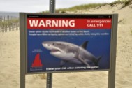
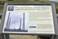
We spent the first morning on Cape Cod, checking out various beaches, before traveling into Provincetown to view (from a distance) the Pilgrim Monument, erected between 1907 and 1910 to commemorate the landing of the Pilgrim Fathers in 1620. We also visited the site where Marconi built a transatlantic wireless communication station just after the turn of the 20th century.
Then we headed west to Newport, Rhode Island and the Beavertail Lighthouse at the southern tip of Conanicut Island at the entrance to Narragansett Bay, crossing the impressive Claiborne Pell Newport Bridge in the process.
Then it was on to Plainfield, CT for our second night.
The next day we headed down to the Connecticut coast at Old Saybrook at the mouth of the Connecticut River, before turning west to have a picnic lunch and a walk on the beach at Silver Sands State Park in Milford, some 15 miles west of New Haven (home to Yale University).

The ‘dangerous’ sand bar out to Charles Island where is access is not permitted during the breeding season of various sea birds.
In the northwest of the state we visited Kent Falls State Park, before heading to Poughkeepsie (pronounced Puckipsee, home to Vassar College) on the banks of the Hudson River (and close to Hyde Park, the home of President Franklin D Roosevelt that we didn’t have time to visit).
In Poughkeepsie we found an excellent restaurant, The Tomato Cafe on Collegeview Ave just outside Vassar, and enjoyed probably the best meal of the trip.
From Poughkeepsie we had a long drive west into Pennsylvania before heading south and east to end up near Atlantic City on New Jersey’s coast. From the coast we headed west into Pennsylvania at Gettysburg.
Our day started early, crossing the Hudson River on US-44 at Poughkeepsie despite my satnav refusing to calculate a crossing there.
Our first destination was the Delaware Water Gap National Recreation Area in Pennsylvania, and Dingmans Falls, just a mile west of US209, in particular. On the way there we came across the remains of the Delaware and Hudson Canal, whose construction started in 1823 to carry coal from the Pennsylvania coal fields.
The Visitor Center at Dingmans Falls was closed during our visit, but the boardwalk trail to the Falls themselves was an easy walk of just under a mile. However, the climb up to the top of the Falls was a little more challenging.
About 20 miles south of Dingmans Falls, the Delaware River cuts through the mountains and heads east. It forms the stateline between Pennsylvania and New Jersey. We stopped for a bite to eat at the Kittatinny Point rest area on the New Jersey side.
By this time we were becoming a little concerned about reports of exactly where, on the Atlantic Coast, Hurricane Dorian would make landfall. High winds had been predicted for Atlantic City, and some rain, but as the storm was moving quite slowly, we had no idea if it would affect us or not.
We had already seen forecasts of severe weather in northern New Jersey (just south of New York) and we weren’t disappointed! I misread my satnav and exited from the highway one exit too soon, and found myself heading over the Raritan River at Perth Amboy on the wrong bridge. Fortunately my satnav quickly sorted me out, sending me back north over another bridge on Convery Boulevard, and entering the Garden State Parkway where I had originally intended. We only lost about 10 minutes, but driving among six or more lanes of fast-moving traffic in a downpour and with all the road spray was not an experience I would wish to repeat.
When we arrived at our hotel in Absecon (a few miles outside Atlantic City) it was certainly windy, the clouds were lowering, but there was no immediate threat of the hurricane hitting or any flooding, although our hotel (a rather inferior Travelodge) faced the marshes fronting the ocean.
The next morning dawned bright and sunny however, and hardly a breath of wind. Dorian had passed us by and headed out east into the Atlantic. What a difference a day makes!
So we drove into the center of the city, and walked up and down Atlantic City’s famous boardwalk for a couple of hours.
Longwood Gardens near Kennett Square in Pennsylvania (west of Philadelphia and northwest from Wilmington, DE) was not on our original itinerary. However, through a Facebook chat with a former colleague, accountant Lisa Panes, from IRRI in the Philippines, she mentioned that a visit to Longwood would be worthwhile. I’d never heard of the gardens before, but then discovered they are considered among the best in the USA. And not only that, just a few miles east of the original route I’d planned.
We spent four glorious hours wandering around the gardens. I’ll be writing about the gardens (and other locations we visited) in a separate blog post.
Tired and rather hot, we set off on the last leg to Gettysburg, passing through the heart of Amish country, at Intercourse, PA.
Sunday morning dawned bright and sunny. After breakfast we set off to the Gettysburg battlefield visitor center, received battlefield guide maps, and decided which routes to take. Over the whole site, seemingly every few yards, there are monuments to different regiments, both Federal and Confederate, and the many skirmishes that took place there over a period of three days in July 1863. Very poignant.
We also went into town to view Gettysburg station where President Lincoln arrived on 18 November 1863, just over four months after the battle.
At the end of the visit we strolled around the Gettysburg National Cemetery, and saw the spot where, on 19 November 1863, Lincoln delivered his Gettysburg Address. Have 272 words ever been more powerful?
After lunch we headed northwest from Gettysburg to Horseshoe Curve near Altoona, PA, a feat of railway engineering that was completed in 1854, would you believe.
From there, it was an 80 mile drive south to Frostburg in the mountains of northwest Maryland, a most beautiful landscape that I hadn’t expected. Our hotel there, a Quality Inn, was the best of the trip, about 1½ miles south of the town center, where we also had a lovely meal in an Italian restaurant, Giuseppe’s.
The next two days took us from Frostburg south through the Monongahela National Forest of West Virginia, before turning east into Virginia to spend nights in Appomattox (where General Robert E Lee surrendered the Army of Northern Virginia to Union General Ulysses S Grant at Appomattox Court House on 9 April 1865), and Colonial Williamsburg.

Seneca Rocks, in Pennsylvania, in the heart of the Monongahela National Forest, almost 74 miles south of Frostburg.
Colonial Williamsburg was not quite what I expected. It’s like a living museum, with quite a number of original buildings but many that have been reconstructed.
Our last day, Wednesday, was spent traveling north up the Delmarva Peninsula, stopping off for an hour at Lewes beach, before the last (and heavy traffic) push into Baltimore, for our final night close to Baltimore International Airport (BWI) from where we flew next day to Minneapolis-St Paul (MSP). This last day also included crossing the impressive Chesapeake Bay Bridge and Tunnels, almost 18 miles in length.

On the east Virginia shore, there’s an observation rest area where some of the bridges and causeway can be seen in the distance.

It was over 90F on the beach at Lewes.
So, for another year, our USA road trip is over. We averaged just over 240 miles per day (discounting the first day trip south to Orleans), and only on two days did we travel more than 300 miles (unlike in 2018, for instance, when most days were over 300 miles, and often closer to or more than 400 miles). So, in that sense, this year’s trip was easier, even though I felt the trip took more out of me than I had expected. Must be an age thing.
Overall, I was pleased with the Jeep. We spent only $203 on gasoline and achieved an impressive (considering the size of the vehicle) 26 mpg; $804 on hotels (or about £645 at current—and disappointing, Brexit -induced—exchange rates), and maybe $350 or so on meals.
Where to in 2020? Maybe the Rocky Mountain states, or do we bite the bullet and tour the southern states from Georgia through Alabama, Mississippi, Louisiana, Arkansas, Oklahoma, and Texas? Decisions, decisions!


