Since moving to the northeast of England almost four years ago, Steph and I have grabbed every opportunity (weather permitting, of course) to explore Northumberland north of the River Tyne, and the Durham coast south of the river.
 What we hadn’t done, until last week, was explore the hills southwest of Newcastle in the North Pennines National Landscape (NPNL, formerly known as the North Pennines Area of Outstanding Natural Beauty, or AONB). Within the counties of Northumberland, Durham, Cumbria, and North Yorkshire, the NPNL covers an area of approximately 770 square miles (2000 km2), and the landscape encompasses heather moors, deep valleys or dales, and several of its villages are the legacy of a rich mining history. Click here to explore an interactive map.
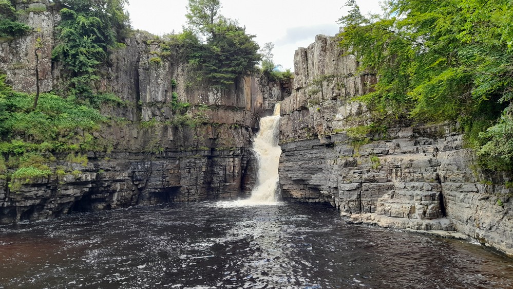
Specifically, we were headed to High Force Waterfall in Upper Teesdale, about 55 miles from home on the circuitous (and rather tedious) route that my satnav chose skirting around Durham before heading southwest. Tedious that is until we reached Teesdale itself and a glorious landscape opened up before us, as you can will appreciate from this video (the blue route on the map below).
High Force Waterfall is one of the most impressive in the country, with the River Tees tumbling around 70 ft (>21 m) to a splash pool below.
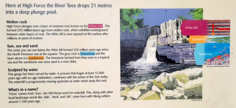
And the reason for this spectacular waterfall lies in its geology, comprising three different layers (which you can be seen in the image above): two relatively soft (of limestone and sandstone) overlain by the hard volcanic Whin Sill, explained in the next image (click to expand). And like Niagara Falls, High Force is slowly (very slowly) migrating upstream as the Tees erodes the rock millimeter by millimeter.
It certainly is impressive, and for an attraction in the middle of nowhere, remarkably accessible, albeit through privately-owned land with an entrance fee of £3.50 per adult. There’s also a minimum car park fee of £3 for three hours. The Pennine Way footpath follows the south bank of the River Tees, and passes the top of the waterfall with perhaps even more impressive views.
The path from the car park to the waterfall is just under half a mile, gently sloping suitable even for wheelchairs. There’s a return route through the woodland, but there are several very steep sections, which we didn’t attempt. Beside the splash pool, a small viewing platform (down some very steep steps) provides excellent views of the river tumbling over the precipice.


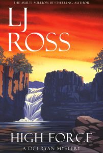 I was quite unaware of the waterfall’s existence until fairly recently, when I read a crime novel by Northumberland-born author LJ Ross, in which it featured.
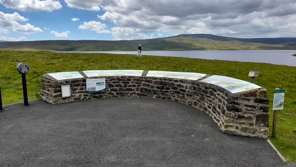
After a picnic lunch back at the car park, we continued our journey to Cow Green Reservoir, and an altitude of around 1600 feet (±500 m) at the car park just above the reservoir.
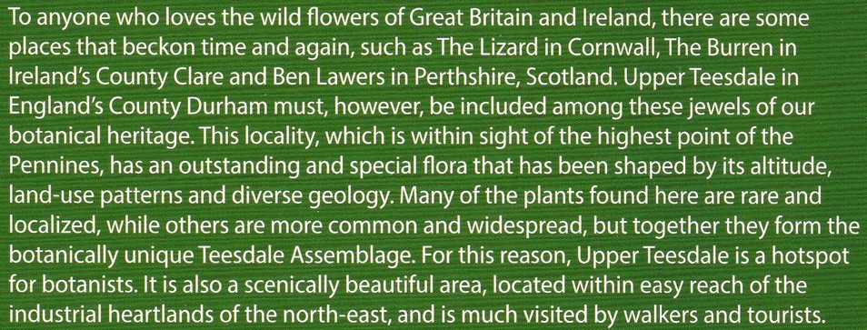
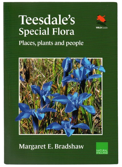
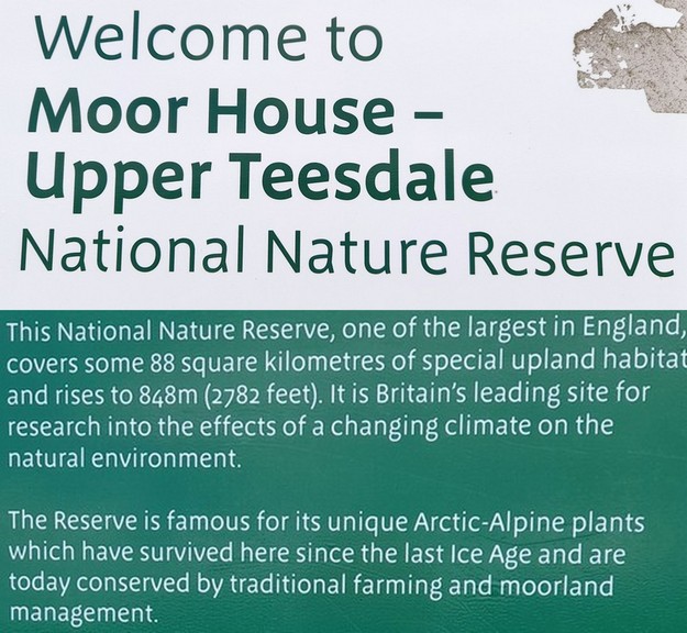
This area of Upper Teesdale is rather special botanically, and has an assemblage of plant species that are found in few other places in the British Isles. They are relics from the last Ice Age, and some, like the Spring Gentian (Gentiana verna L.) that is featured on the cover of this book by Margaret Bradshaw, are otherwise found for example in the mountains of Central Europe.
The importance of the so-called Teesdale Assemblage (* see footnote image) came to the fore in the 1960s with the proposed construction of a reservoir to meet the increased water demand from heavy industry on Teesside. Despite strong and sustained opposition, Cow Green Reservoir was built, but the area is now one of the country’s largest nature reserves.
Botanist Margaret Bradshaw published her book about the Teesdale flora (after seven decades of study, and often seen out and about on her sturdy pony) when she was 97! She has been a fierce campaigner to save this unique landscape and its rare species. Her book is one of the most comprehensive (and authoritative) monographs that I have come across. A delight for the wealth of detail that she has compiled, and certainly makes us want to visit Upper Teesdale again next year, in the Spring and early Summer when many of these botanical rarities are in flower.
Leaving Cow Green, we headed north and a long and steep descent into Weardale, and from there over the moors towards the valley of the River Tyne. These routes are shown in red and green on the map above, and feature in the next two videos.
What a magnificent day excursion, and one we hope to repeat before too long.
*