9 September 1513. A momentous day. Henry VIII’s reign hung in the balance.
King James IV of Scotland (right) who was Henry’s brother-in-law, had crossed the border with an army of some 30,000 aiming to draw Henry’s troops northwards, thereby cementing his commitment to the Auld Alliance with France where Henry was busy campaigning.
The Scots faced a smaller English army of around 20,000 under the command of the Earl of Surrey who had outflanked the Scots, taking his troops east and north hoping to cut off an escape route. Well, that was the plan.
The two armies met near the village of Branxton in north Northumberland just south of the River Tweed, the effective border between the two kingdoms.
The Scots were arrayed on Braxton Hill south of the English line on the opposite hill, and with their superior number of troops and heavy artillery (although rather slow to reload), victory seemed a certainty.
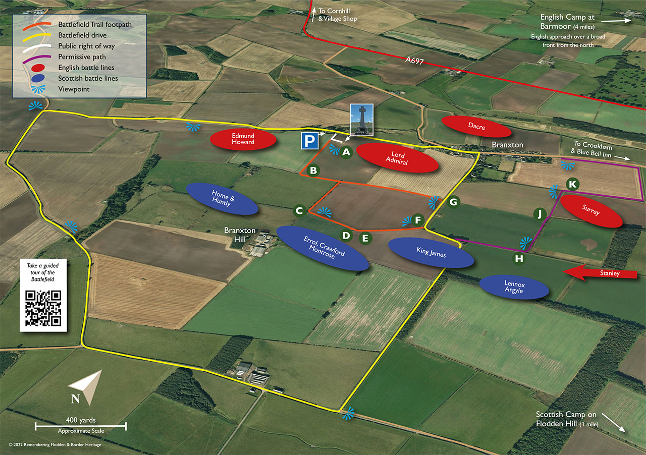
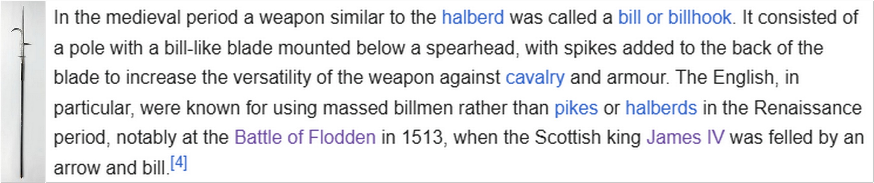
But defeat was snatched from the jaws of victory. Just like at Agincourt almost a century earlier, where the French found themselves mired in boggy ground and at the mercy of English archers, so the Scots encountered marshy ground when they descended Branxton Hill to engage the English army. Their long pikes were ineffective in the ensuing melee and no match for the English billhooks.
It is estimated that 10,000 Scots were killed and many more wounded, while the English lost only 4000. Among the Scots dead was James IV.
The Battle of Flodden Field as it came to be known was the last major battle between the English and Scots.
Earlier this past week (a glorious summer’s day, one of the best this year), Steph and I headed north (a round trip of 138 miles) to visit the battlefield and a couple of nearby castles at Etal and Norham (both now owned by English Heritage) that were briefly captured by the Scots before their defeat at Flodden.
And in the course of our journey, we travelled back almost 5000 years to a stone circle at Duddo.
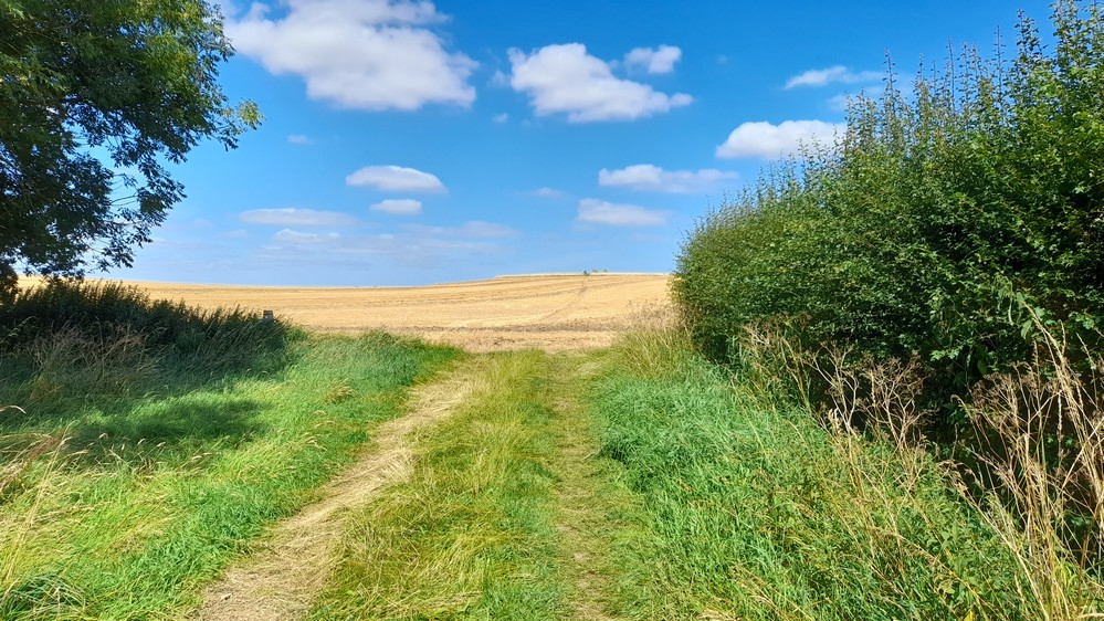
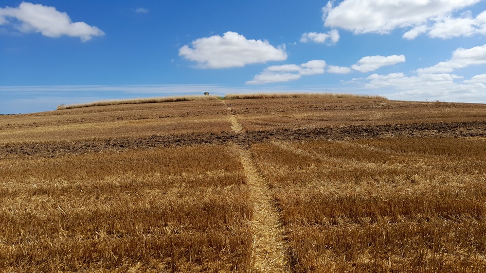
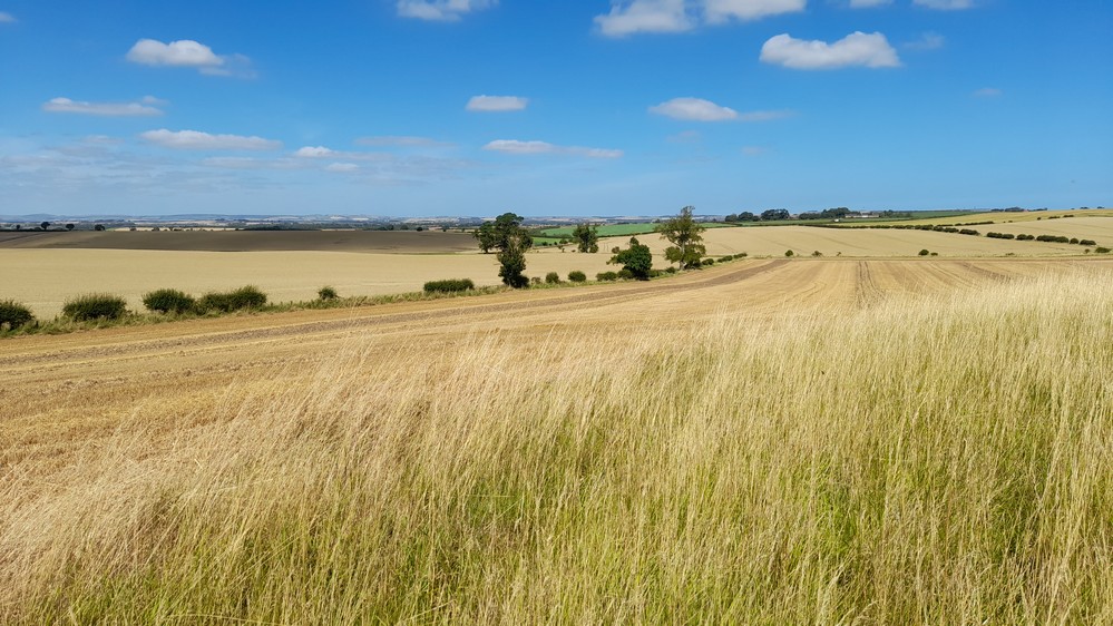
Standing beside the Flodden monument (erected in 1913) and looking over the battlefield, it was hard to imagine that for a brief period 511 years ago this was the site of bloody carnage. Sown to wheat and barley today (and almost ready for harvest) this landscape was incredibly beautiful and tranquil, and with views miles over the border into Scotland.


Before leaving Branxton we visited the Flodden Visitor Centre in the village: a converted telephone kiosk!


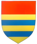
Coat of Arms of the Manners family
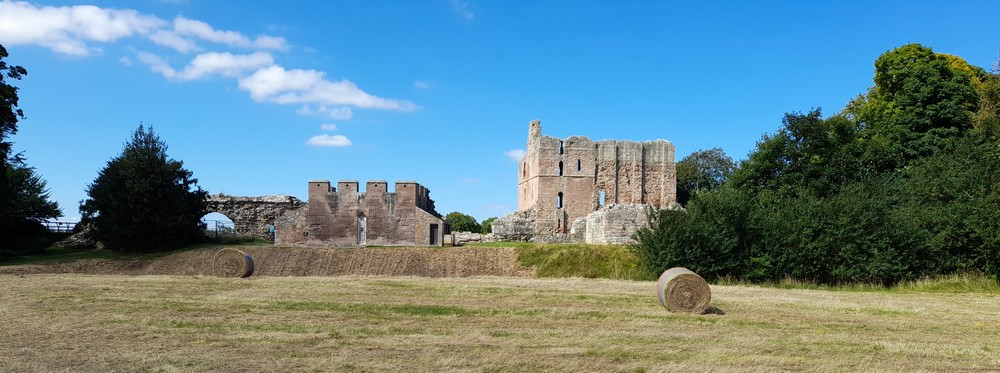
Etal Castle, just under 5 miles from Flodden, was the family home of the Manners family. It dates from the 12th century, and finally abandoned in the late 16th century. You can read all about its history here.
Still standing today are the Tower House (built before 1341), parts of the Curtain Wall, and the impressive Gatehouse.


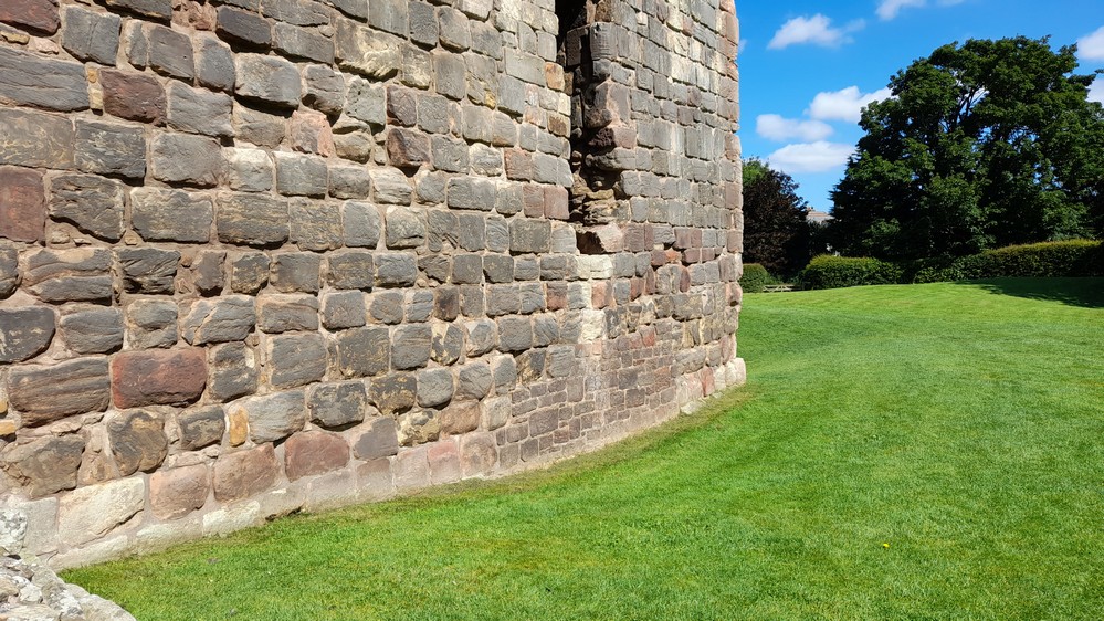
After the Battle of Flodden Field, the Scottish heavy artillery was sent to Etal Castle. An opening was made in the wall of the Tower House to store the guns in the basement. And the blocked-up opening can still be seen in the rearranged stonework outside, and in the basement.
Norham Castle, stands on the bank of the River Tweed, and commands a view of one of the fords across the river. It dates from the 12th century and was finally allowed to fall into ruin by the end of the 16th century when there was no longer a threat from the Scots from across the border.
Surprisingly perhaps, the castle was founded by Ranulph Flambard, Bishop of Durham from 1099 until 1128. Durham is known as the Land of the Prince Bishops, who wielded extraordinary power in the north of England in return for defending the border. Norham came under attack frequently and occupied over the centuries, including during the Scottish incursion in 1513. English Heritage provides a comprehensive history of the castle on its website.
The Great Tower is the part of the castle still standing, although derelict. Its height was increased several times, and this can be seen in the differences in stone color.
Some of the outer defences are still standing, as is the West Gate. Parts of the site are closed off to visitors.


And although it has been ruined for four centuries, it’s not hard to imagine just how magnificent and threatening the castle would have been in its heyday.
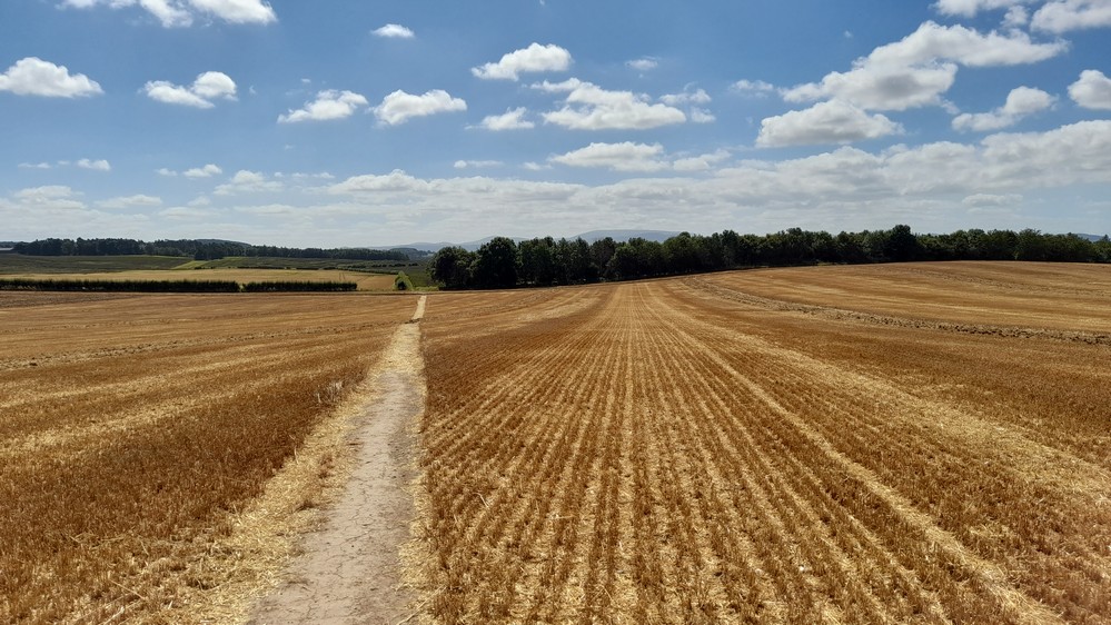
Almost equidistant between Etal and Norham, along a footpath in the middle of wheat fields, and about 1 mile northwest from the village of Duddo, the Duddo Stone Circle stands on a hillock overlooking the Northumberland landscape. Talk about wide open skies!
Dating from about 2000 BCE, the Stone Circle comprises five standing stones, with remains of others just showing above the surface of the soil. There is also evidence of burials there around 1700 BCE.
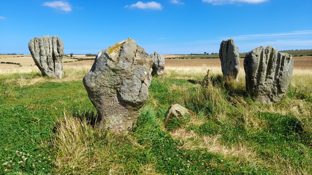
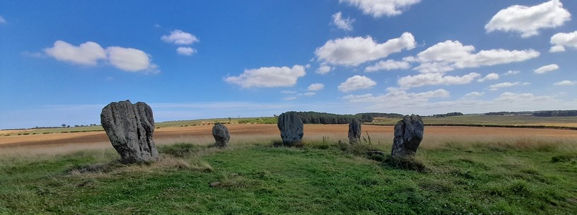
Two of the stones stand more than 6 feet.
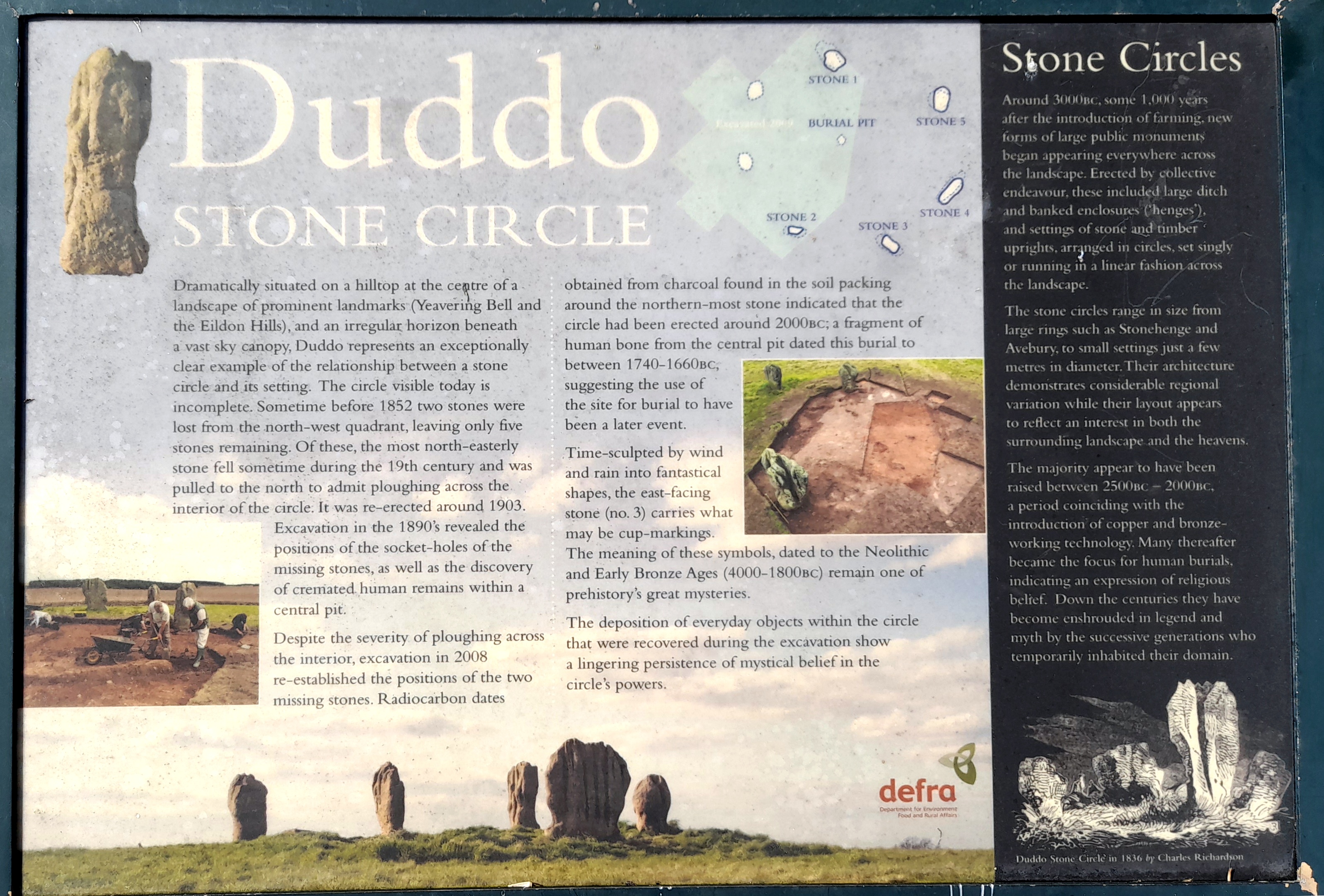
Click on the image below to read more about access to the Stone Circle across private land, and the history of the stones.
This was certainly one of our more enjoyable excursions since moving to the northeast almost for years ago. This was the second time we’d toured this area of north Northumberland (the first time in 1998). And it won’t be our last.
I have posted all the photographs in an online album. Just click on the image below to view those.