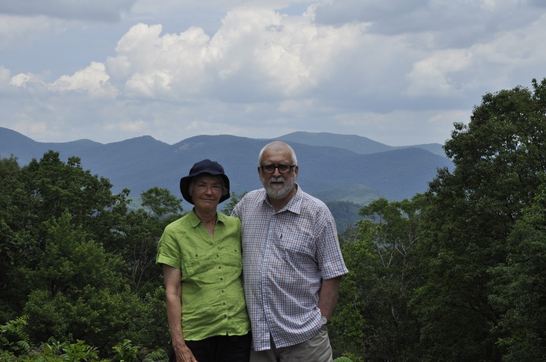
Well, we booked our flights way back at the beginning of January. And here we are, five months later, in St Paul, Minnesota for a month-long vacation with our elder daughter Hannah and her family.
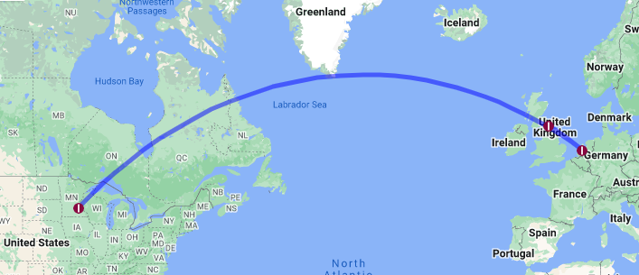
Our trip started very early last Thursday (9 May). I’d booked a local taxi for 03:30 to take us to Newcastle International Airport (NCL) for the flight to Amsterdam (AMS), so had the alarm set for 02:30. Just ten minutes before the scheduled pick-up time, I received a message on a phone app with the name of the driver, make and registration of the car, and when he would arrive. Imminently!
The roads were quiet at that time of the morning, as expected, and the 11 mile drive to the airport took less than 20 minutes.
All went smoothly at the KLM check-in; there was no-one in the queue ahead of us. Unlike last year when it was mayhem at NCL.
We quickly cleared security but then had to wait until 05:30 for the gate to open.
Once on board, the captain announced there would be a delay for about 1 hour due to fog at Schipol. Groans all round! But then, just five minutes later, he announced the good news that the weather had improved in AMS, and our flight had been given clearance to depart.
KLM operated a Boeing 737-800 (registration PH-BGC) on this sector.
It was bright and sunny, warm even, when we landed in AMS, around 08:20, but there was a very long taxi (around 15 minutes) to Gate D44.
Our connecting Delta flight (DL161) to MSP left from Gate E3 at 10:15. Schipol is a huge airport, and even with walkways it can take many minutes to walk from one gate to another. But as we’d arrived on time, we ‘enjoyed’ a leisurely stroll to our gate. Unlike last year when our arrival into AMS was delayed by more than 1 hour and we had to rush, arriving at the departure gate just as the flight was boarding. And as I’m still having some mobility issues, I was relieved we had the extra minutes this year.
Delta operated an Airbus A330-300 (registration N821NW) on this route. As with previous years we booked Delta Comfort+ seats. We enjoy the slightly bigger space and seat recline (and dedicated overhead bin space). And in the 2-4-2 seat configuration, window and aisle seats are a good choice for us. On the return journey last year, from Detroit (DTW) to AMS, I used airmiles to upgrade to Premium Economy. Not worth it!
The flight was almost completely full, yet despite that boarding proceeded smoothly and we actually departed about 10 minutes ahead of schedule.
This was one of the smoothest flights I’ve had over the North Atlantic, and although I never can sleep well on any flight, I must have snatched some, helped by a couple of these with my lunch, and another with a snack later on.
On arrival at MSP (Gate G2), at 11:40 (about 40 minutes ahead of schedule), there was quite a long walk from the plane to Immigration. With just a couple of passengers ahead of us in the queue, we sailed through, and both our bags arrived within 10 minutes. Hannah and Michael were waiting for us, and since they live just 4 miles (and around 9 minutes) from MSP, we were home by about 12:30 and soon enjoying a refreshing cup of tea.
In 2023 we visited the US for the first time since 2019 and made just a short road trip overnight to meet up with old friends Norma and Roger Rowe in La Crosse, Wisconsin. It was in September 2019 that we made our last long road trip, and I ‘vowed’ it would be our last. Until we agreed to make another trip this year. Who knows what’s in store in 2025?
Anyway, we’re flying out to Las Vegas (LAS) next Tuesday to begin a road trip of around 1800 miles across Utah and Colorado, visiting several national parks along the way: Kolob Canyon, Zion, Bryce, Arches, and Canyonlands in Utah, and Mesa Verde and Florissant Fossil Beds National Monument in Colorado. I’ve chosen some exciting (challenging, even) routes through the Rockies, taking in the ‘Million Dollar Highway’, weather permitting. And stopping off at the Hoover Dam in Nevada on the first day.
This is our planned route that will be subject to changes depending on road conditions at the time. But we do have all our overnight stops booked, so that much remains fixed.
Then, a week later, we’ll fly back to MSP from Denver (DEN).
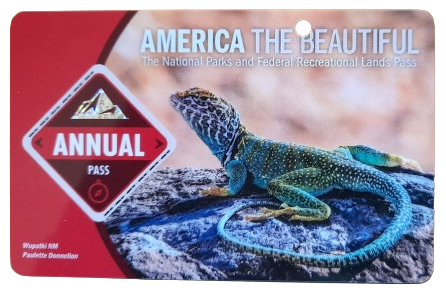
Yesterday, we visited the Minnesota Valley National Wildlife Refuge (just 6 miles from Hannah’s house) to purchase an America the Beautiful National Parks and Federal Recreation Lands annual pass. At US$80 (=£64.29) this is great value, saving probably half of what we would pay for all the individual visits on our trip, and permits entrance to all the national parks and facilities of several other federal agencies.
We also enjoyed a short walk around one of the trails near the Visitor Center, and within just a few minutes of arrival saw an incredible array of bird species. We will be returning there and to several of the other trail sites along the Minnesota River.
So look out for more posts in the coming weeks because I’ll be writing about each day’s adventures, posting lots of photographs and dashcam footage as we wend our way through the various canyons and over the mountain passes.
The Lincoln Highway. America’s first transcontinental highway, opened in October 1913. Three thousand, three hundred and eighty-nine miles!
If you’re traveling east to west, it begins in Times Square in New York and, originally crossing twelve states, ends at Lincoln Park in San Francisco on the west coast in California. Originally there was a ‘Colorado Loop’, removed in 1915, and in 1928, the route was realigned to take in northern West Virginia.
Over the years, however, the Lincoln Highway was subsumed into the US numbered highway system, with much of the section between Pennsylvania and Wyoming becoming part of US 30. Nowadays, I-80 west of Chicago follows much the same route as far as I can determine, although in places to the south of US 30.
So what’s this interest in the Lincoln Highway, and US 30?
Well, I’ve just finished reading The Lincoln Highway by Amor Towles, published in 2021. It’s an unusual tale of three teenagers and an eight year old boy who travel from Nebraska to New York. However, from the outset, the intention was for Emmett Watson and younger brother Billy (the main characters), to take the Lincoln Highway westwards to California in search of their mother who had abandoned the family some years earlier. And the only idea of where she might be is a series of postcards sent over nine days after she departed, from locations along the Lincoln Highway.
But instead of trying to explain the rationale of the book, let author Amor Towles tell you himself.
Towles’ previous books, Rules of Civility and A Gentleman in Moscow were published in 2011 and 2016, respectively, to considerable acclaim. I found The Lincoln Highway somewhat of a strange read, even though several reviewers gave it high praise. I decided to take it up after a friend posted a comment on Twitter about her enjoyment of this book.
I’m not so sure. About one third of the way through, I had to put it to one side for a while. I found the pace, and the literary tangents, not to my liking. Although, on reflection, it’s precisely those tangential narratives that are the mainstay of the novel. I guess I’d been expecting to read a more traditional travelogue about the Lincoln Highway. In many respects it is, but not the one I ‘hoped’ for. And since the narrative commences in Nebraska, about half way along the Highway, it emphasizes the in medias res approach of the author (and his characters), where the narrative skips forwards and back.
At the end of the novel we finally see Emmett and Billy heading to Times Square to commence that long journey westwards: the whole route, not just the western half that was promised at the beginning.
I try not to read too much into any novel that I take up. I had enough of literary analysis when I studied English Literature in high school for my pre-university exams. I like a narrative to take me along, and I particularly like to see how an author uses language to paint literary images. Amos Towle has a most acceptable writing style.
However, there’s another aspect of the Lincoln Highway that grabbed my attention. Being of a geographic bent, I went online to discover more about this particular transcontinental artery.
Since 2011, Steph and I have made some special road trips across America, and in the last one, in 2019, before the Covid pandemic prevented our return to the USA, we traveled from Massachusetts, through New England, around New York, down through New Jersey, across Pennsylvania, and south through Maryland and Virginia, before flying on to Minneapolis-St Paul from Baltimore.
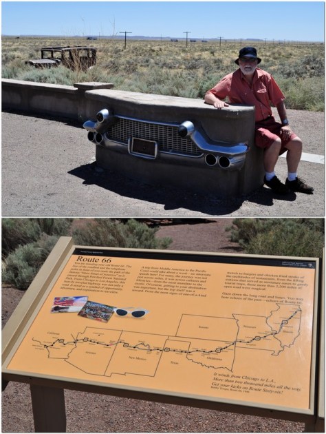
Much of our route through Pennsylvania was on US 30, and indeed during earlier road trips we had crossed or traveled short distances along the same route in Ohio (at Canton), in Indiana, and Iowa. Now, we didn’t make our road trips in a vintage Studebaker like Emmett and Billy (and their ‘companions’ Duchess and Woolly). But, when I saw the cover of The Lincoln Highway, it took me back to the road trip Steph and I made to the American Southwest in 2011, when we checked out that other iconic highway, Route 66, near Holbrook and the Petrified Forest National Park in Arizona.
Perhaps it’s just the call of wide open spaces, but American road trip narratives have almost become a genre of their own, and one that I would like to contribute to more myself, given half the chance.
You can check out some more of our road trips under ‘USA’ on this page.
Yes. That’s right. Eleven states in just ten days.
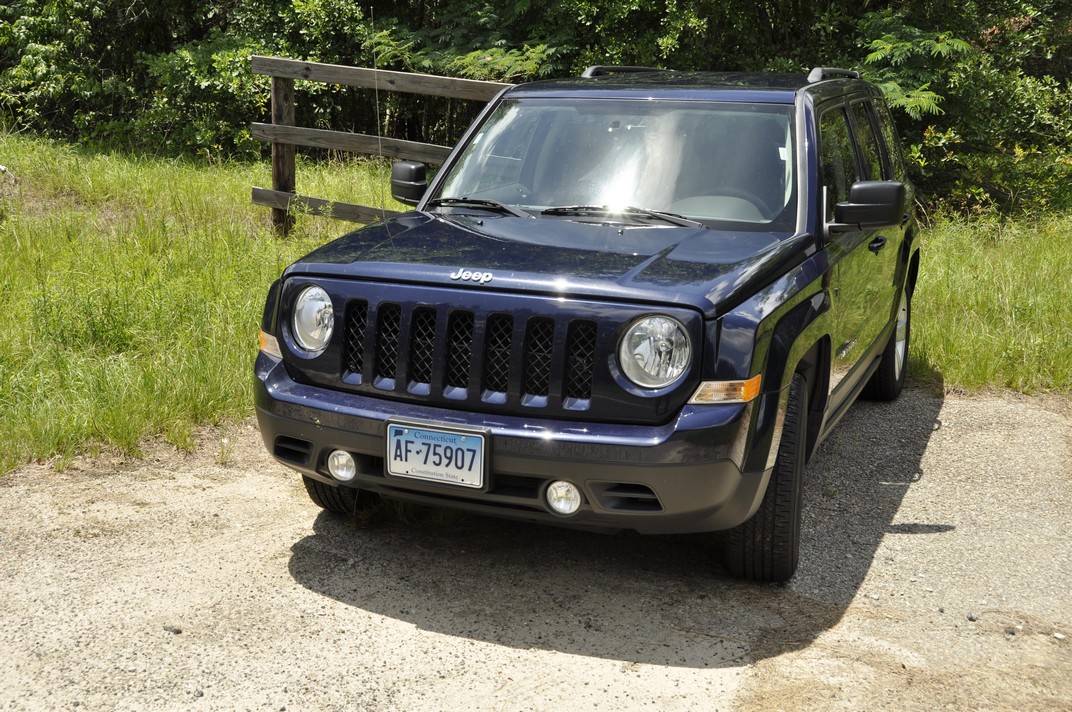
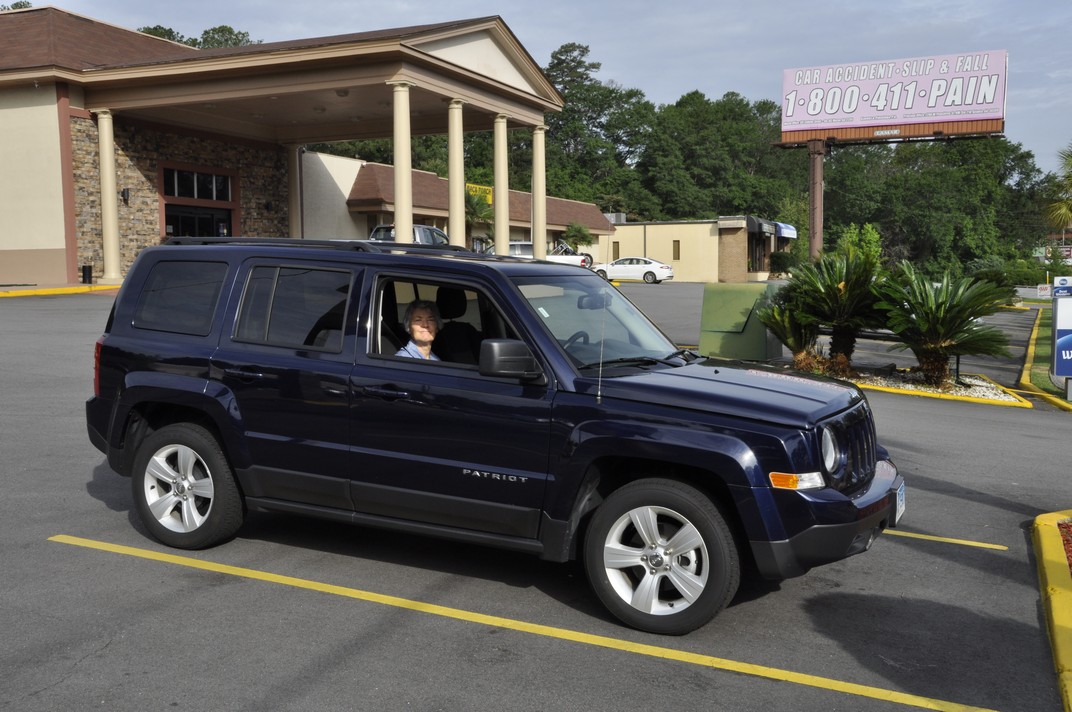
2764 miles to be precise. Ninety-four gallons of gasoline consumed. Almost 30 mpg at just USD209. That’s not bad considering we rented a Jeep Patriot SUV (with a Connecticut licence plate!).
I’d opted for a car rental through Rentalcars.com and chose Alamo as the best deal. Just USD357 for the actual rental, USD250 for the one way drop-off fee, and USD98 for roadside assistance cover and various taxes.
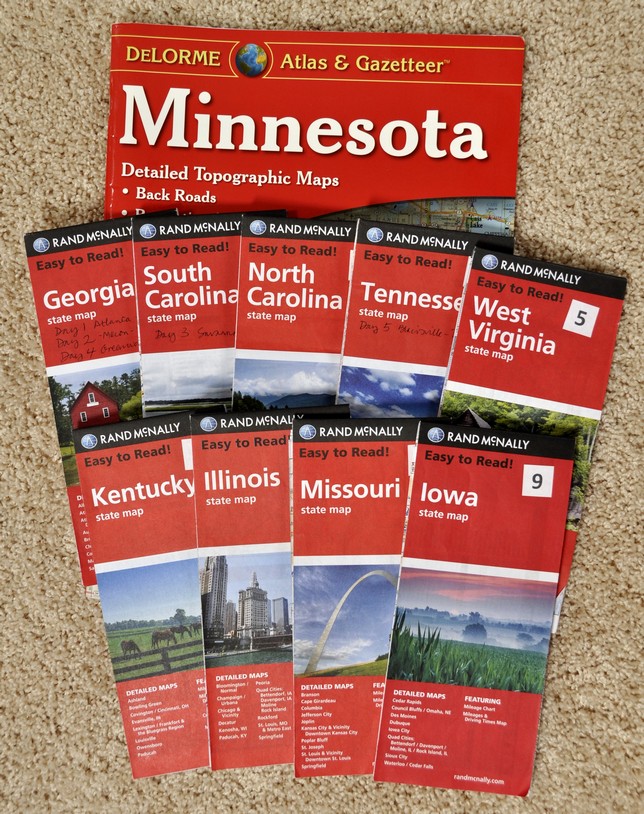
I had planned our route meticulously, taking in various sites and landscape features I thought would be interesting, and avoiding as much as possible any of the interstate highways. I bought Rand McNally road maps for all states except Virginia and Minnesota (we already had a DeLorme Atlas & Gazetteer for MN). I checked precise US and State Routes using Google maps since the scale of the Rand McNally didn’t always show the road name. I even used Google Streetview to check the various intersections, and before we traveled I already had an image in my mind of the entire route.
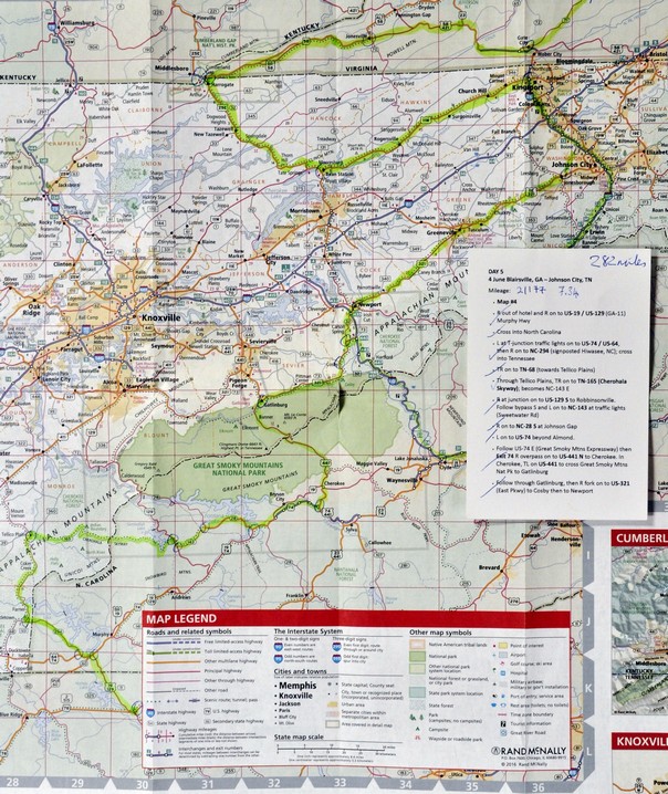
I prepared daily detailed route plans on cards, which Steph used to navigate us across country from Atlanta to Minnesota, with each map marked at decision points corresponding to the route card details (you can just make out a series of circles on the map below).
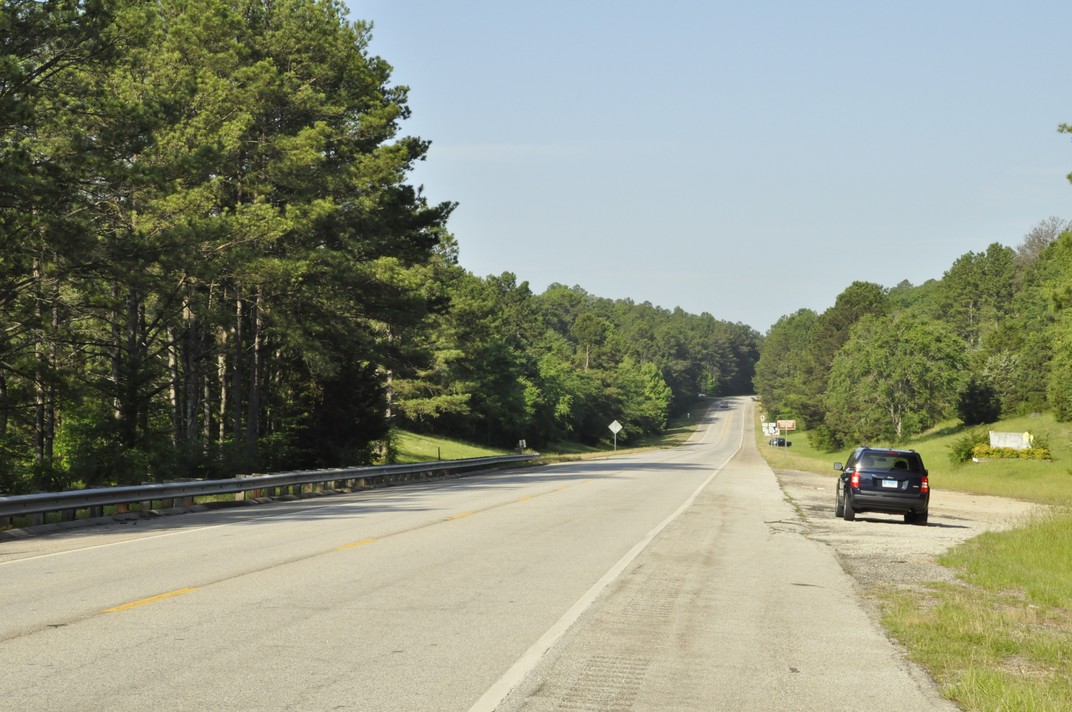
Fortunately, US roads are very well signposted and road signs (e.g. US61 or GA23, for example) are posted every few miles. It was hard to go wrong, but we did on three occasions; nothing major, however. My first mistake was leaving the car rental center at Atlanta Hartsfield-Jackson International Airport. I turned on to I-85N instead of I-85S, but was able to turn around within a mile. On two other occasions we made a turn too early, but realised almost immediately. Not bad really for such a long road trip. Nor did we encounter any road works that held us up, or any road accidents. We almost never saw a police car.
These four map links show the actual route we took over the ten days:
We stayed in ‘chain’ hotels like Best Western, Comfort Inn, Quality Inn and the like, about USD100 or so a night. In Savannah we stayed at The Planters Inn on Reynolds Square, close to the river and other historic attractions, and this was our most expensive at around USD230 including taxes and valet parking. Breakfast (if you can call it that) was provided in each hotel. For lunch, eaten by the roadside or at a scenic viewpoint, we picked up a freshly-made sandwich and with some fruit from the hotel, we had enough to keep us going until a substantial dinner in the evening. Surprisingly, we ate Mexican on three nights and had very good meals. There was even beer! Twice we ate at the nearby Cracker Barrel Old Country Store – reasonable food but no beer. Walking into our second Cracker Barrel in Troy, IL it was déjà vu; the layout of the restaurant and the store was identical to the one we patronised in Johnson City, TN.
Anyway, here is a summary of our epic road trip.
31 May, Atlanta, GA – Macon, GA, 82 miles
Our flight (DL73) from Amsterdam landed on time just after 14:15, and despite arriving at an E pier and having to walk the considerable distance over to the new F International Terminal for immigration and customs, then taking a 15 minute shuttle to the new car rentals center beyond the airport perimeter, we were on the road not long after 16:00. We were headed to Macon on I-75, some 82 miles southeast of Atlanta towards Savannah to spend our first night, and recover—to the extent possible—from our long day of travel from Birmingham (BHX), arriving to our hotel (Best Western on Riverside Drive) just around 18:00
Just arrived at Best Western in Macon
We had the room on the right of the balcony, overlooking Reynolds Square
1 June, Macon – Savannah, GA, 167 miles
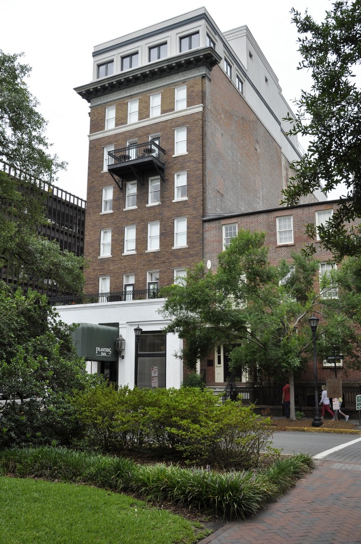
Since we had only a relatively short journey to reach Savannah, and because I wanted us to get a good rest before setting off once again, we didn’t leave Macon until after 09:00. Our hotel in Savannah (Planter’s Inn on Reynolds Square) had contacted me that morning by SMS asking what time we expected to arrive and hoping to have a room ready then. Not only was our room ready at just after 11:00, but we’d been upgraded to a balcony room. Once we had settled in, we set off on a leisurely stroll around the historic riverside where the old cotton warehouses have been converted to restaurants and other retail outlets, as well as apartments.
Savannah oozes history (and Spanish moss) – a direct line of historical events from the early 18th century, when it was founded, through Colonial times, and the turmoil of the Revolutionary and Civil Wars.
Savannah, GA
2 June, Savannah – Greenwood, SC, 196 miles We spent the morning in Savannah absorbing the Colonial, Revolutionary and Civil Wars history of this beautiful city. The weather didn’t look promising, with thunderstorms forecast, so we left the hotel by 07:30 and wandered through the various squares, parks and colonial streets for three hours, with just a small shower to bother us. After freshening up at the hotel and checking out, we were on the road again by 11:30, headed for Greenwood in the northwest of South Carolina.
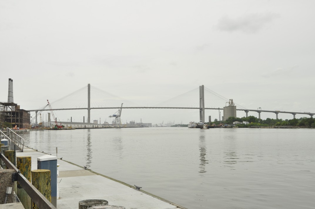
The US17 route out of Savannah crosses the Savannah River over the fine-looking Talmadge Memorial Bridge, completed in 1991, 185 feet above the water.
We passed through a heavy rainstorm for the first 20 miles or so, but the weather brightened, and we stopped for a bite to eat beside the road in glorious sunshine. The road north was almost completely straight passing through small towns with names like Denmark, Sweden and Norway. There wasn’t much evidence of much agriculture, just some maize on this coastal plain with rather sandy soils. Communities seemed quite impoverished (according to the 2010 census it is the 7th poorest state). Nevertheless, the Southern Baptist (and some Presbyterian) churches and chapels stood in stark contrast. I’ve never seen so many places of worship so close together. There must be a lot of wicked souls need saving in South Carolina (and surrounding states) to require so many churches, often within just a few hundred yards of each other (or closer).
We were in Greenwood by 17:00, found our hotel, the Hampton Inn, and enjoyed steak and seafood meals at the Red Lobster outlet beside the hotel.
3 June, Greenwood – Blairsville, GA, 195 miles
Distance-wise this was never going to be one of the longest days, but I had planned our route climbing into the Appalachians through the Chatterhoochee National Forest on US60, a winding road among the trees.
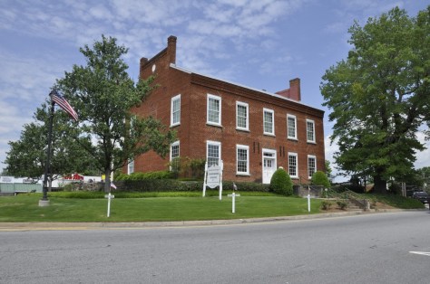
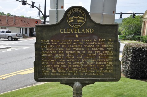
We departed from Greenwood around 08:00 and made our first stop at the SC-GA state line to look over the Savannah River at Calhoun Falls. We had another stop at Cleveland, GA to tour the historic courthouse museum, and arrived in Blairsville by about 15:00.
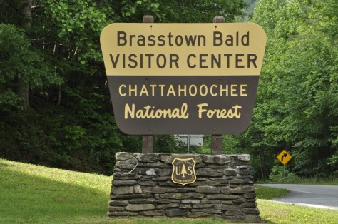
Not wanting to go straight to our hotel, the Comfort Inn, so early in the day, we opted for a 55 mile round trip taking in some of the hills and forest to the north and east of Blairsville, arriving to Brasstown Bald, the highest point in Georgia at 4500 feet, around 16:30 just in time to take the last shuttle bus to the summit, and down again. I decided not to walk the 1 mile descent from the summit to the car park because the average gradient was more than 14%, and Steph and I were concerned that I might hurt my right leg, which is still giving me some grief 18 months after I broke it.
4 June, Blairsville – Johnson City, TN 282 miles
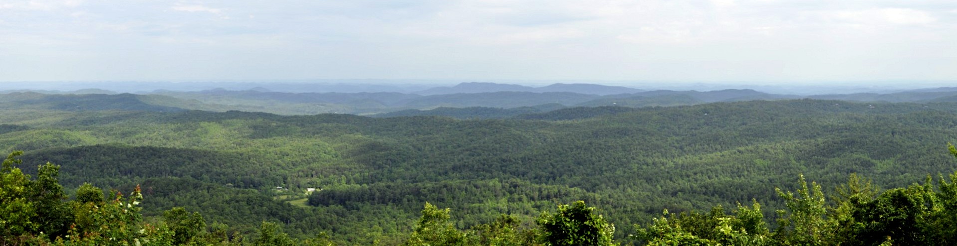
This was our opportunity of really traveling through the Appalachians. I’d chosen to travel east along the Cherohala Skyway in North Carolina. We had expected some poor weather this day, so set off as early as we could get away in order to enjoy the early morning brightness. The Cherohala offers some spectacular views along the way, and we were not disappointed at all.
Looking south from the Cherohala Skyway over North Carolina
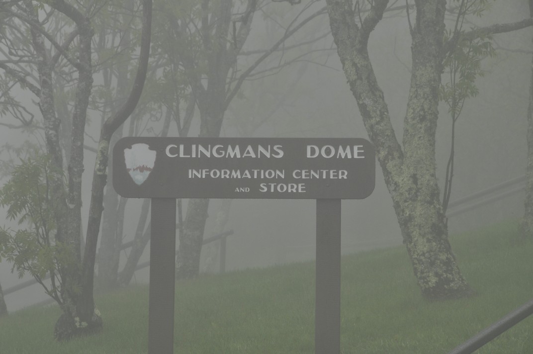
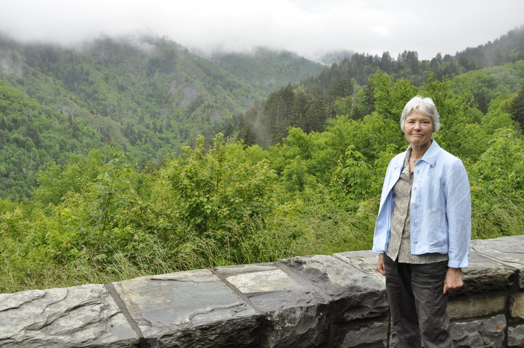
But the further east we went, the more cloudy it became, and by the time we reached US441 to cross the Great Smoky Mountains National Park, it was raining quite hard and we didn’t really see very much at all. We took the side route of about seven miles to Clingman’s Dome, the highest point over 6600 feet. Couldn’t see a thing! But lower down on the north side, the weather improved and we did see something of the Smoky Mountains.
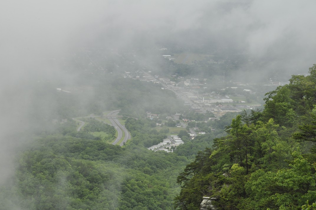
We then dropped down to Gatlinburg in Tennessee. If you’ve ever harbored the desire to visit Gatlinburg – don’t. What a tourist disaster! A narrow highway through the center of the town, tackiest tourist souvenir stores lining both sides, and even though this was early in the tourist season, there were throngs of people about. I’m glad we were only passing through. Then it was on to our hotel on the outskirts of Johnson City.
5 June, Johnson City – Charleston, WV, 380 miles
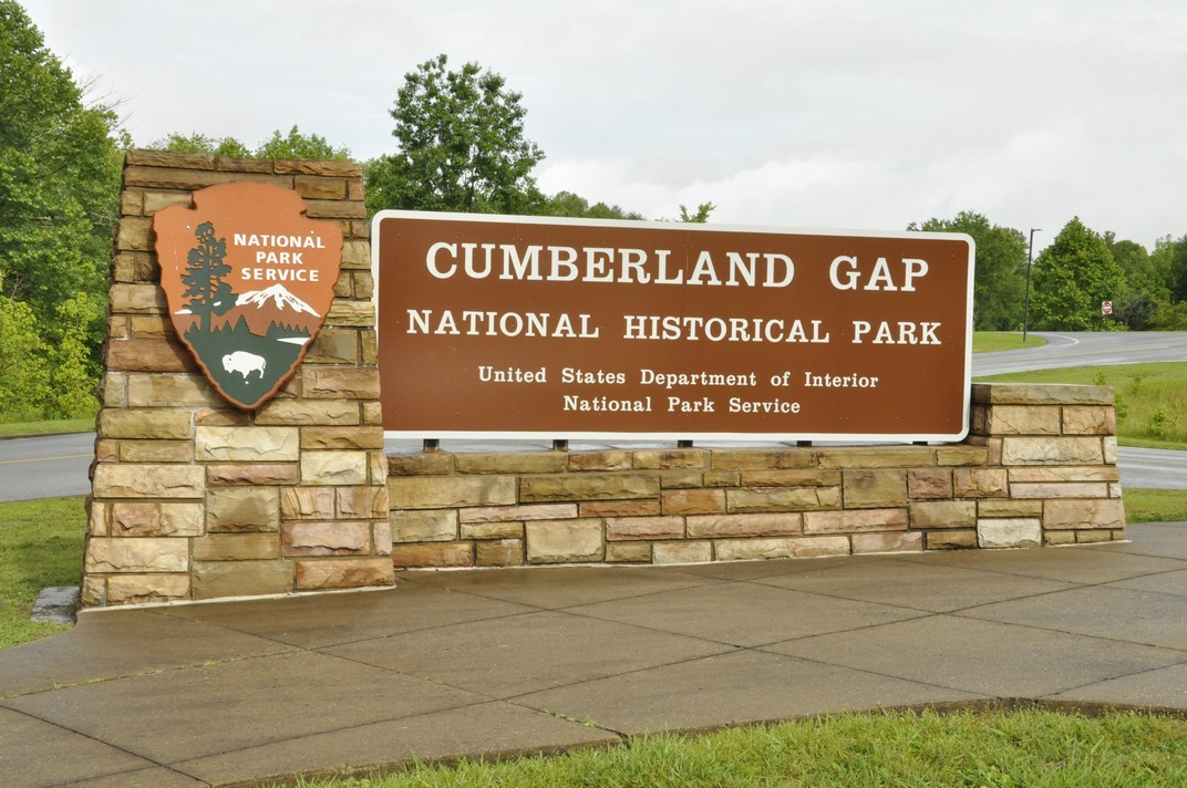
The focus early in the day was the Cumberland Gap, northwest of Johnson City by about 80 miles or so. Not long after leaving Johnson City, along US11, we passed through one of the heaviest rain storms I’ve ever experienced. I could hardly see in front of the car. But by the time we reached Cumberland Gap, the clouds had lifted somewhat, and the sun appeared.
The ‘Cumberland Gap’ is familiar to me from my skiffle days, as sung by Lonnie Donegan.
We went up to the Pinnacle Overlook, hoping to see the views over Tennessee, Virginia, and Kentucky – even as far as North Carolina on a good day. It was only a case of ‘now you see it, now you don’t’ as the clouds came rolling in, then dispersed. As a major pass through the Appalachians, the Cumberland Gap was strategically important for both the Union and Confederacy during the Civil War of the 1860s, and changed sides every so often. There is still evidence of military occupation high on the Overlook.
Looking north into Kentucky and the town of Middlesboro. The highway has just emerged from the tunnel through the Gap.
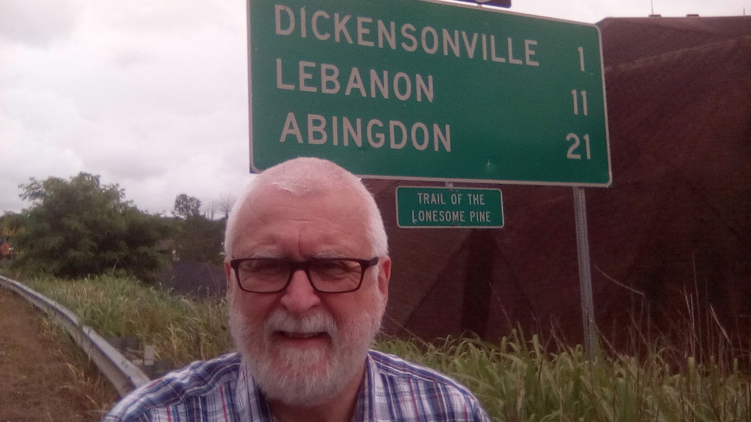
Then later in the day, heading east towards Charleston, the capital of West Virginia, we traveled along The Trail of the Lonesome Pine in Virginia. Until I was planning this trip, I wasn’t even aware that the Trail was a real entity, not after I’d heard Laurel and Hardy singing about it.
6 June, Charleston – Cave City, KY, 371 miles
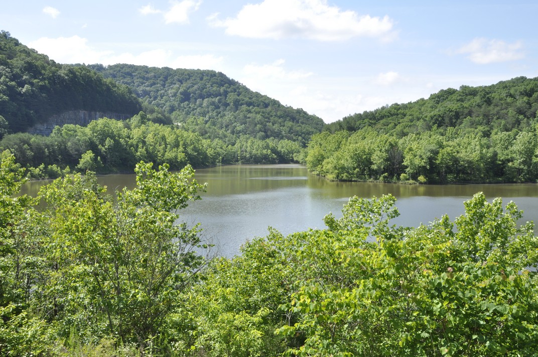
Our destination this day was Cave City in central Kentucky where we planned to visit the Mammoth Cave National Park the following day. Heading west out of Charleston on I-64, we turned south at Morehead in Kentucky (about 110 miles west) to head south through the Daniel Boone National Forest.
We traveled some 125 miles along scenic highways and byways. Then we turned west on the Cumberland Parkway west of Somerset, KY for the rest of the day’s trip to make up some time and so as not to arrive to our hotel too late. However, Kentucky is divided into two time zones, so we gained an hour (from Eastern to Central Time) about 80 miles east of Cave City.
7 June, Cave City – Troy, IL, 367 miles
The Mammoth Cave National Park opened at 08:00, and we were at the Visitor Center not long afterwards. I had booked a tour of the Frozen Niagara cave some months back, at 09:20. This was a guided tour, the first of the day, and to a cave that was easily accessible. I didn’t want to contend with scrambling over rocks with my leg. In any case we planned to stay at the Park only until late morning as we still had the whole day’s trip of over 350 miles to make.
We enjoyed the cave, along with a group of fewer than 30 others. The caves are kept closed and it’s generally not possible to visit them alone. What amazed us is that the cave system, at over 440 mapped miles is the largest system in the world. The Park gets very busy during school holidays, and we were fortunate to have visited when we did.
Our next port of call was Fort Defiance at the confluence of the Ohio and Mississippi Rivers, and the southernmost point of Illinois. Most impressive.
That’s the Ohio River behind us and the bridge between Kentucky and Illinois . . .
At Fort Defiance, at the southernmost tip of Illinois, at the confluence of the Mississippi and Ohio Rivers
Then we followed the Mississippi north towards St Louis and our hotel in Troy just northeast of the city, catching a glimpse of the famous Gateway Arch as we skirted the city center on the Illinois side of the river.
8 June, Troy – Iowa City, IA, 332 miles
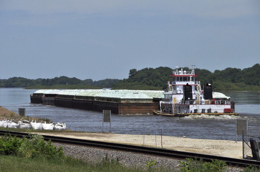
Our plan was to follow the Mississippi north through Missouri into Iowa. Heading west around the north of St Louis we crossed both the Mississippi and Missouri Rivers close to their confluence. Heading north on MO79, we stopped at Clarksville to stretch our legs, and look at the dam and lock, where a very large combination of barges was being ferried northwards slowly against the current.
Further north we stopped also at Louisiana, MO to view the Champ Clark Bridge that connects MO and IL, from a vantage point high above the river.
Then it was on to our next, and last, overnight stop in Iowa City.
9 June, Iowa City – St Paul, MN, 333 miles
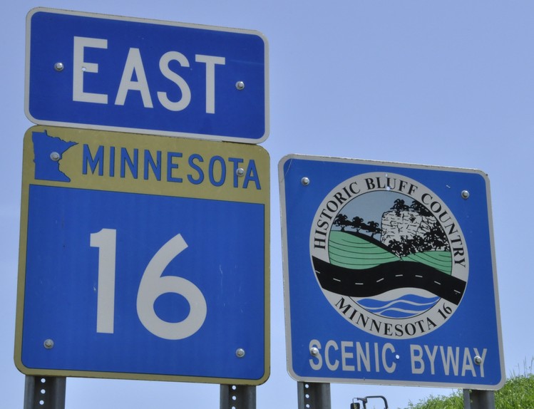
Our last day on the road, heading north on very straight roads, before crossing into southern Minnesota and crossing the Bluff Country eastwards to reach Winona on the Mississippi.
Just south of the Iowa-Minnesota state line we passed through Cresco, IA which proudly advertises itself as the birthplace of Dr Norman Borlaug, father of the Green Revolution in wheat and Nobel Peace Prize Laureate in 1970, who I had the honour of meeting when I worked at IRRI.
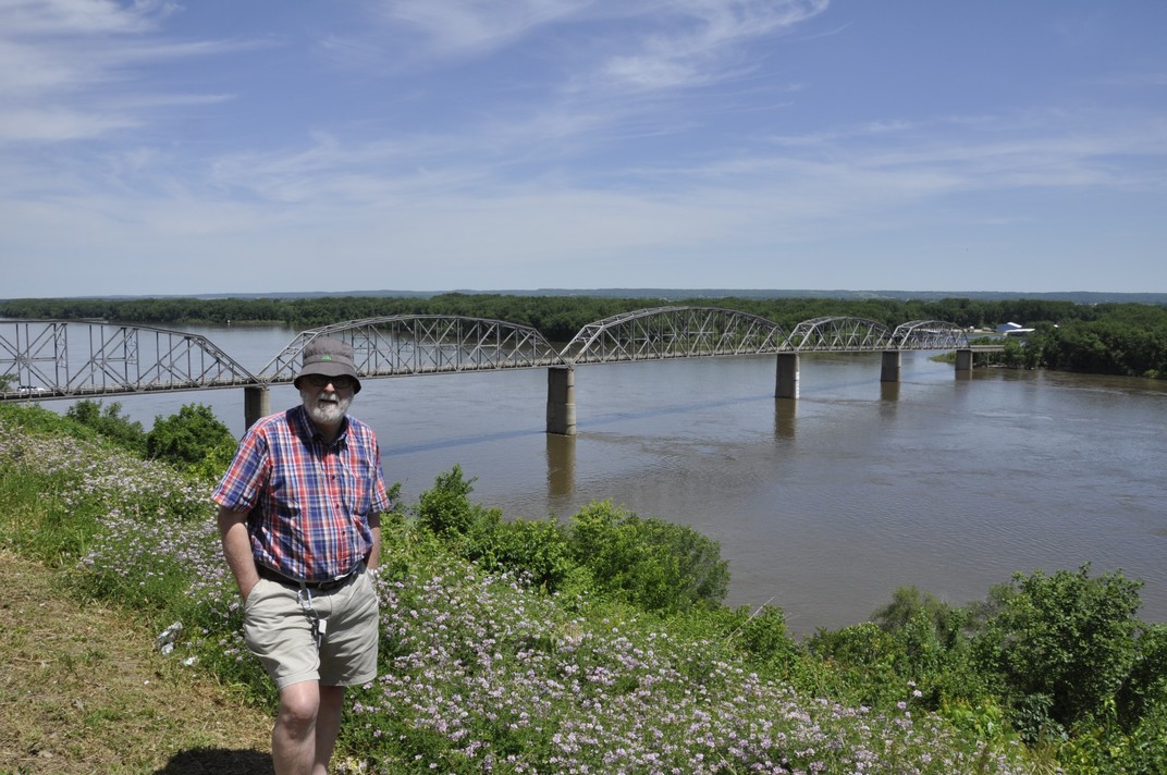
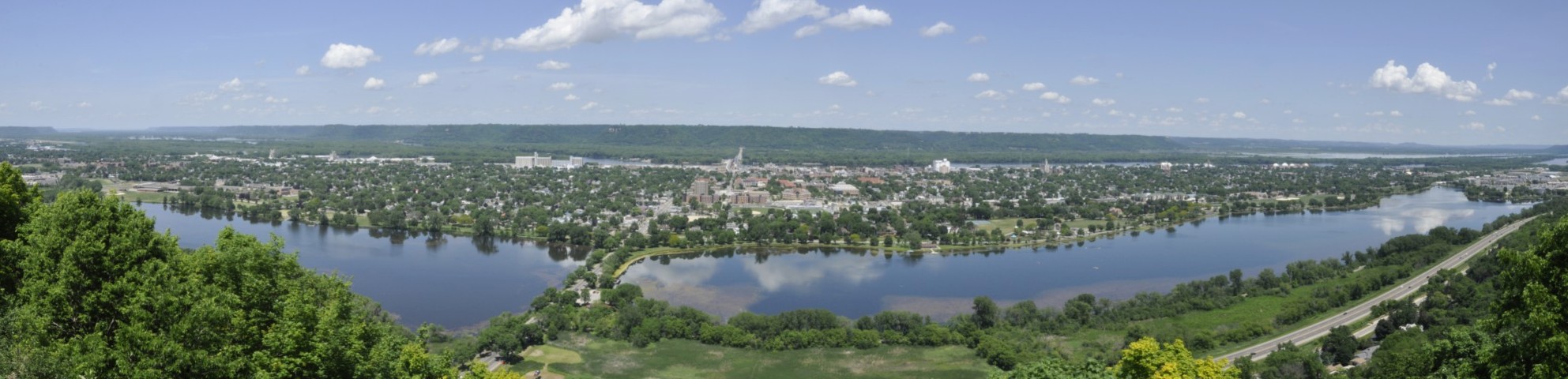
In Winona, we took a short diversion to a scenic overlook about 500 feet above the river valley and had a spectacular view north and south.
Then we set off with added determination to arrive to Hannah and Michael’s in the Highland Park area of St Paul by late afternoon, and the end of our enjoyable 2017 road trip adventure.
Here are the individual blog posts about the various places we visited:


 Over the years, however, the Lincoln Highway was subsumed into the US numbered highway system, with much of the section between Pennsylvania and Wyoming becoming part of US 30. Nowadays, I-80 west of Chicago follows much the same route as far as I can determine, although in places to the south of US 30.
 Well, I’ve just finished reading