Nestling under the Cleveland Hills in North Yorkshire, about half way between Thirsk and Middlesbrough along the A19 (map), Mount Grace Priory has stood proudly overlooking this beautiful landscape for over 600 years. It is owned by the National Trust, but managed by English Heritage.
Founded in 1398 by Thomas Holland, 1st Duke of Surrey, Mount Grace is a walled Carthusian priory or Charterhouse, of which there were several throughout England. It’s regarded as the best preserved. The priory was finally closed down in 1539 at the time of the dissolution of the monasteries under King Henry VIII.
* Recently I received a comment that questioned the reference to St. Benedict:
It is entirely incorrect to say that the Carthusians follow the Rule of Saint Benedict. They follow the constitutions laid down by Guigo who succeeded St. Bruno as their head of the order in the twelfth century. The way of life of the Carthusians, with its combination of eremitical [i.e. solitary or hermitic] and cenobitic [i.e. community] practices, bears little resemblance to that of the Benedictines and other followers of St Benedict’s rule, for example the Cistercians.
It appears that English Heritage might have got this wrong.
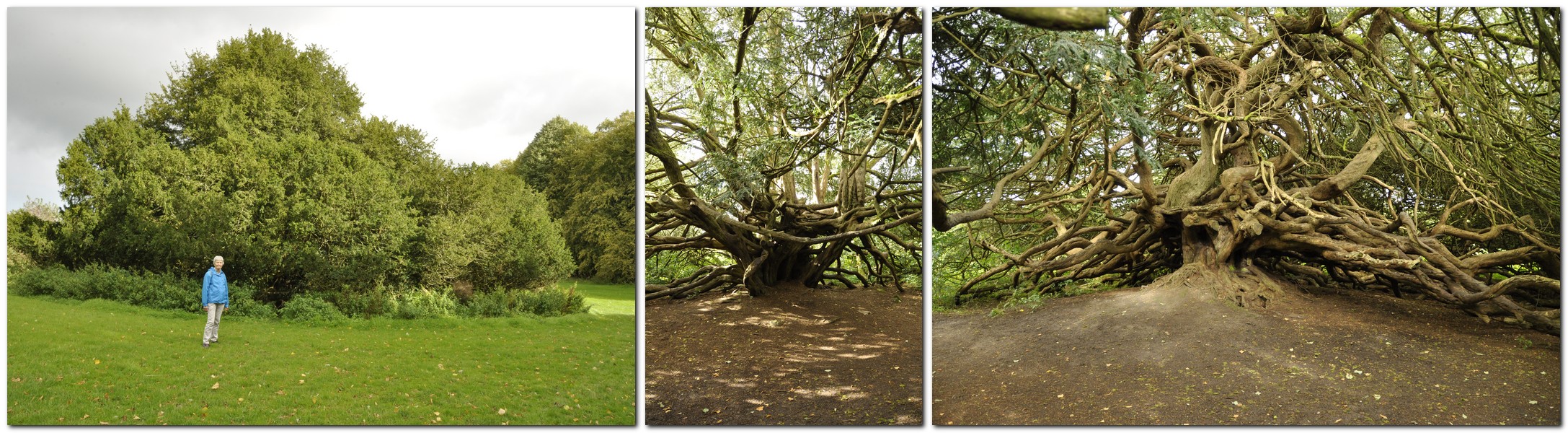
Built from a beautiful yellow stone that glowed in the early winter sun last Sunday when we visited, Mount Grace was a community to fewer than 20 monks, living more or less as hermits each in his own cell (6). Actually, these cells must have been the 15th century equivalent of a ‘des-res’. These surrounded a large cloister (5), were two storey buildings, with piped in water, outside latrine, and a garden that each monk attended. By the entrance door there is a large niche through which food and other necessities were passed to each monk. One of the cells (8) has been reconstructed.
As we entered the cloister the air was filled with the eerie sound of pheasants calling among the trees on the surrounding hillside.
The priory was dedicated to the Assumption of the most Blessed Virgin in Mount Grace, and an small but impressive ruined church (4) lies at the center of the priory compound.
More photos of the priory ruins, and a little more history can be viewed in this album.
The site was acquired in the mid-17th century by Thomas Lascelles, and then in the 1740s to the Mauleverer family. The priory guest house became the heart of the manor house we see today. But its current aspect was the work of a wealthy industrialist at the end of the 19th century, Sir Lowthian Bell.
Just a few rooms are open to the public. A carpet designed by William Morris is on loan to Mount Grace, and is laid in one of the ground floor rooms.
The coat of arms of the Bell family is displayed above the fireplace in another room on the ground floor.
The west facade of the manor house is covered in Virginia creeper, glowing red in its full autumn glory, overlooking a small, but carefully laid out terraced garden, leading to several pools that were used by the monks to raise fish. It was nice to see plant name labels throughout the garden.
Mount Grace Priory, house, and gardens were a true delight. We’ve often passed the entrance on our way north to visit our younger daughter Philippa and her family in Newcastle. But this time we were determined, weather-permitting, to stop off and explore the site. And that’s how we spent a very enjoyable three hours last Sunday morning, before hitting the road again, heading south to home in north Worcestershire.
We made a second visit here on 16 June 2021, mainly to see the gardens in full bloom. I have combined the photos I took then with an earlier album. You can view the whole set here.
Yesterday, I was reminded of that great radio broadcaster, Alistair Cooke (1908-2004) who presented Letter from America, a weekly 15-minute broadcast on the BBC from March 1946 to February 2004.
2,869 episodes! In each, Cooke presented a topical issue in the USA, tying together different strands of observation and anecdote and often ending on a humorous or poignant note.
Growing up, my family would listen faithfully to Letter from America, and that habit stayed with me as I moved on to university, and even while I was working overseas. Cooke had an excellent broadcasting voice, and always had something worthwhile and erudite to impart.
Originally from the UK, he moved to the USA in the 1930s and became a US citizen in 1941.
So why did Cooke drop into my mind yesterday, 10 October? It was one of those bright and sunny days, warm even, that we come to hope for in October, but rarely expect or experience. It was certainly a typical ‘Indian summer’ day, around 22-24°C, not a cloud in the sky.
When I was at university in the late 1960s, I remember listening to one particular Letter from America (I’m unable to track down the broadcast or transcript, although many are available online) in which Cooke waxed lyrical about Fall in New England, and went on to discuss the origin of the term ‘Indian summer‘. He described the unseasonably warm and dry days with clear, sunny skies that can occur around this time of year, often accompanied by misty mornings. It’s from this phenomenon, Cooke suggested, that the term was derived. The early colonists were aware that Native Americans would take advantage of this weather to hunt, and often attack their settlements under the cover of these misty mornings.
Yesterday’s weather pulled a memory of that broadcast, stored away for about 50 years, from the recesses of my mind.
Steph and I took full advantage to walk a stretch of the Heart of England Way, starting at the National Trust’s Baddesley Clinton in Warwickshire (just under 20 miles east of Bromsgrove, and about 30 minutes from home by car). I even had to retrieve my summer shorts from the drawer where I had put them away for the winter.
Described as An easy walk along country lanes and field paths, taking in Baddesley Clinton, Rowington Church and the Heart of England Way, it’s listed at under 3 miles in length, although according to my pedometer it was more like 3.8 miles.
We arrived at Baddesley Clinton just before 10:30 and, not having seen much traffic heading to the property, were rather surprised to encounter a very full car park. The place was heaving! We decided to take our walk before lunch, and then visit the gardens afterwards.
The weather was glorious, the rolling Warwickshire landscape stretching to the horizon, leaves changing color on trees all around, and also full of berries. I’ve never seen so many holly berries.
We set off through the churchyard of St Michael’s Church (1), and along the gravel road to turn right (2) on to Haywood Lane, and then, after about a mile, right on to Rowington Green.
A little distance along Rowington Green, the walk leaves the road and crosses fields (3) — along the Heart of England Way — to Rowington (4). We took a short break in the churchyard of the 12th century Church of St Lawrence (or St Laurence).
From Rowington, the walk heads north, along a public bridleway (5), and ending back at St Michael’s. I guess the walk took a couple of hours; we never rush.
Baddesley Clinton is a moated house, first built in the 1400s. One of the original owners was Nicholas Brome, Lord of the Manor of Baddesley Clinton, and is buried in St Michael’s Church. The house passed to the Ferrer family who occupied it for the next 500 years.
We didn’t visit the house yesterday, but decided to take a look at the garden – and we were not disappointed. There was a magnificent display of dahlias in one of the borders inside the walled garden.
Thank goodness we did take advantage of the exceptional weather. Today’s weather could hardly be more different. It’s windy, overcast, and all morning it has been spitting with rain. It’s a little cooler than yesterday, but going to go downhill as we progress into tomorrow and the weekend. That’s because Storm Callum is due to sweep in from the Atlantic overnight tonight, bringing a lot of rain. Climate change? What climate change? I wonder how long it will take for the remnants of Hurricane Michael to reach us?
Cornwall is home to several National Trust jewels. We visited these four:
St Michael’s Mount, on an island in Mount’s Bay off Marazion in the south of the county
Lanhydrock, close to the A30 near Bodmin
Cotehele House and Quay, overlooking the River Tamar, north of Plymouth
Trerice, close to Newquay on the north coast
Knowing how popular St Michael’s Mount can be (even slightly out of season, as we were), Steph and I decided to head to Marazion early on the day of our visit, so we could easily find a parking place. I guess we must have been there before 9:30 am, and knew we’d have to take the boat over to the island as the tide was still ebbing then and the causeway was still covered.
Parking was no problem. However, when we returned from our visit to the island just before 2 pm, visitors were streaming across the open causeway in the hundreds, and it seemed as if every parking place was already taken in the several car parks along the sea front.
Just before 10 the first passenger boat of the day pulled up alongside the jetty, and about eight persons clambered aboard. Since the sea was calm, there being no waiting queue of visitors, and it being the first boat, the boatman suggested going right round the island instead of just across directly to the harbor on the island. What a treat, as we had many different views of the island and buildings that would not have seen on a normal crossing.
St Michael’s Mount (the Cornish equivalent of Mont Saint-Michel in Normandy, although not quite so grand perhaps) was originally home to a 12th century priory, and there is evidence of human occupation over several thousand years. It has a rich history. It became the home of the St Aubyn family in the late 17th century, and the family continues to occupy the Victorian wing. in the 19th century there was a village and thriving community of several hundred residents living below the castle.
A visit to St Michael’s Mount includes not only a tour of the house, and its magnificent views over Mount’s Bay, but the gardens below the castle that have been built into and cling to the cliff face. We were told by our boatman that the four resident gardeners are also qualified abseilers! It’s quite a steep climb up to the castle, but well worth the effort.
By the time the causeway had opened and hundreds of visitors were pouring across, access to the house was becoming difficult. We had made the tour earlier, and even then passing the narrow entrance caused significant tailbacks.
Nevertheless, no visit to Cornwall would be complete without a visit to St Michael’s Mount. Its inaccessibility for half of the day just adds to its attraction. Check out more photos of the interiors and gardens here.
Lanhydrock, just a mile or so off the A30 near Bodmin) is special for two reasons: so many of the rooms (>50) are open to the public, and the Long Gallery in the north wing) and its magnificent 17th century plastered ceiling survived the 1881 fire that gutted most of the rest of house. The house is U-shaped; an east wing was demolished in the 18th century. It has been the family home of the Robartes for four centuries.
The weather for our visit was overcast with a little drizzle. As we wanted to visit Restormel Castle in nearby Lostwithiel later in the day, we decided to forego a walk around the park, just viewing the gardens and parterre close to the house.
You can take a virtual tour of the house and gardens here. There’s no doubt that Lanhydrock is one of the National Trust’s ‘premier’ properties full of exquisite objects that passed to the Trust when it acquired ownership in 1953. Definitely one of the properties that should be on everyone’s National Trust bucket list.
The first question I asked one of the volunteers when we arrived at Cotehele House was how to pronounce ‘Cotehele’. It’s ‘cot-eel’ apparently.
And it’s also one of the National Trust gems, having so many exquisite tapestries on display. The house dates from the late 15th century but then had 16th century Tudor additions, and is built I guess from local granite, a lovely soft grey color. It was the home of the Edgcumbe family. Passing through a small courtyard, you enter the Great Hall, on to the chapel, and up to the treasures of the first floor and above.
Cotehele has terraced gardens beside the house, and others slightly further away. The Valley Garden follows a steep-sided valley from the terraces to the River Tamar, and Cotehele Quay and Mill.
Trerice is an Elizabethan, 16th century manor situated a few miles inland from Newquay on Cornwall’s north coast. We visited this delightful house on our last day in Cornwall, on the way back to our holiday home after a visit to Tintagel Castle.
The Arundell family inherited Trerice more than 700 years ago. It passed to the Aclands in the late 17th century. In the 20th century, the Elton family took on a lease from the National Trust and carried out some major refurbishments, including replacing the roof.
There is some particularly smart plasterwork in several rooms, as well as impressive oil paintings.
Outside there is an attractive knot garden, and other horticultural attractions like a 1km mowhay.
An archaeological dig was underway behind the house on the day of our visit.
More photographs of this dig and exterior/interior views of the house are available in this album.
These are the other four stories in this Cornwall series:
For those interested in photography, I use a Nikon D5000 DSLR, with a Nikon AF-S DX Nikkor 18-200 mm f/3.5-5.6 GII ED VR lens.
Flash photography is not permitted inside National Trust properties, so that means shooting with the slowest speed I can get away with, since all my photos are hand held. Often I’m shooting as slow as 1/15, and 3200 ASA. All the interiors at these four properties were photographed in this way. It’s remarkable how the colors of the tapestries at Cotehele, for example, are revealed. I’m getting quite the dab hand at holding my breath as I’m about to press the shutter.
Gardens. How many were designed and planted decades, even centuries ago, that can only now be fully appreciated? They were never seen in all their glory by their visionary originators. What a horticultural legacy they bequeathed to later generations.
The National Trust manages four important gardens in Cornwall which we were delighted to visit during our recent break there. Of course, many of the houses which the NT owns have their own gardens. But the four we visited are ‘marketed’ as gardens in their own right:
Glendurgan Garden, on the east coast, just south of Falmouth
Trelissick, at the head of Carrick Roads near Truro
Godolphin, an important medieval garden east of Penzance
Trengwainton Garden, northwest of Penzance.
All lie south of 50.2°N, and so there are many exotic species like tree ferns and bamboos that thrive under these conditions. And although these gardens would have been in their prime earlier in the year, with rhododendrons, camellias, and magnolias in flower, we saw enough during our exploration of these gardens to appreciate how they might look in another season.
Glendurgan Garden was the first on our list. Having enjoyed a walk at Lizard Point earlier on this bright, sunny day, we looked forward to a pleasant stroll around the garden.
The garden was planted in the 1820s and 1830s by Alfred Fox, and occupies a steep-sided valley down to the fishing village of Durgan, below Glendurgan House, home of the Fox family (not open to the public).
We followed the red trail down to Durgan village, and came back up the brown trail on the left, taking in a viewing platform overlooking the maze (that was planted in 1833).
It was a mizzly sort of day when we stopped by Trelissick on our way back to our holiday cottage after visiting another NT property northwest of Plymouth, Cotehele House. So we were never going to fully appreciate one of the triumphs of Trelissick: the panorama from the terrace in front of the house down to the shores of the River Fal estuary.
Trelissick was the family home of the Copeland family, owners of the Spode China factory in Stoke on Trent (I used to pass nearby everyday on my way to grammar school in Trent Vale in the 1960s). Just a few rooms on the ground floor are currently open to the public. It was passed to the National Trust in 1955.
From the terrace, we made our way south through the garden, taking in the views (such as they were) from the tennis lawn (8) and the parkland (9) that did provide nice views back to the house. From Jack’s summer house (at the tip of the garden) we worked our way back up on the eastern side, crossing over the bridge into Carcaddon (11), then back towards the house across the main lawn (4).
Godolphin has a particular claim to fame. In its various gardens, the King’s Garden (5) and Side Garden (14), it seems little has changed since at least the 16th century, maybe earlier.
The Godolphins derived their wealth from some of the most important mines in Cornwall, the remains of which can still be seen dotted around the estate.
The main entrance of Godolphin House (9)
The Undercroft (8)
On the day of our visit just the King’s Room was open to the public. The National Trust has a holiday let here at Godolphin, and mostly the house is off-limits to the general public apart from certain days per year.
We also enjoyed the 1.5 mile walk to the top of Godolphin Hill, from where there is a 360° panorama to be enjoyed.
Looking towards Land’s End from the top of Godolphin Hill.
Northwest of Penzance, Trengwainton Garden offers magnificent views over Mount’s Bay, towards St Michael’s Mount in the east and Land’s End in the west.
Only the garden, full of exotic shrubs (particularly bamboos and tree ferns) is open to the public, although there is access to the terrace (R) below the house from where the panorama can be enjoyed.
Once again we were too late for many of the shrubs that flowered earlier in the year, but nevertheless our stroll through these leafy glades was rewarded by the view from the terrace.
There is also an impressive walled garden, divided into several ‘rooms’ growing vegetables and ornamentals. On the day of our visit there was an exhibition of scarecrows made by local schoolchildren to celebrate the centenary of women getting the vote in the UK.
We enjoyed this horticultural tour of Cornwall, and of course the gardens at the various houses we also visited: St Michael’s Mount, Lanhydrock, Cotehele House, and Trerice. We decided not to visit the Lost Gardens of Heligan (which must also be included in Cornwall’s horticultural heritage) having more than enough on our itinerary of National Trust and English Heritage sites to add another.
These are the other four stories in this Cornwall series:
On reflection, I’m not completely sure our choice of holiday accommodation was appropriate.
It was located in the far south of Cornwall, just north of Helston, excellent for visiting the coast around the Lizard and Land’s End Peninsulas, but not so handy for any of the other sites we wanted to visit in the north of the county. So on two or three days we had 100 mile plus round trips. Maybe we should have looked harder to find a cottage in the center of the county.
Nevertheless, it was very comfortable, and in terms of facilities and cost, it was just what we were looking for. And we were very happy with our week’s stay there.
Having traveled more than 250 miles south on the Saturday to reach Cornwall, we decided to spend the first two days, Sunday and Monday, exploring the coast in the far south. In any case, perusal of the weather forecast indicated that these two days would be favored by warm and sunny weather, ideal for enjoying the coast.
First port of call was Lizard Point (owned by the National Trust), the most southerly point on the British mainland. We always hear about John o’ Groats to Land’s End. But I think it should be Dunnet Head, the most northerly point on the mainland, in Caithness (which we visited in 2015) to Lizard Point.
Lizard Point, from the east
Having found the National Trust car park, we set off east along the cliff path towards Lion’s Den, a hole in the cliff created when a cave collapsed in the mid-1800s, overlooking Housel Bay.
The cave fall lies immediately in front, overlooking Housel Bay
Just as we approached Lion’s Den, I saw two black birds take to the air from a field to the side of the path, and fly down into Lion’s Den. Could those be choughs, I asked myself.
I hadn’t seen the distinctive reddish-orange curved bill and legs, but their call and size were different from either crows or jackdaws that were common in the area, especially jackdaws.
A local naturalist confirmed they were choughs, a resident pair that had nested at the Lizard in 2018. A few minutes later and he showed us a photo he’d just managed to take (with a super telephoto lens) of one of the birds deep down inside Lion’s Den.
So we returned to the spot, a few meters away where he took the photo, and waited. We could hear them calling. Our patience was rewarded, for after a couple of minutes, one of the birds hopped on to a ledge in full sunlight, and I had a brilliant view of this remarkable rare bird. Once common in Cornwall, choughs only returned to the Lizard in 2001, although more can be seen on the north coast of the county. We’d seen the Lizard’s only choughs! Needless to say, we were chuffed! Magic!
Returning to Lizard Point, we heard this eerie crying, wailing almost, coming from Enoch Rock just offshore. Talk about mermaids enticing unsuspecting sailors to their doom, shipwrecked on hidden rocks (no wonder the lighthouse was built there). A group of Atlantic grey seals was basking in the midday sunshine and calling to one another.
We enjoyed a coffee, overlooking Polpeor Cove, at Britain’s most southerly cafe, before heading west to follow the path towards Old Lizard Head through Pistil Meadow. On the way there were great views of the old lifeboat station, home to the RNLI’s biggest rescue in March 1907.
The following day, we headed to the north coast of the Land’s End peninsula, and the National Trust’s Levant Mine and Beam Engine (that had just shut down when we arrived there).
Levant Mine is located on Cornwall’s ‘Tin Coast’ (part of the Cornish Mine World Heritage Site), west of Lower Boscaswell (map). The 1840s beam engine has been fully restored. Both copper and tin were mined here, and the mine stretched for 1.6 miles out sea, and more than 500 of feet below the seabed. The mine closed in 1930.
There’s a small museum providing a window into the past and who were the miners and their families (particularly young women) who worked at the mine, underground and at the surface sorting and cleaning the ore. The coast path passes by the mine, but we didn’t walk too far; it was just too blustery and at the end of the day (after several other visits) we were feeling a little tired. The landscape is dotted with the remains of engines houses and chimneys of mines and their shafts long abandoned.
Continuing round the coast near St Just, we ended the day at Cape Cornwall (map). We had already decided to give Land’s End a miss: too commercialized. Cape Cornwall in the late afternoon sun was more than an adequate substitute. What glorious views west over the Atlantic Ocean (next stop: North America); and south to Land’s End, jutting just that little further out into the Atlantic, with the Longships Lighthouse just over a mile offshore.
Cape Cornwall
At the end of our week in Cornwall, we visited Marazion and its the sandy beach before crossing over to St Michael’s Mount.
St Michael’s Mount at Marazion at low tide
And to Tintagel on the north coast, where (after visiting the castle and the Old Post Office) we enjoyed a picnic lunch overlooking the Atlantic from the National Trust’s car park at Glebe Cliff beside the Church of St Materianna, that can be seen from Tintagel Castle.
Looking north from Tintagel Castle
Looking south towards the Church of St Materianna
Tintagel Castle island from Glebe Cliff
Church of St Materianna
Tintagel village from Glebe Cliff
There’s no doubt that Cornwall has a spectacular coastline; cliffs and beaches, waves for even the bravest surfer. The places we chose fitted in with our National Trust and English Heritage itinerary – and didn’t disappoint.
These are the other four stories in this Cornwall series:
Steph and I began planning a short, one week break in Cornwall way back in the Spring. As followers of my blog will know by now, we are avid members of the National Trust and English Heritage, and throughout the year we try to make as many visits as the weather and other commitments permit. In Cornwall, we wanted to explore as many NT and EH properties as we could fit into the six days, and the two days of travel. Eighteen was our tally!
We chose a small studio cottage, suitable for a couple, just north of Helston on the south coast, a round trip of more than 500 miles (including the side trips to a couple of National Trust properties on the way there and back – see map). Dovecote Cottage was located at the end of a 2 mile drive down a narrow lane (with passing places), next to a former farmhouse. It was very peaceful, and comfortable.
Dovecote Cottage
Our home (in Bromsgrove, in northeast Worcestershire) is less than 5 miles from the M5 motorway, the main arterial to the southwest. The M5 and roads south into Cornwall like the A30 can be notoriously busy during the summer, and delays of many hours are not uncommon as lines of motorists (many towing caravans) snake their way to the coast and sunshine. On the way south we had a traffic-free journey, but on our return on the following Saturday we had to make one detour to avoid a jam at road works near Tiverton (on our way to Knightshayes), and we also hit a long queue of traffic attempting to navigate the bridge over the River Avon, backing up about 10 miles although constantly moving.
During the six days touring Cornwall we clocked up another 500 miles, for a total of 1086 miles for the whole holiday.
Heading south, and just 12 miles east of the M5 near Taunton, we visited Barrington Court, a Tudor manor house built between 1538 and the 1550s. It was the first house acquired by the National Trust (in 1907) and became the residence of Col. Abram Arthur Lyle (of the sugar refining company Tate & Lyle) who refurbished the property, installing his collection of historic woodwork, and converting the next door 17th century stable block, Strode House, into a residence. Check details of Barrington Court on the National Trust website.
The south face of Barrington Court (on the right) and Strode House on the left. The connecting corridor between the two can be clearly seen.
Barrington Court is unfurnished, but that also permits better appreciation perhaps of the fine woodwork. The long gallery on the top floor is particularly impressive.
In several of the bathrooms, reclaimed Delft tiles surround baths and wash basins.
During the 1920s refurbishment Lyle had asked Gertude Jekyll to design a series of formal gardens surrounding the house. In the eventuality not all were constructed, but what there are now are beautiful accompaniments to an elegant house.
A full album of photographs of Barrington Court can be opened here.
A week later, and we were headed north to take in Knightshayes, an imposing Gothic Revival mansion standing on a hillside overlooking Tiverton in Devon.
Knightshayes is a late Victorian house (built between 1869 and 1874), designed by William Burges, whose design excesses never made it completely into the interior of the house (although the National Trust has refurbished one room following his designs). The gardens were designed by Edward Kemp.
It was the home of the Heathcoat-Amory family for more than 100 years, and was handed over to the national Trust in 1972. The last occupants, Sir John Heathcoat-Amory and Lady Joyce carried out extensive work on the gardens in the 1950s and 1960s; both were awarded Gold Medals by the Royal Horticultural Society. Lady Joyce (née Wethered) was a world class golfer with many titles to her name.
The interiors at Knightshayes are impressive indeed.
The woodwork and decoration on the ceilings in many rooms is quite stunning.
A few photographs displayed here cannot do justice to Knightshayes, so please take a look at a more complete (and annotated) album of photographs here.
Knightshayes also has one of the largest walled gardens we have ever seen, and on the day of our visit there was a ‘heritage tomato event’.
One of the paintings on display at Knightshayes was recently featured in BBC Four’s Britain’s Lost Masterpieces. A small painting, not much more than 12 x 15 inches perhaps has been attributed to Rembrandt. Using the tool beloved of all art historians, a torch, we could highlight and see the detail in this beautiful small painting.
Rembrandt as a young man – self portrait attributed to the artist
But is it a Rembrandt? Perhaps.
These are the other four stories in this Cornwall series:
Once there were hundreds. Now there’s just Court No. 15, the last remaining (and carefully restored) courtyard of working people’s houses just south of Birmingham city center on the corner of Hurst and Inge Streets.
Court 15 of the Birmingham Back to Backs, with the Birmingham Hippodrome on the north (right) side. Just imagine what the area must have looked like in earlier decades with street upon street of these terraced and back to back houses.
This is the Birmingham Back to Backs, owned by the National Trust, which we had the pleasure of visiting a couple of days ago, and enjoyed a tour led by knowledgeable guide Fran Payne. This National Trust property should be on everyone’s NT bucket list.
Court 15 was completed in 1831 and its houses were occupied as recently as the mid-1960s, when they were condemned. Commercial premises on the street side were still being used as late as 2002.
Court 15 was a communal space for upwards of 60-70 men, women and children, living on top of one another, in houses that were literally just one room deep: built on the back of the terraces facing the street. Just imagine the crowding, the lack of running water and basic sanitation, leading to the spread of social diseases like tuberculosis or cholera that were common in the 19th century. Just three outside toilets for everyone.
Since coming into its hands in 2004, the National Trust has developed an interesting tour of three of the Court 15 houses, taking in the lives of families from the 1840s, 1870s, and 1930s known to be living there then. The tour, encompassing very narrow and steep (almost treacherous) stairs over three floors, takes you into the first 1840s house, up to the attic bedrooms, and through to that representing the 1870s. You then work your way down to the ground floor, and into the house next door. From the attic in that house, the tour passes into the former commercial premises of tailor George Saunders who came to Birmingham from St Kitts in the Caribbean and made a name for himself in bespoke tailoring. When Saunders vacated Court 15 in 2002 he left much of the premises as it was on his last day of trading.
A Jewish family by the name of Levi, was known to reside in one of the houses during the 1840s. The Levis had one daughter and three sons, and like many other families, Mr Levi practiced his trade (of making clock and watch hands) from his home.
On the top attic floor of this house there are two rooms still accessible on the street side, but have never been renovated.
In the next 1870s house, occupied by the Oldfields, who had many children – and lodgers! – there is already a coal-fired range in the kitchen, and paraffin lamps were used throughout for lighting. The children slept head-to-toe in a bed in the attic room, shared with the married lodgers. Modesty was maintained by a curtain.
By the 1930s, there was already electricity (and running water) in the house, occupied by an elderly bachelor George Mitchell.
The premises of George Saunders are full of all the paraphernalia of the tailoring business. An old sewing machine, and another for making buttonholes. Patterns for bespoke suits handing from the walls, and bolts of cloth stacked on shelves. There are some half-finished garments, others ready to collect. Until his death, George worked with the National Trust to document the last years of the Back to Backs.
Throughout the houses there are many contemporary pieces of furniture and ornaments. My eye was caught by this particularly fine pair of (presumably) Staffordshire rabbits.
Finally, no visit to the Birmingham Back to Backs would be complete without a look inside Candies, a Victorian sweet shop on the corner of Hurst and Inge Streets at No. 55, purveyor of fine sweets that I remember from my childhood. What a sensory delight! In fact, tours of the Back to Backs start from outside Candies, so there’s no excuse.
And finally, what about that ‘rule of thumb’ I referred to in the title of this post. Well, while we were looking at the sleeping arrangements for the Oldfield children in the 1870s, Fran Payne reached under the bed for the gazunda, the communal chamber pot (‘goes under’). In the darkness, she told us, this how you could tell, with the tip of your thumb, whether a chamber pot was full or not. Dry: OK. Wet: time to go downstairs to the outside toilet in the courtyard.
I mentioned that our visit to the Back to Backs was very enjoyable, but it’s not somewhere that I would have made a special trip. We had to be in Birmingham on another errand, and since it was just a hop and a skip from the central Post Office, we took the opportunity. The Birmingham Back to Backs are a special relic of this great city of 1,000 trades.
Less than 4 miles by road west of Bromsgrove in northeast Worcestershire (much less as the crow flies) lies the village of Dodford. Nothing remarkable in that, you might say.
Well, until 1849, the village didn’t even exist. The area was known then as Greater Dodford, but became a community (of sorts) when a ‘village’ of more than 40 redbrick cottages (like the one below, known as Rosedene) was built, each in its own 4 acre plot of land. That’s significant.
Chartism was a national (but geographically uneven) working class movement, with violent and non-violent factions, campaigning for political reform between 1838 and 1857. The movement was named after the 1838 People’s Carter that espoused six principles:
manhood suffrage (but not women)
the secret ballot
abolition of property qualifications for MPs
payment of MPs
equal electoral districts
annual elections.
Communities like Dodford were established to help working-class people satisfy the landholding requirement to gain a vote in county seats. That’s why each cottage was built on 4 acres of land, the minimum at the time to satisfy the landholding requirement to make a man eligible to vote.
O’Connor purchased a farm of more than 250 acres at Greater Dodford, and divided it into 4 acre plots for each cottage. The lanes around Dodford remain as narrow today as when first opened in the 1840s.
Potential occupants placed bids for the cottages, with the highest bidder receiving the ‘choicest’ plot, and so on until all plots had been allocated.
Having walked around the plot at Rosedene, I can vouchsafe that it’s a large plot for one family to manage. Many of those who came to Dodford were working class families from the cities, with little experience of agriculture. What they encountered at Dodford was a very heavy clay soil that was extremely difficult to cultivate. Eventually however, they established that strawberries did grow well, and opened up a market to Birmingham for their produce. Likewise, garlic thrived, which they sold to the makers of Worcestershire Sauce, Lea & Perrins, in Worcester, 15 miles to the south.
By the time Dodford was built, O’Connor had perfected his simple cottage design. Each cottage had a simple central living room with a range for heating and cooking, with a bedroom off to each side. To the rear was a small scullery and an indoor water pump. The ash toilet was in an outhouse (much like my grandparents’ cottage in Derbyshire that they occupied until the early 1960s). Maybe there was a pig sty attached to the enclosed small yard. Behind the cottage there is a small barn.
Bricks for each cottage were made on site. Rosedene sits on foundations of stone. I did wonder whether stones from the 12th century priory nearby (now incorporated into a farmhouse) had been used for this purpose but there is no record of that being the case. O’Connor’s design included the ‘modern’ feature of air vents low down on the walls and into the roof to reduce condensation.
The National Trust purchased Rosedene in 1997 and has faithfully restored it. We visited the cottage a week ago. There is only limited access on the first Sunday of each month between April and December (on pre-booked tours).
Unfortunately, the National Trust volunteers waiting to welcome us to Rosedene were unable to unlock the property so we never got to look inside, apart from peering through the windows.
However, you can see something more of the interior here, which also provides a potted history of Rosedene.
Yesterday, Steph and I traveled some 40 miles southeast from our home in Bromsgrove in north Worcestershire, to revisit the National Trust’s Upton House and Gardens near the village of Edgehill in Warwickshire, that lies some seven miles northwest from Banbury (map).
We were last there in July 2012, combined with a trip to nearby Farnborough Hall. Take a look at a web album of photos that I posted afterwards.
Edgehill was the site of the first major battle of the First English Civil War, on Sunday 23 October 1642. Here the Royalist supporters of King Charles I clashed with Parliamentary forces under the Earl of Essex. The King had commanded the high ground and his troops marched down the Cotswolds escarpment to join battle with the enemy, arrayed below. The battle ended in stalemate.
The roar of cannons has long faded, as have the tramp of troops or galloping of horses, the clash of steel on steel, and the screams of wounded and dying men. Over the past four centuries the landscape must have changed immeasurably. Probably back in 1642 there were no fields, just open country, intermittently broken by woodland. And there certainly were no vivid blotches of bright yellow oilseed rape that are so typical of farming in the UK today.
A panorama over the site of the Battle of Edgehill, and north across Warwickshire.
We could see almost 40 miles west to the Malvern Hills, just visible (using binoculars) through the distant murk of an approaching weather front (that finally arrived with a vengeance overnight, and it has been raining heavily since). But what a magnificent view we had, almost perfect weather on May Day, even if a little chilly.
We had been intending to visit Upton just a few weeks ago, and enjoy the National Trust’s recommended ‘What a View’ Walk from Upton house, that takes in the Edgehill escarpment and the glorious view, a circular walk of just under 2½ miles that took around 1½ hours before arriving back at the car park to enjoy a welcome picnic.
We decided just to take a look at the gardens, rather than tour the house again. That would be a better option when the weather is inclement. Yesterday, after weeks of poor weather, it was just too nice to be inside.
The south front of the house overlooks the Main Lawn towards a ha-ha that disguises a steep drop to the Mirror Pool in the valley bottom.
The Main Lawn, looking south to the ha-ha, from where the garden drops steeply to the Mirror Pool. The open fields can be seen beyond the brick wall of the garden (see image immediately below).
The Mirror Pool from the ha-ha, with the Hazel Bank and Sunken Lawn on the right.
It’s remarkable how the landscape was adapted to create quite an intimate garden. We really must return again a little earlier in the year and enjoy the Spring bulbs. Most had already flowered, although there were some patches of Narcissi and beds of tulips adding a vibrancy in the early afternoon sunshine.
Looking west across the Mirror Pool to a magnificent yew behind the Kitchen Garden and the Dry Banks above.
A panorama of the Kitchen Garden and Dry Banks across the Mirror Pool, from the south. The ha-ha is at the top of the terraces, immediately below the Main Lawn.
Well, that was what I thought. Until a few days ago, that is.
On the outskirts of Southwell (pronounced Suthell, or more precisely /ˈsaʊθwɛl/or /ˈsʌðəl/) in Nottinghamshire there is a large redbrick building standing in about six acres of land. This is The Workhouse (or Greet House), beautifully stark in its Georgian symmetry.
Built in 1824 during the reign of King George IV, The Workhouse was ‘home’ to about 160 destitute men, women and children who were provided with ‘Indoor Relief’. The cost of providing support, under the Poor Laws, to recipients in their homes (so-called ‘Outdoor Relief’) had become less sustainable. So the Workhouse was built at Southwell to provide shelter for a limited number of paupers, many old and infirm.
Life in The Workhouse was no bed of roses, but maybe not as harsh as many others around the country, where everyone toiled in the most appalling conditions. But shelter and food was provided, and both boys and girls received a basic education, learning to read and write, and do sums.
No doubt the workhouse regime changed from time to time, as each new Master was appointed and took control of their lives. The Master and his family lived in a suite of rooms above the main entrance.
Workhouse Master Herring and his family in 1855
The Workhouse at Southwell was featured in Episode 4 of the second series of Secrets of the National Trust broadcast recently on Channel 5, and presented by Alan Titchmarsh. I have to admit it presented such a despondent scenario, a visit there didn’t seem very appealing. Consequently, Steph and I decided we wouldn’t make a special visit there, but combine it with another trip in the vicinity. And, as it happened, a diversion to Southwell last Monday added only a few miles to our return journey to visit our younger daughter and her family in Newcastle.
I mentioned my preconceptions about The Workhouse (based on the Titchmarsh program) to one of the volunteers. From what he told me, it seems that Titchmarsh wanted to present a more balanced picture of life in The Workhouse, but the series producer somewhat ‘over-egged the doom-and-gloom pudding’ story of The Workhouse. As I said there’s no denying that life inside was tough for the inmates. Life would probably have been tougher on the outside.
Now, having made a visit to The Workhouse I am so pleased that we did. It was revealing, interesting, conscience-pricking (although it’s not altogether appropriate to judge what The Workhouse stood for by today’s standards), and the National Trust volunteers (mostly in contemporary costume) brought the story of The Workhouse to life and made the visit even more enjoyable. They were very convincing, particularly the skivvy in the cellars who answered all my queries, in character.
The Workhouse consists of a three-story main building (with cellars), divided into separate sections for men and women, and able-bodied or old and infirm for each. Each group had its own exercise yard, with a privy in the corner from which ‘night soil’ was collected as manure for the garden.
Plan of The Workhouse. (5) is the National Trust entrance; (6) is the wash-house; (8) is the garden. The exercise yards can be seen either side of the main entrance to The Workhouse, with a privy in one corner of each. There are now gaps in the wall between the exercise yards to facilitate the flow of visitors. (4) is an assembly point for guided tours.
Husbands were separated from wives, and children from their mothers beyond the age of two. In the children’s dormitory, the glass in the windows (at least the lower panes) was frosted so they could not look at and see their mothers working in the yards below.
A block of outhouses to the rear of the main building contained the laundry, a bakery, and the ‘dead’ room.
Water was collected from the roof, and stored in a 160,000 gallon storage tank underneath the kitchen. Food was stored in the cellars.
Able-bodied men, who were unemployed outside The Workhouse, were considered lazy, and set to work on menial tasks such as unpicking old ropes or oakum. The old and infirm often had no work to do.
The various dormitories were on the first and top floors.
Many of the upper rooms have deteriorated and are in urgent need of conservation.
What is remarkable is that The Workhouse was still being used as an emergency shelter to house homeless families, in the so-called ‘bedsit’, as late as the 1980s.
If walls could talk, what tales they would tell us. But in the able-bodied men’s exercise yard (on the right on the panorama immediately below), and presumably out of view of the Master, at least one of the inmates did leave a legacy of their days in The Workhouse. Clearly etched on several bricks, someone has marked off the days.
It’s hard to imagine just how tough life must have been for the inmates of The Workhouse at Southwell. Surely it cannot have been worse than what they had endured, penniless and hungry, outside. With the enactment of the Poor Laws, society provided (limited) support for those who had fallen on hard times. In many ways, society has a lot to answer for today.
Yesterday (18 April) was, in many parts of the UK, the warmest day since the end of August 2017. After the lingering cold and grey weather we have had to endure in recent weeks, the prospect of a bright, sunny day certainly was encouraging. And, not being ones to squander an opportunity to be out and about when possible, we made the short trip to Coughton Court, a National Trust property on the outskirts of Alcester in Warwickshire, just 12 miles from home.
Coughton Court is one of our ‘local’ National Trust visits, and we’ve been there on several occasions mostly to walk through the bluebell wood and gardens. It has been in the same Throckmorton family for over 600 years, and the family still has apartments there.
We were too early to see a carpet of bluebells in the ancient wood to the east of the house. But we were not totally disappointed and some had already begun to bloom.
The Daffodil Society is holding its 2018 show at Coughton this weekend that we would have liked to attend, but have other plans made. So our visit yesterday was to view the extensive planting of daffodils in the grounds of Coughton Court. We were concerned that they would be past their best, but because of the dreary weather (and access issues at Coughton due to waterlogged car-parking) just hadn’t been able to schedule our visit before now.
Yes, some daffodil varieties were past their best, but there were still plenty more to lift our spirits.
In the orchard, there was a carpet of purple and white fritillaries under the apple trees (just about to come into flower) mixed with primroses and grape hyacinths.
Afterwards, we headed a further two miles southeast to view Kinwarton Dovecote¹ that stands alone in the middle of a field. Built in the 14th century (probably during the reign of King Edward III), the circular dovecote has more than 500 nesting niches, from which young pigeons or squabs would be taken for their meat.
It has walls that are about three feet thick, and it rises at least 20 feet to the top of the nesting ledges. A ‘potence’ or pivoted ladder (in need of repair) provided access to the highest niches. What an impressive structure that has stood proudly in the Warwickshire landscape for six centuries. What stories it could tell.
Kinwarton Dovecote
But what about the reference I made in the title of this blog post to ‘fireworks’. Well, the Throckmorton family of Coughton Court were implicated in the 1605 Gunpowder Plot to overthrow recently crowned King James I (and VI of Scotland) by blowing up the Houses of Parliament. The plot, on 5 November, is celebrated each year by fireworks displays nationwide.
~~~~~~~~~~~~~~~~~~~~~~~~~~~~~~~~~~~~~~~~~
¹ We have visited other dovecotes owned by the National Trust and you can read about them here.
Friday 23 February. A bright, sunny day, and not too much of a breeze. Although the day dawned with a covering of frost everywhere, it was not as cold as I feared. Still, there was a need to wrap up warm.
It looks like things will be rather different next week when the Beast from the East hits the UK. Beast from the East? That’s what the weather system from deepest Siberia has been labeled, and due to hit the UK early in the week, with Arctic sub-zero temperatures, and possibly significant snow fall. There’s a more or less stationary high pressure system over Scandinavia to the northeast of the UK, blocking ‘warmer’ weather systems driving in from the Atlantic, and at the same time drawing in all that cold Siberian air on a strengthening easterly air flow.
So, with much more inclement weather forecast, Steph and I decided that we’d better take advantage of yesterday’s decent weather and head out for a walk, and visit yet another National Trust property: Knowles Mill, a derelict 18th century flour mill alongside Dowles Brook in the heart of the Wyre Forest on the outskirts of Bewdley, about 18 miles west from Bromsgrove.
Knowles Mill along Dowles Brook in the Wyre Forest, with the mill cottage (privately-owned and undergoing renovation) behind.
There are no National Trust signs to Knowles Mill. It’s located within the Wyre Forest National Nature Reserve, and parking (with space for up to a dozen cars) can be found at the end of the very narrow Dry Mill Lane. We arrived around 10:20, and took one of the remaining spaces. Best to get there early although by the time we departed, just after noon, many of the cars had already left. As with all my blog posts, just click on the images to open a larger version.
We decided to follow the Dowles Brook Trail (marked red on the map below), although there is a public bridleway on the other side of the brook, and a bridge over it at Knowles Mill.
This route initially follows the Wyre Forest Butterfly Trail along the bed of the disused Tenbury and Bewdley Railway that was opened in 1864, and closed in July 1961. Then there’s a steep walk down into the valley, with the path emerging behind the mill and cottage.
So what was a mill doing beside Dowles Brook, how long had it been there, and what was its history?
The millstones and gearing mechanisms inside the mill are still in quite good shape.
On the west side of the mill the skeleton of the water wheel can be seen, and beside that the drained mill pond (although with some standing water today).
I couldn’t help wondering how life at the mill must have changed once construction of the railway began in 1860. The peace and tranquility of the site must have been shattered as the gangs of navvies moved in to build the massive embankments across all the small valleys that cut through the hillside above Dowles Brook.
After visiting the mill, we headed upstream, passing Cooper’s Mill (just a cottage now) before crossing over Dowles Brook and returning to the car park along the disused railway. At the car park we enjoyed a hot cup of coffee (we’d brought a flask with us) before setting off home in time for a later than usual lunch.
The walk, just on three miles, had no challenging sections to speak of, and combined the best of both worlds: local history and the enjoyment of beautiful woodland landscapes.
Elgar was born in June 1857 in a small cottage, The Firs, in the village of Lower Broadheath, a stone’s throw west of Worcester, and 20 miles southwest from our home in Bromsgrove. The cottage (formerly the Elgar Birthplace Museum) came into the care of the National Trust in 2016 following an agreement with the Elgar Foundation. Closed for a year for some refurbishment, and the addition of a tea-room at the existing Visitor Centre among other improvements, The Firs re-opened in September 2017.
As the weather forecast for Friday (yesterday) had looked promising from earlier in the week, Steph and I made plans for a day out. But where to go? Looking through the 2018 handbook I came across The Firs (which had not featured in the 2017 handbook for obvious reasons). And with the added attraction of a two-mile circular walk in Elgar country in the vicinity, this was just what the doctor ordered!
Our visit to The Firs was beyond my expectations and unbelievably moving, even bringing me to the point of tears as I watched the 15-20 minute film about Elgar in the Visitor Centre. Throughout our visit, but especially in ‘Elgar’s Study’, I really had the feeling of being in the presence of greatness, and I can’t recall ever having had that reaction before.
Elgar’s parents William and Anne had seven children, although two died young.
William was a piano tuner, and held a warrant from Queen Adelaide (wife of William IV).
Although Elgar moved away to Worcester with his family at the age of two, he retained a life-long attachment to The Firs. At the bottom of the cottage garden (see map) there is a lovely life-size sculpture of Elgar sitting on a bench (by Jemma Pearson) gazing through a gap in the hedge towards the Malvern Hills that he loved so much. It was commissioned by the Elgar Foundation in 2007 to celebrate the 150th anniversary of Elgar’s birth.
Elgar’s daughter, Carice (born in 1890) was the inspiration, in 1935, to acquire The Firs as a memorial to her father.
Entrance to the house is by timed tickets. There’s obviously not a great deal of space inside to accommodate too many visitors at a time.
Inside the entrance porch was a small room with an iron range for heating water and cooking. Today, the National Trust has decorated the room with contemporary though not original-to-the-house items, including a piano tuner’s set of instruments.
On the ground floor, the Parlour (dedicated to Carice Elgar) has a lovely piano, possibly played by Elgar.
At the top of the stairs is a room the full width of the cottage (perhaps earlier divided into two rooms) where Elgar was born. Two other rooms and this one have displays of various musical instruments, his sporting and scientific interests, and other personal belongings such as watches.
Elgar was apparently a keen cyclist, and on one wall of the Visitor Centre there’s a mural of an exuberant cycling Elgar. We were told, although this may well only be anecdotal, that Elgar once cycled from Malvern to Wolverhampton to watch his favorite football team Wolverhampton Wanderers play. A round trip of 100 miles!
Alice and Edward Elgar in 1890
Inside the Visitor Centre, an exhibition illustrates highlights from Elgar’s life and career. He married Caroline Alice Roberts in 1889. Her parents disapproved of Elgar—a ‘jobbing musician’—and did not attend their wedding in the Brompton Oratory in London. I hadn’t realized until yesterday that Elgar was a Catholic.
Alice (who died in 1920) was his inspiration, and early on in their relationship recognized his genius. And that leads to the second point I didn’t know. Elgar received no formal musical training. It wasn’t until 1899, with the first performance of the Enigma Variations, that his growing reputation as a composer was sealed.
In ‘Elgar’s study’ there are original scores of some of his most famous works, as well as the desk at which he worked.
Alice used to prepare the paper on which Elgar composed. Apparently, specially printed paper with the staves was not available, and had to be drawn by hand using the five-pointed pen you can see in a couple of the photos above.
‘Land of Hope and Glory, Mother of the free‘. Famous words by Arthur C Benson put to music in Elgar’s 1901 Pomp and Circumstance March No. 1, sung here by contralto Clara Butt.
A page from the original score of ‘Land of Hope and Glory’
Who hasn’t heard Land of Hope and Glory? It’s the theme accompanying high school and university graduations around the world. Our two daughters graduated from Manila International School in the Philippines in the 1990s, and it was used then.
Another large room in the Visitor Centre, the Carice Room, is used for concerts, and where we watched the film about Elgar. There was also a lovely exhibition yesterday of watercolors by Worcestershire artist David Birtwhistle.
After a spot of lunch—we even sat outside at one of the many picnic tables—we set off on our walk, which took just over an hour. The walk begins on a public bridleway just behind The Firs, and then crosses three fields sown with oilseed rape and winter barley. By the time we reached terra firma again at Bell Lane, it felt as though we were carrying half of Worcestershire on our muddy boots.
And at this point I must come back to Vaughan Williams for a moment, because as we were walking across the barley field, and looking back towards Worcester Cathedral to the east, a skylark rose into the air in front of us, singing lustily throughout its ascent and as it glided slowly back to earth.
What a wonderful sight and sound, reminding me instantly of Vaughan Williams’s The Lark Ascending premiered in 1920, although originally written for violin and piano in 1914.
The staff and volunteers at The Firs were outstanding, and their friendliness and readiness to engage with us added to the enjoyment of our visit. As I said at the outset, we didn’t have any particular expectations when deciding to visit Elgar’s birthplace. I came away deeply affected by what I saw, heard, and learned, and I’m sure that the emotion will stay with me for many days to come. And, coincidentally, as I am finishing writing this post, while listening to Classic FM, Elgar’s Cello Concerto in E minor, Op. 85 has just been featured.
Croome Court, some 20 miles south of our home in Bromsgrove, and nestling beneath the Malvern Hills, is one of our ‘local’ National Trust properties. In fact, it was the second property we visited, at the end of March 2011, just after we’d become members of the National Trust.
And a couple of days ago, on a very bright but cold morning, we made our fifth visit to Croome. The ideal setting for a bracing walk, and not only to recover from some of the excesses of Christmas, but also take a peek inside the house since we’d not done that since 2011.
We can see the Malverns from Bromsgrove, and there is often a clear view south down the valley of the River Severn near Croome, with the Costwolds outlier of Bredon Hill on the east side and, more spectacularly on the west, the line of the Malverns stretching some eight miles north to south and separating Worcestershire from Herefordshire.
As we drove south along the M5 motorway I wasn’t expecting to see the Malverns as we did that morning, covered in snow, and looking even more stately, impressive, and higher than we normally see them. What a surprise! Once at Croome, we had magnificent views of the whole line of hills due west. The snow had somehow ‘etched’ new landscape perspectives that we’d never observed before.
The magnificent Malvern Hills, looking more like the Alps than a modest range of hills on the Worcestershire-Herefordshire border.
The northern end of the Malverns, with Croome’s Temple Greenhouse on the far right, and the Croome River snaking past trees towards the left.
The Panorama Tower has a view westwards towards the Malverns, and east towards Croome Park itself. It lies about 1 mile as the crow flies due west from the house.
First things first, however. We arrived just after 10:45, after a 30 minute drive from home. Fortunately although the night before had been very cold, with a little dusting of snow and some icy patches on rural roads, we did not encounter any holdups at all. Nevertheless, the first place we headed to was Croome’s 1940s-style canteen to enjoy a cup of frothy cappuccino to set us up for the walk around the park.
In the past we’ve taken in the whole circuit of the park, to the far end of the Croome River (see map). But on this day, we walked as far at the Island Pavilion (21 on the map), and back along the far side of the Croome River to the Chinese Bridge (16). After touring the house, we headed to the Rotunda (13) and along the east side of the Walled Garden to exit through the Visitor Centre. It was a walk of around three miles, and most welcome.
The winter walk . . .
Looking east along the ha-ha to the Church of St Magdalene
The Temple Greenhouse
Croome Court from the Temple Greenhouse
The Island Pavilion
The south facade of Croome Court from the Chinese Bridge
A painting by Richard Wilson in 1758 is on display in one of the ground floor rooms. Not much has changed in the intervening 260 years.
Since our first visit, the main entrance to Croome Court is now through the Hall on the north side of the building. Inside, there are few significant changes from our last visit, although I think there were more rooms open on the first floor.
The Robert Adam ceiling in the Long Gallery is a sight to behold. The decorated plaster-work of the dining room is as delightful as ever, likewise the main doorway and ceiling of the Saloon. The bare wooden walls of the Tapestry Room are testament to what was; the tapestries now hang in the Metropolitan Museum in New York.
The wallpaper in the Chinese Bedroom on the first floor caught my eye, as did the portraits of the 9th Earl of Coventry and his wife propped up against the wall of an adjacent room.
Two exhibits stand out above the others. I love porcelain, and in the dining room there is a stunning exhibit, The Golden Box (designed by Dutch artist Bouke de Vries, whose War and Pieces we saw at Berrington Hall in April this year), of some of Croome’s porcelain. The Golden Box took my breath away.
On the first floor, in what was Lady Coventry’s Dressing Room, is the recently opened ‘I AM Archive’, a vortex construction that will eventually house information and documents about Croome. A truly inspirational design.
Finally, it was outside again through the doors of the Saloon, and on to the south-facing steps flanked by two sphinxes. In the early afternoon sunshine, the light coloured stone of the façade glowed a deep gold. At the Rotunda there was a good view over much of the park to the west and south.
Croome was heaving with visitors, all taking advantage of the lovely day, many following children along the ‘Gingerbread Trail’, or taking dogs for walks in the park’s wide open spaces. Everyone seemed to be having fun, as we did, and we look forward to our next visit some time during 2018.
Where Worcestershire Sauce was first concocted. But Worcestershire is also the birthplace (just outside Worcester) in 1857 of Sir Edward Elgar, one of the nation’s most renowned composers.
While reading this post, why not listen to celebrated contralto Clara Butt sing, in this 1911 recording, one of Elgar’s most famous compositions, Land of Hope and Glory (written in 1902, with words by AC Benson).
Bounded on the north by the West Midlands and Staffordshire, to the northwest by Shropshire, Herefordshire to the west, Gloucestershire to the south, and Shakespeare’s county, Warwickshire to the east, Worcestershire is a mainly rural county in the English Midlands. It has an area of 672 square miles, and is 38th out of 48 counties in size. Click on the map below to explore further. The estimated population (in 2016) was a little under 600,000. Ethnically it’s mostly white British (>91%).
Setting up home
Worcestershire is my home, but I’m not a native. I was born and raised in Cheshire and Staffordshire, some 70 miles to the north. My wife hails from Essex, east of London. We chose Worcestershire—Bromsgrove in the northeast of the county to be specific (shown by the blue star on the map above)—more by chance than design. Let me explain.
In March 1981, Steph, Hannah (almost three), and I returned to the UK after living more than eight years in Peru and Costa Rica. I’d just been appointed to a lectureship at The University of Birmingham, in the Department of Plant Biology, School of Biological Sciences. Until we found somewhere to live permanently, Steph and Hannah stayed with her parents in Southend-on-Sea, while I settled into lecturing life at Birmingham. And launch ourselves into the housing market.
Before we left Peru, we had asked Steph’s parents to contact on our behalf as many estate agents (realtors) as they could identify from locations in a wide arc from the west of Birmingham, south into Worcestershire, and southeast towards the Solihull area. We already had decided that we didn’t want to live in Birmingham itself.
Arriving back in the UK we encountered a very large pile of house specs waiting for us at Steph’s parents, and began to work our way through these, rejecting immediately any that did not meet our expected needs. We quickly whittled around 500 down to a handful of fewer than fifty or so.
It must have been the Wednesday of my first week at the university in April, a slack period with no lectures or practical classes scheduled. So I decided to take the afternoon off and go house viewing. But in which direction to strike out?
Bromsgrove is just 13 miles south of the university, connected by the A38, a route that crosses the city right by the university in Edgbaston. We had selected a couple of properties in Bromsgrove that seemed promising, and the drive there was likely to be the easiest of any of the other locations on our list. So I made appointments that same afternoon to view these two properties. And the first house I saw was the one we actually ended up buying. It just ticked all the boxes. Later that evening I phoned Steph to tell her what I’d been up to, and that she should schedule to come up to Birmingham on the train as soon as possible to take a look for herself. Within a week we’d made an offer for the house, and started to sort out a mortgage—at 16¾% interest in the first year or so!
Our younger daughter, Philippa, was born in Bromsgrove in 1982. New house, new baby!
In July 1991, I accepted a position at the International Rice Research Institute in the Philippines, and we stayed there until April 2010, almost 19 years. All the while we kept our home in Bromsgrove, fully furnished, but unoccupied, and available for us to return to whenever we came home on annual leave, and to take up residence once again on retirement.
Worcestershire is a lovely county, dotted with picturesque villages, rolling hills in the north and west, magnificent river valleys slicing through the landscape, and fertile agricultural land to the southeast. We’ve never regretted making the choice to move here. Being located in the middle of England, it’s not too far from anywhere. Our younger daughter lives in Newcastle upon Tyne in the northeast, a smidgen under 250 miles away. And during their lifetime, visiting Steph’s parents in Essex, just 160 miles away, was an (mostly) easy trip. Over the past seven years of retirement, we are enjoying getting out and about to explore not only our ‘home’ county, but also places within a 80-100 mile radius for day trips.
Administration, political life, and towns
Worcestershire has few urban areas. The City of Worcester lies in the center of the county, just 16 miles south of Bromsgrove. It’s the seat of the county council, and also of the Diocese of Worcester and its magnificent cathedral.
There are six local government authorities: 1. Worcester; 2. Malvern Hills; 3. Wyre Forest; 4. Bromsgrove; 5. Redditch; and 6. Wychavon.
There are seven parliamentary constituencies, all held by Conservative politicians. That says a lot about the county. The Member of Parliament for the Bromsgrove constituency is Sajid Javid, Secretary of State for Communities and Local Government, a member of the Cabinet, and once considered as a high flyer and Tory Party leadership contender. His star has waned somewhat.
Bromsgrove is famous for its 17th century nail-making industry, and the iron gates of Buckingham Palace¹ made by the Bromsgove Guild of Applied Arts. Carpet-making Kidderminster is nine miles to the west of Bromsgrove.
Redditch, nine miles to the east, was home from the 18th century to a needle-making industry, and Droitwich Spa, founded on extensive salt and brine deposits, lies about six miles south. In the far south of the county, market town Evesham serves the agricultural community in the fertile Vale of Evesham.
Landscape
Geographically, Worcestershire has some important features. England’s longest river, the Severn, enters the county northwest of Kidderminster (south of Bridgnorth), and flows for some 45 miles south before reaching the Severn Estuary in Gloucestershire and beyond. The River Avon (Shakespeare’s Avon) meanders east to west across the southern part of the county, round Evesham and to the north of Bredon Hill, before joining the Severn at Tewksbury in Gloucestershire.
In the north of the county, to the north and west of Bromsgrove, the Lickey Hills (between Bromsgrove and Birmingham) and Clent Hills rise to 978 and 1037 feet, respectively. On a clear day, the view from the top of Clent can be spectacular, as far as the Black Mountains of South Wales.
The view south towards the Malvern Hills (on the right), the Severn Estuary, and the Cotswolds (on the left).
Looking further west towards Abberley Hill, beyond Great Witley.
Straddling the county border between Worcestershire and Herefordshire, the Malvern Hills are an easily recognisable north-south spine, rising to over 1300 feet, and offering an unsurpassed panorama over the Severn Valley to the east, and the Cotswolds further southeast.
The Malverns (R) looking south to Bredon Hill (center) and the Cotswolds, and the Vale of Evesham, from just south of Great Witley.
This is a view, to the west, of the northern section of the Malverns and the Severn Valley from the Panorama Tower (designed by James Wyatt in 1801) at Croome.
In the south of the county, Bredon Hill (at 981 feet) is a Jurassic limestone outlier of the Cotswolds, affording views north and east over the Vale of Evesham, and south to the steep north-facing escarpment of the Cotswolds proper.
This is the view from Broadway Hill, looking north over the Vale of Evesham, with Bredon Hill on the left.
Horticulturally, the Vale of Evesham is one of the most important areas in the country, famous for its extensive orchards of apples, pears, and plums, vegetables (especially asparagus), and hop gardens, among others. Worcestershire is also ‘home’ to The Archers, an every day story of country folk, based on villages close to Bromsgrove.
In the northwest of the county, and spreading into Shropshire, the Wyre Forest is an important semi-natural woodland, and Site of Special Scientific Interest (SSSI). It covers an area of about 10 square miles.
Transport
Summer visitors to Worcestershire must be very high indeed, but perhaps for just an hour at most as they cross the county. That’s because the M5 motorway is a 32 mile corridor ferrying holidaymakers south to the West Country or north to Lancashire, the Lake District, and Scotland.
Worcestershire has two other motorways. A section of the M42 (the southern orbital around Birmingham) passes north of Bromsgrove, and joins the M5 there. The M50, in the southwest of the county, branches off the M5 and takes traffic west into Herefordshire and south to South Wales.
Worcestershire has two particular transport claims to fame. Running north-south, just over a mile east of Bromsgrove town center, the main-line railway (connecting Birmingham with Bristol and the southwest) traverses the Lickey Incline (currently being electrified as far as Bromsgrove), the steepest sustained main-line incline in Great Britain, for a little over two miles, at 2.65%.
The Incline was first surveyed, but then abandoned, by Isambard Kingdom Brunel in 1832 as a route for the Birmingham & Gloucester Railway.
Just a little further east, the Worcester & Birmingham Canal, completed in 1815, connects the River Severn at Worcester with Canal Basin in the heart of Birmingham, a distance of 29 miles. The 30 lock Tardebigge Flight, close to Bromsgrove, is the longest flight of locks in the UK. I have written about both the Lickey Incline and the canal here.
Tardebigge Top Lock
Part of the Tardebigge Flight
The view from Tardebigge church (above Tardebigge Top Lock) over Bromsgrove to the Malverns (in the southwest on the left) and to Clee Hill (due west, in Shropshire) in the distance.
Another canal, the 46 mile long Staffordshire & Worcestershire Canal (completed in 1771) branches from the River Severn at Stourport on Severn, crosses the northwest part of the county through Kidderminster, eventually joining the Trent and Mersey Canal at Great Haywood in Staffordshire. This was a vital link for 18th century industry.
Famous sons and daughters of Worcestershire
Earlier I mentioned Sir Edward Elgar. He is perhaps the most famous son of Worcestershire. He was appointed the first professor of Music at The University of Birmingham in 1905. The Elgar Concert Hall at the university, opened in 2012, is named after him. It is one of the venues in The Bramall that sits alongside the university’s Great Hall, an extension of the Aston Webb building, completing the red-brick semi-circle vision of Sir Joseph Chamberlain, which has been at the heart of the University since 1909.
In addition to his Pomp and Circumstance Marches, Elgar is also renowned for his Enigma Variations, composed in 1898/99 (0f which the evocative Nimrod must be the most loved). But I think his tour de force must be his Cello Concerto in E minor, Op. 85 played in this video by Jacqueline du Pré, one of the 20th century’s most talented musicians.
AE Housman
Classical scholar and poet Alfred Edward Housman was born in Fockbury, just outside Bromsgrove in 1859. His most famous cycle of poems is A Shropshire Lad, first published in 1896. His statue stands proudly over the High Street in Bromsgrove.
Conservative politician and Prime Minister at the time of the abdication of Edward VIII in 1936, Stanley Baldwin was born in Bewdley in 1857. Roland Hill, credited with the concept of a modern postal service, and the postage stamp, was born in Kidderminster in 1795. William Morris, later Lord Nuffield, and motor magnate and philanthropist, was born in Worcester in 1877.
Led Zeppelin’s Robert Plant was born in Kidderminster in 1948, actor Charles Dance (born 1946) hails from Redditch, and Sting’s wife Trudie Styler was born in Bromsgrove in 1956.
Heritage Historically, Worcestershire has much to offer. Two major—and pivotal—battles were fought in the county. In August 1265, the forces of Simon de Montfort, 6th Earl of Leicester were defeated at the Battle of Evesham by the army of King Henry III led by his son Edward, later Edward I. Almost 400 years later, in the final battle of the English Civil Wars, the forces of King Charles II (who wasn’t restored to the crown until 1660) were defeated at Worcester in 1651 by Oliver Cromwell’s Parliamentarian New Model Army.
Today, the Monarch’s Way is a long distance footpath (>600 miles) that traces the route of Charles II’s escape after his defeat at the Battle of Worcester. Earlier this year we visited Boscobel House in Shropshire (the furthest north Charles fled) where he hid in an oak tree.
The Monarch’s Way crosses the Worcester & Birmingham Canal in places, and passes through Pepper Wood, just west of Bromsgrove.
Standing proudly above the River Severn in the center of Worcester, the cathedral is the final resting place of King John (of Magna Carta fame).
The tomb of King John in Worcester Cathedral.
The cathedral was built between 1084 and 1504, combining different architectural styles from Norman to Perpendicular Gothic. There are many other abbeys and religious buildings throughout the county, most destroyed during the Dissolution of the Monasteries by Henry VIII in the sixteenth century.
There are two outstanding medieval threshing barns standing in the south of the county, near Bredon, and at Littleton near Evesham, as well as good examples of dovecotes at Hawford and Wichenford (both owned by the National Trust).
The medieval barn at Bredon.
The roof of Littleton barn.
Hawford dovecote on the left, and Wichenford on the right.
One of the oldest public schools (i.e. private school) in the country, Bromsgrove School, was founded as a chantry school in 1476, and re-founded in 1553. It takes pupils from all over the world, but despite occupying a large chunk of real estate in the town, seems to have very little connection with the community (even though it’s quite often featured in the local weekly newspapers).
The National Trust also owns two large estates in Worcestershire at Hanbury Hall (just seven miles southwest of Bromsgrove), and Croome Court, southeast of Worcester. Both are impressive 18th century houses. Greyfriars is a medieval merchant’s house and walled garden in the center of Worcester.
Hanbury Hall, built in 1701.
Croome Court, home of the 6th Earl of Coventry, and the first park designed by Lancelot ‘Capability’ Brown.
Looking south along Friar Street in Worcester. Greyfriars is the double gabled building on the left.
At Great Whitley, some 16 miles west of Bromsgrove, stand the ruins of Witley Court, owned by English Heritage, destroyed by a catastrophic fire in 1937. It has become a favorite place for us to visit, since the early 1980s when we moved to the county.
We have yet to visit the only other English Heritage property in Worcestershire, Leigh Court Barn.
The heritage, standard gauge Severn Valley Railway, formed in 1965, runs 16 miles from Kidderminster to Bridgnorth, beside the River Severn, with intermediate stops at several picturesque stations. It’s a delightful way to spend the day, with the opportunity for a good walk around Bridgnorth before returning to Kidderminster.
Worcestershire has such a lot to offer, and to some extent we have just scratched the surface. We look forward to many more years of getting to know this corner of England we call home.
Land of hope and glory? Much of Worcestershire is glorious. Hope? Well, while this Conservative government remains in power, and facing Brexit, there’s little optimism for hope, especially with all Worcestershire MPs being members of the Conservative Party.
~~~~~~~~~~~~~~~~~~~~~~~~~~~~~~~~~~~~
¹ In February 2012, I attended an investiture at Buckingham Palace and received an OBE from HRH The Prince of Wales. In this post-investiture photo in front of the gates at Buckingham Palace, I’m wearing the OBE medal, which is made by Worcestershire Medal Service based in Bromsgrove.
With Steph on 29 February 2012 outside Buckingham Palace after the OBE investiture.
Have you ever been surprised walking through an 18th century landscape? Ha-ha!
Well, you’ve probably come across numerous ha-has without stopping to think what or why?
A ha-ha is a recessed landscape design element that creates a vertical barrier while preserving an uninterrupted view of the landscape beyond. They became very popular in the 18th century, as landscape architects like Capability Brown developed their visions of an open landscape connecting house and surrounding land.
In some ways, they are like a dry moat, built for protection—not against human marauders, but animals. Grazing animals were excluded from the lawns and gardens immediately adjacent to a house. But, with a ha-ha separating this area from the ‘wild’ grazing outside, there was a continuity, a oneness with the surrounding landscape in which a house sat. (Think of an infinity pool as a modern equivalent having the same visual effect).
I first saw a ha-ha when I was a young boy growing up in Leek in North Staffordshire. There’s a good example on one side of the pitch at Leek Cricket Club where my Mum and Dad often took me on a Saturday evening in the summer.
Ha-has are more common than you might think. During our visits to National Trust properties over the past six years, we’ve seen some very good examples. Standing at the entrance of a stately home, gazing out over the landscape, your mind is easily transported back 250 years or so. Magnificent today, what must have been the wonder at these new landscapes in their heyday, and the unlimited vistas that the addition of a ha-ha opened up?
At Hanbury Hall, the National Trust property closest to our home in northeast Worcestershire, from the ha-ha just west of the formal garden and parterre, there is an open view to the northwest, across what must have once been a deer park.
In Herefordshire, a ha-ha separates the lawn in front of the main entrance from the meadows beyond atBerrington Hall.
The ha-ha at Berrington Hall encircles the main entrance to the house, and encloses a lawn and gravel drive.
Croome Court is southeast of Worcester, about 20 miles from home. The park at Croome was the first landscape designed by Capability Brown. However, the ha-ha does not separate the land immediately surrounding the house itself, but an area to the west of the house, around the Croome River, about half a mile from the house, where an orangery, a temple and a grotto were built. From the ha-ha there is an uninterrupted view back to the house.
The view from the edge of the ha-ha in front of the Orangery at Croome, looking towards the house
We just returned from Northern Ireland, where we visited eleven National Trust properties in eight days! In Co. Fermanagh, Florence Court sits comfortably in its landscape. It’s the National Trust’s furthest west property. The ha-ha is particularly impressive.
In these two photos, looking across the lawn in front of the house, the edge of the ha-ha can be easily discerned as a slight change in colour of the grass.
Belton House, near Grantham in Lincolnshire, and 100 miles east from home, is a magnificent property. We visited last August. On the east-southeast side of the house, there is a tree-lined avenue and vista to Belmont Tower, about 1 mile away.
Belmont Tower from inside the house. The ha-ha is just beyond the people in between the trees.
Looking back to Belton House from the ha-ha that is about half way to the Belmont Tower.
Just under half way from the house, a curved ha-ha separates the gardens from the park beyond.
Aerial view of the ha-ha at Belton House (from Google Maps)
Steph standing on the edge of the ha-ha.
I expect there will be many more to find and photograph in the coming years.
In general, I do not read up about any of the National Trust properties we visit ahead of the visit. Maybe I should, from time to time. On our way to Holyhead recently, for an overnight stop before we took the ferry over to Ireland early the next morning (for our National Trust tour of Northern Ireland), we visited Plas Newydd, a mansion alongside the Menai Strait, and home to the Paget family, Marquesses of Anglesey.
There has been a house at Plas Newydd since the late 13th century. The house today reflects the significant changes made by James Wyatt in the late 18th century. There are stunning views along the Menai Strait north to the famous Stephenson Britannia Bridge (the original was constructed in 1850), south towards Caernarvon on the mainland, and further east, of course, the Snowdonia panorama fills the skyline.
The original Paget family home was at Beaudesert, an estate near Cannock Chase in Staffordshire, in the 16th century. Plas Newydd, acquired by the Pagets in the 18th century, was only a holiday retreat, but eventually became their permanent residence.
I didn’t know too much about the estate nor the family, apart from something I’d read about the flamboyant 5th Marquess (featured on the cover of the National Trust magazine for Spring 2017) who squandered much of the family’s wealth, and died, aged 29, in 1905. The consequence of his debts was the sale of Beaudesert by the 6th Marquess in the 1930s, which was demolished but not in its entirety. Many of the contents, particularly paintings, were brought to Plas Newydd. Those in the drawing-room are particularly notable.
The 1st Marquess, Henry William Paget (as the Earl of Uxbridge) was one of the Duke of Wellington’s senior commanders (of the heavy cavalry) at the Battle of Waterloo, who was elevated to the marquessate of Anglesey just three weeks after the battle. Towards the end of the battle, he was struck on the leg by a cannonball, apparently eliciting the exchange between him and Wellington that I have used as the title of this post.
The Duke of Wellington was not well disposed towards Uxbridge, who had eloped with the Duke’s sister-in-law, but who he eventually married. He had eight children by his first wife, and seven surviving infancy from his second marriage. There is a several displays in the house of the Marquess’s regalia, his uniforms, even one of his artificial legs. He was eventually promoted Field Marshal.
In the ample grounds there are many walking trails, a small arboretum, and a terraced garden on the north side of the house.
On the wall of the small Gothick Hall, with its balcony, are early Paget ancestor (which you can just see through the open door from the Music Room). The Music Room itself opens off the left side of the hall.
Through a small door in the far corner of the Music Room, there is an elegant staircase leading to the first floor bedrooms. On the wall above the staircase is an impressive full-length portrait of the Duke of Wellington.
Just a few bedrooms are open to view, including the Alcove Bedroom, opened to the public in 2013, from which there is a wonderful of the Menai Strait. Very relaxing! The bedroom of Shirley, Lady Anglesey and wife of the 7th Marquess, is decorated in pink. Either side of the fireplace are paintings by Constant Joseph Brochart (d. 1889). But what is more remarkable is the hand decoration to the bed posts and canopy that was added by family friend and British artist, designer and illustrator Rex Whistler (d. 1944). More of him later, downstairs. Beyond Lady Anglesey’s bedroom is the bedroom of the 7th Marquess. In several rooms there are examples of old wallpapers.
The study of the 7th Marquess on the ground floor has several desks, piled high with books and documents. He was an enthusiastic military historian. The wallpaper reflects this interest.
Lady Anglesey kept a study at the south end of the house, overlooking the Menai Strait.
Along the east side of the hall (Menai Strait side), several rooms flow from one to another: the drawing-room, a breakfast room, and the dining room with the famous room-length painting by Whistler, and some exquisite trompe d’oeil illustrations on the end walls.
From a vestibule behind the Gothick Hall, you pass through to the drawing-room. At first glance, its colour scheme doesn’t seem to work: green and blue, and a red smaller carpet in front of the fireplace. But I had an enormous feeling of relaxation just walking into this room. Several large landscape paintings by Flemish painter,Balthazar Paul Ommeganck (c. 1789), cover the walls. They were brought from Beaudesert, and cropped to fit the available space. The effect is most pleasing.
Beyond the drawing-room is the breakfast room, with a bust of the 7th Marquess, by Whistler, on the mantelpiece.
Then you come to the masterpiece that is the Whistler painting in the dining room. And how stunning it is, providing different perspectives on the mountains when viewed from different angles.
What a stunning finale to our tour of Plas Newydd, which fitted in perfectly with our plans to visit Northern Ireland. I’m sure we will repeat the pleasure one day.
24 September 2023
During our recent holiday in North Wales, we stopped off at Plas Newydd on the way back to our holiday cottage from a trip to South Stack cliffs on the northwest tip of Anglesey. It was almost exactly six years since we first visited.
In particular we wanted to revisit the Whistler mural and take in the Italian garden. We weren’t disappointed.
We saw the Whistler room at Mottisfont in Hampshire in 2022.
The Italian garden was looking particularly fine, perhaps down to the appointment of a new head gardener since our last visit, who had certainly added some extra color to this Grade 1 listed garden.
Springhill House, near Moneymore in Co. Londonderry, Northern Ireland, is a typical ‘Plantation House‘, a 17th century farmhouse that was embellished in the 18th century with the addition of single storey wings, and pavilions with Dutch gables on either side of the avenue leading up to the front of the house.
Constructed in about 1680, it was the home of the Conyngham family of Scottish settlers who came to Northern Ireland from Ayrshire around 1611. Becoming the property of the National Trust in 1957, the house had remained in the same family until then. The family name had changed to Lenox-Conyngham in the early 18th century. The genealogy is complicated by there being multiple Georges and Williams.
To one side of the entrance hall is a small study with a fine display or guns and swords, especially a long gun on one side of the fireplace. Original 18th century wallpaper was uncovered during the restoration of Springhill by the National Trust.
Ceilings are quite low in the 17th century parts of the house, but much higher in the 18th added wings. This can be seen quite distinctly, moving from the library, to the drawing room, and into the dining room.
Springhill is said to be haunted, by the ghost of Olivia, second wife of George Lenox-Conyngham (whose portrait hangs in the ‘haunted’ bedroom). Was he murdered by his wife or did he commit suicide? A secret door and passage were found in the bedroom, which you can just make out in the far right corner beyond the wash-stand, in the photo below. Was this how Olivia crept in to commit the foul deed? Some documents were found, but the evidence is circumstantial. We will never know for sure.
There’s an interesting costume museum, and ample opportunity for long walks on the estate. The weather (and time) was against us.
With extensive parkland, some of the most beautiful formal gardens, an elegant yet somewhat understated house that simply oozes wealth, position, and history, Mount Stewart on the Ards Peninsula in Co. Down has everything (map).
The Mount Stewart estate (then known as Mount Pleasant) was purchased in 1744 by wealthy merchant Alexander Stewart. His son became the 1st Marquess of Londonderry in 1816. Mount Stewart is the family home.
If I mentioned the name Robert Stewart, this would probably just evince a shrug of the shoulders. Mention Viscount Castlereagh, however, and the reaction would probably be very different, as he was one of the most influential politicians and diplomats of his age, Foreign Secretary in the British government, and a visionary of the Congress of Vienna in 1814-15 that sought to re-establish peace and order (and national borders) to post-Napoleonic Europe. Castlereagh became the 2nd Marquess of Londonderry in 1821 on the death of his father, the 1st Marquess. Yet he had committed suicide just a year later, and the title passed to his half-brother, Charles, who married (as his second wife) one of the wealthiest heiresses of the age, Lady Frances Anne Vane-Tempest. Her wealth gave the impetus for expansion and refurbishment of Mount Stewart. Charles had served as one of the Duke of Wellington’s generals in the Peninsula War, and was Ambassador to Austria at the time of the Congress of Vienna. After this marriage, the family name became, and continues as, Vane-Tempest-Stewart.
Mount Stewart became the principal home of the 7th Marquess and his wife Edith. She was a great socialite and political hostess, and much of today’s decor and the impressive formal gardens are due to her influence and creativity. Their youngest daughter, Mairi, their only child to be born there, was bequeathed Mount Stewart in the 7th Marquess’s will. One of Mairi’s daughters, Lady Rose Lauritzen, still has an apartment at Mount Stewart, and while we were touring the house, I saw her describing some ‘Congress chairs’ to one of the National Trust volunteers in the dining room.
There’s so much to see at Mount Stewart. It must be the ‘Jewel in the Crown’ of the National Trust in Northern Ireland. I’ve read that the Mount Stewart is counted among the world’s top ten gardens!
So let’s start with the grounds, followed by the formal garden, and then a tour of the house.
We took the lakeside walk, about a mile and a half, encountering the White Stag of Celtic legend, and visiting the family burial plot, Tir n’an Og.
To the south of the house, and up a slight hill about 10 minutes walk, you can find the Temple of the Winds, built in the late 18th century (before the house was even built). There are wonderful views over Strangford Lough to the west, and Scrabo Tower, just south of Newtownards on the other side of the lough. Scrabo Tower was constructed in 1857 as a memorial to Charles, 3rd Marquess. It has now been re-opened in partnership with the National Trust.
On the west side of the house, which faces southwest, there is a Sunken Garden and the Shamrock Garden, with a topiary Irish harp, as well as the Red Hand of Ulster planted with bright red salvias. Along the top of the hedges, there are other topiary figures.
You enter the larger garden through an impressive black and gilded gate. What a feast for the eyes, with lots of mythical animals, extinct ones like the dodo for example, and one clearly male fox!
You can explore the house on your own, but there are very knowledgeable and friendly National Trust volunteers in each room, ready and able to fill in the detail.
The entrance hall is quite unexpected, as you first pass through a modest vestibule, with the hall opening out into a sea of light.
Passing from the hall, towards the dining room, there is a very large portrait of the 3rd Marquess above an arch. To one side are some cabinets with articles of the family’s wealth and connections on display. In the room itself, there is a fine portrait of Castlereagh (the 2nd Marquess), and the ‘Congress chairs’ lining the wall beneath a portrait of a familiar figure: Napoleon Bonaparte.
From the dining room, you can enter the study of the 7th Marquess, and through to a Saloon-cum-breakfast room. The ceiling rose is mirrored in the beautiful inlaid woodwork on the floor. The table standing in the middle of the room is a so-called Irish coffin or wake table.
Lady Edith developed her own drawing room, luxuriously furnished, but homely at the same time. There’s a portrait of her on the wall.
At the bottom of the staircase, there are cabinets on either side displaying the family china. The cantilevered staircase divides halfway up, beneath a huge painting of a racehorse, that’s clearly out of proportion: in the horse itself, the length of the groom’s legs, and the right arm of the other boy.
Finally, in a large and very grand drawing room the walls are covered with portraits of family members, and lined with other objets d’art.
It’s no wonder that Mount Stewart is one of the National Trust’s most popular destinations. The history of the house and the family is almost unparalleled. And if you are ever in Northern Ireland, the trip out to Strangford Lough and Mount Stewart has to be high on your list of attractions. We were not disappointed. You won’t be either.
The National Trust manages three properties in Co. Fermanagh in the southwest of Northern Ireland: Castle Coole; Florence Court; and Crom. Florence Court is the Trust’s furthest west property in the United Kingdom. We took in all three on our recent tour of National Trust properties in Northern Ireland, but not on the same day.
Castle Coole and Florence Court and are elegant 18th century mansions, just a few miles apart near Enniskillen. Crom is a little further south, on the east shore of Upper Lough Erne, close to the border with the Irish Republic (map).
Interior photography is not permitted inside Castle Coole and Florence Court. The interior images included in this blog post are providedcourtesy of, and used with permission, from the National Trust, to which I am most grateful. Access to both houses is through a guided tour.
Castle Coole was built by Armar Lowry-Corry, 1st Earl Belmore between 1789 and 1798. He was the grandson of Belfast merchant John Corry who had purchased the estate in 1656. A fine Queen Anne house used to stand on the estate, to the north of the present mansion. The current and 8th Earl still lives in a cottage on the estate, and the family still has access to the south wing. It became the property of the National Trust in 1951 (from the 7th Earl), although the family still own most if not all the contents.
Castle Coole is a very grand, somewhat austere, Neo-Classical mansion with Portland stone façades, built to impress. It appears to have just been placed in the middle of a parkland. Nothing to soften the exterior. But that belies a delight for the eyes inside.
The rear of the house, from the north at the site of the Queen Anne house
There are no formal gardens at all close by. Irish architect Richard Johnston was originally commissioned to design Castle Coole, but got no further than the basement, after which renowned English architect James Wyatt was handed the brief to redesign and complete the building. He also designed some extremely elegant interiors, especially the Saloon, and the furniture to fill it. In fact, the Saloon is one of the most elegant rooms I have seen in my many visits to National Trust properties, and it’s a pity that I’m unable to share any images here.
The entrance hall has four massive scagliola columns, and beyond an impressive double cantilevered staircase, there is another saloon on the first floor, also with scagliola columns.
There is an impressive State Bedroom, decorated in a deep red, on the first floor that was prepared in 1821 for the expected visit to Castle Coole by King George IV. He never got much further north than the outskirts of Dublin, having encountered one of his many ‘lady friends’ there. Obviously he must have found a visit to Castle Coole (and the long journey that would have entailed) less attractive than the charms of M’Lady. Apparently the bedroom has never used on a regular basis subsequently.
All around the outside of the building is an underground passage way, that permitted servants to move about unseen from the residents above. This passage connects, through an impressively wide tunnel (wide enough to accommodate a carriage and four, apparently) to a large stable yard to the north east. Supplies for the house, coal in particular, could be brought right up to the house and stored for easy access in underground storage rooms.
Florence Court sits well in its landscape, the estate nestling below Benaughlin Mountain in the Cuilcagh Mountain range, that straddles the border between C. Fermanagh in Northern Ireland and Co. Cavan in the Republic.
Home to the Earls of Enniskillen, the exact architectural history of Florence Court is somewhat of a mystery. Its central structure is flanked by two pavilions connected by colonnaded passages.
Like at Castle Coole, there is an underground passage that allowed servants to move around without being seen.
The decor of the rooms is defined by stucco plasterwork of the highest quality. When a major fire gutted the entrance hall and rooms immediately above in 1955, the National Trust was faced with a major challenge to repair the damage to the same standard. It is remarkable what they achieved. It’s somewhat ironic that Florence Court had no electricity supply until 1954, and it was an electrical fault that caused the fire! Fortunately, the fire itself did little damage to the rooms either side of the central section, apart from water damage that, at one point, threatened to bring down the ceiling in the drawing room. This was quickly rectified by the judicious drilling of several holes (two of which can still be seen) to allow the water to drain. What is also remarkable is how many of the original pieces of furniture, paintings and other objets d’art were saved. In the entrance hall, there is a rather fine bust of King William III. His travelling trunk is also in the hall, and that of his wife, Mary II, is on display in one of the bedrooms. The nose of the bust has clearly been damaged. Apparently, in the haste to remove artefacts from the burning building, King Billy was unceremoniously thrown on to the lawn outside, and the end of his nose broke off. The butler found it a few days later and glued it back on!
View of the Entrance Hall at Florence Court looking towards the cantilevered staircase. An entablature with a frieze of triglyphs run around the hall, supported by rusticated Doric Pillars.
The Entrance Hall at Florence Court, from the staircase. Fine plasterwork includes the entablature with a frieze of triglyphs. Note: Side table to the right is not shown with leaves extended.
The Entrance Hall at Florence Court looking towards the door with its tripartite doorcase. An entablature with a frieze of triglyphs runs around the hall with rusticated Doric pillars.
The Entrance Hall at Florence Court showing the doric stone chimney piece with triglyphs and pediment and the rusticated doric pillaster on the window wall.
The staircase at Florence Court showing the inner hall with pediment and pendant frieze and the cantilevered staircase with fluted pearwood banisters and polished yew handrail.
View from the Broad Landing at Florence Court looking towards the window. The cantilevered staircase rises in two flights and survived the 1955 fire.
Close up of the plaster detail on the cornice at Florence Court in the Drawing Room. It is one of two masks that depict Comedy and Tragedy.
Detail of the plaster panel on the wall of the Inner Hall at Florence Court. The pattern includes many flowers and leaves in white.
Detail of the ceiling at Florence Court in the Dining Room.This is the most elaborate ceiling in the house and survived the 1955 fire. The centre shows an eagle surrounded by the four winds.
Detail of the ceiling in the Venetian Room at Florence Court. This ceiling decoration was restored after the 1955 fire and shows a mixture of birds, flowers and leaves.
The Dining Room with dust covers over the chairs and table, and paintings off the wall, during the winter months of housekeeping at Florence Court, Co. Fermanagh, Northern Ireland.
Drawing Room at Florence Court. The chimneypiece is neoclassical Carrara marble with Ionic columns & elaborate frieze. The room is filled with Enniskillen family portraits and furnishings.
The outbuildings include a laundry with the highest ceilings I think I’ve seen in such a room, just appropriate for hanging out the drying linen.
There are extensive trails to explore throughout the estate, with views of the surrounding mountains. Because of the weather, and wanting to take an early tour of the house in the afternoon, we only took a short walk. There is a working water-wheel-driven sawmill, as well as a smithy in the grounds.
A large walled garden was developed by Charlotte, wife of the 4th Earl in the 1880s. The National Trust is working hard, and with results already, to restore this garden to its former glory.
Florence Court is well worth a visit. It had been high on my list of Trust properties in Northern Ireland. We had to dodge some pretty serious showers (as we did throughout our week in Northern Ireland), but we enjoyed about four hours walking around the estate, and taking the house tour. We learned that the title went to Andrew John Galbraith Cole in Kenya, who became the 7th earl in 1989, and who still resides in Kenya on his 40,000 acre estate!
There is privately-owned castle (not open to the public) on the Crom Estate, home to the Creighton (or Chrichton) family, Earls of Erne, built in 1820. The family acquired the estate in 1609, and there is also a ruined castle on the estate, on the shore of Upper Lough Erne. The estate is managed by the National Trust.
Leaving Florence Court by mid-afternoon, we reached the Visitor Centre by about 4 pm, and apart from two other couples we were the only visitors. The Visitor Centre closed at 5 pm. In any case, we wanted to take the short walk (less than a mile) to the ruins to take in a view of the lough, and the Creighton Tower on Gad Island, about half a mile offshore. Near the ruins are some impressive yew trees said to be about 1000 years old.
Following this visit, and closer to 6 pm, we headed back to our base on Mid-Ulster, via Co. Monaghan in the Republic and along one road, the A3/N54, that almost imperceptibly crisscrosses the border in just a few miles, and will be a complex situation to resolve during the Brexit talks.

 Nestling under the Cleveland Hills in North Yorkshire, about half way between Thirsk and Middlesbrough along the A19 (map), Mount Grace Priory has stood proudly overlooking this beautiful landscape for over 600 years. It is owned by the National Trust, but managed by English Heritage.

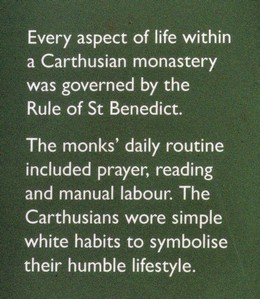


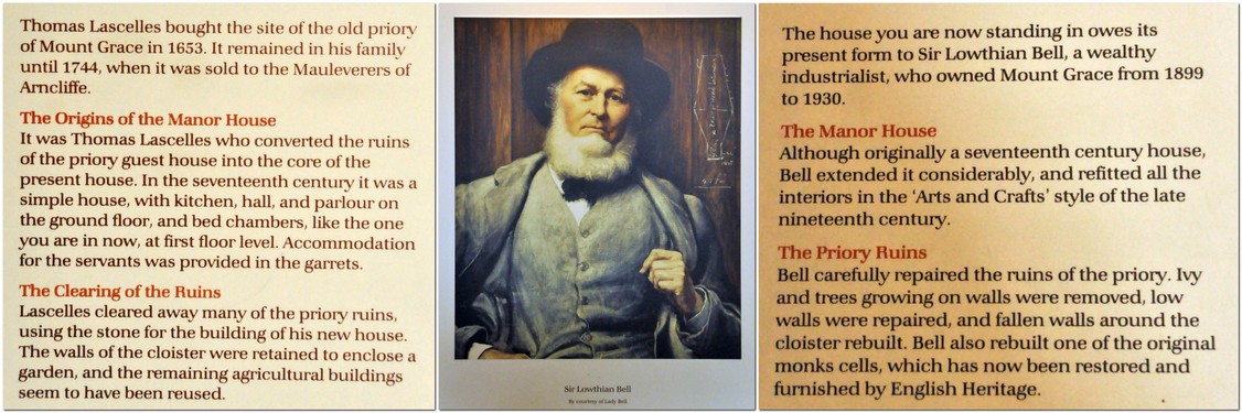


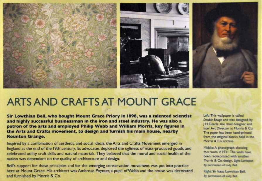


 Yesterday, I was reminded of that great radio broadcaster,
  Steph and I took full advantage to walk a stretch of
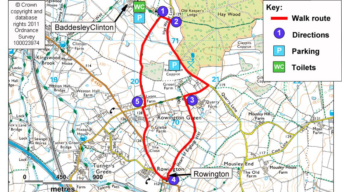
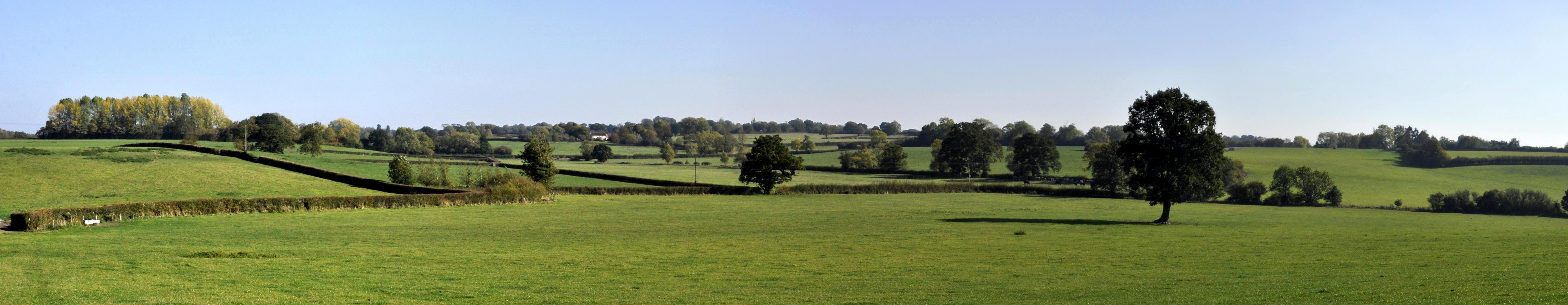
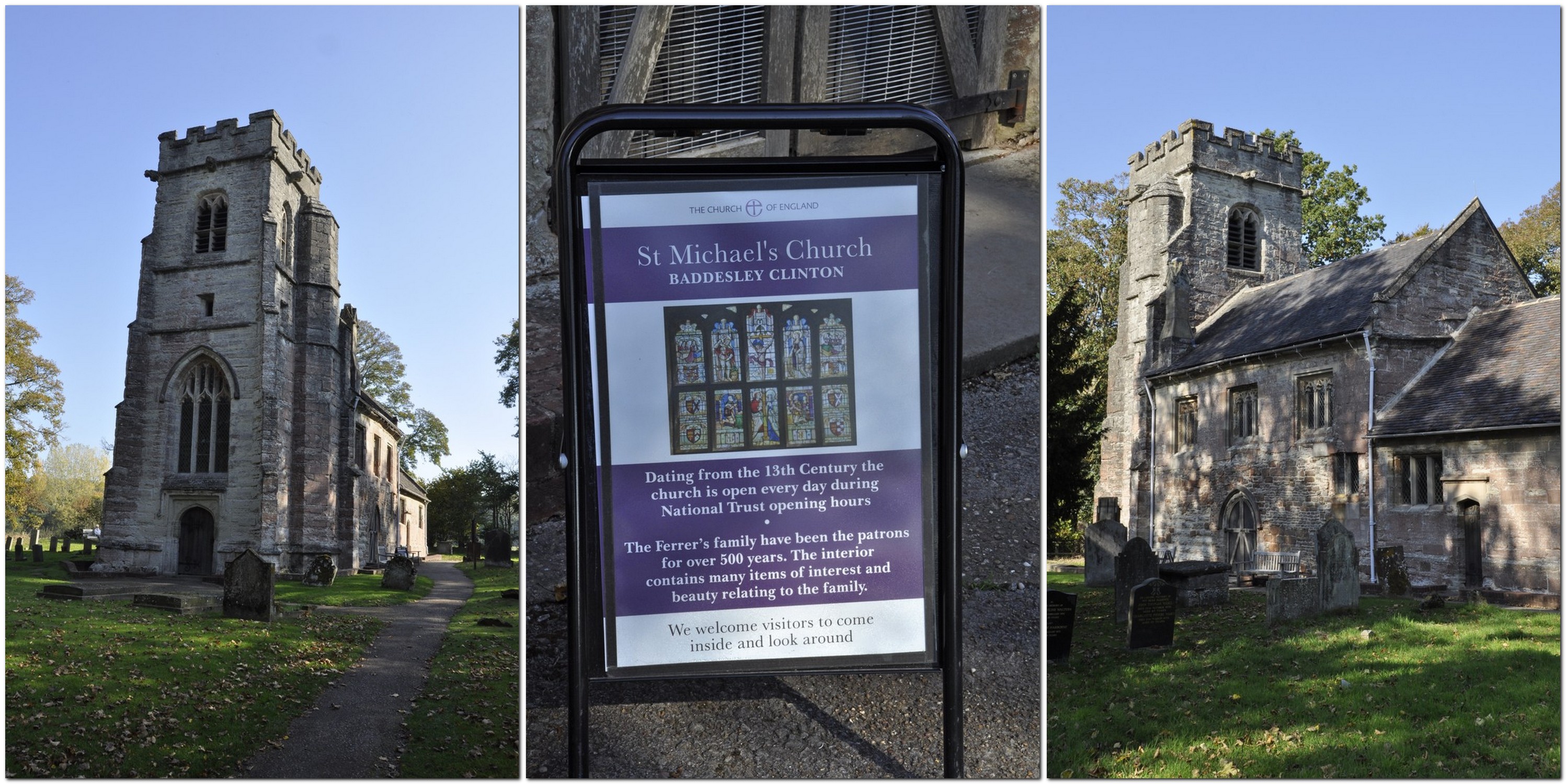


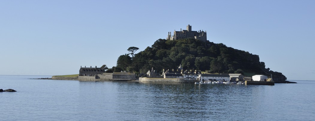


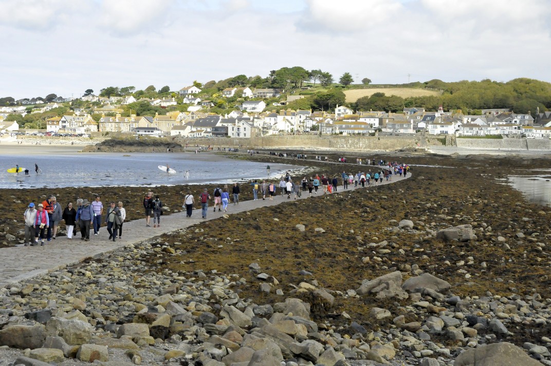
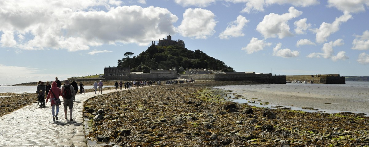
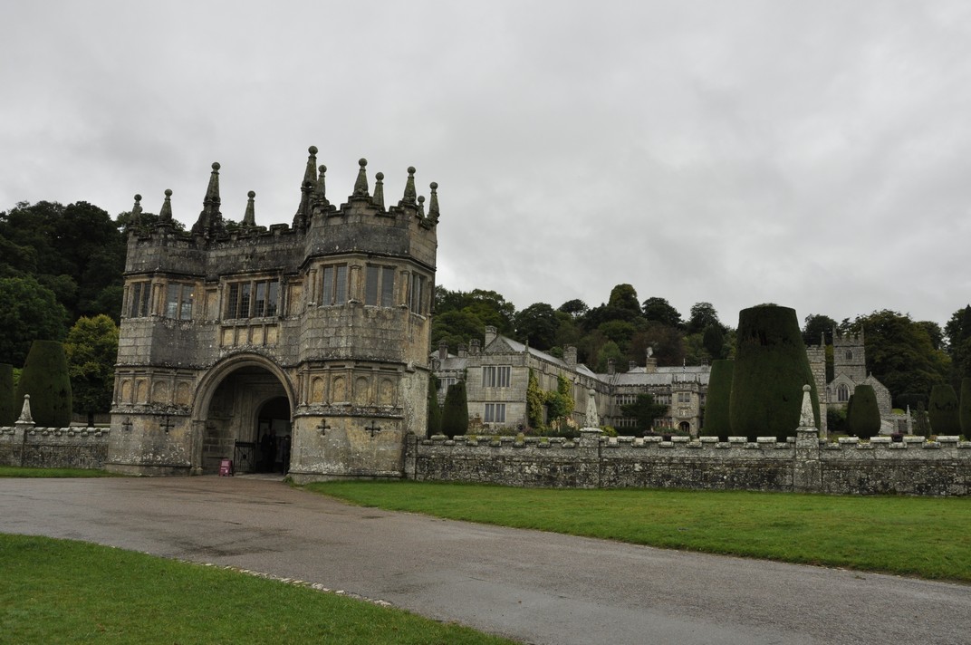
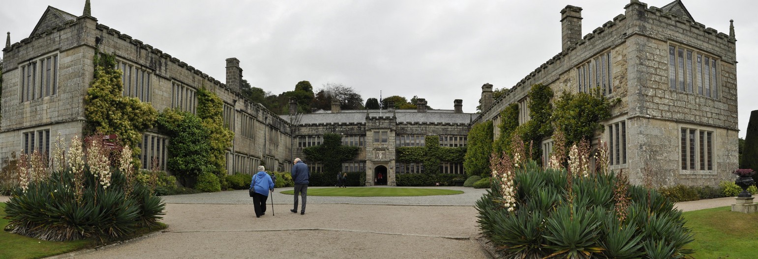


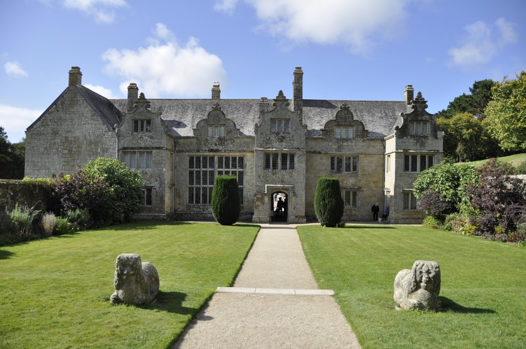


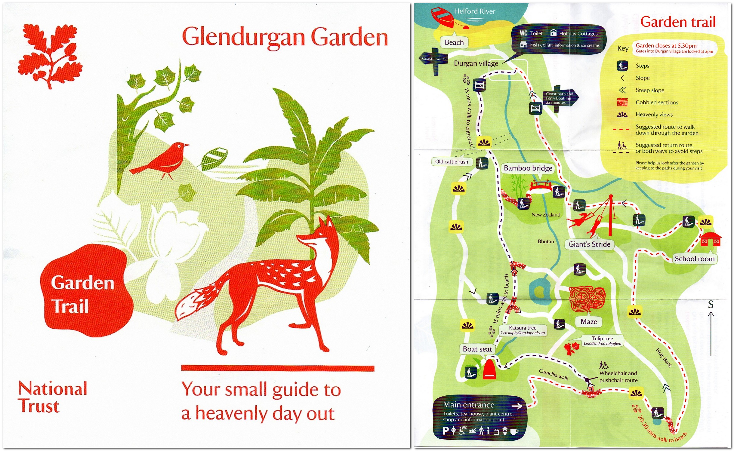


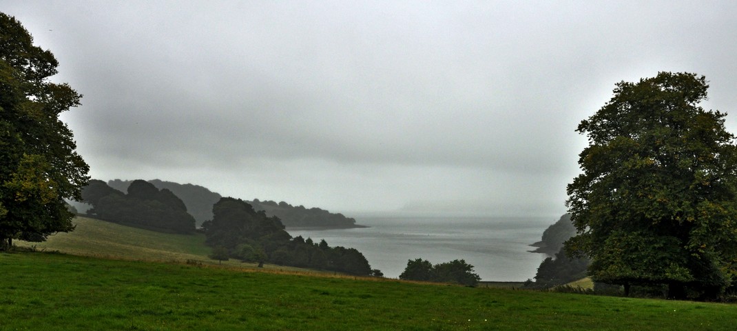
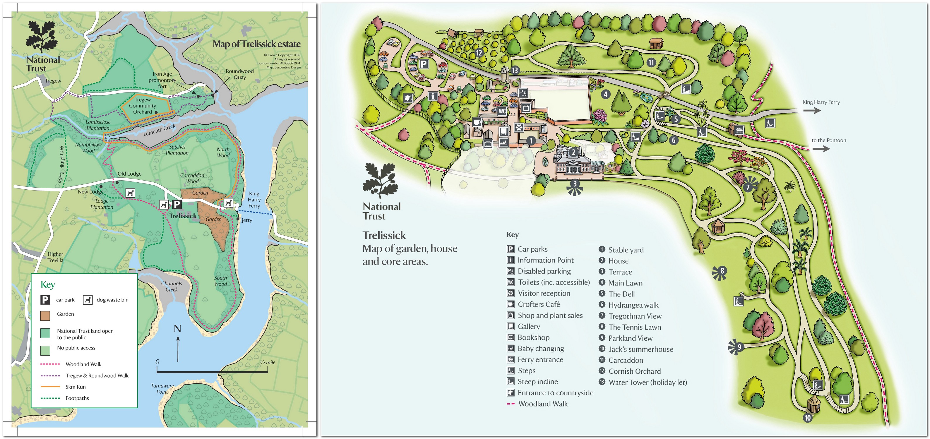


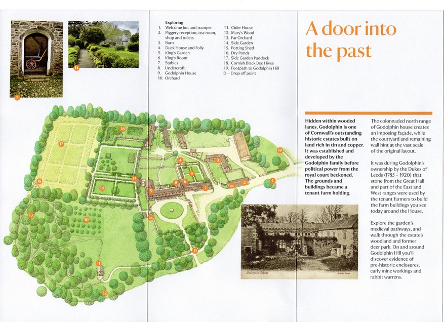
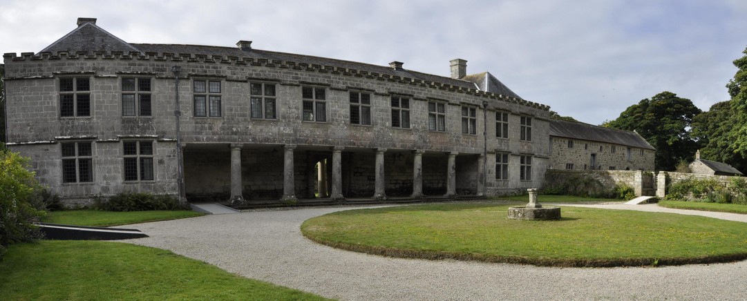
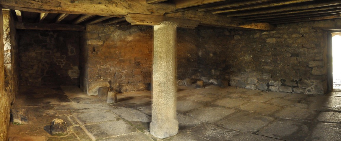
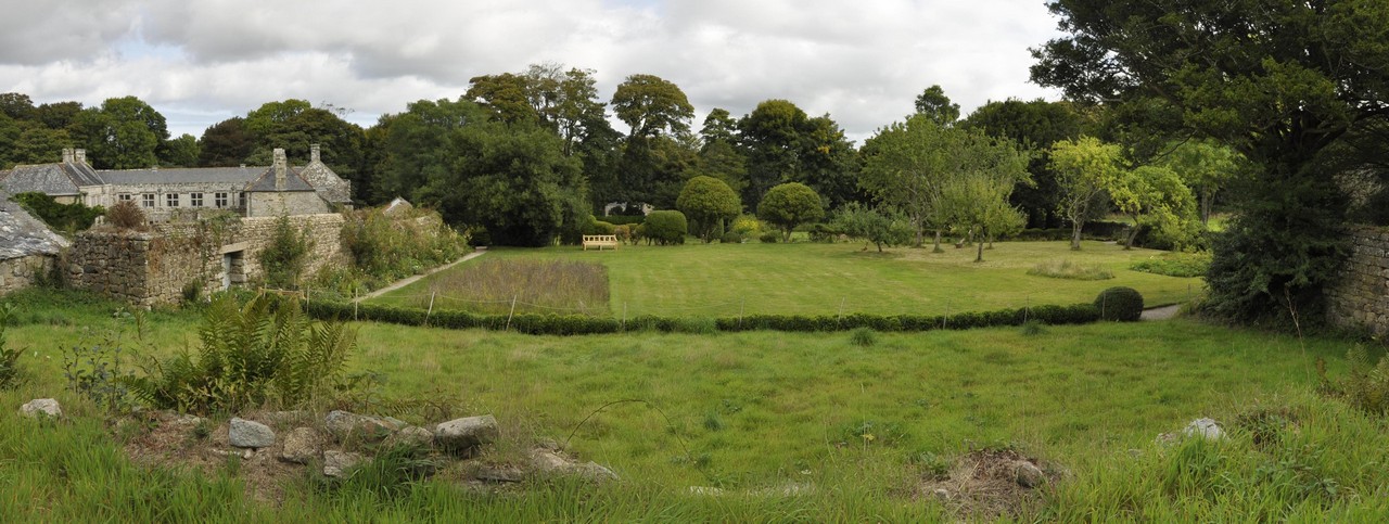
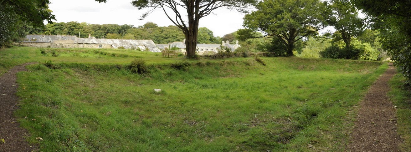
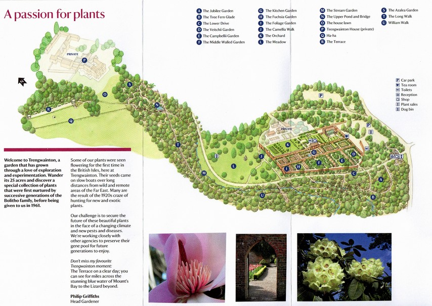


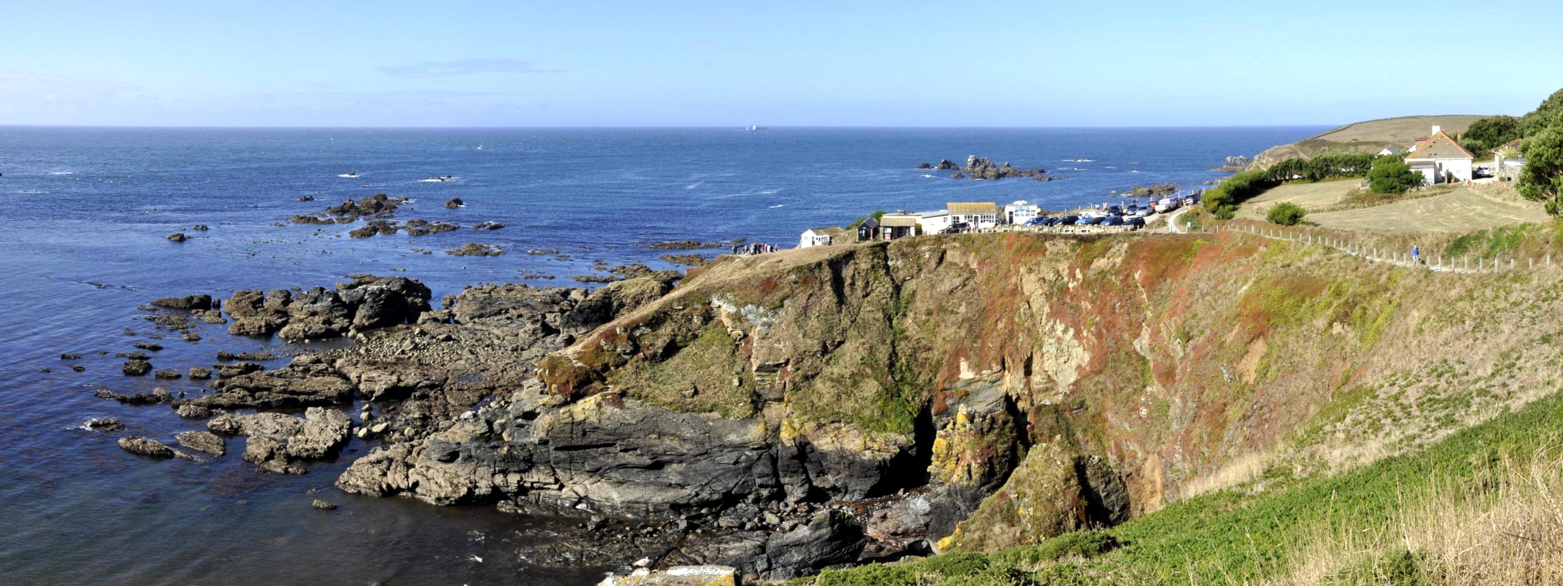
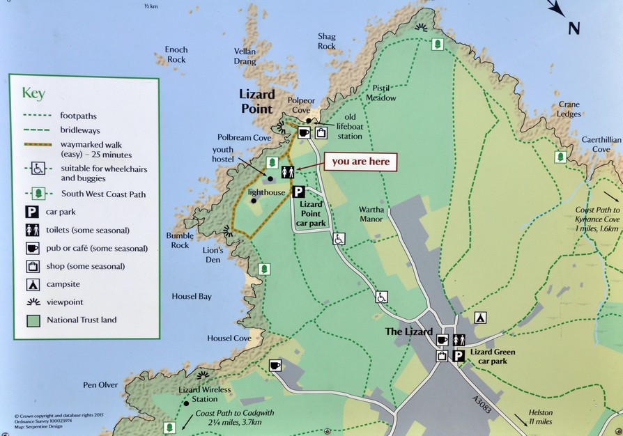
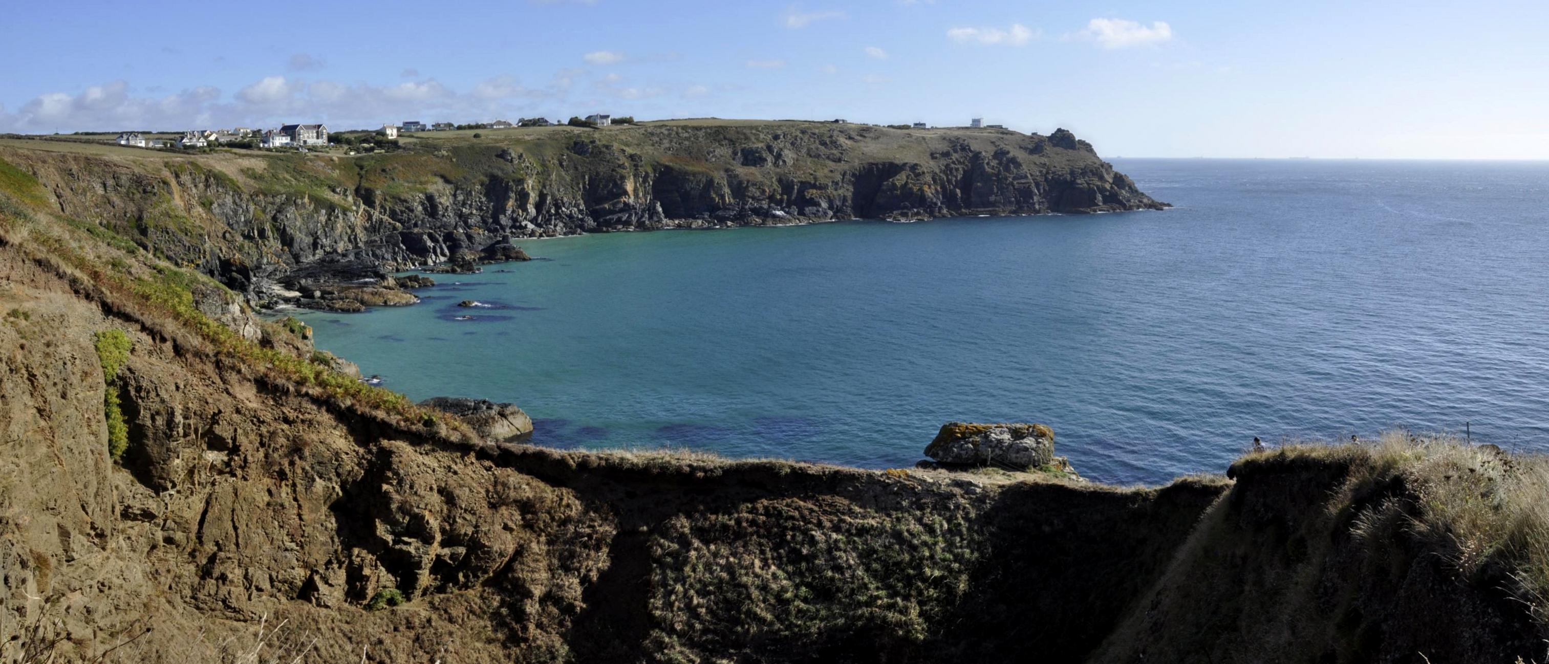

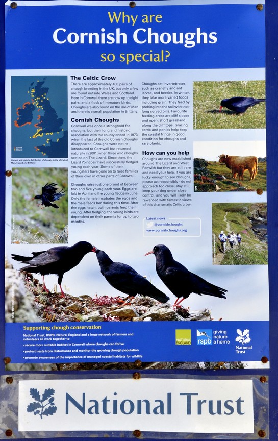
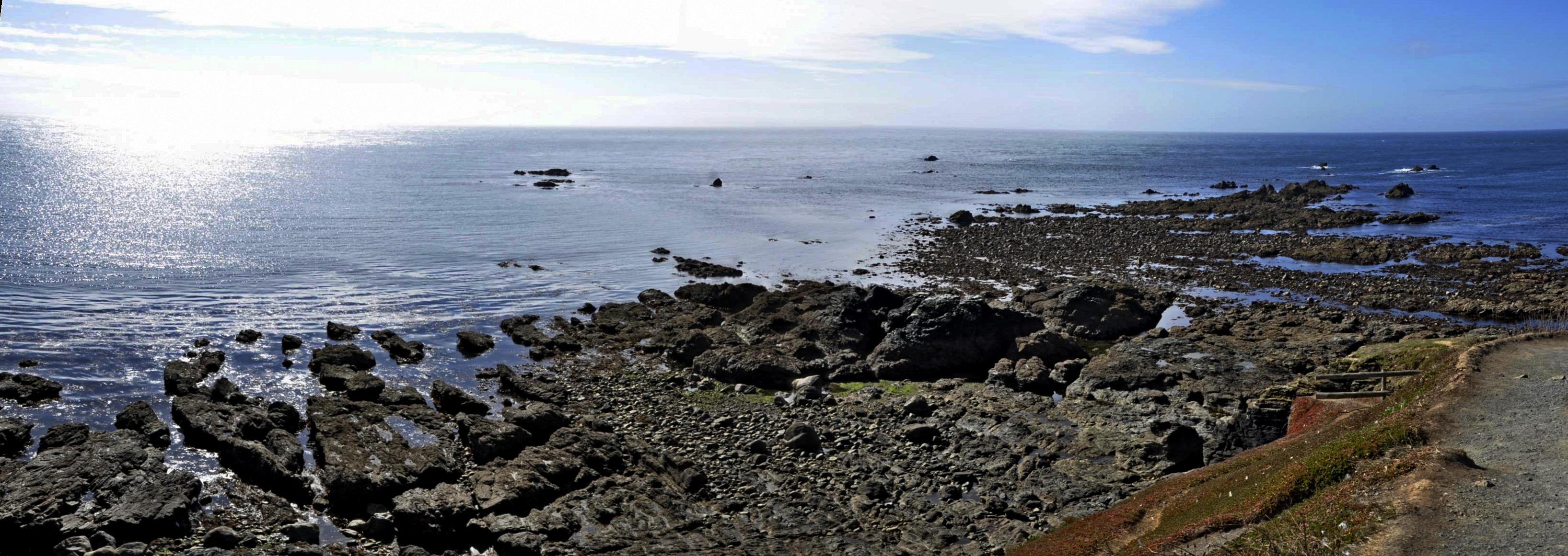
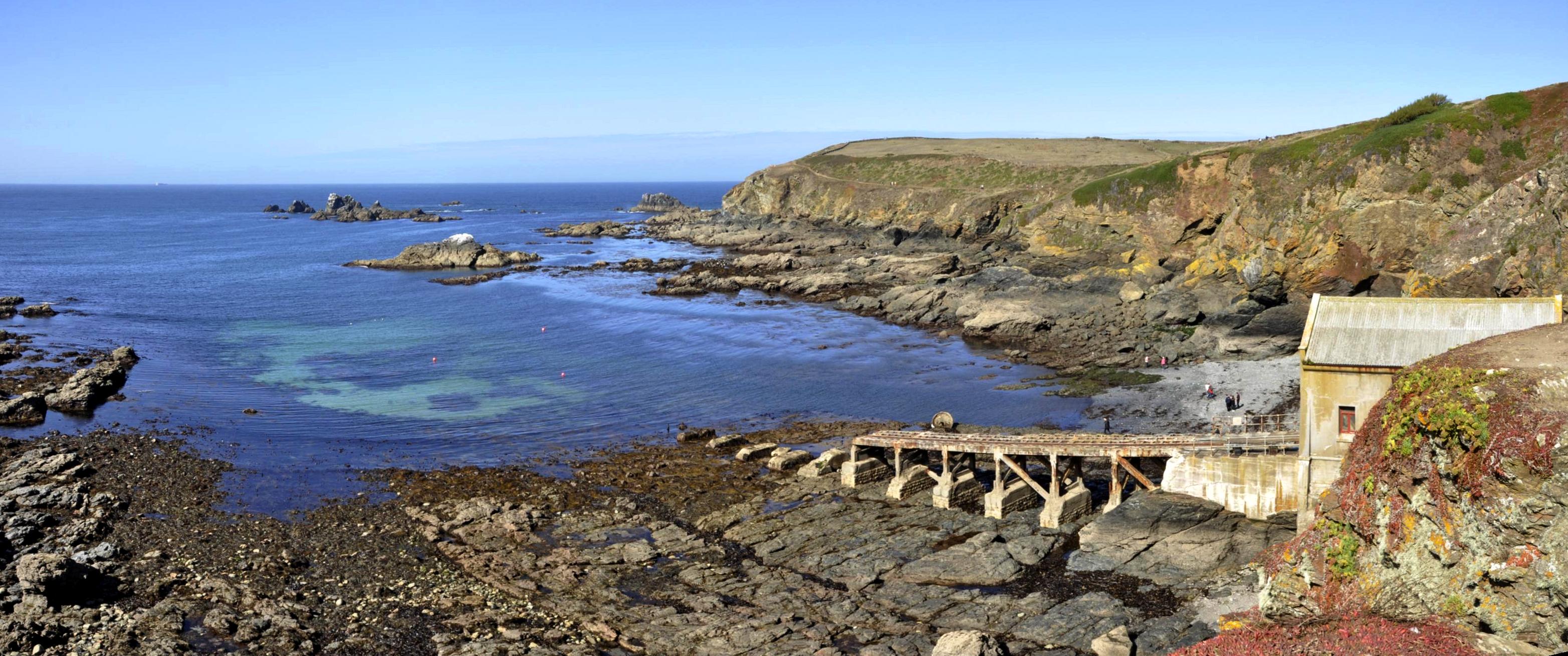
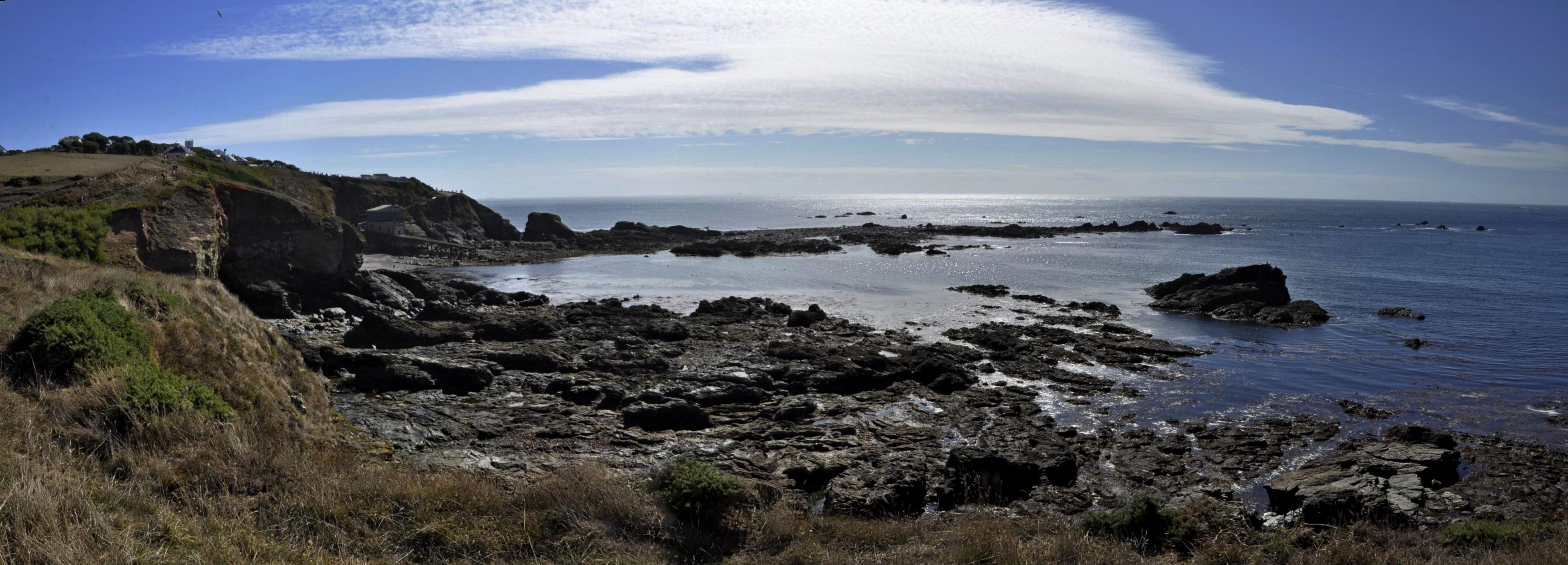


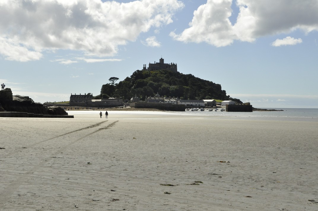


 We chose a small studio cottage, suitable for a couple, just north of Helston on the south coast, a round trip of more than 500 miles (including the side trips to a couple of National Trust properties on the way there and back – see
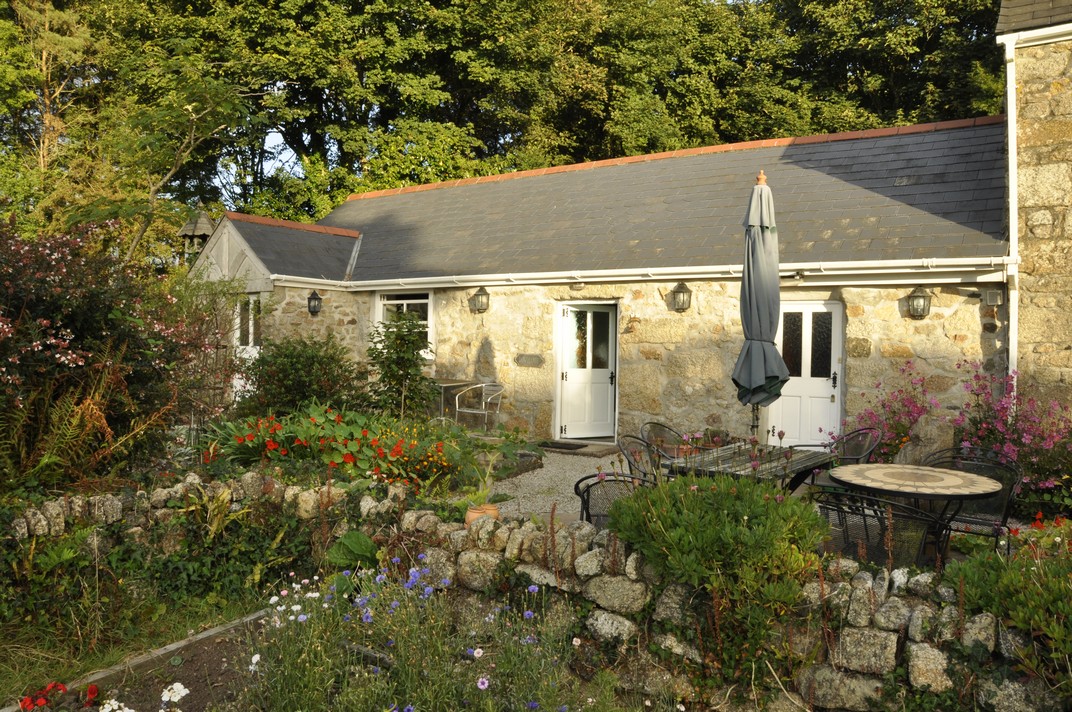
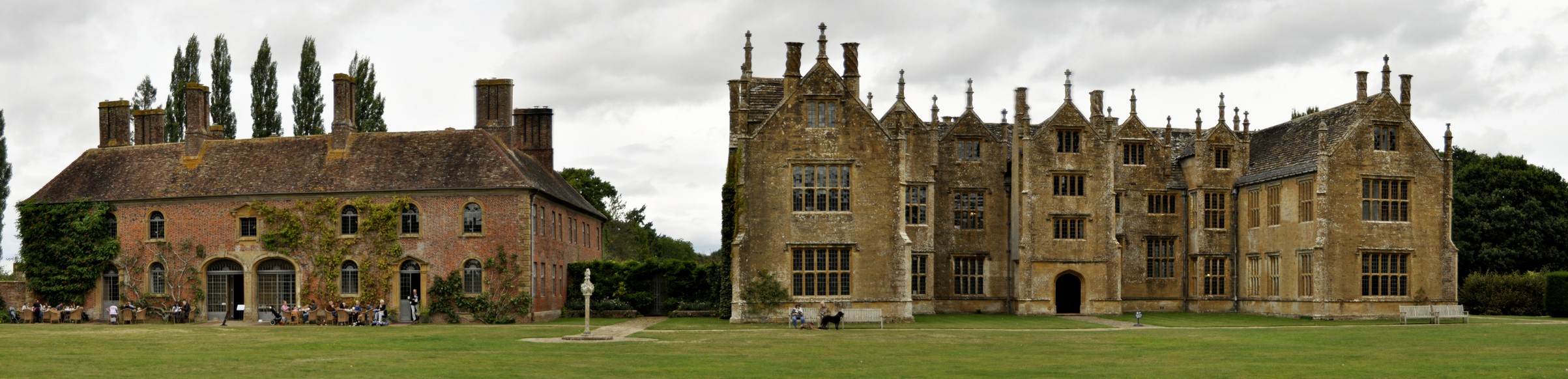


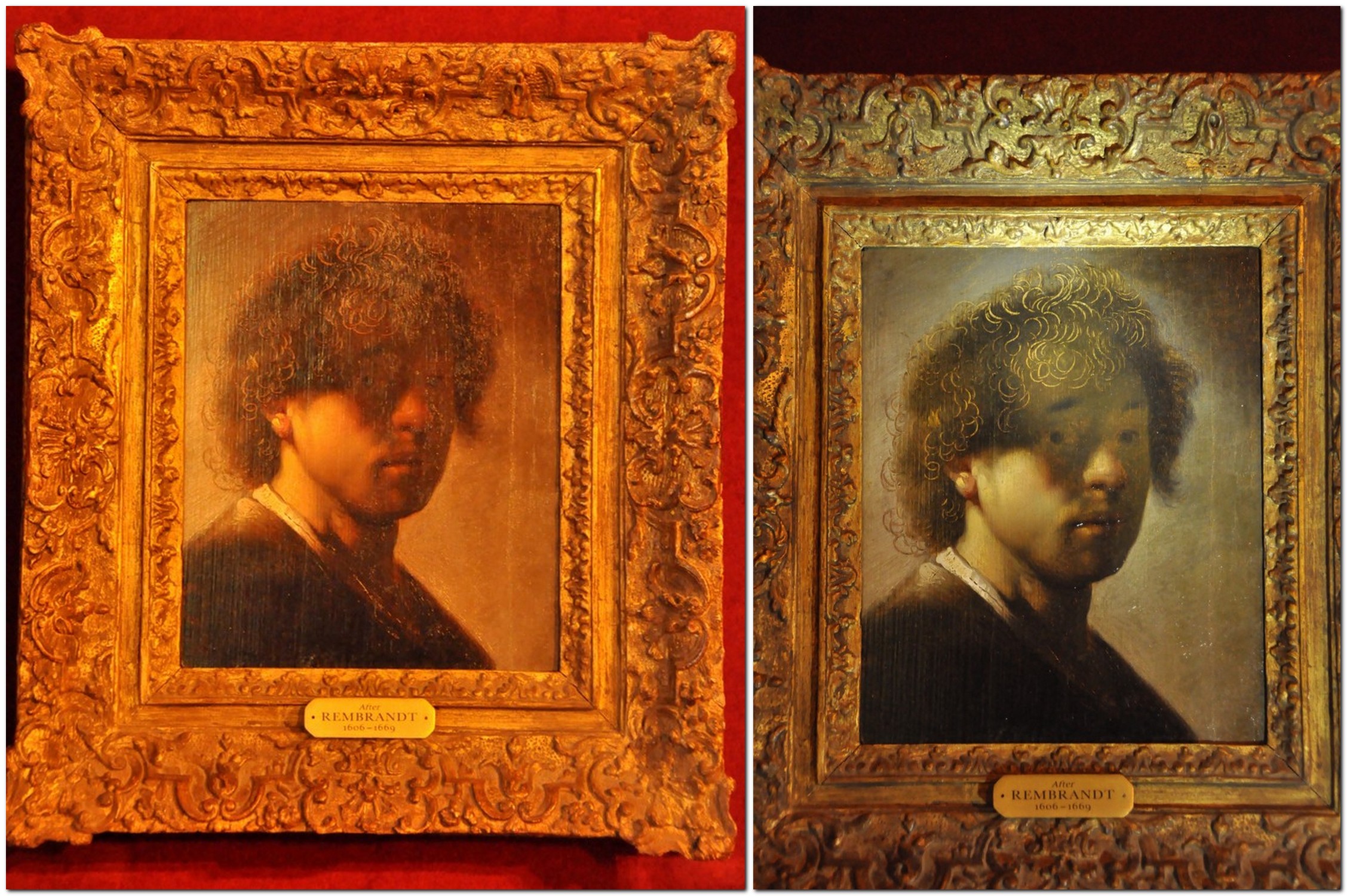

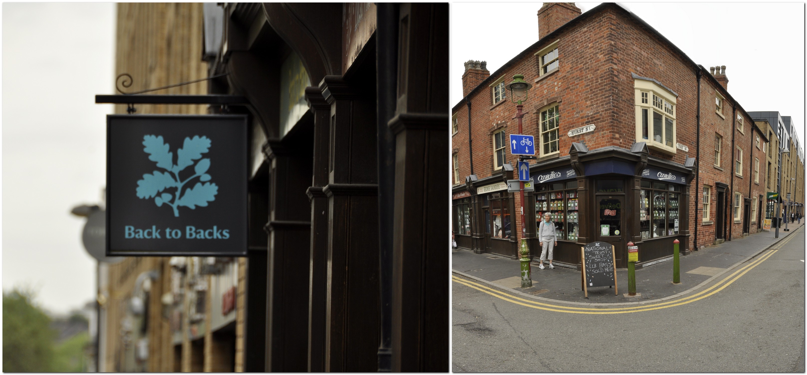
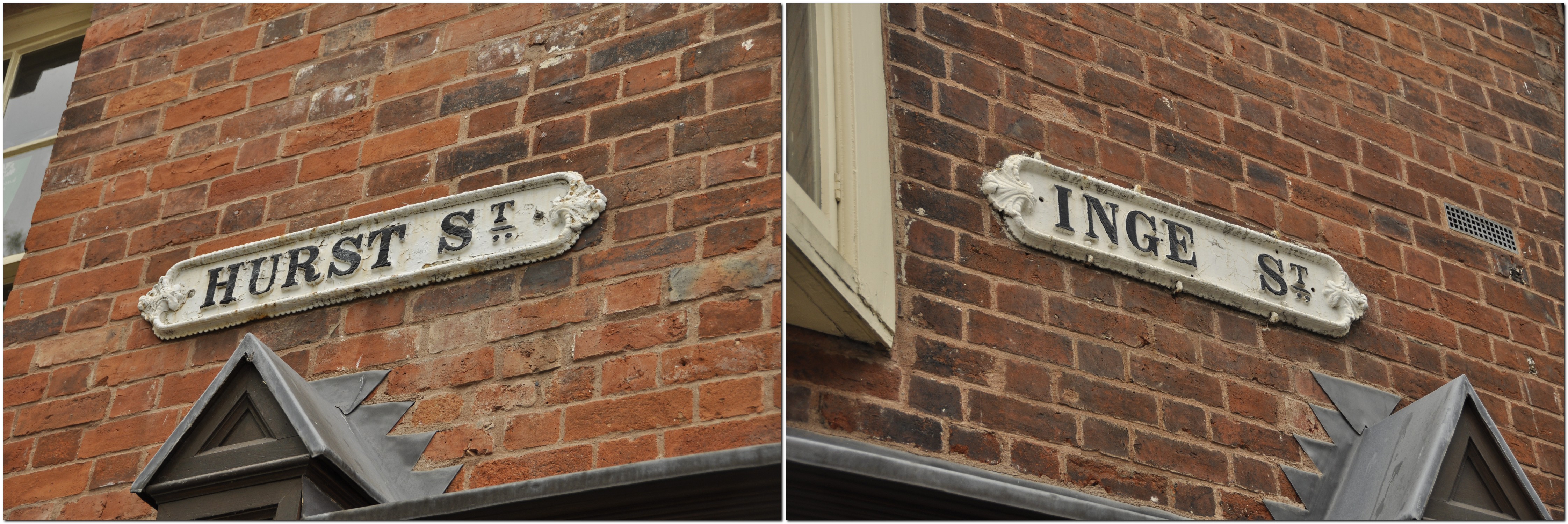
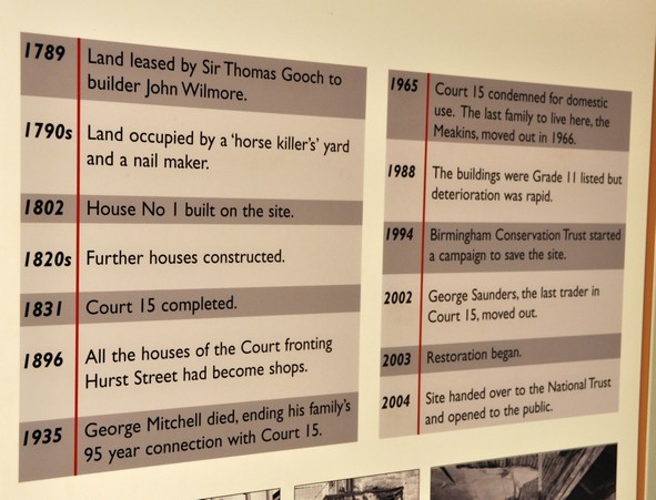


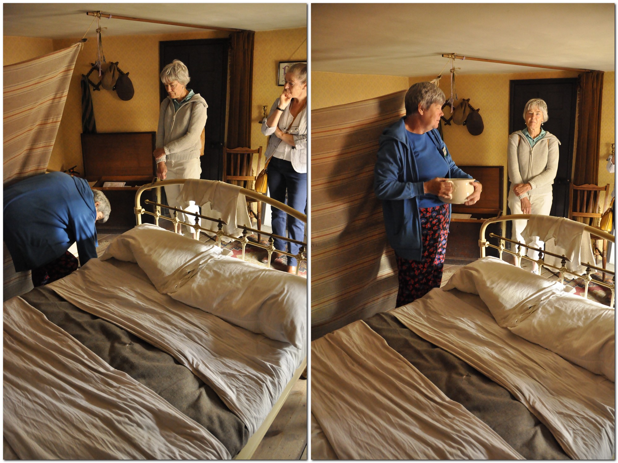

")


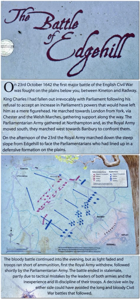

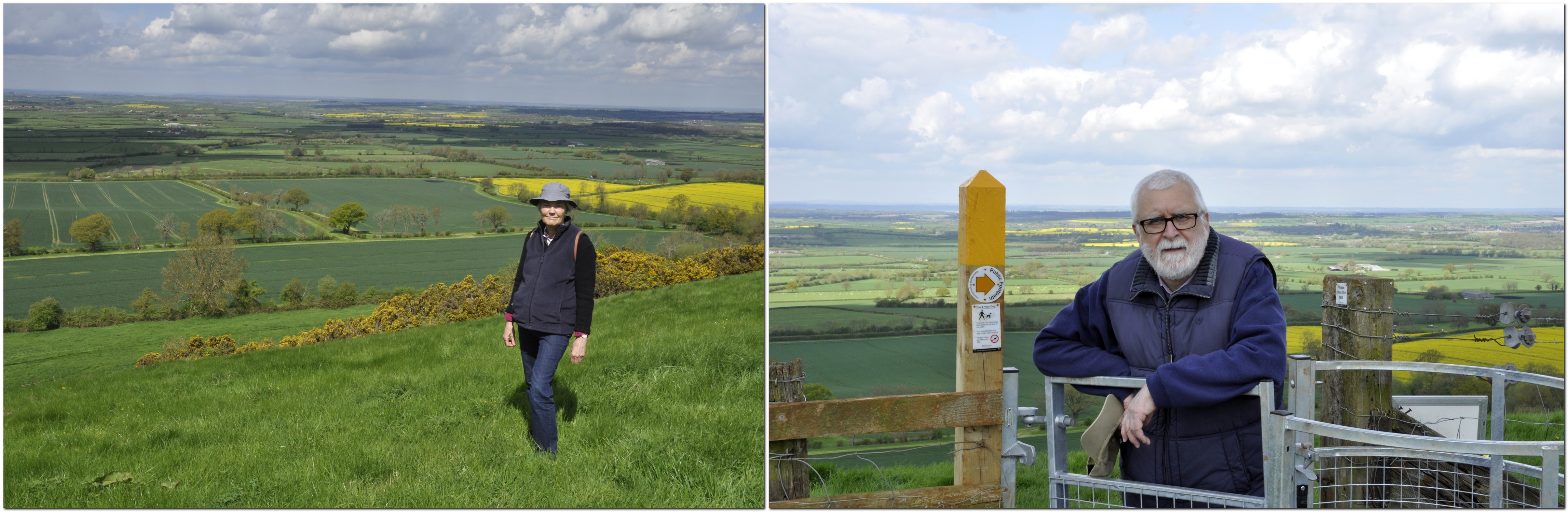
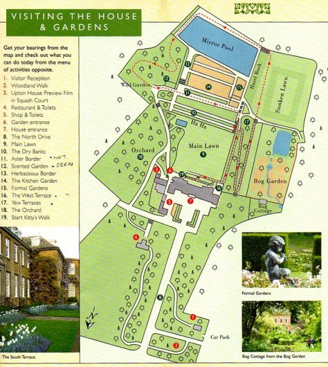

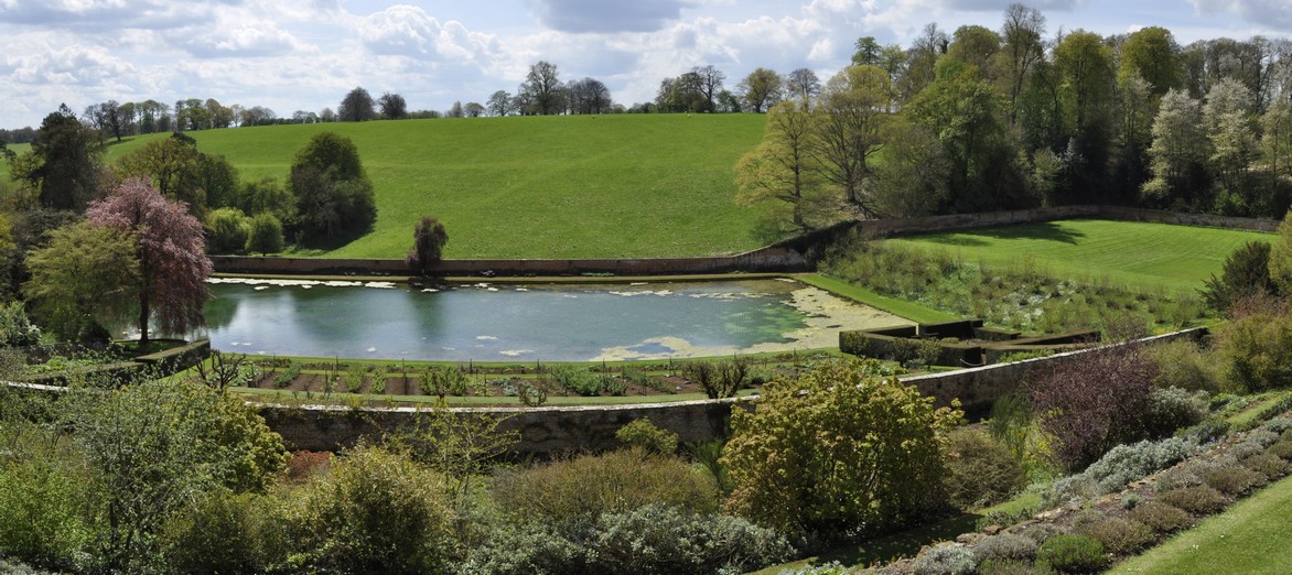
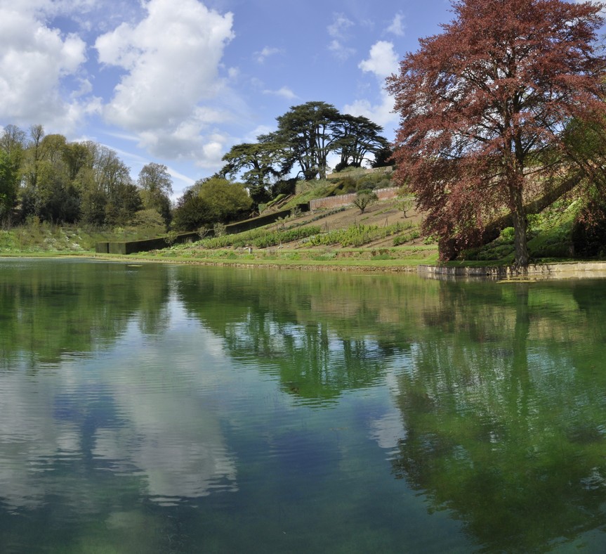
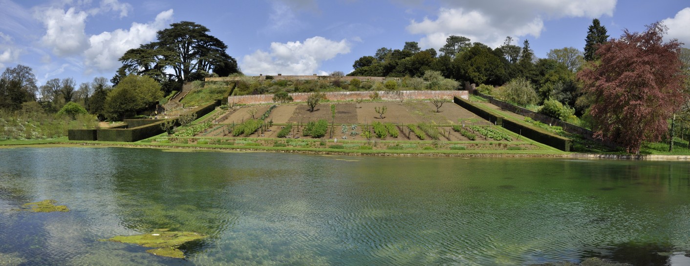


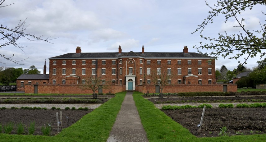
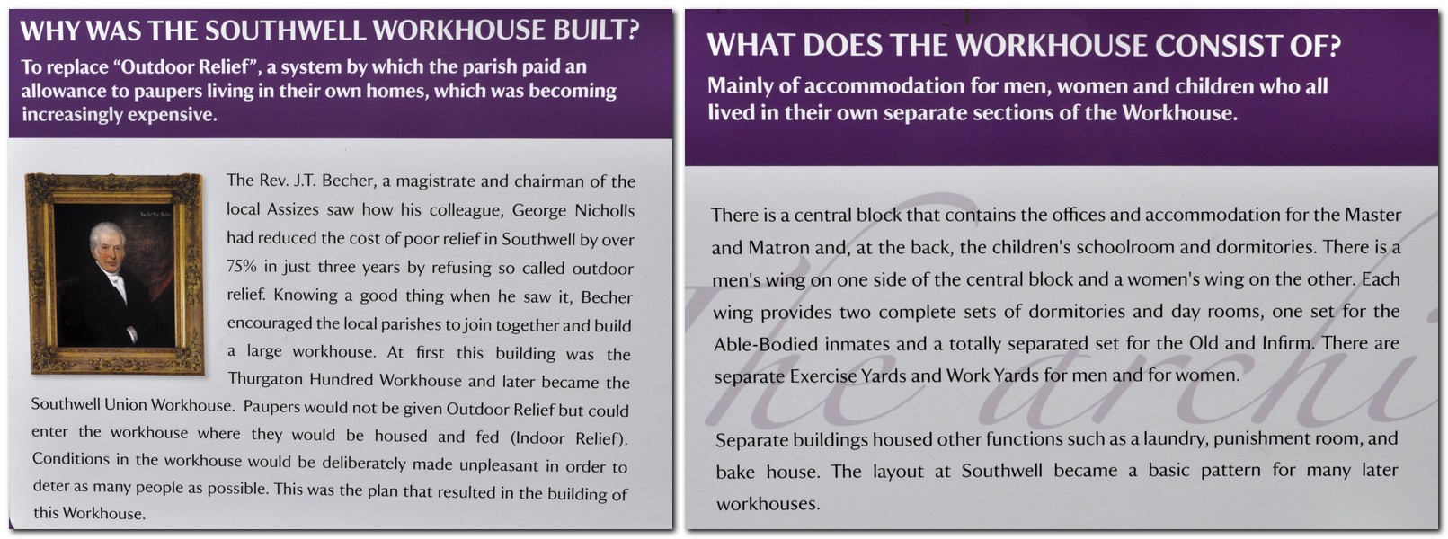

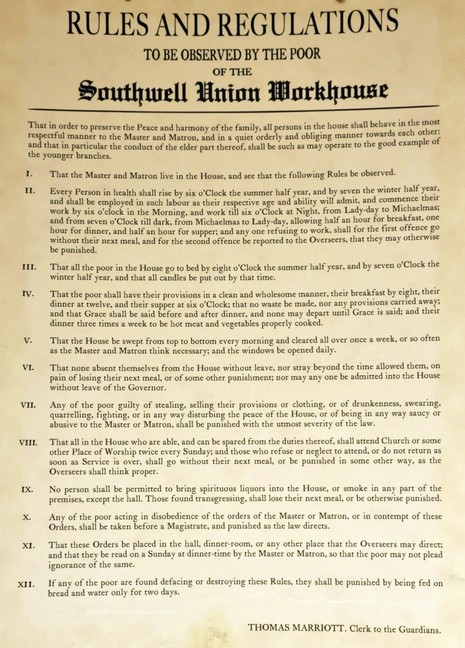
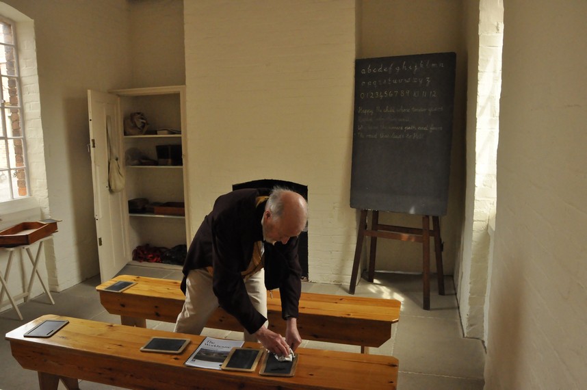
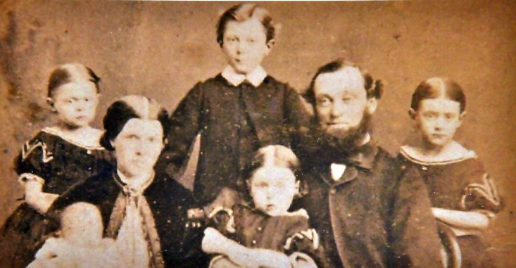


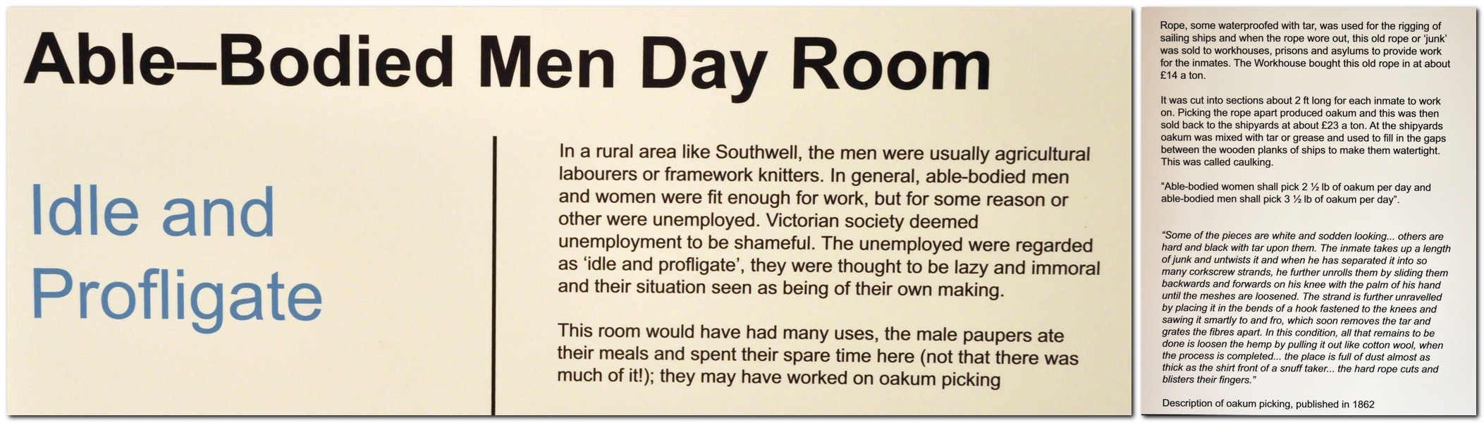
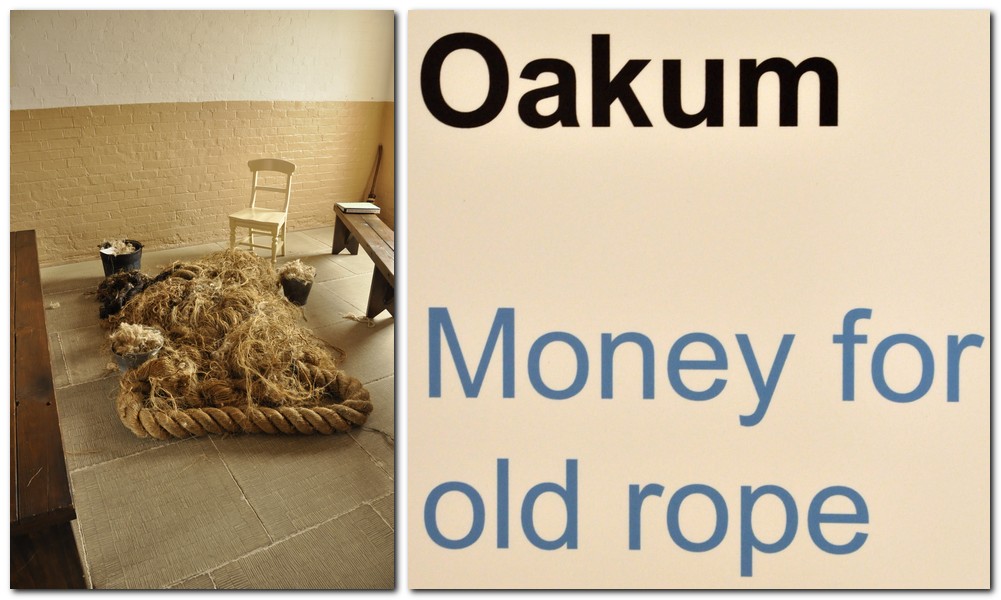
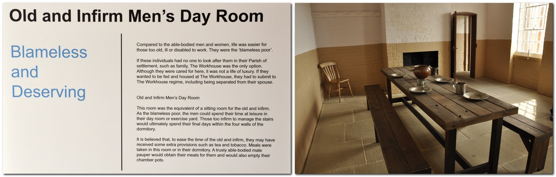
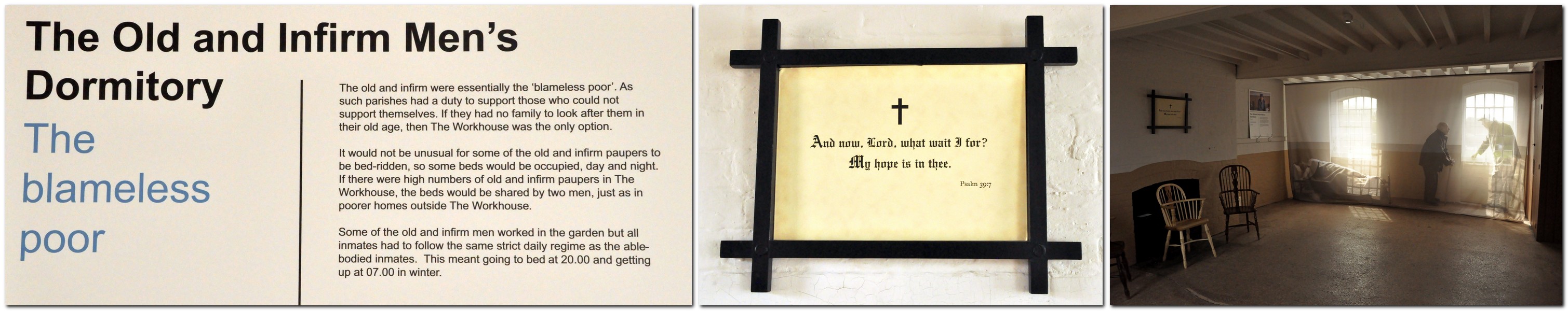
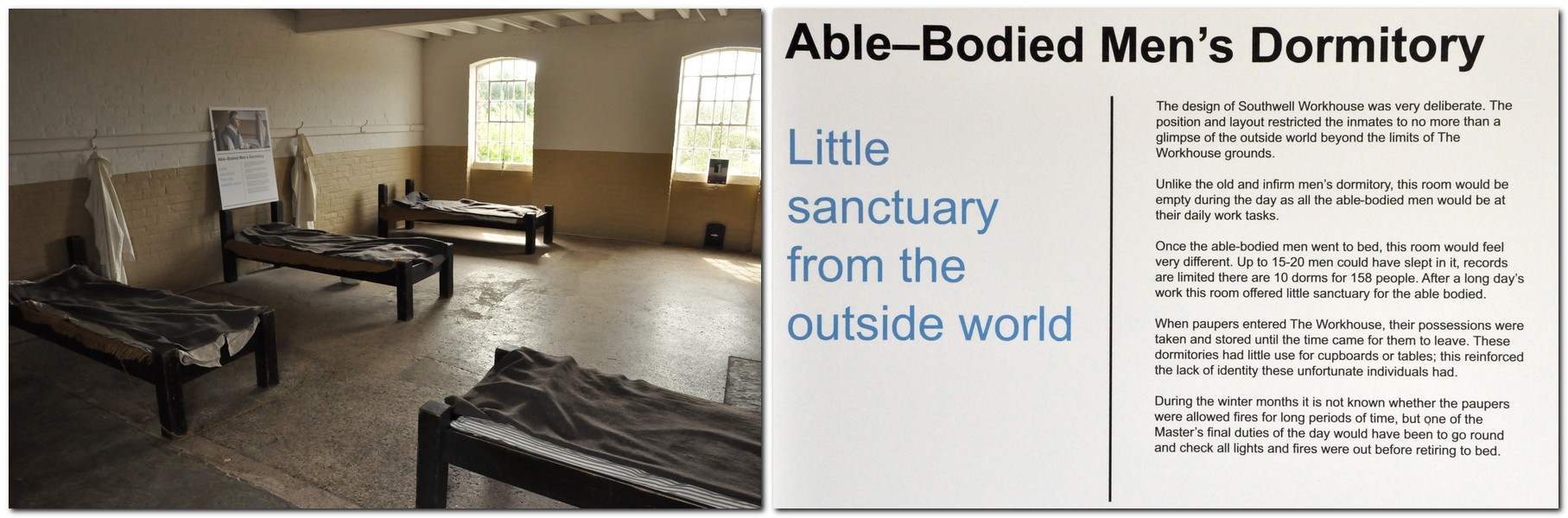
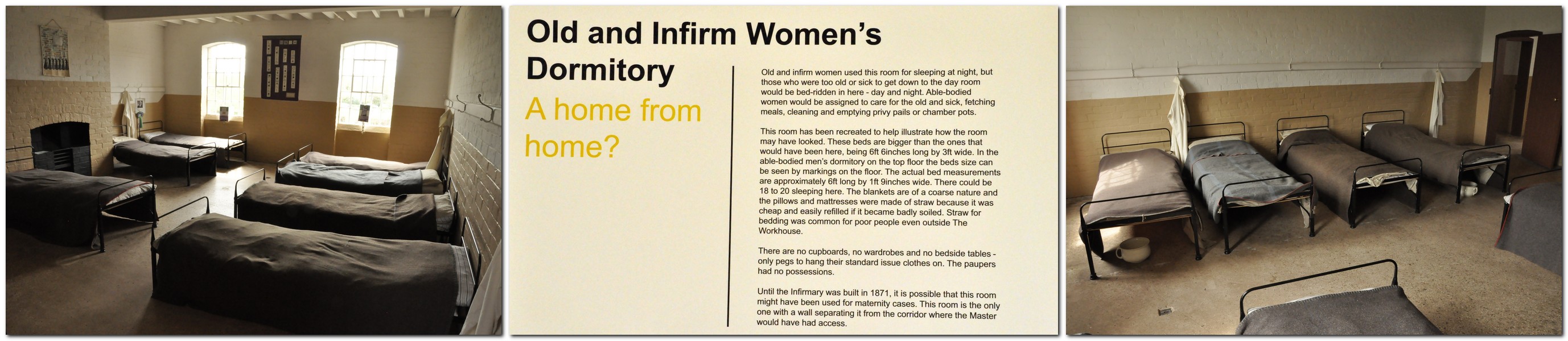
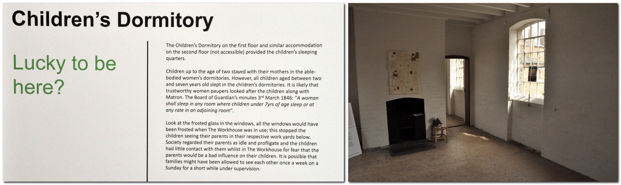


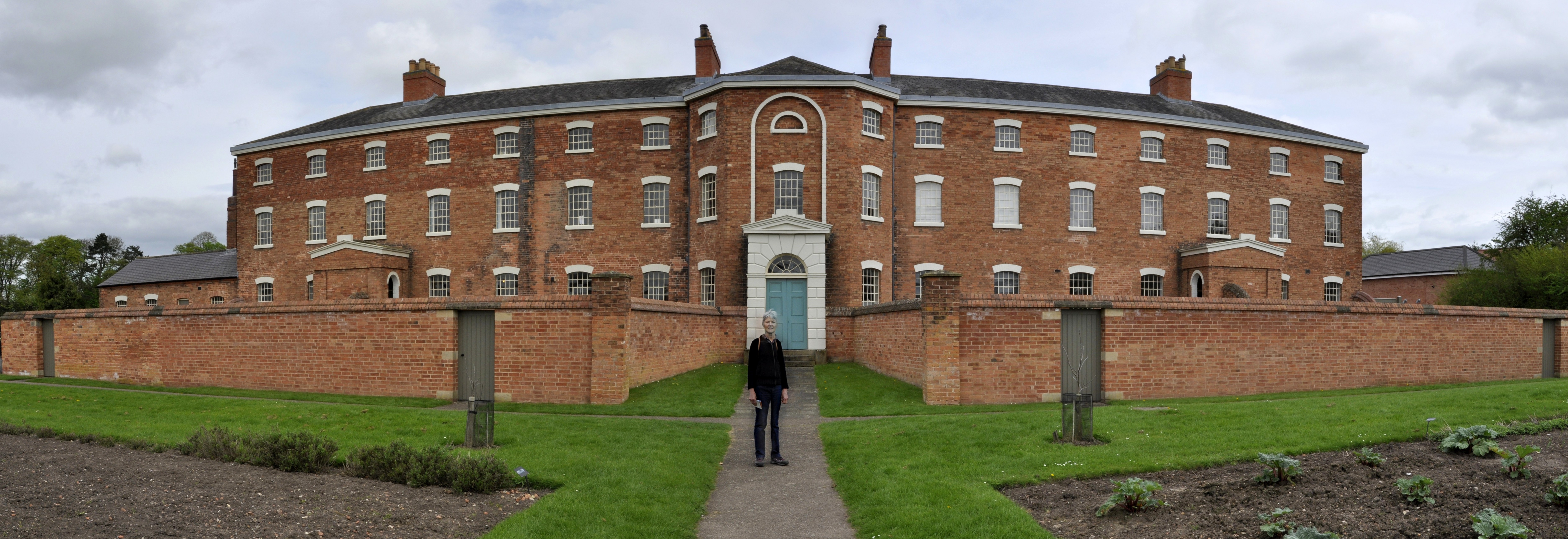
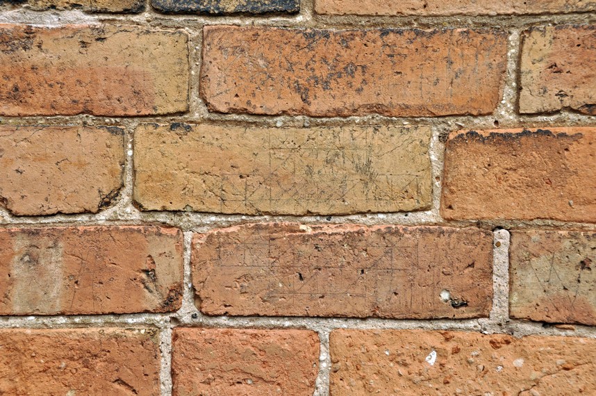


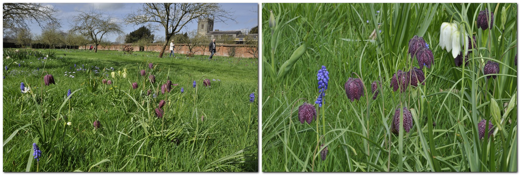
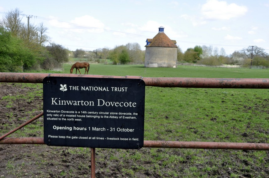


 So, with much more inclement weather forecast, Steph and I decided that we’d better take advantage of yesterday’s decent weather and head out for a walk, and visit yet another National Trust property:
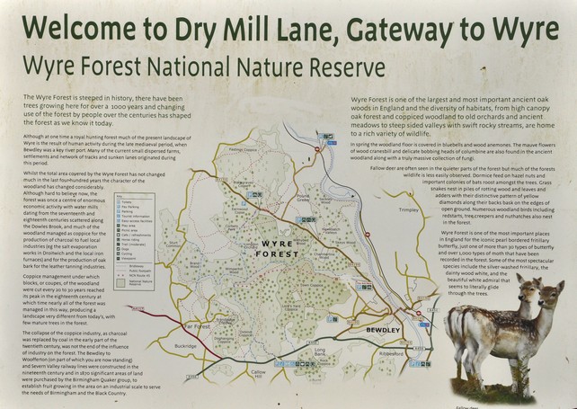
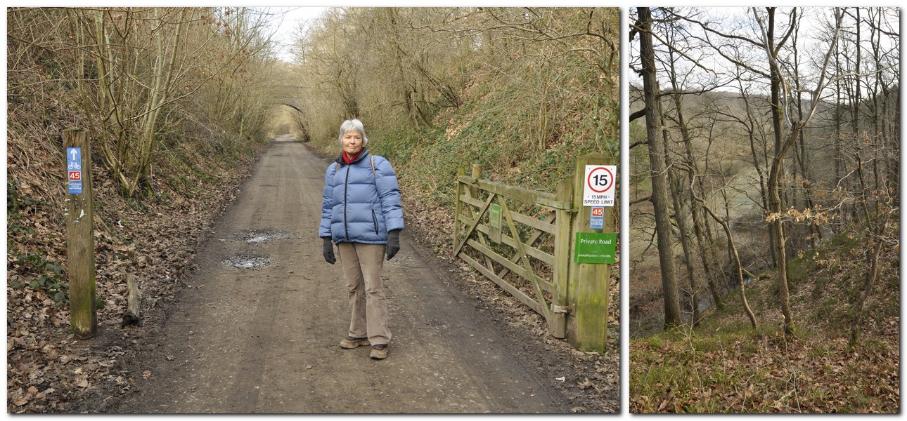
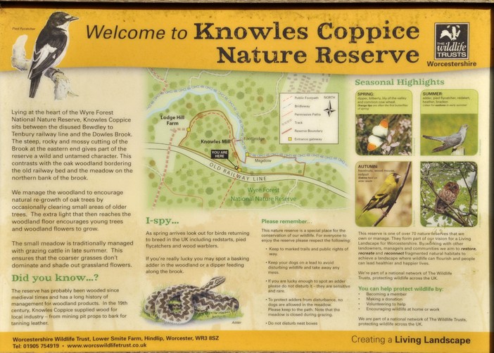
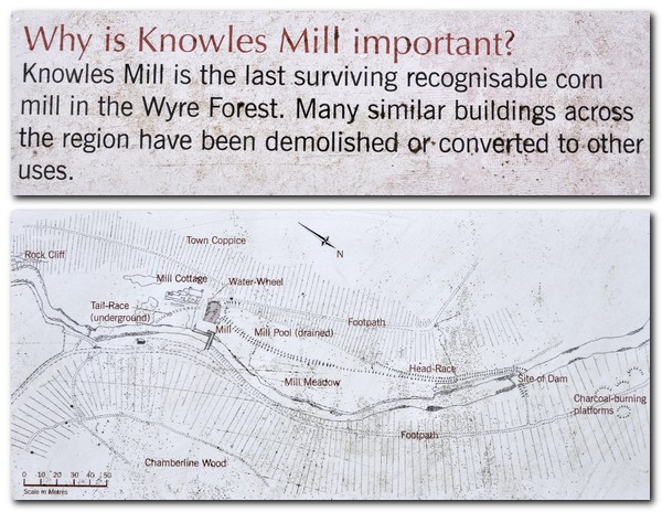
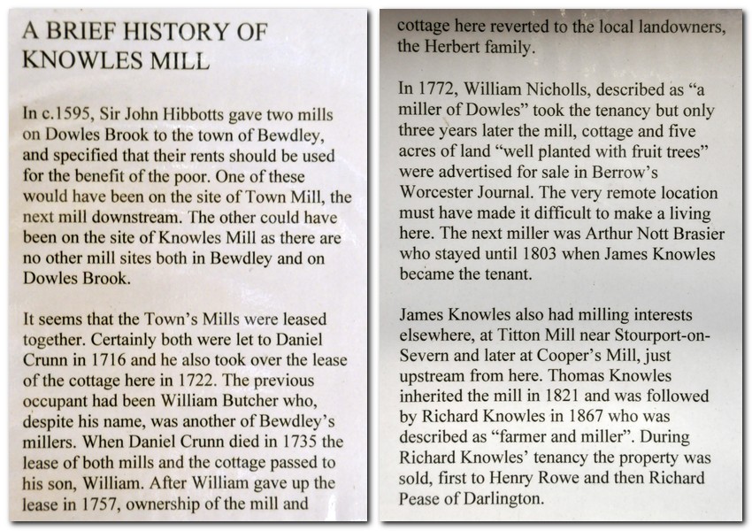
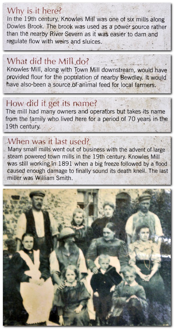
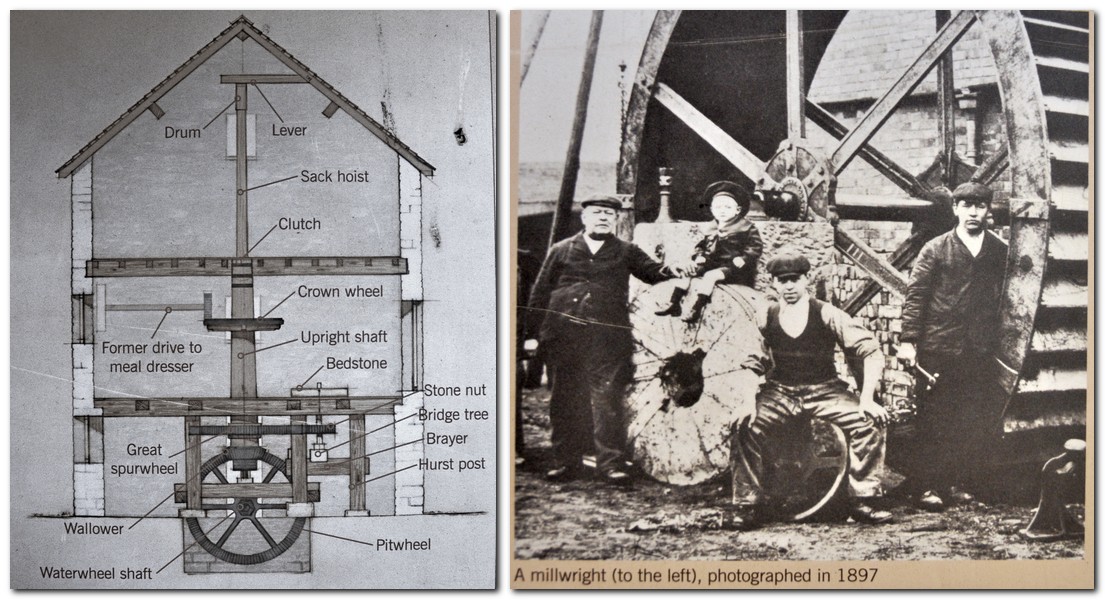


 Elgar was born in June 1857 in a small cottage, The Firs, in the village of
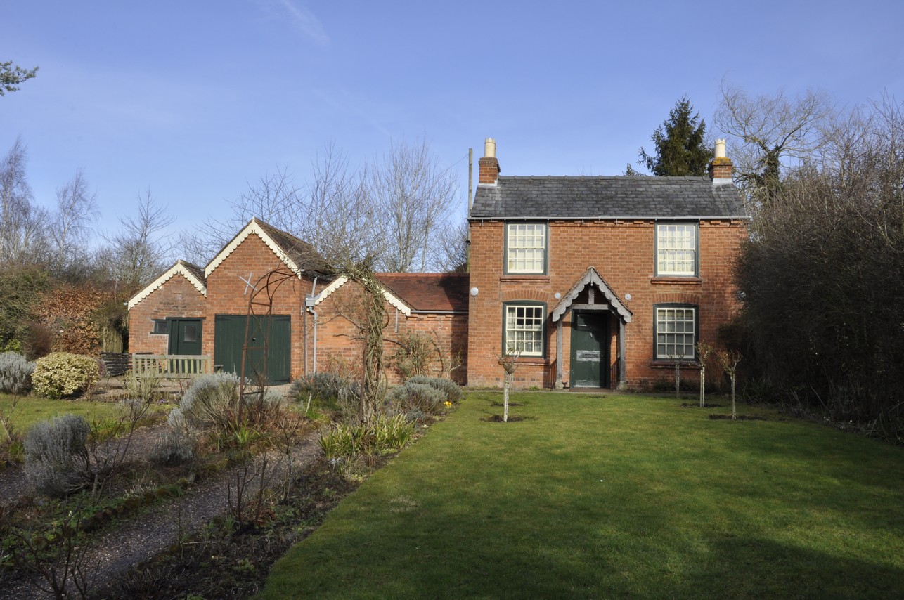
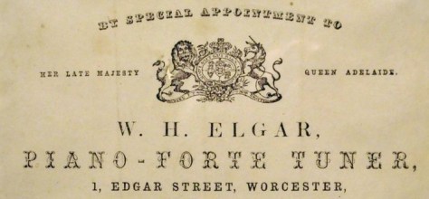
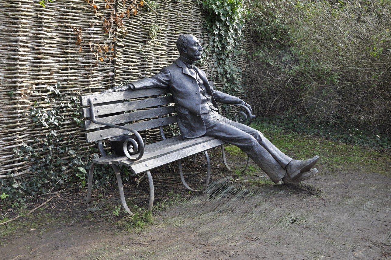


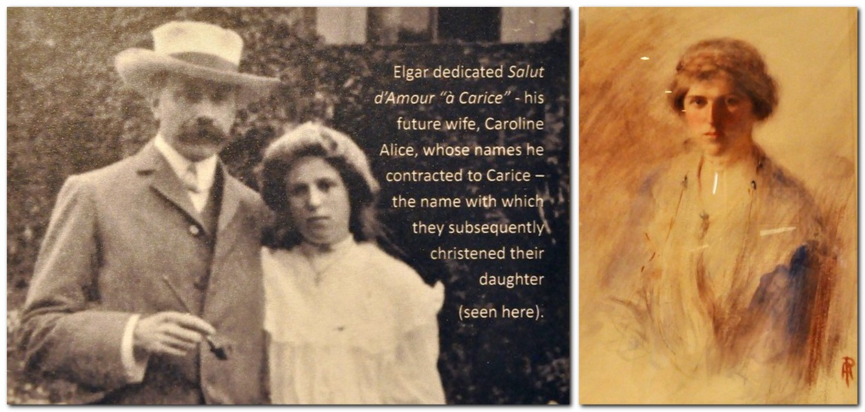
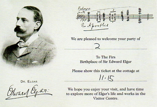


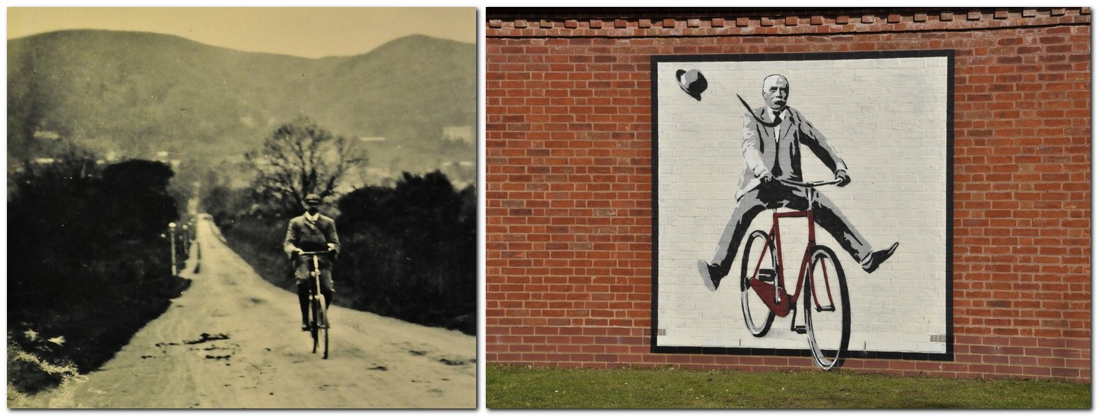
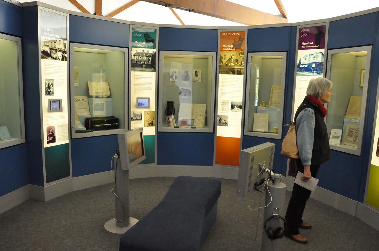

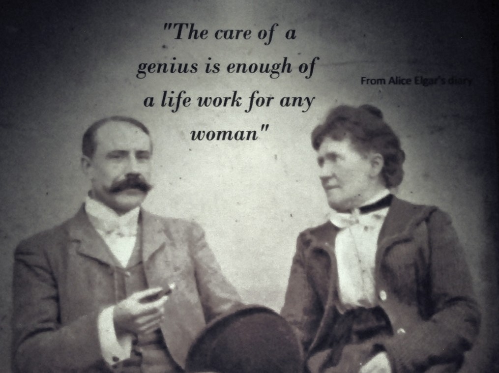
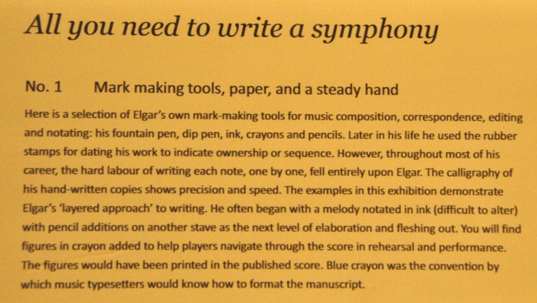


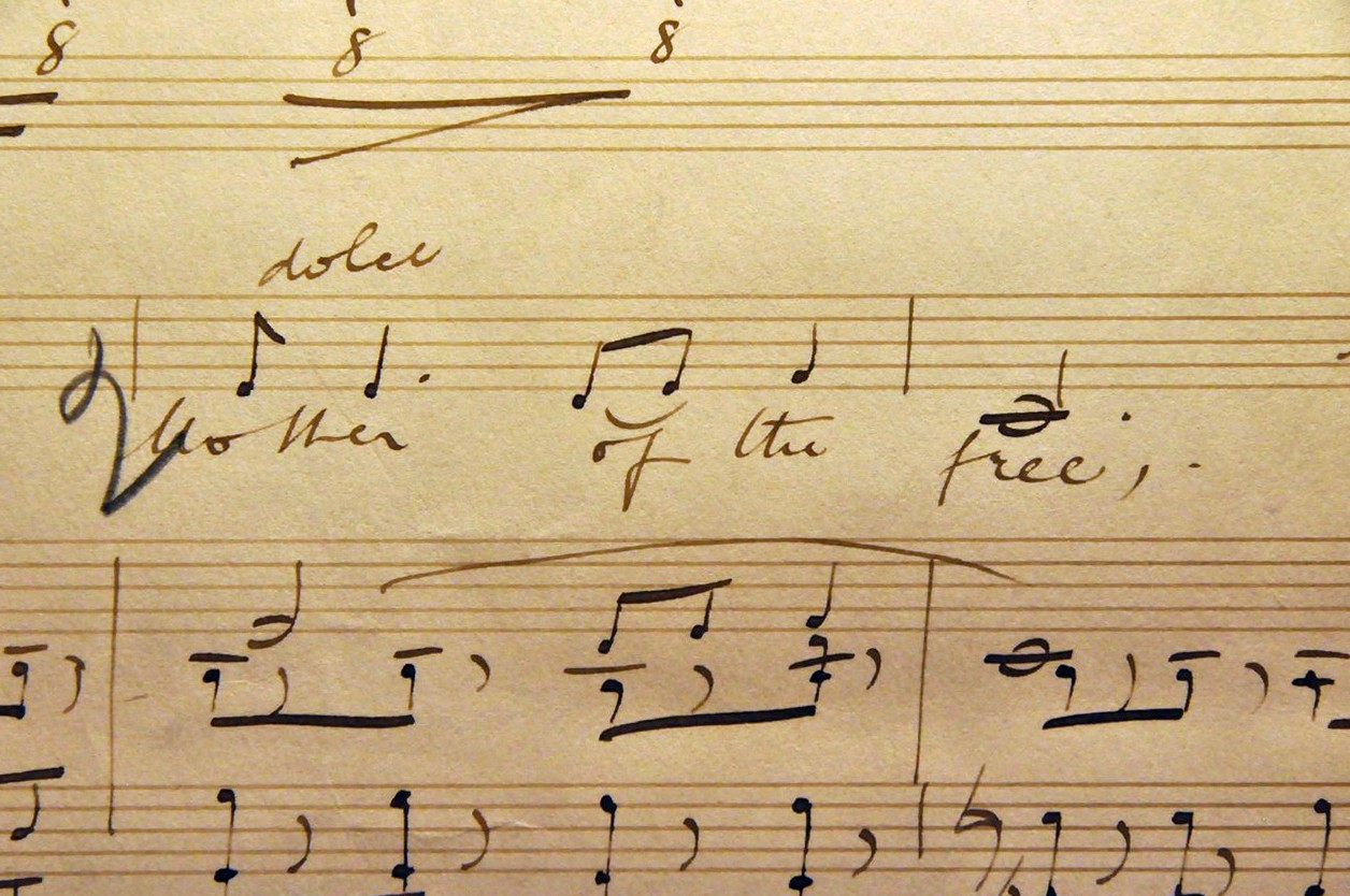
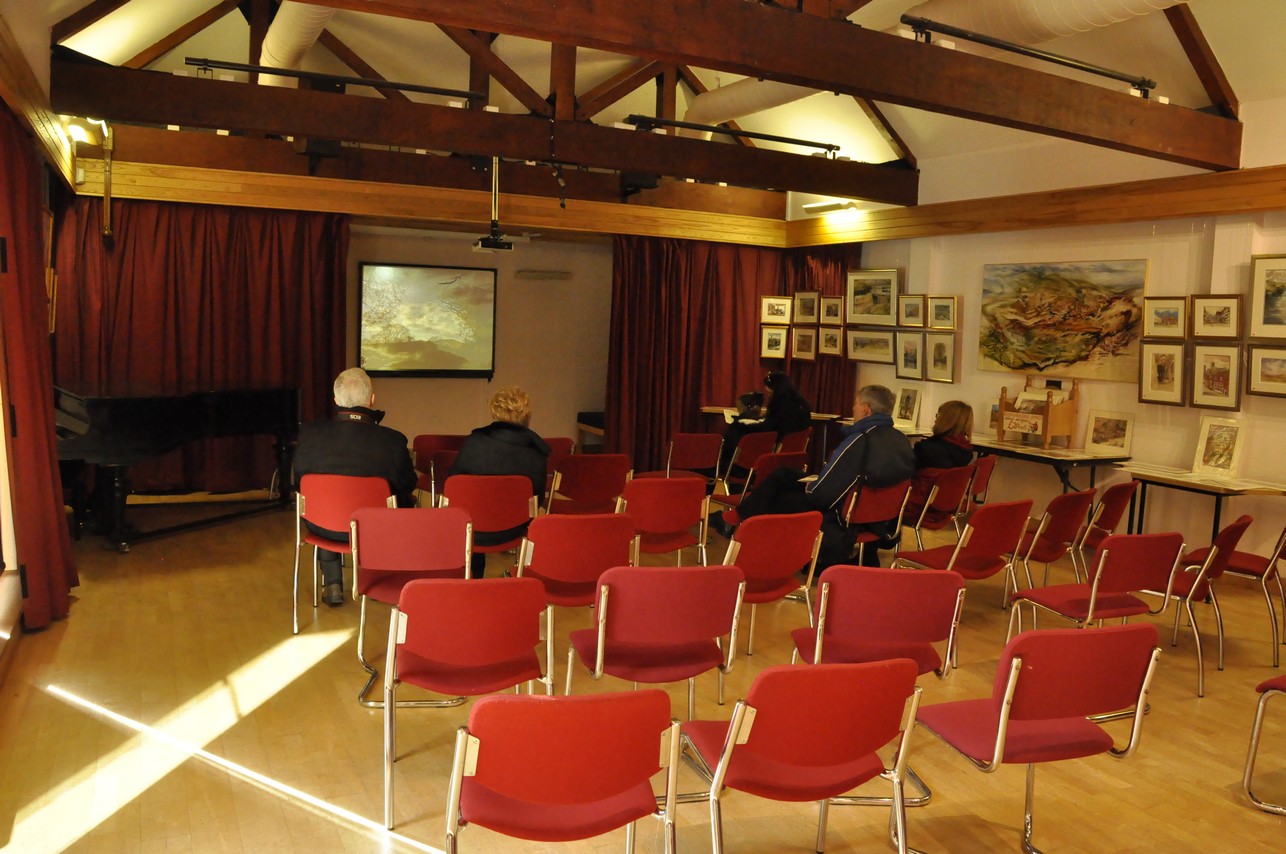


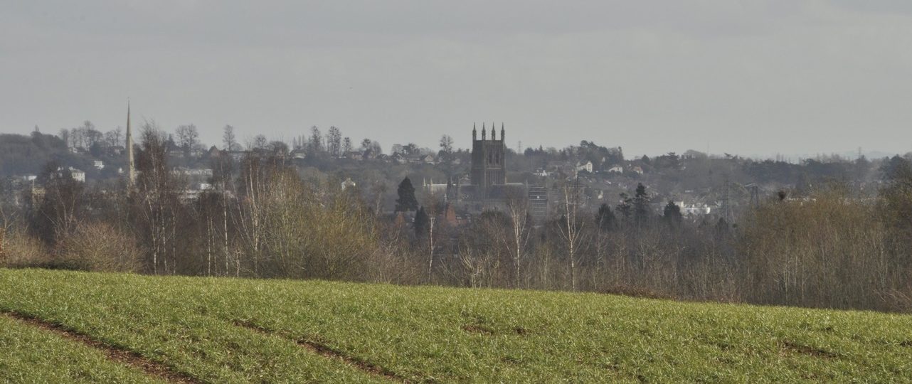

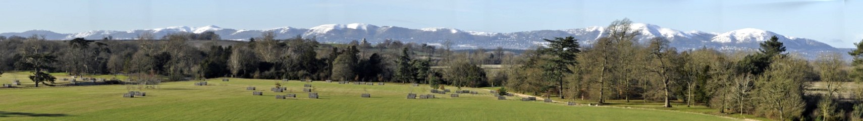
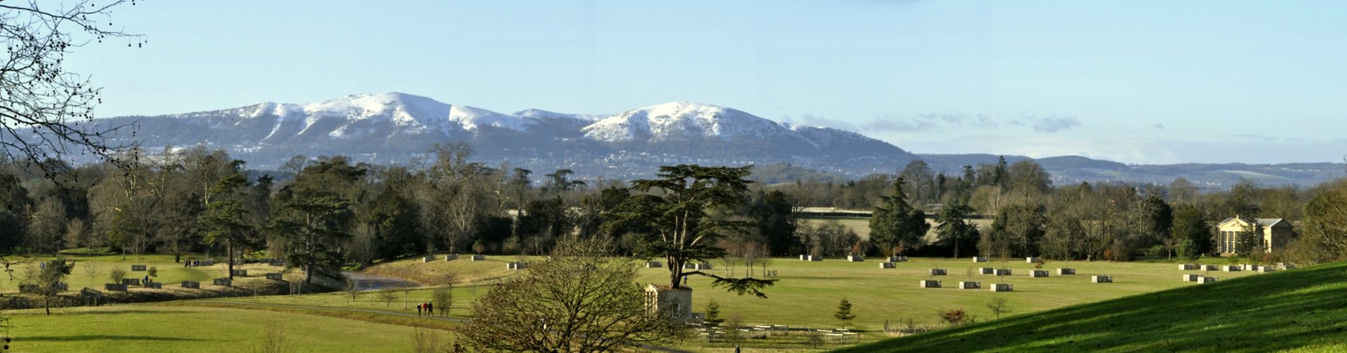
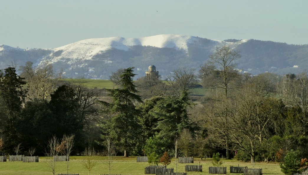


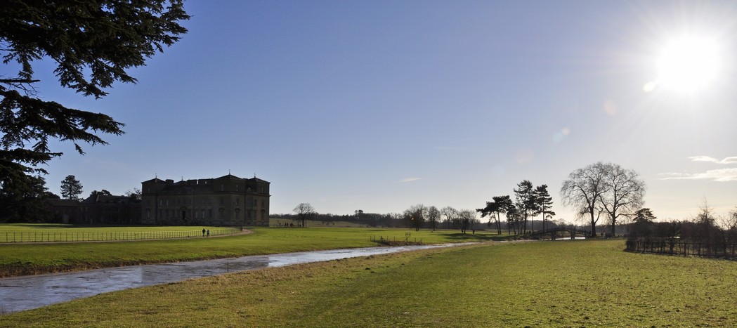
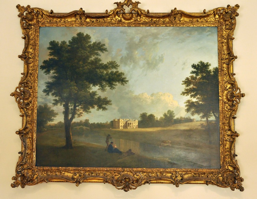
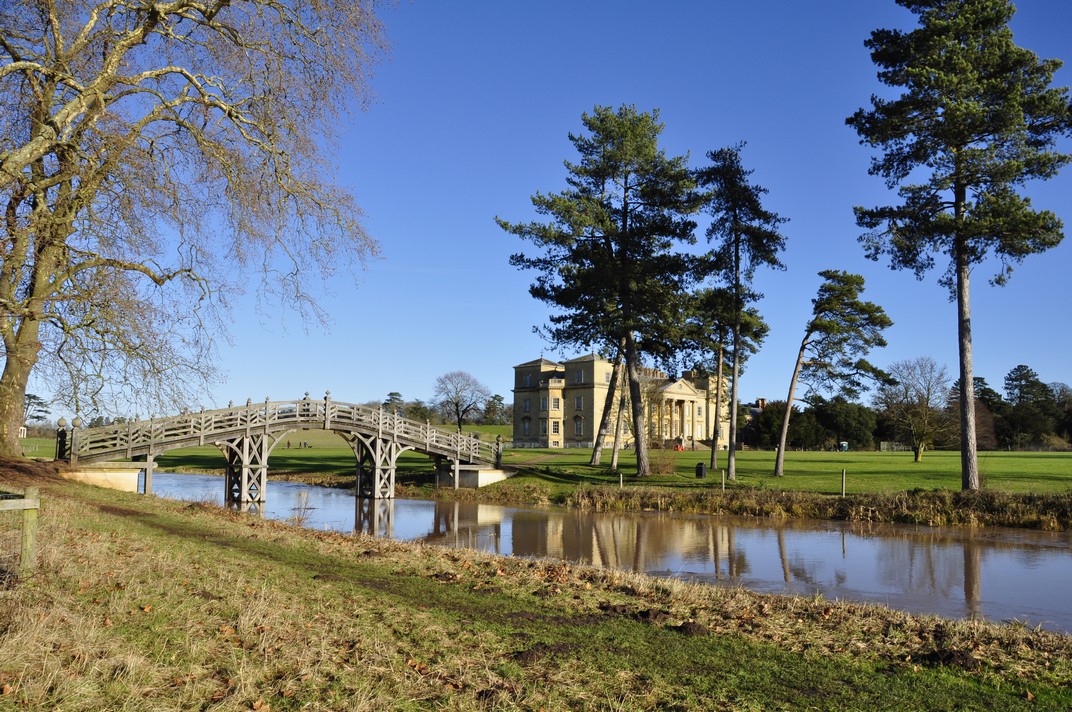


 Where
Where 

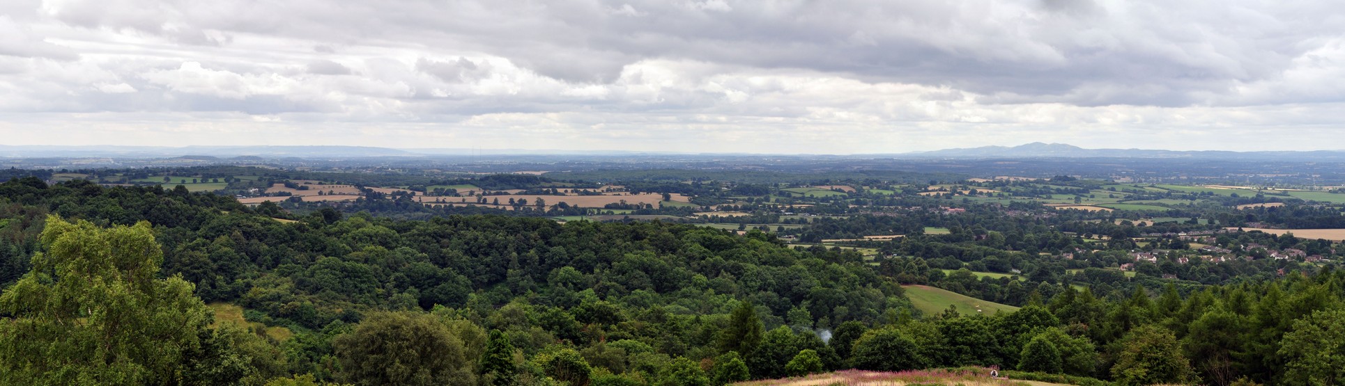
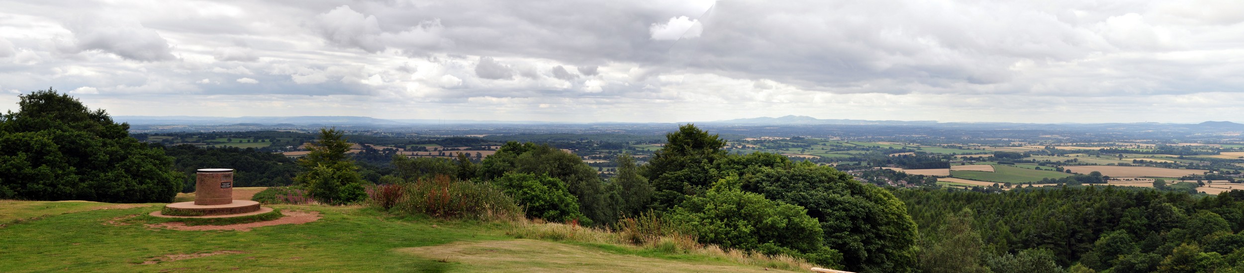
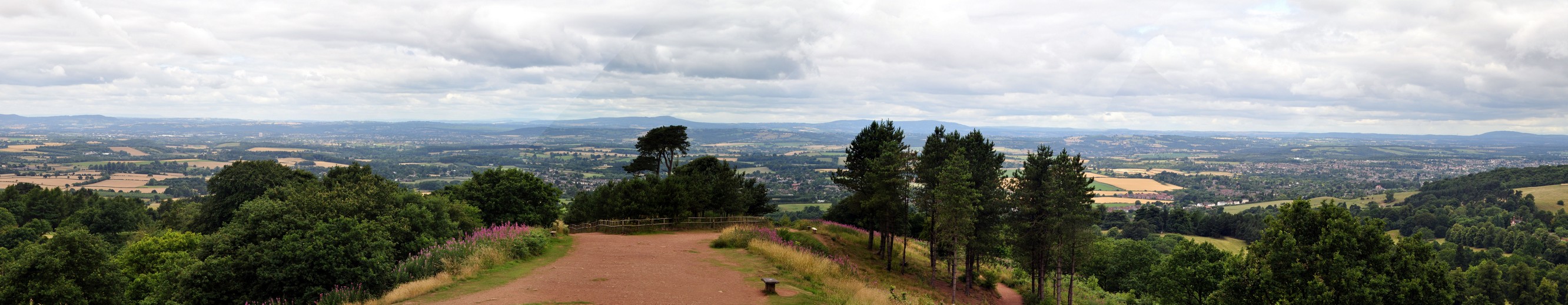
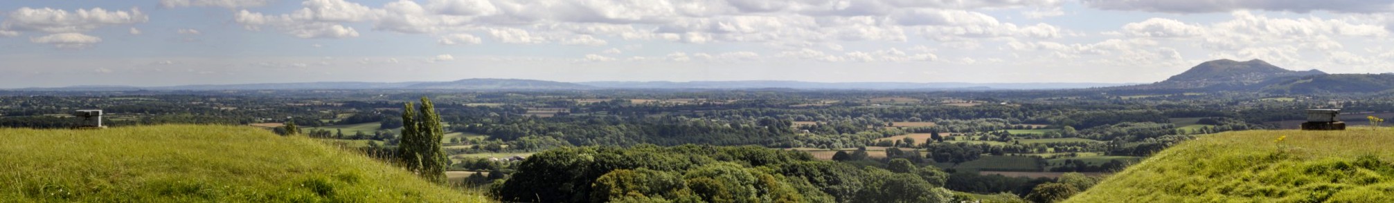
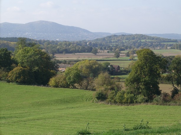
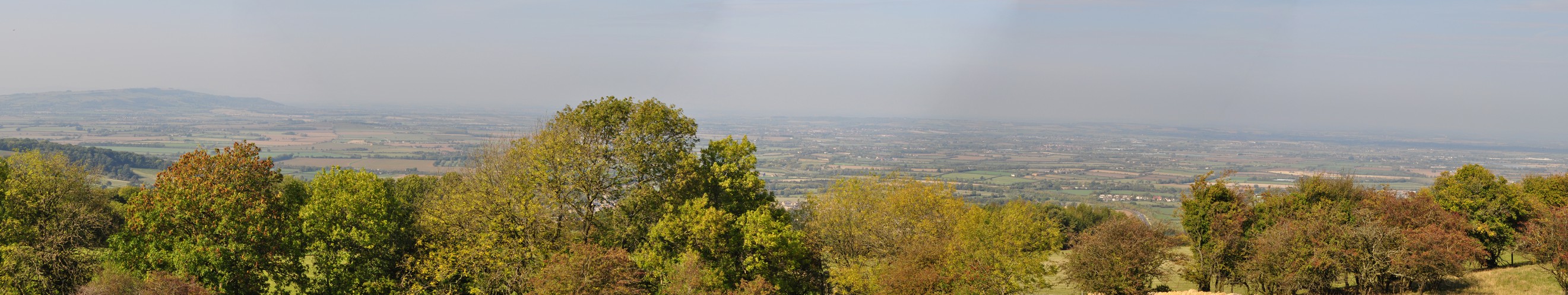
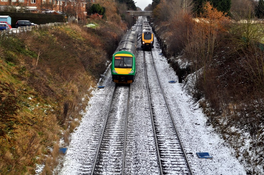
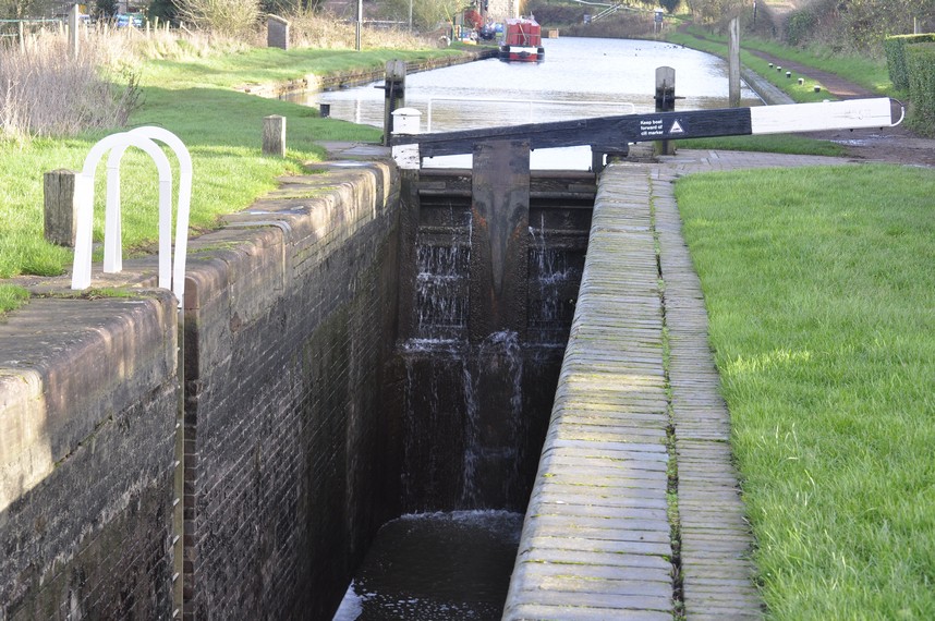
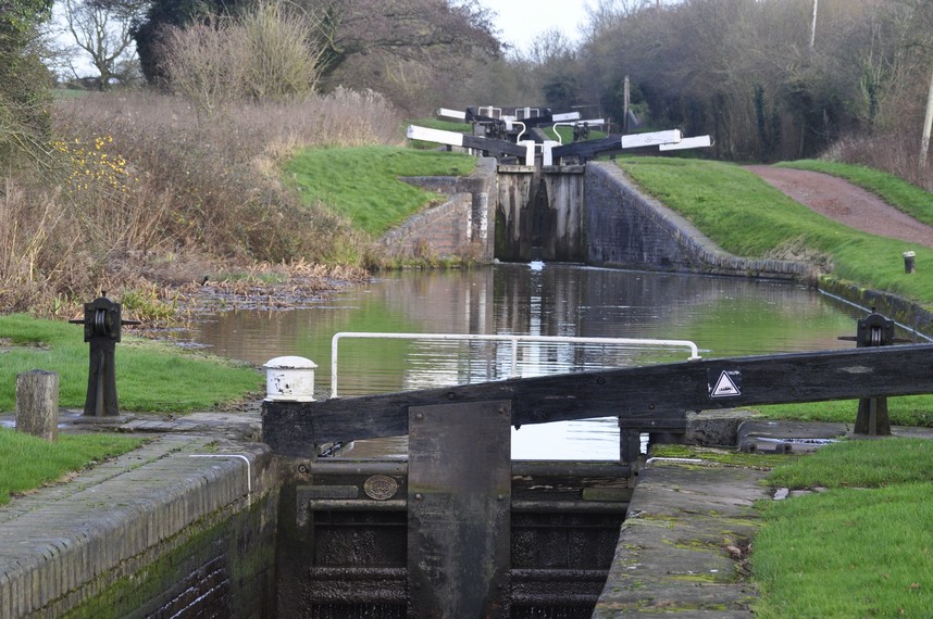
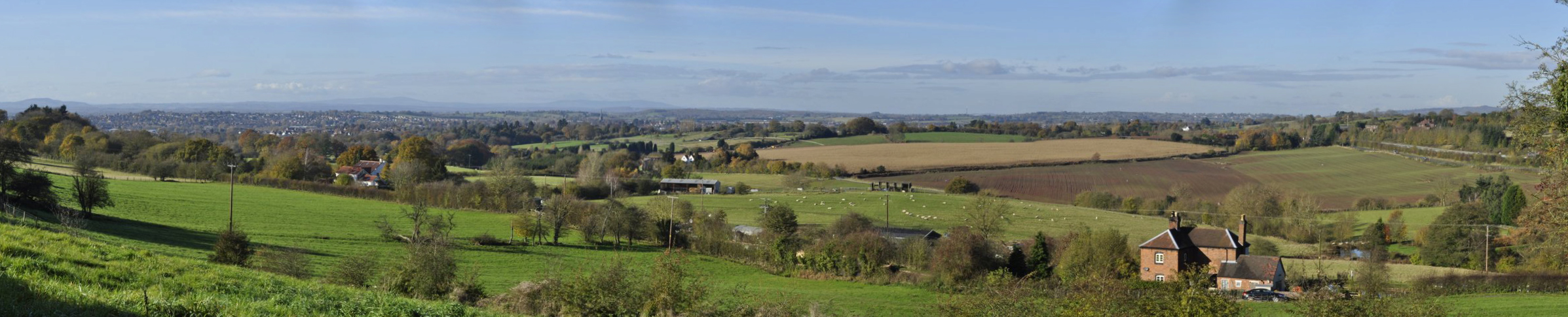
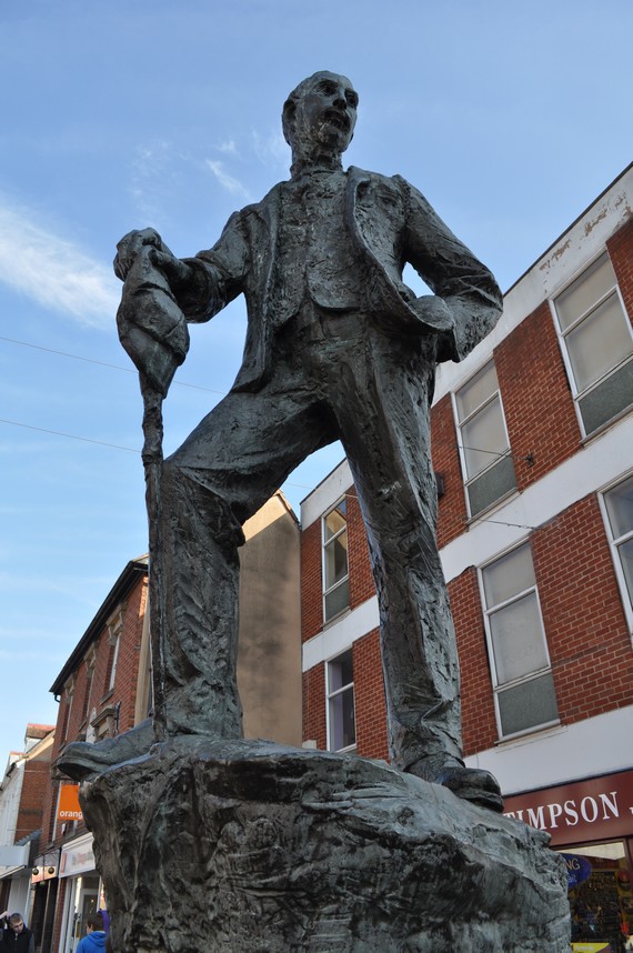
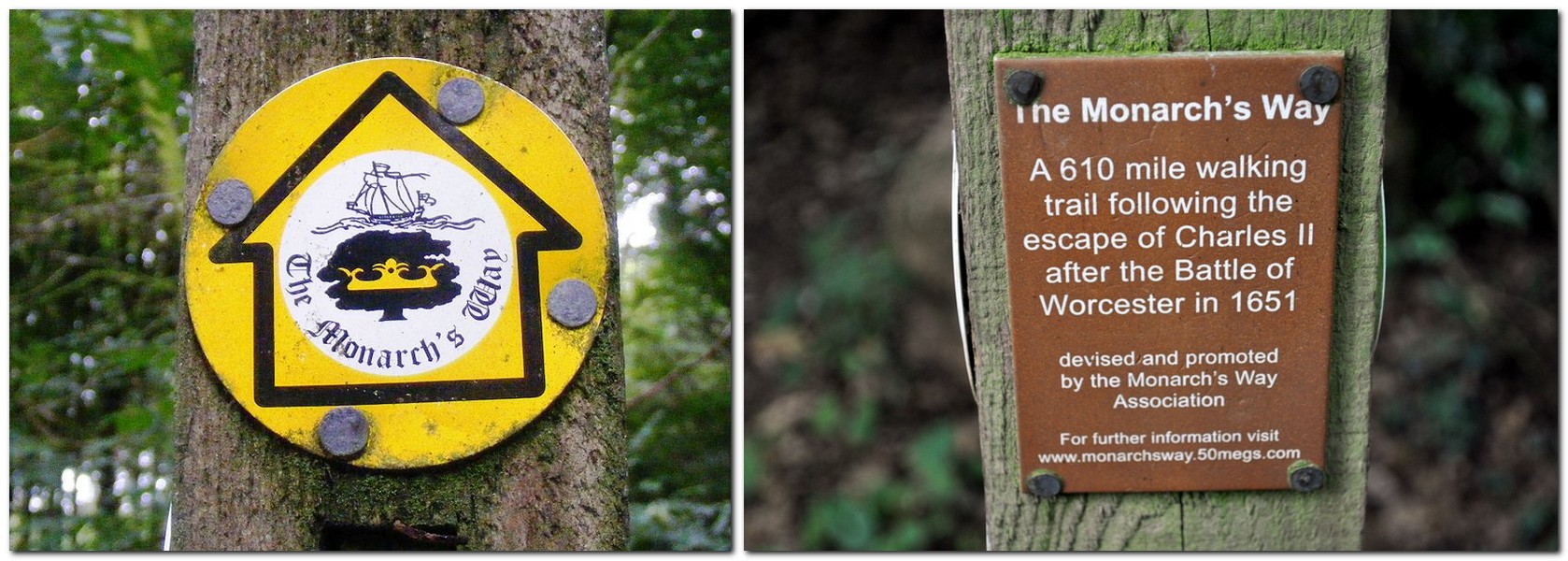

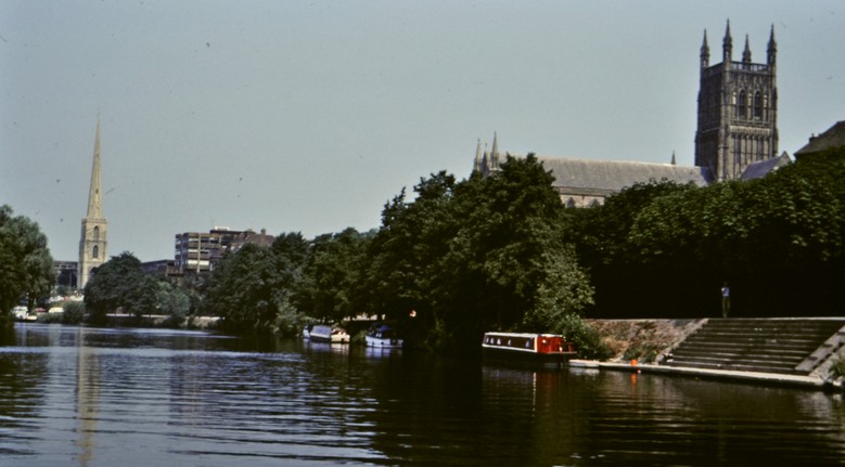
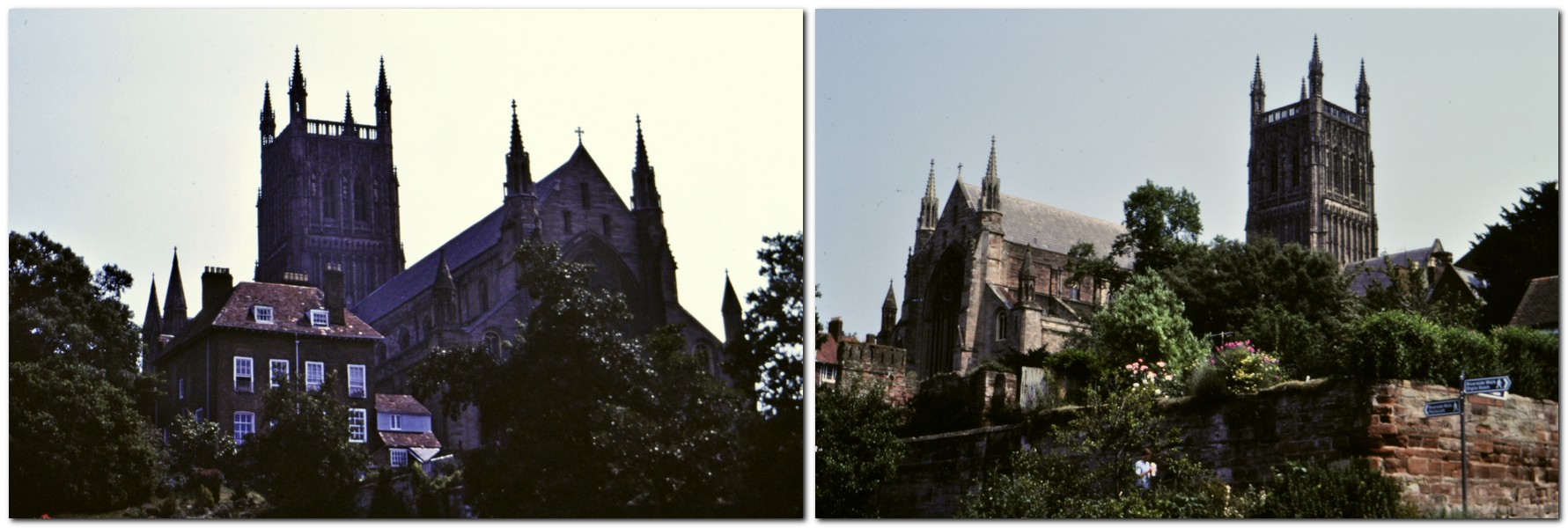

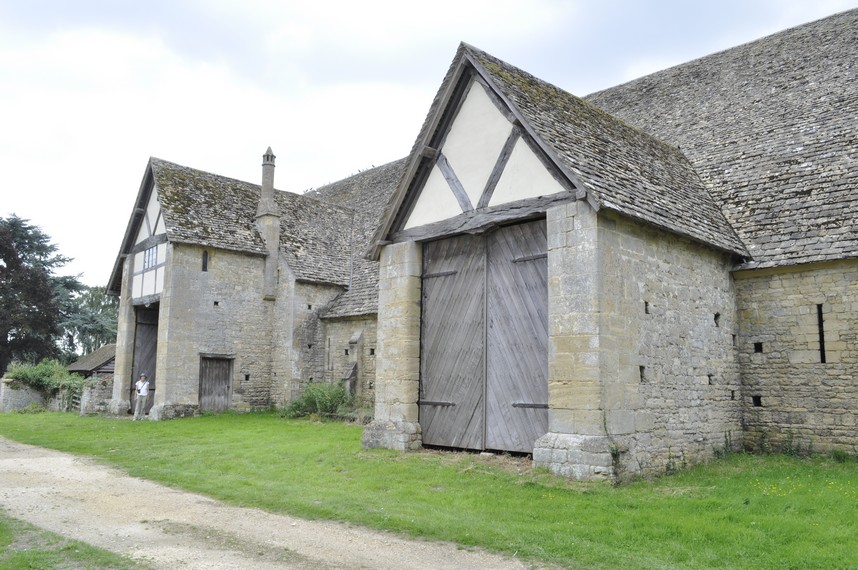
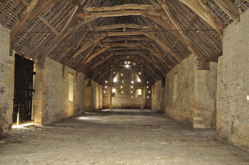
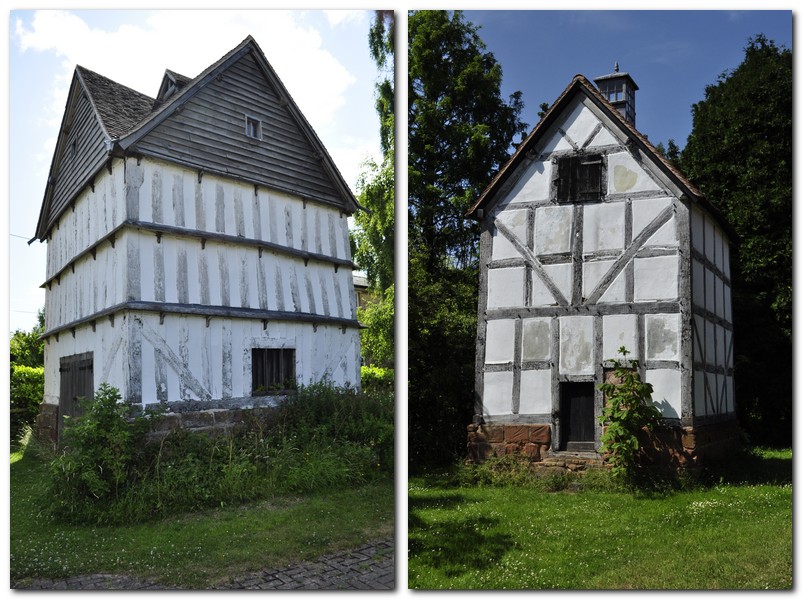
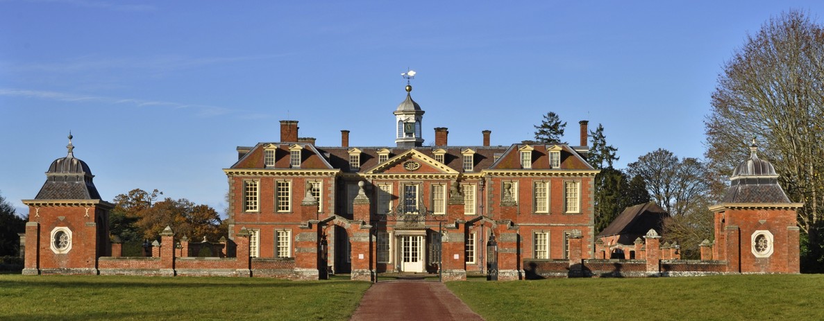
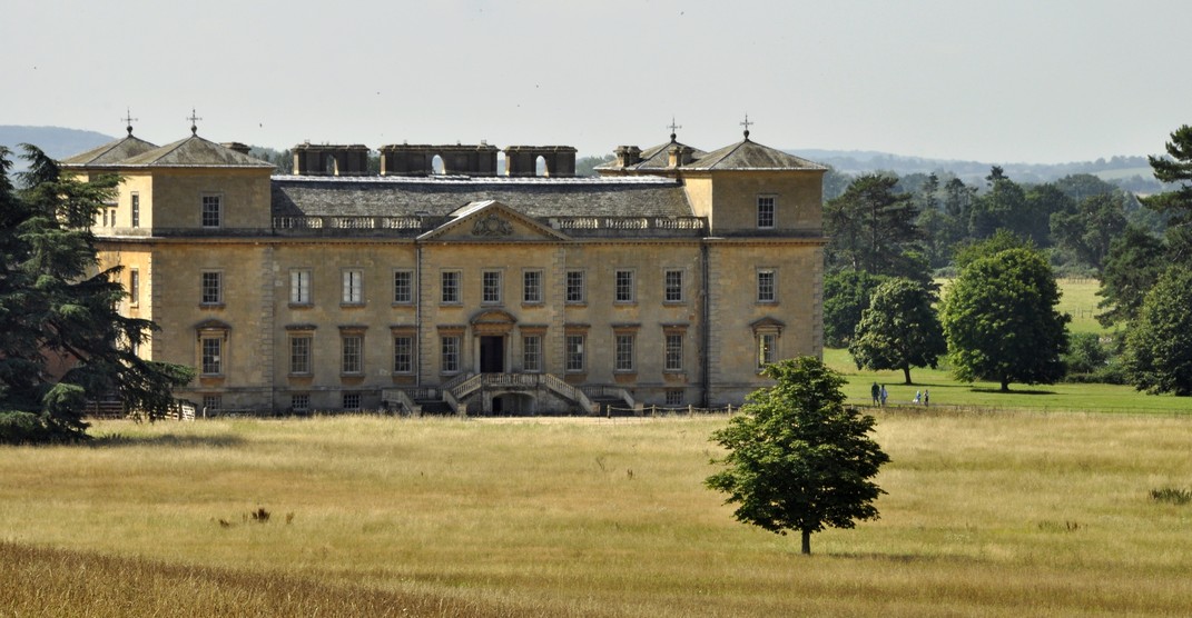
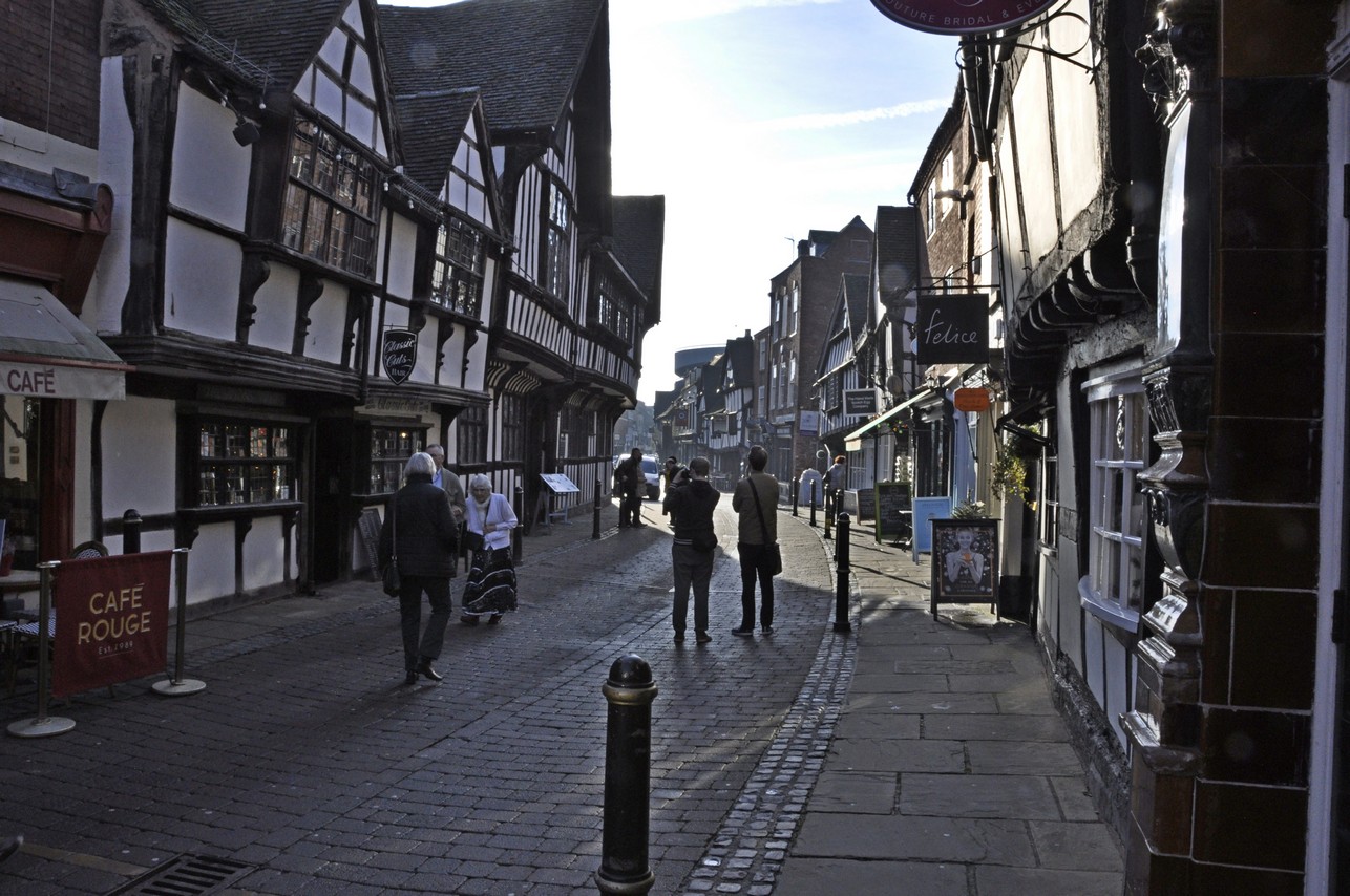
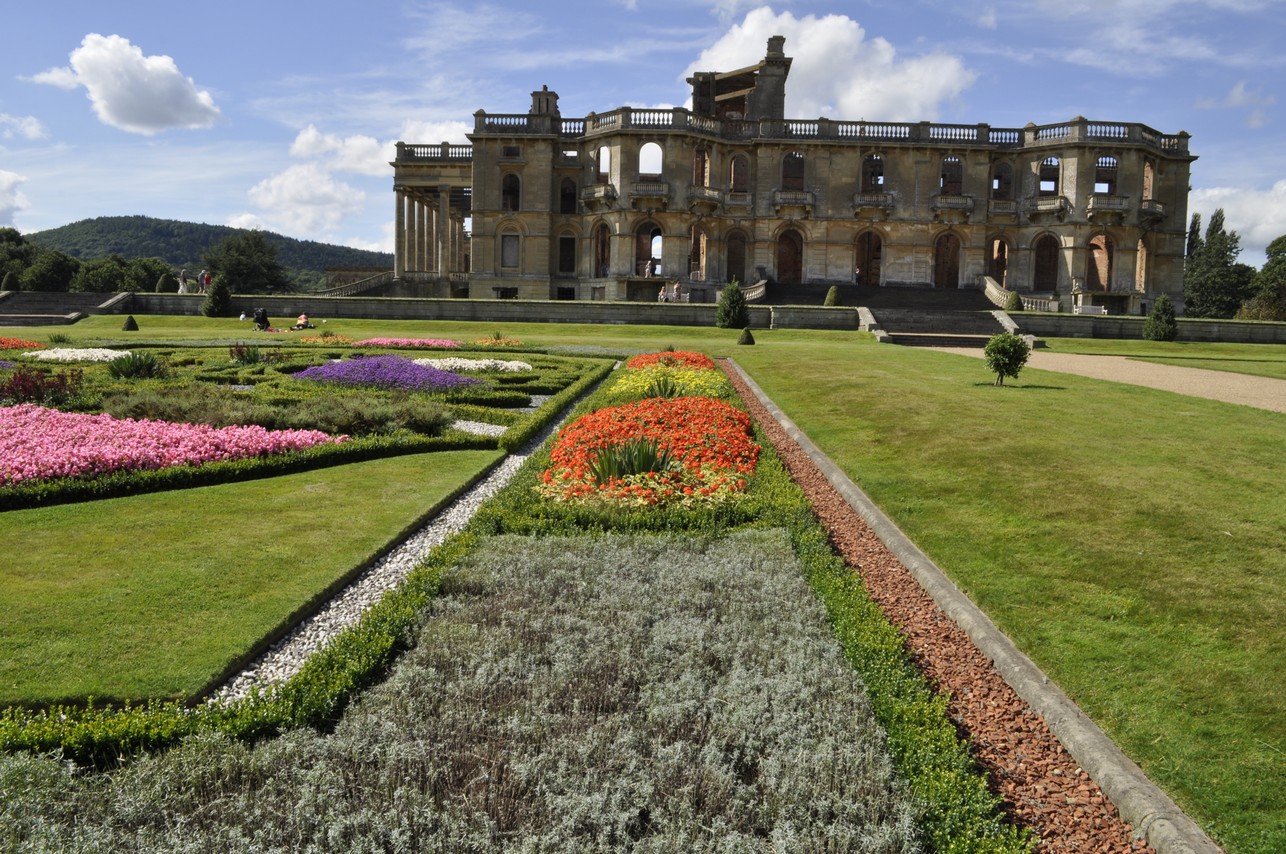


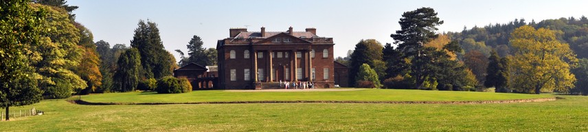


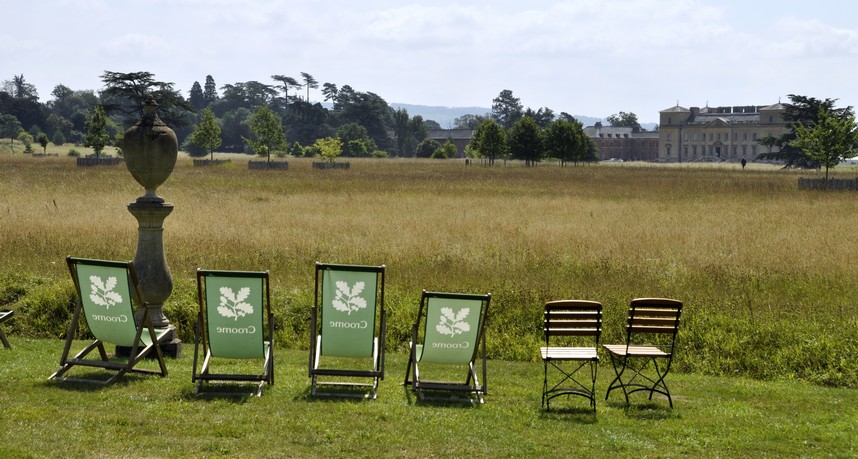


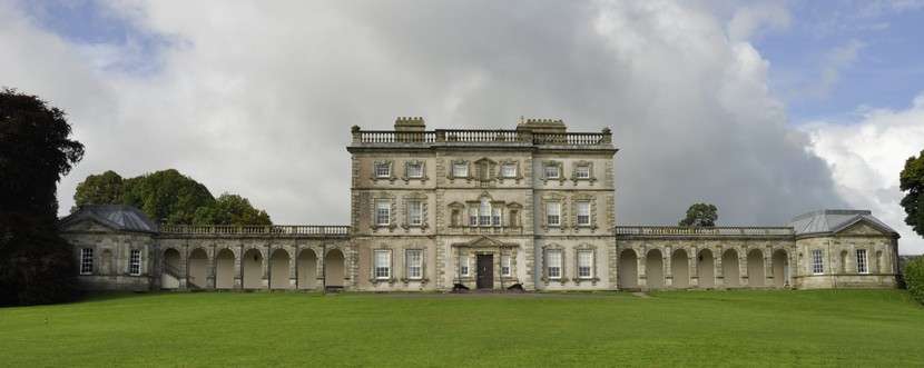


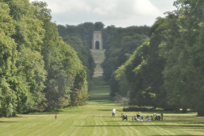
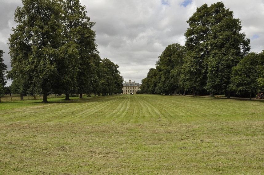


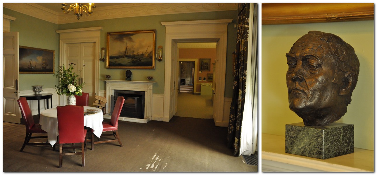
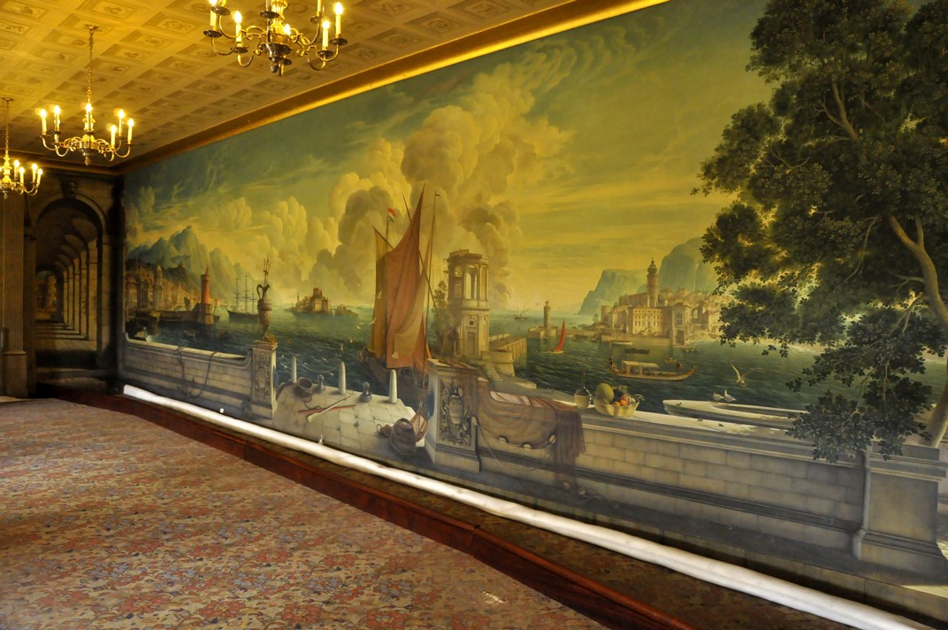


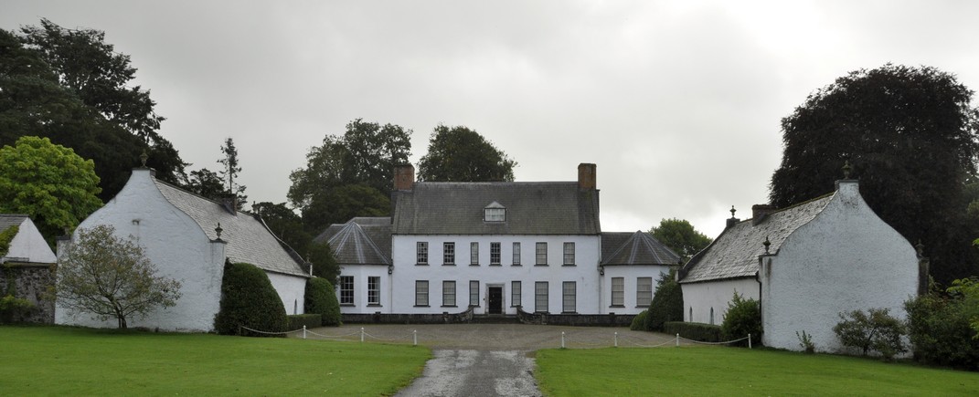


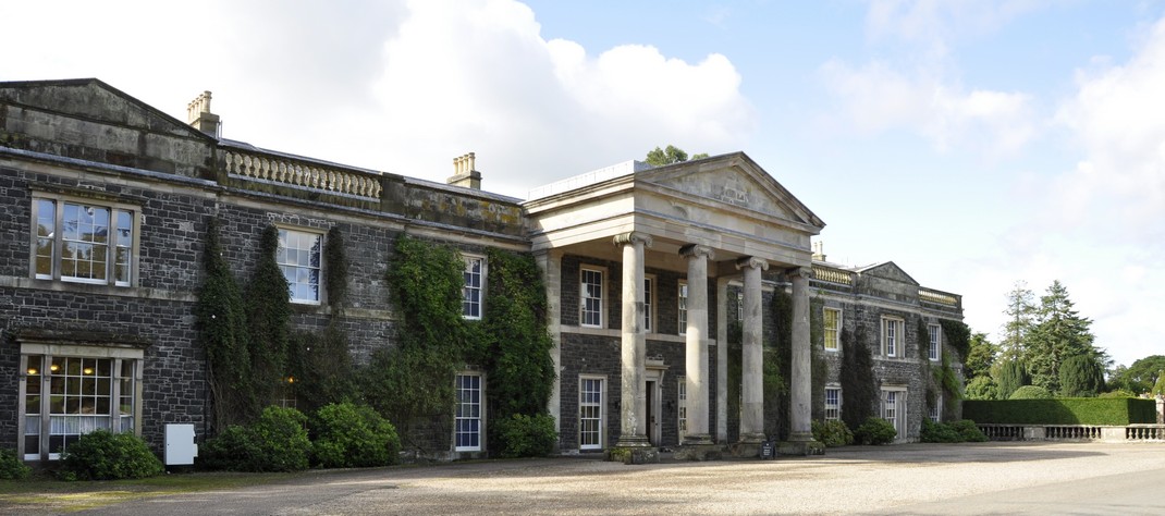


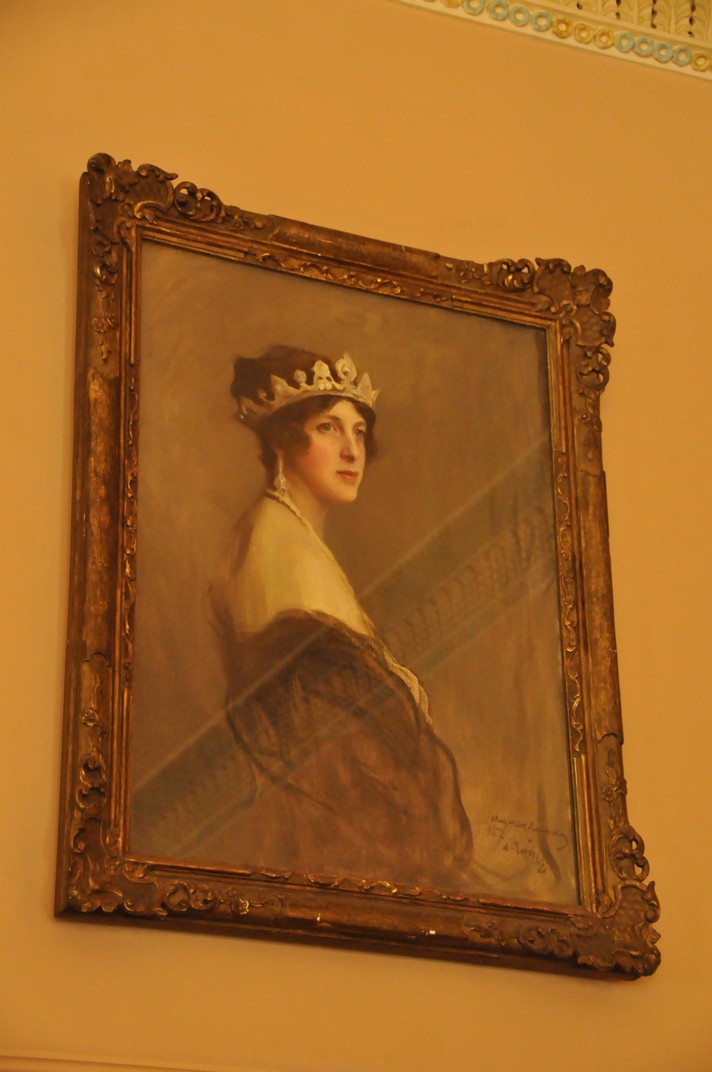


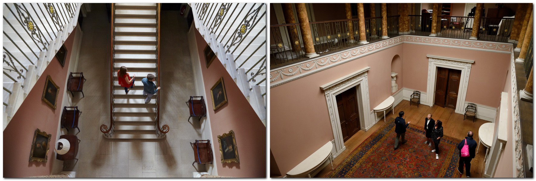


 Florence Court sits well in its landscape, the estate nestling below


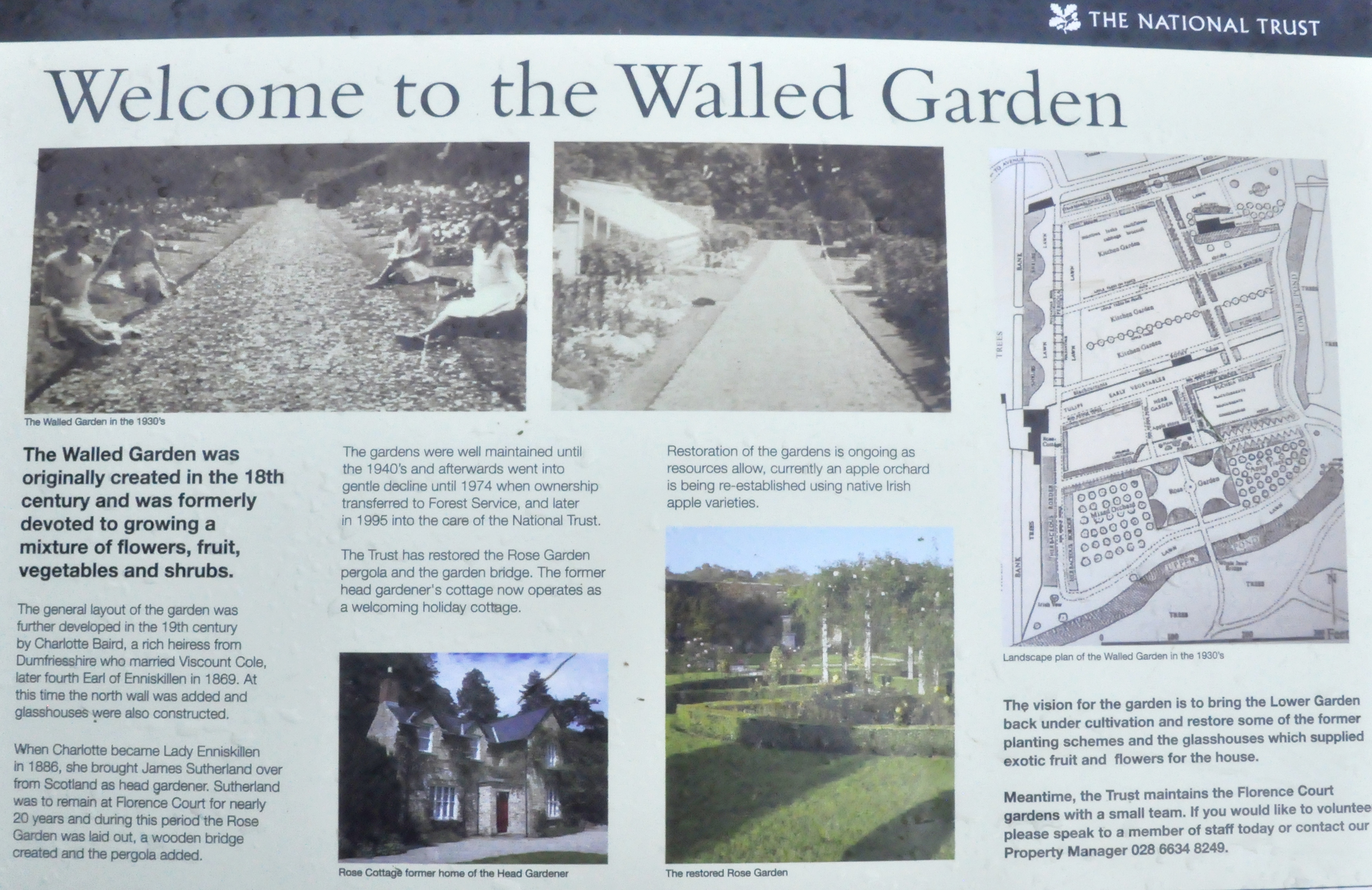


 There is privately-owned castle (not open to the public) on the Crom Estate, home to the Creighton (or Chrichton) family,