Guayabo National Monument in Costa Rica

Compared to the countries to the north (Mexico and Guatemala, for instance) and those in South America such as Peru, there are few archaeological remains of indigenous people in the Central American country of Costa Rica, where I lived from April 1976 until November 1980.

One exception is Guayabo, a Pre-Columbian site that was apparently occupied from about 1000 BC until 1400 AD, and then abandoned. Little is known about the people who lived at Guayabo, but it is believed to have been home to a population of more than 2000.

Guayabo National Monument lies about 18 km (and about 35 minutes) northeast of Turrialba in the Province of Cartago, and east of the capital city of San José, on the southeast slopes of Volcán Turrialba (that has been explosively active for the past few years).

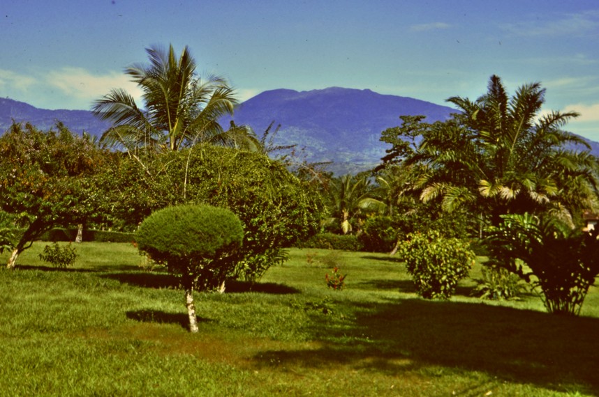
Looking north to the summit of  Volcán Turrialba from CATIE where I lived in Turrialba from 1976-1980.

In January 1980 when Steph and I (and a very young Hannah) visited Guayabo, it took about two hours each way from Turrialba, in a 4×4 vehicle. Obviously, in the intervening years, the roads have improved (map).

It is Costa Rica’s largest archaeological monument, covering more than 200 hectares.  More has been uncovered since we visited in 1980. The various structures include mounds, staircases, roads, open and closed aqueducts, water tanks, tombs, petroglyphs, monoliths and sculptures. Some of its features show Mesoamerican influences, and others from South America, not surprising given Costa Rica’s location on the land bridge between North and South America

Carlos Humberto Aguilar

Artefacts from Guayabo had been studied in the late 19th century, but somewhat dismissed as insignificant. It took until 1968, when University of Costa Rica archaeology professor Carlos Aguilar Piedra (d. 2008) realised Guayabo’s true significance and excavations began.

More recent photo and artists impressions of the settlement can be seen in this post from the Two Weeks in Costa Rica blog.


No laughing matter

Have you ever been surprised walking through an 18th century landscape? Ha-ha!

Well, you’ve probably come across numerous ha-has without stopping to think what or why?

A ha-ha is a recessed landscape design element that creates a vertical barrier while preserving an uninterrupted view of the landscape beyond. They became very popular in the 18th century, as landscape architects like Capability Brown developed their visions of an open landscape connecting house and surrounding land.

In some ways, they are like a dry moat, built for protection—not against human marauders, but animals. Grazing animals were excluded from the lawns and gardens immediately adjacent to a house. But, with a ha-ha separating this area from the ‘wild’ grazing outside, there was a continuity, a oneness with the surrounding landscape in which a house sat. (Think of an infinity pool as a modern equivalent having the same visual effect).

I first saw a ha-ha when I was a young boy growing up in Leek in North Staffordshire. There’s a good example on one side of the pitch at Leek Cricket Club where my Mum and Dad often took me on a Saturday evening in the summer.

Ha-has are more common than you might think. During our visits to National Trust properties over the past six years, we’ve seen some very good examples. Standing at the entrance of a stately home, gazing out over the landscape, your mind is easily transported back 250 years or so. Magnificent today, what must have been the wonder at these new landscapes in their heyday, and the unlimited vistas that the addition of a ha-ha opened up?

At Hanbury Hall, the National Trust property closest to our home in northeast Worcestershire, from the ha-ha just west of the formal garden and parterre, there is an open view to the northwest, across what must have once been a deer park.

In Herefordshire, a ha-ha separates the lawn in front of the main entrance from the meadows beyond at Berrington Hall.

The ha-ha at Berrington Hall encircles the main entrance to the house, and encloses a lawn and gravel drive.

Croome Court is southeast of Worcester, about 20 miles from home. The park at Croome was the first landscape designed by Capability Brown. However, the ha-ha does not separate the land immediately surrounding the house itself, but an area to the west of the house, around the Croome River, about half a mile from the house, where an orangery, a temple and a grotto were built. From the ha-ha there is an uninterrupted view back to the house.

The view from the edge of the ha-ha in front of the Orangery at Croome, looking towards the house

We just returned from Northern Ireland, where we visited eleven National Trust properties in eight days! In Co. Fermanagh, Florence Court sits comfortably in its landscape. It’s the National Trust’s furthest west property. The ha-ha is particularly impressive.

In these two photos, looking across the lawn in front of the house, the edge of the ha-ha can be easily discerned as a slight change in colour of the grass.

Belton House, near Grantham in Lincolnshire, and 100 miles east from home, is a magnificent property. We visited last August. On the east-southeast side of the house, there is a tree-lined avenue and vista to Belmont Tower, about 1 mile away.

Belmont Tower from inside the house. The ha-ha is just beyond the people in between the trees.

Looking back to Belton House from the ha-ha that is about half way to the Belmont Tower.

Just under half way from the house, a curved ha-ha separates the gardens from the park beyond.

Aerial view of the ha-ha at Belton House (from Google Maps)

Steph standing on the edge of the ha-ha.

I expect there will be many more to find and photograph in the coming years.