Morecambe and Wise? Ant and Dec? Lewis and Harris? Not another comedy or presenter duo, surely?
Not by any means. Lewis and Harris is the largest island of the Outer Hebrides. Often referred to as the Isle of Lewis and Isle of Harris, Lewis occupies the northern half of the island, and North and South Harris the southern end. South Harris is almost an island, and there is only a tiny isthmus at Tarbert connecting North and South.
Our journey around the island took one and a half days, to the northern-most tip at the Butt of Lewis, to Rodel on the southern tip of South Harris. We set out from Stornaway to the Butt of Lewis under heavy grey skies, that grew darker and darker the further north we traveled. It was blowing a real gale by the time we reached the Butt of Lewis, the rain was horizontal, and I did wonder whether we’d get chance to see anything at all. But, as on most days of our holiday, the weather improved at the right moment, and it stopped raining. The wind did not drop, however.
Blowing a gale at the Butt of Lewis.
Butt of Lewis panorama – next stop North America!
On our way to the Butt of Lewis we had seen a signpost for a stone circle known as Steinacleit, near the township of Upper Shader. So we decided to stop there once we had begun to make our way south.
At first there didn’t appear to be much to see on the ground. But once we had our bearings, it was possible to discern the remains of an outer circle of stones (the remains of an enclosure, perhaps) surrounding a central cairn. The site has not been excavated scientifically, so not much is known about who built the circle and when. What artefacts that were found in the 19th century have been lost.
Looking west towards Loch an Duin, Siadar and the Atlantic, from Steinacleit, Lewis
Next stop on our Lewis itinerary were the Standing Stones at Callanish—a truly remarkable, mystical yet peaceful location, erected on a low hills overlooking mountains and lochs to the southwest.
Calanish Stones, Lewis
Callanish Standing Stones, Lewis
Our third archaeological site was at Bostadh on the north coast of Great Bernera, where an Iron Age village was discovered, and one of the houses reconstructed.
Then we headed further south, into Harris and on to our B&B a few miles south of Tarbert, at Drinisiadar.
Loch Seaforth.
The hills of North Harris.
Evening sunshine across the loch in front of our B&B.
The following morning, we had a couple of hours free before we had to take the Sound of Harris ferry from Leverburgh to Berneray (and the Uists). So we had a leisurely drive along the coast of South Harris, ending up at Rodel—the end of the road, where’s there is a beautiful little sixteenth century church of the MacLeod clan, St Clement’s (apparently dedicated to Pope Clement I).
Near Seilebost, South Harris
The mountains of South Harris
St Clement’s Church, Rodel, South Harris.
The nave.
A side chapel with the sword stones.
One of the finest tombs in Scotland, of Alasdair Crotach MacLeod, 8th Clan Chief of the MacLeods.
Last Monday was the last day of our holiday in Scotland. We’d reached Lockerbie in Dumfries and Galloway on Sunday night, and just had the journey down the A74(M) and M6 to reach home.
Two hours is about as much as I can take driving on the motorway before I need to take a break. And we had discovered that there was a National Trust property, Rufford Old Hall, in Lancashire just south of Preston, about equidistant between Lockerbie and home. The ideal place to stretch our legs, have a bite to eat, and enjoy another of the Trust’s delights. In fact, it seems that many holidaymakers have exactly the same idea. One of the volunteers told me that Monday is usually a busy day, with many visitors breaking their journey north or south at the hall. Rufford Old Hall is very convenient to the M6, just a handful of miles west of Junction 27.
Formerly the home of the Hesketh family, Rufford Old Hall (is there a new one?) has two main wings: an original timber-framed Tudor one built in 1530 for Sir Robert Hesketh, oriented east-west, that may have once also had another wing on the west side (there are two ‘external’ doors on the west wall) but this no longer exists; and a later seventeenth century brick wing, north-south. The main entrance opens into what was once the kitchen, but that was moved to another location in the same wing at a later date.
Rufford Old Hall is an L-shaped building.
The main entrance in the seventeenth century wing.
The bow window of the Great Hall.
On the south side, there is a dining room and an upstairs gallery in this bow-fronted part of the building.
The exterior of the Great Hall on the south side. The skylight was added in the 19th century.
The crowning glory of course is the Tudor wing, which consists primarily of the Great Hall with its magnificent bow window and small section of original Tudor stained glass. The roof of the Great Hall is a wonder to behold in timber architecture and construction. There is also a moveable screen just inside the hall. Photography is permitted only inside the Great Hall as the National Trust does not own all the items on display elsewhere throughout the property.
Bow window in the Great Hall with original Tudor stained glass.
The east end of the Great Hall, with the large moveable screen.
The screen from the floor above.
The impressive roof and ceiling.
The skylight was added during the Victorian era.
A billiards table was positioned beneath the skylight that allowed more light directly below.
On the west end of the Great Hall, these two doors now open to the exterior, but may once have provided access to another wing that no longer exists.
There is a small formal garden, with renowned squirrel topiaries, and walks through orchards, woodland and meadows alongside the Rufford Branch of the Leeds and Liverpool Canal (built in 1781) on the east side of the property.
One of the two squirrel topiaries either side of the main path in the garden, looking south.
It’s one of the big ‘what ifs’ of British history.
How would Britain as a nation and British society have evolved had the 1745-46 Jacobite Rising of the Young Pretender, Bonnie Prince Charlie (or, to give him his full name: Charles Edward Louis John Casimir Sylvester Severino Maria Stuart, born 31 December 1720, died 31 January 1788) been successful. Would there still be a Union? But he wasn’t successful, and this uprising ended with the last battle fought on British soil at Culloden in 1746. It had a long-lasting impact on Scotland, particularly in the Highlands.
He raised his standard at Glenfinnan on the west coast of Scotland on 19 August 1745 in a bid to reclaim the throne for his father (The Old Pretender, James Francis Edward Stuart, son of deposed King James II, and accepted by many as the rightful heir) from the ‘usurper Hanoverians’.
During our recent road trip round Scotland we came across a number of sites associated with Bonnie Prince Charlie and the 1745. Having made our trip counter-clockwise, we reached Glenfinnan on the penultimate day of our holiday. The weather was atrocious: driving rain and strong winds. In fact I had wanted to make the 15 mile or so detour west of Fort William to see the Glenfinnan viaduct on the railway connecting Fort William and Mallaig. For all you Harry Potter fans, the steam train that runs on this West Highland line featured as The Hogwarts Express in several films.
Robert MacAlpine built the viaduct.
The Glasgow-Mallaig train arrives on time.
The Glenfinnan Viaduct from the top of the Glenfinnan Monument.
The Glenfinnan Monument.
When we arrived at the Glenfinnan visitor centre, I realized that I had seen the Glenfinnan Monument (that commemorates the raising of the standard) on a couple of previous occasions, but never in such weather. We did get tickets to climb the monument—maximum four people at a time plus the guide. It’s an extremely steep and tight stone spiral staircase up the monument, and you have to almost limbo dance to squeeze out through the manhole, that couldn’t have been more than 18 inches square. I did manage my photo of the viaduct from there, and just as we walked back to the Visitor Centre, we heard the steam train puffing its way through the station, where we had been no more than 20 minutes previously. No-one had cared to advise us that the steam train was expected imminently!
During the 1745 uprising, the Jacobites marched south into England, reaching Derby by early December. And it was at this point that they effectively lost their campaign. Some historians believe that the Hanoverian government forces could have been defeated at that time, but Charles Edward Stuart turned round and led his forces back into Scotland, where they were caught and defeated at the Battle of Culloden on 16 April 1746. The battle site is just east of Inverness, managed by the National Trust for Scotland property, and seemingly the site for pilgrimage by people of Scots ancestry from all over the world. The displays and explanations of the battle in the visitors centre are excellent.
Site of the Battle of Culloden, east of Inverness, on 16 April 1746
Culloden Battlefield
In South Uist we passed by the birthplace of Flora MacDonald, who helped Bonnie Prince Charlie escape into exile after Culloden, and also near where she is buried in the north of Skye.
While compiling information for this blog post, I’ve discovered a ‘personal’ link to Bonnie Prince Charlie. My home town is Leek in North Staffordshire: The Queen of the Moorlands. The Jacobite army passed through Leek in December 1745 on its way south. After turning round at Derby, it passed through Leek once again and there is anecdotal evidence that Bonnie Prince Charlie stayed the night in a small house at the top of the Market Place, just across the road from where I used to live, and next to the vicarage of the Church of St Edward the Confessor (where Jacobite soldiers sharpened their swords on a stone cross in the churchyard).
Bonnie Prince Charlie is reputed to have lodged here in Leek in December 1745.
The Bonnie Prince Charlie house is on the left at the top of the Market Place in Leek.
Yesterday, however, I read another account that states that the Prince did not stay in this house after all, but lodged instead in a much finer house, one built in the late 17th century, and located about 200 m east on Stockwell Street. Now a listed building, ‘Greystones’, was once divided into two apartments and rented by the local authority. From 1976 until the mid-1980s, my parents resided in the apartment on the upper two floors. I never had the least inkling whenever I visited them there that this just might have been the place where Bonnie Prince Charlie lay his weary head and dreamed on what might have been.
‘Greystones’ is a late 17th century listed building on Stockwell Street in Leek. It stands in front of the local library, art gallery and museum, the Nicholson Institute, the tower of which can be seen behind. ‘Greystones’ was once occupied by silk manufacturer Joshua Nicholson, who built the Institute in 1884.
I have to admit being disappointed—but only ever so slightly—to discover that John o’ Groats is NOT the northernmost point on the British mainland (although apparently it is the spot where the ‘last house’ is situated.
Since everyone who undertakes a marathon walk, run or bike-ride the whole length of the country, usually for charity, starts or ends their journey in John o’ Groats (to or from Land’s End in Cornwall, with more than 800 miles between them). I don’t know why, but I’d always wanted to visit John o’ Groats. I guess because it appears in the news on a regular basis, an iconic location in our nation’s geography. So it was one of the places we included on our itinerary during our recent Scottish Highlands and Island road trip.
The actual most northern spot on the mainland is Dunnet Head, about 15 miles to west of John o’ Groats. Turns out that Land’s End is not the most southerly point either. That would be the Lizard Point, but which is actually closer to John o’ Groats by less than 10 miles.
We arrived in John o’ Groats under brilliant blue skies on the Saturday afternoon, and enjoyed clear views over the Pentland Firth, the stretch of what can be perilous waters between the mainland and the Orkney Islands, less than a dozen miles north. After wandering around the harbour, we than drove the couple of miles east to Duncansby Head, lighthouse and Stacks, enjoying even more spectacular views over the cliffs.
John o’ Groats, Caithness
The Orkney ferry in the harbour at John o’ Groats.
The harbour entrance.
Duncansby Stacks.
Looking west from Duncansby Head toward Dunnet Head, on the horizon.
Hoy from Duncansby Head
The Duncansby lighthouse.
Since our B&B accommodation for the night was in Thurso we drove there via Dunnet Head and its lighthouse to see the most northern point of the mainland for ourselves.
In the late afternoon sun we could even see the tip of the Old Man of Hoy sea stack above a headland on the northeast coast of the large island of Hoy immediately north.
The south-facing cliffs of Hoy in the late afternoon sun.
Dunnett Head, Caithness
Hoy from Dunnet Head. You can just see the Old Man of Hoy sticking up above the horizon on the left side of Hoy.
It was summer 1966. I was seventeen, and decided to visit the Outer Hebrides, more specifically North Uist, where the Royal Society for the Protection of Birds (RSPB) had just established a new reserve at Balranald near the village of Hougharry (Hogha Gearraidh in Scots Gaelic) on the west coast. Originally the reserve was aimed at protecting breeding populations of two special summer visitors: the corncrake and the red-necked phalarope. Sadly, the phalarope no longer breeds at Balranald.
So, with rucksack on my back, including a one-man tent and all the paraphernalia necessary to support me for a couple of weeks, I set off for Glasgow (where I spent a few nights with my eldest brother Martin and his wife, Pauline) before taking my first ever flight on a Vickers Viscount from Glasgow International Airport (formerly known as Abbotsinch) to Benbecula airport at Balivanich.
I pitched my tent in front of the small cluster of houses in Hougharry, and was invited in for several meals by the old lady with whom the recently-appointed (and temporary) reserve warden was lodged. If I remember, her name was Mrs MacDonald, and she was very kind and hospitable. I don’t remember the name of the young warden. He had just graduated in geography from the University of Hull. Well, I didn’t get to see the corncrake nor the red-necked phalarope, and when I visited again in 1967 I was also unlucky. But the experience was wonderful, and I fell in love with the Outer Hebrides, particularly North and South Uist. What a combination of nature! The machair and all its plant and animal diversity, the lochs and mountains, not to mention the sea life such as grey seals and killer whales. Pure air, no pollution!
I must have been almost the first visitor ever to Balranald in 1966. And I have just returned from a trip to North Uist—a walk down memory lane after 49 years. Still no corncrakes, however, though we did hear them.
Of course the islands have changed a great deal over the past five decades. Almost all of the old whitewashed and thatched croft cottages have disappeared, once so typical of the Uist landscape. Many cottages are now roofless shells, the roofs presumably deliberately removed to remove any property tax liability. There has been an enormous house building boom in the past 20 years or so, I guess. I was told that with government grants it was cheaper to build new, energy-efficient housing (necessary against the icy blasts that pour in from the North Atlantic) than to renovate.
Derelict house on the road to Lochskipport, South Uist
A typical thatched croft cottage.
A derelict blackhouse
I wasn’t able to work out where I had camped in Hougharry nor which was Mrs MacDonald’s house. But I was pleased that I had been able to return and revive good memories from my youth. We stayed a couple of nights at a B&B at Balranald, overlooking the reserve, with Hougharry on the horizon. Run by Mrs Julie Ferguson, Balranald View was excellent. Julie was extremely welcoming, and her scones (with butter and mixed fruit jam) melted in the mouth.
Looking southeast and southwest from South Clettraval, east of Hosta on North Uist.
Looking south towards Kirkibost Island from South Clettraval
The bay at Hougharry with the village in the background.
Along the machair around the bay at Hougharry.
Kilmuir Cemetery, from Hougharry village.
A typical North Uist landscape, south of Hougharry.
Red deer on the B894 to Loch Euport, near Sidinish.
The mountains of North Uist with Eabhal on the right, taken from the A867 to Lochmaddy.
A dreek morning wait for the ferry from Lochmaddy to Uig on the Isle of Skye.
Our B&B accommodation at Balranald, where hostess Julie Ferguson and her husband Roddy made us very welcome. Roddy was born in Hougharry.
Julie Fowlis
As a fan of the BBC series Transatlantic Sessions, I have increasingly become a fan of singer and TV presenter Julie Fowlis who has appeared regularly on that programme, and who I see from time-to-time whenever I tune into BBC Alba on catch-up TV. Well, she hails from North Uist—from Hougharry, in fact (so Julie Ferguson told me).
Here she is talking about her Hebridean roots and music. It’s a six minute film.
This song seems to have almost become her signature tune now: Hùg Air A’ Bhonaid Mhòir (Celebrate the Great Bonnet).
Steph and I have been members of the National Trust since 2011, and so we took advantage of reciprocal membership to visit several National Trust for Scotland properties during our recent Highlands and Islands holiday.
Gardens always feature high on our list of National Trust “to do’s”. Steph’s the gardener at home however. I’m just the admirer and mow the grass. But when we found that we’d be quite close to one of Scotland’s most important gardens, Inverewe in Wester Ross, we made plans to visit before crossing to the Outer Hebrides. We came across the other big garden, Arduaine in Argyll & Bute, quite by chance. It was just a few miles from our accommodation on the penultimate night of the holiday. The third garden was attached to Brodie castle just east of Inverness that we visited on Day 3. We turned up at Brodie only to find that the castle was not open to the public on a Friday, so we spent an hour wandering around the small garden and learning more about daffodils! More of that later on.
Inverewe Garden
This is an oasis of almost tropical splendour on the banks of Loch Ewe in northwest Scotland, about 50 miles southwest of Ullapool.
We spent the night of Day 5 of our holiday at Braemore about 12 miles south of Ullapool at the southern end of Loch Broom.
Loch Broom from the south.
Having booked passage on the 17:30 ferry to cross over to Stornaway on the Isle of Lewis from Ullapool, we had the whole day to visit Inverewe. The weather was not promising when we started out for Inverewe, with low cloud and spitting rain. Typical Scottish weather you might think. However, within just a few miles, the clouds lifted and we were treated to a bright sunny day for the rest of our journey and the two to three hours we spent walking around the garden before heading back to Ullapool for the ferry. Given that a major storm was expected later that evening, and as ferry crossings had been disrupted in previous days we did try to change our booking to the morning crossing at 10:30. No such luck as it was already fully booked. So we just went ahead with the plan we’d already made—and thoroughly enjoyed our visit to Inverewe Garden.
Opened in 1862, the garden was the brainchild of one Osgood Mackenzie who, having planted 100 acres of woodland to protect the garden, set about creating a sub-tropical paradise at almost 58°N, and nurtured by the warm waters of the North Atlantic Drift, full of exotic plant species.
It was taken into ownership by the National Trust for Scotland in 1952. Inverewe is famous for its rhododendrons and azaleas (some of which were damaged in gales in early 2015, especially some very old and large specimens), and is laid out in informal blocks representing different parts of the world, such as China, Tibet, Japan, New Zealand and the like. There are even tree ferns and several specimens of the very rare Wollemi pine from Australia.
Himalayan poppy at Inverewe Garden
Rhododendron at Inverewe Garden
In Inverewe Garden
Arduaine Garden
Just 20 miles south of Oban beside the A816 (and 12 miles short of the village of Ford where we had a room booked) Arduaine Garden was a complete surprise. We originally passed it at about 17:30. It was already overcast, windy and drizzly, but we pulled in anyway to get our bearings and see when the garden was open. 09:00 to sunset! So we decide that if the weather was fine the following morning we would retrace our steps and spend a couple of hours there before re-retracing our steps to Ford, Loch Awe and on to Loch Lomond.
Established in 1898 by James Arthur Campbell on a peninsula jutting out into Loch Melfort (and with views from the headland all the way to the mountains on the Isle of Mull to the northwest), Arduaine lies at 56°N. It is full of rhododendrons and azaleas that were still in full bloom compared to what we had encountered at Inverewe. The garden was gifted to the National Trust for Scotland in 1992.
Arduaine has a more intimate feel about it than Inverewe, and perhaps for that reason I enjoyed my visit here more than to Inverewe.
Or was it because there were far fewer visitors at Arduaine? Afterall, we did arrive just a short while after garden opened and we had it almost to ourselves for the duration of our visit.
Arduaine Garden, Argyll & Bute
Rhododendron at Arduaine Garden
Rhododendron at Arduaine Garden
Arduaine Garden
Brodie Castle
Lying just to the west of Forres on the north coast of Scotland, Brodie Castle has been home to generations of the Clan Brodie, and the last clan chief lived there until 2003.
The castle was built in the 16th century. Major Ian Brodie, the 24th Brodie of Brodie, began assembling a collection and breeding daffodils in 1899, and eventually there were more than 400 different varieties grown. Some have been lost, but the National Trust for Scotland is attempting to re-establish this important collection. I never knew there was so much to daffodils.
During our recent tour of Scotland’s Highlands and Islands we traveled from Fife (where we had stopped the first night after traveling up from the English Midlands) up through Perthshire and Aberdeenshire, Speyside and the north coast and over to Inverness. From there we worked our way up the northeast coast to John o’ Groats and across the top of Scotland and down through Sutherland. We crossed over to the Outer Hebrides (Lewis, Harris, North and South Uist, Benbecula, and Eriskay) from Ullapool, then came back to the mainland via Skye. From there, via the Kyle of Lochalsh, we traveled down the west coast to Argyll & Bute, and over to Loch Lomond on our last day.
I took over 1000 photos on my Nikon D5000. On many occasions I felt I could only do justice to the landscapes we saw by taking a panorama of individual shots and combining them into stitches. The result for some is more than acceptable. For others, the blending between the individual frames is not even, but they nevertheless allow you to appreciate the beauty of these outstanding Scottish landscapes. Click on each of the photo below to open a full size version. I hope you enjoy these photos as much I did taking and editing them.
Taken from the A920 between Huntly and Dufftown, looking southwest.
The last battle fought on British soil was fought at Culloden (just east of Inverness) 0n 16 April 1746, when the Jacobite forces of Bonnie Prince Charlie were defeated by the Hanoverian ‘Butcher Cumberland’.
This bridge, west of Inverness, carries the A9 across the Moray Firth on to the Black Isle of Ross and Cromarty. Taken from North Kessock on the north shore, looking east.
From Dunnet Head – the most northerly point in mainland Britain – looking east towards Thurso and John o’ Groats.
On the A836 westwards from Thurso.
At Coldbackie, near the Kyle of Tongue, on the A836.
Crossing the causeway at the Kyle of Tongue on the A838, west of Thurso.
Loch Eriboll, on the A838, looking southwest from near the mouth of this sea loch on the north coast of Scotland just east of Durness.
Looking westwards along Loch Inchard, near Rhiconich on the A838 in northwest Sutherland.
Loch Laxford, on the A838 in northwest Sutherland.
Approaching Laxford Bridge, looking southwest , on the A838.
Loch a’ Chairn Bhain, on the B869 heading west after Unapool.
Near Drumbeg, on the B869, heading west.
Drumbeg viewpoint, on the B869.
Heading east on the A837 between Lochinver and the junction with the A894.
At Strathcanaird on the A835, looking west towards Ben More Coigach, Stac Pollaidh and Cul Mor.
Little Loch Broom on the A832 towards Inverewe (from Ullapool).
Gruinard Bay along the A832 towards Inverewe Garden.
Looking north across Gruinard Bay (on the A832) to the mountains of the Coigach beyond Ullapool.
The foreshore at Inverewe Garden, looking south at the southern end of Loch Ewe.
The walled garden at Inverewe and the southern end of Loch Ewe.
The landscape of Lewis north of Stornaway.
The Butt of Lewis, almost 59°N. Next stop: North America. Cliffs covered with fulmars, shags, and kittiwakes. And sea pinks, of course.
The mountains of South Harris.
Crossing the Sound of Harris (with Harris on the horizon) to Berneray and North Uist.
On the A865 heading east towards Lochmaddy from Bayhead in North Uist.
Looking southeast over North Uist with the mountain Eaval near Lochmaddy on the left, and the mountains on the right in the distance on South Uist.
The mountains of South Uist (looking east) with Ben Mhor on the right.
Machair and mountains at Garrynamonie, South Uist (looking east).
Machair at Mhalacleit, South Uist.
Ben Mhor on South Uist, looking west from Loch Eyenort.
Houses on Eriskay, looking southwest towards Barra.
The hills of north Skye looking south towards Staffin.
The Cuillins of Skye, looking southeast along the A863 near Drynoch.
Looking southwest along Loch Long at Conchra (near Dornie on the A87) towards Eilean Donan castle.
Looking northeast from the southern end of Loch Awe in Argyll & Bute towards the mountains of Glencoe.
Looking north along Loch Lomond at Inverbeg.
In due course, I’ll be adding more photos to individual posts I am drafting about particular places we visited on our 2,260 mile trip.
Well, we took the high road and the low road, and have just returned from a thoroughly enjoyable road trip road Scotland.
Over 2,250 miles in 13 days!
While I’ll be posting individual stories about the many things we did and saw during this trip, here are some of the highlights.
The decision to tour Scotland this year was almost a ‘spur of the moment’ one. Our daughter in Minnesota and her family had originally planned to come over to the UK later in the summer. But for various reasons this hasn’t worked out. But we had already decided that if they visited us this year, we would not travel to the USA as we have been doing annually for the past five years. So I suggested to Steph that we should make a road trip right round Scotland – to the Highlands and Islands. And that is what I began planning in about mid-February. By the beginning of April Hannah had told us that they would not be able to travel to the UK this year. So we have decided to visit Minnesota in any case, in September, just in time to see Callum begin school.
I’ve visited many different parts of Scotland on other trips, and have even been to the Outer Hebrides twice—almost 50 years ago! While Steph lived in Edinburgh for about 8 months in 1972-73, she never traveled further north. Neither of us had been ‘right round the top’. So we anticipated quite an adventure as we planned each stage of the trip. We had booked all our Bed & Breakfast (B&B) stops ahead of travelling, and the ferries, so it was just a case of enjoying the route and wherever our fancy took us each day. I have provided links to all the routes we took.
Day 1: 27 May (326 miles) Home to Comrie (Fife) Route
This was a ‘getting to Scotland’ day from our home in Worcestershire. Just a long drive up the M6/M74 motorways, and to visit with my sister Margaret and her husband Trevor in Fife for one night.
Day 2: 28 May (163 miles) Comrie to Huntly (Aberdeenshire) Route
Our destination was Huntly in north Aberdeenshire, which is the home town of my sister-in-law Pauline. I first visited there in November 1965 for Martin and Pauline’s wedding. Crossing the rolling hills north of Fife, we headed to Blairgowrie in Perthshire (where we spotted a couple of red squirrels in the woodland beside the River Ericht), and then into the Cairngorms National Park through Glen Shee. We also passed by Balmoral. No, Her Majesty was not at home.
Former textile mills along the River Ericht in Blairgowrie
Ramsons (Allium ursinum) in abundance in woodland along the River Ericht
Glen Shee, looking south
Glen Shee, looking north
Day 3: 29 May (143 miles) Huntly to Braes of Kinkell (Ross & Cromarty) Route
From Huntly we headed west through Speyside, and then up to the coast just west of Inverness, visiting two National Trust for Scotland properties at Brodie Castle (which was unfortunately closed) and the site of the 1746 Battle of Culloden.
Bridge over the Moray Firth west of Inverness
Culloden Battlefield
Brodie Castle
Day 4: 30 May (172 miles) Braes of Kinkell to Thurso (Caithness) Route This was totally new territory for me. Although the day started cloudy the sun soon broke through. And by the time we reached John o’ Groats it was a beautiful late afternoon, and there were clear views across the Pentland Firth to the Orkney Islands. We could even see the Old Man of Hoy. After a visit to Duncansby Head lighthouse, we stopped off at Dunnet Head (the most northerly point on mainland Britain) before heading to our B&B in Thurso.
The hills were golden with gorse (and broom), south of Wick on the northeast coast
The bluebells of Scotland!
It’s a long way to anywhere!
The Orkney ferry in John o’ Groats harbour
The cliffs at Dunscansby Head
As far north as you can travel on the British mainland
Day 5: 31 May (182 miles) Thurso to Ullapool (Ross & Cromarty) Route Sunday morning dawned drab and dreary—dreek as they say in Scotland. The day did not look promising as we headed west out of Thurso, past the former nuclear power plant at Dounreay (in the long process of decommissioning), towards Durness and down the coast of northwest Sutherland to Ullapool where we would take the ferry over to the Isle of Lewis on the following day. The weather forecast was not promising, with strong storms expected for the next 48 hours or so. But we were determined to take in as much of the journey as the low clouds would permit. However, by about 2 pm, the clouds had lifted, the sun had come out, and we were treated to magnificent views of some of the most impressive mountains in Scotland. A side excursion around a peninsula near Lochinver was certainly the highlight of today’s journey, along a very narrow, twisty, and at times very steep road with multiple passing places. It was along this road that I’m sure I saw an osprey hovering above the loch to the side of the road.
Dounreay power station
Loch Eriboll
Just north of Rhiconich, Sutherland
Laxford Bridge
North of Loch a’ Chairn Bhain
Looking south from the A837 between Lochinver and Loch Assynt
Day 6: 1 June (91 miles) Ullapool (via Inverewe Garden) to Stornaway (Isle of Lewis, by ferry) Route With a major storm due to hit later that day, we did contact the ferry operator about transferring to a morning crossing to Stornaway. But to no avail. The boat was fully booked. Not to worry. We just got on with our day as planned, and that was a side trip to the National Trust for Scotland’s Inverewe Garden, about 40 miles from our overnight B&B south of Ullapool. Although we started our journey in the rain, the clouds soon parted and it was bright and sunny by the time we reached the garden, and then spent more than a couple of hours wandering around this fascinating site. It’s special because plants flourish here so far north because of the influence of the warm waters of the Gulf Stream (more correctly the Northern Atlantic Drift).
We were back in Ullapool in time to catch the ferry at 17:30 to Ullapool, and departed under increasingly threatening skies. It was pouring with rain by the time we docked in Stornaway at 21:00. While the sea was definitely choppy, the crossing was smooth on the new and larger ferry, Loch Seaforth that entered service with Caledonian MacBrayne only a couple of months earlier.
Day 7: 2 June (150 miles) Stornaway to Tarbert (Isle of Harris) Route We had three targets for today’s trip around Lewis: the Butt of Lewis at the northern tip; the Calanais Stones, and the iron age village at Bostadh on Great Bernera. It was heavily overcast as we headed north, and the skies became even more lowering as we approached the Butt of Lewis. In fact, it was raining very heavily when we arrived, and blowing a gale. The winds didn’t die down, but the rain did stop for a while allowing us to have a walk around, and take care not to be blown over the cliff.
The standing stones at Calanais are indeed impressive—mystical even, and I’ll be writing a special blog post about these in due course. With some due diligence, bobbing and weaving I was able to take all the photos I wanted, and hide any other visitors behind the various stones, so it seems as though Steph and I were the only visitors. The camera never lies!
We had to cross the Atlantic Ocean to reach Great Bernera. Well, cross the Atlantic is a bit of an exaggeration. Great Bernera is an island just 100 m across a channel from Lewis, connected by a bridge through which the Atlantic flows.
The bridge connecting Lewis and Great Bernera
Iron Age village site at Bostadh
While three or four Iron Age houses have been found in a shallow valley close to the beach at Bostadh, only one has been reconstructed. The others were filled in with sand after excavation because of the fragile nature of the substrate on which they had been constructed. In seeing this site of early settlement and others around Lewis and the other islands, one can’t help imagining what survival must have been like thousands of years ago, how agriculture developed, and how these early people survived from farming and gathering shellfish along the shore.
Steinacleit stone circle
We then headed south into Harris, and our B&B just south of Tarbert.
Day 8: 3 June (105 miles) Tarbert to Balranald (North Uist, by ferry) Route on Harris / Route on North Uist We took the A859 as far south as possible to Rodel where there is an impressive early sixteenth century church, St Clement’s (apparently dedicated to Pope Clement I), the church of Clan MacLeod. There is a fine tomb of Alasdair Crotach MacLeod of Dunvegan and Harris, 8th Chief of MacLeod.
Then it was on to the Sound of Harris ferry from Leverburgh to Berneray, and over the causeway on to the island of North Uist. I had first visited North Uist in the summer of 1966 at the age of 17, just after the Royal Society for the Protection of Birds (RSPB) had established its Balranald Reserve near the village of Hougharry (Hogha Gearraidh). I was then among the very first visitors to the reserve—if not the first! We stopped by Hougharry, but it has changed so much in the past half century—as have all the islands. Gone are the typical thatched roofed crofts and other single storey houses. Everywhere is new and relatively new construction. Given grants for new housing, it was cheaper to build new than renovate the original homes. Roofs were removed and what few old buildings remain are in a state of decay.
South Harris near Rodel
St Clement’s church
The Sound of Harris ferry
Crossing the Sound of Harris
The village of Hougharry that I first visited in 1966
The RSPB ‘office’ at Balranald
Day 9: 4 June (147 miles) Balranald Route to Eriskay Under fair skies (more or less) we spent the day traveling to the south of the Uists, through Benbecula and South Uist, and on to Eriskay, connected by causeway to South Uist since 2002.
The causeway connecting South Uist and Eriskay
First beach of silvery sand after crossing the causeway on to Eriskay from South Uist
Looking across to Barra from Eriskay
The ‘boat altar’ in the Roman Catholic church of St Michael on Eriskay
Day 10: 5 June (142 miles) Balranald to Dornie (Ross & Cromarty, by ferry via Isle of Skye) Route on North Uist / Route on Skye It was pouring with rain as we left Balranald, and as we sat in the car waiting for the ferry in Lochmaddy for the ferry crossing to Skye, we wondered whether there was any chance of seeing any of the magnificence of the mountains on Skye later in the afternoon.
We were not disappointed! As we crossed The Minch (the channel between the Hebrides and the mainland) we could see the skies clearing to the west. And as we docked in Uig on Skye around 2 pm, there was hardly a cloud in the Skye, and we were treated to some incredible landscapes. We traveled right round the north of Skye, down to Portree, back up towards Uig, but turning off towards Dunvegan, and then turning south down the west coast to join the main A87 at Sligachan. The Cuillin Mountains were lit up in the bright afternoon sunshine. However, once we arrived at the Kyle of Lochalsh bridge to cross over on to the mainland, we were back in cloud and rain. But once again, we had our spirits lifted when we came out of the restaurant in Dornie later that evening, and Eilean Donan castle was bathed in the rays of the setting sun. See our route here.
Looking south towards Staffin on the northeast coast of Skye
Eilean Donan castle in the late evening sunshine
The Cuillin Mountains of Skye
The ferry in Uig harbour, Isle of Skye
Day 11: 6 June (184 miles) Dornie to Ford (Argyll & Bute) Route This was perhaps the least enjoyable day of our holiday. Why? Well, by the time we reached Fort William the weather had deteriorated markedly and our side excursion to see the Glenfinnan monument and railway viaduct at Glenfinnan was made in the pouring rain and a howling gale. But it was the actual driving conditions that bothered me. There was much more traffic than we had experienced at any other day, and all travelling at high speed. It just wasn’t possible to motor along at your own pace, and stopping places were few and far between. Once we had left Oban further south, the volume of traffic dropped on the Argyll & Bute coastal route.
Flaming June – with snow still on the mountains, some of it quite recent
The Glenfinnan Viaduct
The Glenfinnan Monument, commemorating the landing of Bonnie Prince Charlie and the raising of his standard during the 1745 Jacobite Rebellion
Day 12: 7 June (187 miles) Ford to Lockerbie (Dumfries & Galloway) Route We had passed Arduaine Garden the night before, about 12 miles short of our B&B in Ford.
So this morning, under clearer skies, we headed back to this delightful garden located on a peninsula jutting westwards towards North America. We spent a couple of hours wandering around, admiring the beautiful rhododendrons. Then it was a long drive along Loch Awe, heading down to Inveraray, and on to Loch Lomond, before skirting Glasgow and joining the M74 once again after almost two weeks for the drive to our last overnight stop in Lockerbie.
Loch Awe, from the southern end
Looking north on Loch Lomond near Inverbeg towards the mountains near Glencoe
Day 13: 8 June (267 miles) Lockerbie to HOME! Route We set out just after 9 am, and after seven miles we had passed the 2,000 mile distance on our journey. But it wasn’t to be a quick dash home (if 250 plus miles can be called a dash). We broke our journey almost equidistant between Lockerbie and home, at Rufford Old Hall, a Tudor mansion just south of Preston, and owned by the National Trust.
It was a long trip in such a relatively short time. But was it worth it? Definitely! I doubt that we’ll go back to the north of Scotland. And although the saying goes Haste ye back!,we have so many other places we want to visit. Nevertheless, I’m very happy that we made the effort. The scenery was uplifting, and we received a friendly welcome wherever we went. Scotland—weather and all—was a delight. There was one BIG advantages of the cool weather. No midges!
Here are links to detailed accounts about our trip:
Two days ago, after a couple of weeks of really cold, wet and windy weather, it was bright and warm enough to contemplate an outing. Thank goodness, as cabin fever had begun to set in. With our 2,000 mile road trip around Scotland less than a week away, I didn’t fancy a long journey so we looked for a National Trust or English Heritage property that was within easy distance. Having been members of the National Trust for over four years now, we’ve visited most of the nearby venues. As English Heritage members only since the beginning of the year we decided that one of their properties would be a more convenient choice.
We chose to visit Goodrich Castle, built in the 12th century on a red sandstone outcrop along the River Wye in southeast Herefordshire.
It’s about a 400 m walk from the car park to the castle, and emerging through the trees you get this wonderful panorama of the south walls of the castle—or rather, what’s left of them. For having survived from the 12th century, the walls and floors in the towers were deliberately demolished (or slighted) in 1646 after the Parliamentarians captured the castle from Royalist supporters (just as they did at Kenilworth Castle that we visited a month earlier) in the aftermath of the Civil Wars.
‘Roaring Meg’
If you asked a child to draw a castle from memory, then I guess Goodrich Castle would fit the bill, minus the crenelations. These probably disappeared during the Parliamentarian vandalism. There are four towers around a ‘central’ keep (actually closer to the south wall). The towers no longer have any floors; but in the keep, stairs have been constructed up to first floor level from where it’s possible to climb to the roof of the keep, up an extremely narrow and tight spiral staircase.
The climb to the roof of the keep – very narrow and steep. Not for the faint-hearted.
The castle is surrounded by a deep moat, although I don’t think it was ever filled with water, more of a deep ditch on the east, west and south sides. The outcrop on which the castle stands descends steeply on the north side to the River Wye that would have provided a natural defence. I did wonder whether the sandstone excavated to construct the moat was then used to build the castle’s walls. Above several courses of grey, and presumably harder sandstone, the upper courses of the walls were built from red sandstone.
What are particularly impressive are the straight-sided, triangular buttresses propping up the southeast and southwest round towers.
West wall, and southwest tower
Base of the southwest tower
Southwest tower from the southwest
Looking east along the south wall
Demolished south wall and keep from the moat
Southeast tower and the east wall
Looking north along the east wall
The east wall
Looking south along the east wall from the gatehouse
Below the gatehouse on the west side of the castle is a large hemispherical barbican, with a short causeway leading into the castle. This would have been protected originally by a drawbridge, wooden gates, and two separate portcullises.
The barbican from the gatehouse
The portcullis chamber, with the slot for one of the two portcullises in front of Steph
The gatehouse and drawbridge entrance, from the moat, looking north
Underneath the gatehouse entrance
Interestingly, the castle chapel can be found alongside the gatehouse, just to the south.
Holy water alcove
It seems that Goodrich Castle was more of a residence, luxuriously furnished, by its different owners over several centuries, rather than playing much part in the various conflicts that affected this part of England that is quite close to the border with Wales. That is until the 17th century English Civil Wars. Even after the Royalist besieged had surrendered, many parts of the castle were still inhabitable. That is why the Parliamentarians decided to demolish the walls and rooms deliberately.
English Heritage provides access to many parts of the castle, and you can walk along the upper part of the walls. In some buildings where there are no original stairwells, stairs have been installed.
It was our original intention of combining a visit to Goodrich Castle with a National Property such as Tredegar House in Newport (much further south), calling in at Goodrich on the way home. We thought that it would be just a quick visit to Goodrich, not a lot to see. How wrong we were! We must have spent well over two hours clambering over the various buildings, climbing up to the highest levels (at the top of the keep), and walking around the moat and remains (actually just the foundations) of the stable block—which was where the Parliamentarians first gained access to the castle in 1646.
St Mary’s Church, Kempley. You’ve probably never heard of it, nor have the least idea where to find it. Neither had I—until yesterday, that is. Kempley is a small village just north of Junction 3 on the M50 in the Forest of Dean district of Gloucestershire close to the county boundary with Herefordshire, a handful of miles north of Ross-on-Wye. St Mary’s is a further couple of miles to the north of the village, and was replaced by another parish church, dedicated to St Edward the Confessor.
Owned by English Heritage, 12th century St Mary’s Church (built around 1130) is an outstanding example—perhaps the most significant and most complete set in the whole of northern Europe—of Romanesque fresco paintings. We had stumbled across this little gem, while deciding if there were other sites near the main objective of our outing yesterday: Goodrich Castle (which is about 12 miles or so south of Kempley). St Mary’s is not the easiest building to find, but the effort is worthwhile. The north wall of the church is plain stone. But come around to the south side, and surprisingly the wall is rendered in the most fetching shade of pale pink.
But it’s inside that the biggest surprise awaits you. The church has the most exquisite medieval wall paintings you could ever imagine. It also proudly boasts one of the oldest roofs (even original doors) in the country, with its original timbers dating back to its construction.
Looking through to the nave from the 13th century tower.
The original door leading to the tower.
It wasn’t until the late 19th century that these paintings were discovered beneath layers of whitewash—presumably applied for generations following the Reformation in Tudor times. The images on both north and south walls of the nave were worked in tempera on dry lime mortar, and depict the Wheel of Life and to its right either side of a window, depictions of St Anthony of Egypt (on the left side) and St Michael accompanied by the Virgin Mary (on the right).
Looking towards the chancel from the tower door.
The magnificent Norman arch leading to the chancel.
The west end of the nave (from the pulpit).
The north wall with its paintings of the Wheel of Life, and those of St Anthony of Egypt and St Michael and the Virgin, either side of window.
The Wheel of Life, tempera painting on dry lime mortar.
St Anthony of Egypt.
St Michael and the Virgin.
Reamins of a tempera painting on the south wall of the nave.
But the real glory of St Mary’s is found in the chancel, where the wall paintings are true frescoes, painted on wet plaster. They lift your soul! On the ceiling is a magnificent portrayal of Christ. I cannot better Simon Jenkins’ description published in The Guardian in 2008: The sensation lies in the chancel, composed of the most complete set of Romanesque frescos in northern Europe. Christ sits in the middle of the ceiling on a rainbow, his feet on a globe. He is attended by sun, moon, stars, candelabra, a winged ox and seraphim with books and scrolls, the complete Book of Revelation. Below him sit rows of sepia apostles gazing up at Him from a Romanesque arcade. No inch is left untouched. Here is a bishop, there lay pilgrims heading for a heavenly Jerusalem. Everywhere is chequerboard and zigzag decoration.
The fresco of Christ on the ceiling of the chancel.
Six of the 12 apostles on the north wall of the chancel., St Mary’s Kempley
St Anthony of Egypt.
The chancel side of the Norman arch leading from the chancel to the nave.
The church porch is apparently also original, and above the door is a depiction of the Tree of Life.
Detail of the tiling in the porch.
The Tree of Life carved into the stonework above the church door.
Let me finish with another quote from Simon Jenkins’ article. ‘England’s Sistine Chapel lies lost in the western reaches of Gloucestershire. It is smaller, to put it mildly, and older by 350 years. But what it lacks in grandeur it adds in serenity. I would exchange five minutes in the chancel of Kempley church for an hour in Rome. And I would have it to myself.’
Steph and I were fortunate to have this haven of serenity to ourselves for more than 30 minutes before we had to head home. I felt remarkably calm for several hours afterwards. Go and seek that serenity for yourselves. You won’t be disappointed.
Neither modest in size, nor lacking in importance, Kenilworth Castle was indeed slighted – in about 1650. It’s an archaic use of the word. The walls were deliberately destroyed, and razed to the ground. So after five hundred years of continuous occupation, the castle became a ruin, with only the Gatehouse (now fully restored) made a home by Sir John Hawksworth after the end of the Civil Wars. The Gatehouse was still occupied into the middle of the 20th century. But by then, the castle had been a ruin for 400 years or more. Kenilworth Castle is a fascinating testament to power and wealth from the Normans (from the time of Henry I) to the Stuarts.
Built by a Norman baron in the middle of the 12th century, and occupied for the next five centuries – as fortress, royal palace, or aristocratic residence – Kenilworth Castle, in the heart of Warwickshire (Shakespeare country) is a jewel in the English Heritage crown.
On a beautiful Tuesday, a couple of days ago, we made the 30 mile trip due east arriving at the castle just before 11:00 and spending almost four hours exploring the site, and what remains of the ruined Priory of St Mary just a short distance from the castle and built about the same time.
The gatehouse to the Priory of St Mary
The gatehouse from the south
The gatehouse from the north
The gatehouse, from the north
The cloister, along the outside of the nave. The wall is constructed from various pieces of masonry, some elaborated carved.
The ‘barn’
I hadn’t appreciated before our visit just how large the castle site is, and for how long it had been occupied. As a budding historian, I’ve encountered references to Kenilworth Castle in many of the books I’ve read. It was, during the late 14th and throughout the 15th centuries a residence of John of Gaunt, Duke of Lancaster and a Lancastrian stronghold. During the reign of Elizabeth I in Tudor times a century later, Kenilworth Castle was gifted to Robert Dudley, Earl of Leicester, the queen’s favorite and erstwhile suitor. Many parts of the ruin and the (reconstructed) Elizabethan garden are the legacy of Robert Dudley. Elizabeth visited Kenilworth a number of times, and Dudley actually constructed the Leicester Building (#10 on the graphic above) in 1572 especially for one of Elizabeth’s visit while on royal progress. Likewise the garden.
The castle is entered through Mortimer’s Gate (#2) over a ‘dam’ that was originally constructed by King John in the 13th century. It blocked the flow of the Finham Brook on the south side of the castle’s curtain wall, and creating what was once one of the largest man-made lakes in England. It provided great defensive possibilities. The later buildings lie to the west and south of the Norman tower (#6). The 16th century half-timbered stable block (#3) is now a cafe and exhibition hall. The construction of the timber gables and eaves is impressive.
The dam and Mortimer’s Tower
The 16th century stable block
Roof of the stable block
Leicester’s gatehouse – once a residence, now restored, with an exhibition about Elizabeth I and Robert Dudley, Earl of Leicester
On the ground floor – an implressive alabaster fireplace with the initials RL – Robert Leicester
The Great Tower, built during the Norman period
The Gatehouse from the Great Tower
Norman gateway to the Great Tower
Inside the keep, where one of the walls had been slighted
Inside the keep of the Great Tower
Looking towards the Great Hall from the Great Tower
The Great Tower from Leicester’a Building
The Great Tower, south side
On the west side of the castle is the Great Hall constructed by John of Gaunt. Of course most of the floors have disappeared, but you can easily see where each floor was located, with its windows and fireplaces.
Entrance to the Great Hall
Basement and first floor of the Great Hall
West exterior wall of the Great Hall
The Great Hall from Leicester’s Building
Vaulted stone ceiling
And then just to the east is Leicester’s Building, over four or five floors. Now it’s a hollow shell, but English Heritage have constructed a walkway inside right to the top. I’ve not got a very good head for heights, and my knees were just a little wobbly by the time we reached the top, and peered over the side.
The Inner Court
The Great Hall from the Inner Court
Leicester’s Building
The Great Hall from Leicester’s Building
Leicester’s Building, east wall
Elsewhere, access has been made to reach some of the battlements and great views are afforded all over the site, especially the Elizabethan garden, with its aviary and singing canaries. The garden was researched before reconstruction and is believed to look much like it would have done during Elizabeth’s visit.
If walls could talk what secrets would they reveal? Did King John plot here against his barons, or the Lancastrians plan their anti-Yorkist strategy during the Wars of the Roses? Did Dudley eventually make it into Elizabeth’s bedchamber? We’ll never know.
As we arrived to Kenilworth Castle a large group of German school children was leaving. Their visit had lasted just 45 minutes, I was told. Very short! We were there for nearly four hours, and although I think we saw almost all there was to see, another visit would merit a perimeter walk along the exterior curtain wall. Again, we were lucky with the weather, and there were not too many visitors. Kenilworth Castle welcomes thousands of visitors during the school vacations. A late spring day was just right for us.
Just twenty miles or so as the crow flies, maybe less, but separated by more than a thousand years. That pretty sums up two English Heritage properties that we visited yesterday.
Nestling under the Shropshire Hills, Stokesay Castle is a fortified medieval manor house, a few miles north of Ludlow, built in the late 13th century, and added to over the centuries.
On the other hand, Wroxeter Roman city, a few miles southeast of Shrewsbury was established as a fortified outpost not long after the successful Claudian invasion of Britain by the Romans in AD40.
As in all my blog posts, the links I included above will take you to web sites with a lot more information than I have space for here.
With the weather set fair – just as the forecasters had predicted – Steph and I set off just after 09:30 to our first stop, Stokesay Castle, arriving there just before 11:00.
Unlike many if not most of the properties owned by the National Trust, which are furnished, English Heritage manages many castles and other ruined buildings. However, Stokesay castle is remarkably intact. Once a moated property, the courtyard is entered through a 16th century half-timbered gatehouse, that has the most beautiful carvings on the wood surrounds. And, unlike many other Tudor buildings of this style, such as Little Moreton Hall in Cheshire, the Stokesay gatehouse has a yellowish daub instead of the ‘typical’ white.
Stokesay Castle comprises a large vaulted hall, with a number of lower and upper rooms at each end, and an adjoining three storey round tower. At the north end of the hall on the upper floor are half-timbered bay windows overlooking the parish church of St John the Baptist. This is as old as the manor, but was also rebuilt during the Civil Wars in the 17th century. Sadly, the main part of the church roof is covered in ‘modern’ tiles, rather than what were probably once stone tiles, just like the main hall of the castle.
No doubt if walls could talk, those at Stokesay would have a lot to relate. Located as it is on the English-Welsh border – the Marches – the castle no doubt saw its fair share of turmoil and violence. Some of the key conflicts of the Wars of the Roses occurred in this general area, and it’s unlikely that Stokesay would have been spared.
A number of features are worth describing, besides the gatehouse.
The roof of the hall is a wonderful timber construction, and the underside of the tiles is still exposed; you can still see how they were fastened to the eaves.
To the south of the hall, and one floor up, is the solar, a room with 17th century wood paneling. It has two small windows from which to monitor goings-on in the hall below.
Then there is the tower. Initially we couldn’t find any way to climb to the roof. And although we had reached the second floor, we didn’t notice a small doorway, in the wall to the side of a window, leading to another stone stairway.
The rooms in the tower are inhabited by several species of bat, some rare, and infected apparently with bat rabies. Caution!
The gatehouse
Looking along the moat wall
The gatehouse from the roof of the tower
Entrance to the solar
The solar
Looking into the hall from the solar
The hall
First floor of the tower
Window in the tower
One of the cellar rooms
Looking south towards Ludlow along the valley of the River Onny
Inside the church of St John the Baptist – with its enclosed pews
The moat is now a walk right round the castle, and on the east side planted with flower beds, as are parts of the courtyard.
After almost two hours, and a visit to the church as well, we’d seen everything there was to see, and headed northeast, and two millennia back in time, to Roman Britain.
Now I have been to Rome many, many times, a city almost littered with ruins. In the Baths of Caracalla, for example (close the headquarters of the UN’s Food and Agriculture Organization where I attended many meetings), all the beauty of Roman brickwork is exposed for all to see. At Wroxeter Roman city – or, more correctly, Viroconium Cornoviorum – there are the remains of typical Roman buildings, displaying the same construction techniques as in the Baths of Caracalla, with alternate layers of red tiles and brickwork, hard as concrete. Click on the artist’s interpretation below for a large image of the city in its heyday.
Viroconium was reportedly the fourth largest settlement in Roman Britain, and as large as Pompeii. Established as a Roman garrison in about AD55, the soldiers had moved on within a few decades, but the city continued to grow. It remained an important town until the Romans left Britain in the fifth century, and went into slow decline for another couple of centuries until sacked by the Anglo-Saxons.
Not much remains today, just a site about 150m square or so. Over the centuries stone was taken from the site and used for building materials in the local village of Wroxeter, and farms in the surrounding district. Located as it was close to the River Severn, and commanding a site on the border with Wales, Viroconium was an important base for the Roman campaign against the Welsh tribes.
Close to Wroxeter lies Coalbrookdale – site of the birth of the Industrial Revolution and iron smelting. This part of Shropshire is rich in coal and iron ore.
The exposed ruins today cover the central city block or insula near the forum, markets and bath house.
Gate at Wroxeter
Wroxeter
Wroxeter
If what remains exposed today is just one city block, then the city itself would have been an impressive piece of Rome in its distant province of Britannia – the very edge of the empire.
Spring had really sprung a couple of days ago. With hardly a cloud in the sky, and a warm day promising, Steph and I headed east some 80 odd miles from our home in north Worcestershire, to visit two properties in Northamptonshire constructed in the late 16th century by Catholic Sir Thomas Tresham, a celebrated recusant who was imprisoned on several occasions for his faith.
First stop, in Rushton, was one of the most peculiar buildings I’ve ever visited but I’d wanted to see for quite some time – I’d seen it on TV in the past year.
The Triangular Lodge – a folly – was completed by 1597, is owned and managed today by English Heritage. This was our first visit to an English Heritage property since we became members at the beginning of the year.
Full of religious symbolism, the Lodge is a perfect triangular building, and there are threes everywhere you look. The sides of the building are exactly 33 feet long, the windows are triangular. There are three floors from basement to upper floor. Each floor has a hexagonal room, with a small room in two of the corners and the stairwell in the third. The roof is a triangular maze.
Constructed of alternate bands of light and dark limestone, the Triangular Lodge is odd – and yet ethereally beautiful – in so many ways. A testament to Tresham’s devotion to the Holy Trinity, it continues to stand in a corner of rural Northamptonshire.
Just 12 miles from Rushton is another Tresham treasure – Lyveden New Bield. At first glance, it appears a desolate ruin, and one imagines what calamity has befallen this impressive building. But it’s not a ruin. Tresham died before it was completed, and there has never been a roof. It is now owned and managed by the National Trust.
Designed as a garden lodge or secret retreat to which he could retire, or even worship as a Catholic in privacy, Lyveden New Bield has all the religious symbolism – and more – that we encountered at the Rushton Triangular Lodge. It is shaped like a perfectly symmetrical Greek cross, each of the four wings of the building mirroring the others. Each of the bow windows has five sections, each five feet wide.
There are no floors but they must have been in place at some time or another since there are wood remnants in the walls where joists would have spanned the building. You enter the building through a very low servants’ entrance (on the south side), into what would have been the basement; there’s a large fireplace and behind, a series of ovens in what must have been the kitchen.
Main entrance
Detail of the arch above the main entrance
North wing
West wing
Serbants’ entrance on the south wing
Inside of the south wing
Kitchen
Remnants of the wooden floor joists
Detail of an interior arch
The labyrinth
The north moat
Looking to Lyveden Old Bield through the orchard
The main entrance, on the north side, is almost six feet or so above ground level. The arches above the entrance and to other internal doors are fully finished and sculpted.
The lodge stands on an open lawn, surrounded by a ditch on all sides, not far from the moat that once surrounded (but on three sides only) a 14th century manor house, now totally demolished and erased from the landscape. But nearby, there are the outlines of what would have been a parterre, and more intriguingly, a Tudor labyrinth. Its existence only came to light in recent years after someone discovered a wartime aerial photograph from the Luftwaffe – presumably on their way to raid Coventry or Birmingham. An old orchard has been replanted with varieties of apple, pear, plum, damson, quince and medlar among others from the National Fruit Collection at Brogdale in Kent. Nearby is the old hall, Lyveden Old Bield, which was Tresham’s home after he moved from the original family home of Rushton Hall.
As a young boy, Tresham went to live with the Throckmorton family of Coughton Court near Alcester in Warwickshire (and only 12 miles from our home) and eventually married one of the daughters. One of their sons was implicated in the 1605 Gunpowder Plot, as were the Throckmorton family.
Listen to CGIAR pioneers Dr Norman Borlaug and former World Bank President (and US Defense Secretary) Robert McNamara talk about how the CGIAR came into being in 1971.
I spent almost 19 years at IRRI, more than eight years at a sister center in Peru, the International Potato Center (CIP), and worked closely with another, Bioversity International (formerly known as the International Board for Plant Genetic Resources – IBPGR – from its foundation in 1974 to October 1991, when it became the International Plant Genetic Resources Institute – IPGRI – until 2006).
During my second career at IRRI, from May 2001 until my retirement at the end of April 2010 I was responsible, as Director for Program Planning and Communications (DPPC), for managing the institute’s research portfolio, liaising with the donor community, and making sure, among other things, that the donors were kept abreast of research developments at IRRI. I had the opportunity to visit many of the donors in their offices in the capitals of several European countries and elsewhere. However, very few of the people responsible for the CGIAR funding in the donor agencies had actually visited IRRI (or, if they had, it wasn’t in recent years). One thing that did concern me in working with some donors was their blinkered perspectives on what constituted research for development, and the day-to-day challenges that an international institute like IRRI and its staff face. I guess that’s not surprising really since some had never worked outside their home countries let alone undertake field research.
International Centers Week 2002
In those days, the CGIAR used to hold its annual meeting – International Centers Week – in October, and for many years this was always held at the World Bank in Washington, DC. But from about 2000 or 2001, it was decided to move this annual ‘shindig’ outside the Bank to one of the countries where a center was located. In October 2002, Centers Week came to Manila in the Philippines, hosted by the Department of Agriculture.
What an opportunity, one that IRRI was not going to ignore, to have many of the institute’s donors visit IRRI and see for themselves what this great institution was all about. Having seen the initial program that would bring several hundred delegates to Los Baños over two days – on the 28th (visiting Philippine institutions) and 29th October (at IRRI) but returning to Manila overnight in between – we decided to invite as many donors as wished to be our guests overnight. Rumour had it that the Chair of the CGIAR then, Ian Johnson (a Vice President of the World Bank) and CGIAR Director Dr Franscisco Reifschneider, were not best pleased about this IRRI ‘initiative’.
Most donors did accept our invitation, and we hosted a dinner reception on the Monday evening, returning some of the hospitality we’d been offered during our visits to donor agencies. This also gave our scientists a great chance to meet with the donors and talk about their science. Most (but not all scientists) are the best ambassadors for their research and the institute; however, some just can’t avoid using technical jargon or see past the minutiae of their scientific endeavors.
As the dinner drew to a close, I spread word that the party would continue at my house, just a short distance from IRRI’s Guesthouse. As far as I remember about a dozen or so donor friends followed me down the hill, and we continued our ‘discussions’ into the small hours. Just after dawn I staggered out of bed and, with a rather ‘thick head’, went to see the ‘damage’ in our living room, where I found a large number of empty glasses, and several empty whisky, gin and wine bottles. A good time was had by all! Unfortunately it was also pouring with rain, which did nothing to lift my spirits. Our program for the day had been developed around a series of field visits – we didn’t have an indoor Plan B in case of inclement weather.
However, I’m getting ahead of myself. Let me tell you how did we went about organizing the IRRI Day on the 29th October.
Getting organized Ron Cantrell, IRRI’s Director General in 2002 asked me to organize IRRI Day. But what to organize and who to involve? We decided very early on that, as much as possible, to show our visitors rice growing in the field, but with some laboratory stops where appropriate or indeed feasible, taking into account the logistics of moving a large number of people through relatively confined spaces.
How to move everyone around the fields without having the inconvenience getting on and off buses? In 1998 I had attended a symposium to mark the inauguration of the Dale Bumpers National Rice Research Center in Stuttgart, Arkansas (self-proclaimed Rice and Duck Capital of the World). To visit the various field plots we were taken around on flat-bed trailers, towed by a tractor. We sat on straw bails, and each trailer also had an audio system. It was easy to hop on and off at each of the stops along the tour. However, we had nothing of that kind at IRRI and, in any case, we reckoned that any trailers would need some protection against the sun – or worse, a sudden downpour.
And that’s how I began a serious collaboration with our Experimental Farm manager, Joe Rickman to solve the transport issue.
Joe Rickman
We designed and had constructed at least 10 trailers, or bleachers as they became known. As far as I know these are still used to take visitors around the experimental plots when appropriate.
So, transport solved. But what program of field and laboratory visits would best illustrate the work of the institute? In front of the main entrance to IRRI are many demonstration plots with roads running between them where we could show research on water management, long-term soil management, rice breeding, and pest management. We also opened the genetic transformation and molecular biology labs and, I think, the grain quality lab. I just can’t remember if the genebank was included. The genebank is usually on the itinerary for almost all visitors to IRRI but, given the numbers expected on IRRI Day, and that the labs are environment controlled – coll and low humidity – I expect we decided to by-pass that.
The IRRI All Stars
From the outset I decided that we would need staff to act as guides and hosts, riding the trailers, providing a running commentary between ‘research stations’. I put word out among the local staff that I was looking to recruit about 20-30 staff to act as tour guides; I also approached several staff who I knew quite well and who I thought would enjoy the opportunity of taking part. What amazed me is that several non-research staff approached me asking if they could participate, and once we’d made the final selection, we had both human resources and finance staff among the IRRI All Stars.
The IRRI All Stars L-R: Carlos Casal, Jr., Josefina Narciso, Ato Reano, Reycel Maghirang-Rodriguez, Arnold Manza, Crisel Ramos, Varoy Pamplona, Lina Torrizo, Tina Cassanova, Jessica Rey, Caloy Huelma, Beng Enriquez, Joe Roxas, Remy Labuguen, Sylvia Avance, Ailene Garcia-Sotelo, Mark Nas, Ofie Namuco, Estella Pasuquin, Ria Tenorio, Ninay Herradura, Lily Molina, Tom Clemeno, Joel Janiya.
Once we had a trailer available, then we began planning and practising in earnest. I wanted my colleagues to feel confident in their roles, knowledgeable about what everyone would see in the field, as well as feeling comfortable fielding any questions thrown at them by the visitors.
I think some of the All Stars felt it was a bit of a baptism by fire. I was quite tough on them, and encouraged everyone to critique each other’s ‘performance’. And things got tougher once we had the research scientists in the field strutting their stuff during the practice runs. My guides were merciless in their comments to colleagues about their research explanations. Not only did we reduce the jargon to a manageable level, but soon everyone appreciated that they had to be able to explain not only what they were researching, but why it was important to rice farmers. And in doing so, to actually talk to their audience, making eye contact and engaging with them.
It was worth all the time and effort we spent before IRRI Day. Because on the day itself, everyone shone. I don’t think I’ve been prouder of my colleagues. After the early morning rain, the clouds parted and by 9 am when we started the tours, it was a glorious Los Baños day at IRRI. The feedback from the delegates, especially the donor representatives, was overwhelming. Many had, as I mentioned earlier, a blinkered view of research for development, and rice research in particular. More than a few had a ‘Damascene experience’. Many had never even seen a rice paddy before. I believe that IRRI’s stock rose among the donor community during the 2002 International Centers Week – due in no small part to their very positive interactions with IRRI’s research staff and the All Stars.
Ron Cantrell welcomes visitors to IRRI Day
CGIAR Chair Ian Johnson and Ron Cantrell
Let’s get this show on the road . . .
They’re off!
Dr John Bennett, Senior Molecular Biologist
Rice breeder Dr Gary Atlin explains about drought tolerance in rice
Dr Bas Bouman explains some of the intricacies of water management in rice paddies – bootless!
Entomologist Gary Jahn highlights some of the issues surrounding integrated pest management
Dr Nollie Vera-Cruz explains how diseases can be reduced by planting mixtures of rice varieties
Breeders Sant Virmani and Parminder Virk talk about selection of improved lines
Donors from DFID, Canada and Germany are among this group
On reflection, we had a lot of fun at the same time. It was extremely rewarding to see how positive all the staff were about contributing to the success of IRRI Day. But that’s the IRRI staff for you. Many a visitor has mentioned as they leave what a great asset are the staff to IRRI’s success. I know from my own 19 years there. In fact we had so much fun that just over a week later we held another IRRI Day for all staff, following the same route around the field and listening to the same researchers.
Using camera-mounted drones, it’s now possible to give IRRI’s visitors a whole new perspective.
Humble? Boiled, mashed, fried, roast, chipped or prepared in many other ways, the potato is surely the King of Vegetables. And for 20 years in the 1970s and 80s, potatoes were the focus of my own research.
The potato (Solanum tuberosum) has something scientifically for everyone: the taxonomist or someone interested in crop diversity, geneticist or molecular biologist, breeder, agronomist, plant pathologist or entomologist, seed production specialist, biotechnologist, or social scientist. So many challenges – so many opportunities, especially since many potatoes are polyploids; that is, they have multiple sets of chromosomes, from 2x=24 to 6x=72.
Much of my own work – both in the Andes of Peru in the early 70s and once I was back in Birmingham during the 80s – focused on potato genetic resources, understanding the evolutionary dynamics of speciation, and the distribution and breeding value of wild potatoes.
If you’re interested in species diversity, then the potato is the crop for you. In South America there are many indigenous varieties integral to local farming systems at high altitude. Grown alongside other crops such as oca (Oxalis tuberosa) and other Andean tubers of limited distribution, quinoa, and introduced crops such as barley and faba bean (that must have been brought to South America by the Spanish in the 16th century and afterwards). In a recent series on BBC TV (The Inca – Masters of the Cloud), archaeologist and South American expert Dr Jago Cooper repeatedly talked about the wonders of Incan agriculture as one of the foundations of that society yet, disappointingly chose not to illustrate anything of indigenous agriculture today. Farmers still grow potatoes and other crops on the exactly the same terraces that the Incas constructed hundreds of years ago (see my post about Cuyo Cuyo, for example). The continued cultivation of native potato varieties today is a living link with the Incas.
Native cultivated potatoes are found throughout the Andes from Colombia and Venezuela in the north, south through Ecuador, Peru, Bolivia and Chile, and into northern Argentina. One of the main centres of diversity lies in the region of Lake Titicaca that straddles the border between Peru and Bolivia.
Another important centre of diversity is in the island of Chiloé , southeast of Puerto Montt, a well-known potato growing region of Chile.
The wild tuber-bearing Solanums have a much wider distribution, from the USA south through Mexico and Central America, and widely in South America. And from the coast of Peru to over 4000 m in the high Andes. They certainly have a wide ecological range. But how many wild species are there? Well, it depends who you follow, taxonomy-wise.
SM Bukasov
Some of the earliest studies (in the 1930s) were made by Russian potato experts SM Bukasov and SV Juzepczuk, contemporaries of the great geneticist and plant breeder, Nikolai I Vavilov.
In 1938, a young Cambridge graduate, Jack Hawkes (on the left below), visited the Soviet Union to meet with Bukasov (and Vavilov) as he would soon be joining a year-long expedition to the Americas to collect wild and cultivated potatoes. His PhD thesis (under the supervision of Sir Redcliffe Salaman) was one of the first taxonomies of wild potatoes. By 1963, Hawkes had published a second edition of A Revision of the Tuber-Bearing Solanums. By 1990 [1] the number of wild species that he recognized had increased to 228 and seven cultivated ones. Hawkes (and his Danish colleague Peter Hjerting) focused much of their effort on the wild potatoes of the southern cone countries (Argentina, Brazil, Paraguay and Uruguay) [2] and Bolivia [3]. Working at the National Agrarian University and the International Potato Center (CIP) in La Molina, Lima, Peru, potato breeder and taxonomist Carlos Ochoa (on the right below) spent several decades exploring the Andes of his native country, and discovered many new species. But he also produced monographs on the potatoes of Bolivia [4] and Peru [5].
Jack Hawkes
Carlos Ochoa
Both Hawkes and Ochoa – rivals to some extent – primarily used plant morphology to differentiate the species they described or recognized, but also using the tools of biosystematics (crossing experiments) and a detailed knowledge of species distributions and ecology.
March 1975, somewhere above Canta in Lima Province. Probably a small population of Solanum multidissectum = S. candolleanum (that now includes S. bukasovii)
I made only one short collecting trip with Jack Hawkes, in March 1975 just before I returned to Birmingham to defend my PhD thesis. Travelling in the Andes between Cerro de Paso, Huanuco and Lima, at one point he asked me to stop our vehicle. “There are wild potatoes near here,” he told me. “To be specific, I think we’ll find Solanum bukasovii”. And within minutes, he had. That’s because Jack had a real feel for the ecology of wild potatoes; he could almost smell them out. I’m sure Carlos Ochoa was just the same, if not more so.
David Spooner
The potato taxonomist’s mantle was taken up in the early 1990s by USDA Agricultural Research Service professor David Spooner at the University of Wisconsin. Over two decades, and many field expeditions, he has published an impressive number of papers on potato biology. More importantly, he added molecular analyses to arrive at a comprehensive revision and understanding of the diversity of the tuber-bearing Solanums. In fact, in December 2014, Spooner and his co-authors published one of the most important papers on the biodiversity of wild and cultivated potatoes, recognizing just 107 wild and four cultivated species [6]. For anyone interested in crop evolution and systematics, and potatoes in particular, I thoroughly recommend you take the time to look at their paper (available as a PDF file).
~~~~~~~~~~~~~~~~~~~~~~~~~~~~~~~~~~
[1] Hawkes, JG. 1990. The Potato – Evolution, Biodiversity and Genetic Resources. Belhaven Press, London.
[2] Hawkes, JG & JP Hjerting. 1969. The Potatoes of Argentina, Brazil, Paraguay, and Uruguay – A Biosystematic Study. Annals of Botany Memoirs No. 3, Clarendon Press, Oxford.
[3] Hawkes, JG & JP Hjerting. 1989. The Potatoes of Bolivia – Their Breeding Value and Evolutionary Relationships. Clarendon Press, Oxford.
[4] Ochoa, CM. 1990. The Potatoes of South America: Bolivia. Cambridge University Press.
[5] Ochoa, CM. 2004. The Potatoes of South America: Peru. Part 1. The Wild Species. International Potato Center, Lima, Peru.
[6] Spooner, DM, M Ghislain, R Simon, SH Jansky & T Gavrilenko. 2014. Systematics, diversity, genetics, and evolution of wild and cultivated potatoes. Bot. Rev. 80:283–383
DOI 10.1007/s12229-014-9146-y.
So said – or words to that effect – an army officer named Ludlow during Oliver Cromwell’s campaign of persecution throughout Ireland between 1649 and 1653.
And what was he referring to? The Burren – located in the west of Ireland, in County Clare, and one of the most impressive – and ostensibly bleak – landscapes anywhere. I have visited Ireland three times, and each time I made a beeline for the Burren.¹
The Burren is a landscape of limestone pavement, or karst, one of the largest expanses of such in Europe, covering an area of more than 200 km². The Burren National Park – the smallest in Ireland – covers an area of only 1500 ha. Although ‘devoid of trees, water and soil’, it is nevertheless an incredibly biodiverse environment, with an impressive array of wildlife.
Luxuriant plantlife among the grikes and clints.
Limestone pavement or karst.
Right beside the ocean.
Limestone pavement ‘meadow’.
Dryas octopetala
Botanically, the Burren is fascinating, with Arctic-alpine plants growing alongside those more typical of the Mediterranean, as well as both lime-loving (calcicole) and acid-loving (calcifuge) species. One of the signature species of the Burren is the mountain avens (Dryas octopetala) which is found throughout the Alps and far into the north of Europe. But here on the Burren it grows almost at sea level. There is also an impressive list of orchids that have been recorded here.
The Burren attracts many tourists wishing to have a special ‘botanical experience’ to discover all manner of plants among the grikes and clints of the limestone pavement. And it was in July 1968 that I first visited the Burren, participating in an end of first year undergraduate field course from the University of Southampton. Based in the small town of Lisdoonvarna (famous for its annual matchmaking festival), the course was led by tutors Mr Leslie Watson (a plant taxonomist) and Dr Alan Myers (a plant physiologist/ biochemist). We were a small group of only about 19 students who had survived the end of year exams when several of our colleagues who had failed were required to withdraw from the university. There were no re-sits in those days! The group included four students (including me) studying for a combined degree in botany and geography, and one zoology student who would continue with botany as a subsidiary subject into his second year. The others were all ‘single honours’ students in botany.
Back row (standing), L to R: Chris ? (on shoulders), Paul Freestone, Gloria Davies; John Grainger; Peter Winfield. Middle row, L to R: Alan Mayers, Leslie Watson, Jenny ?, Nick Lawrence (crouching), Alan Mackie, Margaret Barron, Diana Caryl, John Jackson, Stuart Christophers. Front row (sitting): Jill Andison, Janet Beasley, Patricia Banner, Mary Goddard, Jane Elliman, Chris Kirby.
Spending two weeks on the west coast of Ireland could have been a disaster, weather-wise. But how fortunate we were. Almost two weeks of perfect sunny and warm days. Apart from several days exploring the Burren – in clear weather and in fog! – we had day trips to the mountains of Connemara, along the beaches close to Lisdoonvarna (where I did a short project on brown algae), and a ‘free day’ to search for ‘Kerry diamonds‘ – actually quartz crystals – on the Dingle Peninsula, about 100 miles south of Lisdoonvarna.
Close to Lisdoonvarna are the spectacular Cliffs of Moher², rising over more than 120 m from the Atlantic Ocean – next stop North America! Part of our interest was to look for fossils in the shale layers that make up the cliffs.
But all work and no play makes Jack(son) a dull boy. We had plenty of opportunity of letting our hair down. Every day when we returned from the field we were pleased to see a line of pints of Guinness that had already been poured in readiness for our arrival, around 5 pm. In the evening – besides enjoying a few more glasses of Guinness – we enjoyed dancing to a resident fiddler, Joseph Glynn, and a young barmaid who played the tin whistle. Since I had spent the previous year learning folk dancing, I organized several impromptu ceilidhs.
Joseph Glynn of Limerick, July 1968
All too soon, our two weeks were over, and we headed back to Dublin via Limerick to catch the boat train from Dún Laoghaire to Holyhead and on to our homes from there. We arrived in Holyhead in the early morning, and I had to travel to Stoke-on-Trent where my parents would pick me up. Leslie Watson also came from Leek, and we were headed in the same direction together as he was taking the opportunity of visiting his parents there. I remember that we cheered ourselves up around 6 am or so on Crewe station, taking a wee dram from a ‘smuggled’ bottle of raw poteen, a traditional spirit distilled from potatoes or grain, whose production was outlawed and remained illegal until the 1990s.
~~~~~~~~~~~~~~~~~
¹ Landscapes photos of the Burren used from Wikipedia under its Creative Commons licences – http://en.wikipedia.org/wiki/The_Burren, where all attributions are filed.
² Photos of the Cliffs of Moher used from Wikipedia under the respective Creative Commons licences – http://en.wikipedia.org/wiki/Cliffs_of_Moher, where all attributions are filed.
First performed on 25 November 1882, the Gilbert & Sullivan comic opera Iolanthe targets the aristocracy in its satire. At the opening of Act II, we see a lonely Grenadier guardsman, Private Willis, on sentry duty reflecting on politics, and reaching the conclusion that ‘every boy and every gal that’s born into this world alive is either a little Liberal or else a little Conservative‘. Was this Gilbert being sarcastic, or was he just poking fun at the Establishment and ingrained political affiliations from birth with his piercing and brilliant wit?
Well, this must seem a strange way to begin a blog post about the current state of UK politics, and the dilemma I personally face come next May 2015 when the General Election will be held. I began this blog post about three weeks ago, but just didn’t get around to completing it before Christmas and the New Year. And on Monday last (5 January) the ‘starting gun was fired’ to mark the beginning of the General Election. Good grief! That’s four months of electioneering that we are going to have to put up with; attack and counter-attack, platitudes and spin. No-one telling the British public how it really will be.
I’m 66, and I first voted in the May 1970 General Election, at age 21 (that was the voting age then). I was a student at Southampton University on the south coast of England, and I voted for the Conservative candidate, helping to bring the government of Prime Minister Edward Heath to power and, as a consequence, the UK’s membership of the European Union (the EEC as it was then).
Many of my perspectives on life and what is happening politically in the UK today have certainly been colored by my work experiences. For over 27 years I lived and worked abroad in South and Central America and in Asia. While teaching at the University of Birmingham in the 1980s, most of my graduate students came from developing countries. The 1980s was one of the most turbulent recent political decades. Thank you, Margaret Thatcher!
So I have experienced – and celebrated – diversity of culture, and ethnic origins, and the tensions that unfortunately are unhappy bedfellows. I myself am partly a product of the Irish diaspora, through my maternal grandparents; however, they were ‘British’ when they moved from Ireland to mainland UK as Ireland was still part of the United Kingdom.
Why am I prattling on in this way? Well, unfortunately, immigration is going to be one of the major campaign issues for the election. Along with the state of the economy (the UK seems to be doing better than many at the moment), the future of the National Health Service (NHS), and the nationwide devolution fall-out in the aftermath of the referendum on independence for Scotland.
And here is my dilemma. I found myself feeling like the proverbial ‘floating voter’. I have no idea – almost – where I will place my X on the ballot paper on 7 May. It’s my democratic right – and responsibility, I believe – to vote. But for which party? Now if I interpret WS Gilbert’s words slightly differently, then I am ‘a little Liberal and a little Conservative’. No one party claims my complete allegiance. I am a man of the centre ground. In this sense I believe that the Liberal Democrats (LibDems) have played a useful role in moderating what would have been even more disastrous Conservative policies – and unfortunately they have been hammered for it in the polls and are likely to be decimated in the General Election. Coalition government is all about compromise – but many voters don’t seem to have appreciated that fact.
My problem is that I find the leaders of the three main parties – David Cameron (Conservative), Ed Miliband (Labour) and Nick Clegg (LibDems) – unconvincing leaders and politicians. The sound bite and spin have certainly debased political debate. Thank you, Tony Blair!
Leader of the Conservative Party, and Prime Minister, David Cameron
Leader of the LibDems, Nick Clegg
Leader of the Labour Party, Ed Miliband
Will my vote make any difference? Should I vote strategically on 7 May? The Bromsgrove constituency (where I live) has a Conservative Member of Parliament (MP), Sajid Javid, first elected to parliament in 2010 and considered a rising star and possibly a future Prime Minister. He’s also the first British Pakistani Conservative MP, and joined the Cabinet in April 2014 as Secretary of State for Culture, Media and Sport. Javid also seems to be a good constituency MP, in spite of his Cabinet responsibilities, and is frequently seen around the town, and attends many local events.
Bromsgrove MP Sajid Javid
Bromsgrove is a safe Conservative seat (with a majority of more than 11,000 at the last election) and has been for decades. That’s unlikely to change. Neither Labour nor the LibDems will unseat him. But what about the UKIP (UK Independence Party) elephant in the room? It’s the impact of swings to UKIP throughout the country (primarily in England) that has many worried. The outcome of this election is perhaps the most uncertain for a generation or so. Most pundits are predicting a hung parliament again and another coalition. But what will be the flavor of that coalition?
UKIP Leader and MEP, Nigel Farage
Returning to the Bromsgrove constituency, however. We don’t know yet who will be the candidates fighting the Bromsgrove seat. I would be surprised if UKIP did not field a candidate. Labour and the LibDems most certainly will. I have no idea about the Green Party. One thing is certain: I will not be voting under any circumstances for any UKIP candidate. I cannot stomach the thought of supporting UKIP leader Nigel Farage and his buffoons, albeit dangerous buffoons. UKIP is anti-EU, anti-immigration, and anti-Westminster.
Will my vote for the Labour or LibDem candidate allow a UKIP candidate to gain ground on Javid? Or should I vote for Javid in order to deny the election to UKIP? Supporting a continuation of the Conservative government sticks in my throat, but would a Labour administration do any better? Today’s politicians lack credibility, and that’s probably the basis of the anti-Westminster sentiment that abounds in the UK today. I also think that many of them are not conviction politicians. We could do with a few more of those around. You might not approve of ‘The Beast of Bolsover’, veteran left-wing Labour MP Dennis Skinner, but he says what he believes. Read his put-down of recently sworn-in UKIP MP Mark Reckless following Reckless’s comments on immigration.
What will probably happen is that UKIP will win enough seats – as will the Scottish Nationalist Party (SNP) in Scotland from Labour, and possibly Plaid Cymru (PC) in Wales – to deny either the Conservatives or Labour from forming a majority administration. So although I won’t be voting for UKIP, nor for the SNP and PC in Bromsgrove (they won’t be fielding candidates here, nor will any of the Northern Ireland parties) – these ‘minority’ and regional parties could well hold the balance of power in the next parliament. What a thought! While 2015 looks like it will be interesting politically here in the UK, it’s not a future that I look forward to with any enthusiasm whatsoever.
Earlier today, I visited the public library in Bromsgrove searching for a book in the history section to read over Christmas. And I spotted a new acquisition by Stephen Bates with the title Penny Loaves & Butter Cheap – Britain in 1846.
1846 was just six years after my great-grandfather William Jackson was born. And that got me thinking.
My middle name is Thomas, and I’m named after my paternal grandfather. Yesterday, 17 December, would have been his 142nd birthday. He was born in 1872.
Grandad was a Staffordshire man, from Burton-upon-Trent, son of William Jackson (b. 1839) and Harriet neé Bailey (b. 1842). He died in February 1967, aged 94.
When I was born in 1948, the fourth youngest of his grandchildren, he was already in his mid seventies. He was profoundly deaf, so never served in the military – unlike my maternal grandfather, Martin Healy, who served with the Royal Irish Regiment on the Northwest Frontier for nearly five years from December 1894, and in South Africa during the Boer War for almost three years from November 1899.
Grandad was married twice. His first wife, Maria Bishop, died in 1902 giving birth to their second child, William. A daughter, Alice was born in 1899. He married Alice Bull (my grandmother) in August 1904, and they had four children: Winifred (b. 1905), Frederick (my father, b. 1908), Edgar, (b. 1914) and Rebecca (b. 1916). Grandad worked in one of the breweries in Burton, as a stationary engine driver.
Alice Jackson
L to R: Grandad, Alice, Frederick, Winifred, William, Edgar, Grandma – in about 1915.
After retirement in 1931, Grandad and Grandma moved to Hollington, a small village about halfway – more or less – between Ashbourne and Derby, where Grandma was born in 1880.
They lived in Ebenezer Cottage, and some of my earliest memories are of visiting them, along with aunts and uncles and cousins for large family Sunday gatherings. Grandad had his chair in the far corner of the room from the door, and woe betide any of us grandchildren bumping up against his chair and waking him up from a nap. He had this big white moustache, and bushy eyebrows. It was hard talking to Grandad – you always had to shout to make yourself understood.
With our extended family at Hollington in 1950. I’m the little boy standing on the left, being hugged by my sister Margaret.
At Hollington in 1949. I’m the babe-in-arms!
With Grandma and Grandad, and my elder brother Edgar, late 50s.
Rebecca (my Dad’s younger sister, and mother of Angela),Grandma, my Mum, cousin Angela, me, Edgar, Grandad – about 1961.
I’m sure he was very fond of all his grandchildren, but you couldn’t always tell as he often had this stern look on his face. I don’t remember him smiling very much, but I’m sure he must have done. I have heard told that he was very strict with his children.
In 1954 my grandparents celebrated their Golden Wedding, with a party held in Hollington village hall. In 1964 it was their Diamond Wedding anniversary, a small family affair held at the house of my Auntie Wynne (my dad’s elder sister) and Uncle Cyril, where my grandparents had been living since the early 1960s after they had become too frail to continue living on their own at Ebenezer Cottage.
The Golden Wedding in 1954. I’m sitting on the ground on the left (aged five).
60th wedding anniversary – August 1964.
60th wedding anniversary, L to R: my sister Margaret, Wynne, Cyril, Grandma, Gwen (Bill’s wife), Angela, Bill, Grandad, my mum, my dad.
The beginning of the Victorian Age is for me only three generations back, to 1839 and the birth of great-grandfather William. The Napoleonic Wars had ended just a couple of decades earlier; the Crimean War was still 14 years in the future. The railway network was just beginning to expand rapidly, the canals already moving towards decline. And of course, there was increasing urbanization and that major transition from a pre-industrial to an industrial age and its associated evolution of the political system in the UK. Twelve of Charles Dickens’ 15 novels were published during William’s lifetime. William died in 1888, aged 49.
And for me, it has always been interesting to conjecture what impact – if any, or to what extent – the great events of those times had on my family. At least we know when and where they lived, and what they did for a living. These are my ‘live’ connections with history.
Stowe Landscape Gardens. Perhaps one of the finest examples we have of the fashion for ‘natural’ gardening that blossomed in the mid- to late-18th century. And this was natural as opposed to the more formal approach to gardening that was common before this period, and perhaps quite well exemplified by the Anglo-Dutch garden at Westbury Court in Gloucestershire.
Covering an area of about 250 acres, Stowe Gardens and Park are open to the public almost all year round, and are best approached along the Grand Avenue from the nearby town of Buckingham.
It’s a 10 minute walk from the car park to the entrance into the gardens, and there, on the other side of the lake, stands the magnificent Palladian mansion, Stowe House (now a public school and open periodically to the public). We must have walked more than eight miles in total.
The gardens as we see them today were developed – and greatly expanded from an original formal garden – by General Sir Richard Temple, later Viscount Cobham follwoing his marriage in 1715. A number of landscape architects were involved in developing the gardens and building the various temples and other structures that are dotted about the park, including ‘Capability’ Brown who was Lord Cobham’s head gardener in 1746. A detailed description of the gardens and the various buildings has been published in Wikipedia (so there’s no need to repeat this here) and is certainly worth referring to for more information about each, who designed them and when.
Stowe Landscape Gardens are now regarded as one of the most significant to have survived into this century, and can now be enjoyed through the National Trust. The rest of this particular post is dedicated to the photography I enjoyed during our visit in early September. Each of the images has a caption so you can locate each building on the map below.
Entering the gardens
The view from in front of the East Lake Pavilion across the Octagon Lake to Stowe House
The eastern Lake Pavilion
The Pebble Alcove
The derelict Temple of Friendship
The Chinese House
Detail of one of the side panels on the Chinese House
The Palladian Bridge
Approaching the Palladian Bridge from the west
The Palladian Bridge from the west
Approaching the Palladian Bridge from the west
Looking northwest from the Palladian Bridge
Crossing the Palladian Bridge
Looking southeast from the Palladian Bridge
The Palladian Bridge
The Palladian Bridge from the east bank of the lake
Along Lord Cobham’s Walk from the Palladian Bridge to the Grecian Valley
The Gothic Temple from the Palladian Bridge
One of the Saxon Deities
Lord Cobham’s Pillar
The Fane of Pastoral Poetry
Detail from the Fane of Pastoral Poetry
Looking west down the Grecian Valley from the Fane of Pastoral Poetry
The Temple of Concord and Victory
The south facade of the Queen’s Temple
The Gothic Temple, taken from near the temple of British Worthies
The Grotto
From inside the Grotto
Looking out of the Grotto towards Captain Cook’s Monument
Virtue and Worthies
Captain Greville’s Column
The Temple of Ancient Virtue, taken from Captain Greville’s Column
Inside the Temple of Ancient Virtue
The Temple of Ancient Virtue taken from in front of the Temple of British Worthies
The Temple of Ancient Virtue
The Temple of British Worthies, taken from the steps of the Temple of Ancient Virtue
The Temple of British Worthies
The Shell Bridge, taken from in front of the Temple of British Worthies
The Doric Arch
The western walks
The Hermitage
Looking from The Hermitage across the Eleven Acre Lake towards The Rotunda and Stowe House
George Washington, one of the Founding Fathers of the Nation, Commander-in-Chief of the Continental Army, first President (1789 – 1797) of the United States of America, and slave owner, was born in Virginia in 1731. And like many (most, probably) of his contemporaries, descended from English forebears.
In fact, the Washington family is an old one from County Durham (now Tyne and Wear) in the northeast of England, and the ancestral home is Washington Old Hall in the small community of Washington that is now surrounded by a complex of arterial roads that connect Newcastle and Sunderland to the main motorways to the south.
At the end of September on our way home from Newcastle, we stopped off at Washington Old Hall – less than 10 miles from where our younger daughter Philippa lives in Newcastle with her family.
The south facade of Washington Old Hall, from the Nuttery
Situated in the center of the ‘village’, the hall is not very well sign-posted and it took a couple of wrong turns before we ended up at the hall, and were, for the most part, the only visitors that morning inside the house (although some local mums were walking in the gardens with their children).
Although there has been a building on this site since the 12th century, much of what we see today was built in the 17th century. And had links to the Washington family until the 1930s. Before it was taken over by the National Trust, it had been divided at some period of the last century into a series of dwellings, each family essentially having just one or two rooms. The ground floor of the hall has been restored more or less in 17th century style, while the upper floor has mainly been turned over to Washington family memorabilia and their connection with the USA’s illustrious first president.
The grounds are quite small, but attractive. Below the main terrace in front of the hall there is a parterre garden, an apple orchard and vegetable garden, and beyond those, a nuttery. And, as with most National Trust properties, there’s a small cafe where you can enjoy a welcome cuppa.
In 1976, the USA celebrated its bicentennial. Jimmy Carter was elected the 39th President in November that year and took office on 20 January 1977. During his first overseas trip as president, Carter visited the UK, and on Friday 6 May he made a special visit to Washington Old Hall, flying into Newcastle International Airport (known as Woolsington Airport then) on Air Force One (a Boeing 707), in the company of UK Prime Minister Jim Callaghan. Click here to read the detailed itinerary and schedule of that visit to Washington Old Hall, as well as Newcastle and Sunderland.
This visit to Washington Old Hall in September was our second encounter with George Washington this year. In June we visited the Mount Rushmore National Memorial in South Dakota and saw the impressive sculpture that honors Washington along with presidents Jefferson, Teddy Roosevelt and Lincoln.

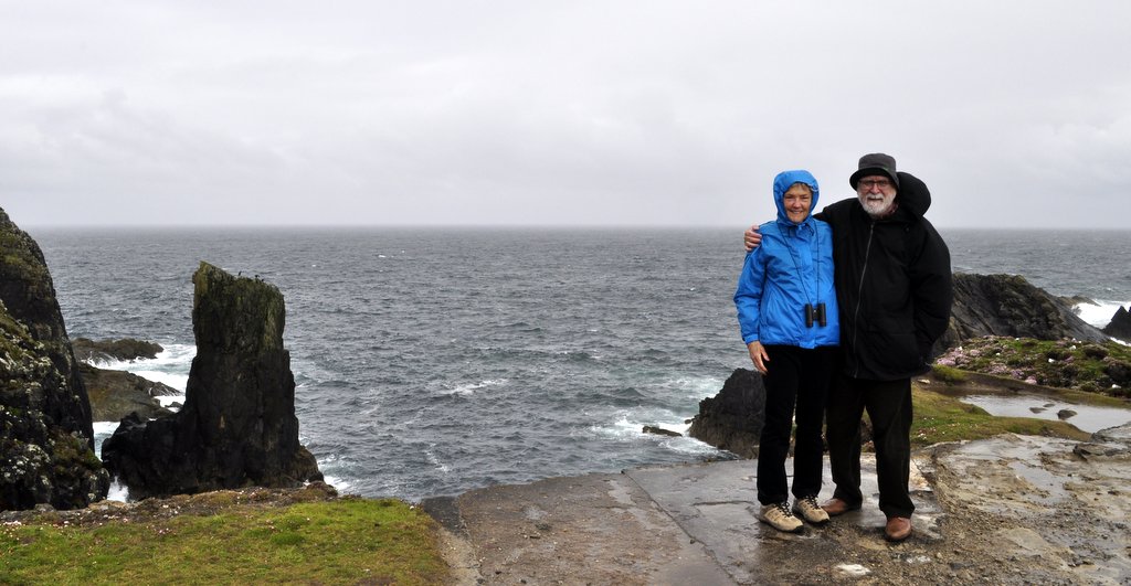
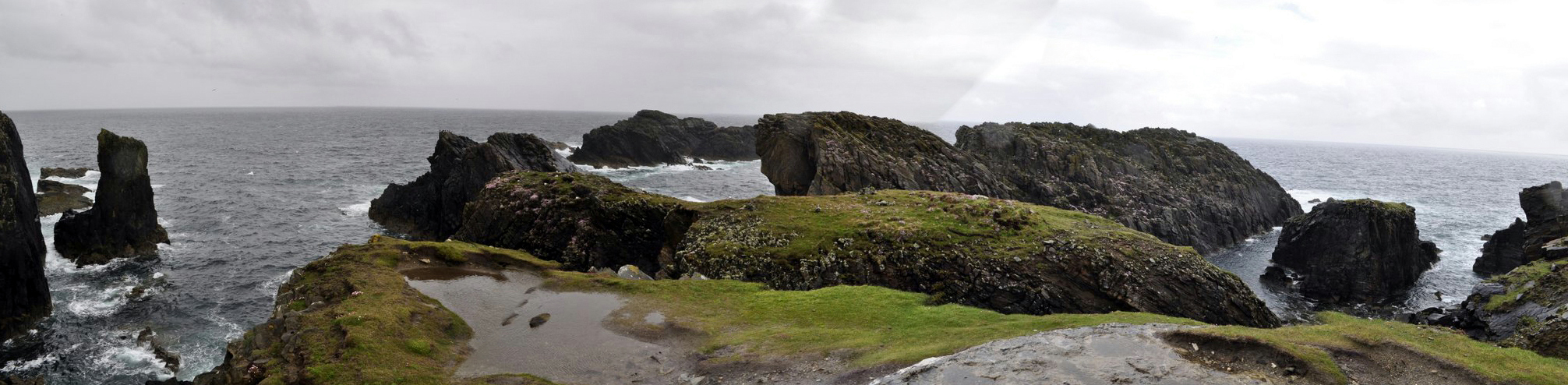


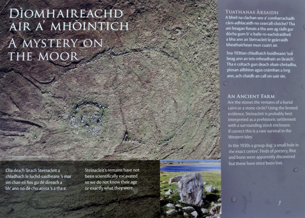


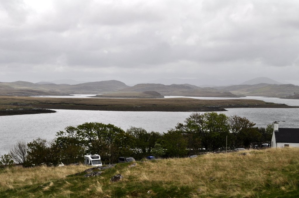


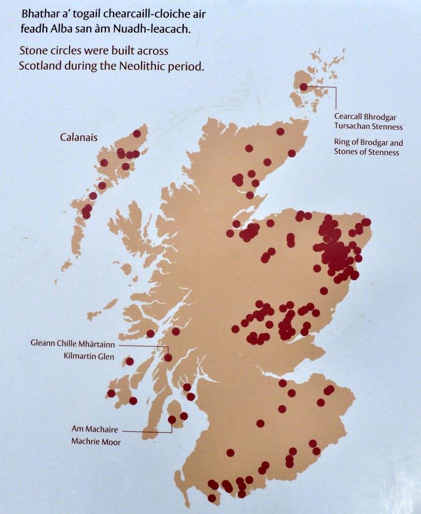
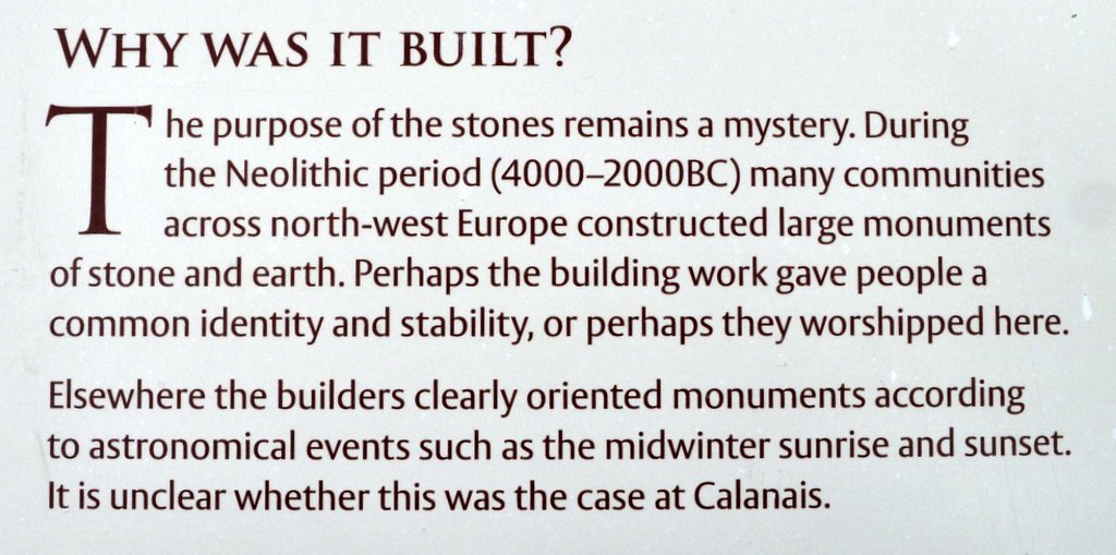
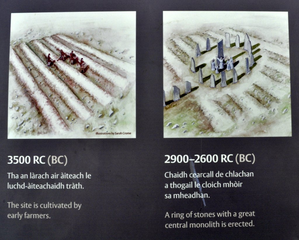
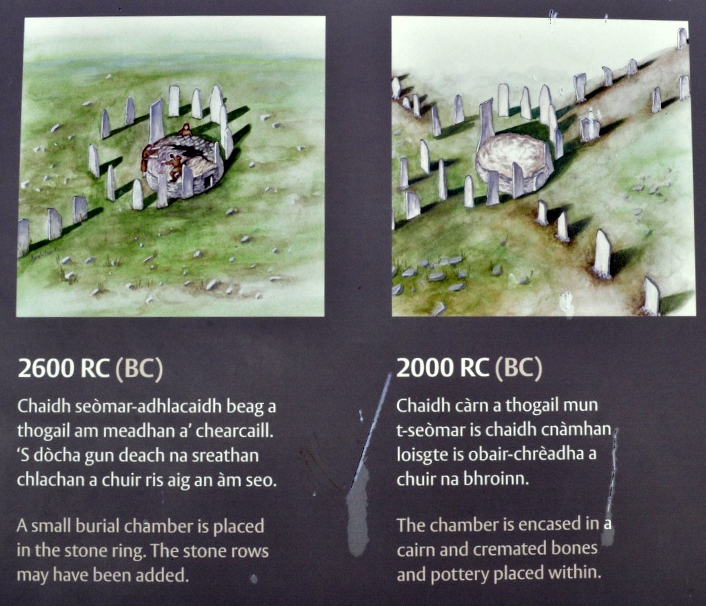
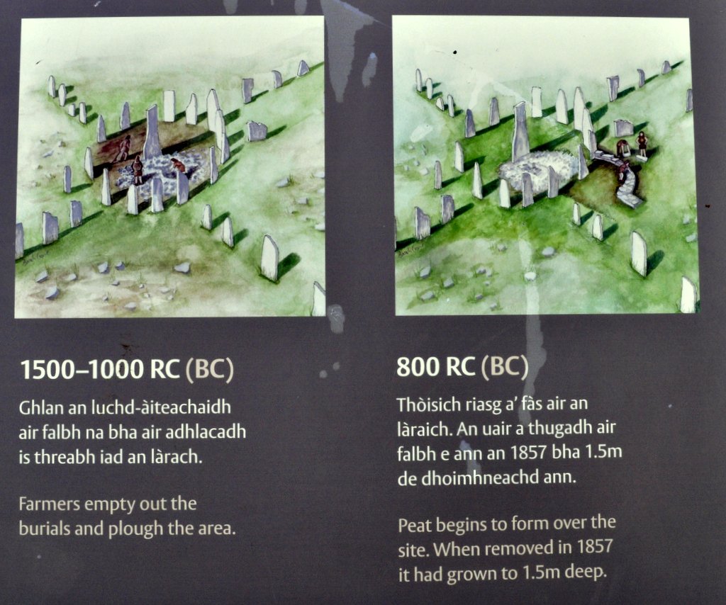


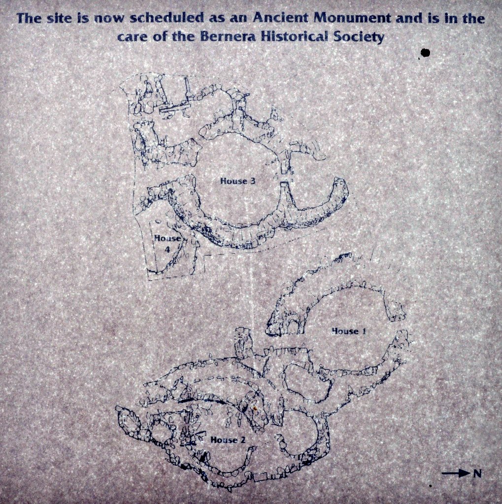
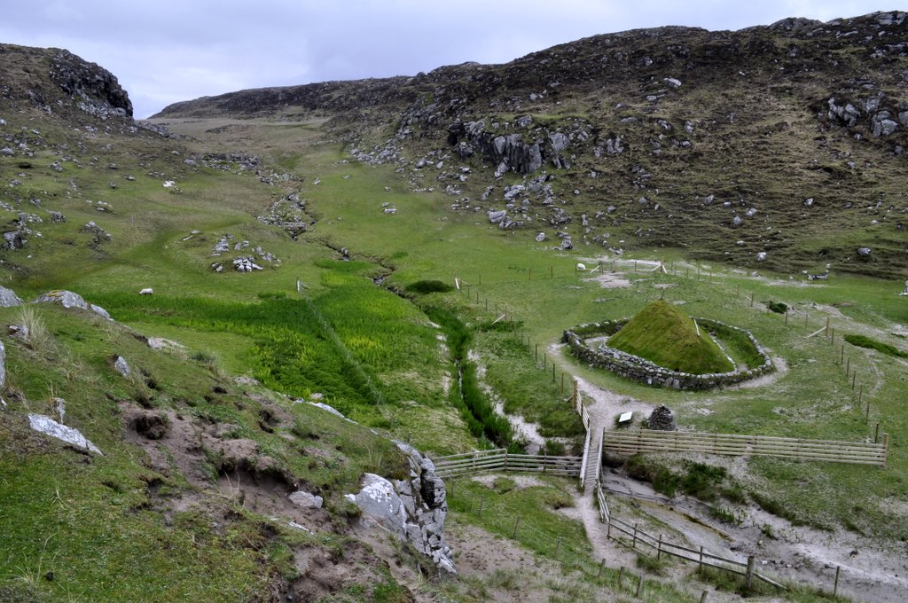

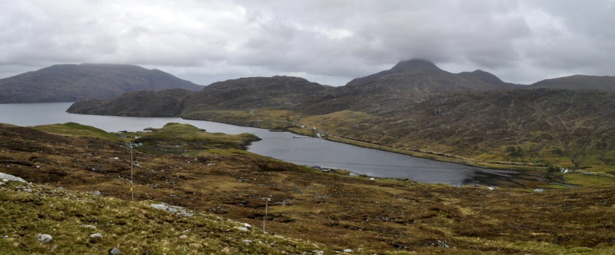


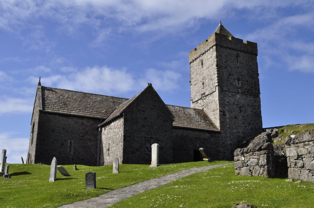
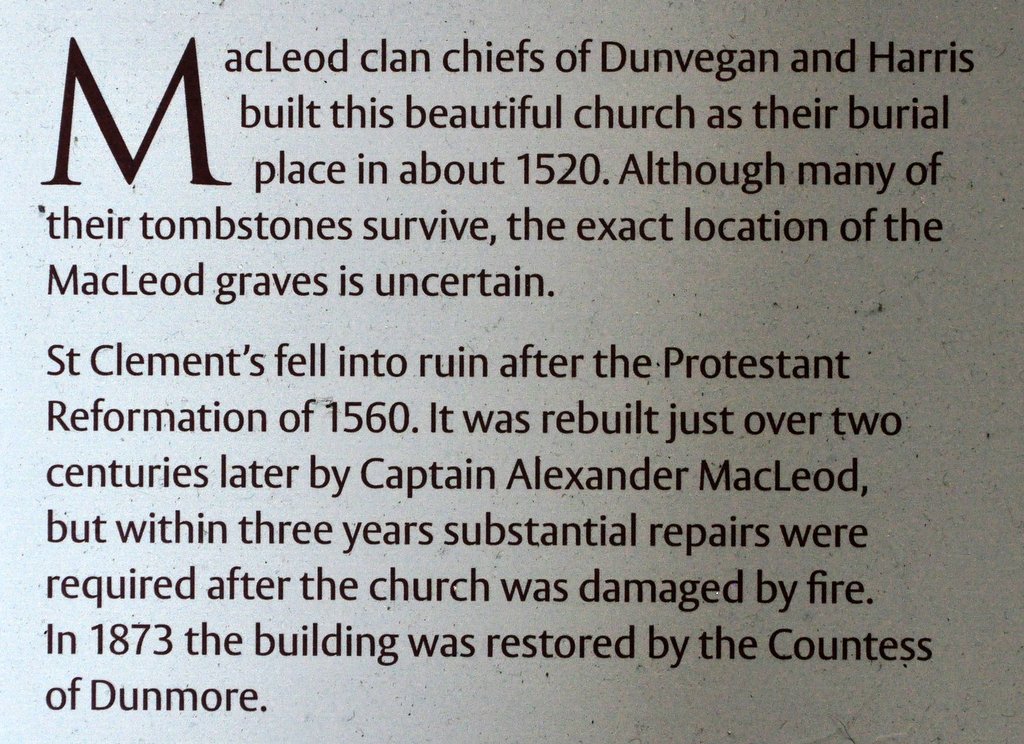


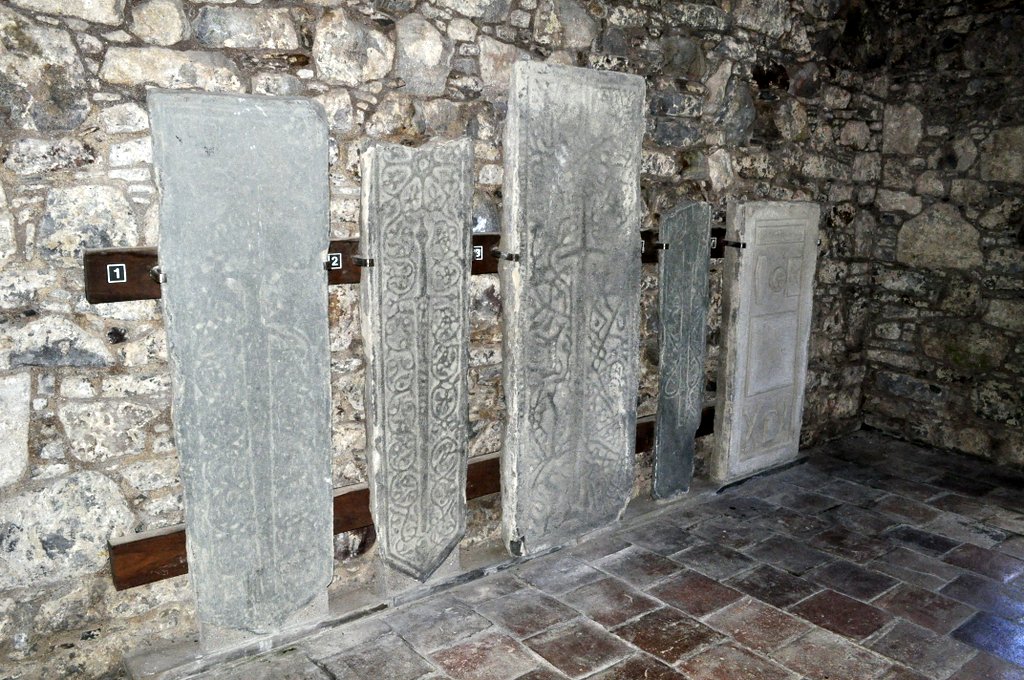
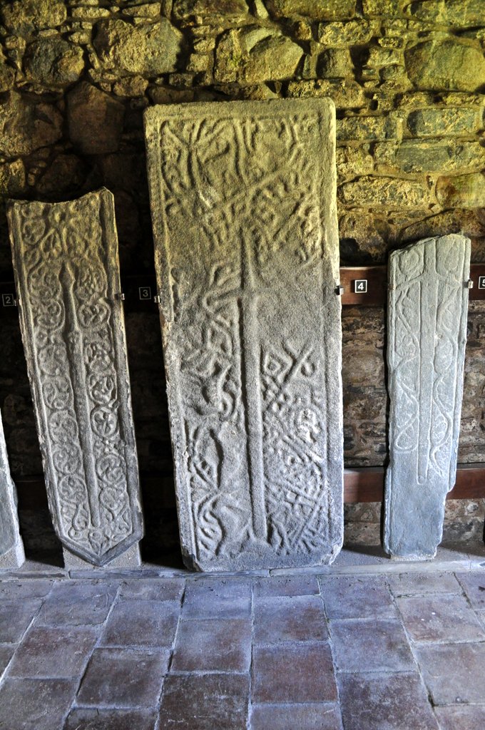
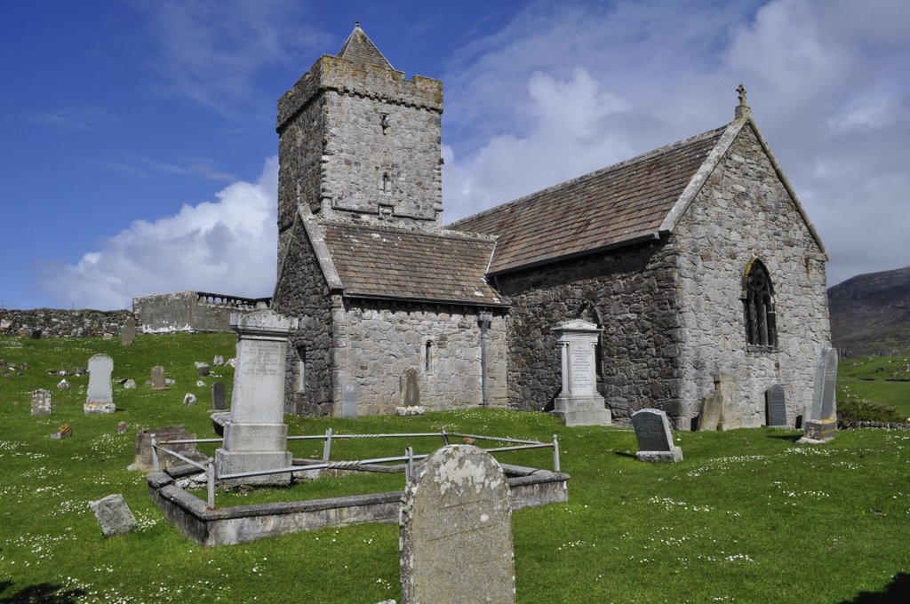
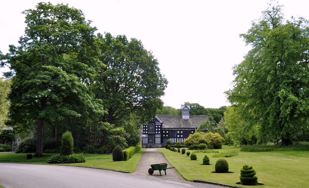


 How would Britain as a nation and British society have evolved had the 1745-46


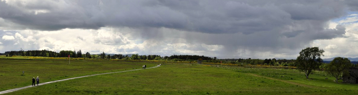


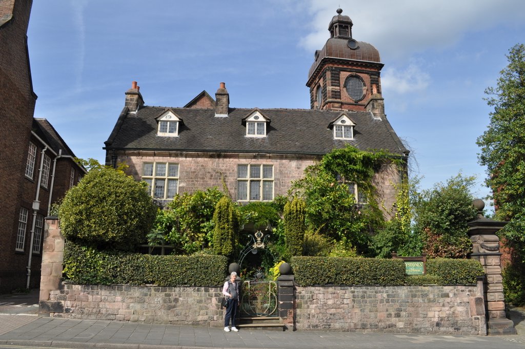
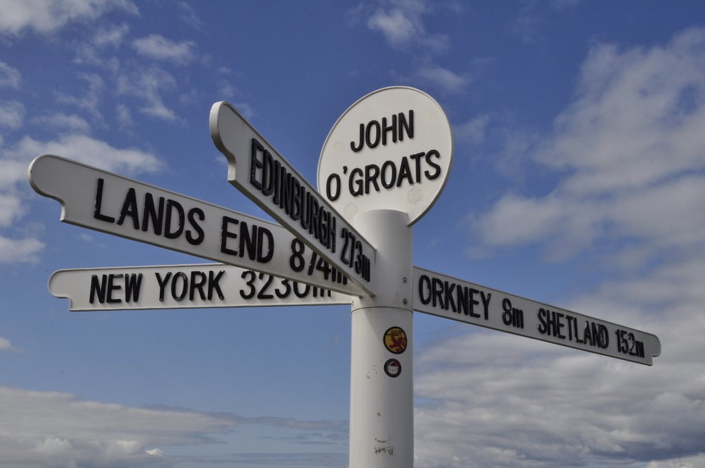


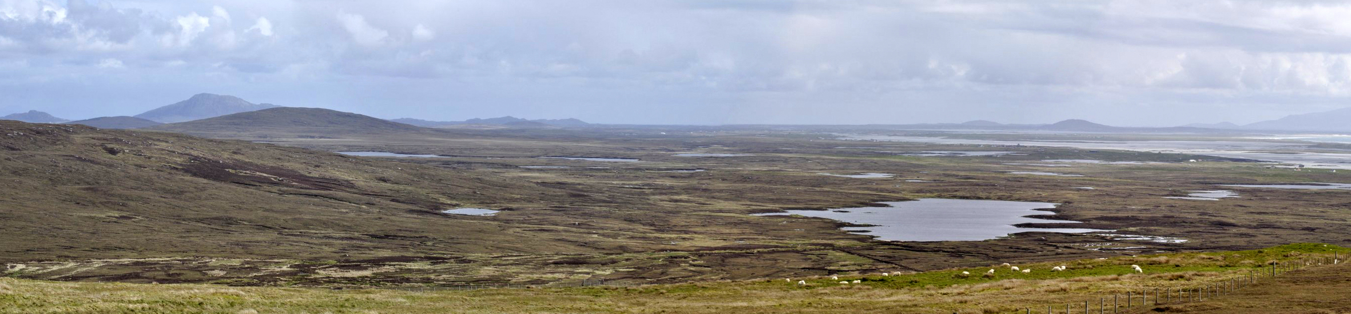
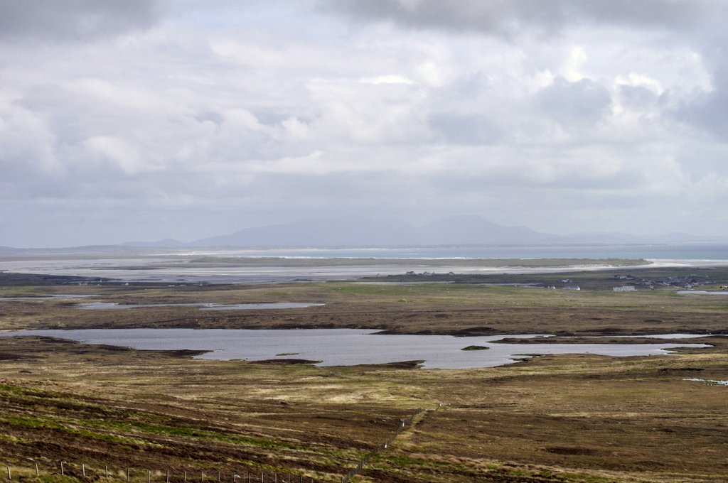

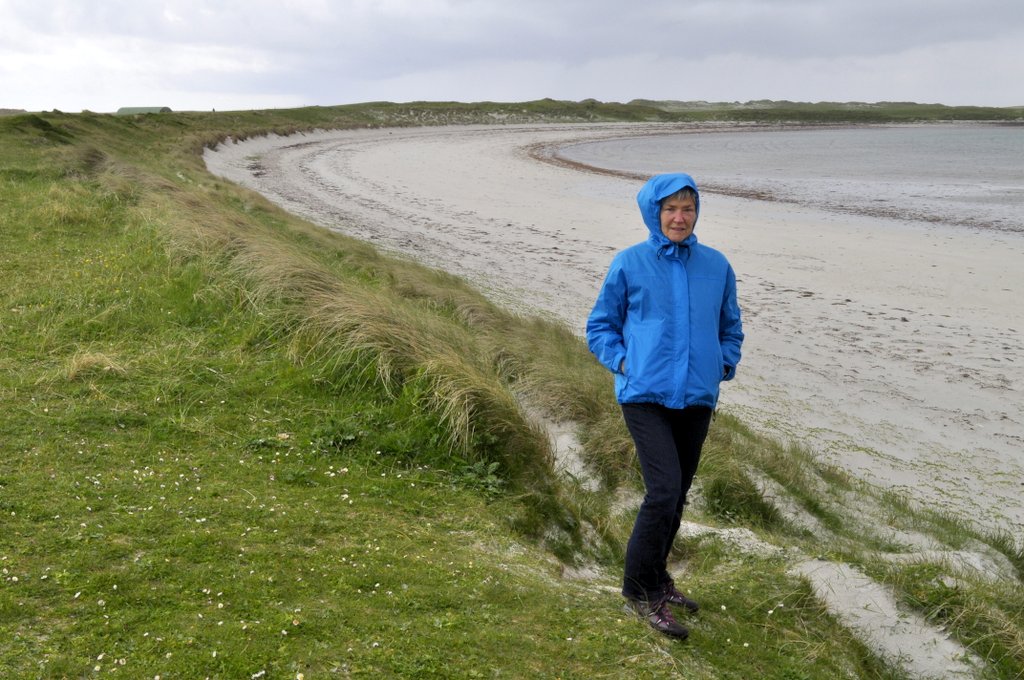
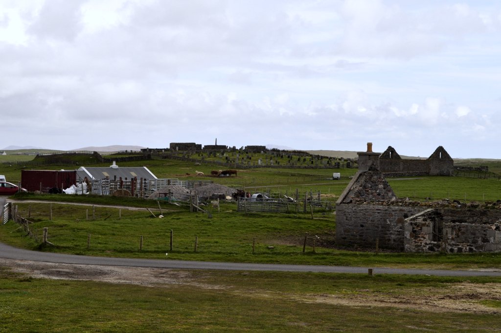
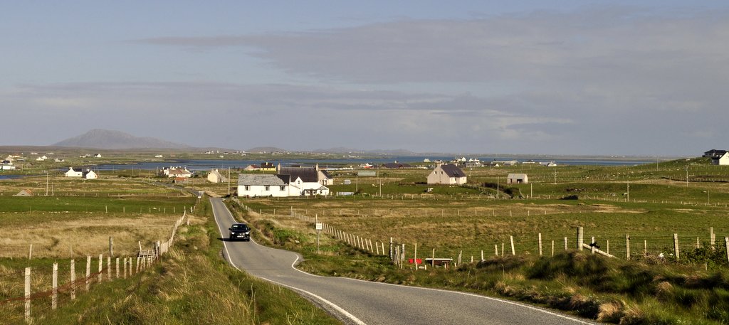
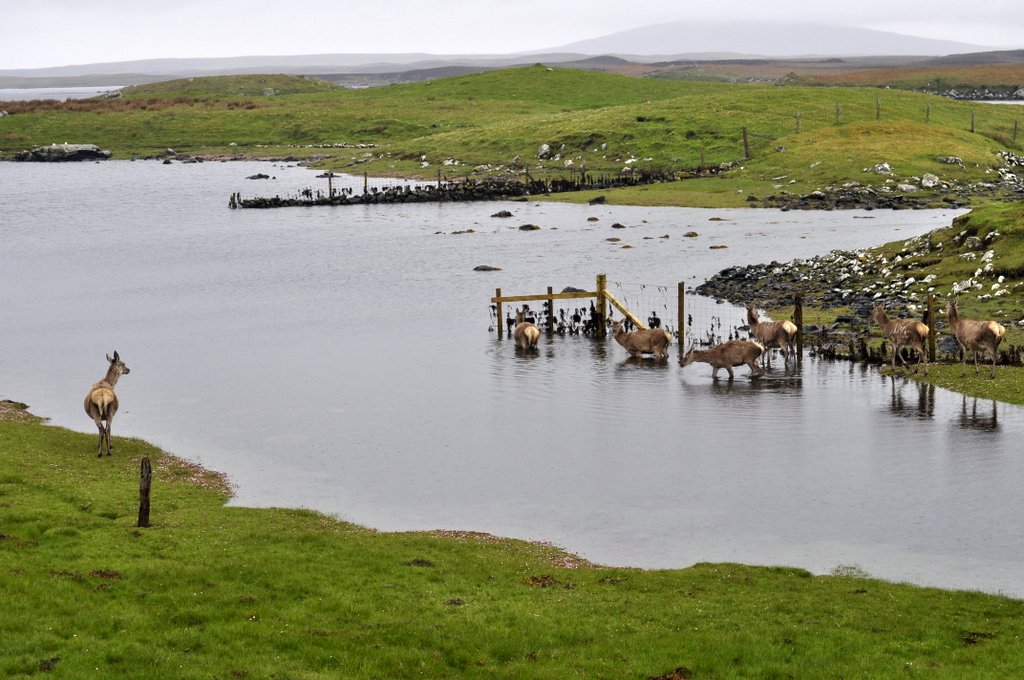
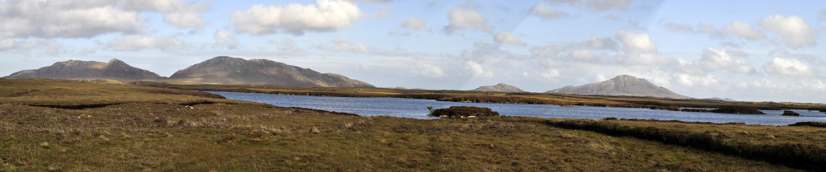
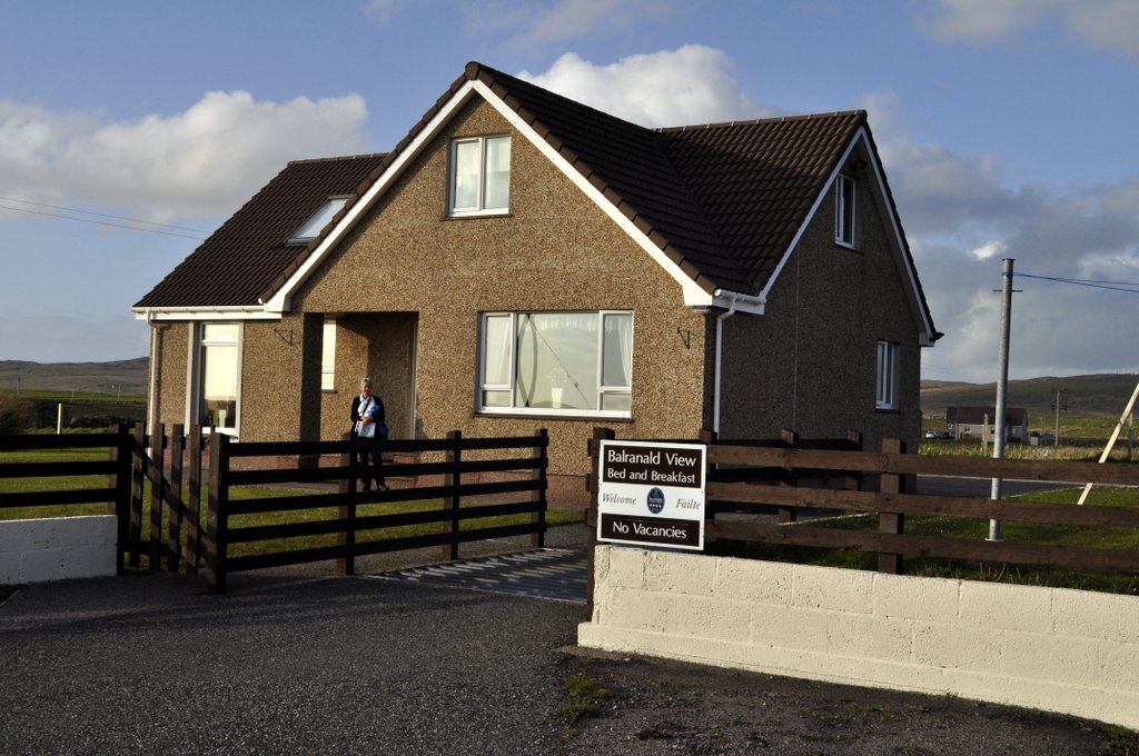


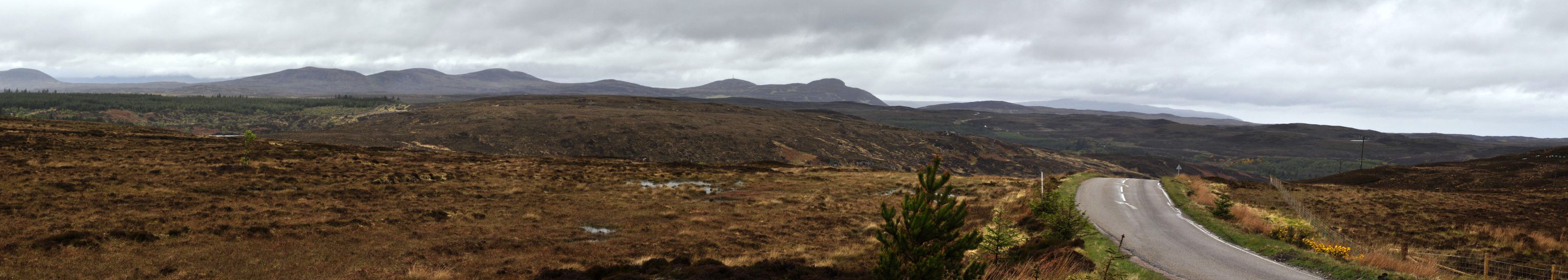


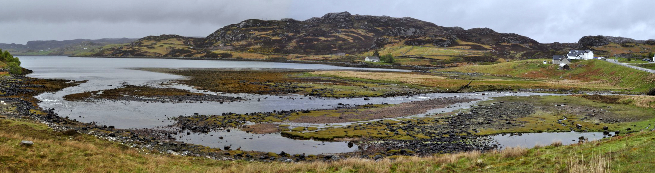

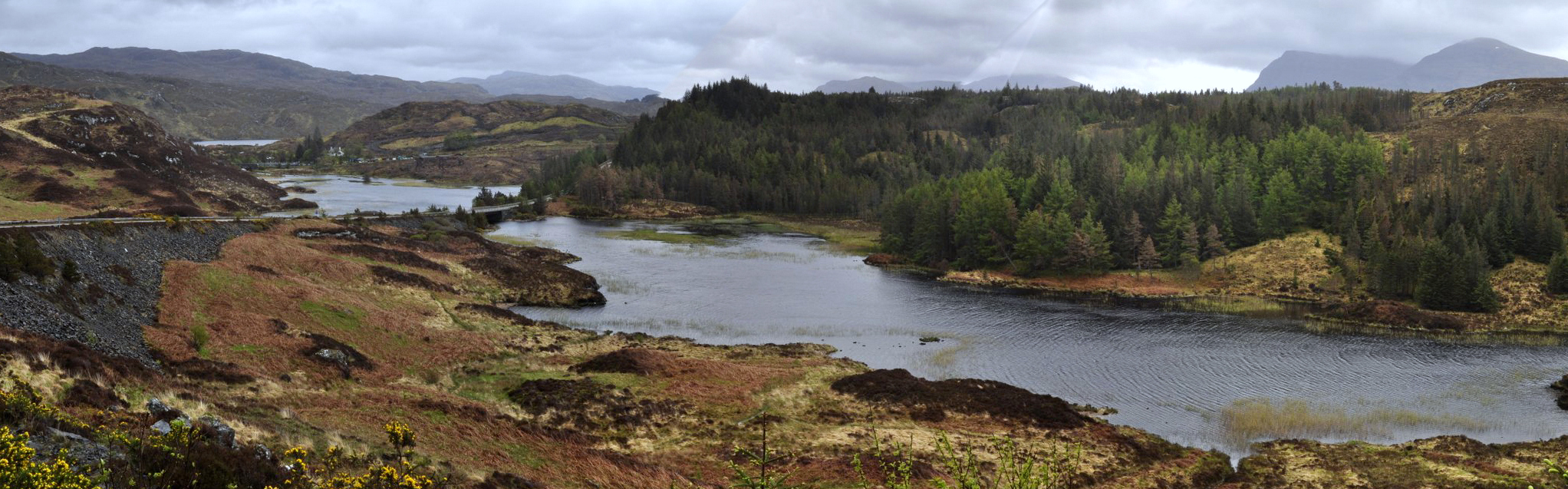

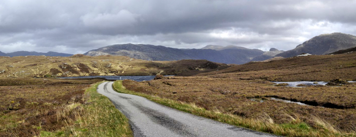


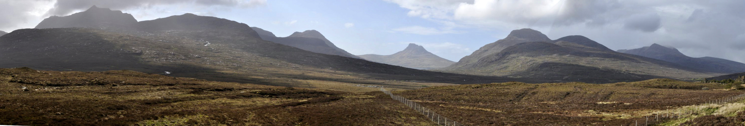

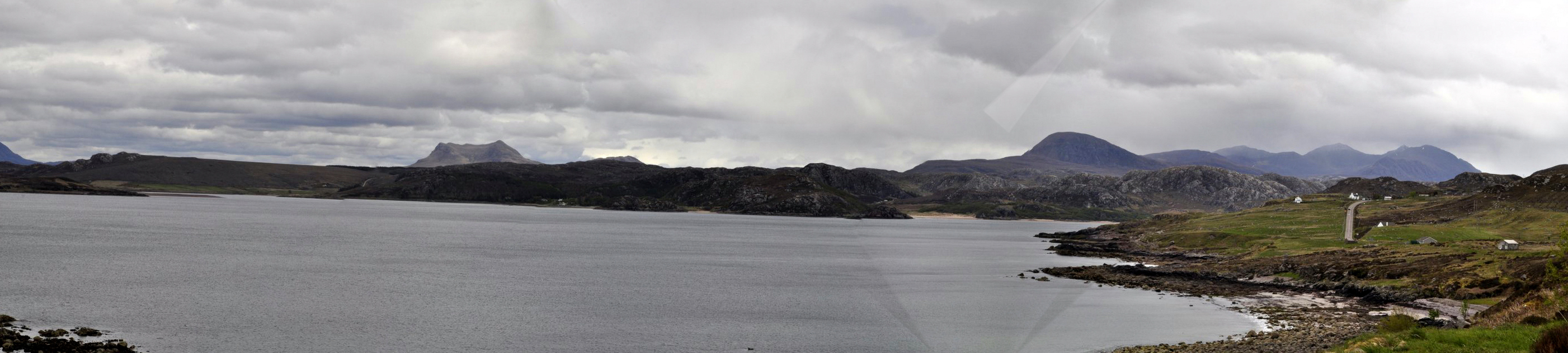


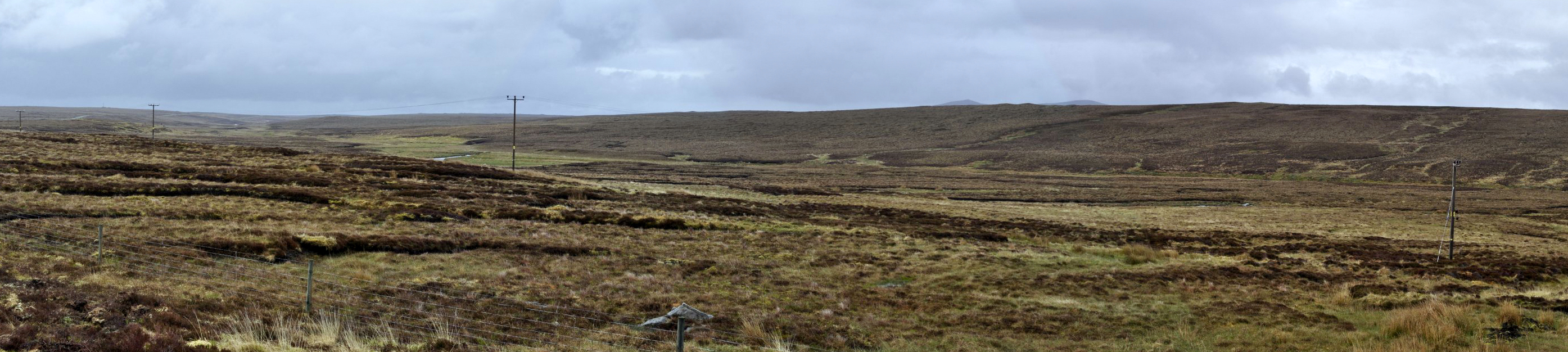

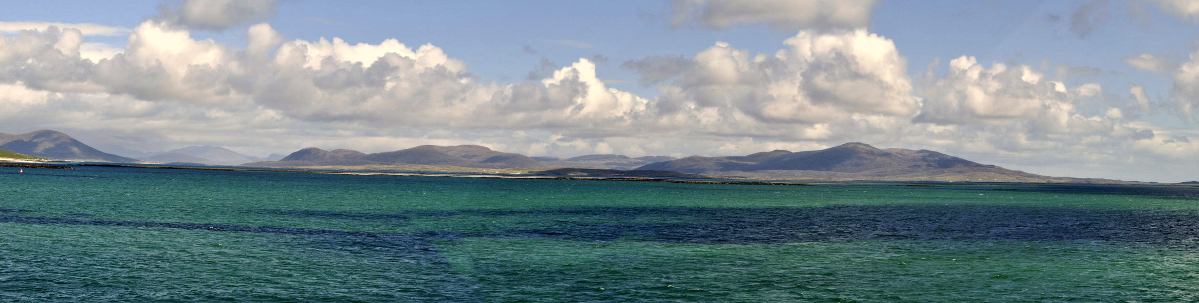
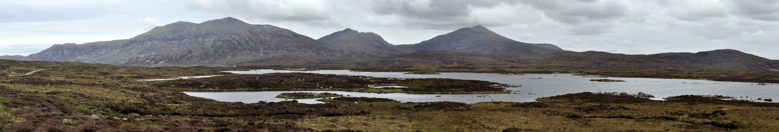


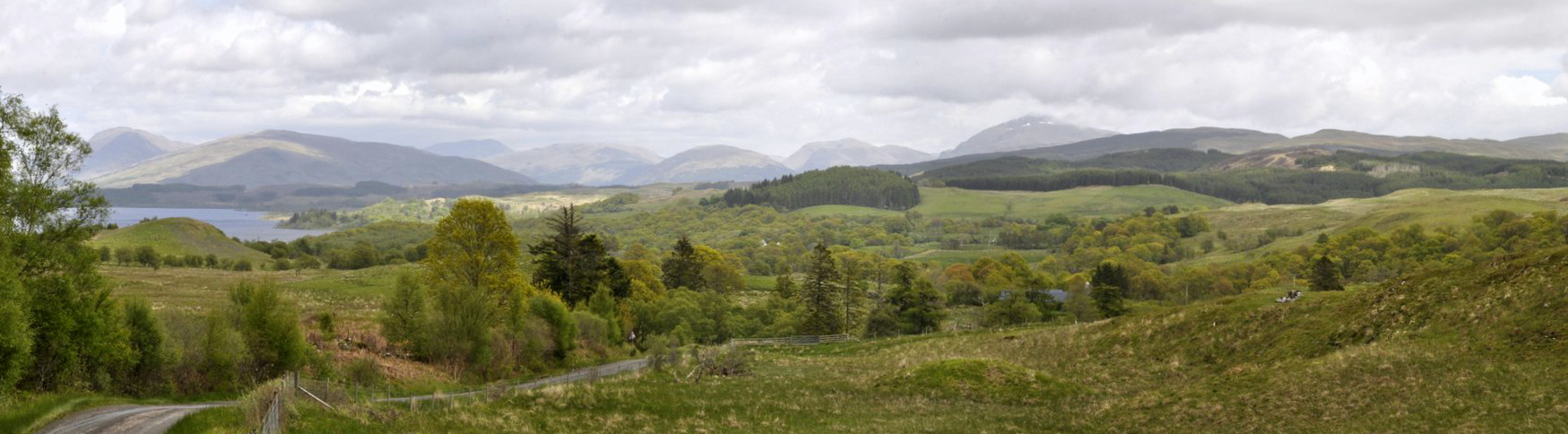

 Well, we took the high road and the low road, and have just returned from a thoroughly enjoyable road trip road Scotland.


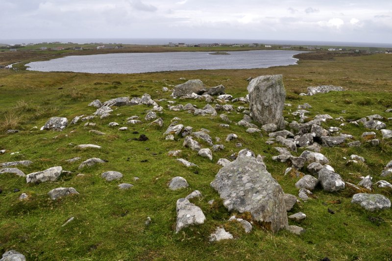


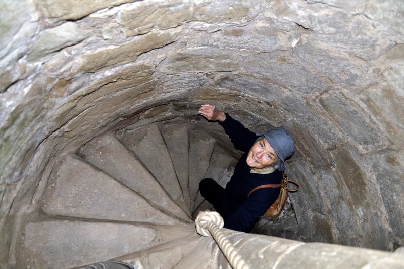


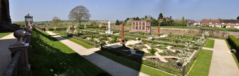

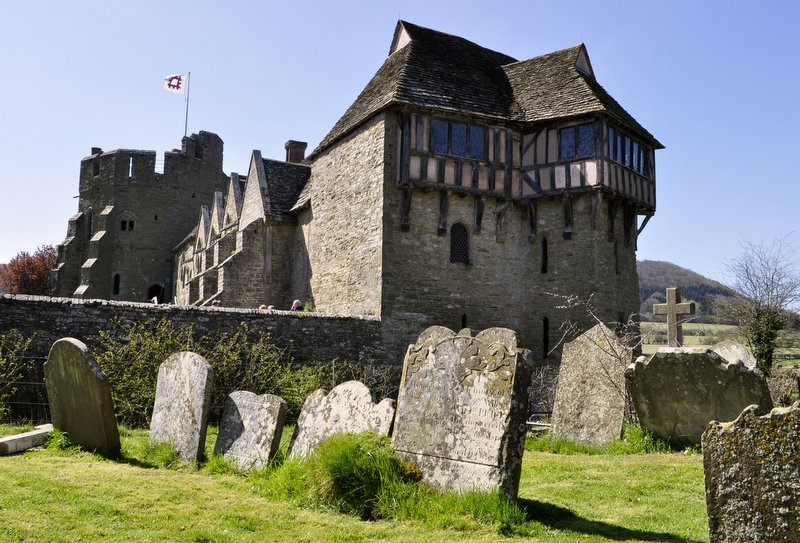
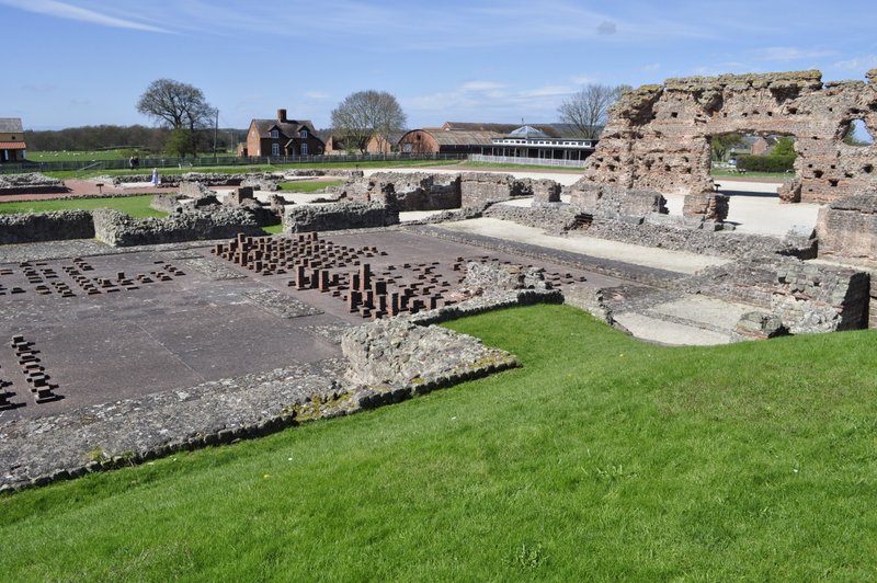


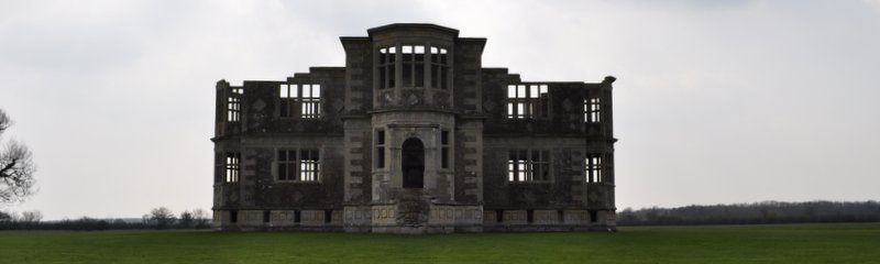


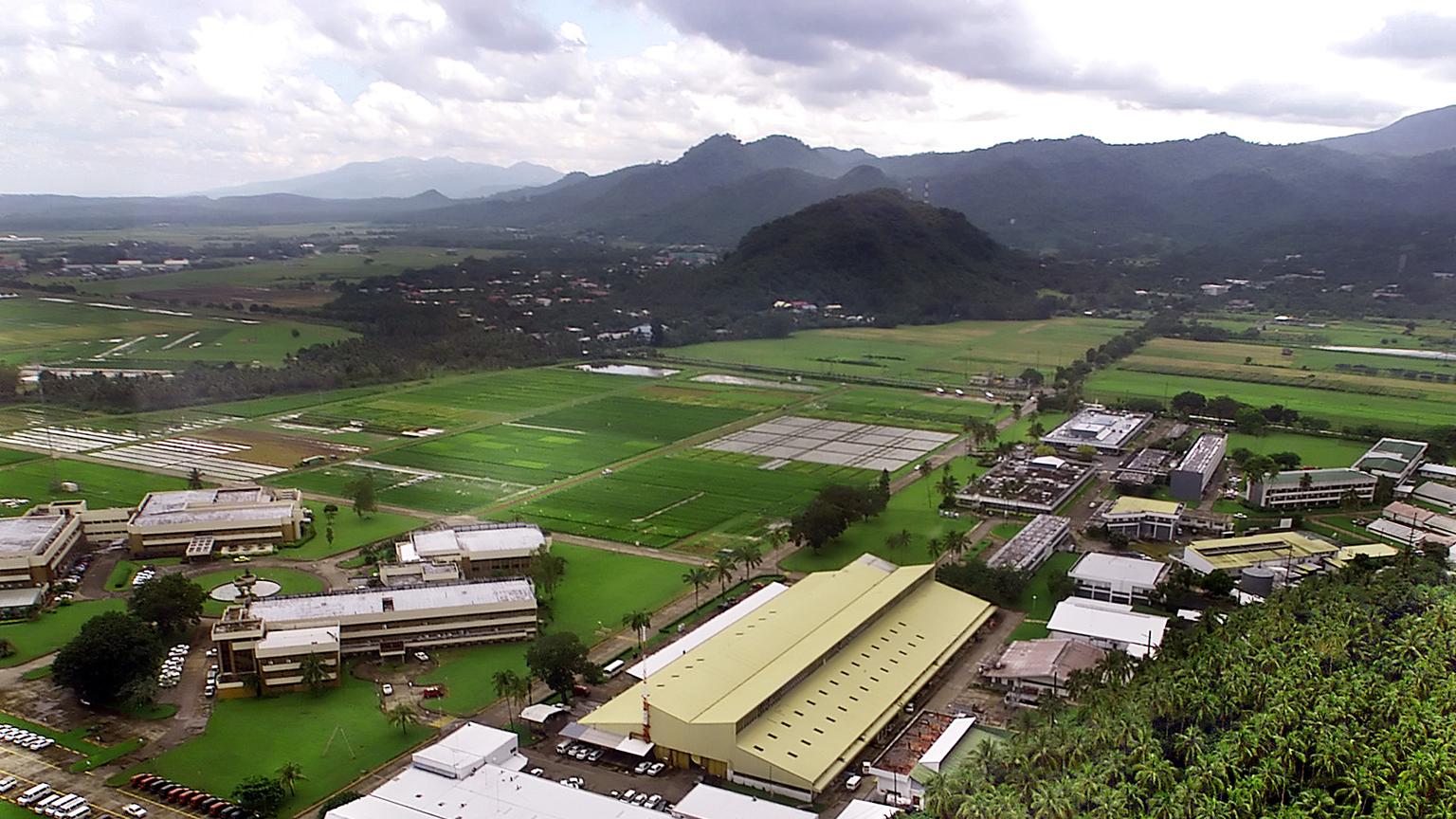
 Ron Cantrell, IRRI’s Director General in 2002 asked me to organize IRRI Day. But what to organize and who to involve? We decided very early on that, as much as possible, to show our visitors rice growing in the field, but with some laboratory stops where appropriate or indeed feasible, taking into account the logistics of moving a large number of people through relatively confined spaces.
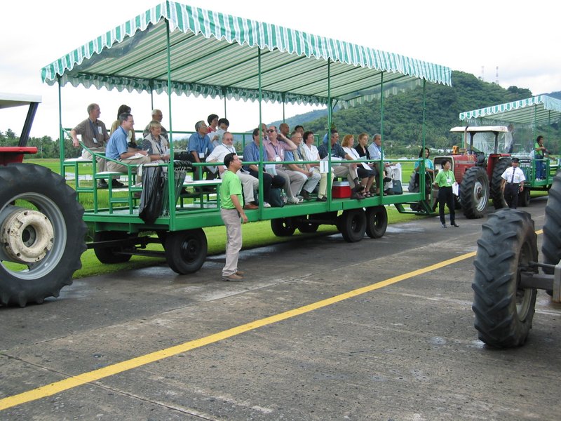
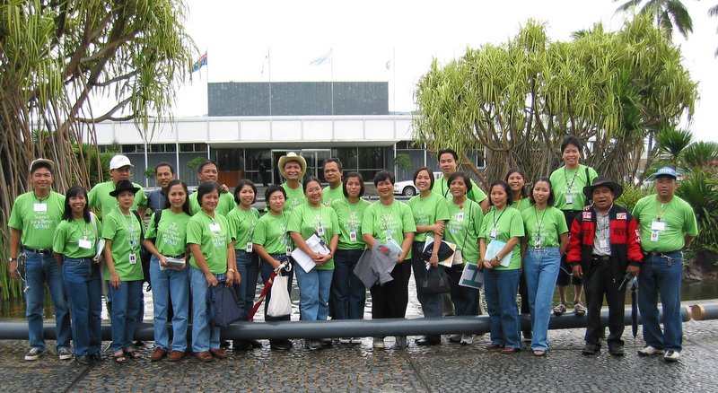


 Humble? Boiled, mashed, fried, roast, chipped or prepared in many other ways, the potato is surely the King of Vegetables. And for 20 years in the 1970s and 80s, potatoes were the focus of my own research.
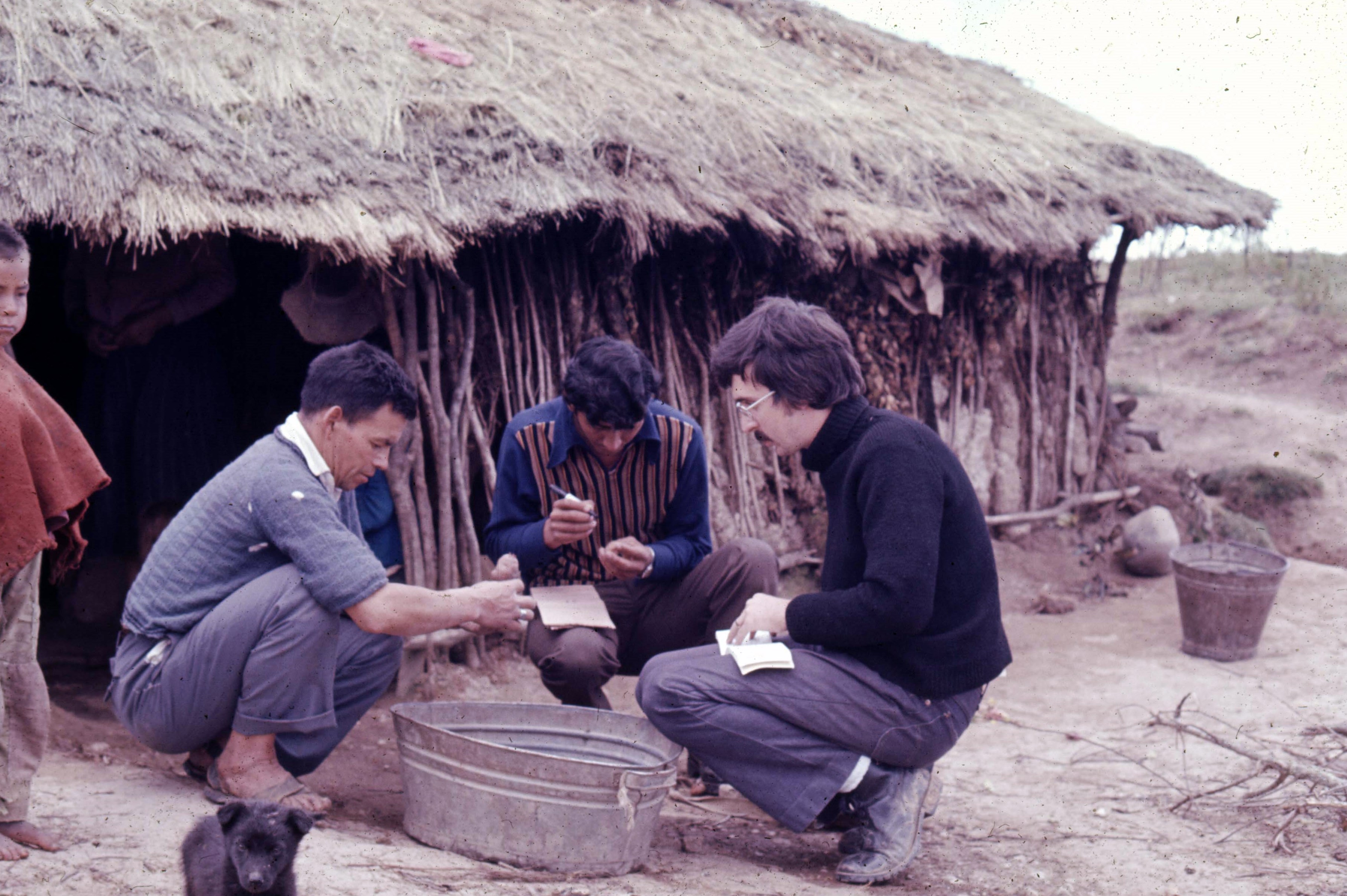


")
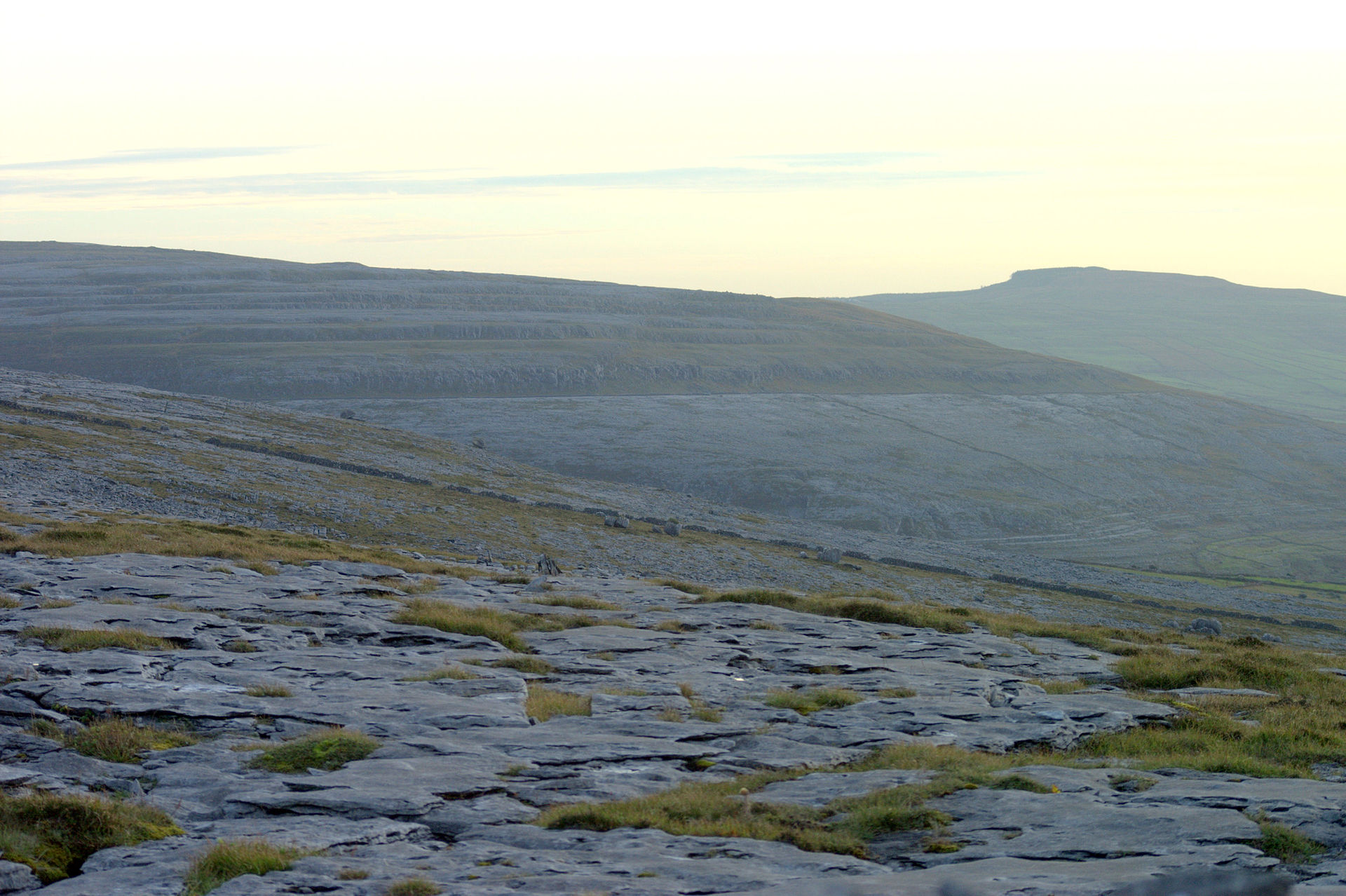


], via Wikimedia Commons")


 [CC BY-SA 2.0 (http://creativecommons.org/licenses/by-sa/2.0)], via Wikimedia Commons") But all work and no play makes Jack(son) a dull boy. We had plenty of opportunity of letting our hair down. Every day when we returned from the field we were pleased to see a line of pints of Guinness that had already been poured in readiness for our arrival, around 5 pm. In the evening – besides enjoying a few more glasses of Guinness – we enjoyed dancing to a resident fiddler, Joseph Glynn, and a young barmaid who played the tin whistle. Since I had spent the previous year learning folk dancing, I organized several impromptu ceilidhs.
But all work and no play makes Jack(son) a dull boy. We had plenty of opportunity of letting our hair down. Every day when we returned from the field we were pleased to see a line of pints of Guinness that had already been poured in readiness for our arrival, around 5 pm. In the evening – besides enjoying a few more glasses of Guinness – we enjoyed dancing to a resident fiddler, Joseph Glynn, and a young barmaid who played the tin whistle. Since I had spent the previous year learning folk dancing, I organized several impromptu ceilidhs.


_cropped.png")


 In 1976, the USA celebrated its bicentennial. Jimmy Carter was elected the 39th President in November that year and took office on 20 January 1977. During his first overseas trip as president, Carter visited the UK, and on Friday 6 May he made a special visit to Washington Old Hall, flying into Newcastle International Airport (known as Woolsington Airport then) on Air Force One (a Boeing 707), in the company of UK Prime Minister Jim Callaghan. Click