I visited Sri Lanka just the once. However, I don’t even remember which year or month. Only that it was the early 1990s, probably around 1993 or 1994. That was when I was planning a major rice conservation project at IRRI, and I wanted to determine if or how any Sri Lankan organizations would participate. As it turned out, for reasons that I’ll explain in due course, Sri Lanka did not join the project.
The Sri Lankan genebank, The Plant Genetic Resources Centre (PGRC) is based in Kandy in the island nation’s Central Province, of which it is the capital. It lies amongst the hills of the central plateau. The hills surrounding Kandy are covered in tea plantations. And, in many ways, Kandy is a magical place to visit. The scenery is outstanding.
Although I don’t remember in which hotel I stayed, I do remember it was perched on the summit of one of the hills, with views in every direction, as you can see in the gallery above. In the stillness of the dawn, I woke each morning to the sounds of birds calling to each other across the valleys. What a wonderful start to the day.
Kandy is home to a magnificent botanical garden (the Royal Botanical Gardens at Peradeniya just west of the city) and one of Buddhism’s most sacred places of worship, the Temple of the Tooth or Sri Dalada Maligawa, is located in the city center.
The Plant Genetic Resources Centre was opened in 1990. Its construction was a donation from the Government of Japan in 1989. So when I visited it had been open for just a few years—and looked like it. But, unlike one or two other genebanks whose construction Japan had supported in other Asian countries, the staff at PGRC were certainly making the most of their expanded facilities to store seeds and tissue culture or in vitro conservation.
Once again I am unable to name most of the people I met at PGRC, with one exception: Mr CN Sandanayake, who was one of my MSc students at the University of Birmingham in 1986.
CN Sandanayake talks with one of his colleagues at PGRC.
And as you can see from one of the photos in the gallery above, everything stops for tea!
When I discussed participation in the IRRI-led rice biodiversity project, it was clear that Sri Lanka had already made significant progress to collect and conserve indigenous rice varieties and wild species. My former colleague at IRRI, Dr Duncan Vaughan had visited Sri Lanka in the 1980s to help with the collection of wild rices.
Furthermore, PGRC had a cadre of excellent technical staff, and as you can see from the photos, excellent facilities for germplasm conservation. And, given the ongoing civil war there were many no-go areas in the country, especially in the north and east. However, in Kandy, there was no tangible signs of the conflict.
I made a side trip, with Sandanayake, to the Rice Research & Development Institute at Batalagoda, some 50km north of Kandy. Here are a couple of photos I took on that journey.
There I met with MS Dhanapala, a rice breeder who had also come to Birmingham in the 1980s to attend short courses on plant genetic resources, and also spend some time in the Department of Genetics.
Sitting, L-R: Dhanapala, me, Sandanayake. I don’t remember the names of those standing.
Sri Lanka has had a very successful rice breeding program, and many of its varieties have been adopted throughout Asia, after being shared and trialled through INGER, the IRRI-led International Network for the Genetic Evaluation of Rice, that I wrote about in 2015.
Now to return to Kandy tourism.
The Royal Botanic Gardens at Peradeniya cover almost 150 acres. There are wide open spaces to wander around, but also exquisite orchid houses to enjoy, with a multiplicity of species and varieties to take in.
As I mentioned, the Temple of the Tooth is a sacred shrine to Buddhists, and although not overrun with pilgrims during my visit was, nevertheless, quite busy.
One of the most impressive exhibits, in a side room, is a huge, stuffed elephant that died in 1988. This was Raja, a tusker who led ceremonial processions from the Temple for over 50 years.
All too soon my stay in Kandy was over, and I headed down to Colombo on the west coast to take my flight back to Singapore, and from there to the Philippines. It’s certainly a country I would like to return to.
During the nineteen years I spent in the Far East, I visited China just twice. The first time was in March 1995, and this post is all about that visit. It must have been in 2009 that I was in China again, for the annual meeting of the CGIAR (Consultative Group on International Agricultural Research) held in Beijing, just across the street from the famous Beijing National Stadium (aka Bird’s Nest) built for the 2008 Olympic Games.
However, back to 1995.
Dr Bao-Rong Lu
A year earlier I had recruited Dr Bao-Rong Lu (a Chinese national from the southwest Sichuan Province) to work in IRRI’s Genetic Resources Center (GRC) on the diversity of wild rice species. Bao-Rong had just completed his PhD in Sweden at the Swedish University of Agriculture under the supervision Professor Roland von Bothmer, studying the cytogenetics of wheat species, if memory serves me correctly. He had also spent some months working at the Institute of Botany, The Chinese Academy of Sciences (IB-CAS), in Beijing prior to joining IRRI.
With a major rice biodiversity project getting underway at IRRI in 1995, I decided that a visit to China with Bao-Rong was the appropriate moment to initiate some further contacts and possible collaboration. Our visit took in three cities: Beijing, Hangzhou (in Zhejiang Province west of Shanghai), and Guangzhou (Canton) in the south.
First stop was the IB-CAS where I met with the Director (whose name I cannot recall, unfortunately) and many of the staff.
With the Director of the Institute of Botany and staff. Bao-Rong is standing on my left, and the Director on my right.
I was invited to present a seminar about the International Rice Genebank at IRRI and its role in the global conservation of rice genetic resources.
There was also some time for sightseeing around Beijing, and this was my opportunity to tick off another item on my bucket list: walking on the Great Wall of China (at Mutianyu, about 45 miles north of Beijing).
As you can see from these photos, there were few visitors, unlike scenes I have seen in the media in recent years.
We also took a tour of the Forbidden City in Beijing, and a walk around Tiananmen Square. Again not crowded! In one of the photos you can see the Great Hall of the People behind Bao-Rong. During the CGIAR meeting in Beijing that I mentioned earlier, the official dinner (and entertainment) was hosted by the Chinese in the Great Hall. It’s massive!
The photos appear hazy, because it was. It was quite cold in Beijing in March, with a stiff northwesterly breeze blowing over the city, laden with dust from the far west of China. It felt like being sand-blasted.
We also visited some Ming era tombs near Beijing, but I’m unable to find any photos of that particular visit.
On one night the Vice President of the Chinese Academy of Sciences hosted a small dinner in my honor. On another, Bao-Rong introduced me to the delights of spicy Sichuan cuisine. There was a Sichuan restaurant in our hotel where all the staff were from the province.
Trevor Williams
Later that same evening, as Bao-Rong and I were enjoying a beer in the bar overlooking the hotel reception, I saw someone who I recognised enter the dining room. I had to investigate. And, lo and behold, it was Trevor Williams who had supervised my MSc dissertation at the University of Birmingham in 1971. Around 1977, Trevor left Birmingham to become the first Director of the International Board for Plant Genetic Resources (IBPGR – now Bioversity International) in Rome. In 1995 I hadn’t seen Trevor for about six years, and so we spent the rest of the evening catching up over rather too many beers. Having left IBPGR by then, he was in Beijing setting up an organization that would become INBAR, the International Network for Bamboo and Rattan with its headquarters in Beijing.
After a few days in Beijing, we headed south to the city of Hangzhou (inland from Shanghai on the Qiantang River) in Zhejiang province. We were there to visit the China National Rice Research Institute (CNRRI) and meet with its director Professor Ying Cunshan. Professor Ying participated in the rice biodiversity project as a member of the project Steering Committee. CNRRI is the home of China’s largest rice genebank, which was modelled (inadvisedly in my opinion) on the genebank at IRRI.
With Bao-Rong and Professor Ying outside the entrance to CNRRI.
Inside the genebank with Professor Ying.
After a couple of days in Hangzhou, we headed southwest to the city of Guangzhou (Canton) and I experienced one of the most nerve-wracking flights ever.
Much as I am fascinated by aviation in general, I’m somewhat of a nervous flyer. And in the mid-1990s Chinese airlines were only just beginning to modernise their fleets with Boeing and Airbus aircraft. Many were still flying Soviet-era Russian aircraft, like the Tupolev (probably a ‘154’) that was assigned to our flight. On that morning, flights out of Hangzhou were delayed due to fog, and at the same time Guangzhou was also fogged in. Over a period of a couple hours, other flights (of mainly new aircraft) did depart, leaving just the Tupolev on the apron for our flight. Eventually the flight was called and we made our way out to the aircraft. Looking around the cabin as I made my way to my seat, it crossed my mind that this aircraft had seen better days.
Anyway, we took off and headed for Guangzhou. Approaching that city after a flight of about 90 minutes, the captain informed us that fog was still hanging over the airport but he would continue the landing. Only to abort that just before touching down, and returning to Hangzhou! My nerves were on edge. After refuelling, and a further delay, we departed again. This time we did find a gap in the fog and landed. As we were on our final approach and seconds from touch-down, a female passenger immediately in front of me decided to get out of her seat to retrieve her hand luggage from the overhead bin. That was the final straw for me, and I shouted at her, in no uncertain terms, to sit the f*** down. Not my best moment, I admit.
In Guangzhou, our destination was the Guangzhou wild rice nursery and meet with the staff (again I don’t remember who precisely). I believe the nursery was managed through the Guangzhou Academy of Agricultural Sciences. As in Beijing, I gave another seminar here.
In a 2005 paper, Bao-Rong and others has written about wild rice conservation in China.
Completing our visit to Guangzhou, I took a flight into Hong Kong (maybe under 40 minutes) to connect with another back to Manila.
Although China did not participate directly in the rice biodiversity project since the country had already invested heavily in rice collection and conservation, Professor Ying Cunshan served on the Steering Committee for the 5-year life of the project. We felt that his experience, and recognition among other rice scientists, would be an invaluable addition to the team.
I have two particular reflections on this first trip to China. First, in crowded areas the Chinese had little ‘respect’ for personal space, and I often found myself checking my pace of walking as others crossed in front of me, seemingly oblivious of the fact that I was there. And it wasn’t just me, being a foreigner. It just seemed the normal thing to do.
Secondly, I realised that I am not a very adventurous eater. Some of the dishes I was presented with did not encourage my appetite. There was certainly a lack of synchronization between my stomach, eyes and brain. I did find Sichuanese cooking delicious, however. In Guangzhou, where many ‘exotic’ dishes were prepared, I got round any difficulties by explaining to my hosts, through Bao-Rong, that I was vegetarian. And those dishes were equally delicious.
Bao-Rong remained at IRRI for two contracts, a total of six years. After he left IRRI in 2000, he returned to China and it wasn’t long before he joined Fudan University in Shanghai. He is now Professor and Chairman of the Department of Ecology and Evolutionary Biology, and Deputy Director of the Institute of Biodiversity Science. He currently serves as a Member of the Chinese National Biosafety Committee.
Laos or the Lao PDR (the Lao People’s Democratic Republic – actually a Unitary Marxist–Leninist one-party socialist republic) is one of the few landlocked countries in Asia. But it does have a connection to the sea, down the Mekong River where, through its mighty delta in Vietnam, it disgorges into the South China Sea. For a considerable length, the Mekong is the international border between Myanmar and Laos, and Thailand and Laos.
During the 19 years I spent in Asia (with the International Rice Research Institute in the Philippines) I visited Laos more than any other country, probably a couple of times a year over a five to six year period. Why? Because it was a focal country for the major rice conservation project that I managed between 1995 and 2000, funded by the Swiss government.
The Swiss, through the Swiss Agency for Development and Cooperation (SDC), also funded an in-country Lao-IRRI Program. So, as we were looking to strengthen the collection and conservation of indigenous rice varieties and wild rices in that country, it was a logical step to associate our rice biodiversity project administratively with the Lao-IRRI Project. The scientist who we hired for the Lao component of the project, Dr Seppana Appa Rao (originally from a sister center, ICRISAT, in Hyderabad, India) was based in the Lao capital Vientiane, and reported on a day-to-day basis to the leader of the Lao-IRRI Project, Australian agronomist Dr John Schiller (who passed away a couple of years ago).
Enjoying dinner with Appa Rao and John Schiller at John’s home in Vientiane.
In February 1997 I was joined on one of these visits to Laos by my wife Steph. IRRI had a generous travel policy. For every so many days a scientist was travelling outside the Philippines (but discounting the days of departure and arrival), his/her spouse or partner was entitled to one trip to a destination in Asia. So, we took advantage of that policy for a slightly extended visit to Laos (to take in some of the sights) as well as a weekend in Bangkok, through we had to transit in any case. A trip to Laos inevitably involved an overnight stop in Bangkok on both legs of the journey, taking a late flight out of Manila to Bangkok (about three hours) then the first flight on Thai Airways or Lao Aviation the next morning to Vientiane.
When I first visited Laos in 1995, the population of Vientiane was less than 400,000. It’s now reported at over 800,000. Back in the day it had the feel of a small town hugging the banks of the Mekong. But even then the traffic could become snarled at times. I wonder what it’s like nowadays? Looking at a satellite image the other day, the spread from the city center is clear. Even back in the 1990s, the city had begun to rapidly spread eastwards. The National Agricultural Research Center (NARC) of the National Agriculture and Forestry Research Institute (NAFRI) had its research station in this area, and where a rice genebank was constructed with financial support from the Swiss.
On this particular trip, Steph and I spent time with Appa and his Lao colleagues, Dr Chay Bounphanousay and Ms Kongphanh Kanyavong at the research center, looking at the genebank, field plots and various other facilities used to conserve the rice varieties collected throughout the country. This was also of interest for Steph as she originally trained in genetic resources, and has an MSc degree in genetic resources conservation and use from the University of Birmingham (where we met in 1971/72).
L-R: Kongphanh Kanyavong, Appa Rao, and Chay Bounphanousay
We also visited a research site where wild rices were being monitored in a joint project with Japanese scientists. It was hoped that data from that project would inform the establishment of field or in situ conservation sites around the country.
Driving around Vientiane as tourists, we noted that two buildings dominate the skyline in the city center. The first, the Patuxai monument, is a huge war memorial that commemorates the struggle for independence from France. The other, a short distance away to the northeast, is Pha That Luang, a large, gold covered Buddhist stupa.
Patuxai
Pha That Luang
Ph Phat Luang
And after a hard day in the field, or touring the city and markets, what better way to end the day than a stroll along the banks of the Mekong.
That’s Thailand on the far bank.
On another day, Appa, his wife, Chay, and Kongphanh took us for a boat excursion round the Nam Ngum Reservoir, about 70 km north of Vientiane, and afterwards to the Lao Zoo nearby.
Steph and I were also invited to participate in a Baci Ceremony at John’s home, which involves the tying of white cotton strings around person’s wrists and the prayer saying or well wishing for the person that the ceremony is intended for. I had been to one of these ceremonies before, during my first visit to Laos. Another new IRRI staff member, agronomist Bruce Linquist and his family, were also welcomed to Laos at this particular ceremony.
But the tourist highlight of our visit was a weekend in Luang Prabang (a 40 min flight north of Vientiane), an ancient city standing on a peninsula at the confluence of the Mekong and the Nam Khan River.
In 1997 there were few tourists in the city besides ourselves. As we walked through the streets of the ‘old town’ the locals we passed would smile and say hello, and go on about their business. They paid no attention to us whatsoever. Luang Prabang has become a mecca for tourists from afar, and must be a very different place nowadays.
After checking into our hotel (I don’t remember which one—it was new and on the southwest of the city center), we set out to explore the sights.
First on our list was the sixteenth century Buddhist temple Wat Xieng Thong, or Temple of the Golden City, at the northern end of the peninsula. It is one of the most important shrines in the country.
The architecture is breathtaking, and as we wandered around the temple, there was a just a feeling of serenity.
Later in the day before sunset, we climbed 100m high Phousi Hill to enjoy the 360° panorama from the summit, looking north over the old town and the Nam Khan River.
I guess the highlight of our trip to Luang Prabang was the 25 km or so boat trip we took upstream along the Mekong to visit the shrines at the Pak Ou Caves, which are opposite the mouth of the Ou River as it flows into the Mekong.
As I already mentioned, Luang Prabang was very quiet, and we hired a river boat to ourselves. The journey took about two hours, during which we had the chance to take in, close-up, the majesty of the Mekong.
At the landing stage where we took our boat. You can see several of these boats behind Steph, looking north along the Mekong.
Mekong River, nr. Luang Prabang, Laos
Approaching the landing stage at Pak-Ou, our boatman carefully positioned his boat so that we could disembark safely. While we were ashore, he turned the boat around ready for the return, but also a short diversion into the mouth of the Ou River.
There are two caves: Tham Ting is the lower; Tham Phum is the upper. Both are filled with hundreds if not thousands of Buddha sculptures.
Approaching the caves from the Mekong
Tham Ting
Tham Phum
Tham Phum
Tham Phum
Lion carving in Tham Phum
We were the only visitors on this day, and had the site to ourselves. Nowadays, it’s rather different as this photo (copied from the website http://www.viajeasean.com) clearly shows.
After a late afternoon meal overlooking the Mekong back in Luang Prabang, our visit to this ancient city came to an end, and we flew back to Vientiane the following morning, and on to Bangkok.
One thing I had known from a young boy was that I wanted to see the world; and work overseas if possible. Following somewhat in the footsteps of my parents, Fred and Lilian Jackson.
Who would have thought that a degree in botany would open up so many opportunities?
Come 1 January, it will be 47 years since I joined the staff of the International Potato Center (CIP) in Lima, Peru, and the start of a 37 year career in the plant sciences: as a researcher, teacher, and manager. Where has the time flown?
After eight years in South and Central America, I spent a decade on the faculty of the School of Biological Sciences at the University of Birmingham. Then, in 1991, I headed to Southeast Asia, spending almost 19 years at the International Rice Research Institute (IRRI) in the Philippines, before retiring in 2010.
However, I have to admit that Lady Luck has often been on my side, because my academic career didn’t get off to an auspicious start and almost thwarted my ambitions.
While I enjoyed my BSc degree course at the University of Southampton (in environmental botany and geography) I was frankly not a very talented nor particularly industrious student. I just didn’t know how to study, and always came up short in exams. And, on reflection, I guess I burnt the candle more at one end than the other.
It would hard to underestimate just how disappointed I was, in June 1970, to learn I’d been awarded a Lower Second Class (2ii) degree, not the Upper Second (2i) that I aspired to. I could have kicked myself. Why had I not applied myself better?
But redemption was on the horizon.
Prof. Jack Hawkes
In February 1970, Professor Jack Hawkes (head of the Department of Botany at the University of Birmingham) interviewed me for a place on the MSc Course Conservation and Utilization of Plant Genetic Resources, that had opened its doors to the first cohort some months earlier. I must have made a favorable impression, because he offered me a place for September.
But how was I to support myself for the one year course, and pay the tuition fees? I didn’t have any private means and, in 1970, the Course had not yet been recognized for designated studentships by any of the UK’s research councils.
Through the summer months I was on tenterhooks, and with the end of August approaching, started seriously to think about finding a job instead.
Then salvation arrived in the form of a phone call from Professor Hawkes, that the university had awarded me a modest studentship to cover living expenses and accommodation (about £5 a week, or equivalent to about £66 in today’s money) as well as paying the tuition fees. I could hardly believe the good news.
Starting a career in international agricultural research
Just before Christmas 1970, Hawkes traveled to Peru and Bolivia to collect wild potatoes. On his return in February 1971, he dangled the possibility of a one year position in Peru (somewhere I had always wanted to visit) to manage the potato germplasm collection at CIP while a Peruvian researcher came to Birmingham for training on the MSc Course. Then, in mid-summer, CIP’s Director General, Dr. Richard Sawyer, visited Birmingham and confirmed the position at CIP beginning in September 1971.
But things didn’t exactly go to plan. Funding from the British government’s overseas development aid budget to support my position at CIP didn’t materialise until January 1973. So, during the intervening 15 months, I began a PhD research project on potatoes (under the supervision of Professor Hawkes), continuing with that particular project as part of my overall duties once I’d joined CIP in Lima, under the co-supervision of Dr. Roger Rowe. That work took me all over the Andes—by road, on horseback, and on foot—collecting native varieties of potatoes for the CIP genebank.
Screening potatoes in Turrialba, Costa Rica for resistance to bacterial wilt.
After successfully completing my PhD in December 1975, I transferred to CIP’s Outreach Program in Central America, moved to Costa Rica for the next 4½ years, and began research on potato diseases, adaptation of potatoes to warm climates, and seed production. This was quite a change from my thesis research, but I acquired valuable experience about many different aspects of potato production. I learnt to grow a crop of potatoes!
But this posting was not just about research. After a year, my regional leader (based in Mexico) moved to the USA to pursue his PhD, and CIP asked me to take over as regional research leader. Thus I began to develop an interest in and (if I might be permitted to say) a flair for research management. In this role I traveled extensively throughout Central America and Mexico, and the Caribbean Islands, and helped to found and establish one of the most enduring and successful research partnerships between national research programs and any international agricultural research institute: PRECODEPA.
Then, just as I was thinking about a move to CIP’s regional office in the Philippines (for Southeast Asia), an entirely different opportunity opened up, and we moved back to the UK.
Back to Birmingham
In January 1981 I successfully applied for a Lectureship in my old department (now named the Department of Plant Biology) at Birmingham. I said goodbye to CIP in March 1981, and embarked on the next stage of my career: teaching botany.
The lectureship had been created to ensure continuity of teaching in various aspects of the conservation and use of plant genetic resources (and other topics) after Professor Hawkes’ retirement in September 1982. I assumed his particular teaching load, in crop plant evolution and germplasm collecting on the MSc Course, and flowering plant taxonomy to second year undergraduates, as well as developing other courses at both undergraduate and graduate level.
In addition to my continuing research interest on potatoes I assembled a large collection of Lathyrus species and one PhD student from Malaysia made an excellent study of species relationships of the one cultivated species, the grasspea, L. sativus. I successfully supervised (or co-supervised) the theses of nine other PhD students (and at least a couple of dozen MSc students) during the decade I spent at Birmingham.
I generally enjoyed the teaching and interaction with students more than research. Having struggled as an undergraduate myself, I think I could empathise with students who found themselves in the same boat, so-to-speak. I took my tutor/tutee responsibilities very seriously. In fact, I did and still believe that providing appropriate and timely tutorial advice to undergraduates was one of the more important roles I had. My door was always open for tutees to drop by, to discuss any issues in addition to the more formal meetings we had on a fortnightly basis when we’d discuss some work they had prepared for me, and I gave feedback.
While I appreciate that university staff are under increasing pressures to perform nowadays (more research, more grants, more papers) I just cannot accept that many consider their tutor responsibilities so relatively unimportant, assigning just an hour or so a week (or less) when they make themselves accessible by their tutees.
The 1980s were a turbulent time in the UK. Politics were dominated by the Tories under Margaret Thatcher. And government policies came to significantly affect the higher education sector. By the end of the decade I was feeling rather disillusioned by university life, and although I was pretty confident of promotion to Senior Lecturer, I also knew that if any other opportunity came along, I would look at it seriously.
And in September 1990 just such an opportunity did come along, in the form of an announcement that IRRI was recruiting a head for the newly-created Genetic Resources Center.
Dr. Klaus Lampe
A return to international agriculture It was early January 1991, and I was on a delayed flight to Hong Kong on my way to the Philippines for an interview. Arriving in Los Baños around 1 am (rather than 3 pm the previous afternoon), I had just a few hours sleep before a breakfast meeting with the Director General, Dr. Klaus Lampe and his two deputies. Severely jet-lagged, I guess I more or less sleep-walked through the next three days of interviews, as well as delivering a seminar. And the outcome? IRRI offered me the position at the end of January, and I moved to the Philippines on 1 July remaining there for almost 19 years.
For the first ten years, management of the International Rice Genebank (the world’s largest collection of rice varieties and wild species) was my main priority. I have written about many aspects of running a genebank in this blog, as well as discussing the dual roles of genebank management and scientific research. So I won’t repeat that here. Making sure the rice germplasm was safe and conserved in the genebank to the highest standards were the focus of my early efforts. We looked at better ways of growing diverse varieties in the single environment of IRRI’s Experiment Station, and overhauled the genebank data management system. We also spent time studying the diversity of rice varieties and wild species, eventually using a whole array of molecular markers and, in the process, establishing excellent collaboration with former colleagues at the University of Birmingham and the John Innes Centre in Norwich, UK.
Dr. Ron Cantrell
Then, one day in early 2001, IRRI’s Director General, Dr. Ron Cantrell, called me to his office, asking me to give up genebanking and join the institute’s senior management team as Director for Program Planning and Communications. As I said earlier, I really enjoyed management, but wasn’t sure I wanted to leave research (and genetic resources) behind altogether. But after some serious soul-searching, I did move across in May 2001 and remained in that position until my retirement in April 2010.
Even in that position, my background and experience in the plant sciences was invaluable. All research project proposals for example passed through my office for review and submission to various donors for funding. I was able not only look at the feasibility of any given project in terms of its objectives and proposed outcomes within the project timeframe, I could comment on many of the specific scientific aspects and highlight any inconsistencies. Because we had a well-structured project proposal development and submission process, the quality of IRRI projects increased, as well as the number that were successfully supported. IRRI’s budget increased to new levels, and confidence in the institute’s research strategy and agenda gained increased confidence among its donors.
What a good decision I made all those years ago to study botany. I achieved that early ambition to travel all over the world (>60 countries in connection with my work) in North and South America, Europe, Africa, Asia, and Australia. But the study (and use) of plants gave me so much more. I used the knowledge and experience gained to help transform lives of some of the poorest farmers and their families, by contributing to efforts to grow better yielding crops, more resilient to climate change, and resistant to diseases.
I’m sure that a degree in botany would be the last in many people’s minds as leading to so many opportunities such as I enjoyed. Knowing that opportunities are out there is one thing. Seizing those opportunities is quite another. And I seized them with both hands. I never looked back.
I should also mention that I also ascribe some of my success to having had excellent mentors—many mentioned in this piece—throughout my career to whom I could turn for advice. Thank you!
If you are interested, a list of my scientific output (papers, book, book chapters, conference presentations and the like) can be seen here.
I don’t particularly like driving. Never have. Especially on the UK’s crowded roads. But it’s a necessity that I live with.
On the other hand, driving around the USA has been a much more pleasant experience. I have enjoyed¹ the road trips (covering at least 12,000 miles) that Steph and I have made around the USA since 2011.
Budget® Car Rental gave us a Jeep Wrangler this year.
Why? Well, for one thing, most of the the routes I have chosen have not been congested, and it’s possible to drive mile upon mile and hardly see another vehicle. In many places, even in the remotest locations, road surfaces are quite good, or indeed, very good. Also, having lived in countries where they drive on the ‘wrong’ side (Peru, Costa Rica, and the Philippines) for almost three decades, driving on the right in the USA doesn’t faze me.
Those who follow my blog, or come across my stories from time to time, will know that I try and illustrate these quite liberally with photos that I have (mostly) taken myself. But on many of our trips across America there are often no places to stop conveniently and take in the landscape.
On a couple of occasions, when we traveled through the redwoods of northern California, or, more recently, worked our way through the Appalachians, for example, Steph held a video camera. But that’s never been a satisfactory solution.
So, earlier this year, I decided to invest in a Nextbase dashcam, which I used during our most recent trip to record the whole nine days. Hours of video to scan, and decide on the best clips. Was it worth it, you might very well ask? I think so, especially as the software bundled with the cam permits me to capture individual frames as images that I can use in the same way as those from my DSLR.
I try to choose routes along scenic byways, where we’ll often see important features in the landscape. During this year’s trip we took in the Delaware Water Gap National Recreation Area along the border between Pennsylvania and New Jersey, as well as the Monongahela National Forest in West Virginia.
The Delaware Water Gap National Recreation Area follows the course of the Delaware River (map), and forms the state line between Pennsylvania and New Jersey. We traveled down the valley on the PA side, northeast to southwest. At the southern end, the Delaware River takes a sharp turn east cutting through a significant mountain ridge.
The Gap at Kittatinny Point in New Jersey
There are a couple of visitors centers. In the north of the area is Dingmans Falls Visitor Center, and the falls close by. This video takes you from the entrance to the Recreation Area in the north, to Dingmans Falls, and south to the Gap, before emerging in New Jersey and looking back westwards to the Gap.
The Monongahela National Forest (19) is one of 26 national forests nationwide.
We’ve been fortunate to pass through several others during previous road trips: Green Mountain/White Mountain (15) in the northeast; Daniel Boone (10) in Kentucky; Allegheny (1) in western Pennsylvania; Black Hills (3) in South Dakota; Shoshone (25) and Bridger-Teton in Wyoming; and Coconino (8) in Arizona; and many more forests and wilderness areas that are not necessarily part of the national forest system.
Monongahela covers a vast area of the ridges and valleys of West Virginia. We traveled southwest down the valleys, but as our destination on that day was Appomattox in central Virginia, we had to keep turning east, climbing and descending ridges in frequent succession.
We stopped at the Seneca Rocks Discovery Center to take a look (from a distance) at the rocks themselves, an enormous quartzite crag, which apparently the only true peak on the east coast.
Criss-crossing these ridges and valleys was where many battles and skirmishes were fought during the Civil War from 1861-1865. It’s hard enough driving over these ridges, never mind tramping mile after mile, hauling wagons with matériel and provisions, ill-clothed and ill-shod, and then having to fight a battle. Awe inspiring!.
Driving across the USA opens one’s eyes to the enormity of the country, the vastness of the landscapes that open up ahead. And on this particular trip, the scale of the challenge to ford rivers, even the ocean, came home to me as we passed over some remarkable bridges, exquisite examples of civil engineering. So, rather than trying to describe each of the bridges that caught my attention take a look at these two videos (speeded up as were the others above). Also check out the map to see where they are located.
I decided to make a separate video of the crossing of Chesapeake Bay that connects Virginia at Norfolk (and its naval base) with the Delmarva Peninsula to the east. Built on stilts across the bay, and incorporating two deep tunnels and a higher bridge on the eastern end, I was blown away by the scale of the project.
At the north end of Chesapeake Bay there is another long crossing, shown at the end in the first bridge video.
I hope you enjoy these vignettes of travel through the eastern USA, as much as we did driving there and putting together the videos.
~~~~~~~~~~~~~~~~~~~~~~~~~~~~~~~~~~~~~~~~~~~~
¹ There are aspects of driving in the USA that still irk me, however. Such as:
Vehicles entering interstates at high speed, and not matching their speed to existing traffic.
Overtaking on both sides.
Rear brake lights that are also indicators on many models.
Locals who are reluctant to overtake on clear roads, but will tailgate.
And there are rules of the road that one has to be aware / careful of:
Low speed limits, typically 55 mph on US and state roads (although from my experience this year, hardly anyone seems to take notice of these limits.
Stopping rules for school buses – this caught me out once in northern California, as I thought only vehicles on the same side as the bus had to stop. No; both carriageways have to stop.
Turning right on a red light can be confusing.
Pedestrian rights when one is turning left, even on a green light.
Priority rules at all-way stop signs. There are few roundabouts that I’ve come across in the USA, although a few more than usual during this year’s trip.
One can get caught out (especially approaching traffic lights) when entering a right or left lane, and having to make a turn.
Until about four months ago, I’d never heard of Longwood Gardens. A friend and former colleague, Lisa Panes, at the International Rice Research Institute (in the Philippines where I used to work) had posted some lovely photos on Facebook and I asked her where they were taken.
I then discovered that the gardens lay just a few miles to the east of a route I had already planned on our recent road trip between Atlantic City on the New Jersey coast and Gettysburg in central southern Pennsylvania, northwest of Wilmington, DE and almost due west of Philadelphia, PA. And that Longwood is one of the best rated gardens in the country!
Since both Steph and I (Steph in particular) enjoy visiting gardens of all sorts, we decided to make the small diversion and include Longwood in our itinerary. And what a worthwhile visit it was.
The park covers 1100 acres (interactive map), of which 400 are open to the public. And what can only be described as the biggest conservatory I have ever seen, covering 4 acres.
So what’s the origin of this beautiful place?
Longwood Gardens were created in 1906 by Pierre Samuel du Pont, scion of the industrial chemicals du Pont family, and great grandson of the company’s founder, Eleuthère Irénée du Pont, who settled in America (from his native France) in 1800. The original purpose of the du Pont company was the manufacture of black powder explosives.
Eleuthère Irénée du Pont (1771-1834) on the left, and his great grandson Pierre Samuel (1870-1954) on the right.
The origins of Longwood trace back to an arboretum established by twins Joshua and Samuel Peirce.
After George Washington Peirce’s death the Park began to decline as was about to be acquired by a development company intent on cutting down the trees. That’s when Pierre Samuel stepped in to rescue the Peirce farm and Park, and to save the many magnificent trees. He set about realising his vision for the gardens and also remodelled the Peirce farmhouse on the property (now known as the Peirce-du Pont House).
The Flower Walk was the first part of the garden to be laid out.
Making our way back to the main entrance, we walked through the Flower Garden Walk. Although it was probably past its best in early September, there was nevertheless enough in bloom to appreciate just how magnificent it must look at the the height of summer.
But the Gardens’ pièce de résistance is the magnificent conservatory, the first parts of which were completed in the early 1920s and further sections added throughout the decade.
du Pont built a huge Fountain Garden in front of and facing the conservatory. What a display! du Pont built another water garden, the Italian Water Garden, to the east of the house which appears at the end of the video.
All in all, we had a lovely visit to Longwood Gardens, and I’m so grateful to my friend Lisa for putting the Gardens on my radar. If you are ever in this part of eastern Pennsylvania, please do make a beeline for Longwood. You won’t be disappointed. From what I can glean from the Gardens website, they are open all year round. I can imagine walking round the park with snow on the ground, and then experiencing the pleasure of a hot Conservatory afterwards.
I have posted a more extensive album of photos here.
Cape Cod. It defines the coastline of Massachusetts, jutting out into the northwest Atlantic Ocean. Next stop: Europe. It must surely be one of the most recognisable geographical features in North America, maybe the entire planet.
We had flown into Boston the day before, and because the flight path that day took us southeast of the airport, we had a fantastic view of the Cape before the aircraft banked north for its final approach. The 93 mile drive south from Boston’s Logan International Airport was not as straightforward as I had planned. Our flight had been delayed by two hours out of Amsterdam, and it was closer to 6 pm before we were on the road south, becoming mixed up in Boston rush hour traffic for almost 35 miles, then completing the final 20 miles or so to our hotel in Orleans in the dark (something which I had hoped to avoid, never being comfortable with night driving). But we made it in one piece, settled down for a good night’s sleep (sadly not achieved) in expectation of an interesting exploration of the Cape Cod National Seashore the following day. We were not disappointed.
Just 4 miles north of Orleans we stopped at the Cape Cod National Seashore Salt Pond Visitor Center, something which I hadn’t planned to do, but was very pleased that we took the opportunity.
The National Park Service staff were extremely helpful (as they are everywhere), providing maps and other pamphlets, and suggestions of where to visit; the Visitor Center had an excellent museum about life on Cape Cod. There’s information about the indigenous inhabitants of the Cape, and the history of the whaling industry. Some remarkable examples of scrimshaw are also displayed.
Heading north, we arrived at the Province Lands Visitor Center on the north coast of the Cape. While the center was closed for some plumbing maintenance work, the observation platform on the roof was still accessible from which there was a panoramic view over the dunes to the miles of beaches.
We moved on to the car park at Race Point Beach, and wandered down on to the beach. There wasn’t a breath of wind, and the sea was as calm as a millpond. Even though it was overcast, it wasn’t cold, and families were enjoying time on the beach, as well as anglers casting their lines. Prominent signs warned of the dangers of swimming because white sharks are common along the coast in search of seals. We were amused to see a small first aid kit on the beach, which we didn’t think would be much use if one did encounter a white shark.
From Race Point Beach we headed to Herring Cove Beach on the western tip of the Cape, which overlooks Cape Cod Bay. By then the sun had broken through, and it was a little windier there, waves breaking on the shore in quick succession.
Herring Cove Beach, with Race Point Lighthouse in the distance
Next stop was the small community of Provincetown (which swells enormously during the summer, a favorite destination of the LBGT community as evidenced by the many rainbow flags flown from many properties). It was here on 11 November 1620 that the Pilgrim Fathers (who had set sail from Plymouth in England some months earlier bound for the Colony of Virginia). Although they came ashore at Provincetown, they eventually settled at Plymouth across Cape Cod Bay. The skyline at Provincetown is dominated by a granite tower, the Pilgrim Monument, almost 253 feet (77 m) tall, built between 1907 and 1910 to commemorate the landfall of the Pilgrim Fathers in 1620 and the signing of the Mayflower Compact that established the governance for Plymouth County.
There’s only one way on and off Cape Cod, so to continue our journey west into Rhode Island and beyond, we had to retrace our steps south. But we took in the site of the Marconi Wireless Station that was opened in 1903 from where the first transatlantic wireless transmission between the US and Europe was made.
When RMS Titanic hit an iceberg on its maiden voyage in April 1912, wireless operators here alerted the crew of RMS Carpathia to the unfolding tragedy and sending the ship to help with the rescue of survivors.
There’s almost nothing remaining of the original station and antenna, victims of cliff erosion. We did see some metalwork and piles of bricks that might have been part of the station.
After a picnic lunch we continued our journey south and west towards our next night’s stop, in Plainfield, Connecticut via Newport, Rhode Island and the Beavertail Lighthouse on the tip of Jamestown island in Narragansett Bay.
In this video, you can experience something of our road trip through Cape Cod.
You can view more photos of Cape Cod and Beavertail Lighthouse here.
Separated by 213 miles and almost two years, the battlefield of Gettysburg in Pennsylvania, and Appomattox Court House in Virginia must be two of the most significant sites of the American Civil War, a war that ravaged the country for more than four years from April 1861, and cost more than 700,000 lives (a higher proportion with respect to population than any other conflict in which the USA has been a belligerent).
If they know anything about the Civil War at all, many people will have heard of Gettysburg, an unexpected and unplanned battle that took place in central southern Pennsylvania over three days from 1 July 1863, and just over half way through the four year struggle. And remembered not just for President Abraham Lincoln’s Gettysburg Address, delivered on 19 November 1863 (of which more later). Gettysburg was perhaps the pivotal moment of the war in favor of the Union, as Confederate General Robert E Lee’s invasion of the North faltered and he retreated south back into Virginia.
Appomattox Court House will perhaps be less familiar. It’s the site, in central Virginia, where General Lee surrendered the Army of Northern Virginia to Union Lt. General Ulysses S Grant’s Army of the Potomac on Palm Sunday, 9 April 1865. The surrender came after one of the last engagements of the war (in which Brevet Major General George Armstrong Custer’s cavalry played an important role). And while the war did linger further west for a couple more months, it was effectively over when Lee surrendered at Appomattox Court House.
During our recent road trip through ten northeast and Atlantic states, Steph and I took in both Gettysburg and Appomattox Court House.
I have been interested in American Civil War history for quite a number of years, and take the opportunity, whenever possible, to visit historic sites. I made a special beeline for these two sites on this year’s road trip. I wasn’t sure whether Steph would be as keen as myself, but she assured me that the visits were equally interesting to her. Made more so, I believe, by the excellent facilities, exhibits, and literature provided by the National Park Service (NPS) of the US Department of the Interior (doing a great job despite the ‘attacks’ on its budget by the current Trump administration).
The bloodiest battle
The Gettysburg battlefield covers a huge area (map), and more or less surrounds the town of the same name which, in 1863, had a population of around 2500, quite sizeable for that era.
The first engagements began to the northwest of the town center, when Federal (Union) and Confederate units ‘collided’. Over the next three days, the battle spread south and east. While much of the terrain is rolling and open, wooded areas provided cover for units on both side from which to attack. And in a couple of places such as Culps Hill and Little Round Top, the armies clashed over steep and rocky terrain.
The attacks and repulses on both sides were savage, and attrition rates high. For example, the First Minnesota regiment lost 85% of its men dead or wounded in one day during Gettysburg, the highest of the war.
The only other major battlefield I’ve visited before was the site of the Battle of the Little Bighorn in Montana, where Custer’s 7th Cavalry was defeated by an alliance of Lakota, Cheyenne and Arapaho tribes in June 1876.
Gettysburg is on a far greater scale, and monuments (some small, some very large indeed) to the dead and wounded of many regiments are scattered but numerous right across the battlefield.
Our tour of the battlefield took about four hours. Rather than follow the recommended chronological route, taking in the locations of the battle as they unfolded, we headed first to Culps Hill where there is an observation tower that gives an excellent view over the entire battlefield. Another tower, on the west side affords views over sites where the Confederates were dug in, near the Virginia Monument (a huge statue of Lee on horseback) and near where the disastrous Pickett’s Charge by Confederates on the Union center was repulsed on 3 July, and Lee was forced to withdraw.
96th Pennsylvania Infantry
View west from the top of Little Round Top
View from Culps Hill observation tower
Pennsylvania Monument, the largest on the battlefield, recording the names of every soldier who served at Gettysburg, PA
Acoss the battlefield
Minnesota Monument
View east from the Virginia Monument
View east from East Cemetery Hill
North Carolina Monument
Virginia Monument (General Robert E Lee on horseback)
Statue of Union Brevet Maj. General George Sears Greene who defended Culps Hill
Soldiers’ National Monument, where Lincoln delivered his Gettysburg Address
View northwest from Little Round Top
It was a bright sunny day on our visit, a quiet morning that was so different from what was experienced 156 years ago. It was very moving as well. In this video you can experience something of what we did during our tour of the battlefield.
Our final stop was the Soldier’s National Monument where, on 19 November 1863, Abraham Lincoln delivered his Gettysburg Address, just 272 words long (POTUS 45 could learn something from Lincoln’s brief but telling oratory).
Lincoln had arrived in Gettysburg by train from Washington the previous day (exactly 85 years before I was born), and stayed overnight in David Wills’ house in the town square, just a block from the station.
The Confederates surrender
Two days later, we were at Appomattox Court House, which lies a couple miles east of Appomattox Station (town). Yes, there is a county court house there, but it was a small settlement that had grown up before Appomattox itself.
There are more than 30 buildings on the site, some original and some reconstructed (the NPS clearly indicates which). But the fact that some buildings are reconstructed does not detract in any way from the importance and significance of the site.
The court house was originally built in 1846 but burnt down in 1892; it was reconstructed in 1964 and is now the Visitor Center which houses an excellent museum on two floors.
The most significant building however, is the McLean House, a fine residence over three floors with outhouses for slaves, where the deeds of surrender were signed by Lee on 9 April 1865.
This house is also a reconstruction. After the surrender ceremony was over, and Lee had returned to his army to announce the terms of the surrender, Union officers relieved the McLeans of many pieces of furniture, including the two tables at which Lee and Grant sat. Today, these original tables are carefully preserved in museums, but the McLean House has faithful replicas on display. The poignancy of the surrender room, the front parlor, cannot be underestimated.
The tables at which Lee (L) and Grant (R) signed the deeds of surrender
Wilmer McLean was a well-to-do farmer who had brought his family west after the Battle of Manassas (Bull Run) in July 1861, the first of the Civil War. His farm was in the middle of the battlefield. Four years later, he was again surrounded by conflict—and peace! He is reported to have stated: The war began in my front yard and ended in my front parlor.
The McLean House at Appomattox Courthouse
Inside the surrender room
Grant offered Lee generous terms of surrender. Soldiers of the Army of North Virginia were paroled, allowed to return home, and even take their horses with them. Paroles were hastily printed in the Clover Hill Tavern just across the street from the court house.
However, the optimism of peace was shattered less than a week later when Lincoln was assassinated by secessionist sympathiser John Wilkes Booth in the Ford’s Theater in Washington.
During our trip we saw two very different aspects of the Civil War. But the war is not just battles and statistics. It’s also about people. The average age of soldiers on both sides was 20. They were mostly single and Protestant. Many came from farming stock. In one way, the Civil War is unique. It’s probably the first war that was fully documented photographically. Not only do we know the names of the soldiers who served. We also have recorded, for posterity, their likenesses in early photographs.
I’m currently reading this excellent book published by National Geographic (that I picked up, secondhand, in St Paul for under $10). And the human cost of war is certainly brought home in the various accounts and anecdotes retold therein.
After the war, there was (as might be expected) considerable analysis and introspection about the causes of the war, its conduct, outcome, and why soldiers served as they did. The NPS has put together three excellent pamphlets which I have combined in the image below (just click to open a larger image).
In two road trips, this year and two years ago when we crossed the Appalachians from Georgia through Tennessee, North Carolina, West Virginia and Virginia, I have traveled through much of the territory where the armies of the Union and Confederacy came to blows. It’s unforgiving terrain, and the thought that hundreds of thousands of soldiers, many poorly clothed, with ill-fitting shoes (or no shoes at all!) tramped backwards and forwards across these hills at the behest of their commanders fills me with awe and horror. This short video, taken from the top of Brasstown Bald (the highest point in Georgia) is typical of the terrain over which much of the conflict was fought.
~~~~~~~~~~~~~~~~~~~~~~~~~~~~~~~~~~~~~~~~
There are more photos of Gettysburg here, and Appomattox Court House here.
The building of railways around the world in the 19th century inspired some impressive feats of engineering.
Among them must surely be included Horseshoe Curve, just west of Altoona in central Pennsylvania, that was completed in 1854 by the Pennsylvania Railroad as a way to lessen the grade over the Allegheny Mountains. Today, its three tracks are operated by the Norfolk Southern Railway, carrying mainly freight, but with Amtrak passenger trains passing through each day.
It is indeed a main artery connecting Pennsylvania’s coalfields with the east coast. During World War II it was considered a strategic target by Nazi Germany because of the armaments and other materiel being transported to the east coast for shipment to Europe.
In the past year I had come across several videos of trains passing Horseshoe Curve, and determined that if I ever had the chance, I would visit.
And that’s precisely what Steph and I did during our recent trip around northeast and Atlantic states. The trains, often pulled and pushed (or braked going downhill) by as many as five or six locomotives, are just mind-blowing in their length. Just see on the video below, of a coal train negotiating the curve, that the leading locomotives are already out of sight before the last cars have appeared around the upper bend (on the right).
Here are some Horseshoe Curve statistics.
During the 45 minutes we sat by the trackside, three freight trains lumbered through. One of them was actually halted on the Curve to check the brakes of the lead locomotive 4115. An audio link between the railroad controllers and engineers was relayed at the track side viewing point so we could understand what was going on.
Steph and I are now relaxing with family in Minnesota.
We have just completed our 2019 road trip: almost 2050 miles across ten states (in yellow), and crossing state lines thirteen times (MA-RI-CT-NY-PA-NJ-DE-PA-MD-WV-VA-MD-DE-MD).
Our visit to the USA started at 03:00 on Tuesday 3 September, when we dragged ourselves out of bed to head to Birmingham Airport (BHX) to catch the 06:00 KLM flight to Amsterdam(AMS). We were surprised to find the airport heaving even at that early hour. While this flight departed on time, on arrival in Amsterdam we discovered, to our (slight) dismay that the onward Delta flight to Boston (BOS) was delayed at least two hours because of the late arrival of the incoming aircraft (from JFK, where severe weather has disrupted many flights the previous day).
But, to give Delta Airlines due credit, they turned the aircraft around quickly and we departed only slightly over two hours delayed. However, as you can imagine that had a knock-on for our arrival in BOS.
Immigration there was a bit of a nightmare. I had hoped to be on the road before 15:00 for the 93 mile drive south for our first night at Orleans on Cape Cod. Because of the various delays, it was closer to 18:00 before we headed out of the car rental center, immediately hitting Boston rush-hour traffic, and then crawling slowly south for at least 35 miles.
Budget car rental assigned us a Jeep Wrangler, perhaps a little bigger than I had contemplated, but it was comfortable and solid on the road.
I had planned to be at Orleans well before nightfall. It wasn’t to be, and I had to drive the last hour in the dark, not something I relish at the best of times. For the final 15-20 miles of the trip, US-6 narrowed to two-way (known locally as ‘Suicide Alley’). Nonetheless, we made it in one piece and enjoyed a good night’s rest.
We spent the first morning on Cape Cod, checking out various beaches, before traveling into Provincetown to view (from a distance) the Pilgrim Monument, erected between 1907 and 1910 to commemorate the landing of the Pilgrim Fathers in 1620. We also visited the site where Marconi built a transatlantic wireless communication station just after the turn of the 20th century.
Then we headed west to Newport, Rhode Island and the Beavertail Lighthouse at the southern tip of Conanicut Island at the entrance to Narragansett Bay, crossing the impressive Claiborne Pell Newport Bridge in the process.
Beavertail Lighthouse.
Then it was on to Plainfield, CT for our second night.
The next day we headed down to the Connecticut coast at Old Saybrook at the mouth of the Connecticut River, before turning west to have a picnic lunch and a walk on the beach at Silver Sands State Park in Milford, some 15 miles west of New Haven (home to Yale University).
Crossing the causeway at Old Saybrook on CT-154
The ‘dangerous’ sand bar out to Charles Island where is access is not permitted during the breeding season of various sea birds.
In the northwest of the state we visited Kent Falls State Park, before heading to Poughkeepsie (pronounced Puckipsee, home to Vassar College) on the banks of the Hudson River (and close to Hyde Park, the home of President Franklin D Roosevelt that we didn’t have time to visit).
Kent Falls State Park
In Poughkeepsie we found an excellent restaurant, The Tomato Cafe on Collegeview Ave just outside Vassar, and enjoyed probably the best meal of the trip.
From Poughkeepsie we had a long drive west into Pennsylvania before heading south and east to end up near Atlantic City on New Jersey’s coast. From the coast we headed west into Pennsylvania at Gettysburg.
Our day started early, crossing the Hudson River on US-44 at Poughkeepsie despite my satnav refusing to calculate a crossing there.
Crossing the Mid-Hudson Bridge at Poughkeepsie
Our first destination was the Delaware Water Gap National Recreation Area in Pennsylvania, and Dingmans Falls, just a mile west of US209, in particular. On the way there we came across the remains of the Delaware and Hudson Canal, whose construction started in 1823 to carry coal from the Pennsylvania coal fields.
The Visitor Center at Dingmans Falls was closed during our visit, but the boardwalk trail to the Falls themselves was an easy walk of just under a mile. However, the climb up to the top of the Falls was a little more challenging.
About 20 miles south of Dingmans Falls, the Delaware River cuts through the mountains and heads east. It forms the stateline between Pennsylvania and New Jersey. We stopped for a bite to eat at the Kittatinny Point rest area on the New Jersey side.
Looking west (from central northern New Jersey) towards the Delaware Gap.
By this time we were becoming a little concerned about reports of exactly where, on the Atlantic Coast, Hurricane Dorian would make landfall. High winds had been predicted for Atlantic City, and some rain, but as the storm was moving quite slowly, we had no idea if it would affect us or not.
We had already seen forecasts of severe weather in northern New Jersey (just south of New York) and we weren’t disappointed! I misread my satnav and exited from the highway one exit too soon, and found myself heading over the Raritan River at Perth Amboy on the wrong bridge. Fortunately my satnav quickly sorted me out, sending me back north over another bridge on Convery Boulevard, and entering the Garden State Parkway where I had originally intended. We only lost about 10 minutes, but driving among six or more lanes of fast-moving traffic in a downpour and with all the road spray was not an experience I would wish to repeat.
When we arrived at our hotel in Absecon (a few miles outside Atlantic City) it was certainly windy, the clouds were lowering, but there was no immediate threat of the hurricane hitting or any flooding, although our hotel (a rather inferior Travelodge) faced the marshes fronting the ocean.
The next morning dawned bright and sunny however, and hardly a breath of wind. Dorian had passed us by and headed out east into the Atlantic. What a difference a day makes!
The Atlantic City skyline from the northwest, sans hurricane.
So we drove into the center of the city, and walked up and down Atlantic City’s famous boardwalk for a couple of hours.
Longwood Gardens near Kennett Square in Pennsylvania (west of Philadelphia and northwest from Wilmington, DE) was not on our original itinerary. However, through a Facebook chat with a former colleague, accountant Lisa Panes, from IRRI in the Philippines, she mentioned that a visit to Longwood would be worthwhile. I’d never heard of the gardens before, but then discovered they are considered among the best in the USA. And not only that, just a few miles east of the original route I’d planned.
We spent four glorious hours wandering around the gardens. I’ll be writing about the gardens (and other locations we visited) in a separate blog post.
Tired and rather hot, we set off on the last leg to Gettysburg, passing through the heart of Amish country, at Intercourse, PA.
Sunday morning dawned bright and sunny. After breakfast we set off to the Gettysburg battlefield visitor center, received battlefield guide maps, and decided which routes to take. Over the whole site, seemingly every few yards, there are monuments to different regiments, both Federal and Confederate, and the many skirmishes that took place there over a period of three days in July 1863. Very poignant.
We also went into town to view Gettysburg station where President Lincoln arrived on 18 November 1863, just over four months after the battle.
At the end of the visit we strolled around the Gettysburg National Cemetery, and saw the spot where, on 19 November 1863, Lincoln delivered his Gettysburg Address. Have 272 words ever been more powerful?
After lunch we headed northwest from Gettysburg to Horseshoe Curve near Altoona, PA, a feat of railway engineering that was completed in 1854, would you believe.
From there, it was an 80 mile drive south to Frostburg in the mountains of northwest Maryland, a most beautiful landscape that I hadn’t expected. Our hotel there, a Quality Inn, was the best of the trip, about 1½ miles south of the town center, where we also had a lovely meal in an Italian restaurant, Giuseppe’s.
The next two days took us from Frostburg south through the Monongahela National Forest of West Virginia, before turning east into Virginia to spend nights in Appomattox (where General Robert E Lee surrendered the Army of Northern Virginia to Union General Ulysses S Grant at Appomattox Court House on 9 April 1865), and Colonial Williamsburg.
Seneca Rocks, in Pennsylvania, in the heart of the Monongahela National Forest, almost 74 miles south of Frostburg.
A typical West Virginia landscape in the Monongahela National Forest.
The McLean home at Appomattox Court House where General Lee surrendered to General Grant.
Colonial Williamsburg was not quite what I expected. It’s like a living museum, with quite a number of original buildings but many that have been reconstructed.
Our last day, Wednesday, was spent traveling north up the Delmarva Peninsula, stopping off for an hour at Lewes beach, before the last (and heavy traffic) push into Baltimore, for our final night close to Baltimore International Airport (BWI) from where we flew next day to Minneapolis-St Paul (MSP). This last day also included crossing the impressive Chesapeake Bay Bridge and Tunnels, almost 18 miles in length.
On the east Virginia shore, there’s an observation rest area where some of the bridges and causeway can be seen in the distance.
It was over 90F on the beach at Lewes.
So, for another year, our USA road trip is over. We averaged just over 240 miles per day (discounting the first day trip south to Orleans), and only on two days did we travel more than 300 miles (unlike in 2018, for instance, when most days were over 300 miles, and often closer to or more than 400 miles). So, in that sense, this year’s trip was easier, even though I felt the trip took more out of me than I had expected. Must be an age thing.
Overall, I was pleased with the Jeep. We spent only $203 on gasoline and achieved an impressive (considering the size of the vehicle) 26 mpg; $804 on hotels (or about £645 at current—and disappointing, Brexit -induced—exchange rates), and maybe $350 or so on meals.
Where to in 2020? Maybe the Rocky Mountain states, or do we bite the bullet and tour the southern states from Georgia through Alabama, Mississippi, Louisiana, Arkansas, Oklahoma, and Texas? Decisions, decisions!
I’m no Sheldon Cooper (thank goodness!), but I do find flags fascinating. There’s more to flags than just colored pieces of cloth fluttering in the breeze.
Indeed there’s a whole world of interesting vexillological facts out there waiting to be discovered. Vexillology is the study of flags.
I’m no vexillologist. By no means, but I do have more than a passing interest.
Flags are symbols of national pride. In the UK we don’t fly the Union Flag (Union Jack is its name when flown at sea) very much, only on government buildings and the like, or special occasions. It’s rare to see the flag flying from residences. However,in my many visits to the USA however, I’m always surprised at just how many households fly the Stars and Stripes on a daily basis.
The largest flags I’ve ever seen were being proudly flown in the center of Mexico City and outside government buildings in Brasilia.
L: raising the national flag of Mexico in El Zócalo, Mexico City; R: the national flag of Brazil flying over the Praça dos Três Poderes in the center of Brasilia. Source: Wikipedia.
Source: HuffPost
Many countries have a strict code about how, where, and when flags can be flown. When I moved to Peru in 1973 I was surprised to discover that it was a legal obligation to fly the national flag from every building on independence day, 28 July.
In the UK we are much relaxed about how the image of the national flag can be used and reproduced on merchandise and the like. Who doesn’t remember the Union Flag outfit worn by Ginger Spice Geri Halliwell in the 1990s?
Across The Pond, how many Americans were impressed by their President groping Old Glory? You can grab it by the flagpole.
Source: Metro News
Flags are, however, increasingly one of the most visible manifestations of a virulent authoritarian far-right nationalism that is re-emerging in so many European countries and elsewhere around the world. Watch any news broadcasts that report demonstrations of organizations like the English Defence League and you will see the English Cross of St George on display in abundance.
Source: BBC
In their hands, the English flag has become a symbol FOR hate and intolerance. In this way they emulate the symbolism of the swastika and abundant flags at the Nuremberg Rallies during the Nazi rise to power in post-First World War Germany, almost a century ago.
There’s so much to learn about flags. So, how did I come to take more than a passing interest?
It began in the early 1990s when I was head of the Genetic Resources Center at IRRI in the Philippines, with responsibility for the International Rice Genebank, the largest genebank for rice in the world.
On joining IRRI in 1991, I was amazed (and somewhat dismayed) at the number of visitors who came to the institute and were shown around the genebank. The way these visits were managed was not sustainable, because they were a constant interruption to the important workflow of the genebank, and a potential threat to the long-term security of the seeds themselves.
We needed to improve how we showed visitors the importance of rice genetic resources and the role of the genebank. So, in addition to improving the infrastructure of the genebank, we set about designing a better visitor experience. I’ve written elsewhere about the ‘tourism’ of genebanks.
Around 1994 (if memory serves me well) we held an Open House for institute employees and from the wider Los Baños academic community, an event that proved very successful, attracting more than 1000 visitors during the day.
One of the displays—and still in use today more than 20 years later—was a wall-mounted world map, with the countries shown by different rice seeds. We needed flags for each of the countries, and in the early 1990s, the internet resources that we rely on today were just not available. However, I happened to make a visit to UNDP in New York, that has its HQ just across the street from the UN Building overlooking the East River in Manhattan. After my meetings (I was trying to raise funds to support a germplasm exchange network, INGER) I decided to cross the street and visit the UN. In the gift shop I came across a large wall poster showing all the flags of UN Member States, which I duly purchased. We cut out all the flags and pinned them to our rice map.
Former head of the Genetic Resources Center (and my successor), Dr Ruaraidh Sackville Hamilton explains the work of the International Rice Genebank to Bill Gates during his visit to IRRI in April 2015. Credit: IRRI
When Klaus Lampe became Director General in 1988 he decided that the institute’s donors should be recognised by flying their flags on the buildings surrounding the ornamental pond, which can be seen in the image below.
I notice things. I can’t help it. Either something is right or it’s not right. One day, almost a couple of decades ago, as I came out of the admin building I noticed that one of the flags flying proudly didn’t seem quite right. It was the flag of Japan, one of IRRI’s most important donors and partners.
IRRI was flying the 1870 flag (the lower flag the image below) and not the 1999 version.
As you can see, the dimensions of the two flags are slightly different, 2:3 in the upper 1999 flag, and 7:10 in the lower 1870 version. While the size of the crimson disc, symbolizing the sun, has the same dimensions relative to the height of the flag, it is centered in the 1999 flag, but very slightly towards the hoist (on the left in this image) in the 1870 example.
I just knew that what I had seen online was not the version on display.
In developing our donor database in the Office for Program Planning and Communications (DPPC) we wanted to show donor flags. Looking online, I came across two interesting sites
from which we could download jpeg or gif images of each of the flags. And on both sites there is a wealth of information about the history and design of all the flags. These are websites where it’s possible to become quite distracted and ‘waste’ a lot of time.
Some flags are instantly recognisable, and among those must sure rank the Union Flag, the Stars and Stripes, and the flags of Brazil, Canada, Japan, Norway, Sweden, and Switzerland, for example.
The flag of Nepal is unique. It’s the only flag that is not a rectangle, but instead based on two separate pennants.
Others are quite similar to one another, both in design and colors. Some have vertical stripes, others horizontal. The combination of colors is the same, or almost so. And two countries have identical flags. But which ones?
Can you name these flags? Answers (left to right) at the end of the blog.
Fig. 1
Fig. 2.
Fig. 3
Fig. 4
Fig. 5
Fig. 6
Fig. 7
Do take a look at the flags websites I have listed. In particular the historical details on the Flags of the World are fascinating indeed.
Last week, Steph and I spent three days exploring five National Trust and English Heritage properties in Lincolnshire and Cambridgeshire. This is not an area with which we are familiar at all. We spent the first night on the coast at Skegness, and the second in the Georgian town of Wisbech.
It was a round trip of just under 360 miles from our home in Bromsgrove, taking in nine counties: Worcestershire, West Midlands, Warwickshire, Leicestershire, Nottinghamshire, Lincolnshire, Cambridgeshire, Norfolk (for about three minutes), and Rutland.
Our first stop was Tattershall Castle in Lincolnshire. There has been a fortified residence on this site since the mid thirteenth century, but it wasn’t until two centuries later that the remarkable brick tower was built. This is quite unusual for any castle, and Lord Cromwell is believed to have seen such buildings during his sojourns in France.
The tower and part of a stable block are all that remain today, although the position of other towers and a curtain wall can be seen. The whole is surrounded by a double moat.
Like so many other castles (see my blogs about Goodrich Castle in Gloucestershire, Corfe Castle in Dorset, and Kenilworth in Warwickshire) Tattershall was partially demolished (or slighted) during the Civil Wars between 1642 and 1651.
And over the subsequent centuries it slipped into decay. Until the 1920s when a remarkable man, Viscount Curzon of Kedleston (near Derby) bought Tattershall Castle with the aim of restoring it to some of its former glory, the magnificent tower that we see today.
The castle was then gifted to the National Trust in whose capable hands it has since been managed.
There is access to the roof (and the various chambers on the second and third floors) via a beautiful spiral stone staircase, quite wide by the normal standard of such staircases. But what makes this one so special is the carved handrail from single blocks of stone. And on some, among all the other centuries-old graffitti, are the signatures of some of the stonemasons.
Do take a look at this album of photos of Tattershall Castle.
Just a mile or so southeast of the castle is RAF Coningsby, very much in evidence because it’s a base for the RAF’s Typhoon aircraft, and a training station for Typhoon pilots. So the noise from these aircraft is more or less constant. However, RAF Coningsby is also the base for the Battle of Britain Memorial Flight, and just as we reached the car park on leaving Tattershall, we were treated to the sight of a Lancaster bomber (the iconic stalwart of the Second World War Bomber Command) passing overhead, having just taken off from the airfield, just like in the video below. At first, it was hidden behind some trees, but from the roar of its engines I knew it was something special. Then it came into view while banking away to the east.
Just 20 miles further east lies Gunby Hall, a William and Mary townhouse masquerading as a country house, and built in 1700. The architect is not known.
It was built by Sir William Massingberd (the Massingberds were an old Lincolnshire family) and was home to generations of Massingberds until the 1960s. You can read an interesting potted history of the family here.
Gunby Hall, and almost all its contents accumulated by the Massingberds over 250 years were gifted to the National Trust in 1944. Lady Diana Montgomery-Massingberd (daughter of campaigner Emily Langton Massingberd) was the last family member to reside at Gunby, and after her death in 1963, tenants moved in until 2012 when the National Trust took over full management of the house, gardens and estate.
Gunby is remarkable for two things. During the Second World War, the house was in great danger of being demolished by the Air Ministry because the runway at nearby (but now closed) RAF Spilsby had to be extended to accommodate the heavy bombers that would operate from there. But Sir Archibald Montgomery-Massingberd (husband of Lady Diana) was not a man without influence. He had risen to the rank of Field Marshal, and had served as Chief of the Imperial General Staff between 1933 and 1936. After he wrote to the king, George V, the location of the runway was changed, and Gunby saved.
It was then decided to gift the property and contents to the National Trust. So what we see in the house today is all original (nothing has been brought in from other properties or museums).
Sir Archibald Montgomery-Massingberd started life a simply Archibald Montgomery, but changed his name by deed poll to Montgomery-Massingberd on his marriage to Diana. It was a condition of the inheritance of the estate that the name Massingberd was perpetuated. Both he and Diana are buried in the nearby St Peter’s Church on the edge of the gardens.
Although not extensive, Steph and I thought that the gardens at Gunby were among the finest we have seen at any National Trust property. Yes, we visited in mid-summer when the gardens were at their finest perhaps, but the layout and attention to detail from the gardeners was outstanding. Overall the National Trust volunteers were knowledgeable and very friendly. All in all, it was a delightful visit.
On the second day, we headed west from our overnight stay in Skegness on the coast (not somewhere I really want to visit again), passing by the entrance to Gunby Hall, en route to Bolingbroke Castle, a ruined castle owned by English Heritage, and birthplace of King Henry IV in 1367, founder of the Lancaster Plantagenets.
There’s not really too much to see of the castle except the foundations of the various towers and curtain wall. Nevertheless, a visit to Bolingbroke Castle is fascinating because English Heritage has placed so many interesting information boards around the site explaining the various constructions, and providing artist impressions of what the castle must have looked like.
So the castle footprint is really quite extensive, surrounded by a moat (now just a swampy ditch) that you can walk around, inside and out, taking in just how the castle was built.
A local sandstone, rather soft and crumbly, was used and couldn’t have withstood a prolonged siege. Interspersed in the walls, now revealed by deep holes but still in situ elsewhere, are blocks of hard limestone that were perhaps used for ornamentation as well as giving the walls additional strength. The castle was slighted in the Civil Wars of the 1640s.
The complete set of Bolingbroke photos can be viewed here.
Heading south to Wisbech, our aim was Peckover House and Garden, occupied from the 1770s until the late 1940s by the Peckover family of Quakers and bankers.
Peckover House is a detached Georgian mansion, among a terrace of elegant houses on North Brink, the north bank of the tidal River Nene, and facing a counterpart terrace on South Brink, where social reformer Octavia Hill, one of the founders of the National Trust, was born in 1838.
Standing in front of Peckover House, it’s hard to believe that there is a two acre garden behind. Among the features there is a cats’ graveyard of many of the feline friends that have called Peckover home.
Inside the house, I was reminded (though on a much smaller scale) of Florence Court in Northern Ireland that we visited in 2017. The hall and stairs are a delicate duck-egg blue, and there and in many of the rooms there is exquisite plasterwork. Above the doorways downstairs are fine broken pediments.
The most celebrated of the family was Alexander (born in 1830) who traveled extensively and built an impressive collection of books and paintings. He was Lord Lieutenant of Cambridgeshire, and was elevated to a peerage in 1907.
He bought one of his books, a 12th century psalter, in about 1920 for £200 or so. Now on loan from Burnley library and displayed in Alexander’s library, the book has been insured for £1,200,000!
Our final stop, on the way home on the third day, was Woolsthorpe Manor, birthplace of Sir Isaac Newton, President of the Royal Society, who was born on Christmas Day in 1642 three months after his father, also named Isaac, had passed away.
This is the second home of a famous scientist we have visited in the past couple of months, the first being Down House in Kent, home of Charles Darwin. Woolsthorpe has become a pilgrimage destination for many renowned scientists, including Albert Einstein and Stephen Hawking who are shown in some of the exhibits.
Woolsthorpe is not a large property, comprising a limestone house and outbuildings. It has the most wonderful tiled roof.
It came into the Newton family as part of the dowry of Isaac Sr.’s marriage to Hannah Ayscough. Keeping sheep for wool production was the principal occupation of the family.
Isaac Newton won a place at Trinity College, Cambridge but had to escape back to Woolsthorpe during an outbreak of the plague in 1665 and 1666. He thrived and the 18 months he spent at Woolsthorpe were among his most productive.
Open to the public on the upper floor, Newton’s study-bedroom displays his work on light that he conducted there.
And from the window is a view over the orchard and the famous Flower of Kent apple tree that inspired his views on gravitation.
On the ground floor, in the parlour are two portraits of Newton, one of him in later life without his characteristic wig, and, high above the fireplace, his death mask.
Also there are early copies (in Latin and English) of his principal scientific work, the Principia Mathematica, first published in 1687.
And, with the 50th anniversary of Apollo 11 and the first landing on the Moon on 20 July 1969, there was a display of NASA exhibits and how Newton’s work all those centuries ago provided the mathematical basis for planning a journey into space. The National Trust has also opened an excellent interactive science display based on Newton’s work that would keep any child occupied for hours. I’m publishing this post on the anniversary of Apollo 11’s blast off from Cape Kennedy, now Cape Canaveral once again.
All in all, we enjoyed three excellent days visiting five properties. Despite the weather forecast before we set out, we only had a few minutes rain (when we arrived at Bolingbroke Castle). At each of the four National Trust properties the volunteer staff were so friendly and helpful, full of details that they were so willing to share. If you ever get a chance, do take a couple of days to visit these eastern England jewels.
~~~~~~~~~~~~~~~~~~~~~~~~~~~~~~~~~
* The Lincolnshire Wolds are a range of hills, comprised of chalk, limestone, and sandstone. The Fens are drained marshlands and a very important agricultural region.
I was born in Congleton, but my family moved to Leek in North Staffordshire when I was seven, in 1956. I haven’t lived in Leek for more than 50 years since I moved away to university in 1967, and afterwards to distant parts across the globe. Despite not being a native-born Leekensian, I always consider Leek, the Queen of the Moorlands, as my ‘home town’. My deep memories of Congleton are really few and far between.
A couple of weeks ago, my wife and I had tickets to the RHS Chatsworth Flower Show, and rather than try and make it to the show in one day from our home in north Worcestershire (a round trip of almost 200 miles by the ‘fastest’ route) we decided to spend a couple of nights in Leek, and take in other visits to Biddulph Grange Garden on the way north, and return home via Lyme Park which is southeast of Stockport.
Leek was an excellent base for these excursions. And it was a great opportunity to see how the town had changed since we were last there in September 2011.
Leek (from Ladderedge in the west) in the 1960s, with The Roaches and Staffordshire Moorlands beyond.
Many of the mill chimneys have disappeared from the Leek skyline, but four (maybe five) buildings still stand out: the tower of the Church of St Edward the Confessor on the left, the green ‘dome’ (now grey) of the Nicholson Institute (centre), and to the right the spire of the Catholic church, St Mary’s, the Monument, and the tower of St Luke’s. What a magnificent panorama! No wonder Leek keeps drawing me back, even if it is only once in a while.
I have included here just a small sample of the photos I took during this visit. There’s a larger collection in this album for you to enjoy.
One thing that struck immediately me on this visit: just how much traffic and congestion there is in the town now. We had traveled into Leek along the Macclesfield Road and Mill St en route to our hotel, the Premier Inn next to the Monument. We followed a long line of cars and trucks (some of them behemoths).
The roundabout was removed after 2013.
The roundabout at the junction of Derby St (Leek’s main shopping thoroughfare), Haywood St and Ashbourne Road has now been replaced by traffic lights. I couldn’t fathom how this change had improved traffic flow, except that it must be easier for large commercial vehicles making their way through the town, rather than having to navigate a rather tight roundabout. Through traffic is routed this way to and from Stoke-on-Trent.
Removal of the roundabout was a cause célèbre among Leekensians at the time. I don’t know whether that has now died down. There does seem to be some nostalgia for it on a couple of Leek Facebook groups that I joined. Personally, I quite like the ‘new’ look around the Monument and the end of Derby Street, with the development of Sparrow Park and its seating areas. But we did find one aspect very confusing. Given the layout there and along sections of Derby Street, and the types of paving used, we often did not realize which parts were traffic free or not. Or maybe I was just having a senior moment.
Leek is about half the size of where I live now, Bromsgrove. But Leek seems to be thriving better than Bromsgrove. Maybe it’s the proximity of Bromsgrove to Birmingham. But the shopping in our High St is rather run down compared to Leek.
In another blog post I commented on the high number of pubs in Leek compared to Bromsgrove. It never ceases to amaze me when wandering around the town just how many there are. However, it seems some are not doing so well, like The Quiet Woman at the bottom of St Edward St, where there was a notice stating that the pub was closed until further notice.
I was interested to see renovation in some parts of the town, such as the opening of Getliffe’s Yard, off Derby Street. I had no idea it was there, and it’s now a haven for a number of upmarket boutiques and a very decent restaurant, Leek Café Bar & Grill, with a Mediterranean (Turkish) flavour. We had an excellent meal there on our first night, washed down with a couple pints of Efes lager.
It’s good to see how a number of mills, like the one on the corner of Shoobridge Street and Haywood Street are occupied once again. But it’s also disappointing that too many are empty, particularly the one that dominates Mill Street that is now in a bad state of repair. Is conversion to apartments not feasible? After all, these mills are a solid part of Leek’s industrial heritage.
I decided to go and look at the six properties around the town where my family had lived since moving to Leek in 1956:
65 St Edward Street, until 1961/62; we lived above the shop
56 St Edward Street, 1962-1963
26 Market Place (an apartment above the former building society that’s now Costa Coffee), 1962-1963
19 Market Place, 1963-1976; we lived above the shop
Greystones, Stockwell Street, in the first floor apartment
13 Clerk Bank – my mother (as a widow) moved here in about 1986, until 1989 when she moved into a care home.
65 St Edward St
56 St Edward St
26 Market Place
19 Market Place
‘Greystones’, Stockwell St
13 Clerk Bank
My dad took over a photography business at No 65 when we first moved to Leek, but when the lease came up for renewal (around 1960) he knew he had to find somewhere with better footfall. In the interim we moved across the road to No 56 (taking over from a retailer of fine china) and living part-time in a room behind the shop until we found the apartment at 26 Market Place.
Around 1962/63, my parents purchased and renovated No 19 Market Place, and stayed there until their retirement in the summer of 1976. They then moved into the first floor apartment in Greystones on Stockwell Street. My father passed away in April 1980, and my mother stayed on in Greystones for a few more years before the council found her a terraced bungalow on Clerk Bank. Suffering a stroke in 1989, she moved away to a nursing home in South Wales, and our direct link with link was severed.
Behind No 19 was a ‘court’ with a couple of cottages, that were no longer occupied when we moved there in 1963. After a year or so, the cottages were demolished, and Mum and Dad began to build their urban garden. No-one passing by in the Market Place would have guessed there was such a jewel hiding there. We decided to see how it looks today, and were disappointed that subsequent residents of No 19 had let the garden decline.
Leek town centre is very much lived in. We enjoyed strolling along the streets off Derby Street, like Bath Street or Ford Street. These seem very much like communities, and can be seen radiating out from Leek town center, a legacy, no doubt, of the town’s industrial past in silk weaving.
Another thing we liked were the ‘blue plaques’ placed on various buildings around the town by the Leek and District Civic Society. Two of the properties which we’d occupied have blue plaques: 56 St Edward Street and Greystones. No 56 is now a photography business once again.
At the entrance to Clerk Bank is a small sandstone cottage, with a blue plaque stating the the Leek and Moorlands Cooperative Society (LMCS) had been founded there in 1859.
By the end of the 1890s, the LMCS had moved to a new premises on Ashbourne Road, next door to the White Lion and across the road from the Talbot Hotel, now Leek’s Premier Inn. This building was being refurbished, and the plaster reliefs depicting some of the town’s trades then were looking splendid. In style and colour they closely resembled the reliefs that adorn one of the original buildings at the Leek School of Art, now the Buxton & Leek College on Stockwell Street. I have it on good authority that the reliefs are by the same architectural sculptor, Abraham Broadbent.
Before we left Leek to return home, we couldn’t resist one last stop: Leek Oatcake Shop on the corner of Haywood Street and London Street. Delicious!
One thing I’d had forgotten was just how beautiful the Staffordshire Moorlands are. One of the finest landscapes in England. Here are a couple of dashcam videos of part of our journey to the RHS Chatsworth Flower Show on 6 June, from the Premier Inn to the Longnor turnoff on the A53 (first video), and from there to crossing into Derbyshire at Crowdecote (second video).
Steph and I became members of the National Trust in 2011. Since then, we have enjoyed visiting more than 100 properties in England, Wales, and Northern Ireland, and a handful owned by the National Trust for Scotland.
One of the first properties we visited in 2011 was Biddulph Grange Garden, between Biddulph (in North Staffordshire) and Congleton (where I was born) in southeast Cheshire. And just over a week ago, we returned for a second visit.
My family had a long connection with Biddulph Grange, way before it was taken over by the National Trust in 1988. Before then, Biddulph Grange was an orthopaedic hospital, founded by Lancashire County Council in 1928 as a hospital ‘for the crippled children of East Lancashire’.
After the Second World War, my father, Fred Jackson, joined the Congleton Chronicle newspaper as a staff photographer. His work took him around the area, within a 10 mile radius I guess of Congleton, taking photos of local events and happenings for publication in the newspaper.
Every Christmas morning he would take photos of Santa visiting all the children on the wards at Biddulph Grange. Even after our family moved to Leek in 1956, Dad (accompanied by Mum) continued to visit Biddulph Grange at Christmas. I remember visiting on many occasions, and meeting the Matron (right), Miss Ruth Cleator.
During our 2011 visit, there was an album of old photos taken during the hospital years, and I believe many of them had been taken by Dad over the years. There was even a photo from one of the Staff Summer Balls (probably late 1950s), that Mum and Dad would attend each year (they loved ballroom dancing), and I found Mum among the large group of ball-goers. She’s on the fourth row, fifth from the left.
The National Trust now looks after the Garden, while the house has been converted to private residential apartments. By the 1980s the garden had suffered from decades of neglect during the hospital years. Now the Trust has brought the garden back to its former glory, as envisaged by the couple who designed and built the garden in the mid-nineteenth century, James and Maria Bateman.
James Bateman was a wealthy landowner (and lay preacher) who bought an old rectory at Biddulph (he moved there from nearby Knypersley Hall) in the 1840s, and set about expanding it to the house we see today. Bateman and his wife were passionate gardeners. He was a keen horticulturalist, and collector of plants from around the world.
Assisted by Edward William Cooke, the Batemans built what has become a world-famous garden. Yet the Batemans did not reside at Biddulph for more than a couple of decades. It never ceases to amaze me how landscapers and gardeners in the 18th and 19th centuries spent all their energies creating gardens they would never come to appreciate in all the glory that we can enjoy today.
Bateman and Cooke’s garden takes you around the world—China, Egypt, and Italy, among others—but the garden is divided into areas and themes. Around every corner there’s something different to see and experience, glens to weave through, tunnels to duck into, and tree-lined walks (lime and Wellingtonia) to add to the broad landscape experience.
The resurrected Dahlia Walk is a real delight in late summer. During the hospital years it had been filled in, and once the National Trust had command of the Garden, it had to be excavated almost archaeologically to reveal its former glory. It’s certainly one of the highlights of the Garden, as are the various parterres below the house.
Here is just a small sample of photos of some areas of the garden which show the garden at two different seasons. Do take a look at this photo album for many more photos.
Another interesting feature is Bateman’s Geological Gallery, now refurbished by the National Trust.
There are few authors whose works I read, and read again. Jane Austen is one such, and my favorite novel of hers is Pride and Prejudice, first published in 1813. I’m in good company; millions of Jane Austen fans have the same opinion.
In 1995, the BBC aired a six episode adaptation (by Andrew Davies) of Pride and Prejudice, starring Jennifer Ehle as Elizabeth Bennett and Colin Firth as Mr Darcy. Who can forget that lake scene filmed in Lyme Park. Lyme was Pemberley, Mr Darcy’s country estate.
Lyme was the home of the Legh family since the late 14th century until it was given to the National Trust in 1946. Over the centuries, numerous additions were made to the original 16th century building.
The south entrance of Lyme seen across the Reflection Lake.
Lyme has a classic Palladian south front, from the early 18th century, best viewed across the Reflection Lake. However, its austere exterior (in this overcast weather) belies an elegant interior.
It was during the Regency Period of the first two decades of the 19th century that the house was extensively remodeled and restored. Thomas Legh commissioned Lewis William Wyatt to undertake that work. The interiors on display today reflect that Regency period. Many of the rooms are open to the public.
Lyme Park lies just to the west of the Peak District, in east Cheshire (and south of Manchester). Steph and I enjoyed a visit there a week ago. The mansion lies at the center of a 1400 acre park (map), surrounded by small but impressive formal gardens. It’s quite a drive from the main road (A6) south to the house.
Passing through the North Entrance, access to the house is from steps on the east side of the Courtyard.
The North Entrance.
The Courtyard and entrance to the house.
The National Trust has laid out a route around the house that ensures visitors do not miss any interesting room.
One thing that strikes any visitor on entering Lyme are the impressive tapestries that hang from so many walls. The tapestries in the Entrance Hall are large indeed, and throughout the house they do not fail to impress. Cost must have meant little to past generations of the Legh family, as in at least two rooms, the tapestries have been cut to fit around fireplaces and other features.
The south wall of the Entrance Hall.
The north wall of the Entrance Hall.
Tapestries cut to fit around features in the Ante-Room to the Dining Room, and in the Morning Room (on the north side of the house).
In the Library, the very early and rare Lyme Caxton Missal is on display. The room has a beautiful wood ceiling.
When first added to the building, there was no internal access to the Dining Room. With the early 19th century remodeling that anomaly was rectified. The doors at either end of the dining room have superbly carved wood lintels.
Beyond the Dining Room is a small room known as the Stag Parlour. It was once only accessible from the outside of the house, and was, apparently, where Jacobite sympathizers met. It’s named the Stag Parlour for the series of reliefs high on the walls depicting the life cycle of the stag. Again, there is a wonderful tapestry on one wall.
The main features of the Drawing Room are the floor-to-ceiling fireplace, the stained glass bow window, and reliefs high on the walls.
The Yellow Bedroom was prepared for King James II in the late 17th century. The eiderdown is original. On the wall is a portrait purported to be one of the king’s mistresses.
On the south side, the walls of the Saloon are decorated with the most exquisite wood carving by the celebrated sculptor and wood carver, Grinling Gibbons, d. 1721 (whose work we have seen at Sudbury Hall and Belton House).
On the second floor is the biggest surprise in the whole house: a 130 foot Long Gallery, along the east side of the house, and overlooking the Orangery and formal gardens.
One other room of note on the second floor is the Knight’s Bedroom, with its solid wood bed, carved relief over the fireplace, and ornate ceiling. The bed looks 17th century, but is apparently a 19th century copy.
At the bottom of the Grand Staircase is a huge oil painting of one of the Lyme mastiffs (now extinct). On the staircase wall is a painting of Thomas Legh, who was an adventurer, and responsible for the look of Lyme that we see inside today.
For more photos of these magnificent room, check out this album.
Access to the house also gives access to the gardens, walks, and the Orangery close to the house. A walk around the Reflection Lake, even when the weather was overcast was worthwhile.
The Italian Garden, southwest of the house, is best seen from the West Terrace.
The weather forecast for the day of our visit was not very promising, and it was heavily overcast, as you can see from the photos taken outside, and from the drive from the entrance to the car park. We toured the gardens first. As we left the house after about three hours at Lyme it began to drizzle. By the time we reached the carpark, which was no more than 200 m, the rain was almost torrential. And so it remained the whole way back home to North Worcestershire.
Nevertheless, it was . . .
I mentioned at the beginning of this piece that Lyme was one of the locations used in the filming of Pride and Prejudice in 1995. The National Trust provides a ‘Jane Austen Experience’ at Lyme, and there is a room where visitors can don Regency clothing, should they so wish. In fact, we saw several people touring the house and gardens in costume.
We have visited two other houses that were used as locations in the series. Belton House near Grantham was used at the home, Rosings, of Lady Catherine de Bourgh. The interiors of Pemberley were filmed at Sudbury Hall.
On our way to the RHS Chatsworth Flower Show on the day before we visited Lyme, we passed Ramshaw Rocks, just north of Leek in North Staffordshire, where some scenes were films. And we passed through the village of Longnor, which became Lambton where Elizabeth Bennett spent a holiday with her aunt and uncle. It was from there that they visited Pemberley.
Here is a short video of Ramshaw Rocks and Longnor.
The more I write this blog, the more apt this quotation from Victorian Prime Minister Benjamin Disraeili seems.
Having visited seventeen National Trust and English Heritage properties in East Sussex and Kent recently in the space of a week, I can now hardly remember where we were on any particular day.
And, to add to the ‘confusion’, we added an eighteenth on the return journey from East Sussex to our home in north Worcestershire.Hughenden Manor, on the northern outskirts of High Wycombe in Buckinghamshire lies almost equidistant between our holiday cottage and Bromsgrove.
Hughenden was purchased by Disraeli’s father Isaac in 1845 and, on his death in 1848, passed to his son and his wife Mary Anne. Built in the late 18th century, Hughenden was remodeled by the Disraelis in the late 1860s. Mary Anne took great interest in the gardens and was very much a hands-on participant in their redesign.
The formal gardens are not extensive, but blend harmoniously with the house itself.
Inside the house there is a wealth of Disraeli memorabilia on display. To the left of the entrance is a full size marble statue of Disraeli later in his life, and in the Entrance Hall itself there are two marble busts of a young Disraeli.
Besides being an important Conservative politician who loyally served Queen Victoria, Disraeli was also a poet and novelist with a prodigious literary output.
On the ground floor, several rooms are open to the public, with one of them dedicated to Disraeli’s political career. There are some excellent cartoons depicting Disraeli and current events, including his long-standing rivalry with Liberal politician William E Gladstone.
Above the fireplace in the Drawing Room is a large portrait of Mary Anne that Disraeli commissioned after her death in 1872. It was based on a miniature that is displayed in one of the cabinets.
In the Library, it’s not hard to imagine all the 19th century grandees who must have met there, and the matters of state that were discussed. Above the fireplace is a portrait of a young Disraeli.
On the first floor, the most significant room is Disraeli’s Study where he dealt with the contents of his Red Boxes, wrote many of his speeches, and his novels.
This room is more or less as it was in Disraeli’s time, with the original furniture. On the mantelpiece are portraits of his parents, Isaac and Maria.
In accordance with custom at the time, no women attended Disraeli’s funeral in 1881, not even Queen Victoria. However, a few days after the funeral, she visited Hughenden, left a wreath on his tomb, and asked to remain alone in his Study.
Just along the corridor from the Study is Mary Anne’s Boudoir and the Bedroom she and Benjamin shared. On the walls of both rooms are many portraits of Queen Victoria and Albert (some signed), and their children, gifts from the Queen herself.
In a final room, a number of personal gifts from Queen Victoria to Disraeli are on display. Disraeli had become a great favorite of the Queen especially since, in 1876, he introduced the Royal Titles Act which conferred on her the title of Empress of India.
I knew that Disraeli became the Ist Earl of Beaconsfield in 1876. What I hadn’t realized is that Disraeli had refused a title in 1868, so that he could remain in the House of Commons. Instead, Mary Anne was created Viscountess Beaconsfield in her own right. Once he became the Earl of Beaconsfield, he served as Prime Minister from the House of Lords. He died at his London home on 19 April 1881.
Disraeli’s death mask.
Wandering through Hughenden there is clearly a sense that this was not only a home, but somewhere the future of the nation had been decided during Disraeli’s years as Prime Minister (just as I’d felt visiting Chartwell, the home of Winston Churchill, just a few days earlier).
But we discovered another side to Hughenden.
During the Second World War, it was requisitioned by the Air Ministry as a base (code-named ‘Hillside’) to produce the maps that air crews used to attack Nazi Germany.
The story of ‘Hillside’ is told through photos of the people who worked there, some of the maps they produced, and really interesting cartoons. After all, the map makers were skilled artists in their own right.
This added another layer of interest to our visit to Hughenden.
Please take a look at more photos of the gardens and inside the house in this album.
After a little over seven years, and more than 530,000 words, this is my 500th post on A Balanced Diet.
During our recent trip to East Sussex and Kent, we visited three National Trust properties that are linked by family and membership of or association with the Bloomsbury Group (or Set) – check the map:
Knole, on the outskirts of Sevenoaks in Kent, family home, since the 16th century of the Sackville and Sackville-West families;
Monk’s House at Rodmell on the south coast near the Seven Sisters at Birling Gap (see map), the home of writer Virginia Woolf and her husband Leonard, prominent members of the Bloomsbury Group.
Top: Knole; bottom left: Sissinghurst; bottom right: Monk’s House
The Bloomsbury Group was a group of associated English writers, intellectuals, philosophers and artists in the first half of the 20th century.
What was their ethos? Their works and outlook deeply influenced literature, aesthetics, criticism, and economics as well as modern attitudes towards feminism, pacifism, and sexuality.
So what is the particular connection, the ‘ménage’ as I’ve called it, between Knole, Sissinghurst, and Monk’s House?
Left: Vita Sackville-West (and husband Harold Nicholson); middle: Eddy Sackville-West, 5th Baron Sackville; right: Virginia Woolf.
Vita Sackville-West was the daughter of Lionel Edward Sackville-West, 3rd Baron Sackville. She was born at Knole in 1892. As a woman, Vita could not inherit Knole on her father’s death. Instead, Knole and the Sackville title passed to Lionel’s younger brother Charles. His son Edward (‘Eddy’), Vita’s cousin, became the 5th Baron. Although he was not a core member of the Bloomsbury Group, many of its members and ‘hangers-on’ were frequent visitors to Knole as shown in the guest book on display in the rooms that Eddy occupied in the Gatehouse Tower there.
Vita and her husband purchased derelict Sissinghurst Castle in 1930 and set about creating a garden that has received acclaim worldwide. Sissinghurst had been the home of one of Vita’s ancestors, Cicely Baker, who married Thomas, Ist Earl of Dorset in 1555.
Vita Sackville-West and Virginia Woolf were lovers.
It’s not my intention here to discuss nor describe further the ancestral, social, or sexual links between all involved. I cannot comment either on the literary output of Vita and Virginia as I have not read any of their works, although I know what they wrote and the genre.
Instead, let me just describe some of my impressions of Knole, Sissinghurst, and Monk’s House.
It took less than an hour to drive north on the A21 to Sevenoaks from our holiday cottage near Robertsbridge. Driving along the High Street (A225) at Sevenoaks, it’s hard to believe that just behind the houses lies a 1000 acre parkland, with Knole and its gardens at the center. The park has herds of fallow and Japanese Sika deer, descendants of the deer introduced centuries ago.
Knole is a large house, but the public has access to just a few rooms. But what a feast for the eyes therein. Treasures aplenty! The items on display inside the house: oil paintings by the dozen, rare furniture and many others remain the property of the Sackville-West family that continues to live at Knole, under a 200-year lease from the National Trust. Robert Sackville-West is the 7th Baron.
No photography is permitted inside the main house; but no such restrictions hold in the Stone [4] and Green Courts [2], or from the roof of the Gatehouse [8]. Likewise photography is permitted in the Orangery [3].
Sissinghurst Castle Garden is a delight. But hard to appreciate fully when there are so many visitors. And on the day we visited, it wasn’t as busy as it must surely get!
Designed by Vita and Harold, Sissinghurst must be on every gardener’s bucket list. Like the garden we saw at Greys Court two years ago, Sissinghurst is also a series of rooms open to the sky, and best seen in their entirety perhaps from the top of the double turret tower, Vita’s Tower.
The White Garden from Vita’s Tower.
The South Cottage from Vita’s Tower.
Vita loved her tower, and had a writing room there. There’s no access to the room, but I visitors can look through a grille to see its layout.
The Library is open however. Over the fireplace there is a grand oil painting of Vita. It’s a comfortable room where no doubt she and Harold entertained their Bloomsbury friends.
Vita and Harold had a turbulent marriage, and both had same-sex affairs. Vita’s affair with Virginia Woolf was perhaps the most notorious. But their marriage survived, and together they worked on creating their garden at Sissinghurst.
Visitors to Monk’s House in the small village of Rodmell new Newhaven make a beeline to Virginia Woolf’s writing room in the garden.
Virginia and husband Leonard shared a 16th century cottage. On the walls are paintings by Virginia’s sister Vanessa Bell (VB) and the person (TR) who became Leonard’s companion after Virginia’s suicide by drowning in 1941 (aged 59) until his death in 1969, Trekkie Parsons.
The ashes of both Virginia and Leonard were laid at the base of a wall in their small but attractive garden, with its views over the South Downs.
Before our visit to Monk’s House, the name of Virginia Woolf was familiar to me, but I knew very little of her life and associates. It was fascinating, however, to see the environment and work room that gave one of the great writers of the 20th century inspiration to continue, even though she suffered mental health problems all her life. For some of visitors I had the sense that their visit to Monk’s House was almost a pilgrimage.
Leaving Monk’s House to drive back to Robertsbridge, we chose a route that would take us down to the coast at Birling Gap where we hoped to have a good view of the chalk cliffs known as the Seven Sisters, where the South Downs meet the sea. It was a sparklingly bright afternoon, and we were not disappointed.
From the National Trust car park there was easy access down to the beach, where we could sit and take in the magnificence of that landscape.
Continuing our journey on from Birling Gap, we passed Beachy Head, although we didn’t stop. The short video below shows our departure from the car park at Birling Gap, and the climb on to the cliffs, passing the Belle Tout Lighthouse (now restored as a bed & breakfast establishment), and finally dropping down into Eastbourne, with Pevensey Bay in the distance, where the Normans landed in 1066. From that drop into Eastbourne you can appreciate just how high the chalk cliffs are at Beachy Head, at more than 530 feet (162 m).
On Senlac Hill (or Senlac Ridge), about six miles north of the coast in Sussex (map), a Saxon shield wall prepares to engage the Norman-French invaders under Duke William of Normandy. The Saxons, under King Harold Godwinson, have just arrived after marching south from Stamford Bridge in the East Riding of Yorkshire where, just three weeks earlier, they had defeated another invading force under King Harald Hardrada of Norway and his ally, Harold’s brother Tostig.
Exhausted and possibly out-numbered, this is a make or break stand for Harold’s Saxons. But, if they stand their ground, they are better positioned than the Normans who must cross a shallow valley then climb Senlac Hill to engage the Saxons.
This is the view from just below Senlac Hill looking south to where the Normans were mustered on the ridge in the distance. They had to cross this shallow valley to engage the Saxons.
For most of the day the battle (of Hastings as it has come to be known) ebbs and flows with neither side gaining an advantage. Until, late in the day, the Normans appear defeated and in retreat. The Saxons break rank and chase the fleeing Normans. But it’s all a feint. The Norman cavalry in small groups of five or six riders turn on the pursuing Saxons, and cut them down. Harold is killed (by an arrow through his eye, so the story goes), and William is victorious.
And so begin several centuries of foreign rule of England, first under the Normans and then under the durable Plantagenets who reign until the death of Richard III (the last Plantagenet king) in 1485 on Bosworth Field in Leicestershire.
Shortly after the Battle of Hastings, Duke William (now crowned King William I, the ‘Conqueror’) founded Battle Abbey, a Benedictine institution, although he died before it was completed.
The abbey endured until 1538 when, during the Dissolution of the Monasteries, under Henry VIII, the abbey was closed, the church demolished, and the lands sold off.
Today, Battle Abbey and the battlefield are owned by English Heritage, and there are many quite well-preserved ruins to explore. From the magnificent gatehouse there is an excellent view not only over the ruins and battlefield but also over the small town of Battle that grew up around the abbey.
The gatehouse (above) and the view over Battle (below)
Among the best preserved buildings is the Dormitory, and beneath it, the Common Room.
At the east end of where the Church once stood, the Crypt is now exposed revealing several chapels.
After the Dissolution, the Abbey passed through several families.
The independent Battle Abbey School now occupies part of the site of the former abbey.
For more photos of Battle Abbey and the battlefield, please take a look at this album.
Dover Castle sits high on the cliffs overlooking the town and modern port. The site has been fortified since at least the second century AD, when the Romans (who invaded in AD43) built a lighthouse (or pharos) there. But there is evidence of much earlier occupation back to Iron Age times.
From near Langdon Hole on the White Cliffs of Dover, looking west, this is the keep of Dover Castle on the right, and the Saxon church on the left.
The pharos still stands proudly beside a Saxon Church of St Mary in Castro (built around AD1000), and was once used as the bell tower.
A century after the Conquest, Henry II (great grandson of William the Conqueror) launched a major building program at Dover Castle. The keep was erected and much of what we see today began to take shape between 1179 and 1188.
Dover Castle has remained an important link in the chain of defences on England’s southern coast. During Tudor times, it was an important castle for Henry VIII. In the 18th century further garrisons were built to house soldiers sent there to face the threat of invasion from France. And it played an important role during the Napoleonic Wars that ended with Napoleon’s defeat and exile to St Helena in 1815.
Dover Castle
The castle also played its part during the Second World War. There are antiaircraft guns mounted on the battlements. And deep under the castle there is a series of tunnels used during the war. These are quite separate from the extensive medieval tunnels on the north side of the castle, which we had the opportunity to explore.
We must have spent four hours or more exploring Dover Castle. It’s an excellent destination for anyone interested in England’s post-Norman history. And also a mecca for families with children. English Heritage makes great efforts to bring history alive.
I mentioned that Dover Castle stands high above the town. Here are two short videos of the drive up to and down from the castle. They give a good impression of just how strategic its location is.
Just a couple of miles to the east are the White Cliffs of Dover. We walked only as far as Langdon Hole, but still managed a good view of the Cliffs and, once the haze had lifted, a view across the English Channel (La Manche) to the cliffs on the coast of northern France. Just twenty or so miles. It clear why Dover Castle was so important for the defence of the realm.
The White Cliffs of Dover are a National Trust property.
Bayham Old Abbey was founded around 1207 and, like the abbey at Battle, survived until the mid-16th century.
The ruins, some of the best preserved in southern England, stand proudly alongside the River Teise. We enjoyed them by ourselves in the late afternoon sun.
Once the Normans and their successors had their feet under the ‘English table’, so to speak, Saxon lands were confiscated and given to Norman families. Throughout southeast England, and more widely over the country, many of the estates we see today came from the spoils of conquest 1000 years ago.
During our exploration of National Trust and English Heritage properties in East Sussex and Kent, we took in three moated castles built in the 14th century.
Bodiam Castle was built around 1385 by Sir Edward Dalyngrigge, a knight formerly in the service of King Edward III (third great grandson of Henry II). It was occupied for almost three hundred years, until it was slighted (partially dismantled) during the Civil War of the 1640s.
Ask any child to draw a castle, and something resembling Bodiam is what they are likely to produce.
With towers at each corner, and imposing gatehouses, Bodiam Castle is surrounded by a deep moat full of large fish, probably carp. Unlike many castles, Bodiam does not have a central keep. The living apartments were built on the inside of the castle walls.
Owned by the National Trust, much of the castle is open to explore, and visitors can climb a couple of the towers, and enjoy the views over the moat and the central courtyard.
I have posted more photos and plans of the castle in this album.
There is a link between Bodiam Castle and the Second World War, and I now regret not taking a photo.
Alongside the path leading to the castle from the ticket office, there is a pillbox (a type of concrete blockhouse) that was constructed some time after September 1939 to help protect Bodiam bridge over the River Rother against a potential German invasion, although I’m not sure how this could have been successful in the face of a serious onslaught.
The moated manor house at Scotney Castle was built around 1380. It stands some distance from a large country house that was built between 1835 and 1843, known as Scotney ‘New Castle’.
You can just see the round tower of the ‘Old Castle’ in the valley below the terrace of the New Castle (L) and the ‘New Castle’ from the causeway on to the island of the ‘Old Castle’ (R).
The ‘Old Castle’ has not been occupied for a long time, and part of the castle has been completely demolished. Although begun in the late 14th century, the buildings date from different periods in the 16th and 17th centuries as well.
See the full set of photos here, including many photos of the interior of the ‘New’ castle. It’s a National Trust property.
Just east of Sevenoaks in Kent, Ightham Mote is one of the most delightful moated manor houses I have ever visited¹. It must be one of the most complete still standing. Over the centuries it has been owned by several families, each generation adding to its architecture (click on the image at right for a larger version), although the Selby family who purchased Ightham in 1591 resided there for almost 300 years.
But perhaps one of its most interesting periods dates from just over 60 years ago, when an American, Charles Henry Robinson (from Portland, Maine), purchased Ightham and lived there for some years. It passed to the National Trust when he died in 1985.
During our recent visit, we watched a short video about the conservation restoration of one of the wings of the house that the Trust commenced in 1989, and was finally completed 15 years and £10 million later. But how it was worth it!
Inside the house, the Great Hall, the New Chapel (with its ceiling panels painted to celebrate the marriage, in 1509, of King Henry VIII and his first wife, Catherine of Aragon), and the Drawing Room (with its exuberant fireplace and raised ceiling to accommodate it), decorated with 18th century hand-painted Chinese wallpaper, are of particular interest.
A visit to Ightham Mote is a stroll through 600 years of history, and the architectural and design interests of several families. What I particularly like about properties such as this are the small details that catch my eye, in the woodwork, the furniture, the wallpaper. The chapel ceiling immediately connects you with early Tudor times, for example, yet in other parts of the house, it’s clear that this was a home until just 35 years ago. Ightham Mote has a remarkable lineage.
Check out the full set of Ightham Mote photos and floor plans here.
¹ Little Moreton Hall in Cheshire (also a National Trust property) has to be the other. We visited there in 2013.
It is clear from our recent visit to Down House in Kent, the Georgian manor that Charles and Emma Darwin called home for 40 years until his death in 1882, that Darwin certainly did discover the value of life.
Charles Darwin, naturalist and confirmed agnostic, turned the world upside down in 1859 with the publication of his seminal On the Origin of Species, published to great claim, and controversy. It was written at Down House as was much of his prolific output.
Born in Shrewsbury in 1809, the son of a doctor and successful businessman, Robert Darwin, he had two illustrious grandfathers: natural philosopher Erasmus Darwin, and potter Josiah Wedgwood, both anti-slavery abolitionists and members of the Lunar Society of Birmingham. Darwin never knew his grandfathers, as both passed away before his birth.
Coming from a wealthy background and supported by his father and the Wedgwoods, Darwin had no need to find other employment. He could concentrate on developing his theories and publishing his ideas. He did not have to sell many of his precious specimens as was often the case for many naturalists like Darwin’s ‘rival’ Alfred Russel Wallace, for example, to keep body and soul together. Many items of Darwin memorabilia are on display at Down House today.
Darwin married his first cousin Emma Wedgwood in January 1839, and over the next seventeen years had ten children. Moving from a cramped house in London in September 1842, Down House was the ideal location for the Darwins to raise their growing family, and for Darwin himself to have the space and tranquility to develop his theories on evolution and natural selection.
When they moved to Down House, the Darwin’s were already the proud parents of a son, William (b. 1839) and a daughter Anne (b. 1841). Another daughter, Mary was born at the time of the move, but lived for less than a month. Their last child, Charles W. (b. 1856), died in infancy aged 18 months. Anne succumbed to tuberculosis in 1851.
Our visit to Down House was the first stop in a recent week-long break in the southeast. From home in northeast Worcestershire to Down House is a journey of 156 miles, under three hours by road, almost entirely on motorways (M42-M40-M25). Leaving the M25 at Junction 4, we took to the narrow lanes to cut across country to the Kent village of Downe.
Just four rooms are open to the public on the ground floor: Darwin’s Study (one can stand there in awe), the Dining Room (that Darwin, as a local Justice of the Peace, used as his court room), the Billiard Room, and the Parlour. No photography is permitted inside the house because all the items on display still belong to the Darwin family.
In the Dining Room there are two fine oil paintings of grandfather Erasmus. The porcelain on the dining table must surely be Wedgwood?
On the first floor (there’s no access to the upper floor) several rooms are filled with Darwin memorabilia, his journals, awards and the like. It’s a snapshot of Darwin’s life. One room was filled with wood engravings by Darwin’s granddaughter Gwen Raverat.
Another room, supposedly the Darwin’s bedroom, with a magnificent bow-window view over the garden, has been reconstructed by English Heritage, and photography is permitted there.
Down House has quite modest grounds, including an orchard. In the walled garden where Darwin conducted many of his experiments, the lean-to greenhouse has a small but fine collection of carnivorous plants and orchids.
At the far end of the garden, and parallel to the house and terrace, is the Sandwalk, a gravel path where Darwin (a creature of habit) would take a walk every day and work through all the ideas swirling around his mind. It’s not hard to imagine Darwin strolling along the Sandwalk.
As an evolutionary biologist who has worked on the variation in domesticated plants and in nature (addressed by Darwin in Chapters 1 and 2 of his On the Origin of Species) in potato and rice and their wild species relatives for much of my career, I had long been looking forward to this visit to Down House.
And I was both pleased and disappointed at the same time. It was incredible to see where Darwin had lived, and formulated one of the most important scientific theories ever, to see his journals and many other personal items, to learn something about his family and family life. Darwin often suffered from ill health, almost considered a hypochondriac. Now it’s thought that he may have been suffering from recurring bouts of Chagas disease that he picked up in South America during his voyage there on HMS Beagle.
On the other hand, I came away feeling that something had been missing. I didn’t feel much emotional connection to Down House as I have experienced in visits to other properties (such as Chartwell or Bateman’s, to mention just a couple). I know Darwin had lived in Down House. There was all the evidence in front of me. It just didn’t feel as though he had.
I mentioned that photography is not permitted inside Down House. Visitors are greeted at the entrance with a sign stating that photography is prohibited. Prohibited! Perhaps English Heritage could tone down the ‘request’. A more welcoming approach would be more appropriate.
Before visiting Down House, I decided to re-read On the Origin of Species, which I had first read many decades ago. I didn’t make good progress. It’s not that the subject matter is difficult. After all, Darwin’s ideas were ‘meat and potatoes’ to me during my working life. It’s just that Darwin’s style of writing is challenging, not helped by an extremely small font in the version I have. I’ll get there, eventually.
So wrote Rudyard Kipling in his 1911 poem The Glory of the Garden, with its ages old image of a kingdom, state or community as a garden, with all its accompanying connotations of natural growth and development, seasonal change, decay and rebirth.
Rudyard Kipling. Journalist, short-story writer, novelist, poet—one of the greats of English literature, the 1907 Nobel Laureate in Literature. He died in January 1936, a couple of weeks after his 70th birthday.
During our recent holiday in East Sussex and Kent, Steph and I enjoyed a visit to Bateman’s, the home that Kipling bought in 1902 and where he and his family resided until his death 34 years later.
The House and Quarterdeck (8 on the map below)
Rudyard Kipling was born in Bombay (Mumbai) on 30 December 1865, the son of John Lockwood Kipling and Alice (née MacDonald). Rudyard. Such an unusual name for a baby boy.
So the story goes, his parents met at a picnic at Rudyard Lake (actually a reservoir to feed the Caldon Canal) in North Staffordshire, less than three miles northwest of my hometown of Leek. It had become popular destination for outings in the 19th century, and still was when I was growing up in the 1950s.
Kipling’s father was working in Burslem in the pottery industry as a designer. John and Alice married in 1865 and moved to India where John had been appointed professor of architectural sculpture in the Jeejeebhoy School of Art in Bombay. He later became its principal.
Inside Bateman’s there are two small paintings, in the Parlour on the ground floor and Kipling’s study upstairs, showing similar scenes of Rudyard Lake, which I am reliably told show an inlet near the dam.
Although raised in India, Kipling returned to England for his early education. He returned to India in 1882, and it was during his time there that he wrote many of the short-stories for which he perhaps became most well-known.
In the exhibition room at Bateman’s there are six first edition copies of stories he published in Allahabad, Uttar Pradesh in 1888.
Back in England, Kipling married Caroline Starr Balestier from Vermont in 1895, but they spent the first years of their marriage in the USA, returning to England in 1896. Two of their children, Josephine and Elsie were born in Vermont, and John in Sussex. Josephine died of pneumonia in 1899 during a visit to New York. John was commissioned a Second Lieutenant in the Irish Guards aged 16 in 1914, and was killed a year later at the Battle of Loos in September 1915.
Christmas cards to the children in 1897, hanging in the Parlour.
Bateman’s is an elegant Jacobean manor house, perhaps the most elegant of all the houses we visited during our week away.
The front door and garden (7)
The Oast Shop (9)
Entrance to the Mulberry Garden (4)
The Lily Pond (11) from the Quarterdeck (8)
The Lily Pond (11)
Viewing the House (6) over the Quarterdeck (8) from the Lily Pond (11)
The House (6) and Quarterdeck (8) through the avenue of trees
The House (6) from the Rose Garden (12)
The gate between the Mulberry Garden (4) and the Orchard (2)
Looking towards the Mulberry Garden (4) through the ‘Pear Pergola’ in the Orchard (2)
Apparently Bateman’s had no running water or electricity in 1902, and Kipling installed both. He replaced the water wheel at the nearby mill with a turbine, in order to generate electricity. During our visit, the Mill Pond was empty and undergoing conservation work. The National Trust hopes to have the Mill operating again later this year, and milling flour powered by the water wheel.
Walking through the Wild Garden (13) on the way to the Mill
Walking to the Mill
The Mill
The Mill across the Mill Pond, now empty
The old water wheel and the turbine beside it that was installed by Kipling
Inside the house, four rooms on the ground floor are open to the public.
The Hall
The Hall
The Parlour
The Parlor
The Parlor
In the Dining Room, the walls are lined with painted leather panels, apparently very old.
At the foot of the stairs, there is an elegant bust of Kipling on a side table, and several paintings adorning the walls.
On the upper floor, the main rooms are Kipling’s study, and John’s bedroom. Another room is full of Kipling memorabilia, including his Nobel Prize citation.
Kipling’s study
Take a look at more photos of the house and gardens here.
Although I’m familiar with what Kipling wrote, the Just So Stories, The Jungle Book, and many others, I have to admit that I have never read any of his works. Having been inspired by Bateman’s, perhaps now is the time to load my Kindle and enjoy many of these stories a century or more after they were first published.

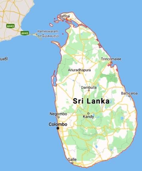


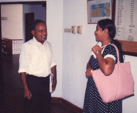


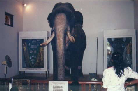
 During the nineteen years I spent in the Far East, I visited China just twice. The first time was in March 1995, and this post is all about that visit. It must have been in 2009 that I was in China again, for the annual meeting of the
 Agriculture under the supervision Professor Roland von Bothmer, studying the cytogenetics of wheat species, if memory serves me correctly. He had also spent some months working at the
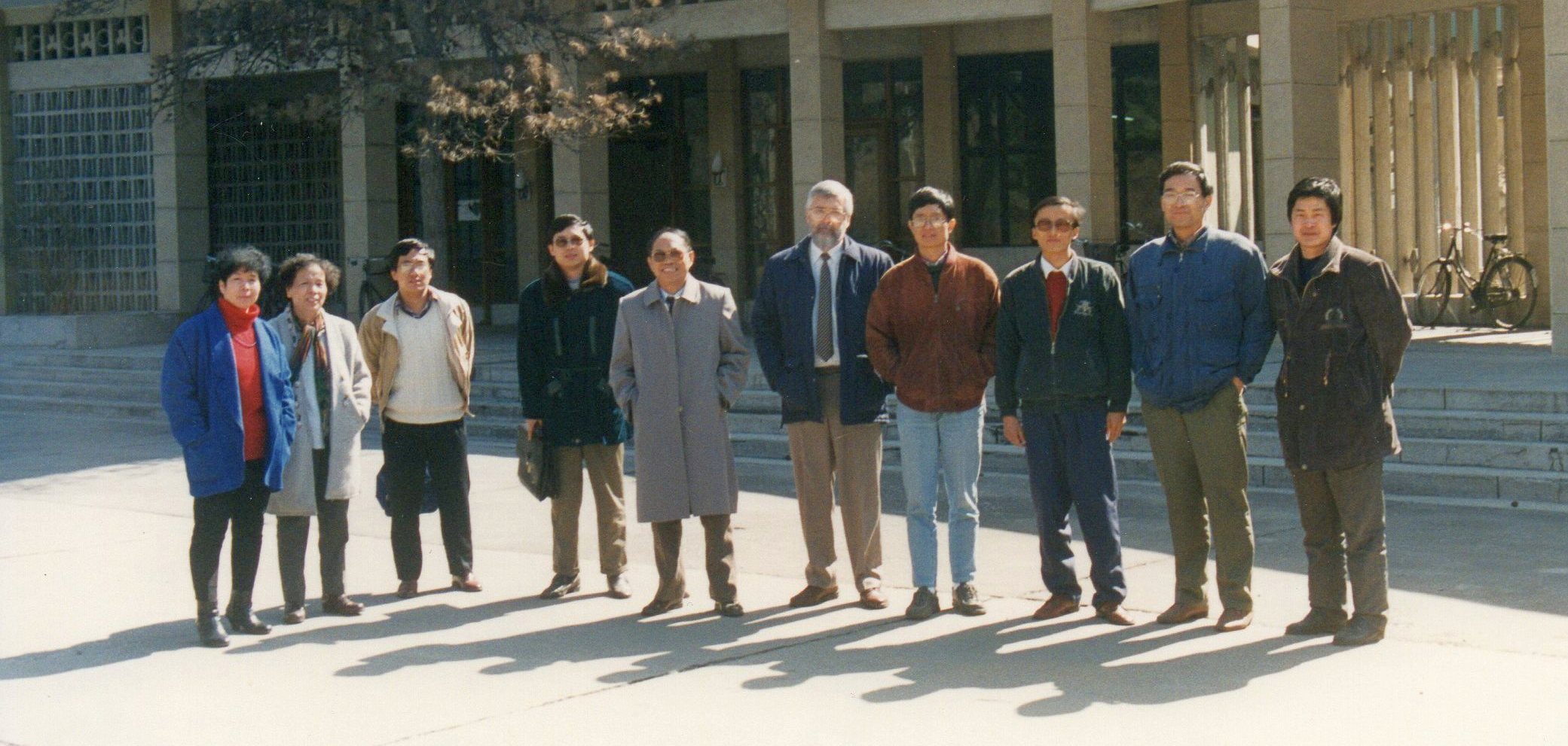
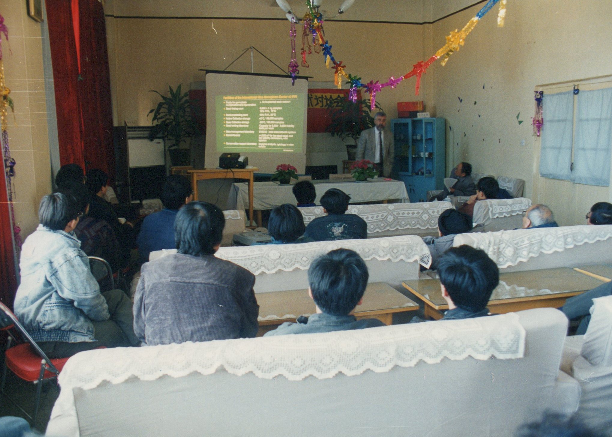


 After a few days in Beijing, we headed south to the city of Hangzhou (inland from Shanghai on the Qiantang River) in Zhejiang province. We were there to visit the
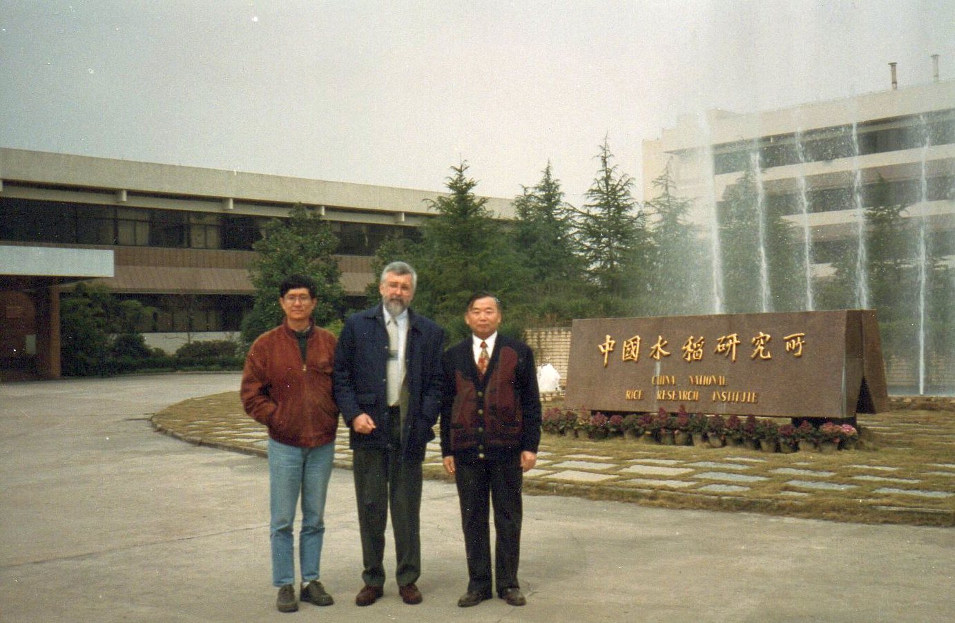
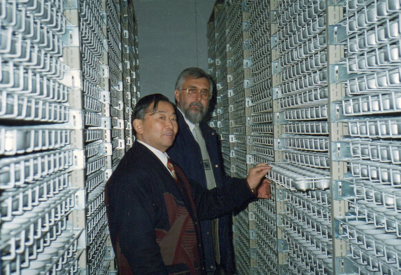


 Bao-Rong remained at IRRI for two contracts, a total of six years. After he left IRRI in 2000, he returned to China and it wasn’t long before he joined

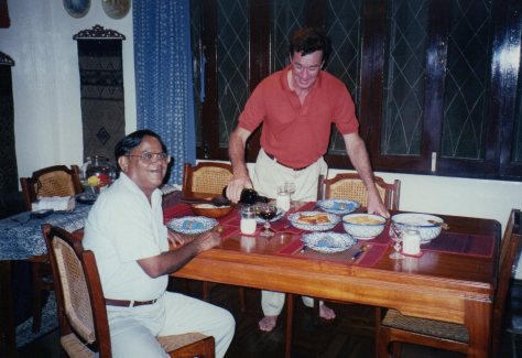
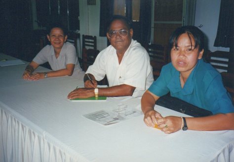


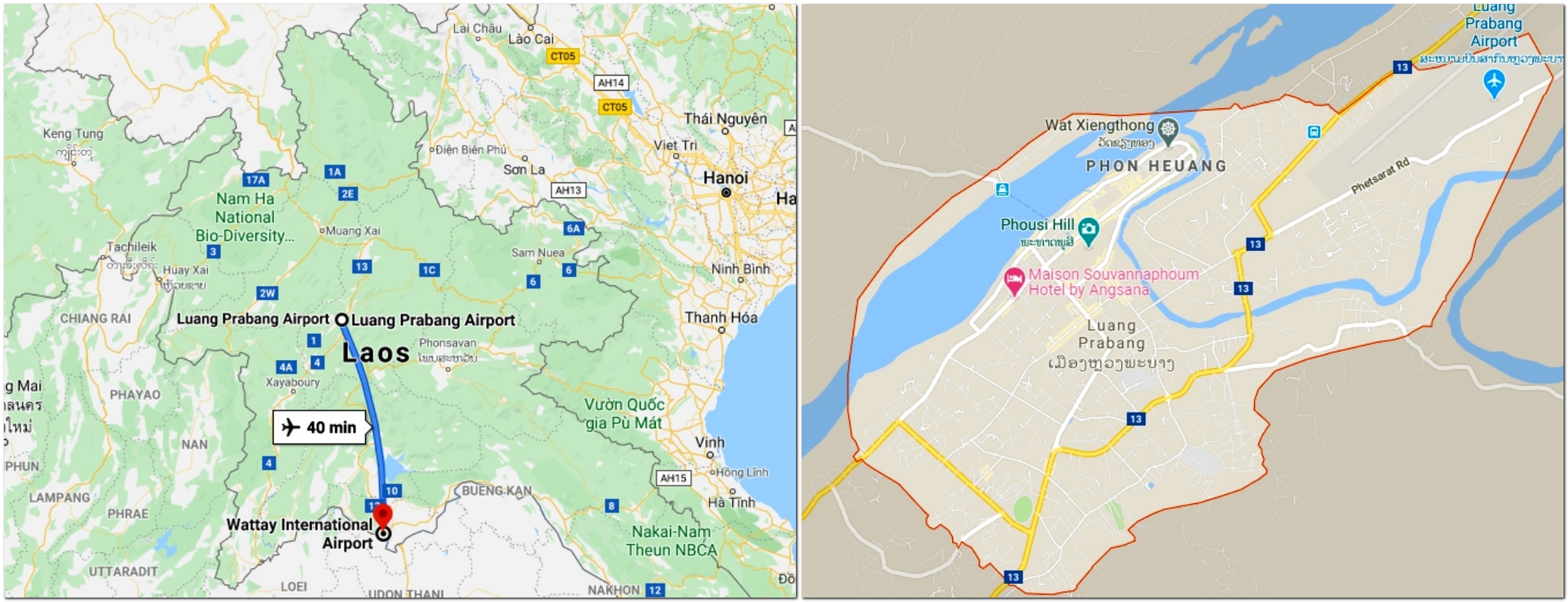


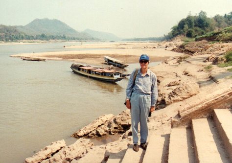


 Starting a career in international agricultural research


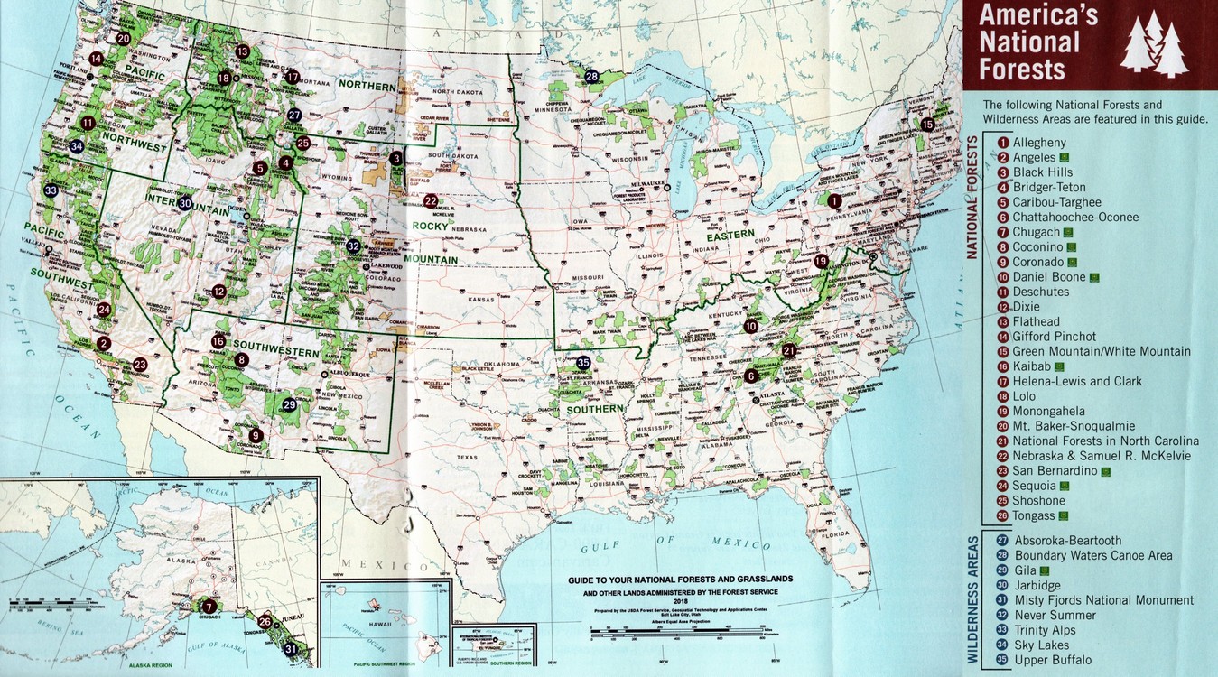


 Until about four months ago, I’d never heard of
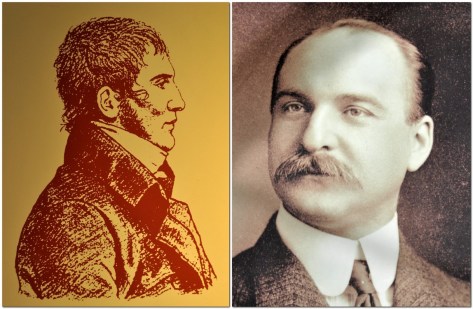


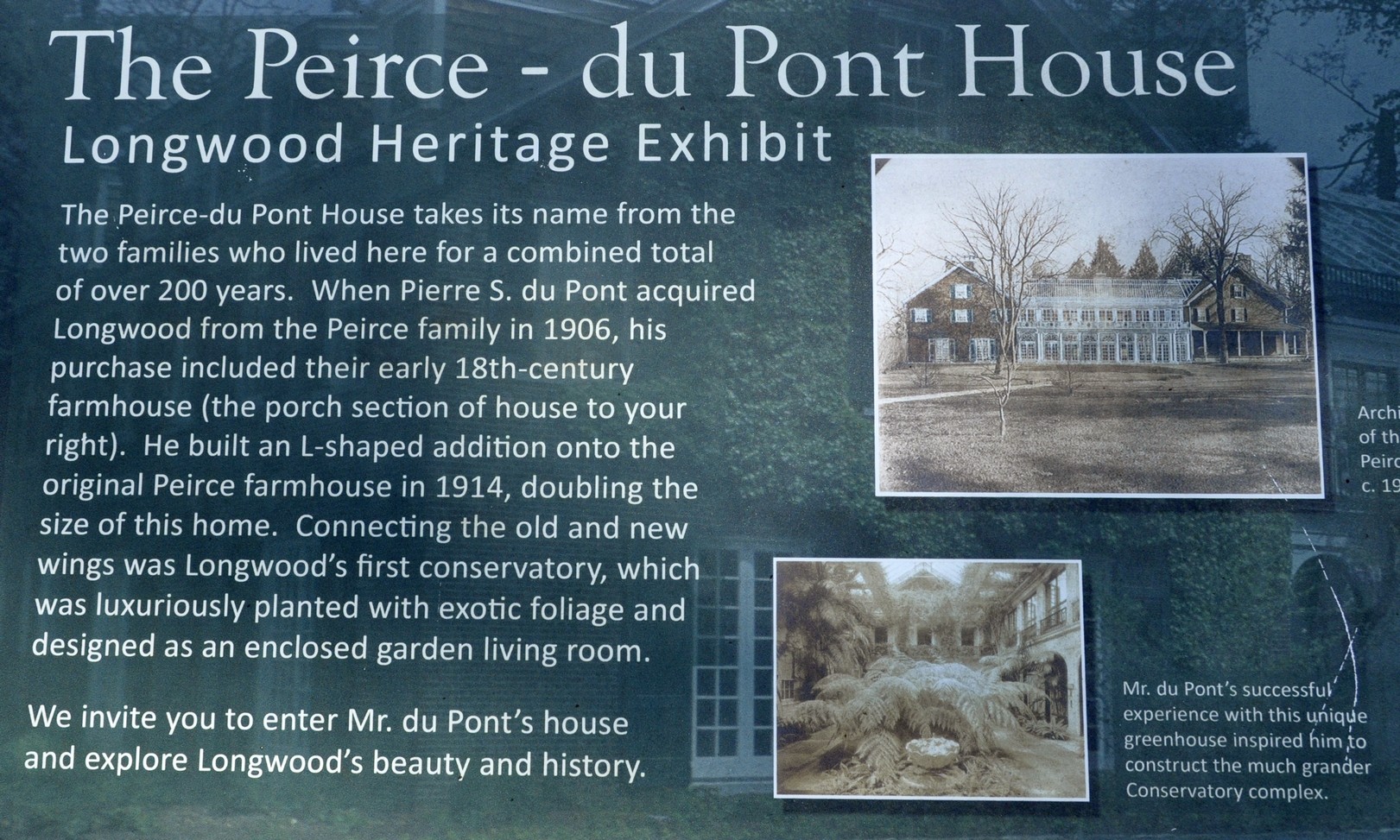


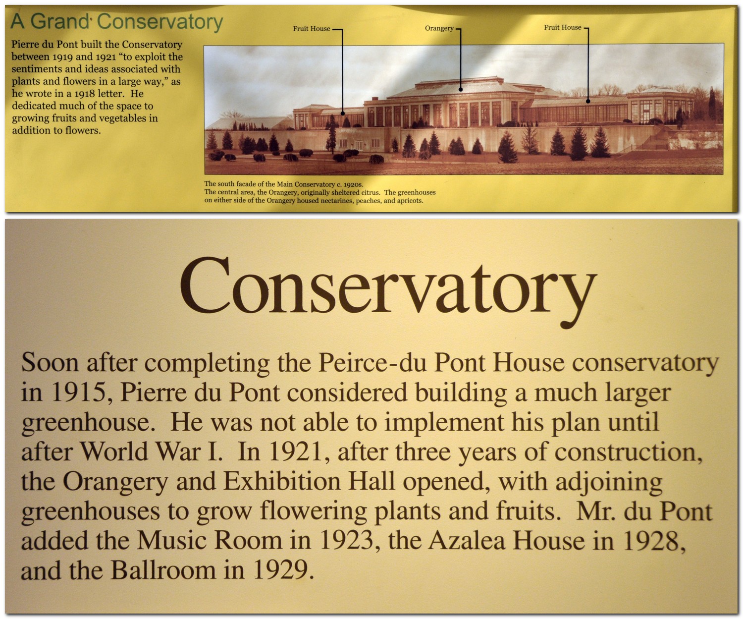


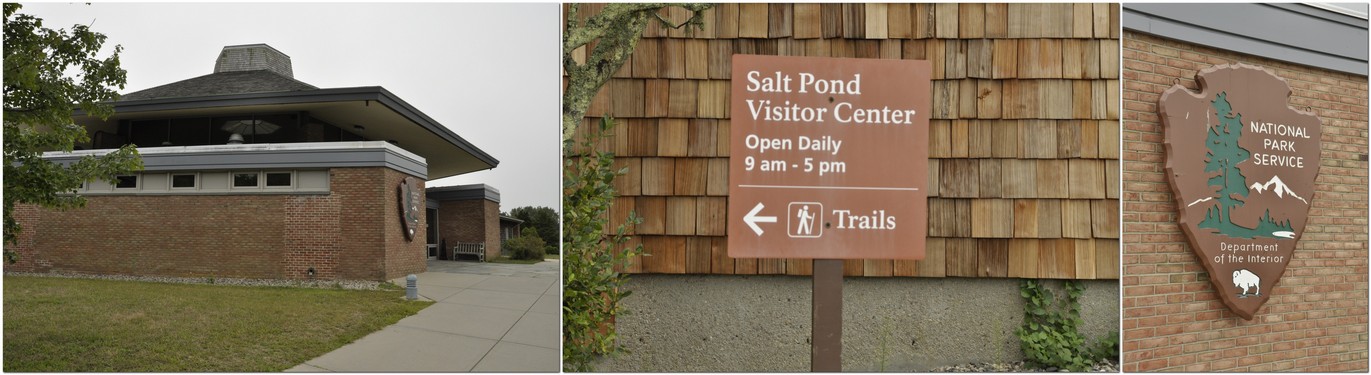


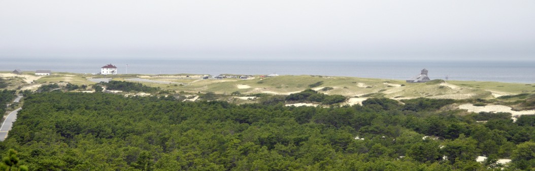
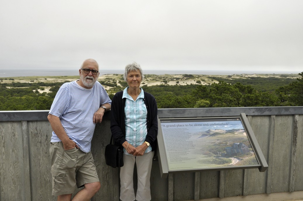


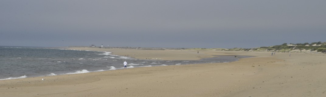


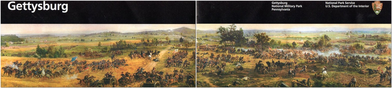

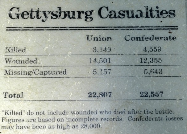
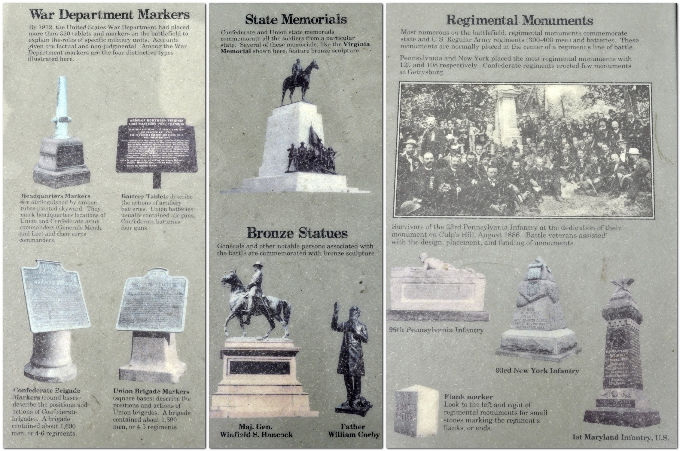


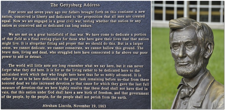
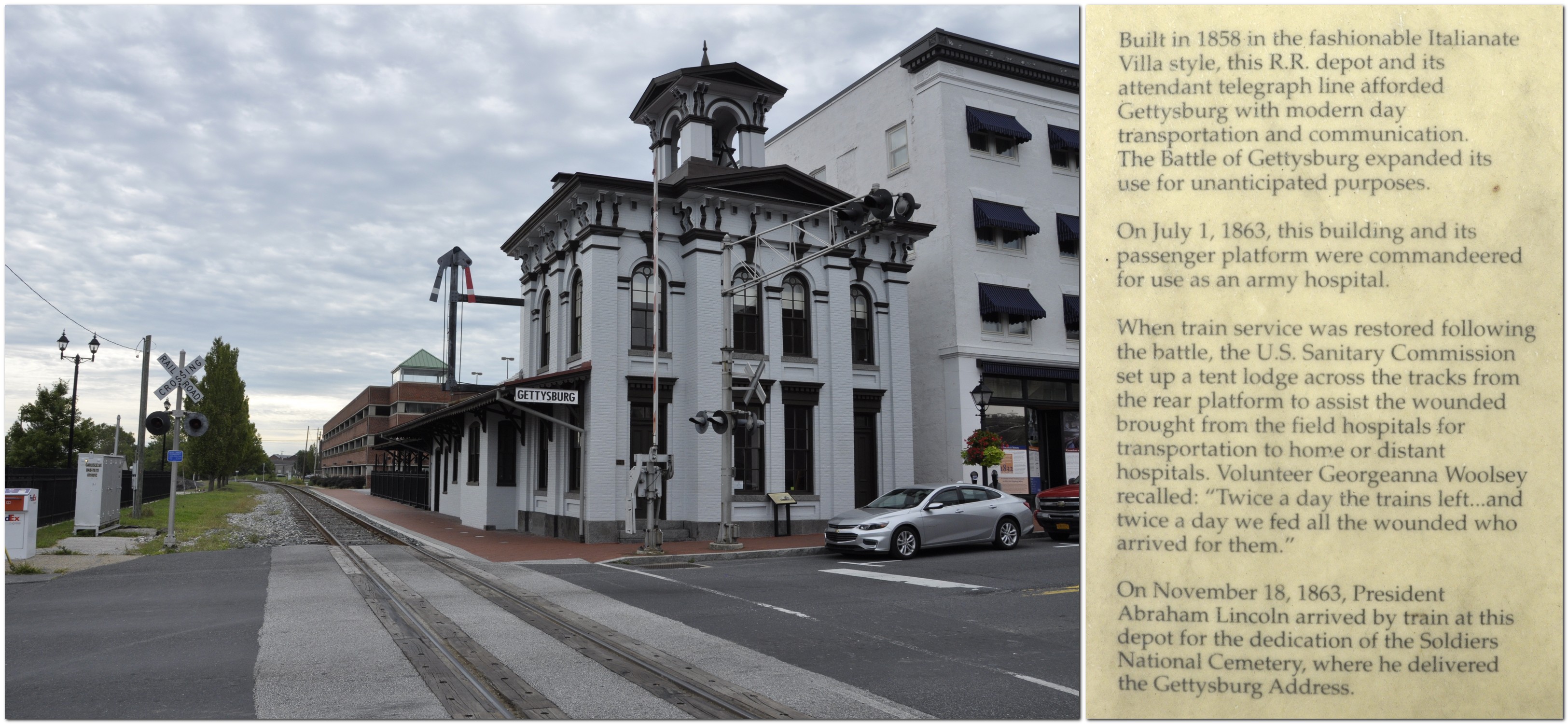
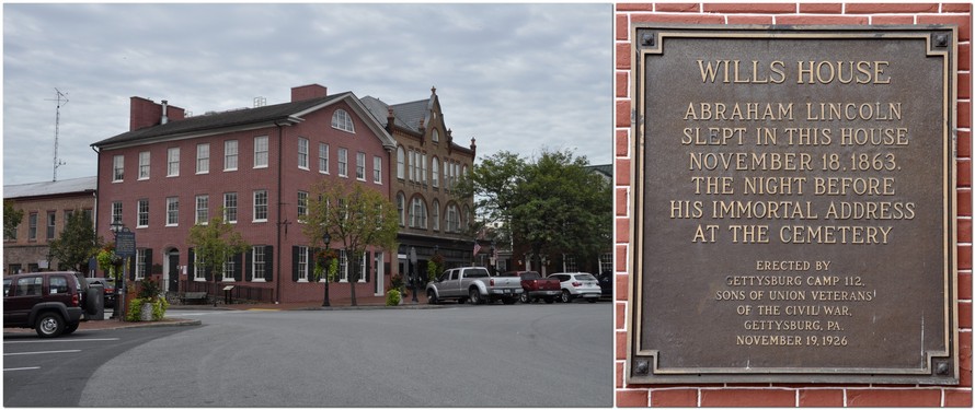
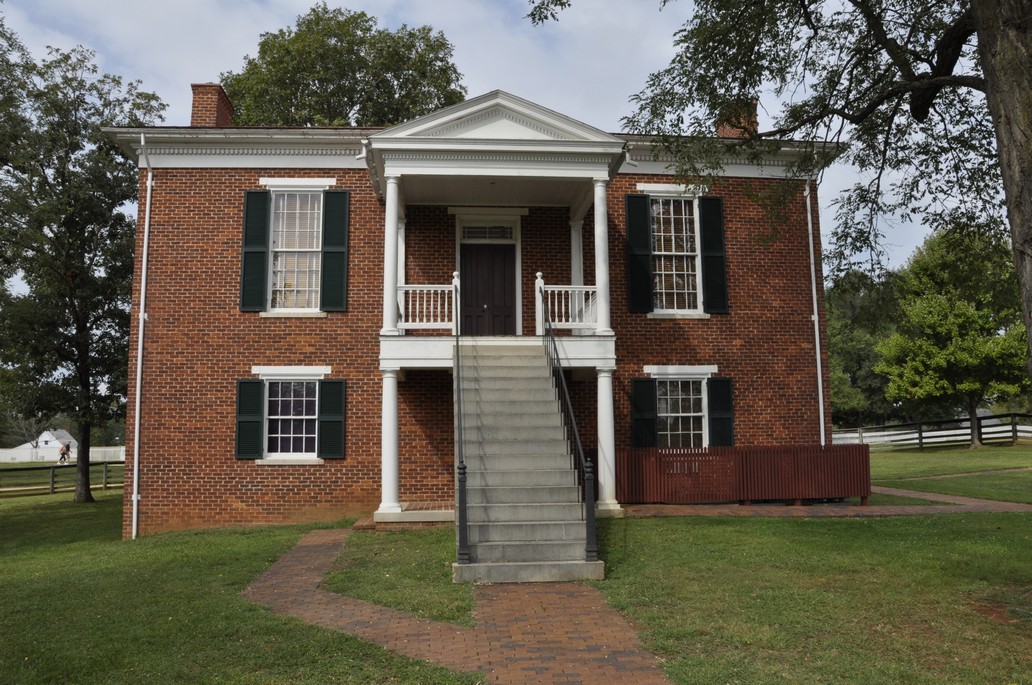
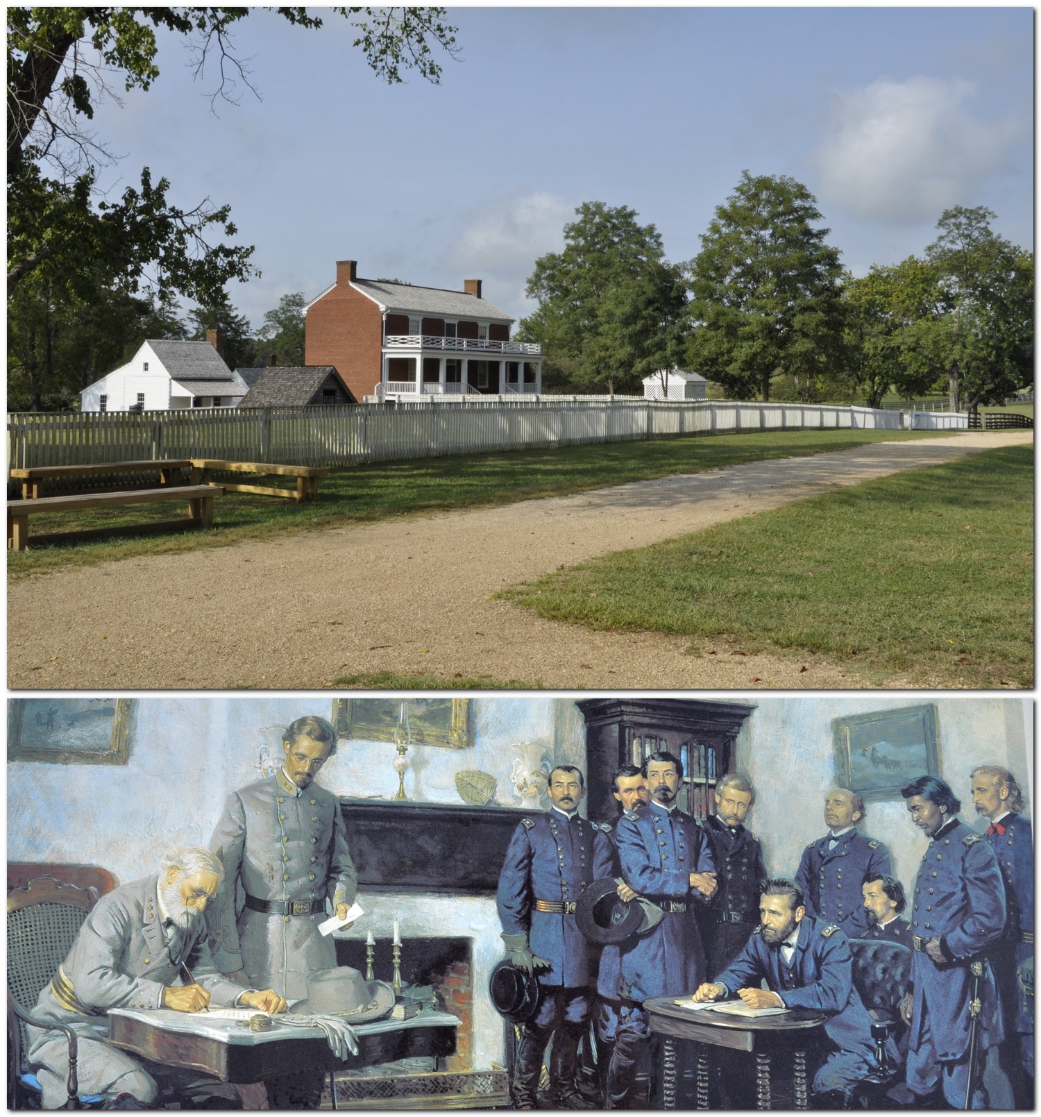
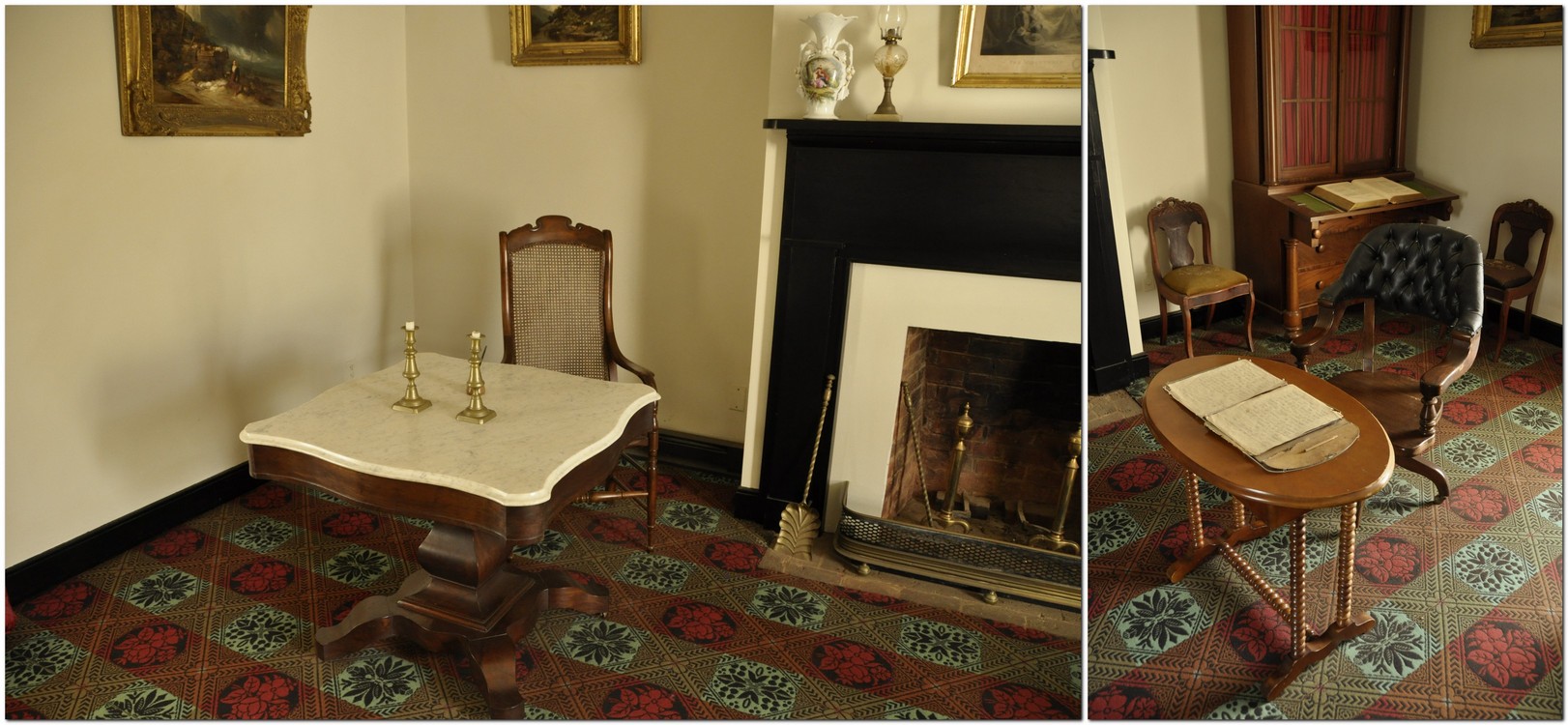


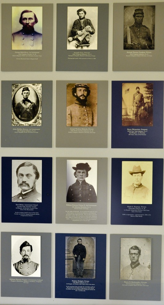

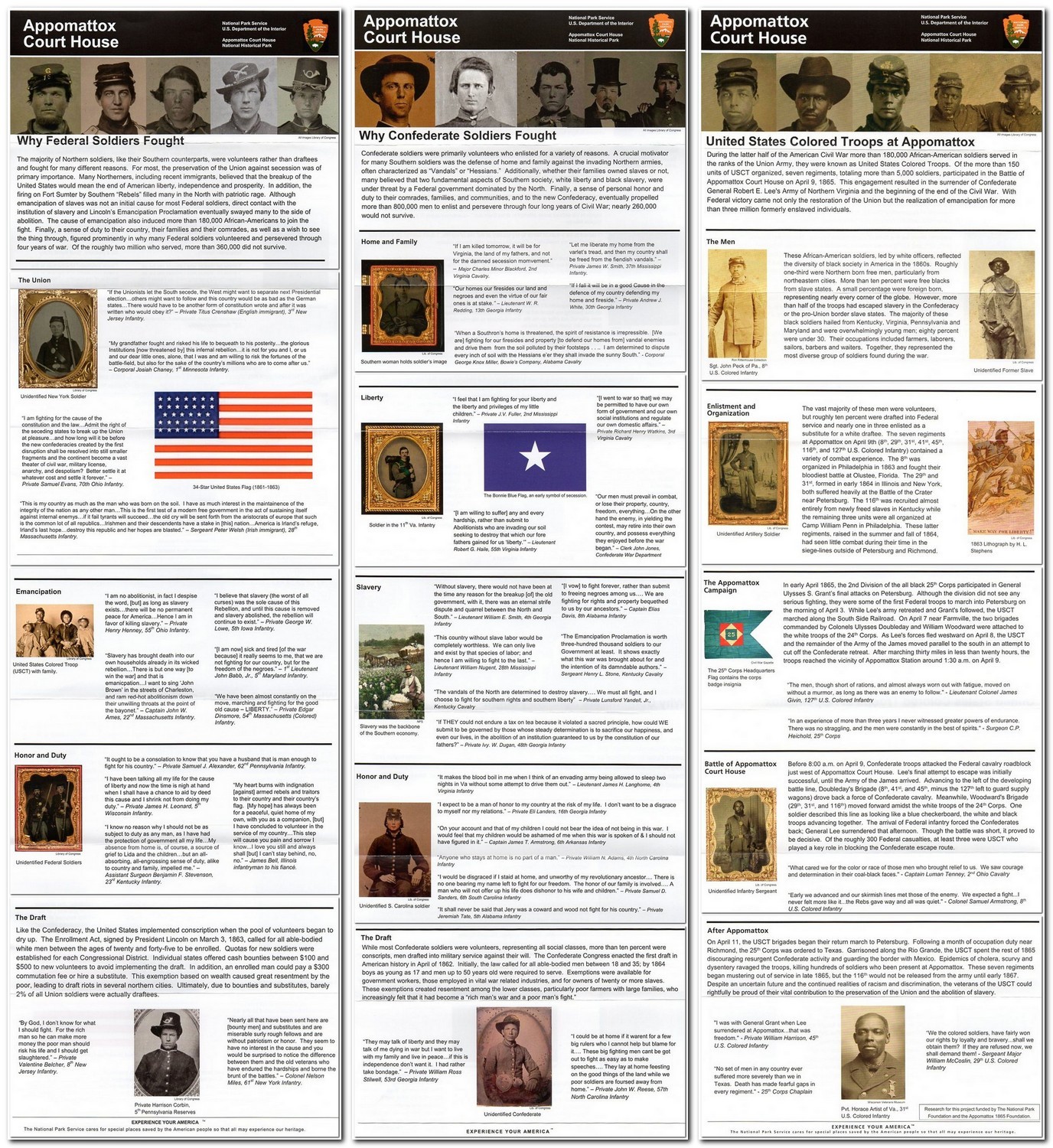
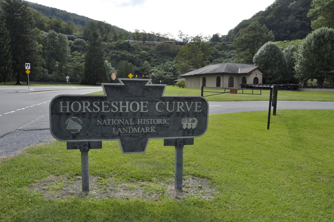

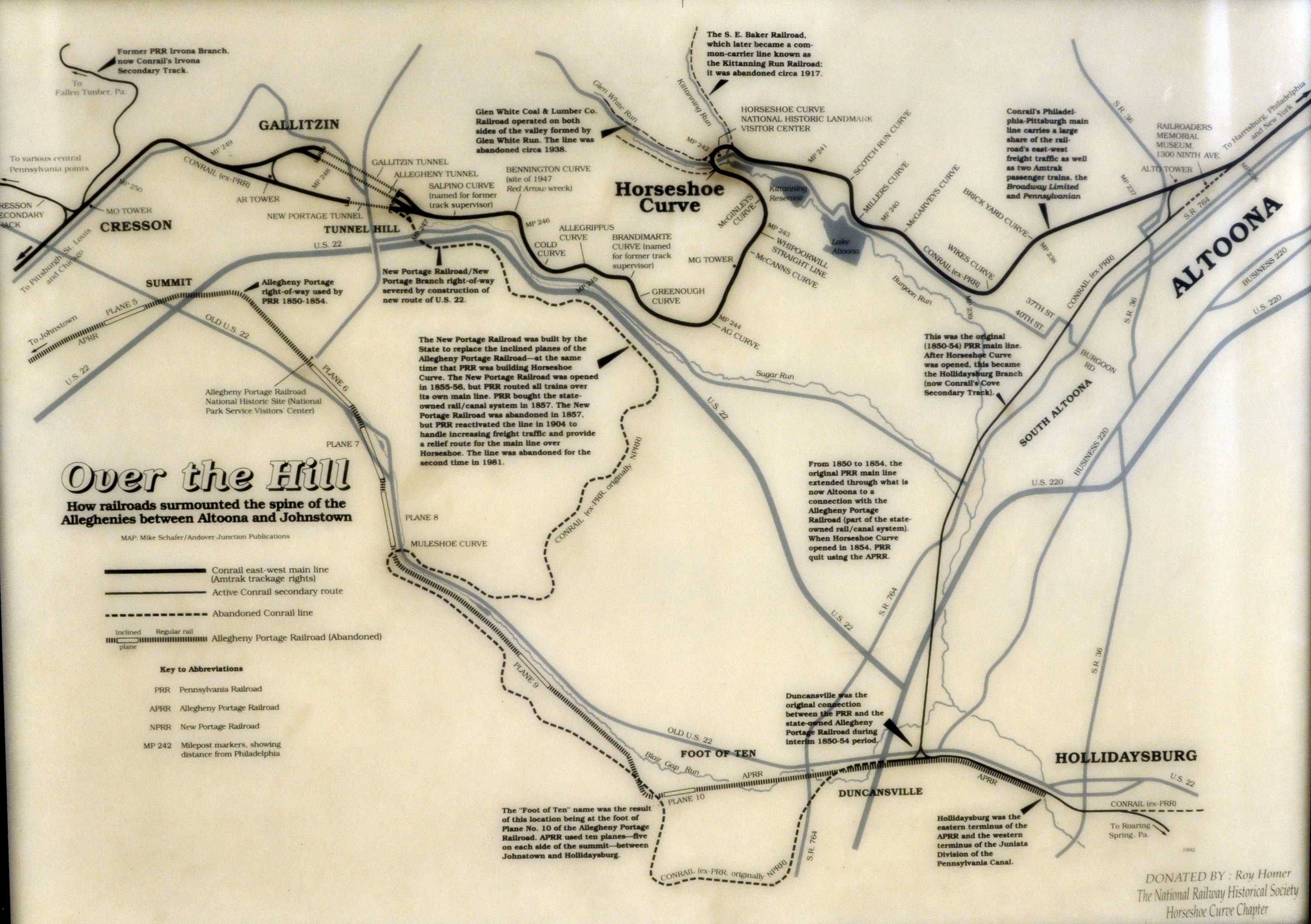
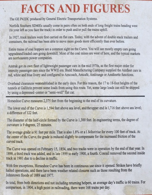
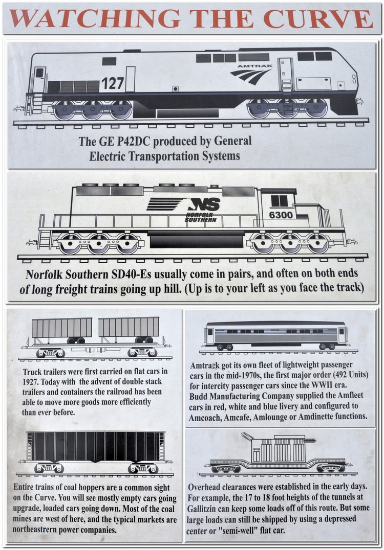
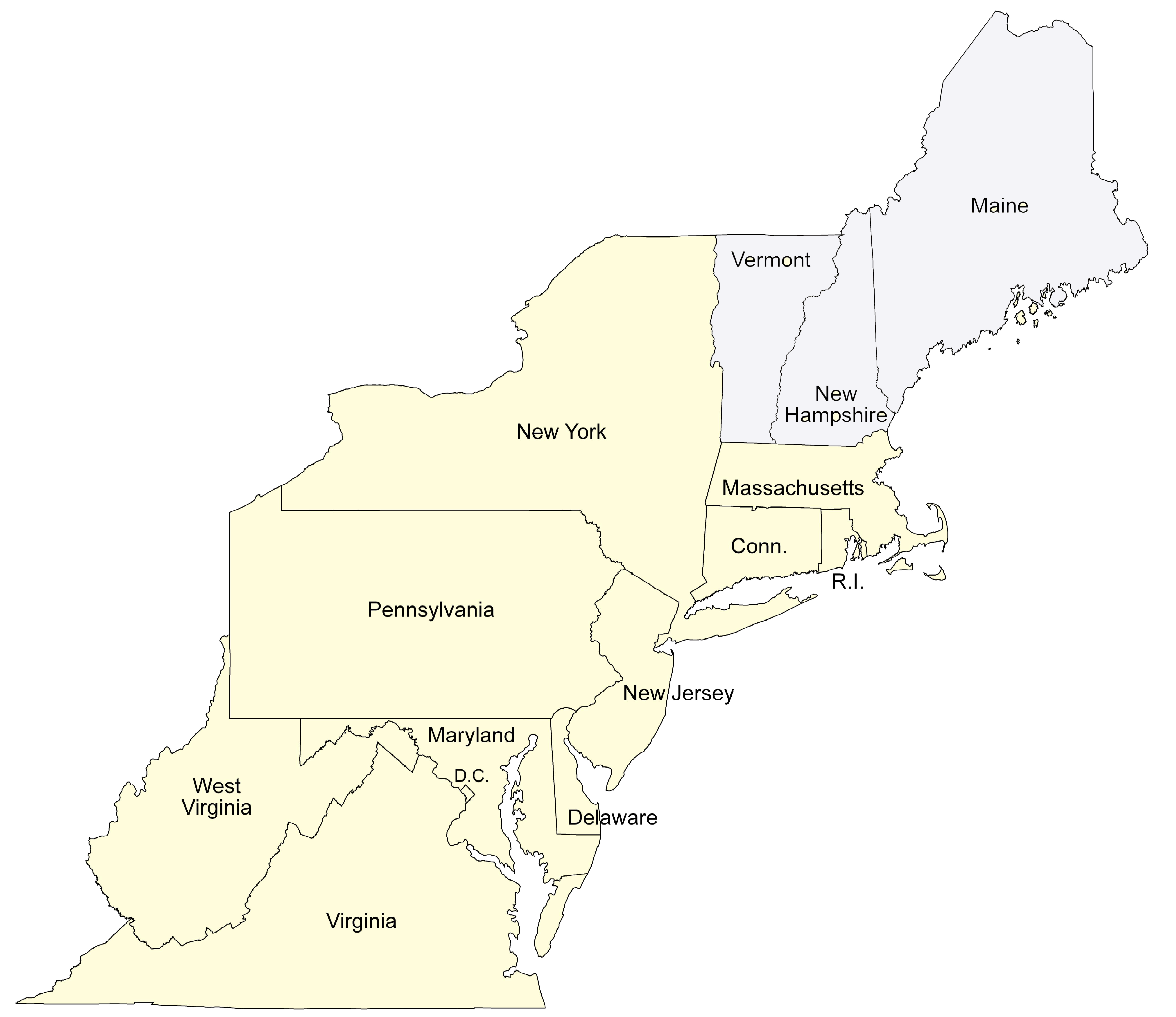

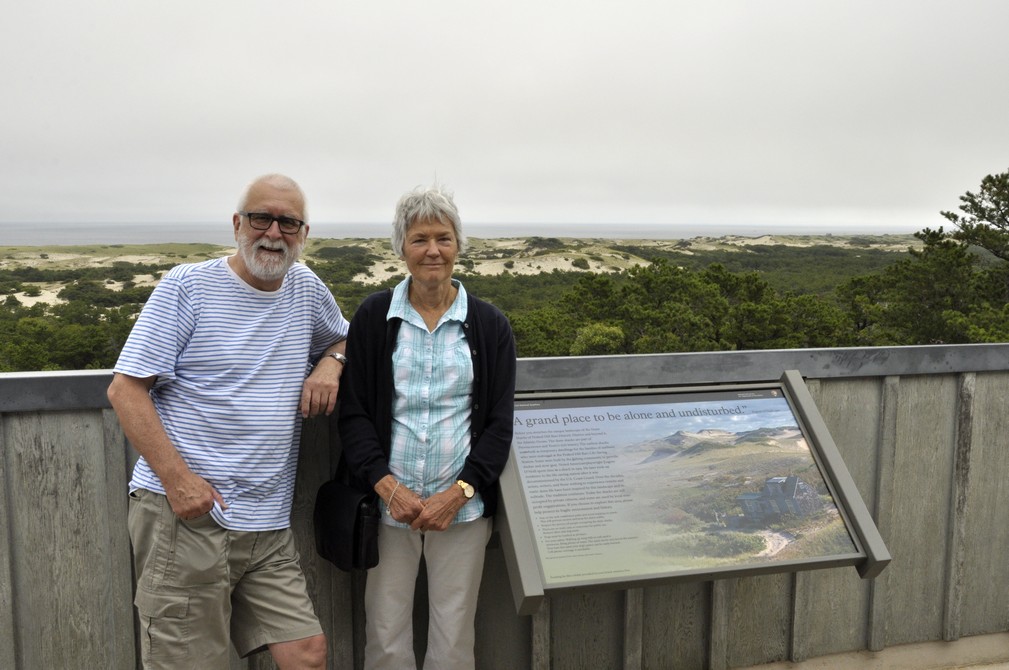


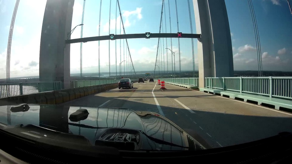
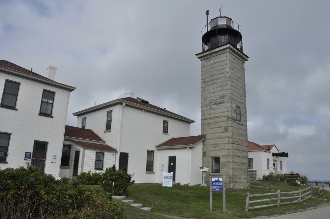


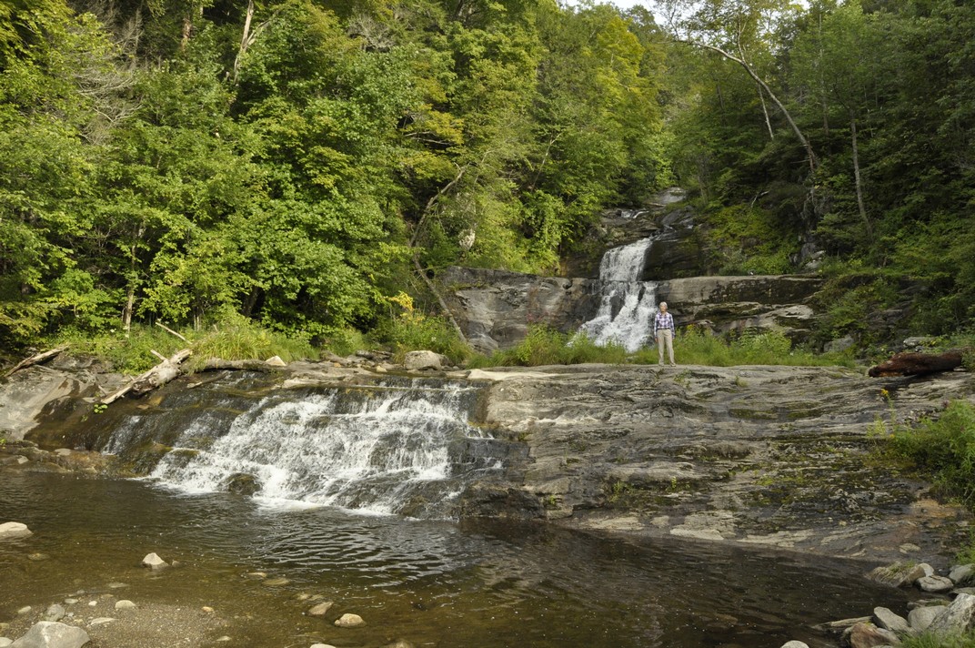
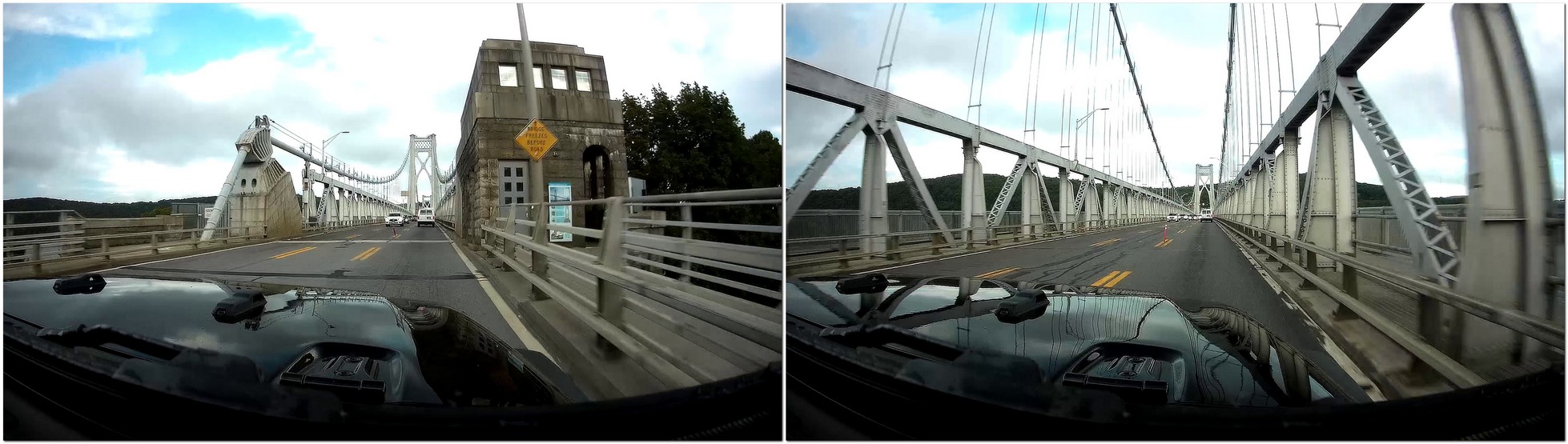
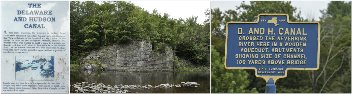
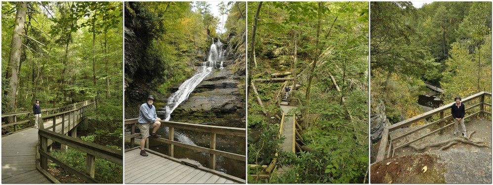
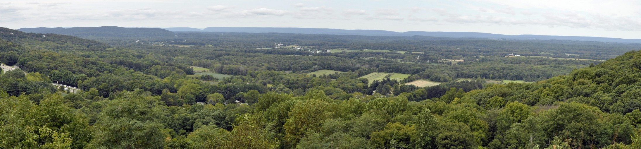

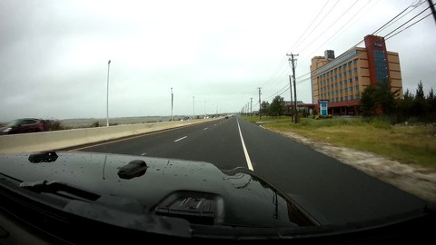


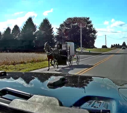


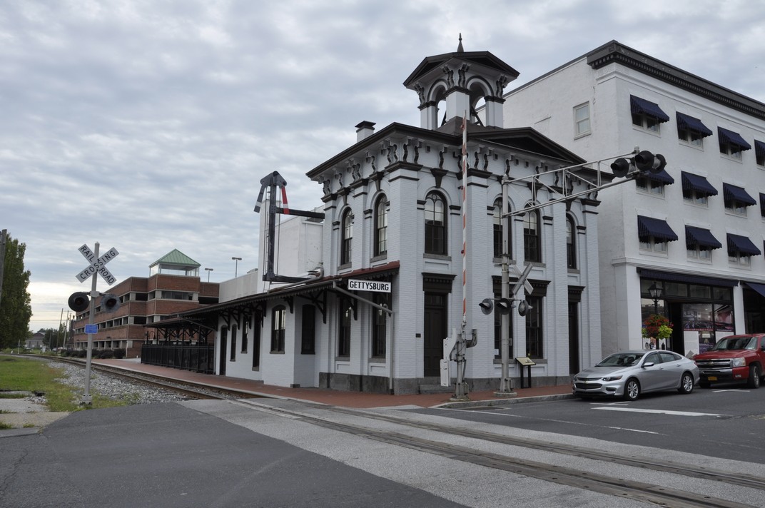

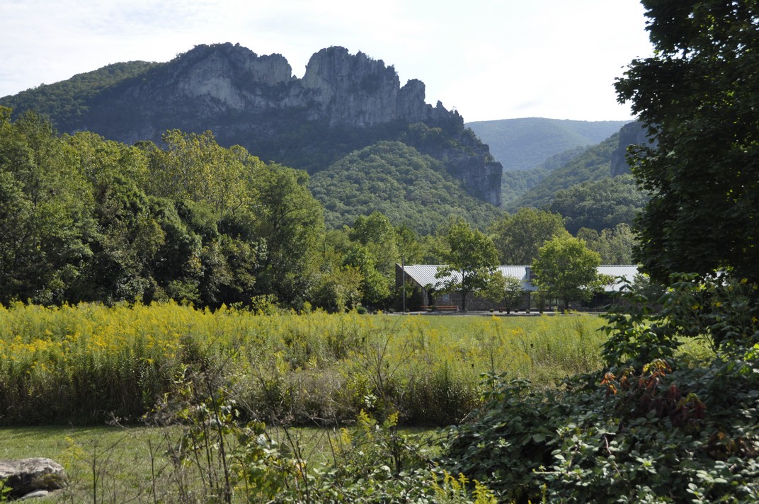
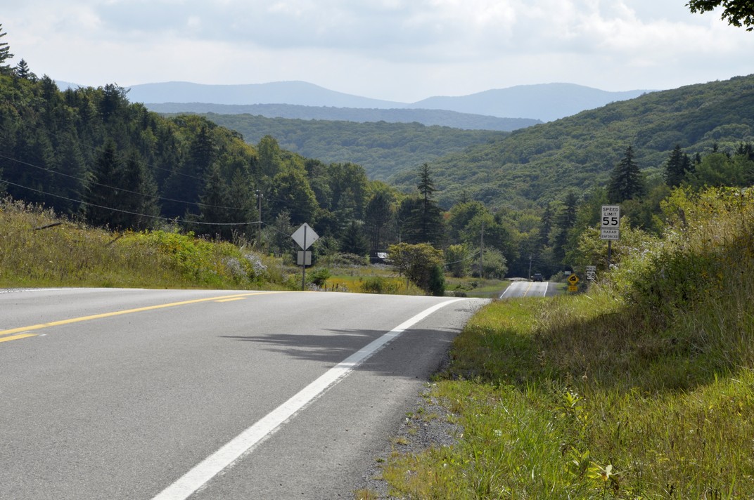
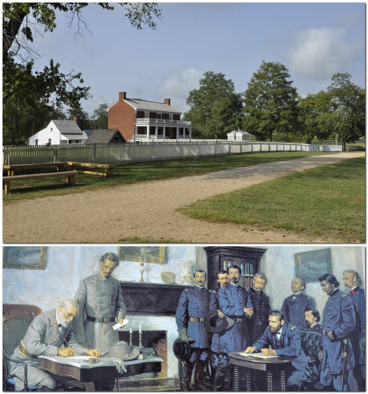


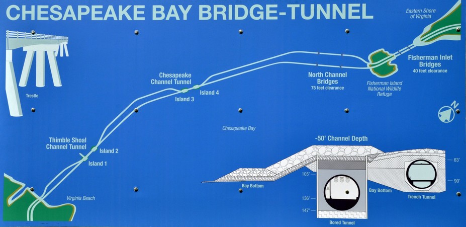
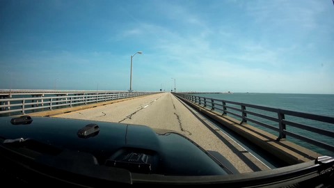
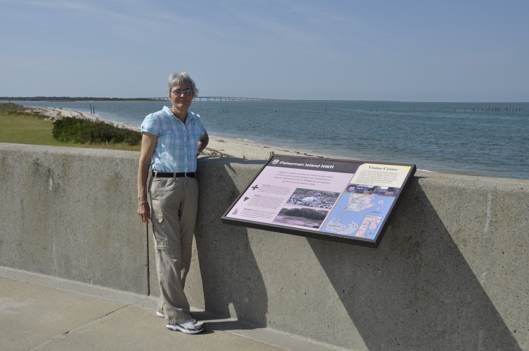
 I’m no


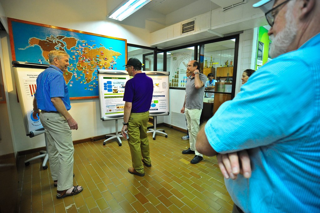
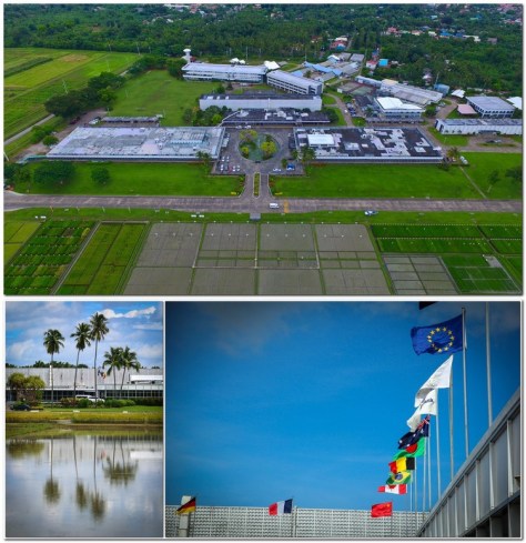


 The flag of Nepal is unique. It’s the only flag that is not a rectangle, but instead based on two separate pennants.


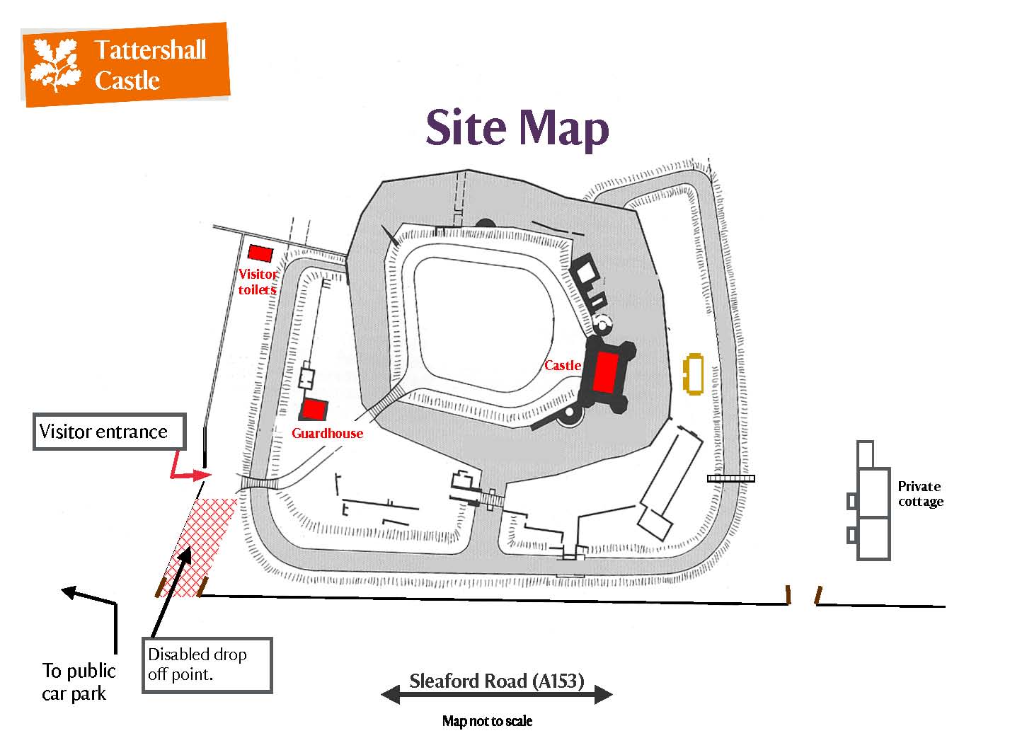
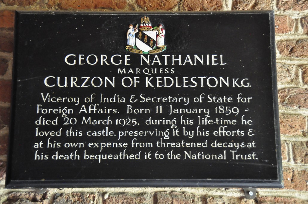


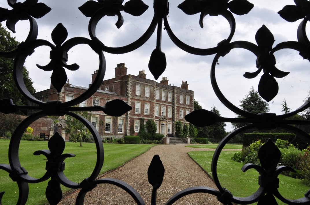


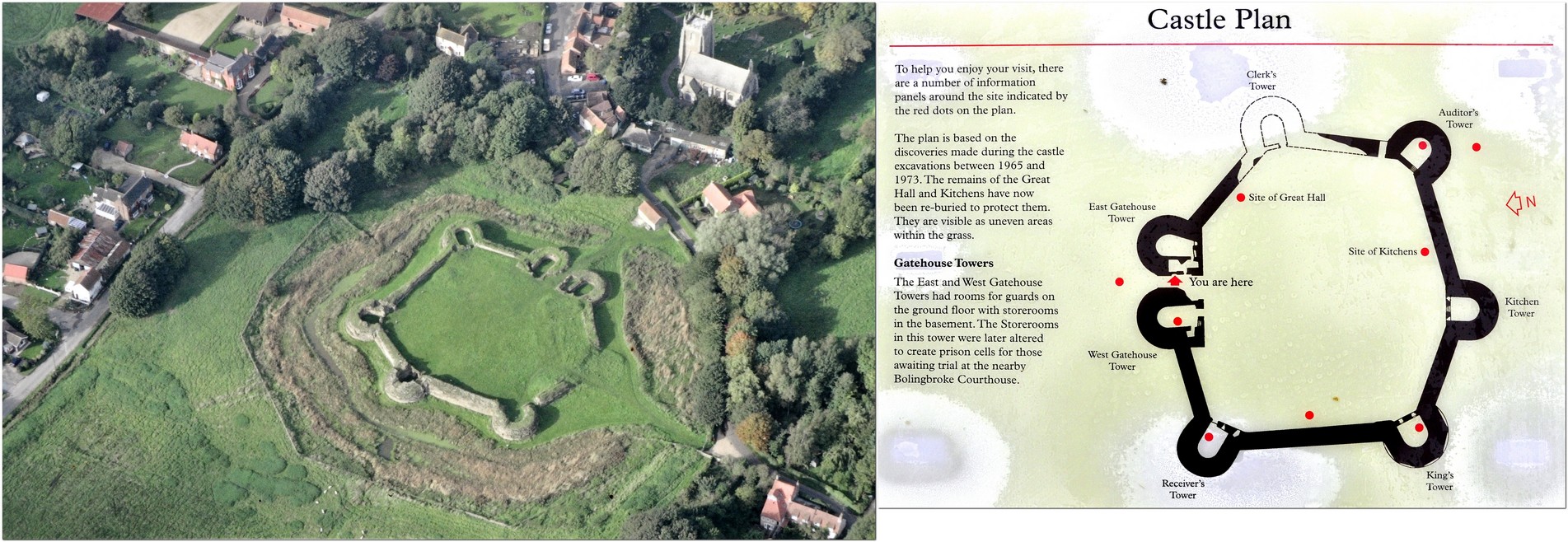


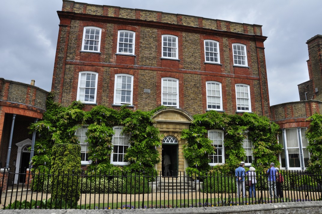


 The most celebrated of the family was Alexander (born in 1830) who traveled extensively and built
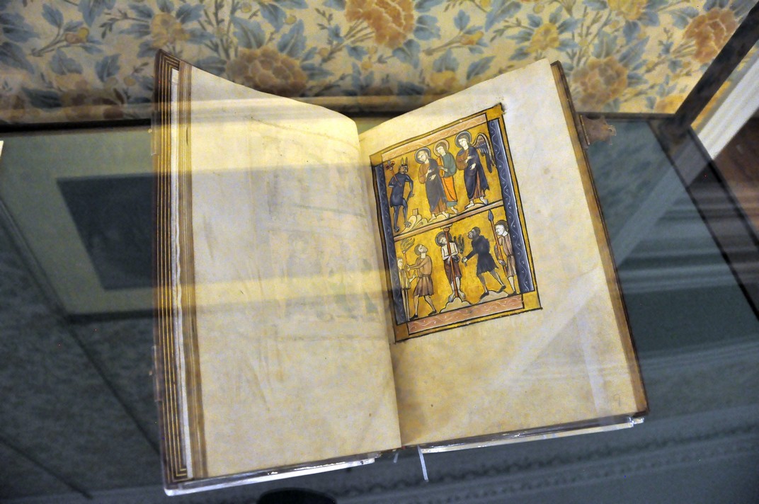


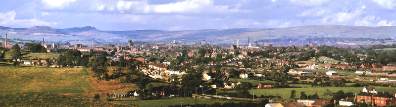
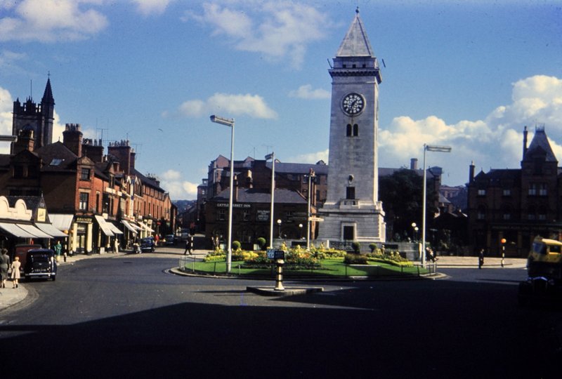


")


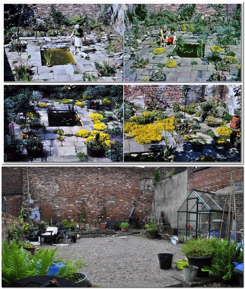


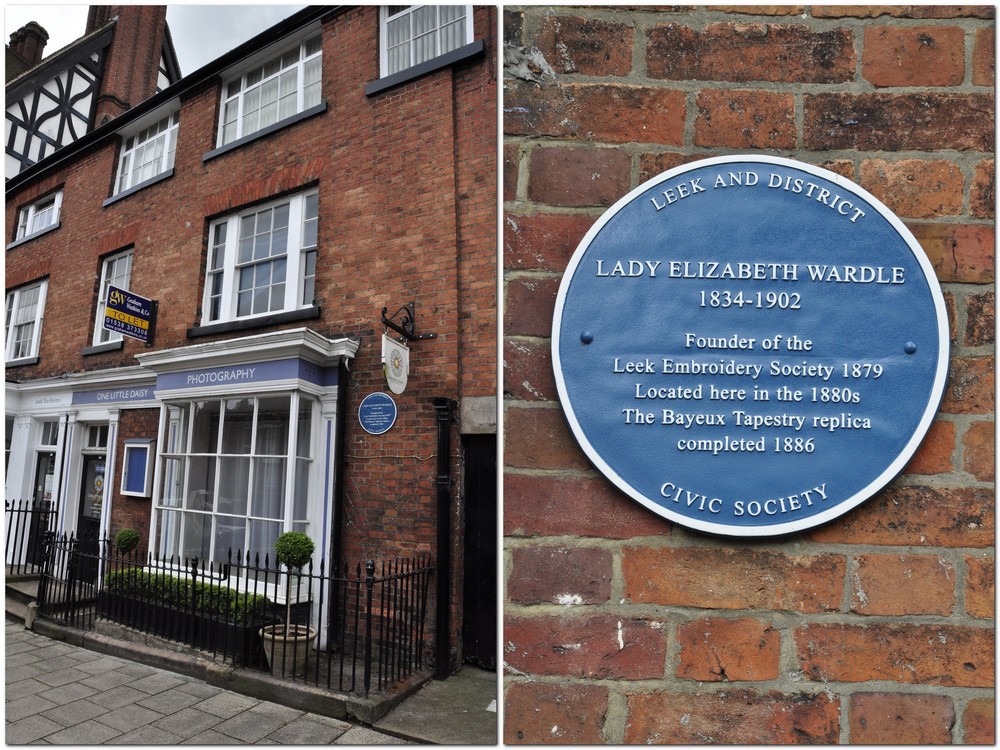
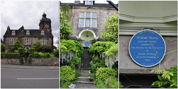
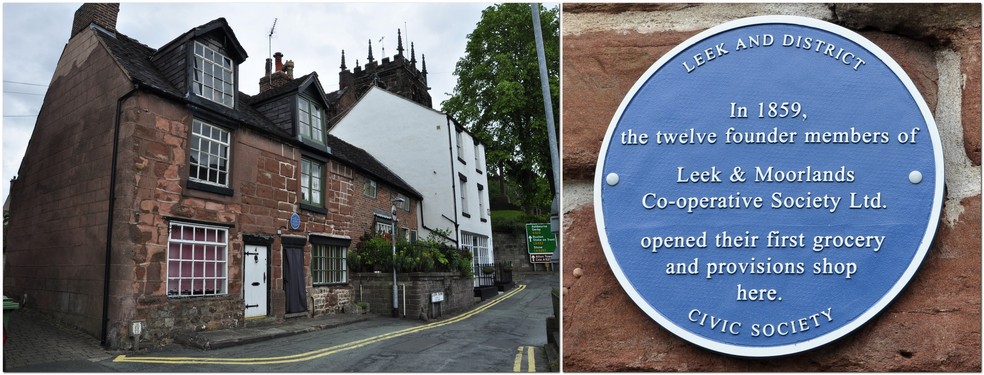
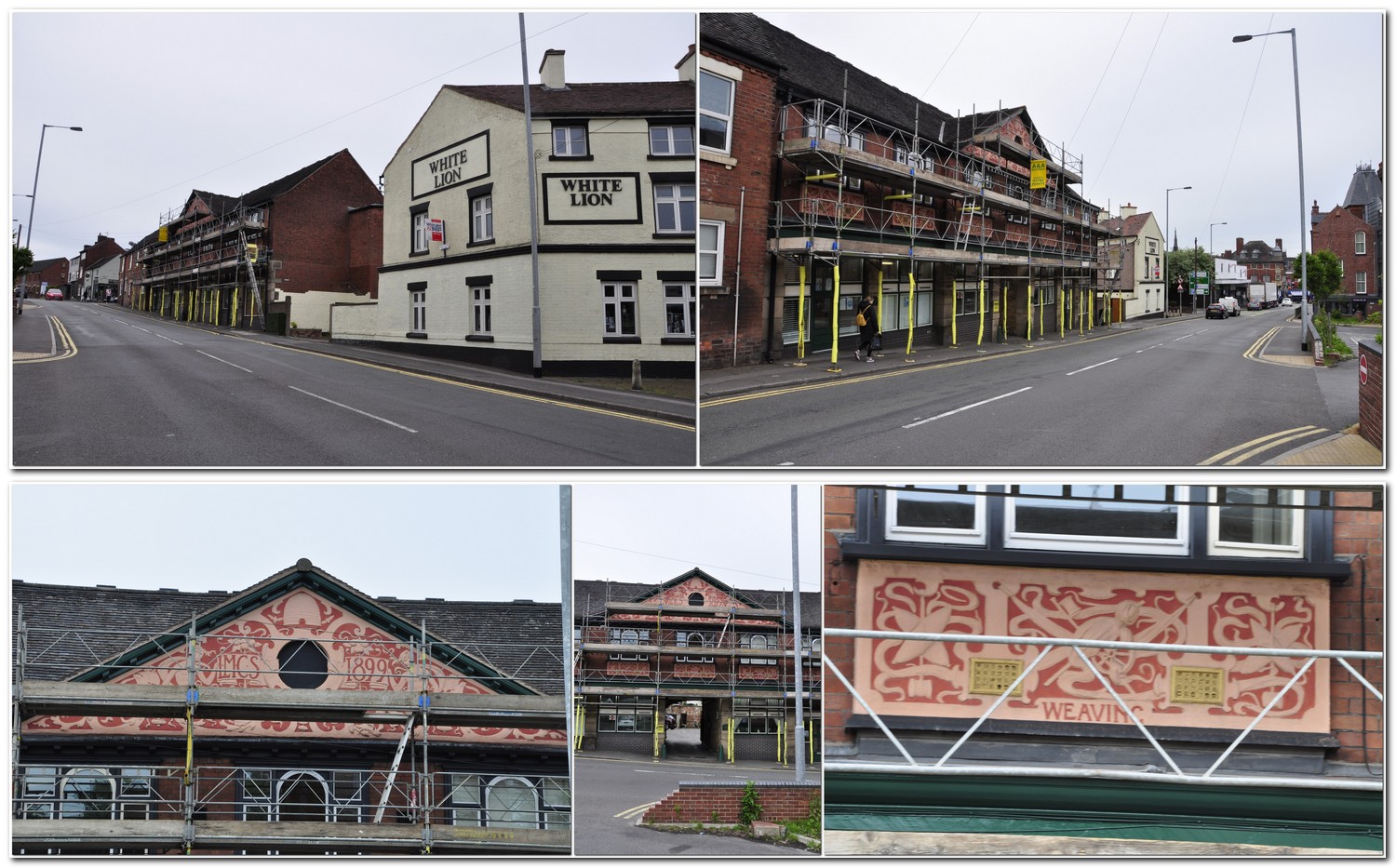
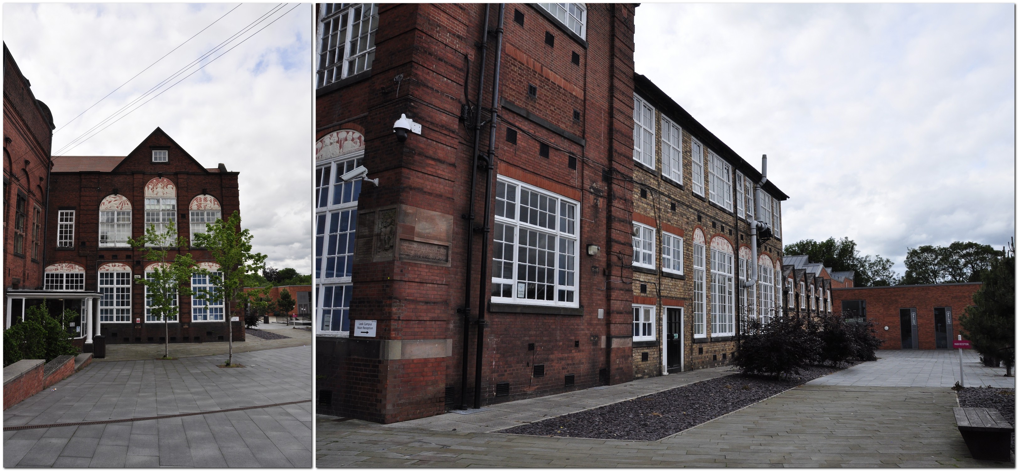
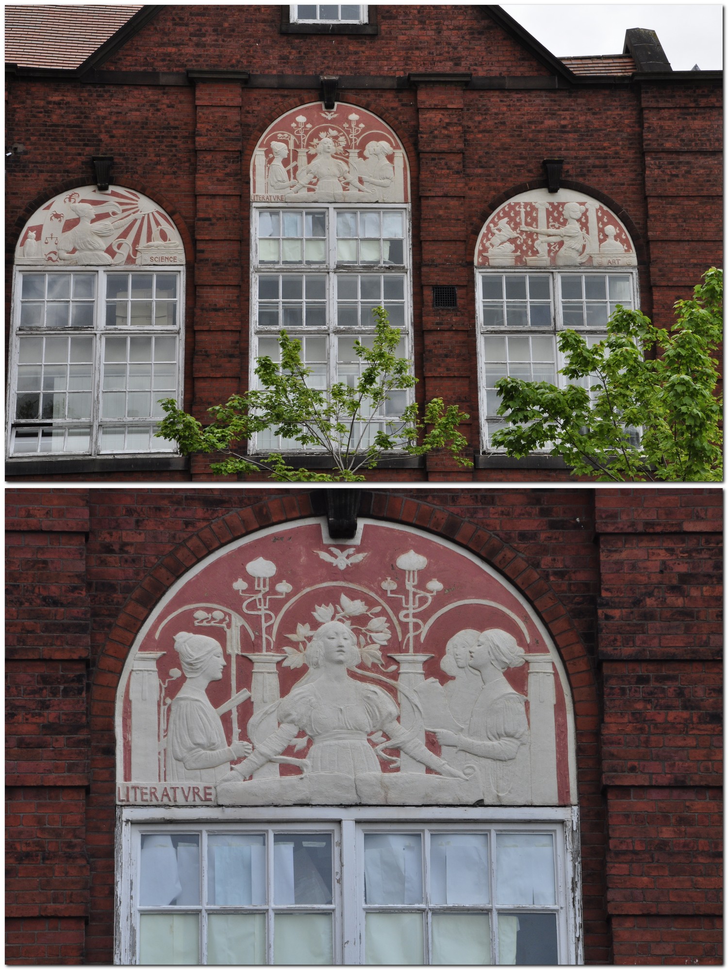
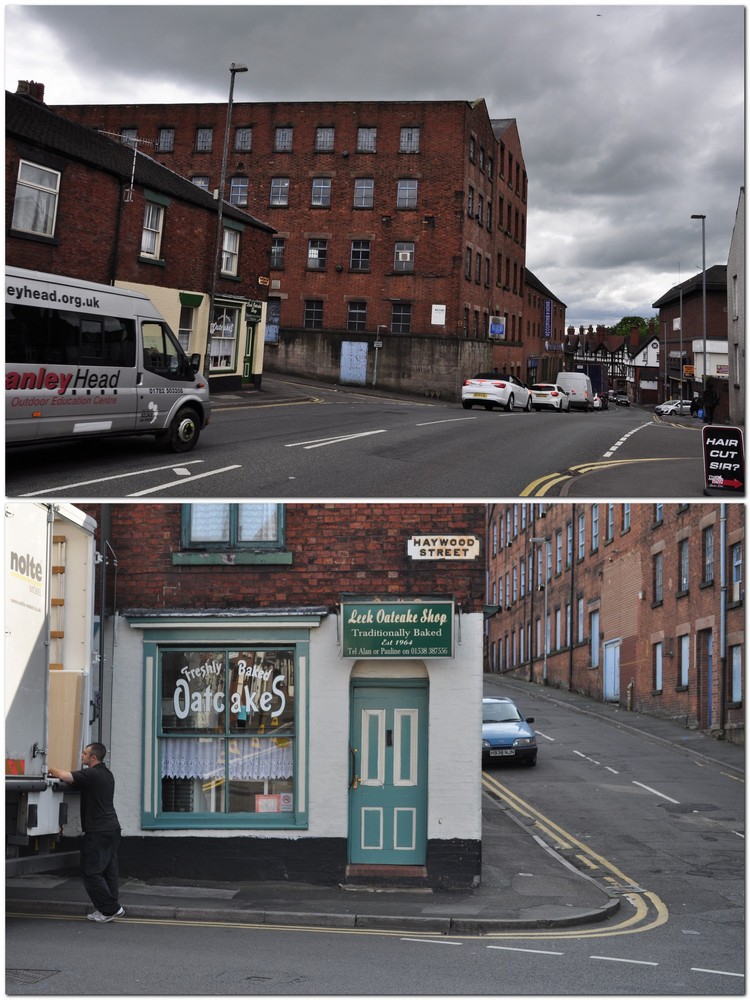
 Every Christmas morning he would take photos of Santa visiting all the children on the wards at Biddulph Grange. Even after our family moved to Leek in 1956, Dad (accompanied by Mum) continued to visit Biddulph Grange at Christmas. I remember visiting on many occasions, and meeting the Matron (right), Miss Ruth Cleator.


 In 1995, the BBC aired a six episode adaptation (by Andrew Davies) of
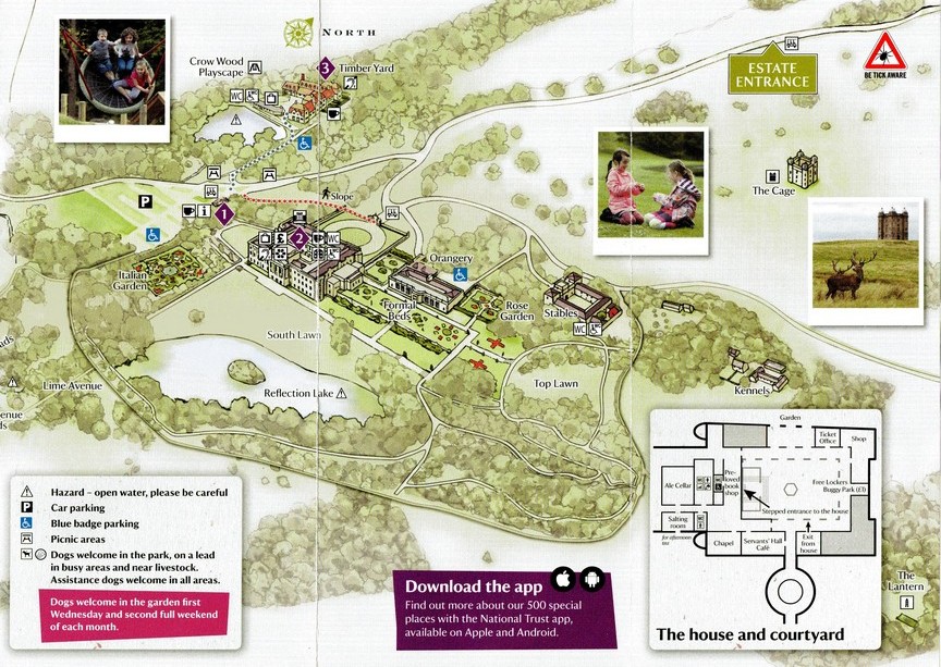
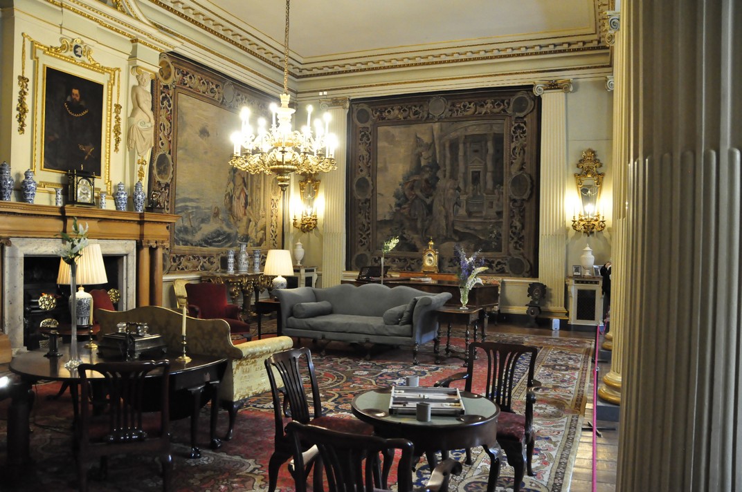
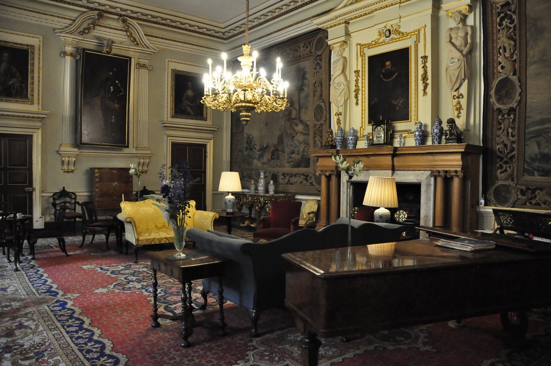
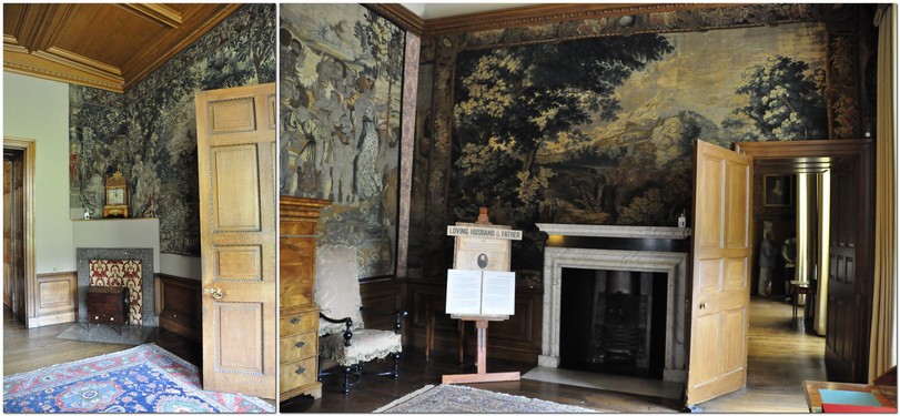


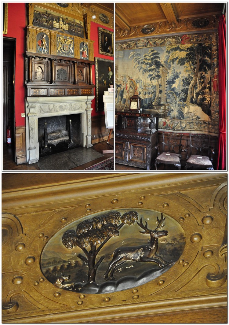

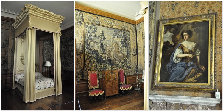

 At the bottom of the Grand Staircase is a huge oil painting of one of the Lyme mastiffs (now extinct). On the staircase wall is a painting of Thomas Legh, who was an adventurer, and responsible for the look of Lyme that we see inside today.
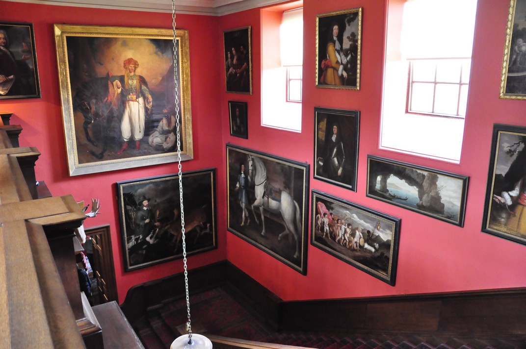


 The more I write this blog, the more apt this quotation from Victorian Prime Minister
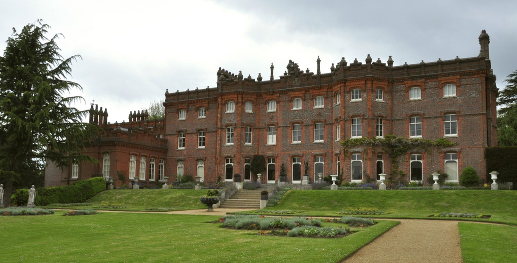
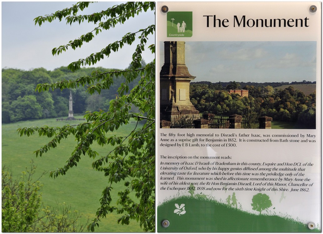
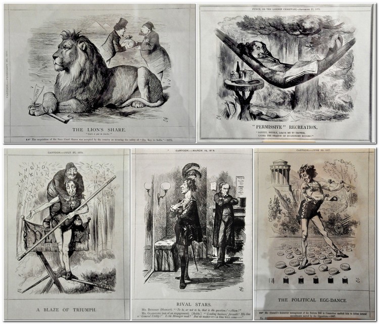
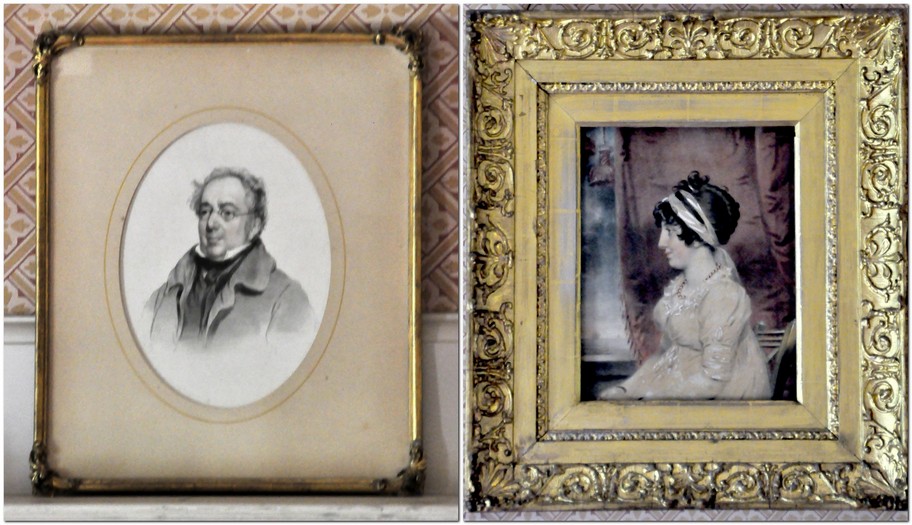
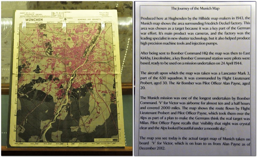
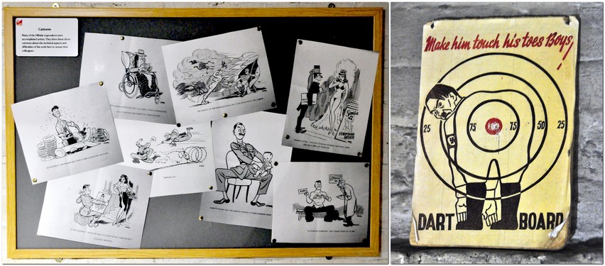
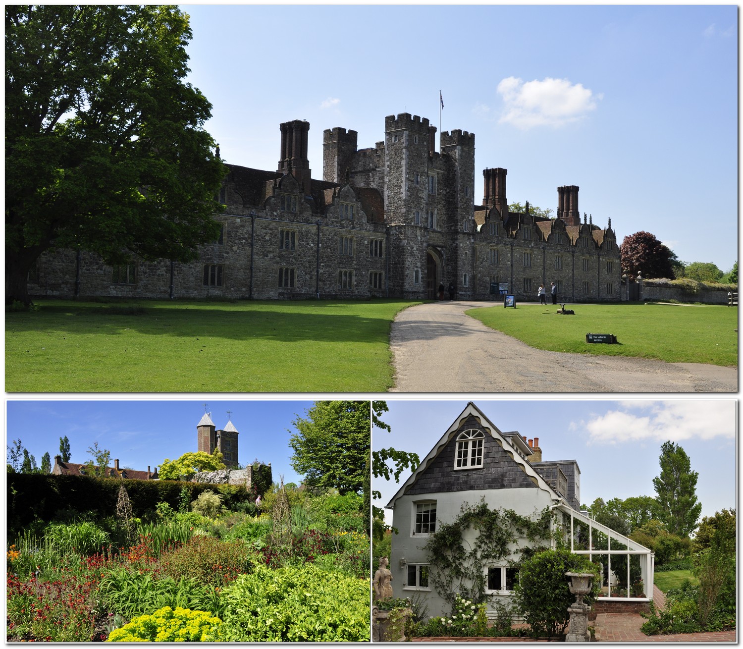

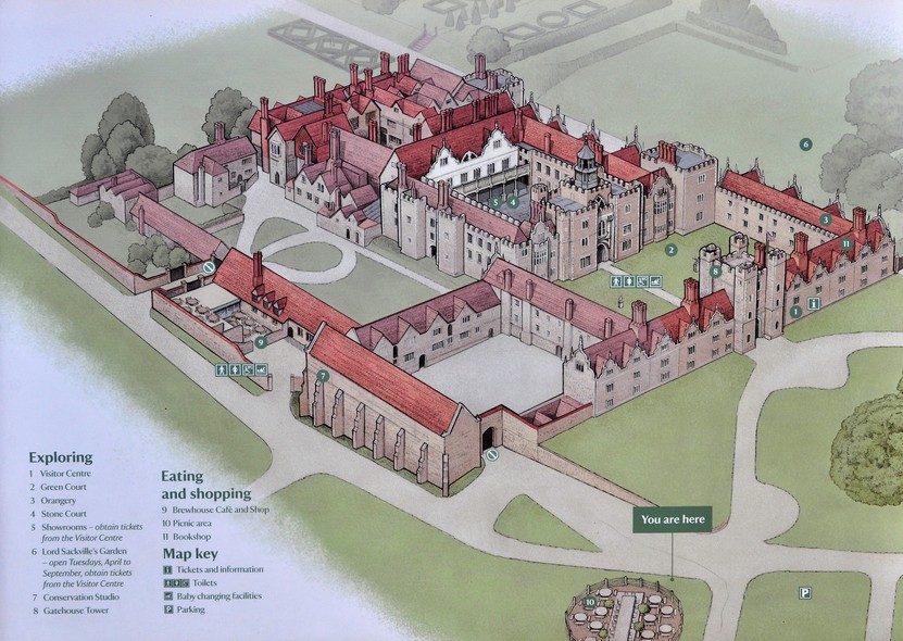


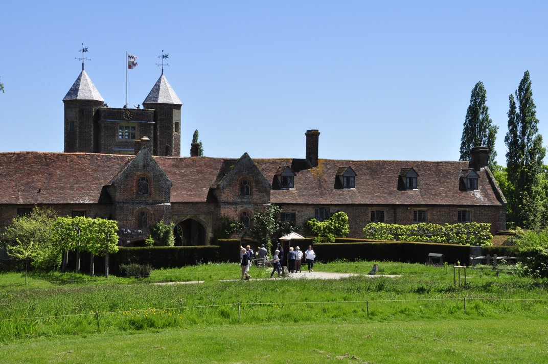


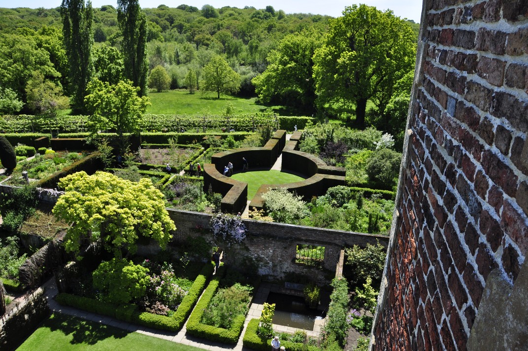


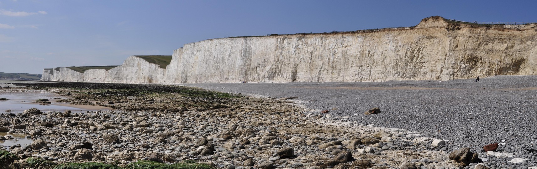


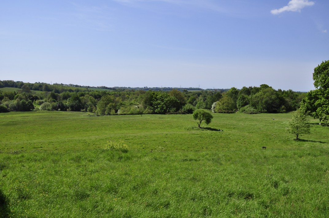

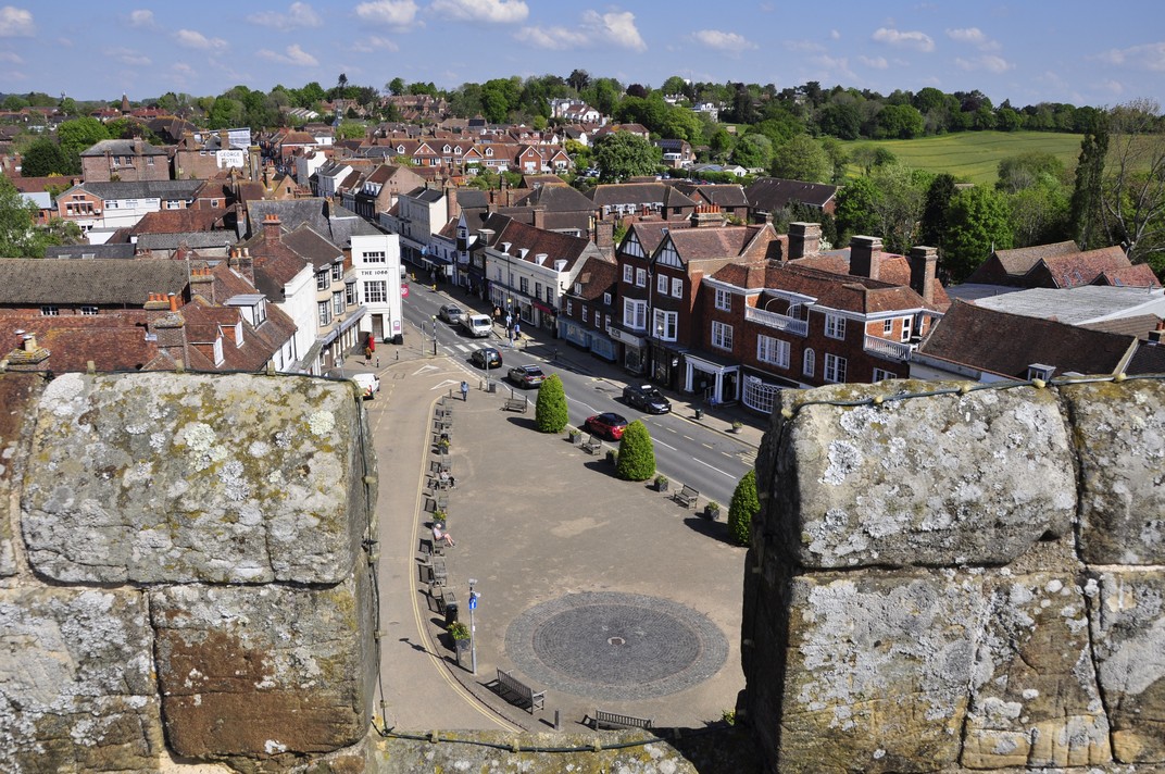

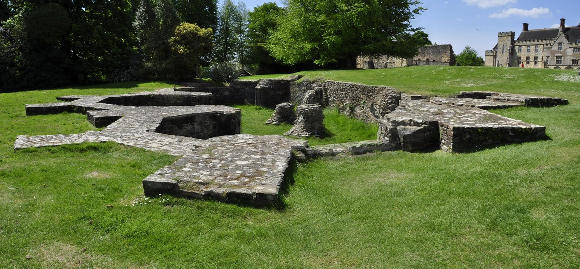
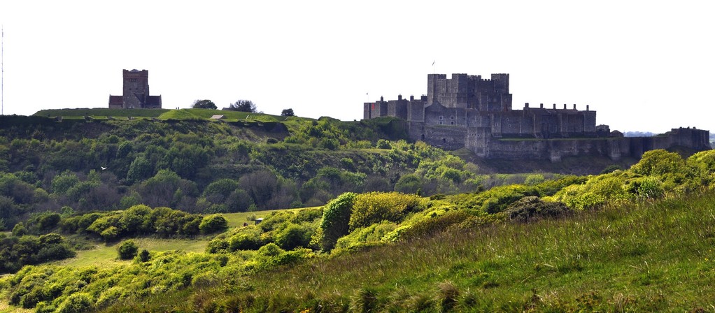
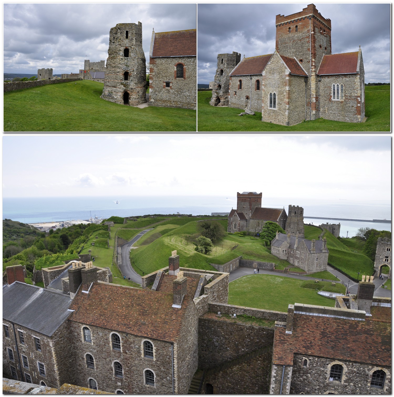


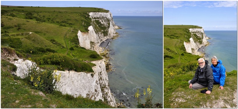
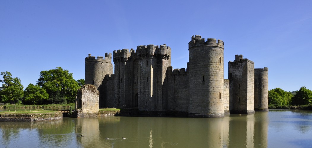


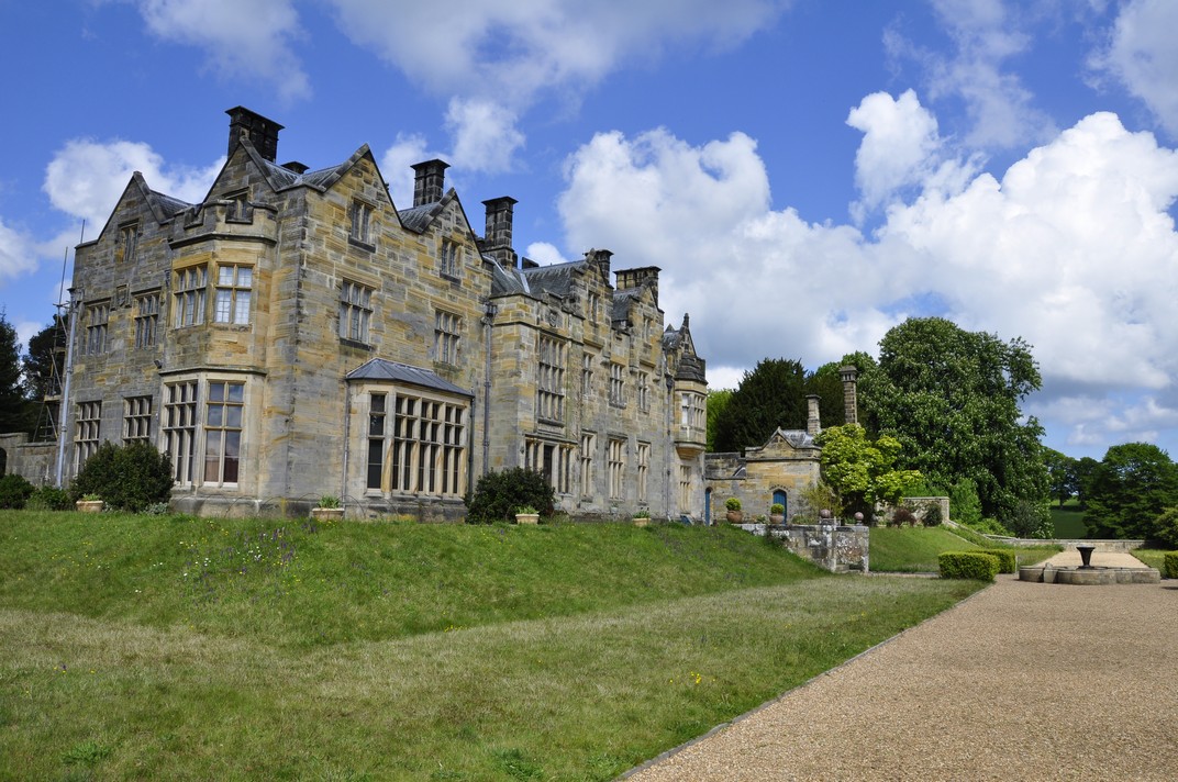
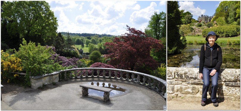


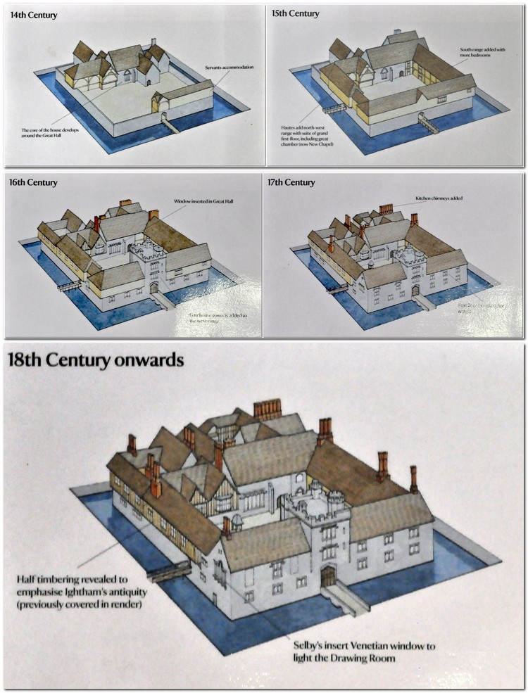


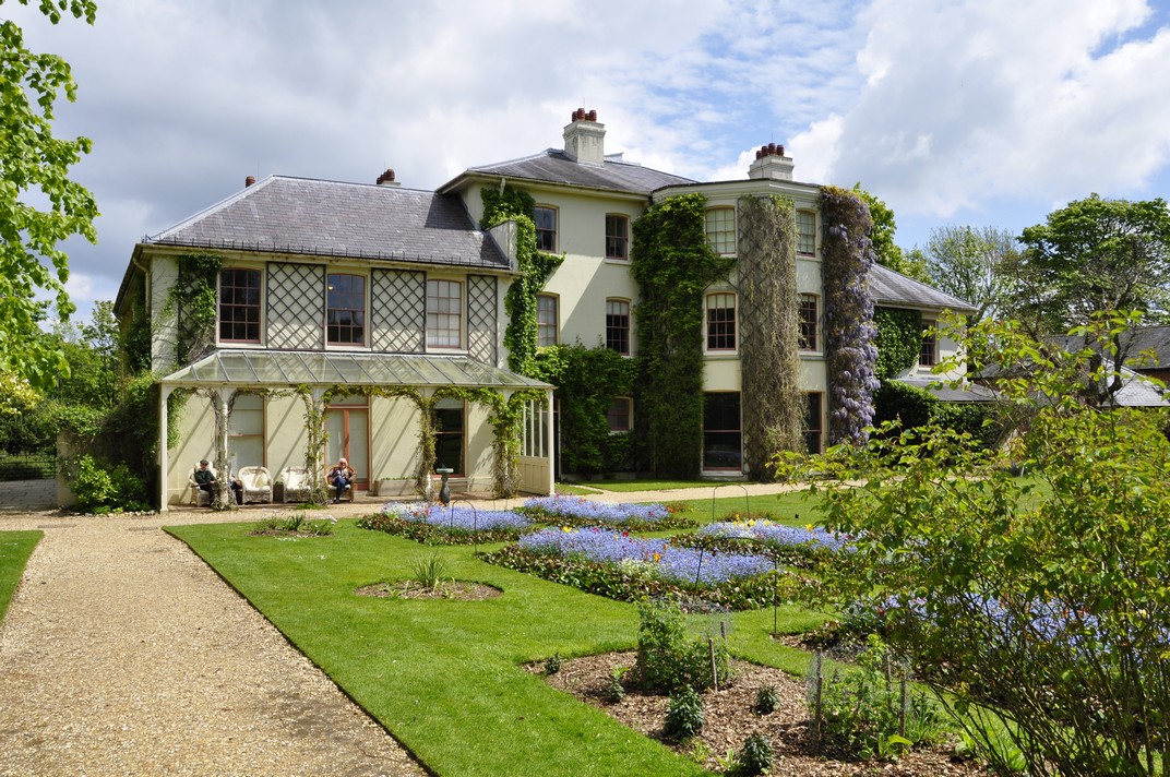
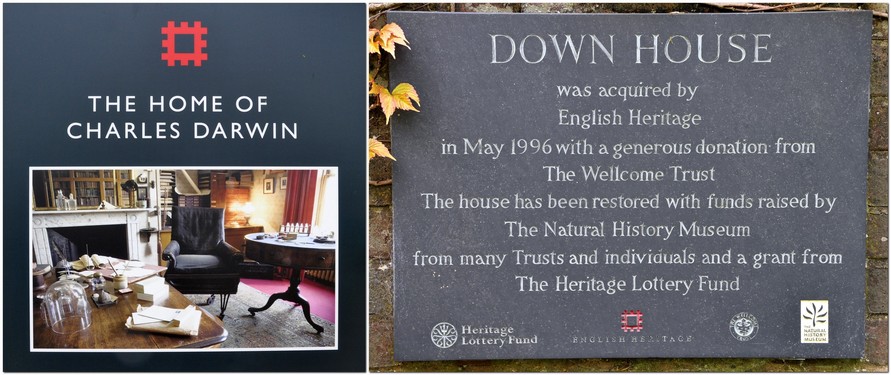


.jpg") So wrote Rudyard Kipling in his 1911 poem
So wrote Rudyard Kipling in his 1911 poem 


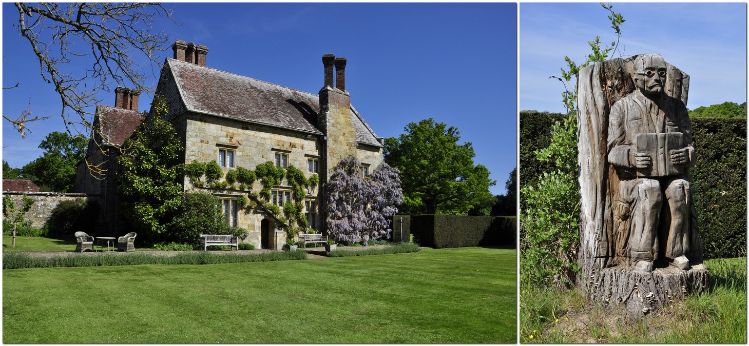


 On the upper floor, the main rooms are Kipling’s study, and John’s bedroom. Another room is full of Kipling memorabilia, including his Nobel Prize citation.