Built by Walter MacGeough Bond in the 1820s along the banks of the River Blackwater in Co. Armagh, The Argory was the fourth National Trust property we visited during our recent tour of Northern Ireland.
The estate was in the family since the 1740s. The family name was originally just MacGeough, but Bond (the maiden name of the grandmother of Walter) was added by Royal Licence in 1824. Walter was the fourth child of Joshua McGeough of Drumshill. Because of particular restrictions in his father’s will, Walter did not inherit Drumsill House (now a hotel), so invested in expanding his estate at The Argory. It remained the family home until 1979, and its interiors have remained unchanged since 1900.
The main entrance on the west front
The east front entrance, used increasingly as there was better coach access
The hallway from the west entrance catches one’s attention immediately. There is a spiral cantilever staircase, one of the finest examples I think I have ever seen. A large stove dominates the floor space; electricity was a late introduction to The Argory.
Off the hall is the dining room, and a very fashionable drawing room off to the other side, with several pieces of outstanding furniture, including Italian marble top tables.
Upstairs, the landing is dominated by an organ.
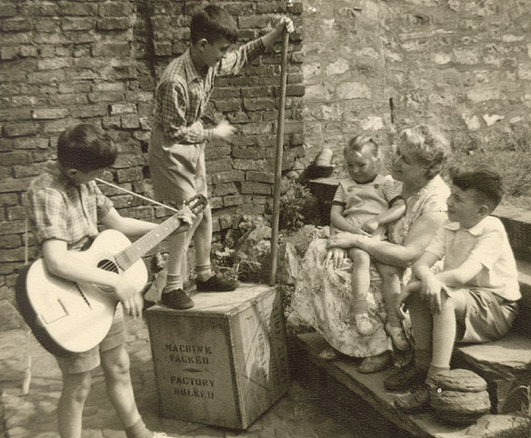
In one of the bedrooms, a story about the second owner Ralph (Walter’s second son), also known as Captain Shelton, is captured in a painting (a copy of the ca. 1892 original by Thomas Hemy) of the sinking of HMS Birkenhead, a troopship that foundered off the coast of South Africa in February 1852. You can see it on the wall to the left of the bed.
Captain Shelton was on board – and survived. He is depicted as the officer on the right hand side carrying two small children. On the other side of the deck the troops line up in a disciplined way, allowing the women and children into the life boats, the first instance of ‘women and children first’ enshrined in what became known as ‘the Birkenhead Drill‘. Only 193 (out of almost 650 persons on board) were saved.
The Argory is a beautiful house, quite understated on the outside, but a feast for the eyes awaits within. We enjoyed our visit, having combined it with a visit to Springhill House earlier that same day. National Trust volunteer Rosheen was an excellent guide.
We landed in Dublin just after noon, taking the M50 tunnel to cross the city northwards to Northern Ireland.
We were headed to Ardboe and the west shore of Lough Neagh, where we had booked a seven night stay at a guesthouse there. Our route north took us past three of the National Trust properties that were on our list for our week-long holiday. We initially intended just to visit Derrymore House, a few miles west of Newry in Co. Armagh, then head off to Ardboe. But we found that we could also spend a couple of hours at Ardress House. And, as it turned out, there was a loose link between the two properties.
Derrymore House is only open on five afternoons a year. The National Trust rents it out as a private residence, and only one room, the so-called ‘Treaty Room’ is open to the public on these days, although there is year round access to the grounds.
Derrymore House is an eighteenth century thatched cottage, ‘in a landscape demesne’, built on land inherited from his father by Isaac Corry, born in Newry in 1755, who became MP for that city in 1776 in the Irish House of Commons. At that time, Great Britain (England, Wales and Scotland) and Ireland were separate kingdoms until the Act of Union was signed in 1800, coming into effect on 1 January 1801. Corry was Chancellor of the Irish Exchequer and government spokesman for the Act of Union.
Cottages of this type were often built just for show, to enhance a landscape, to be used for recreation. It seems, however, that Derrymore was used as a residence on a continual basis. In fact, when Chancellor of the Irish Exchequer, Corry introduced an unpopular window tax, and his coach was stoned by residents near Newry on the road to Dublin, he had a by-pass road built to avoid such confrontations.
There is anecdotal evidence to suggest that the 1800 Act of Union was drafted in the ‘Treaty Room’.
There is a black and white photo among the National Trust’s information showing a fine Irish harp table, made by James Flood in 1799, which is purported to have some connections with the 1800 Act of Union¹. No longer at Derrymore, it now can be seen at Ardress House, less than 30 miles north, and which we visited that same afternoon.
Although photography is not normally permitted inside the house, I was given special permission (for which I am most grateful) to photograph this beautiful piece of Irish craftsmanship. It’s a feast for the eyes, with marquetry of the highest quality, showing the rose, thistle, and shamrock of England, Scotland, and Ireland, respectively (what about the poor Welsh?) inlaid in the table top. The support for the table is in the form of a shamrock, and an Irish harp is also part of that support.
Ardress House was a 17th century farmhouse, nestling in 40 acres of farmland, in the apple orchards of C. Armagh that was remodelled and embellished in 1760 by Dublin chief architect Charles Ensor. His family originally came from Coventry (some 35 miles from where I live in Worcestershire), and he married the heiress of Ardress, Sarah Clarke.
It’s quite easy to see the differences between the two phases of building: lower ceilings and smaller rooms in the 17th centry farmhouse parts; higher ceiling, Neo-Classical design in those from the 18th century.
But Ardress does have another interesting feature: a perfect traditional farmyard. Just like the ones I remember from my childhood when visiting my grandparents in rural Derbyshire.
Such was the start to our Northern Ireland National Trust adventure. The omens were good the following days!
~~~~~~~~~~~~~~~~~~~~~~~~~~~~~~~
¹ There is no evidence it was ever used to sign the Act of Union. However, King George V signed the new constitution of Northern Ireland on this table in Belfast in 1921. For many years, it was ‘lost’ in storage in England, before being returned to Ardress House in 2006.
I’ve been very fortunate (and privileged) to have visited many places of interest all over the world: Machu Picchu in Peru; the temples of Tikal and Angkor Wat in Guatemala and Cambodia, respectively; some of the world’s iconic cities like New York, Sydney, and Hong Kong, to name just three; and many of the wonderful parks and monuments throughout the USA, such as the Grand Canyon, Devil’s Tower, or Crater Lake. I’ve written about these, and many others, in this blog.
But there is one place, much closer to home, that I wanted to see as long as I can remember. And that place is the Giant’s Causeway, on the north coast of Antrim in Northern Ireland. Last week I was finally able to tick the Giant’s Causeway on my travel bucket list.
Steph and I have just returned from a week-long road trip to Northern Ireland, mainly to visit most of the properties owned by the National Trust over there. We actually got to visit nine houses, one garden, and the Giant’s Causeway.
It took a little under two hours to drive north from our guesthouse in Ardboe, beside Lough Neagh, to the Visitor Centre – mainly because we decided to take back roads to avoid the expected early morning congestion around Coleraine, and also because we missed one turn and found ourselves heading east instead of north, delaying about 15 minutes as a consequence.
It must have been around 10:30 or so when we parked, and already the site was busy. The Giant’s Causeway is a UNESCO World Heritage Site, and attracts visitors—by the coach-load—from all over the world, most of whom (not being National Trust members) must handsomely boost the National Trust’s finances. I was surprised to note how many Chinese visitors we met at the Causeway.
The National Trust has built a fine Visitor Centre, with its gift shop and cafeteria, and many exhibits describing the geology and history of the site.
I was surprised how much limestone and chalk can be seen on the north Antrim coast, having been protected, as it were, by an overlay of volcanic rocks. Interesting geology!
It’s the volcanic history that we see at the Giant’s Causeway, an outcrop of beautiful pentagonal and hexagonal basalt columns, stretching from the shore northwards into the incoming tide.
You have to walk just under a mile from the Visitor Centre down the cliff face to reach the Causeway itself. Fortunately, the National Trust does provide a regular shuttle bus service back up, free to members. We were happy to take the bus after wandering over the Causeway for well over an hour.
But the Causeway is not the only landscape attraction. The spectacular cliff backdrop to the landscape just adds that extra grandeur and mystery. Old Irish myths spring to mind! We also took a walk on Runkerry Head (on the left of the map below) so that we could view the Causeway from a distance through a gap in the next headland east (between Portnaboe and Port Ganny). In the far distance the crags of The Amphitheatre just add to the drama.
Looking east from Runkerry Head towards The Amphitheatre (in the far distance) and the Giant’s Causeway that can be seen through the gap in the next headland. The road down the cliff passes through that gap.
With some clever angles and hiding behind various basalt columns I was able to take most photos without any tourists showing, despite there being several hundred or more there at the time. I was also a little surprised at how small an area the Giant’s Causeway covered, but I guess that as the tide was in (or coming in) more would be exposed at low tide. I’m quite happy with my photos, but I have seen several more spectacular photos of the Causeway taken at dawn or sunset.
The Giant’s Causeway is certainly an impressive landscape. If you do plan a visit, do check the weather forecasts carefully. Although mainly overcast, we did have some sunny weather. Half an hour after we left, heading further east and south on the Antrim coast, the heavens opened, and visitors to another National Trust site, the Rope Bridge (where we stopped for a picnic only) were probably soaked to the skin, with the weather turning in the bat of an eyelid. Further south, the chalk is exposed at a number of points including here at Garron Point (map).
Well, if I count the visit to Plas Newydd on the southern shore of Anglesey, on the way to Holyhead to catch the ferry over to Ireland, Steph and I visited twelve National Trust properties in eight days.
We have wanted to visit Northern Ireland for many years, but until now never really had the opportunity, or we felt that the security situation didn’t make for a comfortable visit. All that has changed. Now retired, we have time on our hands. ‘The Troubles‘ are a thing of the past (fortunately), and the Peace Process in Northern Ireland has transformed the opportunities for that part of the United Kingdom.
Being members of the National Trust, and knowing that there were some splendid houses to see over in Northern Ireland, as well as some Trust-owned landscapes such as the spectacular Giant’s Causeway on the north Antrim coast, this was just the incentive we needed to decide, once and for all, to cross over to the island of Ireland again. We have visited south of the border several times. I first went to Co. Clare in 1968, and Steph and I had holidays there traveling around in 1992 and 1996.
Planning the trip – finding somewhere to stay
For a number of recent holidays, I have used booking.com to search for hotels when I was planning our road trips across the USA. So I used this company this time round when looking for an overnight stay in Holyhead, convenient for the ferry to Ireland early the next morning.
In Northern Ireland we were looking for somewhere central from where it would be a relatively easy drive each day to any part because the National Trust properties we wanted to visit were scattered all over (as shown in the map above). After reading various online reviews (are they always reliable?), and looking for value for money, we chose The Drummeny Guest House in Ardboe, Co. Tyrone (Mid-Ulster council district), on the west shore of Lough Neagh.
Me and Tina Quinn on the morning of our departure from The Drumenny Guest House
What a find! Our hosts, Tina and Damien Quinn, were the best. What a friendly welcome, and hospitality like you would never believe. The reviews on booking.com were all very positive. Were they accurate? Absolutely! In fact, our experience was even better than previous reviewers had described. Such a breakfast (full Irish), and lots of other extras that Tina provided. In fact, staying with Tina and Damien it felt as though we were staying with family, and a week at The Drumenny was better than we ever anticipated. So, if you ever contemplate a Northern Ireland holiday, there’s only one place to head for: The Drumenny Guest House in Ardboe. You won’t be disappointed.
Less than a mile away there’s a good restaurant, The Tilley Lamp, that serves good, simple food, and lots of it. Very convenient.
Day 1: 8 Sep — home to Holyhead, via Plas Newydd (168 miles; map) Our Northern Ireland trip started just after 09:15, and because of major road works (and almost certain traffic congestion) we decided to travel northwest from Bromsgrove via Kidderminster and Bridgnorth, before joining the A5 south of Shrewsbury. We then continued on the A5 through Snowdonia, and over the Menai Strait to Plas Newydd House and Gardens, just a few miles west of Llanfairpwllgwyngyllgogerychwyrndrobwllllantysiliogogogoch.
Home to the Marquesses of Anglesey (descendants of the 1st, who as the Earl of Uxbridge, served alongside the Duke of Wellington at the Battle of Waterloo, and had his leg blown off by a cannonball), Plas Newydd stands on the shore of the Menai Strait that separates Anglesey from mainland Wales.
Day 2: 9 Sep — Dublin to Ardboe, calling at Derrymore House near Newry, and Ardress House (120 miles), Co. Armagh
Our Stena Line Superfast X ferry arrived to Dublin Port on time, just after noon, and we quickly headed north on the M1, crossing into Northern Ireland just south of Newry in Co. Armagh.
Derrymore House lies a few miles west of the A1, and is open for just five afternoons a year. That was a piece of luck that we happened to pass by on one of those days. It’s a late 18th century thatched cottage. The ‘Treaty Room’ is the only room open to the public, and the 1800 Act of Union uniting the Kingdom of Great Britain and the Kingdom of Ireland is supposed to have been drafted there.
Further north, and the route to Ardboe, we also visited Ardress House, built in the 17th century, and embellished in the 18th. It has a traditional farmyard.
We arrived to our guesthouse around 18:00, and enjoyed a meal out that evening at The Tilley Lamp. The best pork chops I’ve ever tasted.
Day 3: 10 Sep — Ardboe Cross, Co. Tyrone, Springhill House, Co. Londonderry and The Argory, Co. Armagh (53 miles)
Sunday morning. We decided to briefly explore the Lough Neagh shore near Arboe, and see one of Ireland’s national monuments, the Ardboe Cross.
The Argory is just 20 miles south of Springhill, and was built in the 1820s and was the home of the MacGeough Bond family, and has remained unchanged since 1900. It has magnificent interiors, particularly the cantilevered staircase.
Day 4: 11 Sep — Florence Court and Crom Castle, Co. Fermanagh (169 miles) Florence Court is the furthest west of all of the National Trust’s properties, a few miles southwest of Enniskillen in Co. Fermangh. It was the home of the Earls of Enniskillen, and was built in the 18th century. There are beautiful views of the nearby mountains from the front of the house. Inside, where photography is not permitted, the walls and ceilings have some of the finest stucco plaster work I have seen. In 1955 there was a disastrous fire and it’s credit to the National Trust how well they accomplished the refurbishment. Remarkably many of the precious items in the house were saved.
On our route back to Ardboe, we diverted to make a quick visit to the ruins of Crom Castle, on the banks of Upper Lough Erne. There was time for a walk to the ruins from the Visitor Centre before it closed for the day, and approaching showers drenched us. There were some lovely views over the lough to Creighton Tower.
We also saw how convoluted the border is between Northern Ireland and the Republic. Sorting that out during the Brexit negotiations will be a challenge, nightmare even, and so unnecessary. It is an invisible border, and hopefully obstacles will not be put in place by this incompetent Conservative government that will undermine the economic and social progress that Northern Ireland has made in recent years. This story on the BBC website (20 September) has a video of the very road we took back to Ardboe between the counties of Fermanagh (Northern Ireland) and Monaghan (Republic).
Day 5: 12 Sep — Giant’s Causeway and the Antrim coast, Co. Antrim (162 miles)
The Giant’s Causeway has long been on my Bucket List of attractions to visit. And we weren’t disappointed. We had carefully monitored the weather forecasts and chose what we hoped would be the best day of the week. In general it was. The drive north from Ardboe took just under 2 hours. We passed through the small town of Bellaghy, Co. Londonderry, burial site of Nobel Literature Laureate Seamus Heaney. I wish we had stopped.
Although it was not yet 10:30 when we reached the Visitors’ Centre at the Giant’s Causeway, it was already very busy, and just got busier over the three hours we stayed there. There were visitors from all over the world – particularly from China.
It’s a walk of more than a mile down the cliff to the actual Causeway, so we took a leisurely stroll there. But we did take advanatge of the free bus ride (as National Trust members) to go back up the cliff road.
We then headed east along the north Antrim coast, and stopped for a picnic at the Rope Bridge car park where a torrential downpour spoiled the view and prompted us to move on rather than have a wander around. Then we headed down the east coast on a road that hugs the bottom of cliffs along the seashore, before reaching Larne and then heading west around the top of Lough Neagh and home to The Drumenny.
Day 6: 13 Sep — Mount Stewart, Co. Down (127 miles)
On the northeast shore of Strangford Lough, just south of Newtownards, the Mount Stewart estate was purchased in the mid-18th century, and became the home of the Marquesses of Londonderry when the current house was built at the beginning of the 19th century. It has a beautiful formal garden, mostly the work of Lady Edith, wife of the 7th Marquess.
Day 7: 14 Sep — Castle Coole, Co. Fermanagh, Donegal (Republic of Ireland), and the Sperrin Mountains in Co. Londonderry and Co. Tyrone (200 miles)
On Day 7, we headed west once again to visit Castle Coole, situated just outside Enniskillen. We were not able to visit there when we had travelled west on Day 4, as the property had been closed for a special BBC Proms in the Park event.
Castle Coole was built by the 1st Earl Belmore between 1789 and 1797. It’s mostly the design of famous English architect James Wyatt, who also designed much of the interior and even the furniture. Photography is not permitted inside, and I’m unable to show you some of the splendours of this house, particularly the Saloon, which must rank as one of the finest examples of its kind among any of the stately homes in this country. The current Earl Belmore resides in a cottage on the estate.
Leaving Castle Coole, we headed west into the Republic, turning north at Donegal and crossing back into Northern Ireland at Strabane. We decided to cross the Sperrin Mountains, and had the weather been better (much of the journey north of Donegal was in torrential rain), I could have taken some nice photos. But we did have one surprise. Having taken one wrong turn too many when road signs petered out, we stumbled across a Bronze Age site of stone circles and cairns, at Beaghmore. It had stopped raining, everywhere was sparkling in the evening sun, and we enjoyed a half hour walk around the site.
Given the sunshine and showers, conditions just right for the appearance of rainbows. We saw ten throughout the day, some double.
Day 8: 15 Sep — Rowallane Garden and Castle Ward, Co. Down (136 miles)
Just south of Saintfield alongside the A7, Rowallane Garden is a haven of tranquility, about 50 acres, created in the mid-19th century by the Revd. John Moore and his nephew Hugh Armytage Moore. It’s also the headquarters of the National Trust in Northern Ireland.
Then we headed the further 16 miles southeast to Castle Ward on the tip of Strangford Lough. It’s an extraordinary building: Neo-Classical Gothic! The two architectural styles are reflected on the front and rear of the building, and mirrored inside, because, it is said, the 1st Viscount Bangor and his wife could not agree.
The Ward family, originally from Cheshire, settled here in the late 16th century, and there is an old castle on the estate – used in the hit HBO TV series Game of Thrones.
Steph (L) and Clare at Kilmacurragh Botanic Gardens
Day 9: 16 Sep — Arboe, Co. Tyrone to Rathdrum, Co. Wicklow (224 miles)
We travelled south into the Republic, taking a winding route through Co. Monaghan, Cavan, Longford, Westmeath, Offaly, Kildare and Wicklow to spend the night with old IRRI friends Paul and Clare O’Nolan. Paul had been the IT Manager at IRRI; Clare was my scuba dive buddy (video) for several years. On the evening of our arrival, Clare took us on a tour of the Kilmacurragh Botanic Gardens close to where they live on the edge of the Wicklow Mountains.
Day 10: 17 Sep — Rathdrum to Dublin, Holyhead to home (235 miles)
We left the O’Nolans just before noon, and headed north around the M50 to Dublin Port for our 15:10 Stena Superfast X ferry to Holyhead. We disembarked at exactly 19:00, and the drive home to Bromsgrove took four hours. Fortunately the roads were quite quiet and we made reasonably good progress until we were less than 20 miles from home when we were slowed down by major roadworks on the M5 motorway.
Ten days away, 1594 miles covered, twelve National Trust properties visited, seven enormous Irish breakfasts enjoyed. Northern Ireland was everything we hoped for: beautiful landscapes and friendly people. We had delayed our visit there for too long. And the National Trust was our excuse, if one was needed, to make the effort to visit.
All in all, ten days well spent! Here are the detailed posts for the properties:
Witley Court. Just a few miles west of Droitwich in north Worcestershire. A shell of a ruin, having been destroyed by fire in 1937. It had been the home of the Earls of Dudley.
The grand entrance to Witley Court, with the Church of St Michael and All Angels to the right
Witley Court, fountain and gardens from the south. The golden dome of the Baroque Church of St Michael and All Angels can be seen to the rear on the left
I’m not sure who actually owns Witley Court today; it’s managed by English Heritage. And being just 30 minutes by car from home, we consider it as one of our ‘local’ heritage destinations. We’ve been visiting Witley Court since the 1980s. Then it was freely open to the public. There was no paid access as there is now. Alongside the ruin stands the proud Baroque Church of St Michael and All Angels, not actually part of the English Heritage management of the site, and still in use as a parish church to this day. It must boast one of the most illustrious interiors of any church in the country.
Anyway, to cut a long story short, and it being a fine bright day yesterday, we decided to make another visit, have a walk through the grounds, see the Perseus and Andromeda Fountain fired up (every hour on the hour from 11 am onwards, for about 15 minutes), have a picnic lunch, and still have an afternoon to spend at home. I didn’t feel like making a long journey as we will be off to Northern Ireland a week hence, exploring that Province and all the National Trust treasures it has to offer.
And wandering around the grounds, I took time to carefully read the various information signs that I hadn’t bothered with in the past. And I learnt several new things about Witley Court.
There’s been a house on the site for several hundred years, being transformed from a relatively modest 17th century Jacobean mansion, to the magnificent, somewhat ostentatious Victorian mansion, the ruins of which are still standing.
One of the glories of Witley Court today is the East Parterre. Planted with a variety of plants, the lavender was past its best, and perhaps the overall was not as vibrant as when we saw it in 2016, almost exactly one year ago.
After the 1937 fire, most of what was not damaged was stripped from the house. The grand conservatory on the west side of the house was not damaged in the fire, but was nevertheless stripped. Today it’s planted with lavender, and gazing through the empty windows towards the Perseus and Andromeda Fountain, one can imagine what the house must have been like in its heyday.
Probably the most admired feature at Witley Court is the Perseus and Andromeda Fountain, that was completely refurbished in 2003 (at quite a staggering cost, more than £1 million). But it was worthwhile. It’s magnificent! It was undergoing further renovation in August last year when we visited, but was re-opened in April this year.
There are also woodland walks, taking around 30-40 minutes, the ubiquitous shop, and a tea room is open at the church (but not managed by English Heritage). Entrance to the church is, by the way, free.
To appreciate more fully what the Witley Court estate and ruin looks like, I came across this aerial video on YouTube, taken by drone.
A week ago, Steph and I headed 100 miles northeast from home to visit Belton House in Lincolnshire. On Thursday, it was 75 miles northwest, just south of Wrexham in North Wales, to visit Erdigg Hall, a Restoration house built between 1684 and 1687, and standing in 1200 acres. It was the home to the Yorke family for 250 years, although it didn’t come into their possession until 1733. Seven generations! Here is an interesting Erddig timeline.
Interestingly, we discovered a family connection between the Yorkes of Erddig and the Custs of Belton. Elizabeth, daughter of Sir John Cust, Speaker of the House of Commons, married Philip Yorke I in July 1770, three years after he inherited Erddig. Philip Yorke I was author of the The Royal Tribes of Wales, published in 1799.
Erddig (pronounced Erthigg) is a veritable Aladdin’s Cave. Over the centuries, the Yorkes hardly threw anything away; what’s on display today at Erdigg is a fraction of what the National Trust has in storage (more than 30,000 items). There are even vintage cars and old bicycles in some of the outbuildings. In that respect, Erddig must be almost unique among National Trust properties in that all its contents are ‘original’ – somewhat like Calke Abbey in Derbyshire.
The main entrance of Erddig Hall, facing west towards the Welsh hills
This is the rear of the house, facing east, overlooking the formal gardens and lake.
In 1947, disaster almost struck. Following nationalization of the coal industry, the coal mines just beyond the Erddig estate began to mine underneath the house – contrary to what had been apparently agreed over decades if not centuries with the owners of the private mine. The result was massive subsidence, up to five feet on one side of the house. Faced with significant expenditures to make the property safe and not falling into further disrepair, and with no family to pass it on to, the last Squire, Philip Yorke III bequeathed the estate, house and all contents to the National Trust in 1973.
It took four years to carry out all the work necessary to the house, and rehabilitate the gardens. In June 1977, Erddig was opened to the public. This is Erddig’s Ruby Jubilee, 40 years. And the planting designs in the formal garden reflect this, as you will note from many of the photos I have chosen to illustrate this post.
Structurally, the house is aligned north-south, and is a long ‘thin’ building, with a line of rooms along each side and a narrow corridor in between. There’s a grand staircase at the northern end, leading down to the family chapel. Stairs at the south end gave access to all floors for the servants.
A fine complex of red brick out buildings is located on the south side of the house, with a sawmill, workshops, stables and a coach house among others.
Delightful, formal gardens are laid out to the rear (east side) of the house. It’s hard to imagine what the overgrown gardens must have looked like when the National Trust took over Erddig. The fruits of 40 years labour and TLC are apparent in abundance. There are more extensive walks through the park, but we didn’t take any of these.
The National Trust has carefully laid out a route for visitors to enjoy Erddig Hall. The entrance to the house is through the ‘working’ wing of the house through the bakery, scullery and laundry, along a servants’ passage with offices for the housekeeper, butler, and estate manager.
Entrance to the house through the servants’ quarters
Housekeeper’s room
Estate manager’s office
Kitchen
Refrigerator
Scullery
Laundry
Laundry
Bakery
What is also interesting is that the Yorkes ‘celebrated’ their staff, and apparently were very conscientious for their welfare. The servants’ passage is lined with photos of servants from as early as the mid-19th century.
One of the most striking rooms on the ground floor (at the south end, and east side) is the Dining Room, with its pillars and impressive paintings.
Further along are the Saloon (with its unusual metal ceiling), the Tapestry Room, Chinese Room and Chapel.
Saloon
Tapestry Room
Saloon
North staircase
Chapel
Chapel
Chapel
On the front of the house are the Library, the Entrance Hall (Music Room), and Drawing Room.
Library
Entrance Hall / Music Room
Music Room
Charles II
Judge Jeffreys of the Bloody Assizes
Drawing Room
Drawing Room
Central corridor
On the First Floor are several bedrooms: Red, White, and Blue as well as the State Bedroom with some of the Hall’s oldest artefacts; and the Nursery. There is also access to attic bedrooms on the top floor.
Red Bedroom
View of garden from Red Bedroom
White Bedroom
Attic Room
Attic Room
Nursery
State Bedroom
Blue Bedroom
Erddig was so much more than we expected, and well worth the two hour plus travel time from north Worcestershire. I think we were lucky to hit the gardens at just the right time of the season. Everything was at its best and in full bloom. Credit goes to the Erddig garden staff.
Squire Philip Yorke III must have been quite a remarkable man. He died peacefully while attending a church service, in 1978. These quotes from his diary sum up the Yorke family outlook on life.
Letters will be dropping through mailboxes all over England and Wales this week. High school students are anxiously waiting for their Advanced or A Level exam results. Fifty years ago I was in the same boat.
I’d sat my exams—GCE A Levels in Biology, Geography, English Literature, and General Studies (set by the Joint Matriculation Board)—a few weeks earlier in June, just as the Six Day War broke out between Israel and its Arab neighbours.
Then it was the long wait, constantly full of nagging doubts that I would make the grade to get into university. I nearly didn’t!
I had received offers of places at King’s College and Queen Mary College, University of London, and the University of Southampton. But I’d already decided that if I met their offer (of three Cs) I would accept the place at Southampton to study for a BSc Combined Honours degree in Botany and Geography.
To fill in the time, I took a summer job working as a driver’s mate on lorries (trucks) delivering butter all over the country for Adams Butter, a local company in my home town of Leek in north Staffordshire. Anyway, about a week after I’d received my exam results, having arrived back at the Adams depot late one afternoon from a trip to Liverpool, the supervisor handed me a message that my dad had left there during the course of the day. The message was short and sweet: Southampton wants you! What a relief!
And it really was a relief, because my exam results were not quite up to snuff. Just Grade C for Biology and Geography, and Grade E for English Literature and General Studies. I hadn’t quite met the Southampton offer. However, Lady Luck must have been on my side, because I was accepted on to the course, and duly set of for Southampton in early October to join four other students on the same course.
Burning the candle at only one end
I was not a good student, but I did enjoy being at university.
I scraped through a Geology course in my first year at Southampton. One of the other Botany and Geography students (I only remember he was another Michael, and he came from Birmingham) failed that course, and since there were no re-sit exams in those days (1968), he had to withdraw. Now we were four.
Come Final Exams (or Finals) in May 1970, I was awarded a Lower Second Class degree (often denoted 2:2 or 2ii), with an overall score of 58% apparently, just shy of the Lower Second / Upper Second boundary of 60%. My classmates, John, Stuart and Jane, were awarded Upper Seconds.
Now I should add, for the benefit of my readers outside the UK, that exams are marked on a scale of 1 – 100%, right across the scale. At university, the pass mark was 40%. A First Class degree merited 70% and higher. There were no transcripts, just an overall classification (such as First, Upper Second, Lower Second, etc.) that, for reasons I’ll mention shortly, is increasingly falling out of favour. Fortunately when I was an undergraduate, Finals exams were based just on the courses taken in the third or final year of the degree course. I’m not sure when the changes were made, but in earlier years, Finals were often based on courses taken throughout the whole degree course over three years.
In February 1970, I had applied for a place on a recently established MSc Course on Conservation and Utilization of Plant Genetic Resources in the Department of Botany at the University of Birmingham under the direction of Professor Jack Hawkes. Once I had my BSc under my belt I had to wait for a confirmation from Birmingham. Professor Hawkes very quickly told me that he would take me on the course despite my 2:2, but funding was a problem. No student grant available. I didn’t hear back from him until late August or early September that he had been able to find a small maintenance grant (just sufficient to keep body and soul together), and that my tuition fees would be paid by the university.
I redeemed myself at Birmingham. The course was all I expected, the subject matter fired my enthusiasm and, for the first time, I learned how to study efficiently, and take and pass exams with flying colours. The rest is history. Professor Hawkes took me on as his PhD student, and I started a great career in international agricultural research.
I remember leaving his office after I had successfully defended my thesis in October 1975. I think I must have danced a little jig down the corridor, reflecting that I had just taken (and passed) my last exam. Ever! Now that really was a milestone.
The tables turned
Less than six years later, in April 1981, I returned to Birmingham as Lecturer in the Department of Plant Biology (Botany having changed its name in the interim). As a faculty member I developed and taught various courses at undergraduate and postgraduate levels, setting and marking exams for each.
There is growing concern about grade inflation, and the number of top degrees that are now being awarded. In my graduation year (1970) at Southampton, there were no Firsts in Botany, and from a class of maybe 40 Geography undergraduates, there were only two. There were certainly more 2:2s awarded that 2:1 degrees.
That’s not the case today; most undergraduates obtain a top degree. Remarkable! Does that mean they are better students than we were? Perhaps. It might also reflect more generous decisions while marking exam papers, some justified no doubt, others not. Let me explain.
In the UK, undergraduate degree courses and exams are monitored by External Examiners, with the aim of ensuring standards and equability across universities and degree courses. When it came to Finals exams and course work for the Biological Sciences degree at Birmingham, we marked on a 15 point scale, with 13 and above equating to a score of 70% plus or First Class. I didn’t mark my first Finals papers until May/June 1982. Even then, External Examiners were questioning the low number of First Class degrees being awarded in Biological Sciences, and encouraged staff to use the whole marking range. Many staff were reluctant to awards marks higher than 13 (70-75%) for work that clearly merited a higher mark for a First Class answer. As final degree classification was based on the aggregate score for all examinations taken, higher scores in one would compensate for any lower ones elsewhere with, of course, a minimum number of First Class marks having been awarded. Awarding scores of 14 and 15 was, for some, a tough examination culture change.
On reflection, I did not find it that challenging to assign appropriate marks. I remember giving one second year undergraduate a score 0% for his answer to a question about breeding systems in flowering plants and their relevance to taxonomy. His answer consisted of a single paragraph about goldfish!
On another occasion I gave a score of 100% to one of my MSc students (who subsequently went on to complete a PhD under the supervision of my colleague Brian Ford-Lloyd and myself). 100%? Is that really possible? As I reviewed her answer to a question about the origins of agriculture, I came to the conclusion that it was as good as anyone might be expected to achieve. It was a consistent and well-reasoned discussion that I could not fault, especially since there was only one hour in which to answer.
Students are perhaps under greater pressure today than my generation was. Everyone needs—and probably expects—a top degree. But I find it hard to believe that half a class of students merit a First Class degree. I think it’s about time that we adopted a detailed transcript system (I know there was talk of this at Birmingham after I left in 1991), that provides documentary evidence of a student’s strengths and weaknesses, if any.
Schools are under pressure to ensure that students achieve the minimum expected grades in their GCSE exams. Universities want to demonstrate their academic worth, leading to better employment prospects for students with top degrees. It’s an academic rat race, and one that I’m glad to have left behind many years ago.
Built in the 1680s for Sir John Brownlow, Belton House is an elegant Restoration mansion that retains much of its original structure externally, but which has been remodelled from time-to-time internally over the past 300 years to meet changing demands for its occupancy. English architect James Wyatt had a major influence on the redesign of parts of Belton House in the late 18th century, as he did on many country houses.
The Brownlow fortune came from sheep and wool and, like may wealthy families, the construction of a large home was a sine qua non. Belton House remained the family seat of the Brownlow and Cust families into the 1980s.
The south front – and main entrance – of Belton House
The north front overlooking a parterre garden
We visited Belton House last Friday. Since we became members in 2011, we have ‘picked all the low-hanging fruit’, more or less (visiting most if not all properties within 50 miles or so of home), so must now travel further afield as active (and enthusiastic) ‘Trusters’.
Belton House is almost exactly 100 miles from home, door-to-door. The ‘best’ route (A38-M42-M6-M69-A46-A52-A607) on Google Maps indicated a journey of about 1 hr 40 minutes. And that’s how long it took (although somewhat slower on the return journey after 2:30 pm as the Friday afternoon traffic picked up).
Belton has much to offer: the house itself, formal gardens, long walks through the park, and one of the Trust’s largest adventure playgrounds for children. No wonder the car park was quite full when we arrived before 11 am, and filled up even further by mid-afternoon.
Not being entirely sure of the weather on Friday (fortunately it remained dry although did become quite overcast for a while around noon), we decided to take in the gardens and the grounds close to the house as far as the Boathouse, Lake and Maze (17 on the map below).
The Boathouse was built in the 1820s in a Swiss chalet style. From a distance the walls appear to be made from woven panels of rushes or the like. But no, the walls are solid with a sculpted surface to resemble panels.
A short distance from the east face of the house is the Mirror Pond (16), from which the house can be seen in all its glory, and reflected in the Pond.
A small maze offers a challenge to many of Belton’s younger (and older) visitors.
To the east of the house a long avenue of trees draws you towards a rather high ha-ha, and beyond that more parkland rises to Belmont Tower a further mile out. From the house’s main entrance there is also a mile-long drive through a deer park leading up to the front door. How magnificent it must have been to arrive by horse-drawn carriage and met by footmen. The views are stunning but of course we are seeing the parkland today as the house architects envisioned them three centuries ago, with majestic mature trees spread across the landscape.
On the north side of the house there are two formal gardens: a 19th century parterre, and another with pond and fountain laid out in front of a very impressive Orangery (14).
Much of the house is open to the public. We opted not to take the below stairs tour, which lasted 50 minutes. First, given the long journey home, we wanted to maximise our viewing of the main parts of the house. Second, a tour of this type would probably have involved standing around as the tour guide described each room; since I broke my leg at the beginning of 2016, I no longer find standing still comfortable .
All rooms on Upper Ground Floor are open to the public.
Marble Hall Not particularly large by some country house standards, the Marble Hall is elegantly proportioned, with an array of portraits on the walls, and fine ceramics around the perimeter. On the east wall is a large portrait of Sir John Cust, 3rd Bt (1718-1770) who was twice Speaker of the House of Commons. A couple of portraits have fine wood carving surrounds, reminiscent of the work of Grinling Gibbons (d. 1721) to whom some of this work has been attributed. We first saw his exquisite work during our visit to Sudbury Hall earlier this year.
Staircase Hall
What an elegant staircase, climbing in three sweeps to the first floor. It’s lined with some fine portraits, and overlooks a black and white marbled floor, a continuation from the Marble Hall.
Blue Dressing Room
Adjacent to the Blue Bedroom, this small room has some interesting treasures: a whole array of paintings, including the one shown here which portrays the Madonna and Child, attributed to Italian painter Pier Francesco Fiorentino from the 15th century. Behind the door is a cabinet made from lapis lazuli. And some intricate and very beautiful carving on the fireplace surround.
Blue Bedroom
This is the oldest bed in the house, and has a fine view over the parkland and main entrance driveway from the south.
Chapel, Gallery, and Drawing Room
In the Drawing Room hand two fine 17th century tapestries by Huguenot weaver John Vanderbank, modelled on tapestries owned by Queen Mary II at Kensington Palace.
Saloon
The Saloon has views over the parterre garden on the north side, and has several interesting features, paintings, and pieces of furniture.
Tyrconnel Room
This room has undergone a number of changes over the centuries. This is an impressive portrait of Viscount Tyrconnel (1690-1754) wearing his robes as a Knight of the Order of the Bath. The wide floorboards show the Brownlow coat of arms.
Red Drawing Room
This room was rather dimly lit (although these poor quality photos don’t show that).
Study
What caught my fancy in the Study were the gold busts lining the top of the west wall.
Tapestry Room
This is, in my opinion, undoubtedly the most elegant room in the whole house, and has undergone several changes of use over the centuries. It’s warm, intimate, inviting, and lined with tapestries that, at one time, were found in the attic rooms being used as carpets! The tapestries depict the life of ancient Greek philosopher Diogenes.
One can imagine enjoying a welcome gin and tonic in this room at the end of stressful day. On the piano is a photograph of the Duke of Windsor and Wallis Simpson (it looks like one’s I’ve seen from their wedding in 1937. The Duke certainly spent time at Belton. It’s not certain if Wallis did.
Breakfast Room
There are 20th century portraits of the Cust family in this room.
Hondecoeter Room
Swans seem to be a theme in this room which became a dining room in 1876. The large canvasses by 17th century painter Melchior d’Hondecoeter were installed then. A larger canvas was sold to a buyer in the USA as it did not fit in this room. The fireplace came from another family property.
On a table by the window, overlooking the parterre, is a large vessel (a soup tureen, a wine cooler?) made from more than 41 kg of solid silver. It was commissioned by Speaker Cust, referred to earlier. He died, however, before the vessel was completed.
On the First Floor, some apartments are still reserved for the Cust family if they care to visit, and therefore not open to the public. The Cretonne Bedroom was closed as well.
Yellow Bedroom
The Yellow Bedroom is immediately above the Blue Bedroom, and also benefited from structural changes that James Wyatt made, bricking up windows on the east and west walls, leaving just the windows overlooking the south landscape. You can see how these changes were made on the photograph below, on the farthest side of the house.
Chinese Bedroom
This is a quirky room, with 18th century wallpaper designed specifically for the room, but apparently not hung until about 1840. The bamboo door surrounds are painted not made from bamboo.
Queen’s Bedroom
This room was redecorated in 1840 for the visit of Queen Adelaide, widow of King William IV, and has been known as the Queen’s Bedroom ever since. Her monogram adorns the bed’s headboard.
Ante Library and Library
The Library is approached from one side from an Ante Library, and from the main staircase on the other. It has a domed ceiling. High on the walls at either end of the Library are ‘frescoes’ painted by daughters of the Cust family. The one shown here was painted by younger daughter Lucy Cust (bn. 1784).
Boudoir
This was originally a bedroom but in the 1770s was remodeled by James Wyatt as a dressing room. Only some of Wyatt’s designs remain (such as the ceiling). Its presence design and use dates from 1963.
Windsor Bedroom
I suppose the claim to fame of this bedroom is that it was used by HRH The Prince of Wales while undergoing jet aircraft training at nearby RAF Cranwell in 1971. He apparently preferred to stay at Belton House than in the officers’ mess at Cranwell. Maybe this room was also used by the Duke of Windsor, presumably when he was still Prince of Wales. Or did he visit as Edward VIII?
West Staircase
Not as grand as the main staircase, this one is nevertheless quite impressive. It was originally used just by servants, but in 1810, the 1st Earl made the west entrance into the family entrance. The large painting shows the Cust family in 1741. You can see the West Entrance (opening into a courtyard) in the house photograph under the Yellow Bedroom (above).
Belton House certainly has a lot to offer with its mix of indoor and outdoor interests. The National Trust volunteers were very knowledgeable and freely shared intriguing details of the house’s history. For a day trip, four hours on the road, just under four hours at Belton, it was quite tiring. And I was quite relieved to arrive home and enjoy a late afternoon cup of tea. But as I mentioned from the outset, we will now have to travel further and further afield to visit new properties, and probably plan for several overnight stays into the bargain.
Put Belton House on your National Trust ‘bucket list’!
Sting in the tail. An unexpected, typically unpleasant or problematic end to something.
That’s what the Nawaz Sharif and his family has just found out. If you recall, Sharif was, until yesterday, Prime Minister of Pakistan.
Sharif and his family got caught up in the Panama Papers scandal that erupted in 2016, although they denied (as one might expect) all guilt or culpability. Nevertheless, Pakistan’s Supreme Court justices unanimously decided that Sharif should be excluded from office. Who would credit that a typeface would bring a political dynasty to its knees?
There was one rather unlikely source of evidence against the family that no-one could have anticipated. Among the documents presented by the family in its defence was one dated from 2006 and using one the Calibri fonts. Not a font with a tail on many of the characters. Unfortunately for the Sharifs, the date on the document pre-dated the commercial release of Calibri by Microsoft by some months. There was little chance that the document could be genuine.
I’m sure that’s the last thing anyone would have expected; it was unpleasant and problematic, and Fontgate (as it’s come to be known) has had far-reaching consequences. Here’s something I found on the endgadget website:
The documents from 2006 submitted by Maryam Nawaz (daughter of PM Nawaz Sharif) were in the Calibri font. That font, according to the investigation team’s leaked report, wasn’t publicly available until 2007 . . .
A cursory glance at the history of Calibri reveals it became the default font on Microsoft PowerPoint, Excel, Outlook, and WordPad in 2007. However, Microsoft’s website states that version 1.0 of the font was available to download separately as far back as 2005. And, according to font consultant Thomas Phinney, Calibri was also available as part of a Windows pre-release in 2004 . . .
Pakistan’s leading English newspaper Dawn even reached out to Calibri creator Lucas de Groot, who seemed skeptical of the font’s use before its public release. “Why would anyone use a completely unknown font for an official document in 2006?” he questioned.
I have to admit that I’m a bit of a font geek, but I hadn’t realised that Sans Serif Calibri had become the default typeface for several Microsoft products. I use it all the time, Calibri 12 pt. Incidentally, check out a list of type designers here.
Sans Serif typefaces have become more popular in recent years, no doubt because of the Microsoft default font decision, although until the release of Calibri, Arial (and also Helvetica and Tahoma to some extent) was more commonly used. In earlier versions of Microsoft Word, maybe even Outlook (I don’t remember), the default was I believe Times New Roman (TNR). It’s a typeface that I find particularly ugly. Text appears, to my eyes at least, as rather cramped compared to others. I made a conscious decision to change the default in my Microsoft Office settings from TNR to something else.
When I was setting up the Office for Program Planning and Coordination (later Communications)—DPPC—at the International Rice Research Institute (IRRI) in 2001, I decided we should give all the documents sent to donor agencies (such as project proposals, reports, and the like) a distinctive look and ‘feel’. We felt it was important that IRRI documents stood out from others they might receive. At a glance, a document had to be recognised as one from IRRI, notwithstanding that we also placed the institute’s logo on the cover sheet, of course.
From the outset, I excluded Times New Roman (TNR) as the DPPC typeface, and of course Calibri was not available then. We chose Palatino Linotype 12 pt as our default font. It’s an elegant serif font, but more open, rounded even than Times New Roman. And I find it much easier to read than a document in TNR.
What do you think? Click on the text below in three different fonts: TNR 12, Palatino Linotype 12, and Calibri 12, justified and left justified.
The design and release of typefaces goes back centuries of course to the first experiments in printing in the 1400s. Digital printing has opened up many new avenues for design, as the work of Luc(as) de Groot shows.
I often check the typeface of the books I read, if that information is provided. Mostly it’s not, which for typeface geeks like me, is a pity. I’m halfway through a book about Jefferson Davis, the President of the Confederacy during the American Civil War in the 1860s. Titled Embattled Rebel, it’s by James M McPherson, George Henry Davis ’86 Professor of History at Princeton University, and published by Penguin Press in 2014. Not only is it well written, but Penguin chose a typeface and font that just adds to the overall reading enjoyment. Here’s a sample below.
Incidentally, the default font of the regular text in this Dusk to Dawn blog theme is Verdana, and PT Serif for the headings.
Returning to the original story, however, Sharif was caught out by a Sans Serif font. It was another sting in the tail, but not of the Serif kind. Maybe we should be talking about Nawaz Sharif as Nawaz (Sans) Serif instead.
St Paul, Minnesota is almost a second home. I’ve been visiting there regularly since 1998 when Hannah, our elder daughter, transferred from Swansea University in the UK to Macalester College, a private liberal arts college in St Paul. Incidentally, Macalester is the alma mater of former UN Secretary General Kofi Annan.
Hannah settled in St Paul after graduation, completed her graduate studies at the University of Minnesota, married Michael, and home is now complete with our two American grandchildren Callum (who will be seven in mid-August) and Zoë (five last May). So you see, Steph and I have many reasons for returning to the Twin Cities.
St Paul was the destination of our 2800 mile road trip from Georgia, beginning in Atlanta on 31 May and lasting 10 days, and covering 11 states. It was a great trip, but I was somewhat relieved when we pulled into Hannah’s driveway on the Friday afternoon, having covered the final 333 miles from Iowa City, looking forward to almost three weeks with the family and exploring favourite haunts, and hopefully discovering a few new ones. We are less familiar with the other half of the Twin Cities, Minneapolis (and currently in the news for all the wrong reasons), that lies on the opposite bank of the Mississippi from where Hannah and Michael’s home is in the Highland Park area of St Paul.
Callum finished the school year on the day we arrived, and Zoë didn’t complete her final childcare year at the St Paul Jewish Community Center until the following Wednesday. For the first three days of that first St Paul week we had Callum to ourselves, and both of them for the Thursday and Friday. So we had to find some fun things for Grandma and Grandad to do with them. The second week they went off to summer camp.
We visited Camp Butwin to check it out. Then the following Monday, it was Callum and Zoë’s first day. I was on drop-off and pickup duties!
Stillwater
Stillwater, a small town on the banks of the St Croix River (the state line between Minnesota and Wisconsin), some 27 miles east from Hannah’s home, is one of our favorite places. I first went there in 2004 with Hannah and Michael, and heard my first Lake Wobegon monologue from Garrison Keillor as we sat in the car park beside the river.
It’s a pleasant riverside town, that will become even better once the new bridge over the St Croix River is opened in August. This bridge will replace a narrow, 80 year old lift bridge in the town center.
This is the first time I have seen the bridge raised, to allow a paddleship through. The new bridge can be seen in the distance
The Lift Bridge at Stillwater
Being a main route over to Wisconsin, much heavy traffic currently passes through the town center; this should disappear after August. No doubt to the relief of Stillwater residents and presumably many businesses. But will the diversion away from the town center take away some passing trade? Probably not, as Stillwater has its own attractions for visitors.
Stillwater high street has numerous antique and souvenir shops, and bookshops. One gift shop, Art ‘n Soul, on the corner opposite the lift bridge, sells beads, mainly crystals. Every time we visit Stillwater, Steph (an avid beader) has to pop in just to check things out.
On the hillside above the town there is an excellent children’s play park, and Callum spent a very enjoyable hour amusing himself on all the apparatus.
The St Paul-Minneapolis Light Rail
Opened in June 2014, the Green Line of Metro Transit connects downtown St Paul with downtown Minneapolis, passing through the campus of the University of Minnesota. On a very cold June day in 2014, we queued up to take the first train from St Paul on the Green Line. Then the heavens opened, and we beat a hasty retreat to the car parked nearby. This was our first opportunity since then to ride the Light Rail.
Callum and Zoë couldn’t keep still, and I warned them about standing up while the train was moving. It travels at quite a lick, as the clip below shows, and the cross-city journey takes about 40 minutes.
On the return from Minneapolis (we’d met up with Hannah and Michael in downtown Minneapolis for lunch), and as we were approaching the Capitol/Rice St stop, there was an almighty bang, and the driver slammed on his brakes. We’d hit a car (with five passengers, including a baby) that had apparently tried to run a red light. Within minutes we were surrounded by police cars, rescue vehicles, the fire service, and ambulances. One woman was taken to hospital although did not appear to be seriously injured. For our part, Callum and Zoë happened to be sitting when the impact occurred. No-one was hurt on the train.
While St Paul exudes ‘old money’ and extravagant mansions along Summit Avenue, downtown Minneapolis is the bright and brash commercial center. Skyscrapers gleaming in the sunlight, reflections, and on one building, celebrating a local boy made good. Who? Nobel Laureate (for Literature) and sometime troubadour, Bob Dylan.
Local boy made good . . .
The McNeely Conservatory at Como Park
This is one of St Paul’s jewels. It is always a treat to see what delights the seasonal planting design brings. So, it is no surprise that we had to visit once again this year.
American Swedish Institute Midsummer, and we headed off to the American Swedish Institute, just off E 26th St in Minneapolis. It was a very hot Saturday, so we were glad to be able to tour the Turnblad Mansion, the focus of the institute today. Built by newspaperman Swan Turnblad at the turn of the 20th century. It’s ostentatious but so elegant, and a delight to view. I was fascinated by the Swedish ceramic stoves, known as a kakelugn, in many of the rooms. I didn’t have my Nikon with me, so the quality of the photos I took with a small Casio is less than I’d like. Nevertheless, they do give you an impression of this beautiful building.
Although I’d never been to the American Swedish Institute before, I was ‘familiar’ with the Turnblad Mansion, as I mentioned to one of the volunteers, John Nelson. The mansion featured in one of the programs by Tory politician-turned-TV presenter, Michael Portillo (he of the flamboyant trousers and jacket) about the Twin Cities, in his series Great American Railroad Journeys (a spin-off from his popular Great British Railway Journeys), and broadcast earlier this year on the BBC. I mentioned this to Mr Nelson, and he told me he had sat next to Portillo in the sequence where he dined at the mansion. He said he hadn’t seen the program nor met anyone, until that moment, who had!
The Minnesota Landscape Arboretum
This was our third visit to the arboretum. Again, we enjoyed a tour round the ‘Three Mile Drive’, discovering new landscapes where we didn’t stop last year, and renewing our acquaintance with those we had see previously only on the Autumn.
The St Paul waterfront
Finally, we took advantage of the excellent weather to explore the walks along the Mississippi close to where Hannah and Michael live, at Hidden Falls Regional Park, and beside the Downtown area of St Paul.
Finally, of course, we had time to sit back, relax and just enjoy being with Hannah and Michael and the grandchildren. And, of course, the addition to the family: Hobbes the cat!
All too soon our 2017 visit to the USA was over, and on 28 June we headed back to MSP to catch our overnight flight on Delta to AMS, with a connection to BHX. It’s three weeks today since we came home. It seems a lifetime ago. But there’s always next year!
It’s not even the longest river, as such, in North America. From its source at Lake Itasca in northern Minnesota (that we visited in 2016) until the Gulf of Mexico, the Mississippi is 2320 miles long.
The Missouri, on the other hand, which joins the Mississippi near St Louis, MO, flows eastwards for 2341 miles from its source high in the Rockies of western Montana before it reaches that confluence.
One of the other main tributaries of the Mississippi is the Ohio River, at a mere 981 miles, yet its flow is much greater than the Mississippi, and at its deepest point, near Louisville, KY, it is over 130 feet deep. That’s some river! The Mississippi and its tributaries drain almost half the land mass of the the United States.
The Ohio joins the Mississippi at the southernmost point of Illinois, Fort Defiance, just south of Cairo, an almost abandoned town that looks like it has suffered one flooding event too many over the years.
Cairo was, apparently, the prototype for Charles Dickens’ ‘City of Eden’ in his novel Martin Chuzzlewit (which I read recently as part of my 2017 Charles Dickens challenge) published serially between 1842 and 1844. Dickens visited the USA in 1842. He was not impressed with Cairo; neither were we.
We left Cave City, KY just before noon on the Wednesday (Day 8 of our road trip), heading to Troy, IL, and then to follow the Mississippi north through Missouri, Iowa, and southern Minnesota to St Paul. This is our route from Cave City to Iowa City.
Before reaching Fort Defiance, we had already crossed the Tennessee River, which joins the Ohio River near Paducah, KY. Just before Paducah, we turned west and reached the banks of the Mississippi at Wickliffe, just down river from the confluence.
There are two impressive bridges crossing the Ohio and Mississippi. Seeing the enormity of these constructions makes you really wonder at how much an obstacle these rivers were during the westward expansion of the settlers in the 18th and 19th centuries. Today the Mississippi alone boasts more than 130 bridges along its length.
The Cairo Ohio River bridge on the left (5863 feet) and the Cairo Mississippi River Bridge on the right (5175 feet)
Explorers Meriwether Lewis and William Clark camped here in 1803, and it was a strategic location during the Civil War, for obvious reasons commanding the approaches upriver to both the Ohio and Mississippi.
River selfies! We are standing at the tip of Fort Defiance, the southernmost tip of Illinois. Top: the Ohio River, with Kentucky on the far bank. Middle: the confluence of the the Ohio and Mississippi, looking south, with Kentucky on the left bank, and Missouri on the right. Bottom: the Mississippi River, with Missouri on the far bank over the Cairo Mississippi Road Bridge.
Leaving Fort Defiance, we headed north along the Mississippi, on IL3 until Red Bud, when we headed north and skirted around St Louis to the northeast to reach our next stop at Troy, IL.
The following day, the penultimate one of the trip, took us from Troy all the way north to Iowa City, mostly along the banks of the Mississippi. I can’t deny I faced the 43 miles from our hotel on I-270/70 around the north of St Louis with some trepidation. Although it wasn’t quite as busy as I had feared, there was some careful navigation and changing lanes constantly to ensure we headed out in the right direction. Eventually we reached our exit and headed north on MO79, having crossed the Mississippi to cross into Missouri, and then the Missouri River.
Just over 40 miles north from where we left I-70, the road ran parallel to the Mississippi, and just a few meters away. Having been on the road for a couple of hours, and looking for the inevitable comfort break, we stopped in the small community of Clarksville. There’s a lock and a dam at this point on the Mississippi, and just at that moment a large grain barge (probably empty) was moving through on its way north.
Clarksville has been flooded many times, and some of the riverside properties looked as though they wouldn’t be able to sustain yet another one.
At Louisiana, MO (about 36 miles north of Clarksville) we stopped to view the Champ Clark Bridge from a high vantage point. Built in 1928, this bridge no longer has the capacity for the traffic on US54. By the end of 2019 a new and wider bridge will be in place.
In southern Iowa, north of Montrose, we were reminded once again of the great migration westwards, of pioneers seeking a better life, in this case Mormons heading to Utah. In 1846, Mormons were hounded out of Illinois just across the river, at Nauvoo. The river is well over 1 mile wide here.
A bystander told us that the white building on the opposite bank in Illinois was a Mormon temple, now abandoned.
We turned inland at Muscatine, IA to spend our last night at Coralville, a suburb of Iowa City.
The following morning, we continued our route north across Iowa: flat, rather boring landscape, and mile upon mile of maize. Once we crossed into Minnesota, we turned northeast to Winona and the Mississippi once again. To the west of the town, there is access to Garvin Heights Lookout, some 500 feet above the river. What a view, north and south!
In this stretch of the river, it forms a series of wide lakes. North of Winona, we stopped briefly to view Lake Pepin.
Then it was time to push on, and complete the final 63 miles of our epic road trip via Red Wing and Hastings, MN. Leaving the Mississippi at Hastings and pushing westwards to wards St Paul, we finally arrived at the home of our elder daughter Hannah and her family alongside the Mississippi in the Highland area. The final three days were certainly a Mississippi adventure, although I never aspired to be a latter-day Huckleberry Finn.
The video below covers the final three days of our trip from Fort Defiance to the Twin Cities.
Blink, and you’d pass through Cave City, KY without realising it. Maybe I’m being a little unfair. But the town obviously caters to the myriad of tourists passing through or, like us, stopping overnight, for a visit to Mammoth Cave National Park, just a few miles to the west.
One positive thing about Cave City, however. There was a very good Mexican restaurant just a couple of blocks from our hotel, serving great food and ice cold Mexican beer—most welcome after a long day’s drive.
We visited Mammoth Cave NP on the morning of Day 8 (Wednesday) of our Georgia-Minnesota road trip. Our next stop was Troy, IL, to the northeast of St Louis, and some 370 miles, a distance we normally covered in a whole day. But with our scheduled visit to Mammoth Cave NP in the morning, we knew we would have to cover that distance in much less time than usual if we were to arrive to our hotel at a reasonable hour. And we already had a scheduled stop in southern Illinois at the confluence of the Mississippi and Ohio Rivers.
When researching Mammoth Cave earlier in the year, I discovered it was a very popular destination, especially during the school summer breaks. Now, while we made our trip just before many schools were out for summer, we did expect the national park to be reasonably busy, so decided to book places on one of the first cave tours available. With my ‘weakened’ leg, I didn’t want to take one of the tours that might involve scrambling over uneven surfaces in the dimmed light. The last thing I needed was a twisted ankle – or worse.
The surface area of Mammoth Cave National Park is only 82 square miles (some 53,000 acres), but there are more than 400 miles of surveyed cave passageways. And some experts believe there could be as many as 600 miles of undiscovered passageways. The cave system at Mammoth Cave NP is the longest in the world, and became a UNESCO World Heritage Site in 1981.
Dominated by the Green River (apparently one of the most biodiverse in the USA), and predominantly a limestone karst landscape overlain by a harder sandstone, the caves offer some spectacular sights. There are huge caves open to the public. Notwithstanding time (and access) limitations, our visit to Frozen Niagara gave us (according to our ranger guide) a glimpse of what the whole cave system had to offer.
There has been a long history of exploration and commercial exploitation of the caves, and of course millennia of occupation. There has also been tragedy, with one enthusiastic caver Floyd Collins becoming stuck in a passageway in 1925, and dying before he could be freed.
There is limited and subdued lighting in Frozen Niagara. Thus photography was quite a challenge. Having a good Nikon digital SLR, I was able to make some adjustments, but the end results are not altogether satisfactory. Counter-intuitively, I found that underexposing each shot achieved a better result. I can’t explain why. Anyway, the selection below shows something of the splendour of this easy entry cave.
Mammoth Cave, KY
In the Visitor Center, there is a very nice exhibition (some interactive) showing the geological and human histories of the caves.
More information about the caves can be found here.
Short and sweet, but a worthwhile and interesting visit. Recommended!
Before noon we’d completed our tour, made the necessary ‘comfort stops’, and were ready to hit the road once again, westwards to the mighty Mississippi.
Everyone, every company and organization needs, it seems, a brand. A logo that identifies the brand, and a pithy slogan that suggests orientation, ethos, qualities, aspirations.
Take the International Rice Research Institute (IRRI) for example, where I worked for almost 19 years. It has a distinctive institution logo, in a defined font and font color, and a branding logo and slogan, that succinctly describes the objectives and mission of the institute: Rice Science for a Better World. I was a member (Chair perhaps, I don’t remember) of the committee that came up with this slogan, and my former colleagues in the Communication and Publications Service (CPS) under Ohioan Gene Hettel, then developed the clever logo below.
In the automobile industry, take Ford for example: Go Further . . .
or Nestlé as an example from the confectionery and food industry.
Branding is a real industry, and there’s a lot of ‘science’ behind adopting and deploying the right brand. Even cities get involved.
US states are not immune. As we travelled around the eleven states on our journey from Georgia to Minnesota in June this year, I took photographs of all the state signs at the state lines (except Kentucky – I had to find its brand logo elsewhere). Each of the eleven (with the exception of North Carolina, Missouri, and Minnesota) had a brief slogan to describe itself, such as Virginia is for Lovers, or Wild and Wonderful (West Virginia).
The one that caught my eye, however, and is (as far as I know) quite famous world-wide, is the Kentucky brand.
What an inspiration! Encapsulating, one would think, two of the things that Kentucky is most famous for: the breeding and racing of thoroughbred horses (viz. the Kentucky Derby) and the distillation of fine bourbon whisky.
But these were not, apparently, the ideas behind the brand. Kentucky Unbridled Spirit means that the state is a place where spirits are free to soar and big dreams can be fulfilled. We relish competition and cherish our champions for their willingness to push beyond conventional boundaries to reach new heights of success.
Kentucky has obviously thought in depth about branding. As it states on its website, and citing a Tufts University study, A brand’s purpose is twofold: One – it serves as a major tool to create product differentiation: and Two – it represents a promise of value. From a consumer’s viewpoint, a brand is – above all – a shortcut to a purchasing decision.
Read more about Kentucky’s branding decisions here. I still see racehorses and whisky, and that not so bad really.
Our journey through the Appalachian Mountains (the main focus of our 2017 road trip in the USA) took almost four days traveling through Georgia, North Carolina, Tennessee, Virginia, West Virginia, and Kentucky.
The Appalachians comprise a large system of mountains and valleys, covering a vast area of the eastern USA, and extending into Canada. We explored just the southern end.
Day 4 began in Greenwood, SC where we had stopped the night after traveling north from Savannah, GA the previous day. Leaving our hotel not long after 8 am, we headed west crossing quite soon back into Georgia and working our way northwest through the Chattahoochee National Forest towards Blairsville, GA.
The winding 35 mile climb on GA60 into the Chattahoochee (map) began at Stonepile Gap. With towering trees either side of the road there were few places to stop or see out over the landscape. One of these however was Chestatee Overlook, where we had a first real view of the rolling—and heavily forested—Appalachians.
We expected to arrive in Blairsville after 5 pm, but we were there by 3:30. Rather than heading straight to our hotel, we decided to make a 50 mile circuit to the north and east of Blairsville, and quite by chance came across the entrance to Brasstown Bald, the highest mountain in Georgia, at 4784 feet.
There is a steep drive up to the car park, and a shuttle bus takes you up the final (and very steep) final mile to the observation platform. We arrived around 4:30, just in time to catch the final shuttle of the day, but allowing only about 15 minutes at the summit before the last shuttle would depart for the car park. Given the steepness of the descent (14%), and concerns that my right leg might suffer, we opted for the return shuttle. The visit was somewhat marred by several bikers (who were old enough to know better) using the climb to the car park (a couple of miles at least on a winding road) to ‘race’ their very noisy chopper motorbikes. Quite unnecessary really.
However, it was a glorious afternoon, and the 360° panorama afforded views into North Carolina and Tennessee to the north, and probably Virginia to the east. Just imagine what it must look like in September and October ablaze in all its Fall colours.
The view from Brasstown Bald, GA
The following day, Sunday, our destination was Johnson City, TN taking in the Cherohala Skyway (map), a 50 mile scenic route stating at Tellico Plains, TN and ending at Robbinsville, NC.
The day started fine and sunny, and we weren’t disappointed in the Cherohala. Then we headed to the Great Smoky Mountains National Park, crossing south to north (map) towards Gatlinburg, TN on US441. Unfortunately, by the time we reached the park (one of the busiest in the whole of the country), the weather had deteriorated and it was raining heavily. The Smoky Mountains really were smoky. On the off-chance that we would be above the clouds, we took the seven mile diversion to Clingmans Dome on the North Carolina-Tennessee border, the highest point in the Smokies, at 6643 feet.
There was not a lot to see, to say the least. But dropping down towards Gatlinburg, the clouds did lift and we saw something of the Smokies after all.
Not long after we headed out, we ran into one of the most intense storms I’ve ever experienced. It was raining so hard I could hardly see in front of the car. We did wonder whether our visit to Cumberland Gap would be a wash out. But the closer we got, the weather started to improve, and the sun was even shining as we arrived at the national park. From the Pinnacle Overlook it was hit and miss, now you see it, now you don’t as the clouds closed in, then cleared. But we did have some wonderful views, nevertheless.
The Cumberland Gap has been a major route through the Appalachians for Native Americans and the Europeans who settled there, and wanted to head west.
Overlooking the Cumberland Gap
Cumberland Gap was a strategic route for both Union and Confederate armies during the American Civil War, and exchanged sides from time to time. There are still earthworks high up on the Pinnacle.
The following morning we set off early from Charleston, west into Kentucky. It was going to be a long day, and a rather complex route on minor roads through the Daniel Boone National Forest. This was gently rolling country, but nevertheless magnificent in terms of the trees lining the highways.
Towards the end of the afternoon, we hit the main highways again, heading further west to Cave City, KY for the night, and the next highlight of the trip: Mammoth Cave National Park.
Sitting down yesterday, enjoying a DIY cup of coffee at the The Weir Garden (a few miles west of Hereford), I commented to my wife that we had to be thankful for the eccentricities of the former owners of many of the National Trust’s properties.
I’d picked up a copy of the Trust’s Spring 2017 magazine and there on the cover was a photo of an exceedingly eccentric individual: the 5th Marquess of Anglesey, Henry Paget (whose country estate was Plas Newydd on Anglesey that we will visit in September on our way to Holyhead, and a week’s tour of National Trust properties in Northern Ireland). They could pander to their eccentricities because they were wealthy. And many of them spent their wealth—often to their ruin—in developing large houses and estates, and filling them with the most wonderful artefacts. That’s what we can enjoy today thanks to the work of the National Trust.
A Weir Estate is recorded from the reign of Henry VII in the late 15th century. But the Romans were there over 1000 years earlier, and the remains of a villa or temple have been excavated on the banks of the River Wye that flows past.
The Weir Garden was originally laid out at the end of the 18th century, but it wasn’t until the 20th when wealthy Roger Parr became owner did the garden really flourish. He revitalised the walled garden, installing a state-of-the art (for the 1920s) glasshouse. The house is now a nursing home, and has been ever since the estate became the property of the National Trust in 1959.
The south-facing Garden is certainly worth a visit, and must surely show different ‘faces’ at different times of the year. There are few formal parts—a small rock garden surrounded by elegant Acers—but mostly the garden, laid out on the steep slopes along the river below the house, is woodland with oaks, London plane trees and a few tulip trees dominating the landscape. And as the paths weave their way through the woodland, there are vistas over the River Wye east and west. What a river; fast flowing, but clear as a bell, and no doubt full of trout and other fish. There is a report of an eight foot sturgeon having once been caught in the vicinity in the 19th century.
These photos (and a short video) are my take on The Weir Garden in early July, according to the locations indicated on the map above.
(2) Rustic hut
(3) Rockery
(4) Viewing bridge
(6) River meadow and (7) River wall
(10) Roman ruins
(15) Walled garden and Foster & Pearson glasshouse
Yesterday (28 March 2019) the weather promised much for the day, so we headed west again to enjoy The Weir Garden during its Spring emergence. And we weren’t disappointed.
The trees were magnificent, with no foliage to hide details of their splendid skeletal architecture, although many were just beginning to come into leaf. Another thing we noticed (and on the drive through Herefordshire) was the amount of mistletoe in many of the trees; a veritable mistletoe haven.
So here are a few of the photos we took yesterday. A more complete album can be viewed here.
Savannah, Georgia. Founded in 1733, the oldest city in Georgia. It must be one of the most picturesque cities in the whole of the USA. Sitting just 20 miles or so upstream from the mouth of Savannah River on the Atlantic coast.
A city of squares and cobblestone streets, colonial houses, and Spanish moss dangling ubiquitously from trees surrounding the many colonial squares and lining broad avenues that cross the city.
Savannah. A city overflowing with Colonial, Revolutionary War, and Civil War history. A city full of historical markers, and some historical surprises. And, unfortunately, a city with one of the highest gun crime rates in the whole country.
Savannah was the first port of call on our recent road trip from Georgia to Minnesota. I’ve wanted to visit the city for a long time now. Not sure why that was the case, but it is one of those cities that you just have to visit, at least once.
We were not disappointed. And we had just an afternoon and morning to see the sights.
Having arrived to the USA on the Wednesday evening, and traveled just as far as Macon (about 80 miles southeast of Atlanta on I-75), we set off just after 09:00 on the following morning, after a reasonably comfortable night recovering from the journey over from the UK.
South of Macon, I-16 is mostly tree-lined the whole way to Savannah, and there’s little opportunity to see what the landscape is like, other than it’s rather flat. We easily found our hotel, Planters Inn on Reynolds Square, in the historic center of the city (see map), and I’d arranged for valet parking of our vehicle at a nearby multi storey car park.
Once we had settled into our room—upgraded to a larger one with a balcony—we set out to explore the River Street area just north of Reynolds Square, and find a bite to eat for lunch.
There’s so much to see. Along the Savannah River, River Street is lined by cotton warehouses now converted to commercial premises and apartments. Fortunately we were there at the beginning of the tourist season, but I can imagine that later on in the season, this area must be thronging with tourists. I was particularly taken with the wrought iron balconies that were a signature feature of many of the warehouses along River Street. It’s not hard to imagine what the cotton trade must have been like, and ignominy of slavery.
By Thursday evening we were rather tired, enjoyed dinner at the Cotton Exchange Tavern on River Street, and retired early to bed to catch up on our jet lag.
Next morning, with storms threatening by about 10 am, we decided to set out very early to explore the colonial streets of the city to the south of Reynolds Square, and heading to Forsyth Park. We had breakfast at 6:30, and were out of the hotel by 7:30. Within half an hour the first showers appeared, but lasted for just a few minutes, and it was more or less bright thereafter.
There’s one rather interesting surprise in Reynolds Square: a statue of John Wesley, one of the founders of Methodism, who spent a couple of years in Savannah from 1735.
An old cemetery is now the peaceful Colonial Park that we wandered through, the final resting place of so many of the great and good from Savannah’s past. It’s almost next door to Savannah’s Cathedral of St John the Baptist.
Colonial era houses still line Jones Street, and the history of Savannah during the Civil War of the 1860s is evident everywhere. Confederate President Jefferson Davis stayed there. Savannah was occupied by Union troops under General William Tecumseh Sherman after laying waste to Atlanta.
Forsyth Park (some 30 acres) lies at the southern end of the historic district, with an impressive monument to Confederate soldiers.
We returned to the hotel after about three hours, rather hot and sweaty, and took advantage of the hotel offer to use one of the restrooms on the first floor, to freshen up. Having cooled down, settled our bill, and called for our vehicle from the valet parking, we set off for Greenwood, just under 170 miles to the north in South Carolina, over the Talmadge Memorial Bridge around 11:30.
Greys Court is a National Trust property a few miles west of Henley-on-Thames in Oxfordshire. Owned by the Trust since 1969, and most recently the family home of the Brunners (first baronet and industrialist Sir John Brunner was co-founder of a chemical company that merged with others in 1926 to form Imperial Chemical Industries – ICI – in the UK). We spent three hours at Greys, taking the noon tour (that covers just the ground floor rooms) but returned later in the afternoon to explore the house more thoroughly including the library and bedrooms upstairs.
There has been a dwelling here for almost 1000 years. Greys Court today is an attractive brick and flint Tudor country house that underwent some embellishments during the 18th century. From the front of the house there are views over the Chilterns countryside.
Greys Court was erected by Sir Francis Knollys, a courtier under Henry VIII, Edward VI, and Elizabeth I. In 1724 it became the property of the Stapleton family who lived there until 1937 when it was bought by Liberal politician Sir Felix Brunner (third baronet and grandson of Sir John) and his wife Lady Elizabeth. She was the granddaughter of the famous Victorian actor Sir Henry Irving. Lady continued to live at Greys Court until her death in 2003.
The house is full of Brunner memorabilia, not the property of the National Trust. Photography is unfortunately (from my blogging perspective) not permitted inside the house. The plasterwork ceiling in the downstairs reception room dates from the 18th century when the height of the room was increased, and a crenellated two floor semicircular extension was added, clearly.
But the exteriors are delightful, and the small but exquisite garden excites the senses. Because Lady Brunner developed the gardens to explore, to entice, to delight, they were set out as a series of ‘rooms’ connected by gates or doors that invited the visitor to open and see what lay on the other side. One can walk through a wisteria arbour, 150 years old, wander between the silence of the White Garden (under the Great Tower), and check out the orchard and vegetable plots, all surrounded by brick and flint walls.
Outside the garden is a brick path maze (no hedges!), ‘symbolizing the journey through life’, dedicated by the then Archbishop of Canterbury, Robert Runcie, in 1981.
In the grounds there is a Tudor wheelhouse with a donkey wheel, drawing water up some 200 feet, and still in operation until 1914.
At the entrance there was a hand-written welcome sign to the property extolling the friendliness of the staff. And they were!
Yes. That’s right. Eleven states in just ten days.
2764 miles to be precise. Ninety-four gallons of gasoline consumed. Almost 30 mpg at just USD209. That’s not bad considering we rented a Jeep Patriot SUV (with a Connecticut licence plate!).
I’d opted for a car rental through Rentalcars.com and chose Alamo as the best deal. Just USD357 for the actual rental, USD250 for the one way drop-off fee, and USD98 for roadside assistance cover and various taxes.
I had planned our route meticulously, taking in various sites and landscape features I thought would be interesting, and avoiding as much as possible any of the interstate highways. I bought Rand McNally road maps for all states except Virginia and Minnesota (we already had a DeLorme Atlas & Gazetteer for MN). I checked precise US and State Routes using Google maps since the scale of the Rand McNally didn’t always show the road name. I even used Google Streetview to check the various intersections, and before we traveled I already had an image in my mind of the entire route.
I prepared daily detailed route plans on cards, which Steph used to navigate us across country from Atlanta to Minnesota, with each map marked at decision points corresponding to the route card details (you can just make out a series of circles on the map below).
Fortunately, US roads are very well signposted and road signs (e.g. US61 or GA23, for example) are posted every few miles. It was hard to go wrong, but we did on three occasions; nothing major, however. My first mistake was leaving the car rental center at Atlanta Hartsfield-Jackson International Airport. I turned on to I-85N instead of I-85S, but was able to turn around within a mile. On two other occasions we made a turn too early, but realised almost immediately. Not bad really for such a long road trip. Nor did we encounter any road works that held us up, or any road accidents. We almost never saw a police car.
These four map links show the actual route we took over the ten days:
We stayed in ‘chain’ hotels like Best Western, Comfort Inn, Quality Inn and the like, about USD100 or so a night. In Savannah we stayed at The Planters Inn on Reynolds Square, close to the river and other historic attractions, and this was our most expensive at around USD230 including taxes and valet parking. Breakfast (if you can call it that) was provided in each hotel. For lunch, eaten by the roadside or at a scenic viewpoint, we picked up a freshly-made sandwich and with some fruit from the hotel, we had enough to keep us going until a substantial dinner in the evening. Surprisingly, we ate Mexican on three nights and had very good meals. There was even beer! Twice we ate at the nearby Cracker Barrel Old Country Store – reasonable food but no beer. Walking into our second Cracker Barrel in Troy, IL it was déjà vu; the layout of the restaurant and the store was identical to the one we patronised in Johnson City, TN.
Anyway, here is a summary of our epic road trip.
31 May, Atlanta, GA – Macon, GA, 82 miles
Our flight (DL73) from Amsterdam landed on time just after 14:15, and despite arriving at an E pier and having to walk the considerable distance over to the new F International Terminal for immigration and customs, then taking a 15 minute shuttle to the new car rentals center beyond the airport perimeter, we were on the road not long after 16:00. We were headed to Macon on I-75, some 82 miles southeast of Atlanta towards Savannah to spend our first night, and recover—to the extent possible—from our long day of travel from Birmingham (BHX), arriving to our hotel (Best Western on Riverside Drive) just around 18:00
Just arrived at Best Western in Macon
We had the room on the right of the balcony, overlooking Reynolds Square
1 June, Macon – Savannah, GA, 167 miles
Since we had only a relatively short journey to reach Savannah, and because I wanted us to get a good rest before setting off once again, we didn’t leave Macon until after 09:00. Our hotel in Savannah (Planter’s Inn on Reynolds Square) had contacted me that morning by SMS asking what time we expected to arrive and hoping to have a room ready then. Not only was our room ready at just after 11:00, but we’d been upgraded to a balcony room. Once we had settled in, we set off on a leisurely stroll around the historic riverside where the old cotton warehouses have been converted to restaurants and other retail outlets, as well as apartments.
Savannah oozes history (and Spanish moss) – a direct line of historical events from the early 18th century, when it was founded, through Colonial times, and the turmoil of the Revolutionary and Civil Wars.
Savannah, GA
2 June, Savannah – Greenwood, SC, 196 miles We spent the morning in Savannah absorbing the Colonial, Revolutionary and Civil Wars history of this beautiful city. The weather didn’t look promising, with thunderstorms forecast, so we left the hotel by 07:30 and wandered through the various squares, parks and colonial streets for three hours, with just a small shower to bother us. After freshening up at the hotel and checking out, we were on the road again by 11:30, headed for Greenwood in the northwest of South Carolina.
The US17 route out of Savannah crosses the Savannah River over the fine-looking Talmadge Memorial Bridge, completed in 1991, 185 feet above the water.
We passed through a heavy rainstorm for the first 20 miles or so, but the weather brightened, and we stopped for a bite to eat beside the road in glorious sunshine. The road north was almost completely straight passing through small towns with names like Denmark, Sweden and Norway. There wasn’t much evidence of much agriculture, just some maize on this coastal plain with rather sandy soils. Communities seemed quite impoverished (according to the 2010 census it is the 7th poorest state). Nevertheless, the Southern Baptist (and some Presbyterian) churches and chapels stood in stark contrast. I’ve never seen so many places of worship so close together. There must be a lot of wicked souls need saving in South Carolina (and surrounding states) to require so many churches, often within just a few hundred yards of each other (or closer).
We were in Greenwood by 17:00, found our hotel, the Hampton Inn, and enjoyed steak and seafood meals at the Red Lobster outlet beside the hotel.
3 June, Greenwood – Blairsville, GA, 195 miles
Distance-wise this was never going to be one of the longest days, but I had planned our route climbing into the Appalachians through the Chatterhoochee National Forest on US60, a winding road among the trees.
We departed from Greenwood around 08:00 and made our first stop at the SC-GA state line to look over the Savannah River at Calhoun Falls. We had another stop at Cleveland, GA to tour the historic courthouse museum, and arrived in Blairsville by about 15:00.
Not wanting to go straight to our hotel, the Comfort Inn, so early in the day, we opted for a 55 mile round trip taking in some of the hills and forest to the north and east of Blairsville, arriving to Brasstown Bald, the highest point in Georgia at 4500 feet, around 16:30 just in time to take the last shuttle bus to the summit, and down again. I decided not to walk the 1 mile descent from the summit to the car park because the average gradient was more than 14%, and Steph and I were concerned that I might hurt my right leg, which is still giving me some grief 18 months after I broke it.
4 June, Blairsville – Johnson City, TN 282 miles
This was our opportunity of really traveling through the Appalachians. I’d chosen to travel east along the Cherohala Skyway in North Carolina. We had expected some poor weather this day, so set off as early as we could get away in order to enjoy the early morning brightness. The Cherohala offers some spectacular views along the way, and we were not disappointed at all.
Looking south from the Cherohala Skyway over North Carolina
But the further east we went, the more cloudy it became, and by the time we reached US441 to cross the Great Smoky Mountains National Park, it was raining quite hard and we didn’t really see very much at all. We took the side route of about seven miles to Clingman’s Dome, the highest point over 6600 feet. Couldn’t see a thing! But lower down on the north side, the weather improved and we did see something of the Smoky Mountains.
We then dropped down to Gatlinburg in Tennessee. If you’ve ever harbored the desire to visit Gatlinburg – don’t. What a tourist disaster! A narrow highway through the center of the town, tackiest tourist souvenir stores lining both sides, and even though this was early in the tourist season, there were throngs of people about. I’m glad we were only passing through. Then it was on to our hotel on the outskirts of Johnson City.
5 June, Johnson City – Charleston, WV, 380 miles
The focus early in the day was the Cumberland Gap, northwest of Johnson City by about 80 miles or so. Not long after leaving Johnson City, along US11, we passed through one of the heaviest rain storms I’ve ever experienced. I could hardly see in front of the car. But by the time we reached Cumberland Gap, the clouds had lifted somewhat, and the sun appeared.
The ‘Cumberland Gap’ is familiar to me from my skiffle days, as sung by Lonnie Donegan.
We went up to the Pinnacle Overlook, hoping to see the views over Tennessee, Virginia, and Kentucky – even as far as North Carolina on a good day. It was only a case of ‘now you see it, now you don’t’ as the clouds came rolling in, then dispersed. As a major pass through the Appalachians, the Cumberland Gap was strategically important for both the Union and Confederacy during the Civil War of the 1860s, and changed sides every so often. There is still evidence of military occupation high on the Overlook.
Looking north into Kentucky and the town of Middlesboro. The highway has just emerged from the tunnel through the Gap.
Then later in the day, heading east towards Charleston, the capital of West Virginia, we traveled along The Trail of the Lonesome Pine in Virginia. Until I was planning this trip, I wasn’t even aware that the Trail was a real entity, not after I’d heard Laurel and Hardy singing about it.
6 June, Charleston – Cave City, KY, 371 miles
Our destination this day was Cave City in central Kentucky where we planned to visit the Mammoth Cave National Park the following day. Heading west out of Charleston on I-64, we turned south at Morehead in Kentucky (about 110 miles west) to head south through the Daniel Boone National Forest.
We traveled some 125 miles along scenic highways and byways. Then we turned west on the Cumberland Parkway west of Somerset, KY for the rest of the day’s trip to make up some time and so as not to arrive to our hotel too late. However, Kentucky is divided into two time zones, so we gained an hour (from Eastern to Central Time) about 80 miles east of Cave City.
7 June, Cave City – Troy, IL, 367 miles
The Mammoth Cave National Park opened at 08:00, and we were at the Visitor Center not long afterwards. I had booked a tour of the Frozen Niagara cave some months back, at 09:20. This was a guided tour, the first of the day, and to a cave that was easily accessible. I didn’t want to contend with scrambling over rocks with my leg. In any case we planned to stay at the Park only until late morning as we still had the whole day’s trip of over 350 miles to make.
We enjoyed the cave, along with a group of fewer than 30 others. The caves are kept closed and it’s generally not possible to visit them alone. What amazed us is that the cave system, at over 440 mapped miles is the largest system in the world. The Park gets very busy during school holidays, and we were fortunate to have visited when we did.
Our next port of call was Fort Defiance at the confluence of the Ohio and Mississippi Rivers, and the southernmost point of Illinois. Most impressive.
That’s the Ohio River behind us and the bridge between Kentucky and Illinois . . .
At Fort Defiance, at the southernmost tip of Illinois, at the confluence of the Mississippi and Ohio Rivers
Then we followed the Mississippi north towards St Louis and our hotel in Troy just northeast of the city, catching a glimpse of the famous Gateway Arch as we skirted the city center on the Illinois side of the river.
8 June, Troy – Iowa City, IA, 332 miles
Our plan was to follow the Mississippi north through Missouri into Iowa. Heading west around the north of St Louis we crossed both the Mississippi and Missouri Rivers close to their confluence. Heading north on MO79, we stopped at Clarksville to stretch our legs, and look at the dam and lock, where a very large combination of barges was being ferried northwards slowly against the current.
Further north we stopped also at Louisiana, MO to view the Champ Clark Bridge that connects MO and IL, from a vantage point high above the river.
Then it was on to our next, and last, overnight stop in Iowa City.
9 June, Iowa City – St Paul, MN, 333 miles
Our last day on the road, heading north on very straight roads, before crossing into southern Minnesota and crossing the Bluff Country eastwards to reach Winona on the Mississippi.
Just south of the Iowa-Minnesota state line we passed through Cresco, IA which proudly advertises itself as the birthplace of Dr Norman Borlaug, father of the Green Revolution in wheat and Nobel Peace Prize Laureate in 1970, who I had the honour of meeting when I worked at IRRI.
In Winona, we took a short diversion to a scenic overlook about 500 feet above the river valley and had a spectacular view north and south.
Then we set off with added determination to arrive to Hannah and Michael’s in the Highland Park area of St Paul by late afternoon, and the end of our enjoyable 2017 road trip adventure.
Here are the individual blog posts about the various places we visited:
Just over seven weeks ago, on a sunny early April morning, we headed west from our home in Bromsgrove in northeast Worcestershire, to visit the National Trust’s Berrington Hall in Herefordshire, about 8 miles due south of Ludlow (that’s in Shropshire).
Yesterday, on what was probably the hottest day of the year so far, and without a cloud in the sky, we headed in the same direction, to another National Trust property, Croft Castle and Parkland, just five miles northwest of Berrington Hall. This was our second visit; Croft Castle was one of the first properties we visited in June 2011, just after becoming members of the National Trust.
The main entrance of Croft Castle, and the Church of St Michael
What is particularly remarkable is that Croft Castle has been the home of the Croft family for about 1000 years, and was listed in the Domesday Book in 1086. The Croft family has made many contributions to the annals of British history, under the Plantagenets, during the 15th century Wars of the Roses, Tudor and Elizabethan England, the Civil Wars of the 1640s, and through to recent decades. The Croft baronetcy was created in 1671. The castle itself is a somewhat eclectic mix of architectural styles that reflect its long history.
South face
South face
Corner of south and west faces
West face
Much of the interior has an 18th century feel, although some of the rooms on the ground floor must have been used as family rooms when the Croft family were in residence continually. Today the family retains some rooms on the first floor, not open to the public. In fact, during our visit there was only one room on that floor open, the Ambassador’s Room overlooking the main entrance, that has been ‘returned’ to its First World War decor.
Just opposite the main entrance to the castle stands the small church of St Michael. Inside, there is the grand tomb of Sir Richard Croft and his wife Eleanor. Sir Richard fought at the Battle of Mortimer’s Cross, just a few miles away from Croft Castle, in 1461 on the Yorkist side. He later became a high ranking member of the household of Henry VII (who usurped the throne at the Battle of Bosworth Field in 1485, defeating King Richard III, and establishing the Tudor dynasty).
The castle is surrounded by some 1500 acres of parkland, and the National Trust has set out some well marked walks for visitors to follow. We basically took the Blue walk up to the Iron Age fortress of Croft Ambrey (that dates from about 550 BC), covering almost 4 miles before we returned to the car park, a well-deserved sit down, and picnic lunch under the welcome shade of the magnificent beech and oak trees surrounding the castle.
The Blue walk passes through a grove of pollarded Spanish chestnut trees (panted in the late 16th century) that are said to have come from ships of the failed Spanish Armada.
The 360° views from Croft Ambrey are truly stunning: south to the Black Mountains of South Wales; east to the Malverns in Worcestershire; northwest to Clee Hill; and west into the border hills between England and Wales. The climb (not steep) to the summit is really worth the effort. Despite the heat of the day, there was a pleasant breeze taking the edge off it.
Croft Castle has a particularly fine walled garden, and a glasshouse area. The garden covers some six acres, with many rows of vines in its northeast corner. Having now visited quite a number of National Trust properties, my wife and I are in agreement that this walled garden must be one of the nicest in the Trust’s portfolio.
Since our first visit in 2011, the National Trust has made a number of operational changes to how it manages the property. There is now a free flow for visitors through the house, and photography is permitted throughout. In 2011 I was told off—in no uncertain terms—by one of the volunteers for deeming to take a photo of some panelling detail. The Trust is much more relaxed about photography nowadays, except where there are restrictions (for personal family or copyright reasons) at some houses.
The Hall
The Library Anteroom
The Library and Turret Room
The Drawing Room
The Blue Room
The Oak Room
The Dining Room
The Staircases, Gallery, and Courtyard
The Ambassador’s Room
No such problems yesterday. The staff were most welcoming, particularly the lady who greeted us at the main entrance. The tea room appears to have been expanded, and the toilets have been upgraded – clean as ever at National Trust properties. Last time there was a water shortage, and visitors had to queue up to use portaloos!
Croft Castle is just an 83 mile round trip from home – almost one of our local National Trust properties. Perhaps it does not yet have the finest collection of furniture and paintings (compared to many others), but the rooms have a homely feel. And the parkland of course is stunning, with space for everyone to enjoy. The walled garden is Croft’s ‘jewel in the crown’. Well done to the two full-time gardeners (assisted by volunteers, of course) who keep this garden so well maintained.
It was not uncommon during the 1960s (when I was a teenager) for many young people to have a part-time job to earn some pocket-money, me included. From 1964 for almost three years I worked on Saturdays at a local garage in Leek, my hometown in north Staffordshire. Peppers Garage, on High Street, next to the Grand Cinema. The Grand was one of three at that time, the others being the Palace a little further down the same street on the corner with Salisbury Street (and a converted skating rink), and the Majestic across town on Union Street, I believe—a real ‘flea pit’. How times change. All the cinemas have disappeared, and from what I saw today on Google Street View, there is now a vacant lot where the garage once stood.
The vacant lot where Peppers of Leek once stood. The new building to the right occupies the site of the former Grand Cinema.
I ‘inherited’ this Saturday job from my elder brother Ed in the autumn of 1964 (maybe a little earlier) when he went to university at the London School of Economics. I had to get to work around 08:30, if not earlier, and stayed there until the garage closed around 17:30 or thereabouts. For this I was paid the princely sum of £0 15s 0d (that’s ‘old money’, pre-decimalization). In ‘new money’ that’s equivalent today to £0.75, but of course that belies the real equivalency of about £13.33. Given that the current minimum hourly wage for under-18s is £4.05, I was paid about £1.66 an hour. Child exploitation!
But the pocket-money came in handy. I bought myself a record player, and a pair of binoculars (I was a keen bird-watcher then) among other things. It gave me a sense of achievement to save this money and spend it on things I really wanted, but my parents couldn’t afford.
Looking back, I can’t say it was a hard job. They assigned me to the car parts sales section, and also to attend the gasoline (petrol) pumps (no self-service in those days). All the vets from a local practice would come by on a Saturday, fill up their vehicles, and sign for what they had taken. We had a select group of customers who signed for their gasoline and were billed monthly.
Peppers sold car models made by the British Motor Corporation (Austin, Morris, Wolseley, Riley). Of course nothing was computerised in those days, so when someone came in looking for a particular part, we had to work our way through voluminous parts manuals (once we’d identified what the part was actually for), and then see if we had it in stock. There was an old geezer working at Pepper’s who must have been there for years by the name of Bill Wragg. He was a real rough diamond, but generous, who had an extremely colourful vocabulary. Maybe I learned to swear effectively from Bill and others working at Peppers.
Once I’d turned 17 and had a full driving licence, I was allowed to move cars around, and even collect new models from a distributor based in the Potteries (Stoke-on-Trent) some 10 miles to the west. These jaunts took me out of the garage (and the tedium) for several hours, and I looked forward to these occasional assignments, and learning to drive different cars.
Being the junior, so-to-speak, I also had to make the twice-daily brew of tea: plentiful, hot, and very sweet! But once I went off to university if October 1967 I left all this behind me.
But being a budding car parts salesman was not my only venture into part-time employment. In those days, during the Christmas rush (from about 15 December onwards) the GPO (as it was then known, today the Post Office) took on extra temporary staff to take care of the huge increase in mail. Many of these temporary staff were from local schools. I was among them, and did my Christmas mail shifts for about four years from when I went into the Sixth Form at high school in 1965 until the Christmas of my second year at Southampton University in 1968. What was remarkable, looking back on it, was that we were actually given permission to take a few days off from school to help with the Christmas mail. It wouldn’t be allowed today. The first year, all I did was deliver mail that others had sorted. The second year I was assigned only to sorting, keeping nice and warm inside while others braved the winter weather. In the third and fourth years I was assigned my own ‘walk’, and had to sort and deliver all the mail for a particular route in the town, carrying a very heavy bag of cards and packages on the handlebars of an old GPO bicycle. But it did mean I got many more hours of work.
After I had completed my pre-university exams in June 1967 (I can hardly imagine that the 50th anniversary is upon us; the Israeli-Arab Six Day War was fought and over while I was sitting my exams), I took a job with Adams Butter in Leek, as driver’s mate on large, refrigerated articulated trucks like the one below.
Adams Butter (now part of Ornua Foods) was a local company, a big employer in Leek that processed butter, repacked it and distributed it to outlets all over the country. I had to be at work very early, often around dawn to begin the day’s trip to deliver butter. The trucks carried about 25 tons of butter, packed in 28 lb boxes. All these had to be shifted by hand. We had a strict delivery route as the trucks had been loaded accordingly. Often it was a question of arriving at a supermarket, waiting around for some time until we could back into the off-loading bay, then 30 or more minutes of hard graft picking up the boxes and throwing them out of the back of the refrigerated compartment. Today everything is delivered on pallets, and fork-lift trucks take the pallets away. It was brute force in 1967. I suffered for the first few days, but once I’d learned how to pick up the boxes without hurting myself, and throwing them to the driver for stacking (or vice versa) I became a dab hand, and quite fit.
Once the truck had been unloaded at our last drop off, we then made our way to the nearest port to pick up a consignment of ‘raw’ frozen butter that had come in from the Irish Republic, Australia or New Zealand. This is what Adams would blend and redistribute. Mostly we went to Liverpool Docks, picking up our load from huge cold stores on the quay. Now these boxes, completely frozen, weighed 56 lb each, and rather difficult to man handle. Once again, it took some practice to safely lift and stack these boxes, and the dockers (known as longshoremen in the USA) didn’t hang about, and certainly didn’t make any allowances for a rookie like me. Three or four days into my work every muscle ached. I didn’t think I was going to be able to continue. But, you know, it was probably the fittest I ever was once I’d been working for a week or so.
I never knew from one day to the next who I would be partnered with. On my very first day, heading up the M6 motorway towing an empty flatbed trailer towards Liverpool Docks, the brakes caught fire and we had to abandon our trip and wait on the hard shoulder for several hours until rescued by mechanics with a replacement trailer. Some times we had deliveries much further afield, to the northeast in the Newcastle area, or even to Glasgow. These were usually three-day trips.
I made particular friends with one driver. I remember his name was Harold, but I can’t remember his family name. Sheldon, perhaps? I often worked with him, especially on the overnight trips. He was very widely read, and had a passion for archaeology. I remember one day out we made with his wife and young children to Wroxeter Roman City near Shrewsbury. Happy days.
I’ve only been to Liverpool once since 1967. That must have been around 2000 when I gave a lecture at the University of Liverpool. Liverpool has changed enormously over the past 50 years. It’s very much on the tourist map, particularly for its connections with The Beatles and the Liverpool Sound. And talking of The Beatles and the Beatles Story, I really must go back there and see for myself the large poster about skiffle near the entrance of the Beatles Story that features my brother Ed and me in the late 1950s.
Sammy Jackson visiting The Beatles Story several years back. Sammy is the son of my nephew Alex.
As of three weeks ago, it was still there among the exhibits, so my good friend Prof Brian Ford-Lloyd informed me. And it was Brian’s comments about his visit to Liverpool that got me thinking about doing the same, remembering about my visits to the city, and the other ideas that came to mind that I have related in this blog post. Funny how one little idea can cause so many others to resurface.

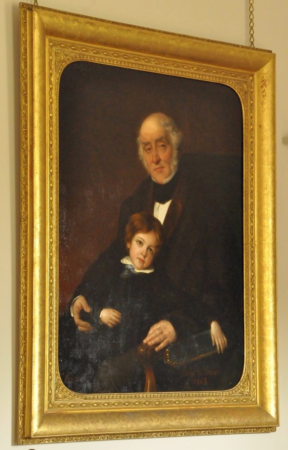
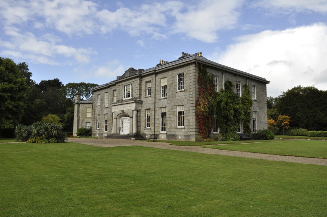
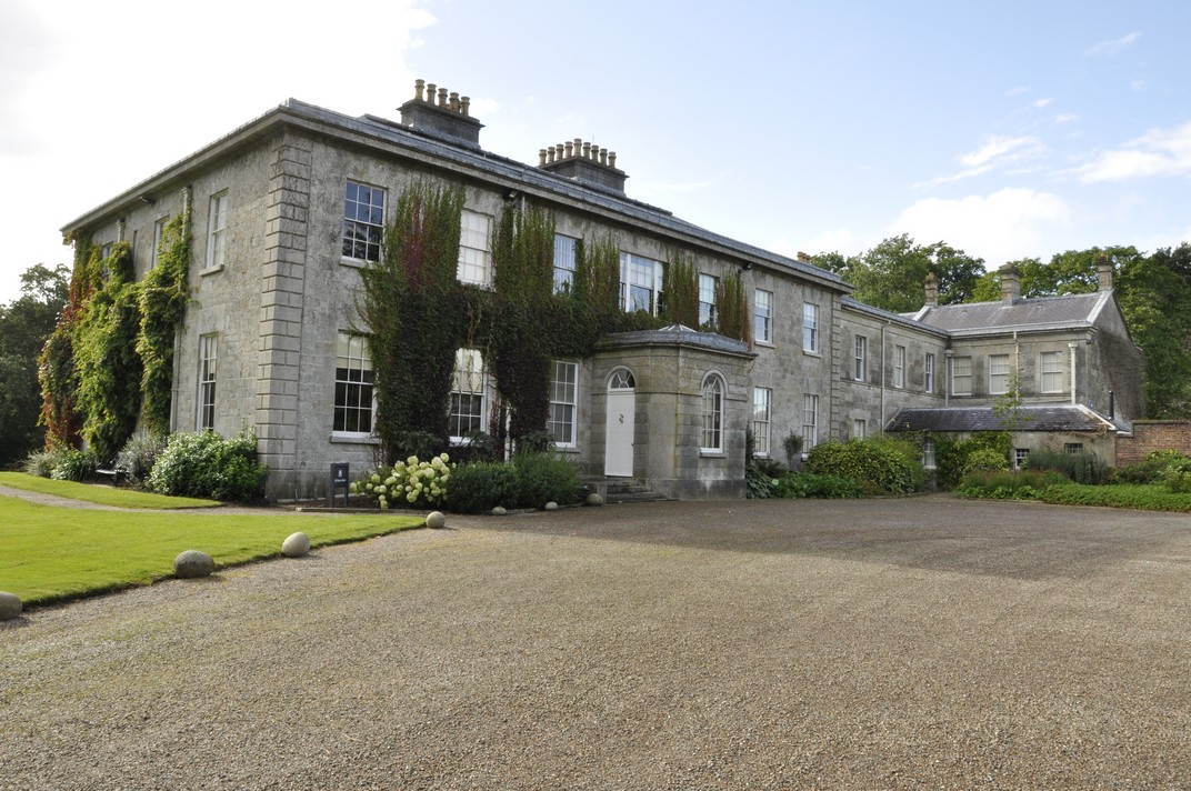
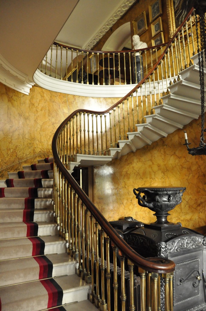


 Captain Shelton was on board – and survived. He is depicted as the officer on the right hand side carrying two small children. On the other side of the deck the troops line up in a disciplined way, allowing the women and children into the life boats, the first instance of ‘women and children first’ enshrined in what became known as ‘the Birkenhead Drill‘. Only 193 (out of almost 650 persons on board) were saved.
 The Argory is a beautiful house, quite understated on the outside, but a feast for the eyes awaits within. We enjoyed our visit, having combined it with a visit to Springhill House earlier that same day. National Trust volunteer Rosheen was an excellent guide.


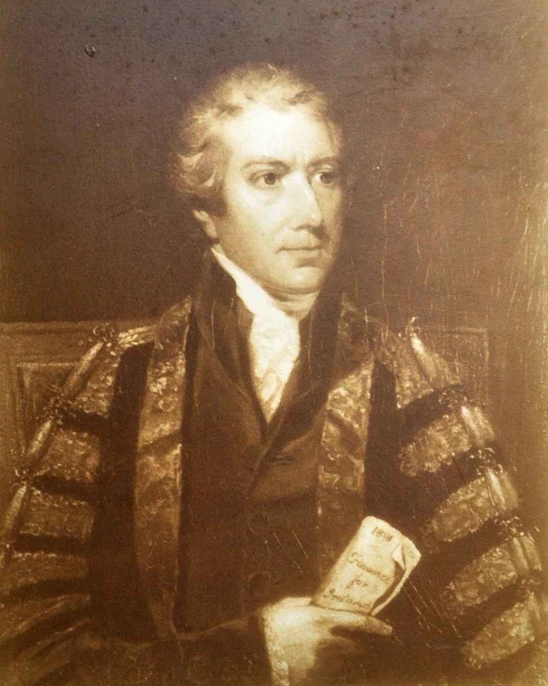


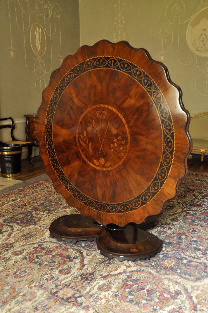


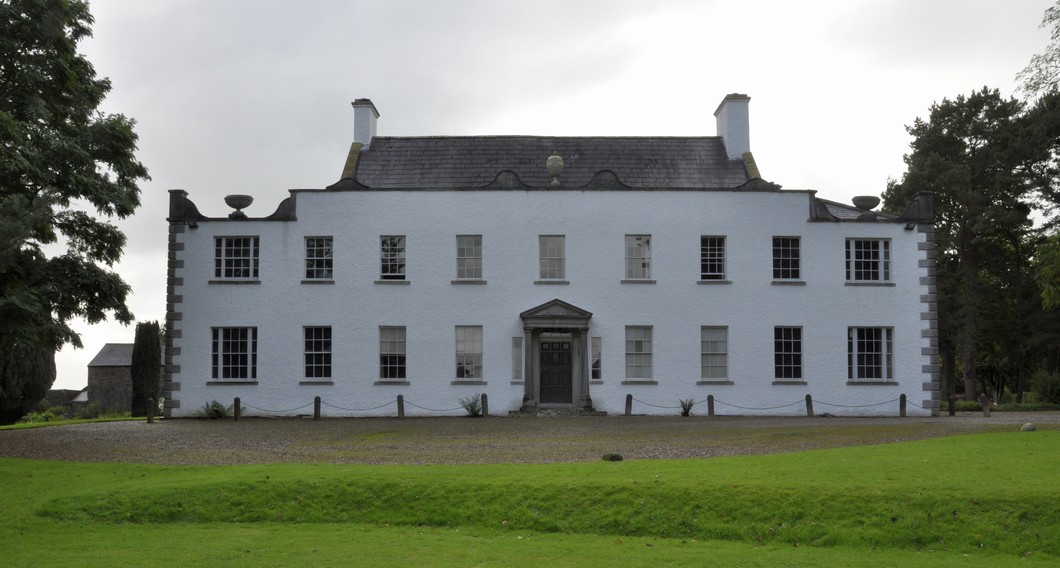


 But there is one place, much closer to home, that I wanted to see as long as I can remember. And that place is the
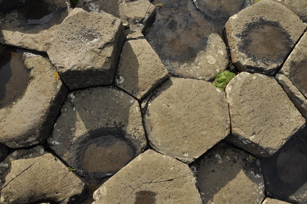
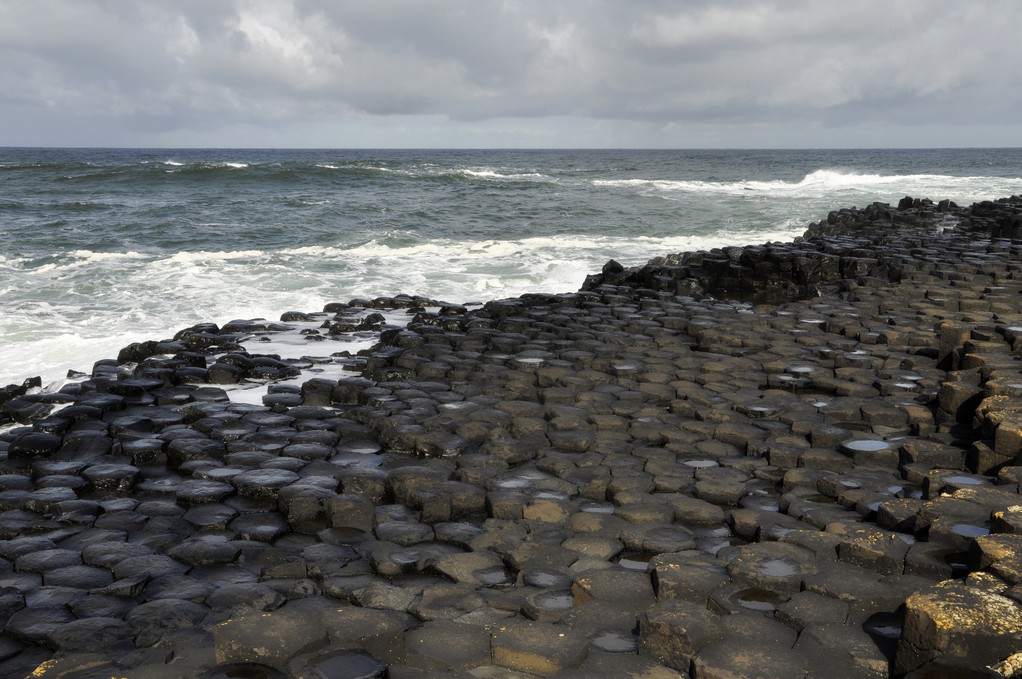
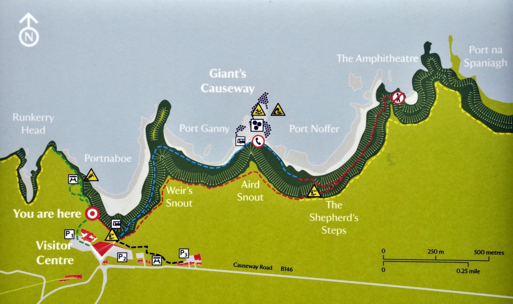
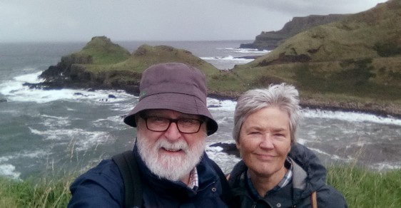


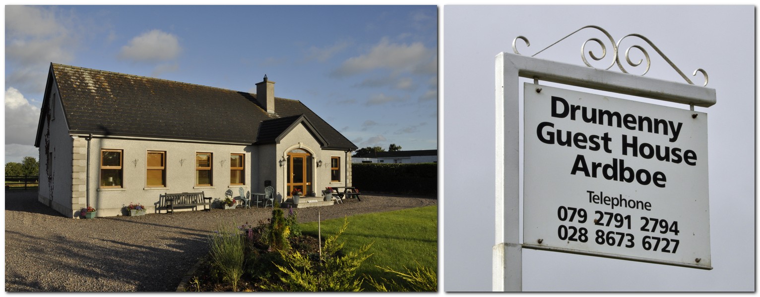
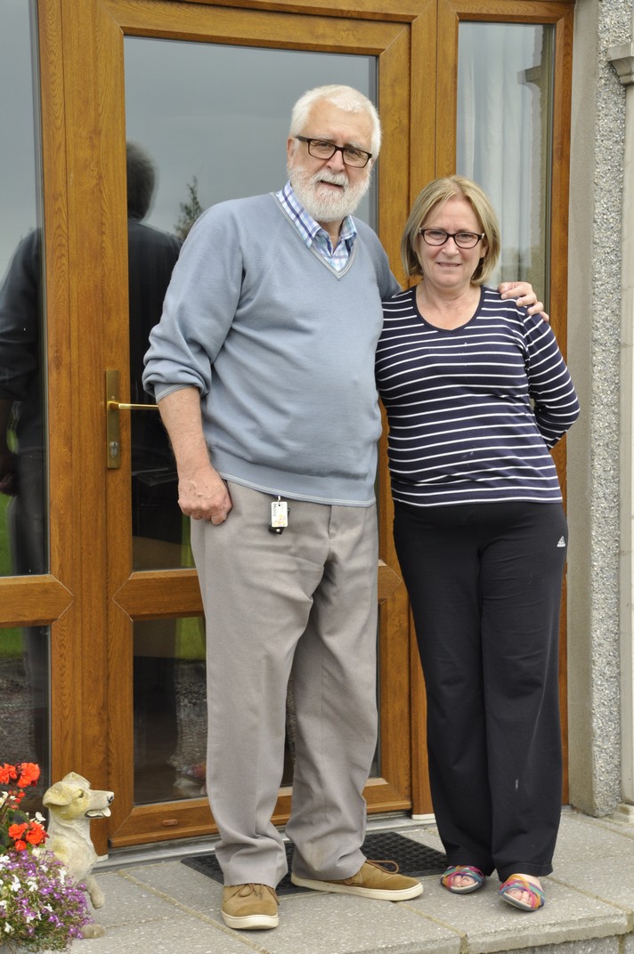
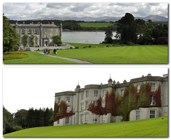


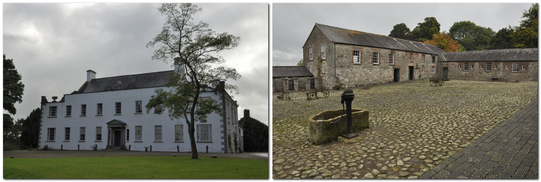
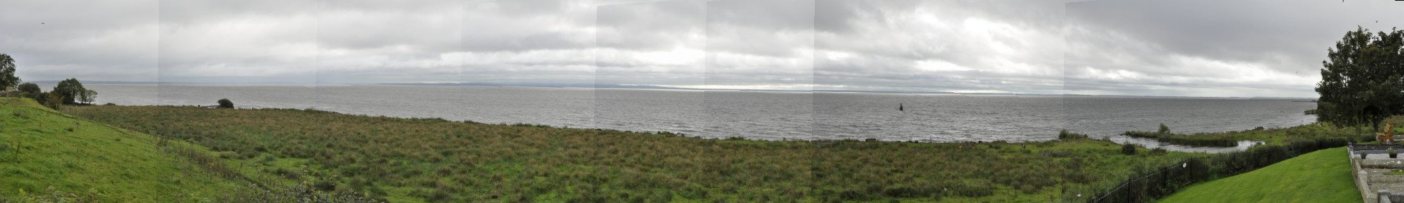


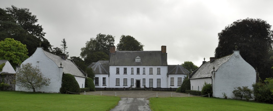


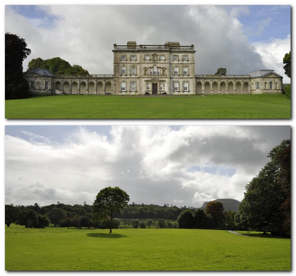
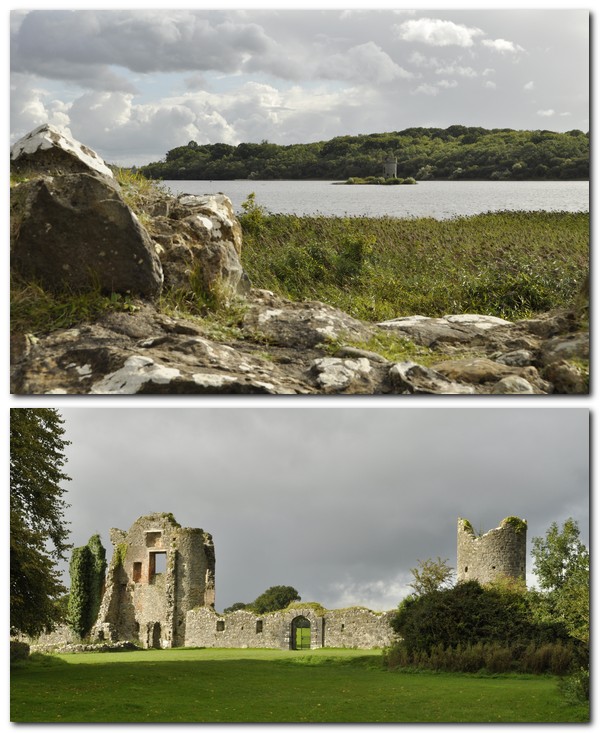


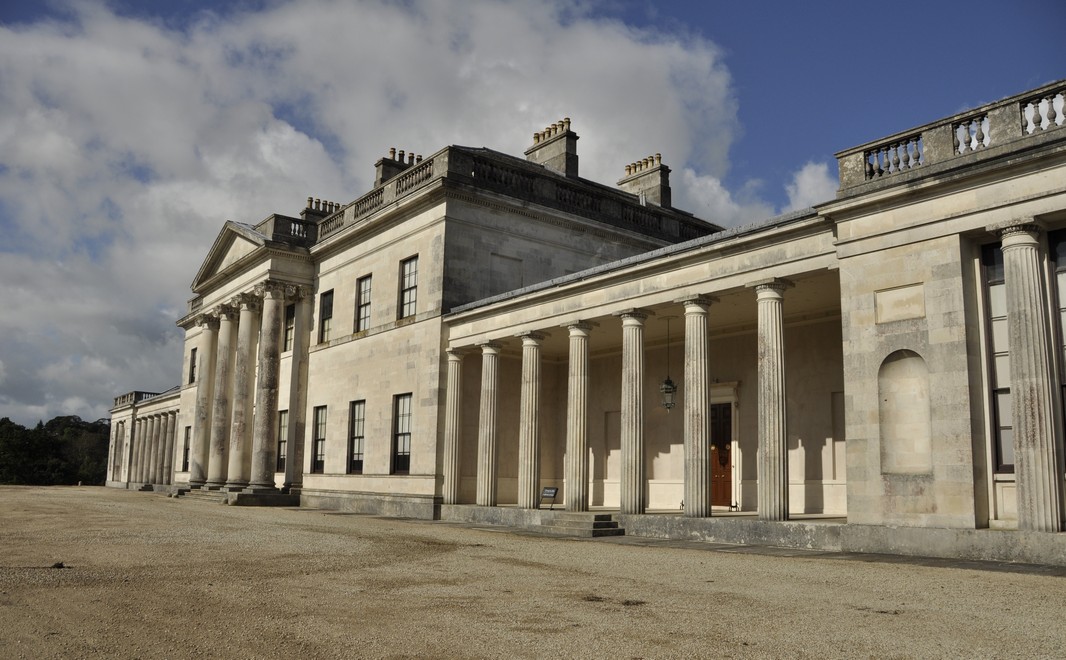


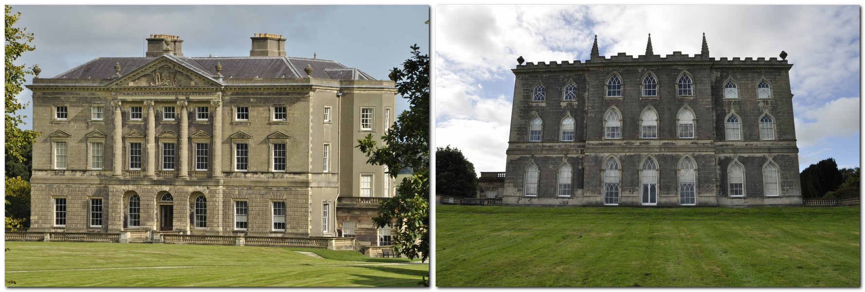
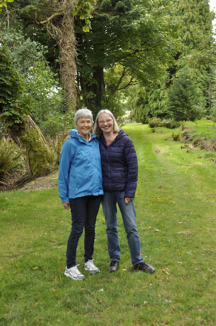
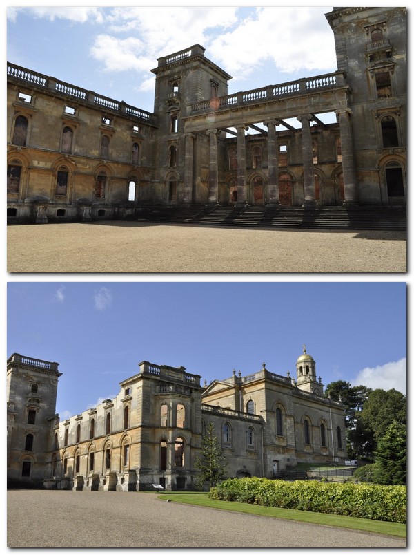
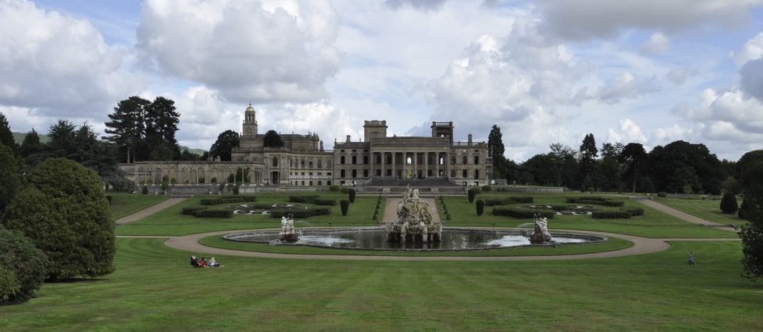

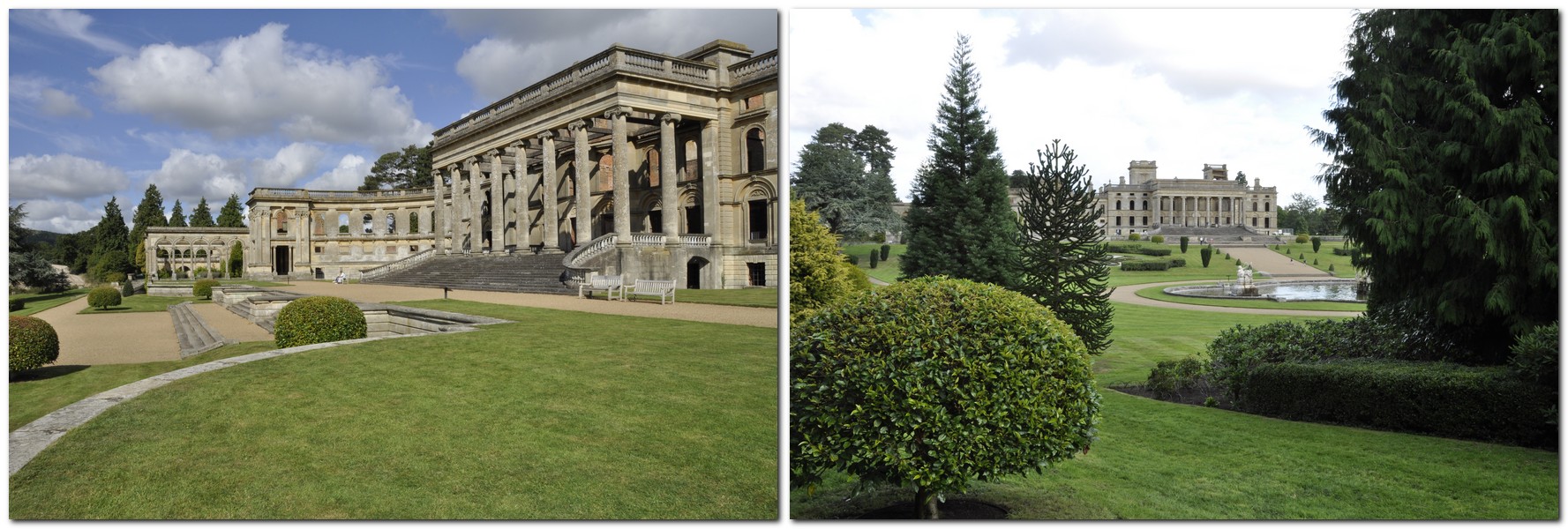
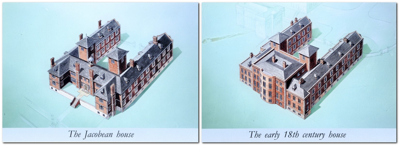
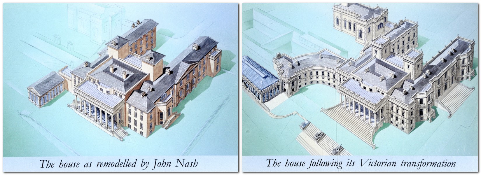


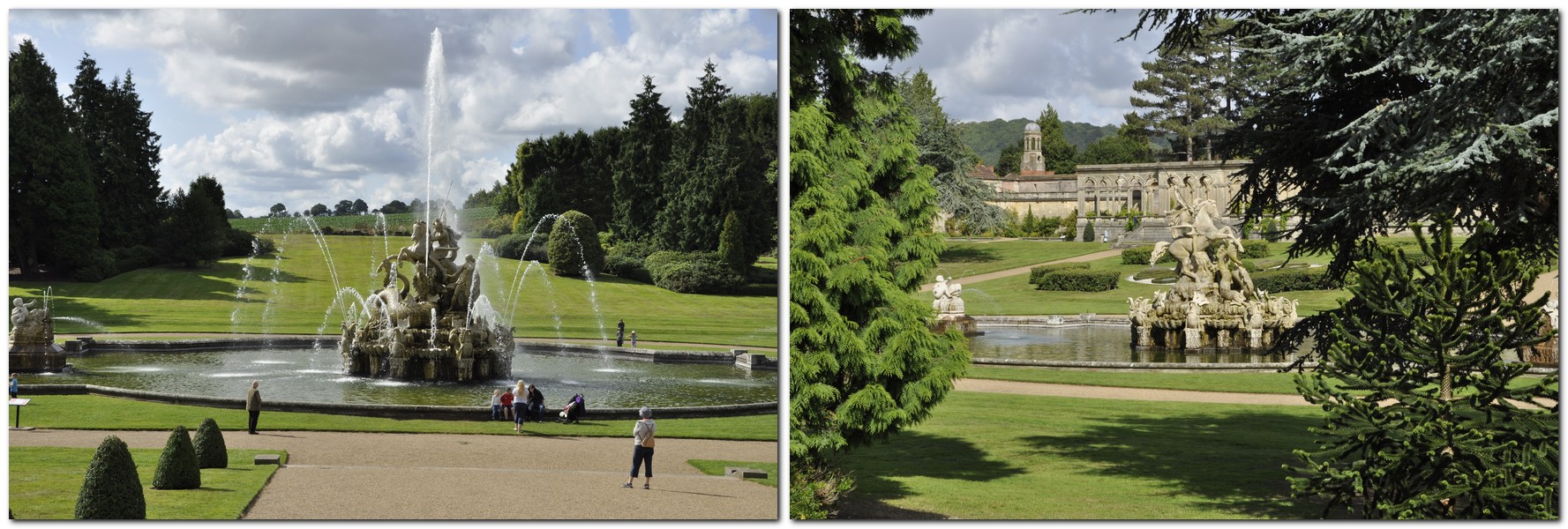

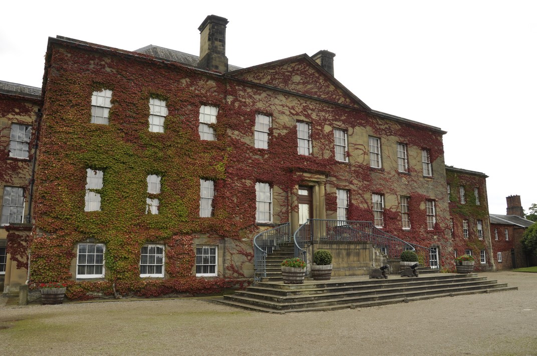


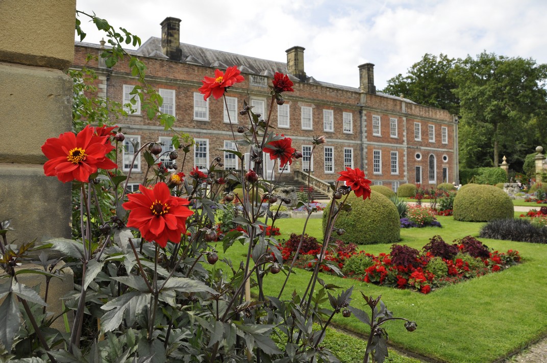

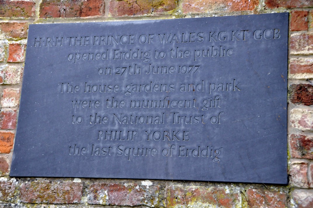


 To fill in the time, I took a
  In February 1970, I had applied for a place on a recently established
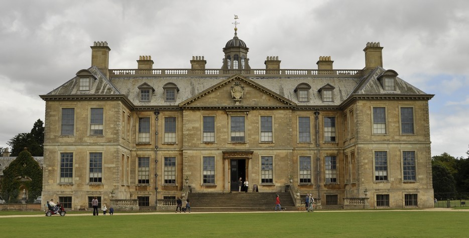
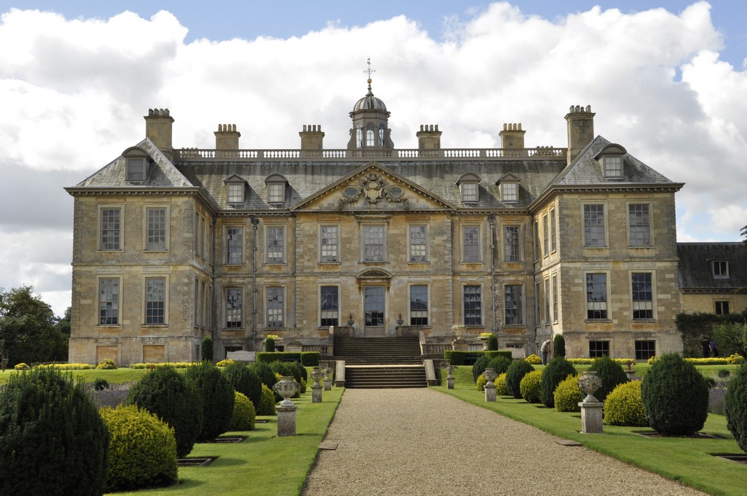

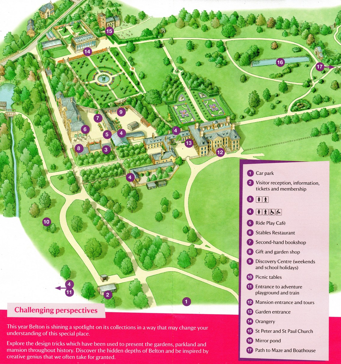


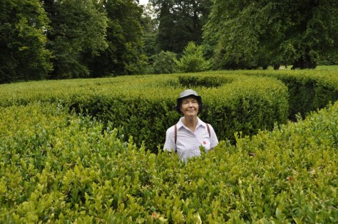


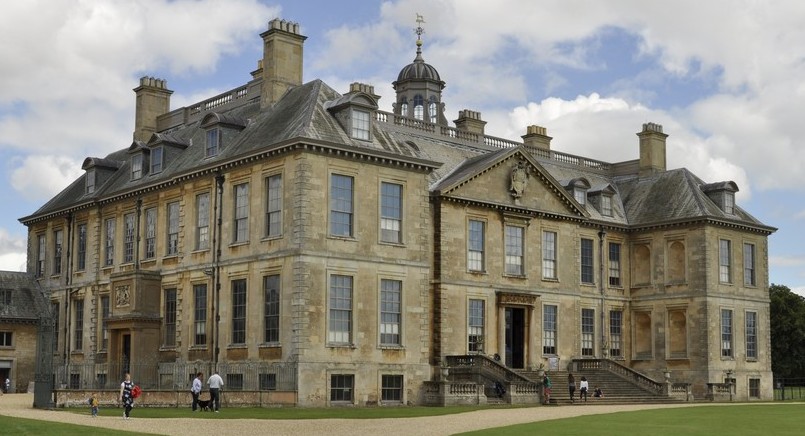


 That’s what the
 Sans Serif typefaces have become more popular in recent years, no doubt because of the Microsoft default font decision, although until the release of Calibri,

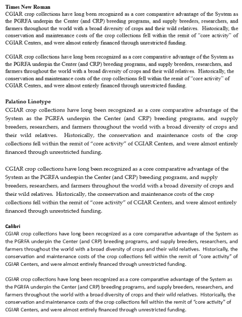

 St Paul, Minnesota is almost a second home. I’ve been visiting there regularly since 1998 when Hannah, our elder daughter, transferred from Swansea University in the UK to
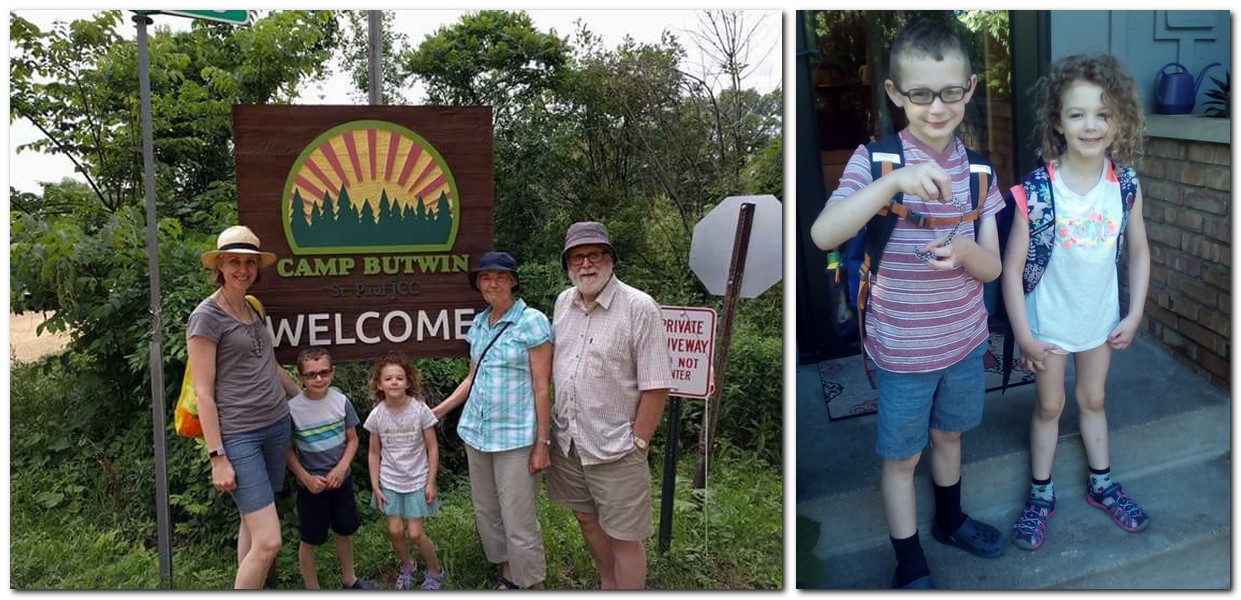


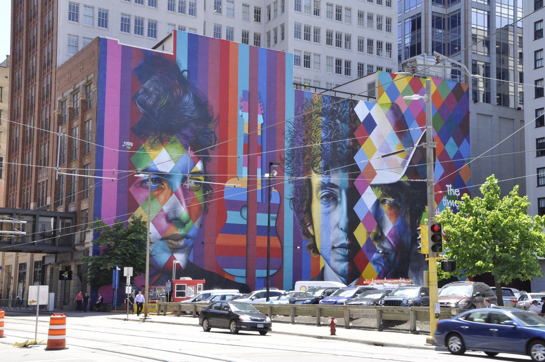


 Midsummer, and we headed off to the


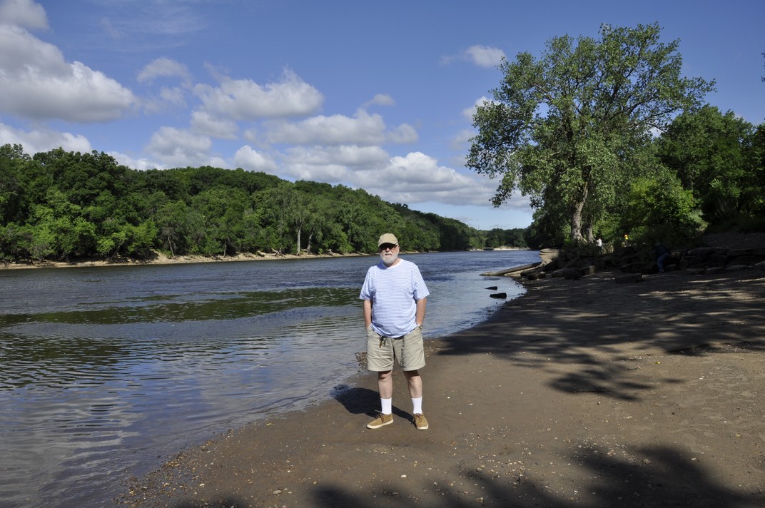
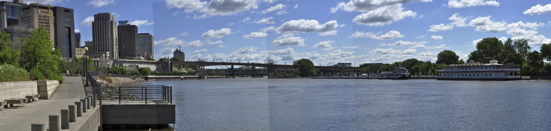


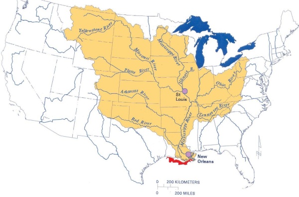


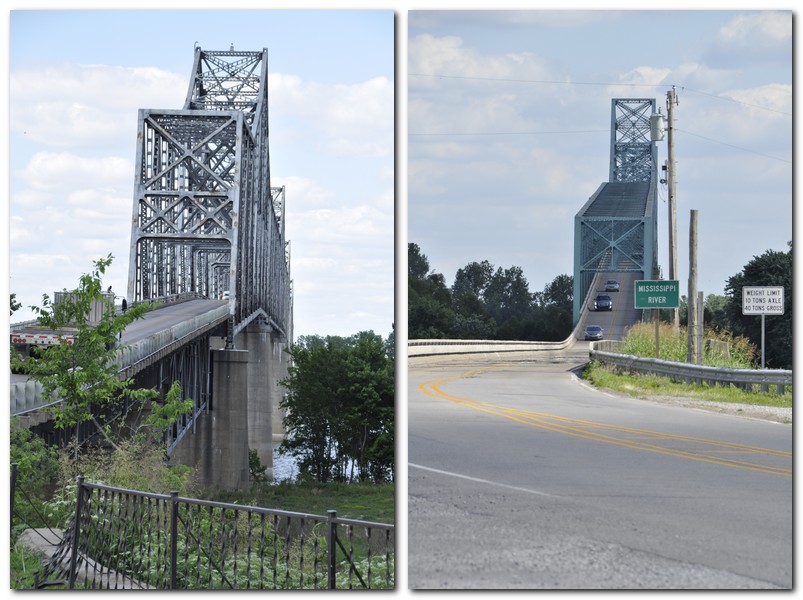
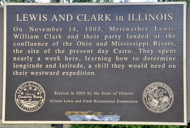
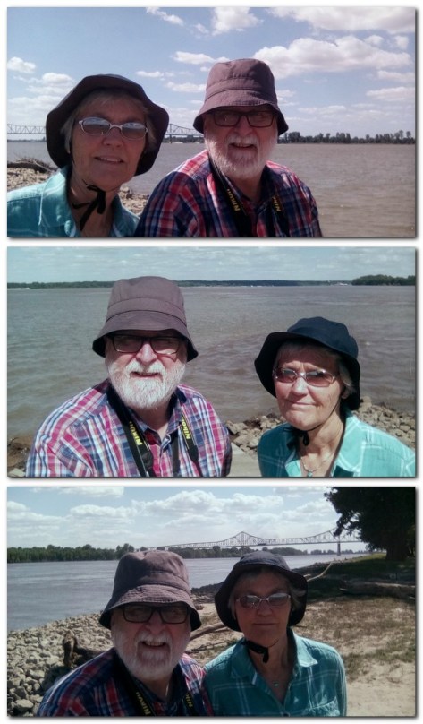
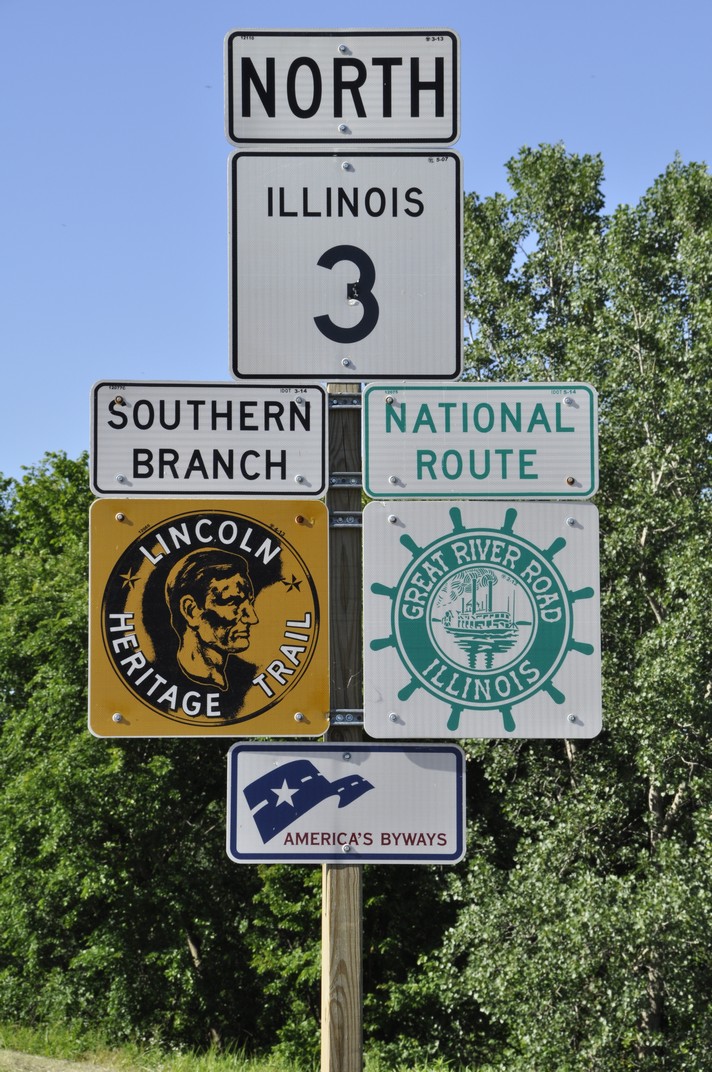


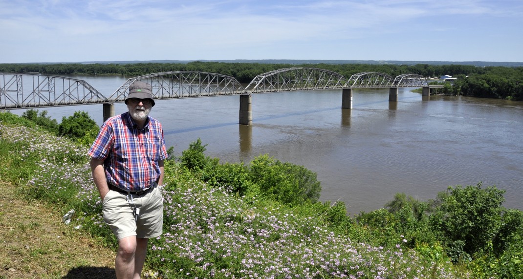
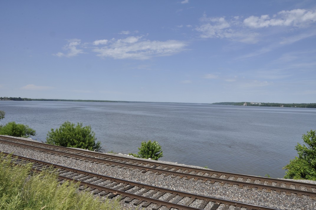
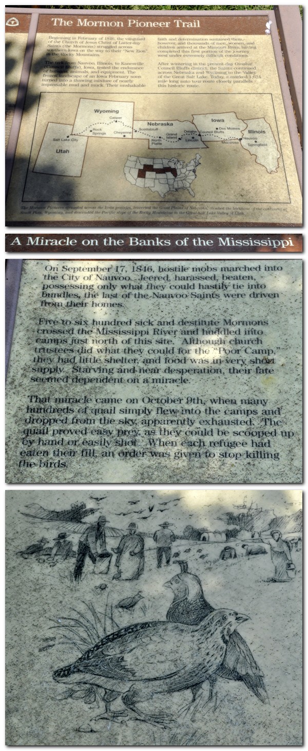

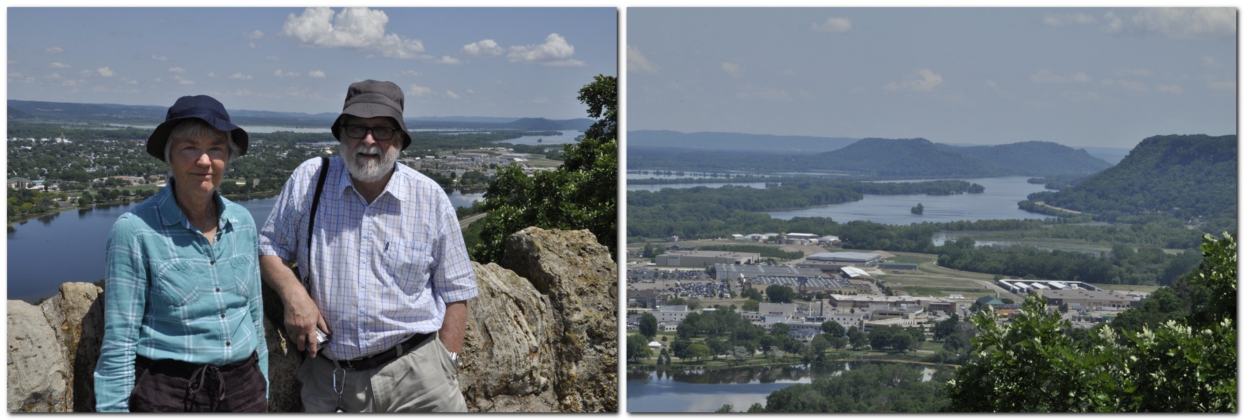
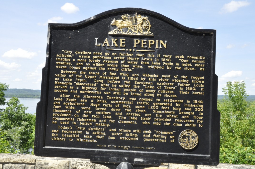
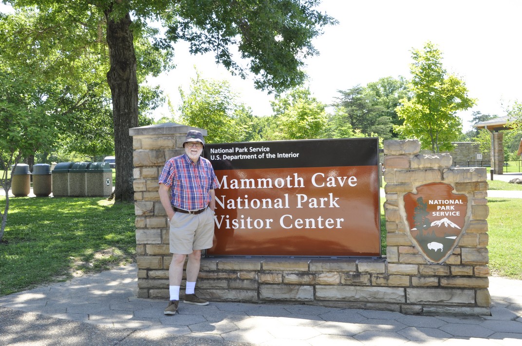
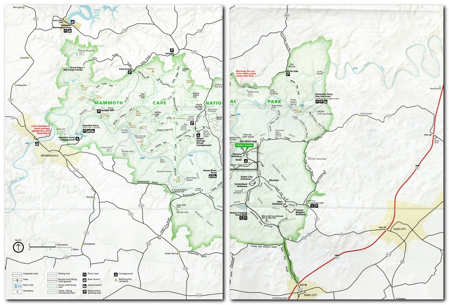


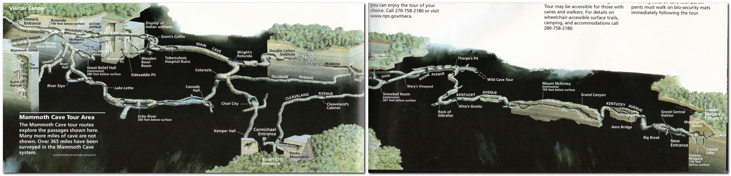
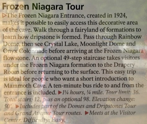
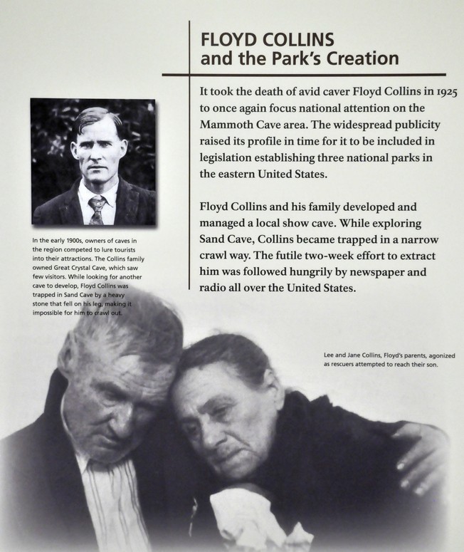


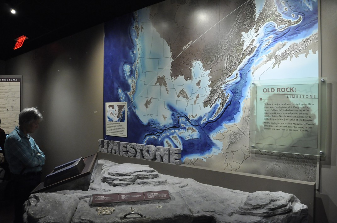

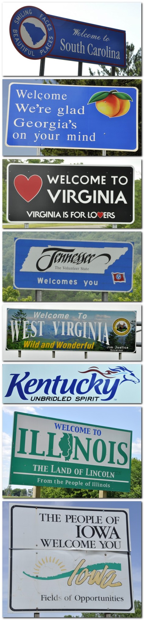


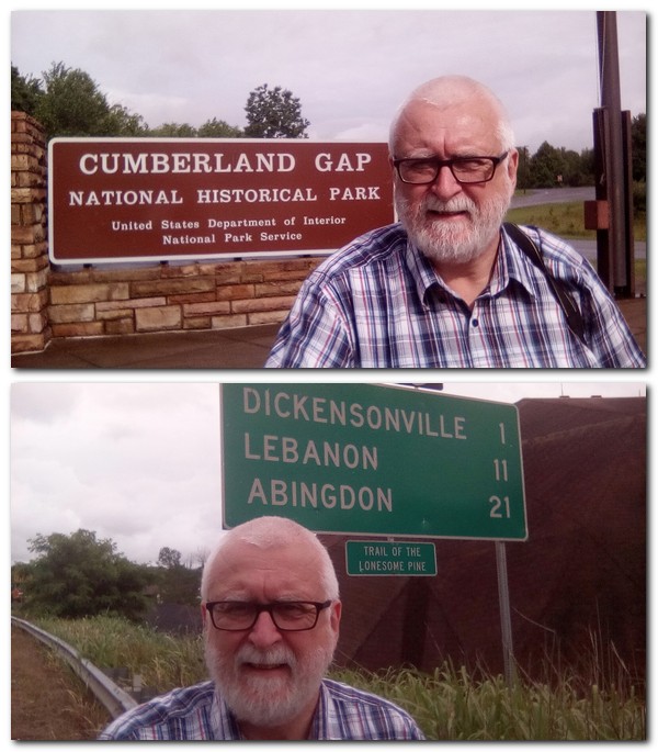
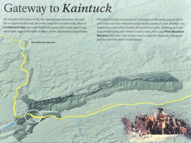
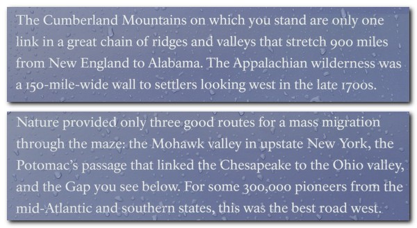
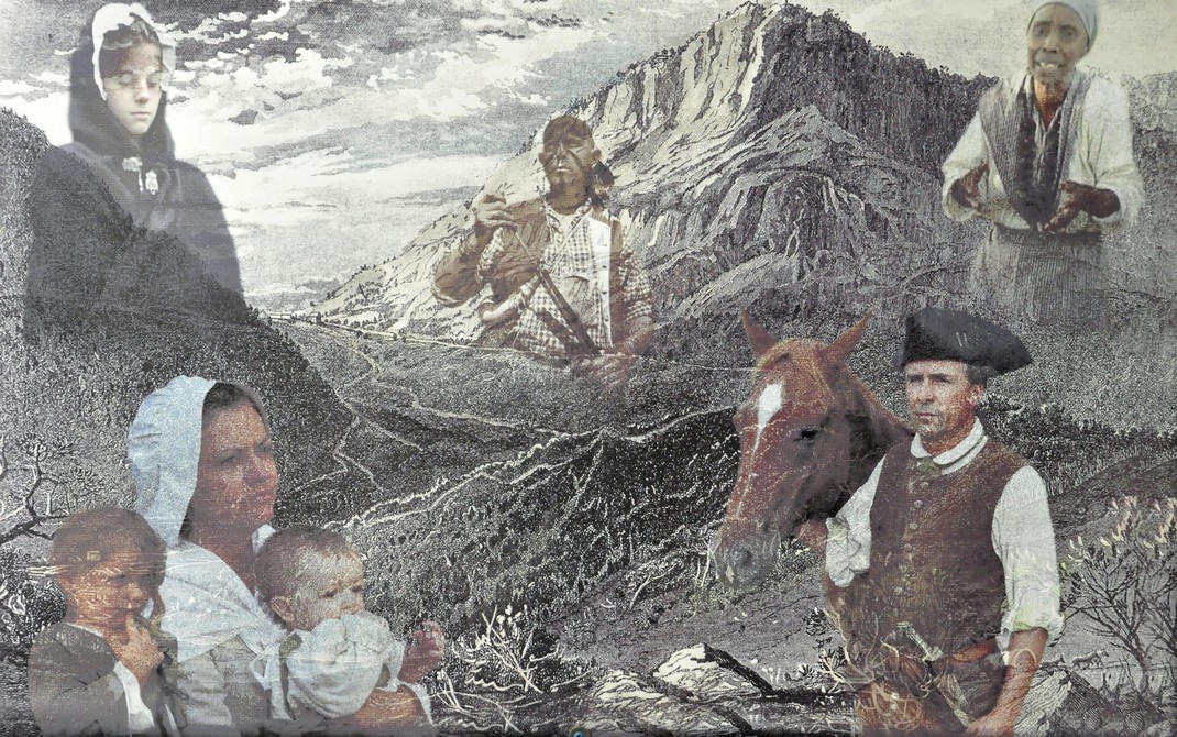
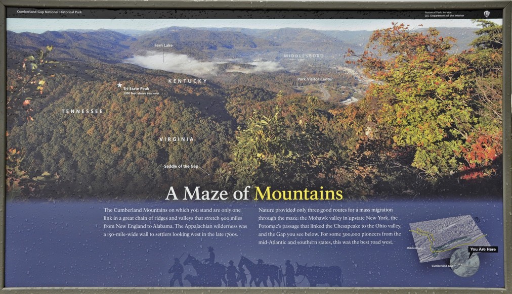


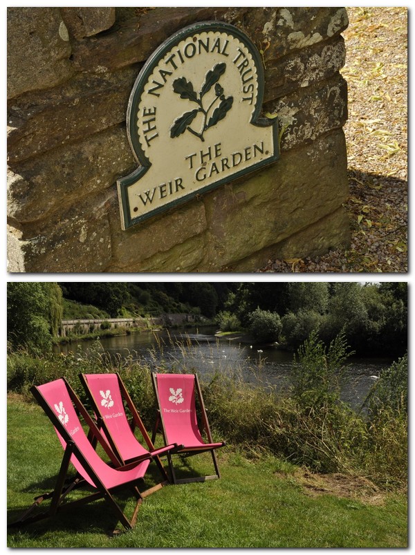
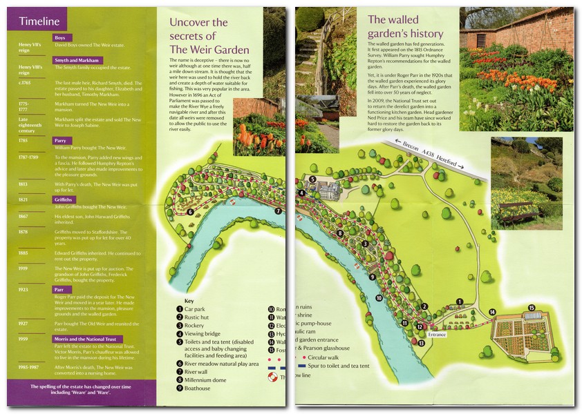


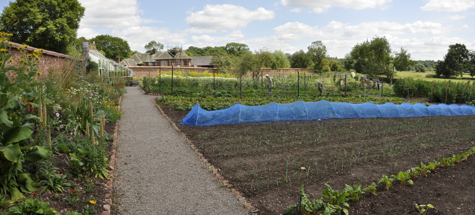
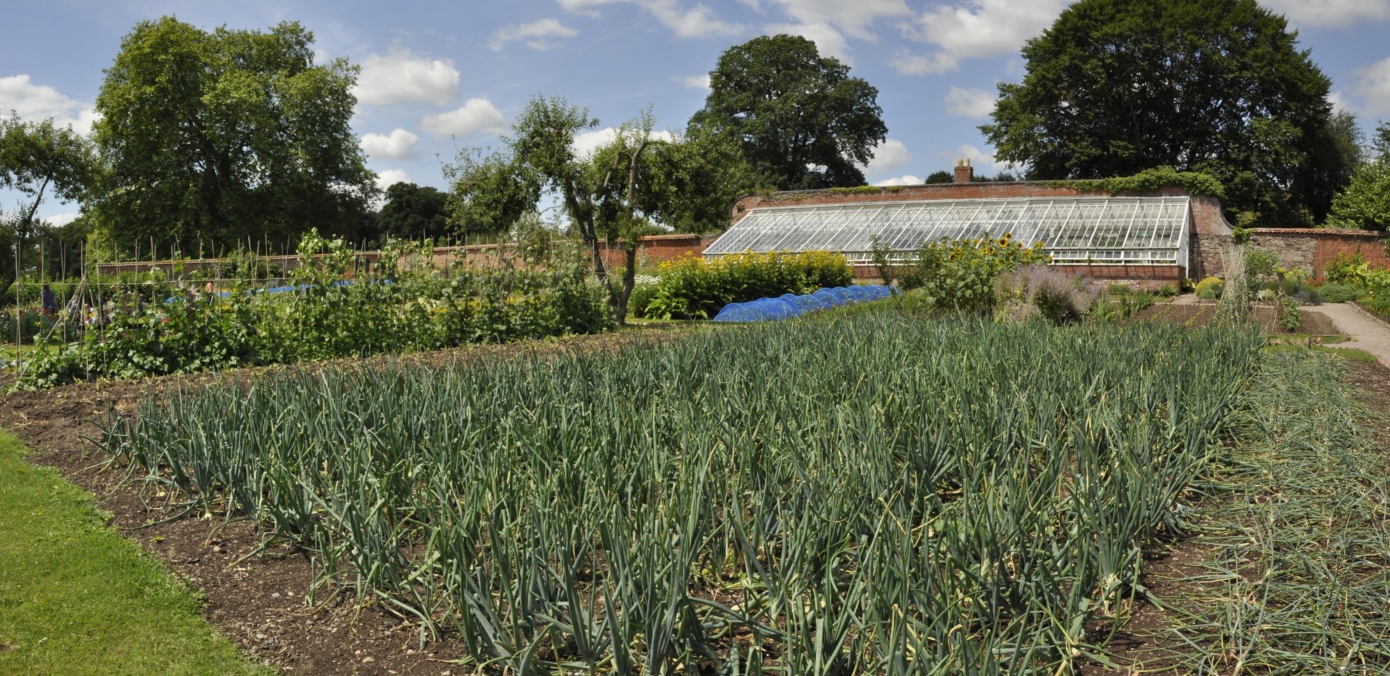


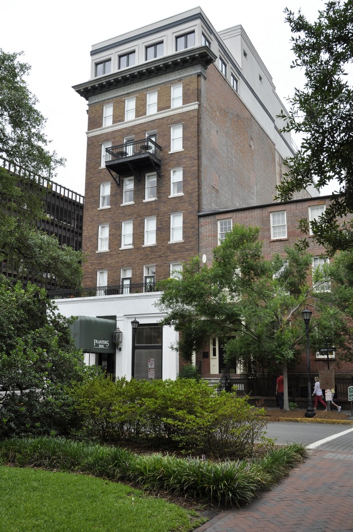


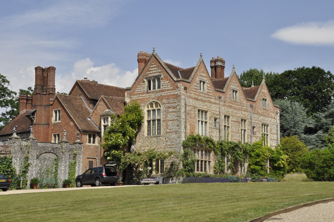


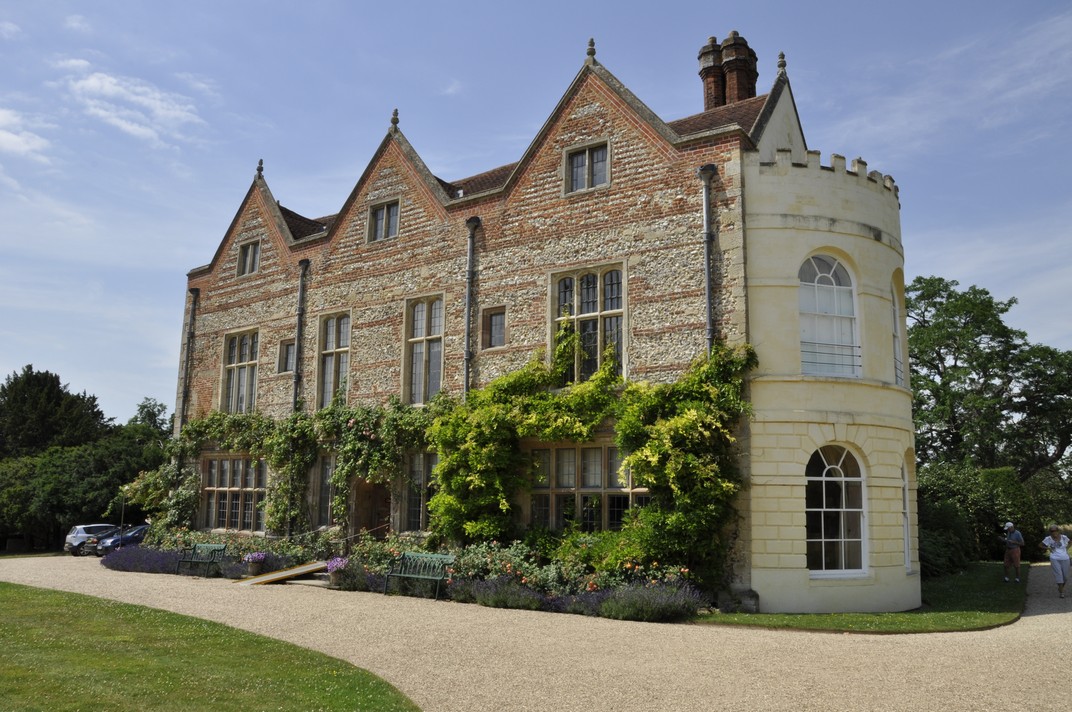


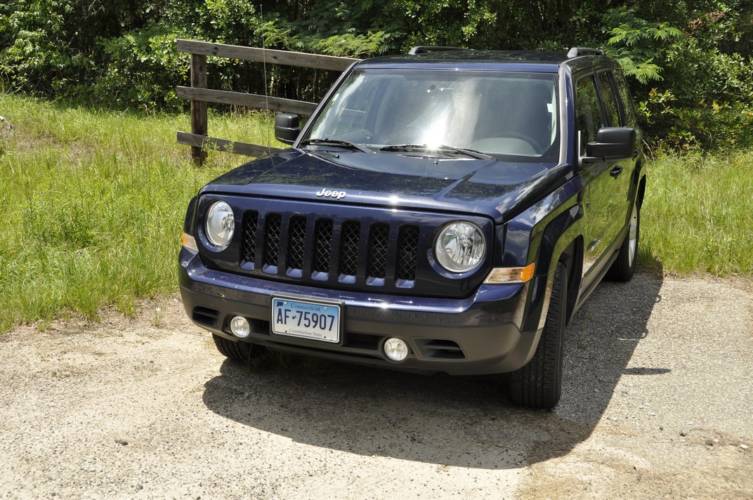
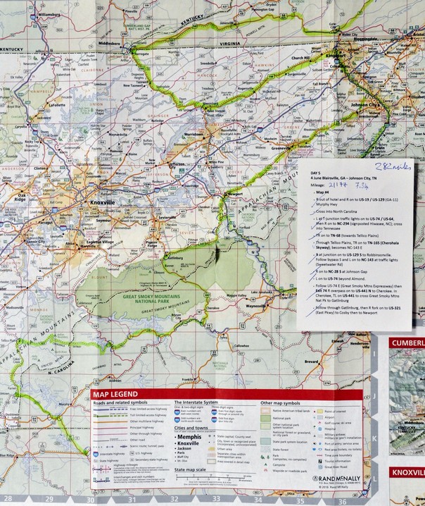


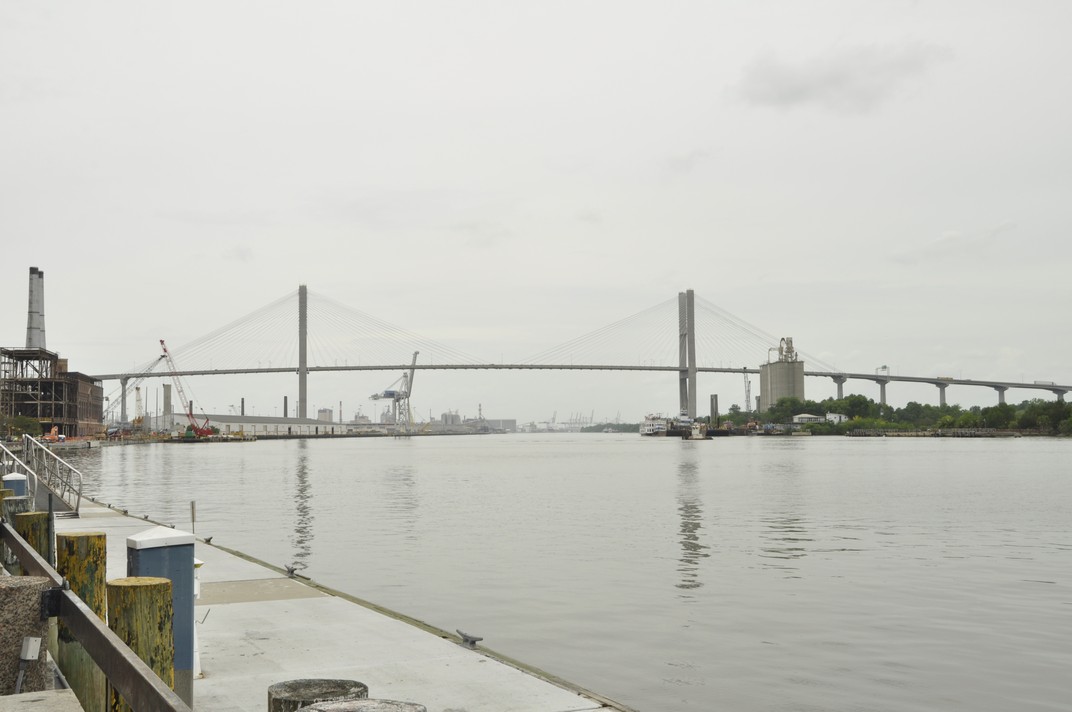
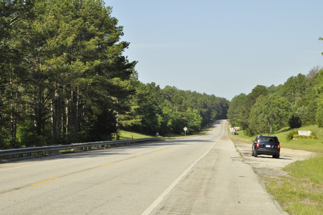
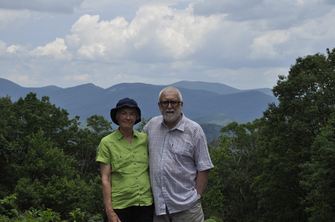
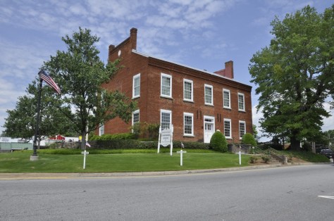
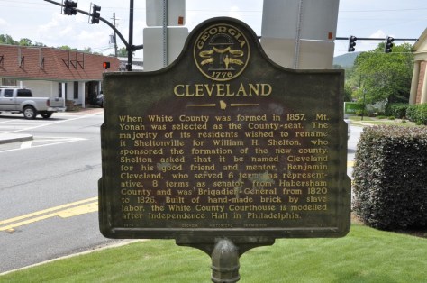
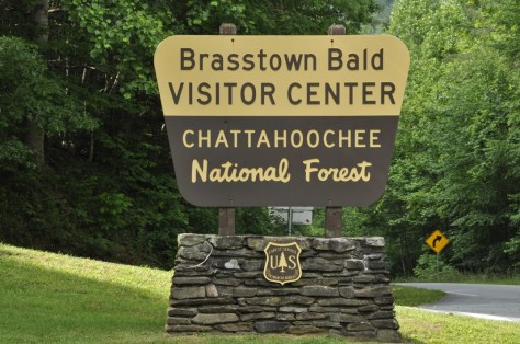

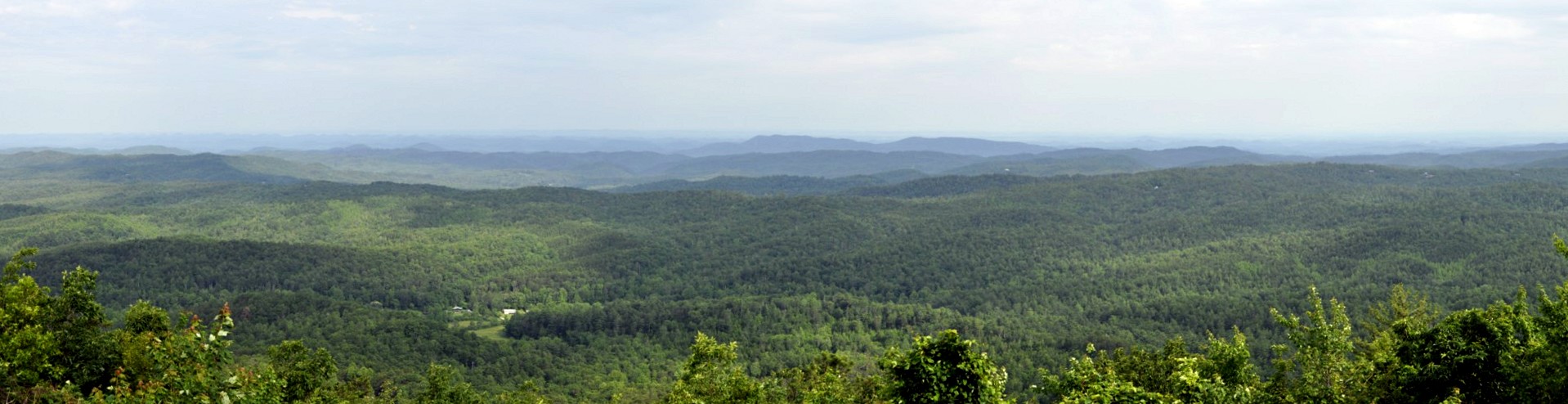
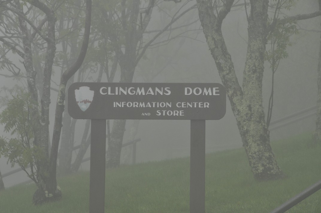
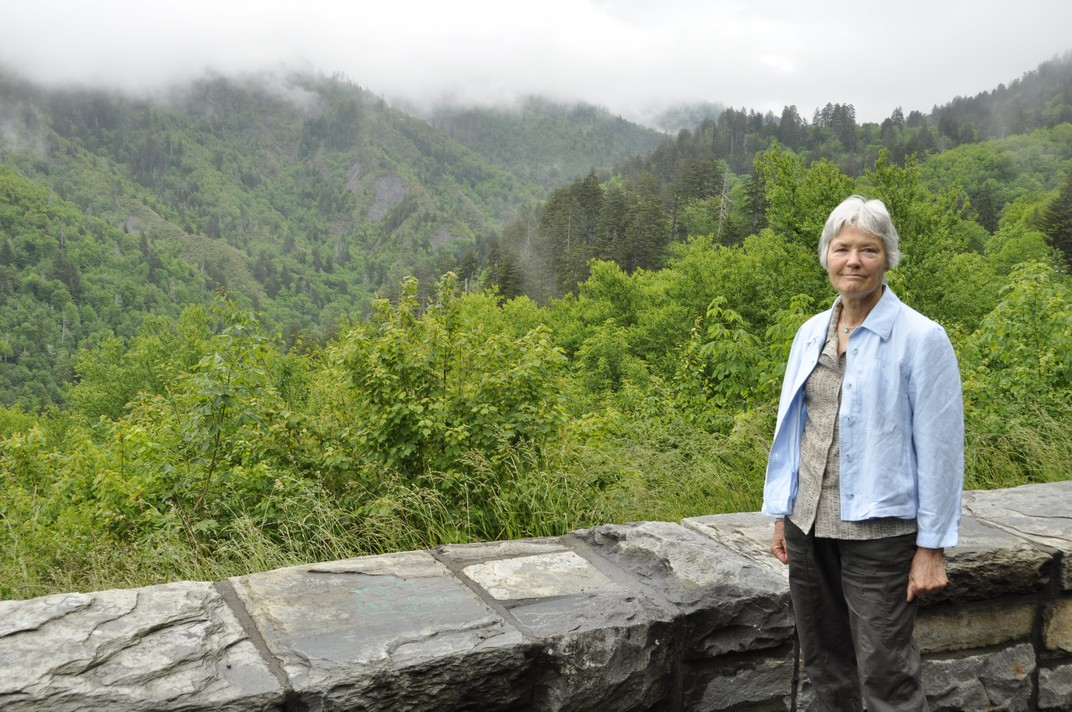
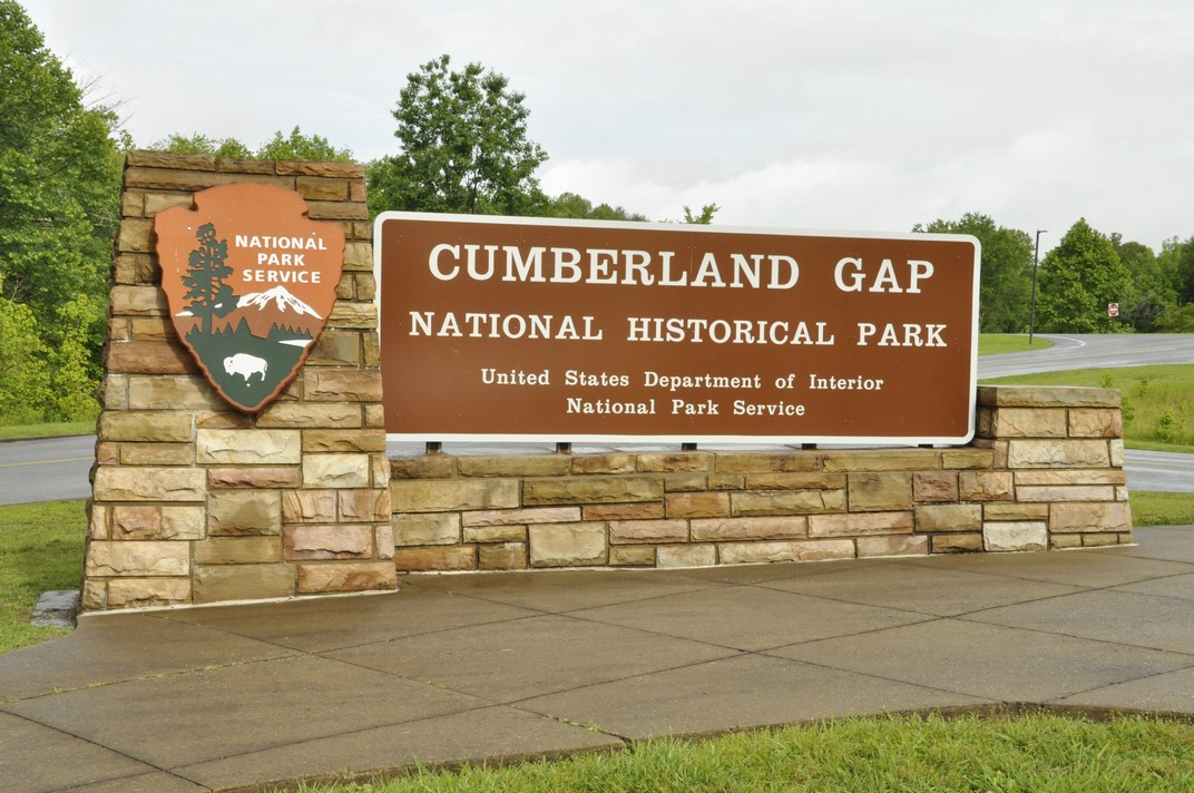
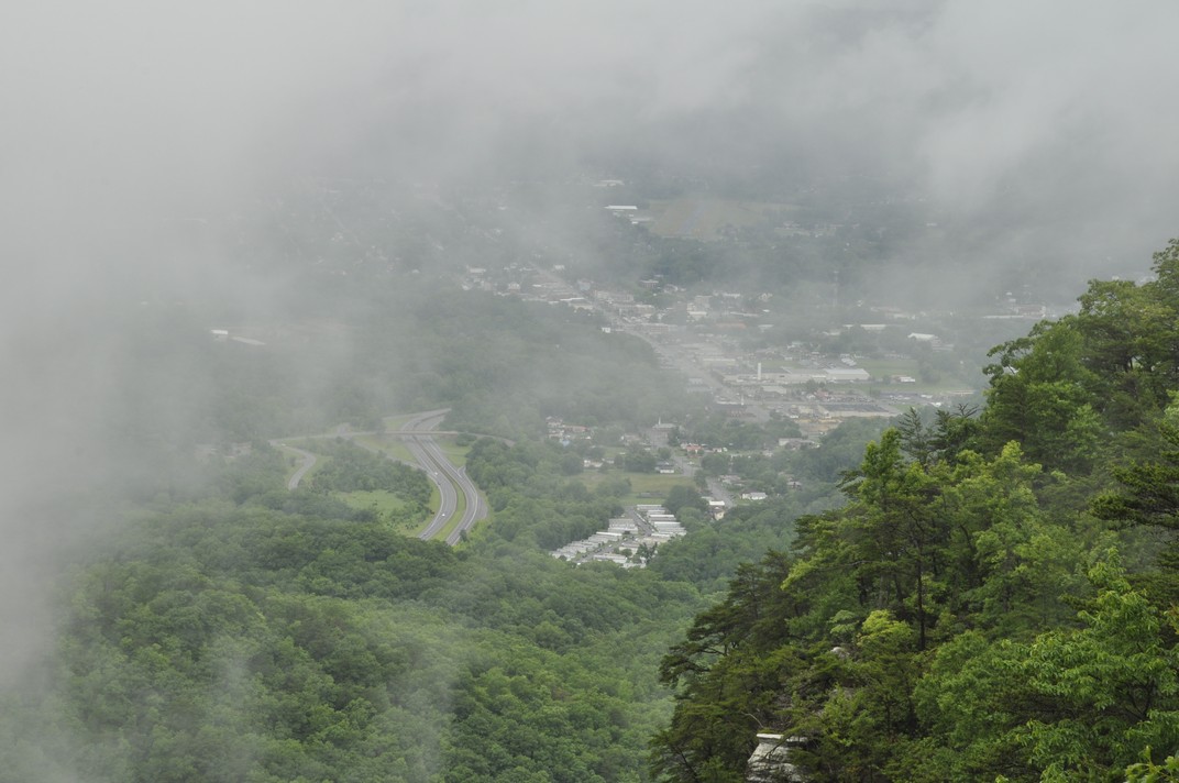
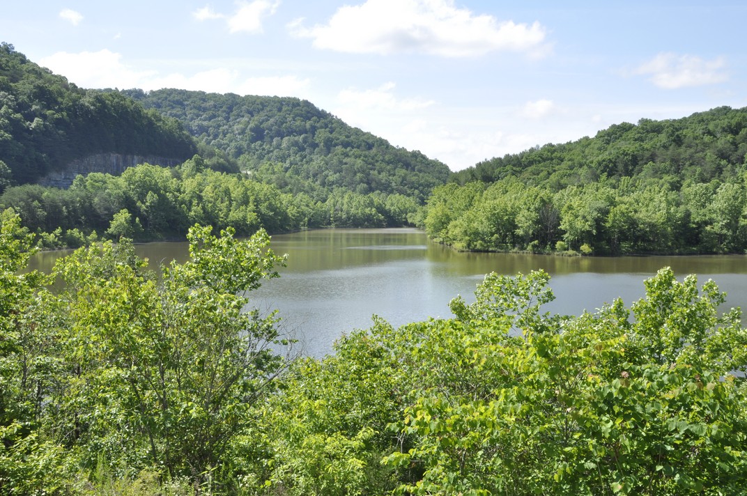
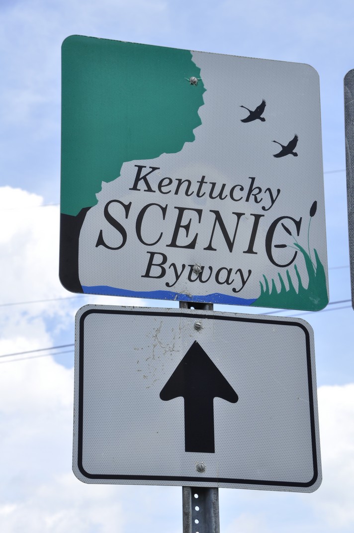


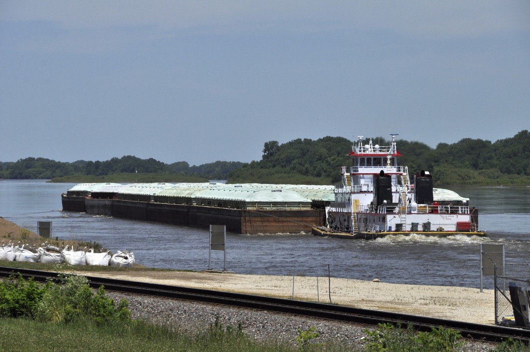
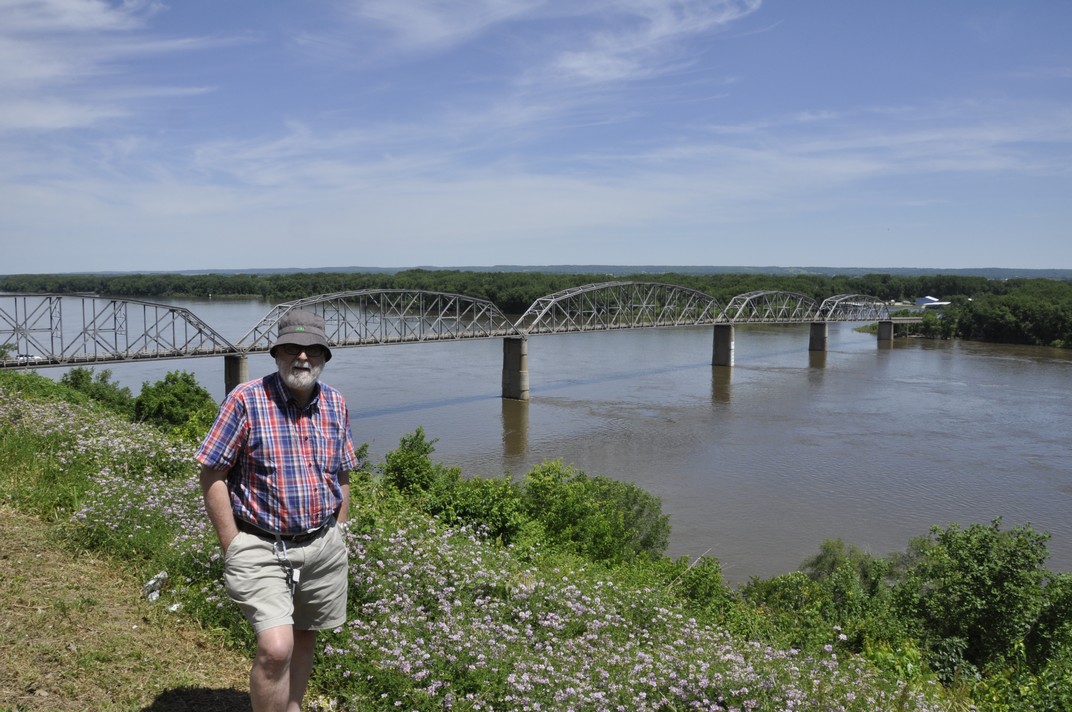
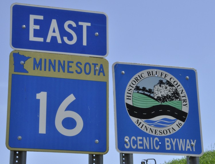

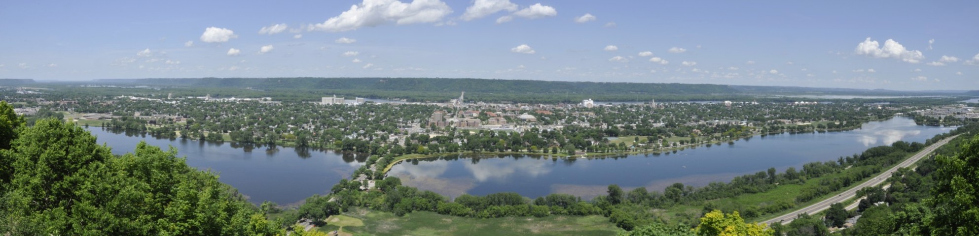
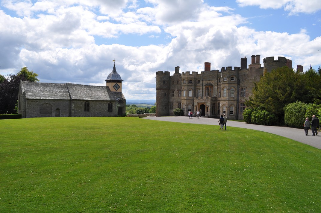


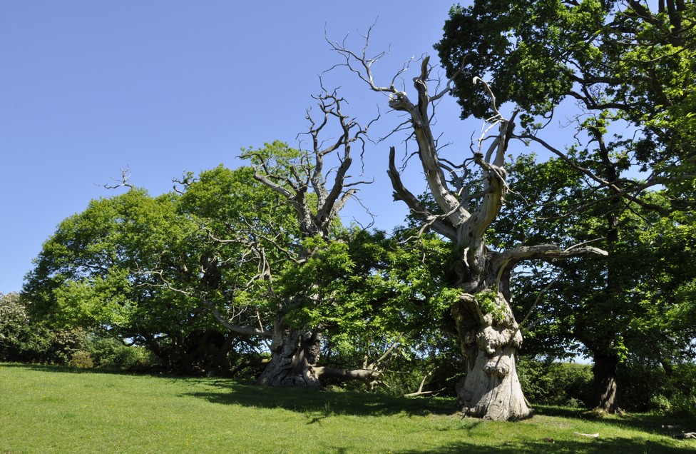


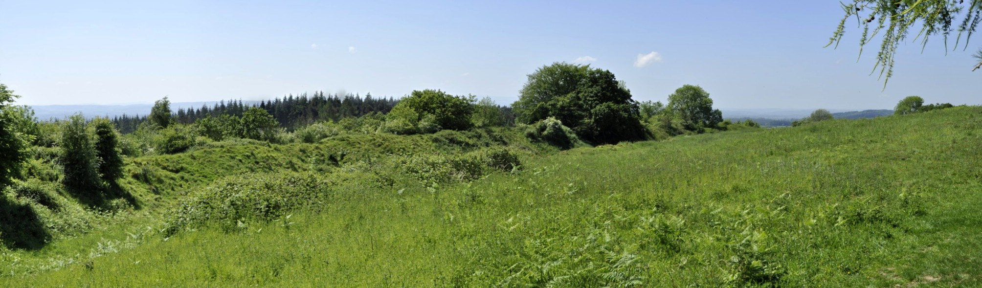


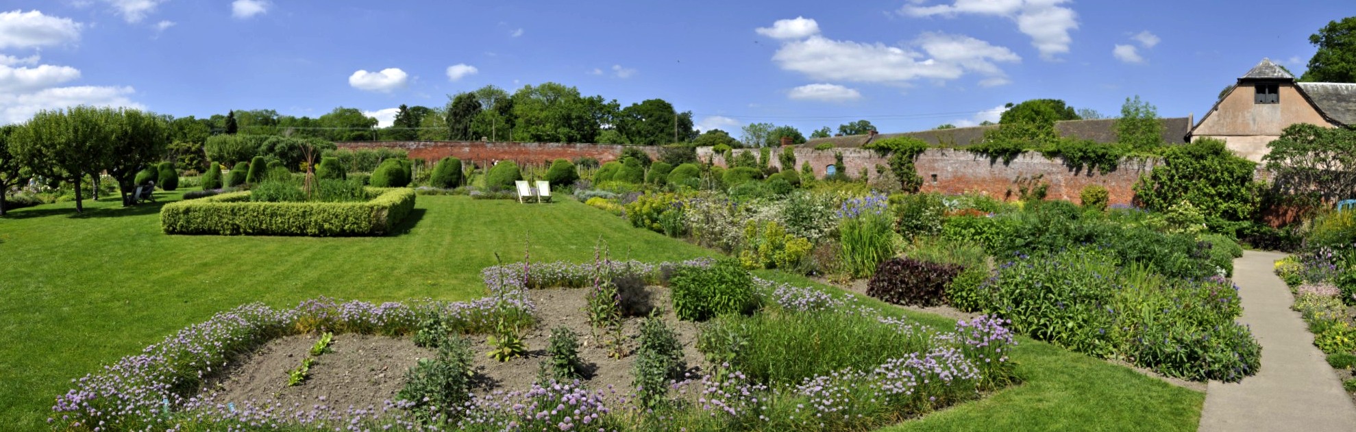


 Peppers sold car models made by the