Around the world in 40 years . . . Part 19: O’er the land of the free and the home of the brave!

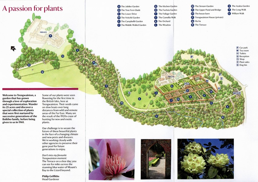
Steph and I really enjoy our visits to the USA. Over the years, we have experienced much of what this beautiful, fascinating, diverse, challenging, often bewildering (to the outsider, at least), and HUGE (or should that be ‘yuge’?) country has to offer.

And now that we have family there (our elder daughter Hannah studied in Minnesota, was married there in 2006, and she and her family live in St Paul), there’s an added incentive to visit the USA annually.

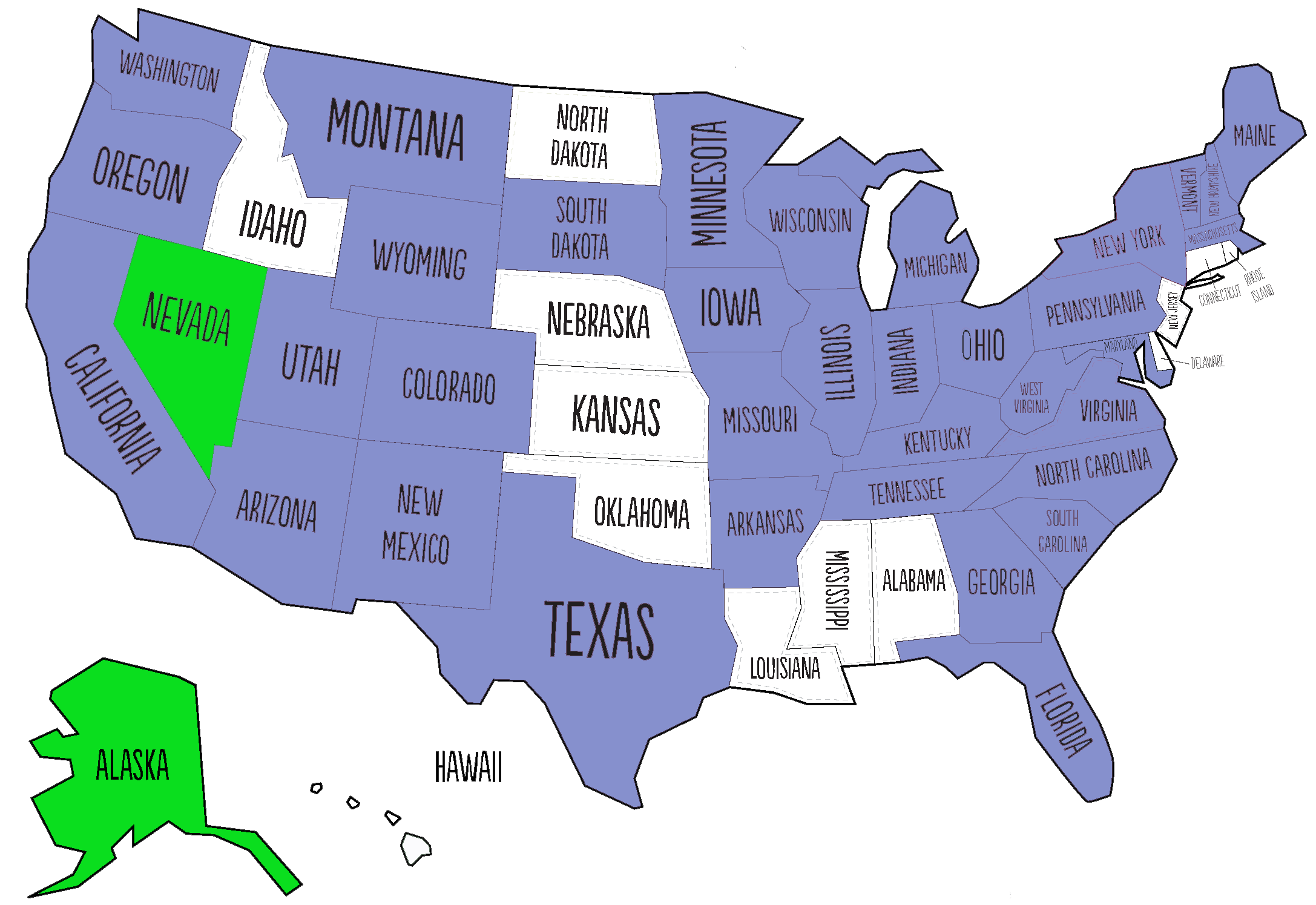
Since retiring in 2010, we have made some spectacular road trips to explore the country. In fact there are now few states (shown in white) that we have not visited, and just two (Nevada and Alaska) where sitting in an airport was as close as I got. Just click the various links below to open earlier blog posts or photo albums.

On one flight from Japan to the USA on Delta Airlines, we were diverted to Anchorage, Alaska because of a medical emergency, then spent three hours or so on the tarmac before continuing our journey. In Las Vegas, Nevada we transferred to a domestic flight having arrived from the Philippines.

The first time we ever set foot in the USA was in April 1975, but that was only to transfer flights in New York’s JFK airport. Steph and I had left Peru about a week or so earlier on our way back to the UK where I would write and present my PhD thesis at The University of Birmingham later that year.

I was working at the International Potato Center (CIP) in Lima, and the center’s Director General, Richard Sawyer, had offered me a postdoctoral position (provided I successfully defended my thesis) and a posting in Central America. So our trip home took us to Costa Rica for about 3-5 days (via an overnight stop in Panama City), a brief stopover of about the same length in Mexico to visit former CIP friends, and then on to New York on an Eastern Airlines Lockheed L-1011 TriStar, the first wide-bodied aircraft we had flown. From New York we took British Airways (on our first Boeing 747) to Manchester.

In April 1976 Steph and I moved to Costa Rica and remained there until November 1980. As CIP’s Regional Representative (and potato production specialist), I worked throughout Mexico, Central America, and several countries of the Caribbean. Travel from Costa Rica out to the Caribbean islands (mainly the Dominican Republic, but occasionally other islands where potatoes figured in the agricultural cycle for at least some period of the year) inevitably involved flights through Miami in Florida, and I soon got to know Miami International Airport intimately. Because transit through Miami was a good opportunity to stock up on items we couldn’t readily purchase in Costa Rica, I would always try and schedule my return flights via Miami, arriving there in the early morning and taking the late LACSA flight to San José, giving me several hours for shopping in one of the nearby malls in Dade County. Each year when we flew back to the UK on our annual leave, we took flights via Miami to London.


However, the first big challenge of any visit to the USA is actually entering the country. The immigration experience is not always a pleasant or easy one.

When traveling in the 1970s, unlike today when we enjoy visa-free ESTA travel (unless Brexit changes that), it was necessary to have a visa to enter the USA, even if only transferring flights, as was frequently the case in Miami. There were no transit facilities.

In September 1978, when our elder daughter Hannah was about five months, we traveled to the UK on leave. Things started to go pear-shaped on presentation at the immigration desk in Miami. Although Hannah was registered in Steph’s passport she apparently needed her own visa; Steph’s visa was not good for the both of them. After some intense discussion for perhaps 30 minutes or more, we were finally allowed to enter the USA (and headed straight to a day room in the airport hotel), but with the advice/warning that Hannah’s visa needed to be sorted in London.

To cut a long story short, we chanced our arm on the return journey without a visa for Hannah, and I sorted that soon after at the US embassy in San Jose. I had to take six month old Hannah for an ‘interview’ and answer, on her behalf, all the nonsensical questions that one has to answer, about ever being a Communist or a Nazi. I felt like providing sarcastic responses to these, but held my tongue. All babies are communist, right?

On another occasion I traveled with a Peruvian colleague, Oscar Hidalgo (who was based in Mexico), to the Dominican Republic, and from there to St Kitts and Barbados, starting our trip in Nicaragua. If memory serves me well, we took a flight operated by the Spanish airline Iberia from Managua to Santo Domingo. So far, so good.

But to travel on to St Kitts, we had to transit in San Juan, Puerto Rico. I had a US visa; Oscar did not. Our transit time was about four hours, and although Oscar was eventually permitted to enter the airport, he had an armed guard by his side throughout the whole period, ensuring that he didn’t become an illegal immigrant!


Steph and Hannah at the Golden Gate Bridge, on the north side in Marin County, in July 1979

In July 1979, I attended the annual meeting of the Potato Association of America in Vancouver, and Steph and Hannah (then 15 months) came along for the ride. Flying from Costa Rica via Guatemala City (a hub for American airline Panamerican in those days), we took a short break of about three days for sight seeing in San Francisco, our first and only visit to that extraordinary city.

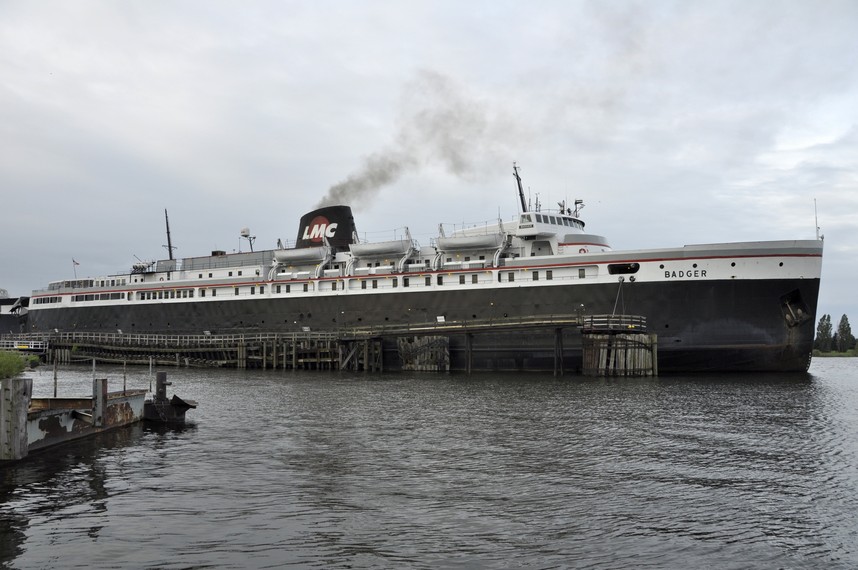
From Vancouver we drove to Edmonton, then flew down to Madison, Wisconsin where I visited the university for a couple of days, and also the USDA Potato Introduction Station at Sturgeon Bay in Door County alongside Lake Michigan in the northeast of the state.

In March 1981, after I had resigned from CIP to return to an academic post in the UK, we flew to New York (on a Lufthansa DC-10), spending three nights there before heading on to London with British Airways.

Steph and Hannah at the top of the Empire State Building in New York, in March 1981

During the 1980s, I visited the USA only once, to attend a scientific conference in St Louis, Missouri, held at the Missouri Botanical Garden in the summer of 1982. This was the first time that I saw the Mississippi River, and also the Missouri a few miles upstream where we had a conference dinner at a restaurant on its southern bank. I had no inkling then that the Mississippi would eventually become a regular feature of our visits to the USA.


When we moved to the Philippines in 1991, my work with the International Rice Research Institute (IRRI) took me the USA on a regular basis, to visit the USDA genebank in Fort Collins, Colorado, to attend meetings at the World Bank in Washington, DC (a city I visited many times), or scientific conferences in Seattle (Washington), Minneapolis (Minnesota), Charlotte (North Carolina), Baltimore (Maryland), Stuttgart (Arkansas), and Salt Lake City (Utah).

Steph and I also visited old friends in Seattle in May 2000, and toured the Olympic Peninsula with them.

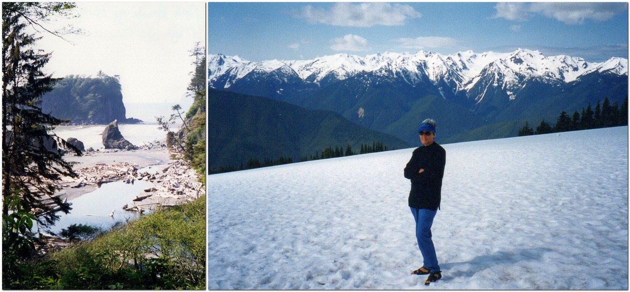
L: Sea stack at Ruby Beach on the Pacific coast of the Olympic Peninsula; R: snowfield at Hurricane Ridge on the north of the Olympic Peninsula.

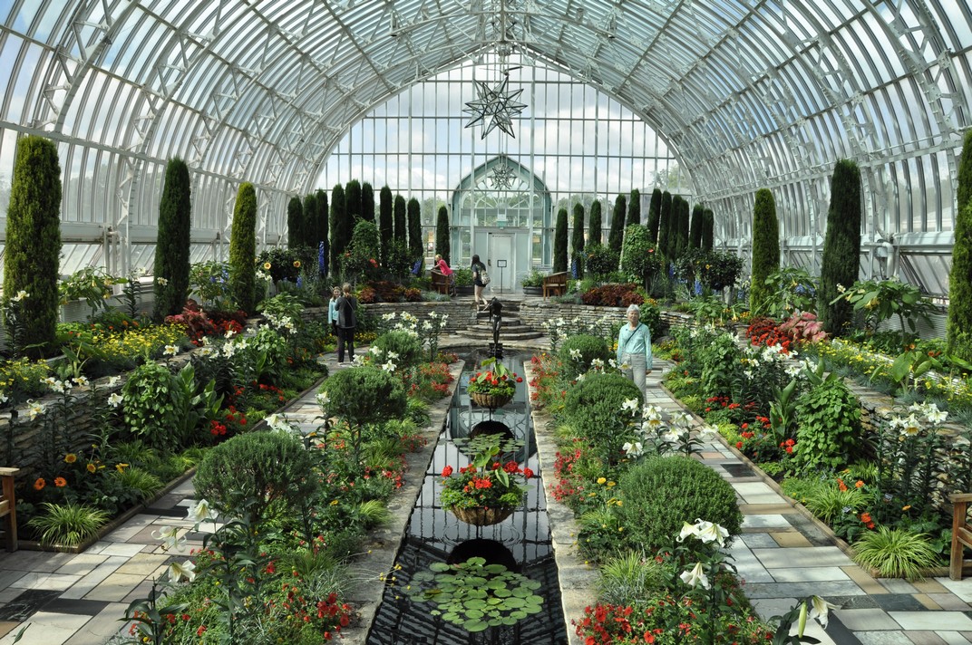
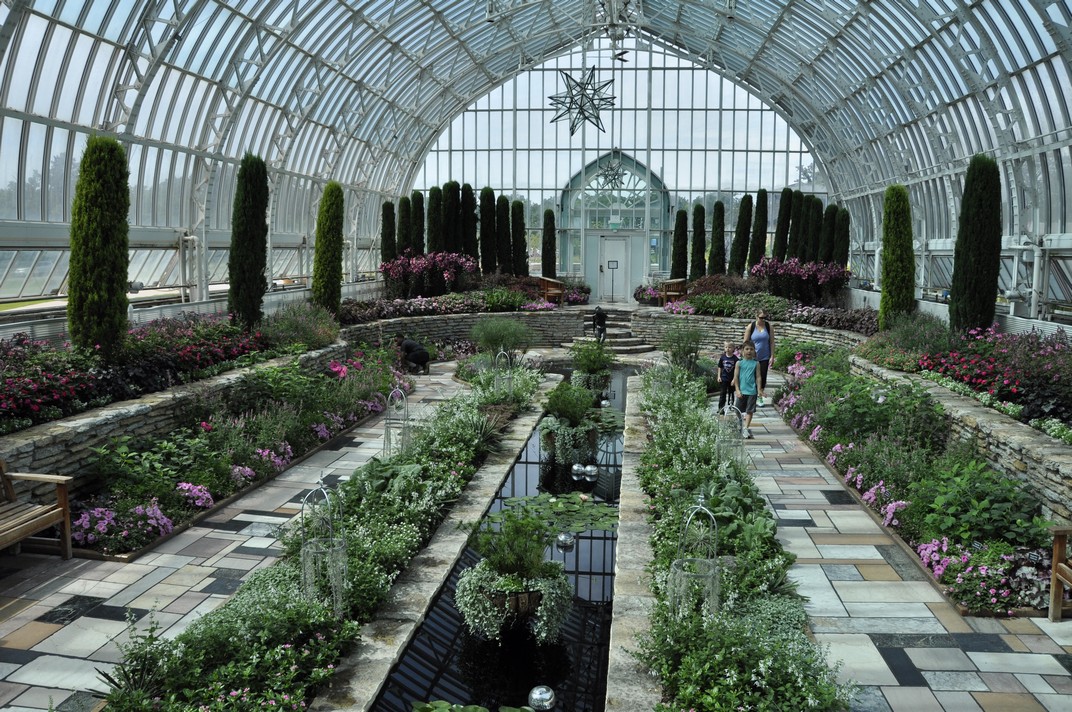
When Hannah joined Macalester College in St Paul in the autumn of 1998, I would, as far as possible, route my trips via the Twin Cities, and got to know the area quite well.


But it wasn’t until after I had retired that Steph and I really set about exploring the country.

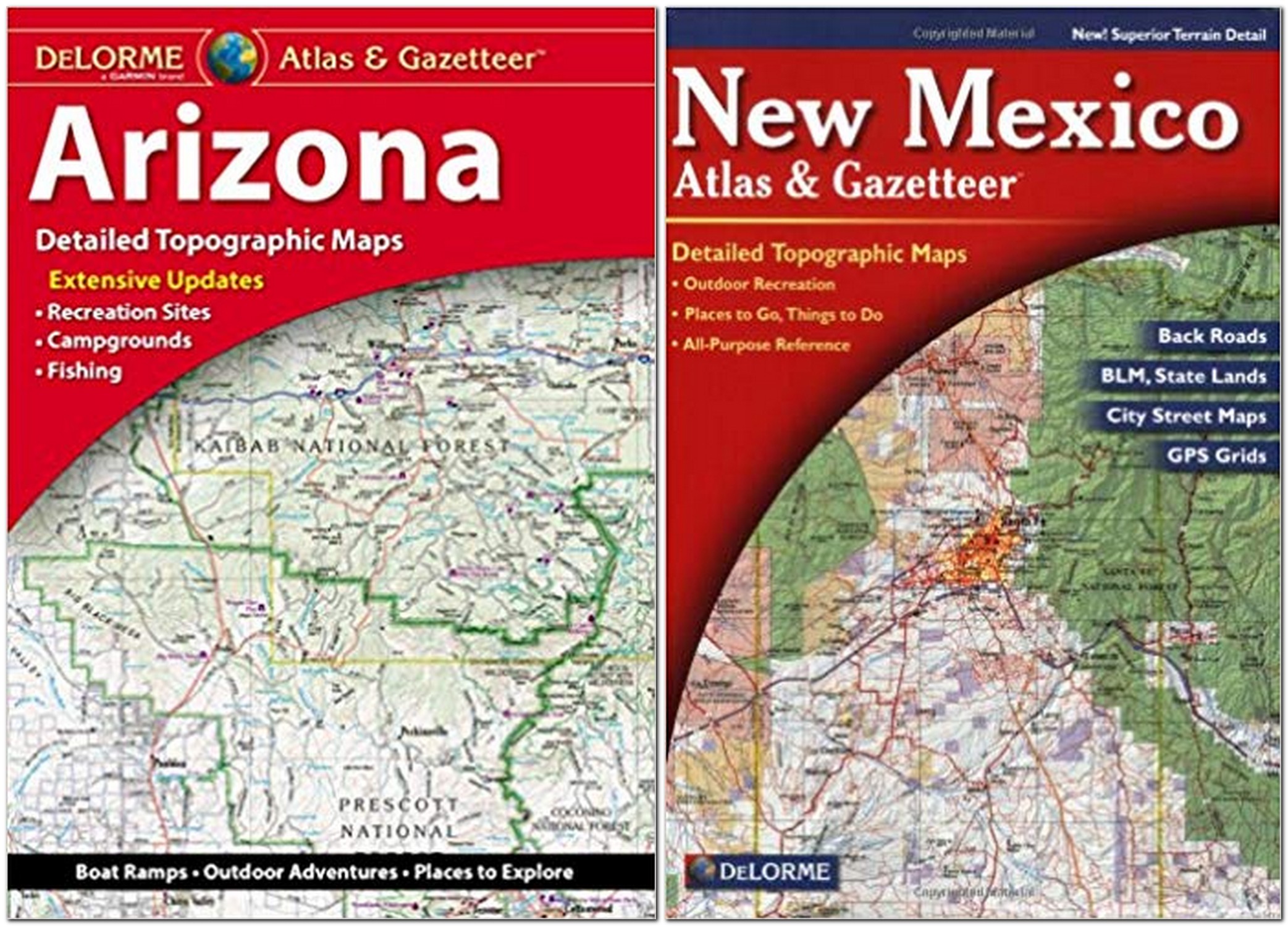
Our first road trip in May-June 2011 took us to canyon country in Arizona and New Mexico, beginning in Phoenix, AZ and ending in Albuquerque, NM taking in the Grand Canyon, Monument Valley, Canyon de Chelly, the Painted Desert, and Bandolier National Monument, among a number of locations.


A year later we explored the Minnesota Riviera along Lake Superior, and north to the Boundary Waters Wilderness Area.


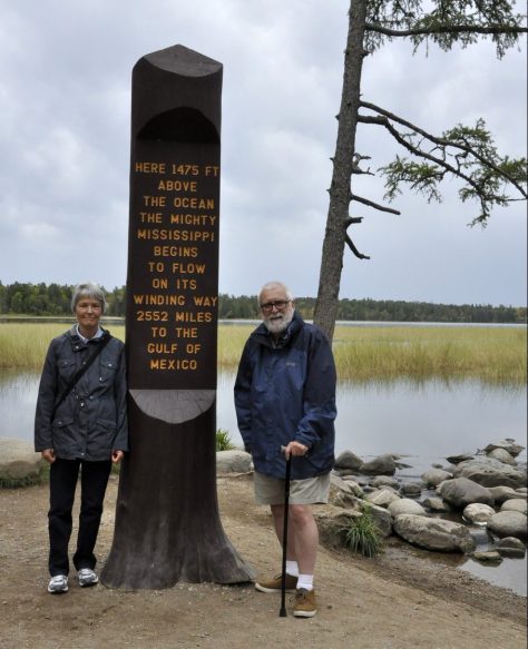
In 2016, after I’d broken my leg in January, we made just a short trip to find the source of the Mississippi in central Minnesota.


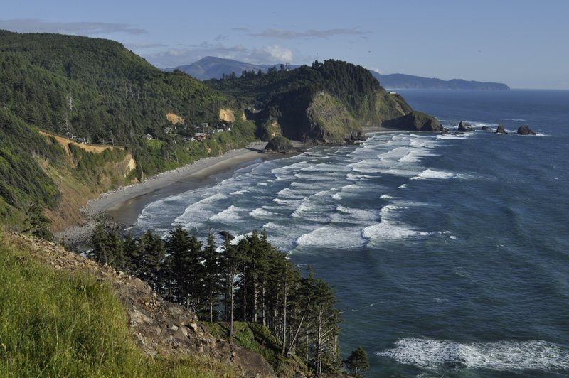
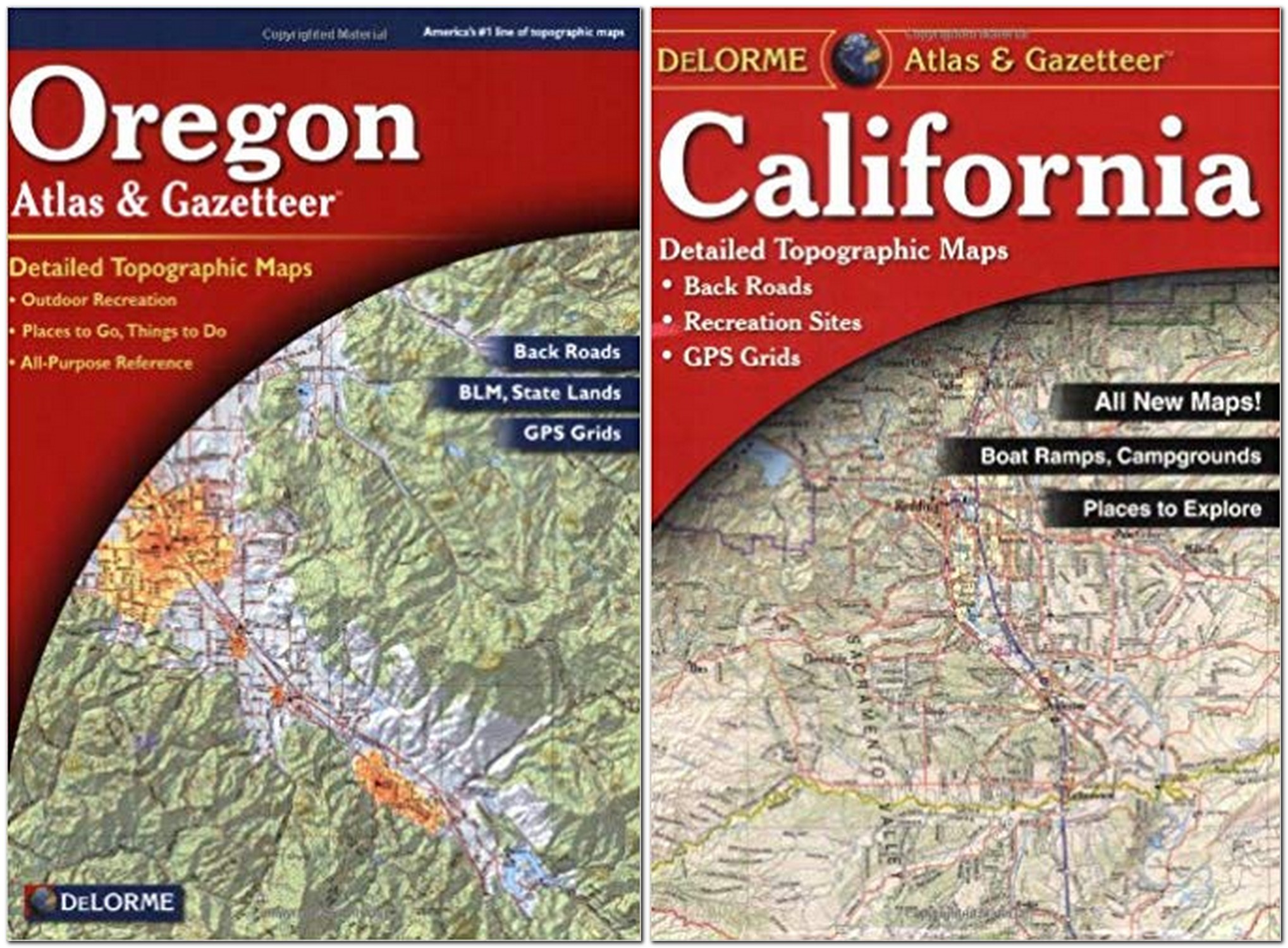
June 2013 saw us on the Oregon coast, spending time with Hannah and family in a house overlooking the spectacular coastline at Oceanside just south of Cape Meares, where the photo below was taken.

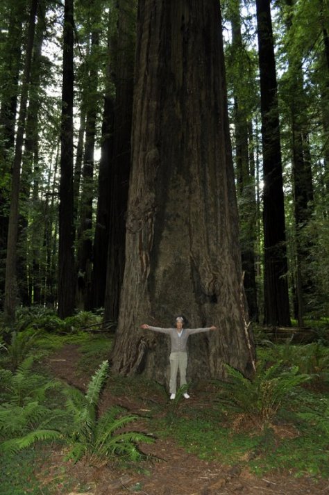
Then Steph and I headed south into northern California to take in the coastal redwoods. But not before stopping off at Crater Lake, OR.
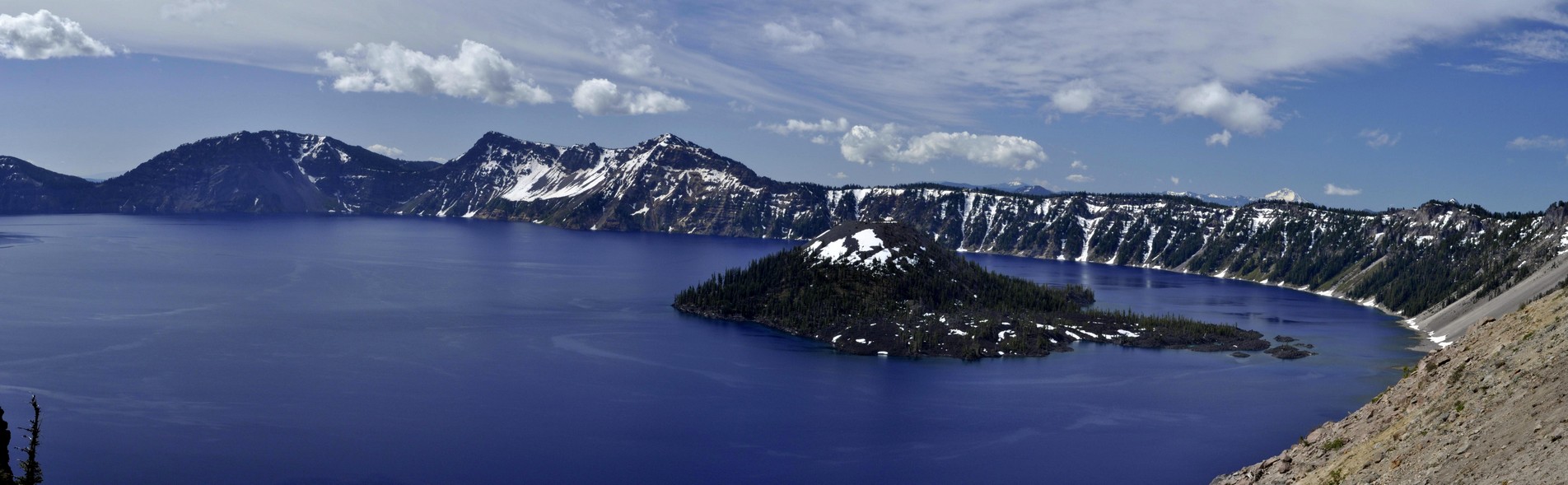
Crater Lake, OR


In 2014 we made the first of three road trips of more than 2500 miles. Heading west from St Paul, we took in the Badlands and Mount Rushmore of South Dakota, Devil’s Tower in Wyoming, the Little Bighorn Battlefield in Montana, before heading up the Beartooth Highway (America’s most beautiful?) to enter Yellowstone National Park from the north.


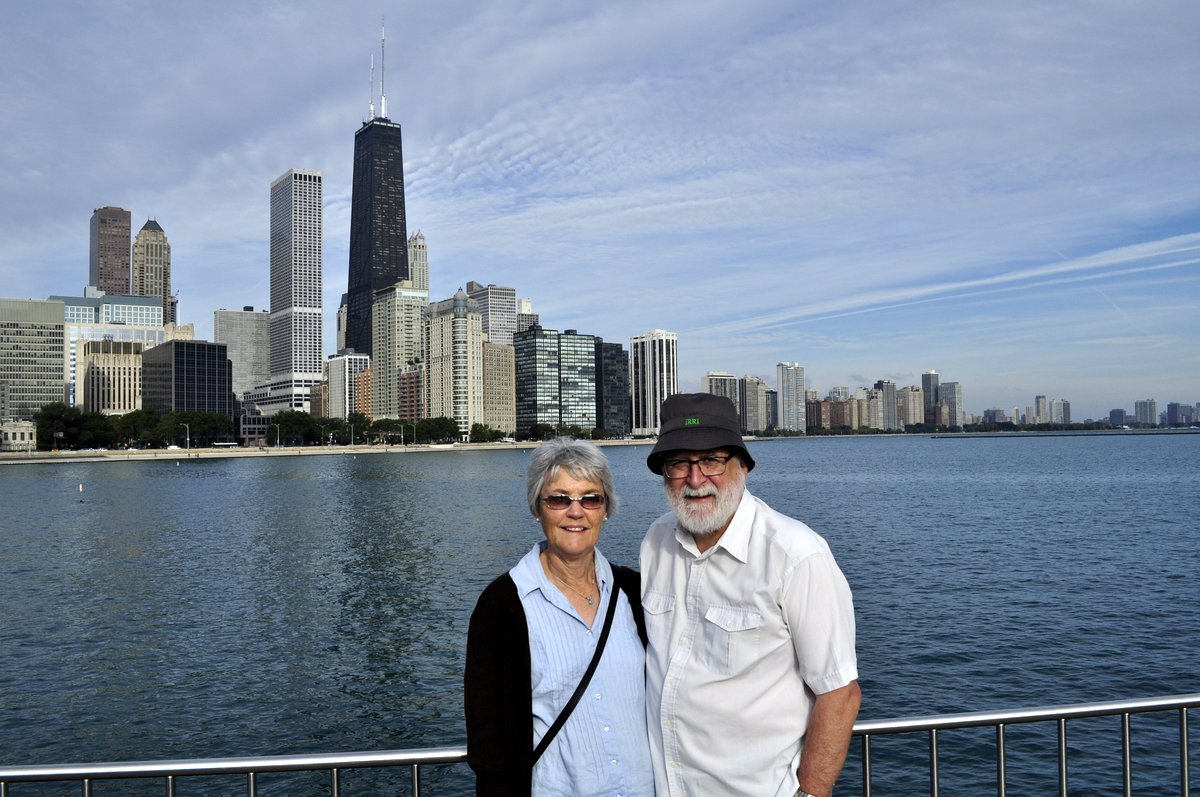
In September 2015, having made a long tour of Scotland in May, we decided on just a mini-break in the Windy City, Chicago, and traveled there by train from St Paul on Amtrak’s Empire Builder.


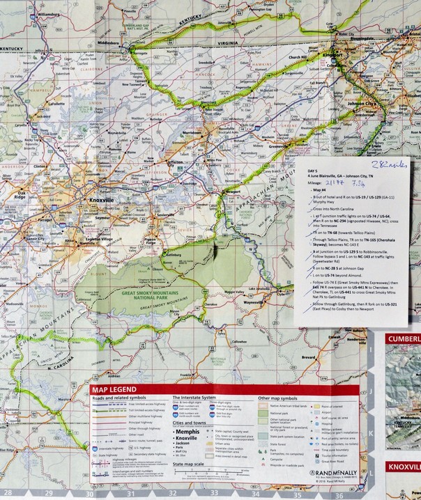
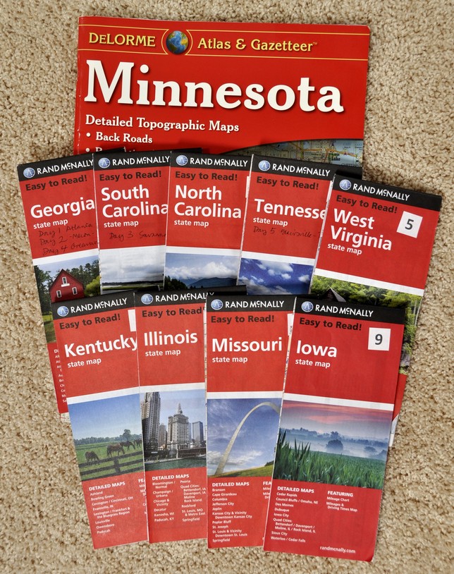
In 2017, we made the long road trip from Atlanta in Georgia to St Paul, taking in eleven states: South Carolina, North Carolina, Tennessee, West Virginia, Virginia, Kentucky, Illinois, Missouri, Iowa, and back into Minnesota. Among the many attractions were the streets and parks of Savannah, the Appalachians, Mammoth Cave National Park in Kentucky, the confluence of the Mississippi and Ohio Rivers, and following the meandering Mississippi north through Illinois, Missouri, and Iowa.


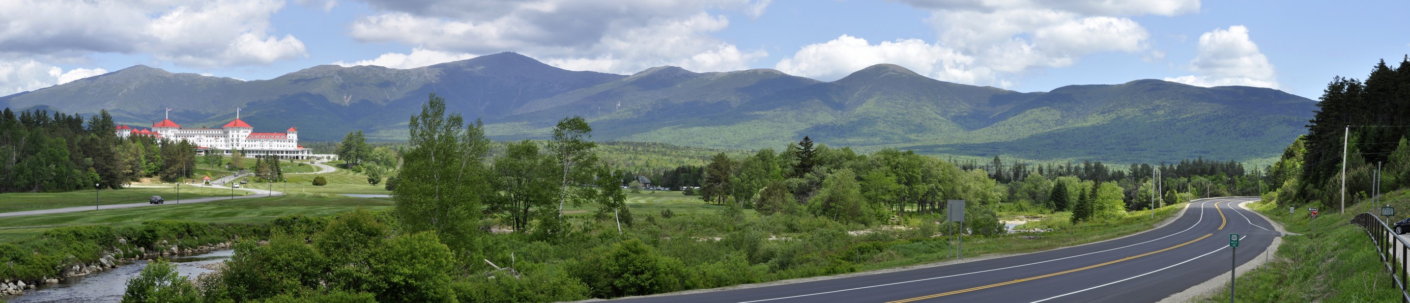
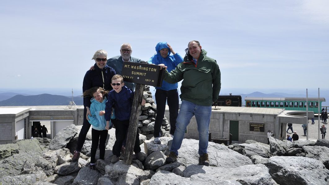
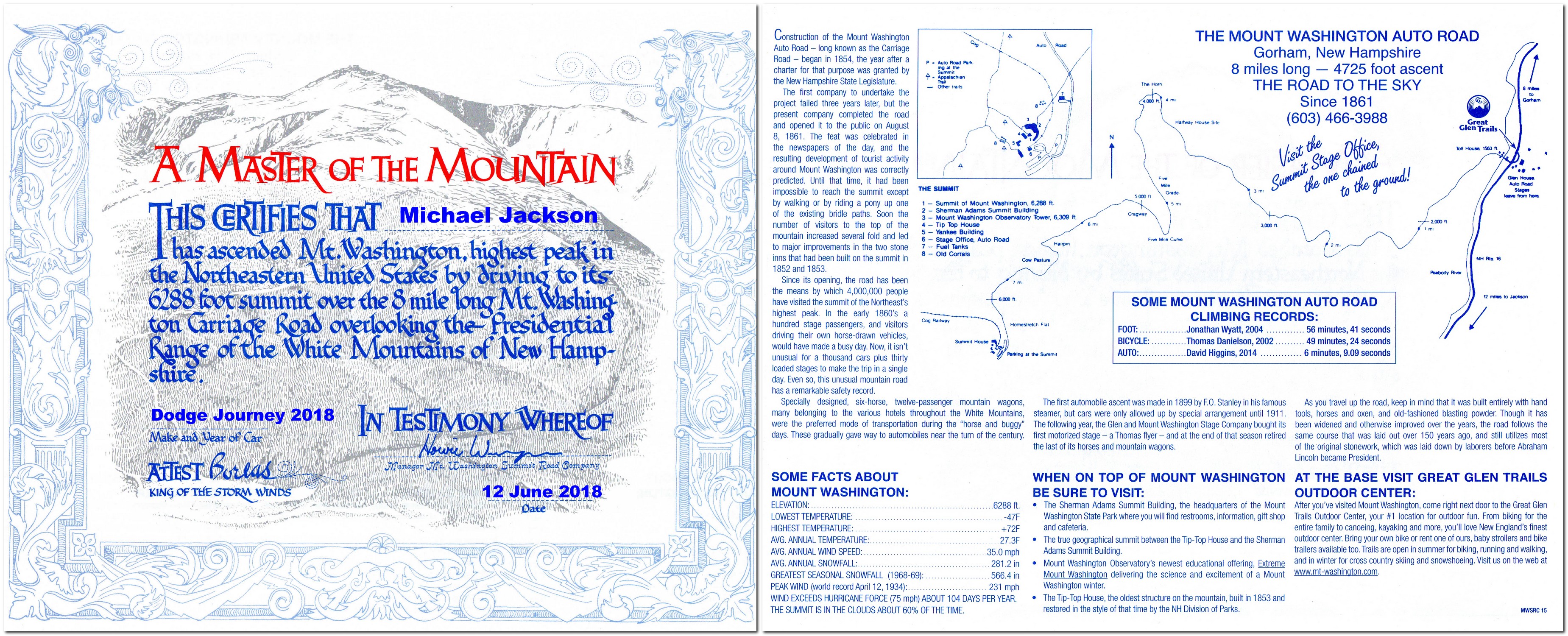
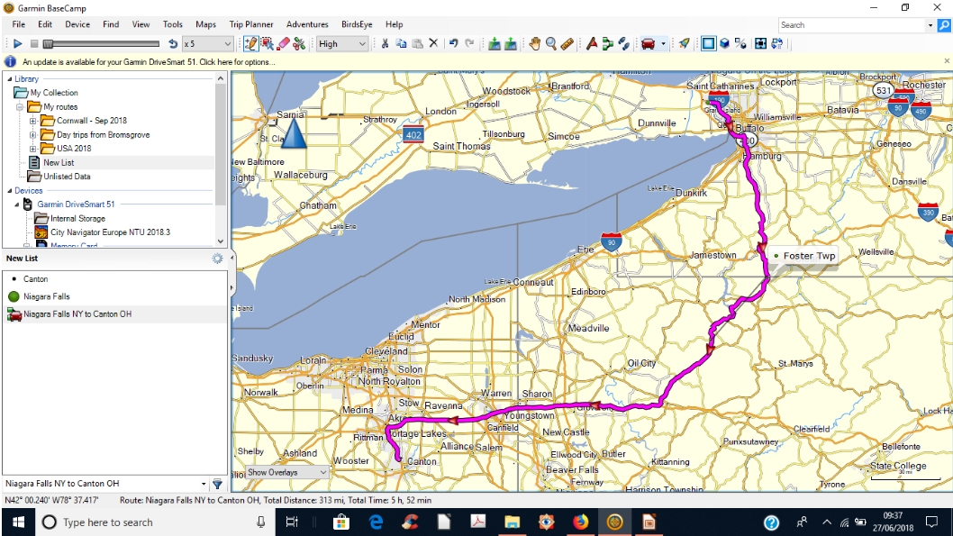
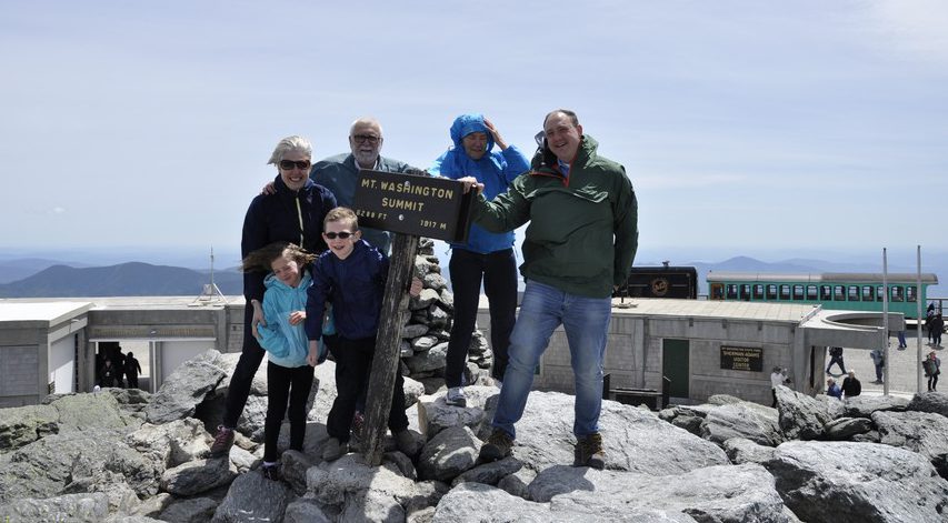
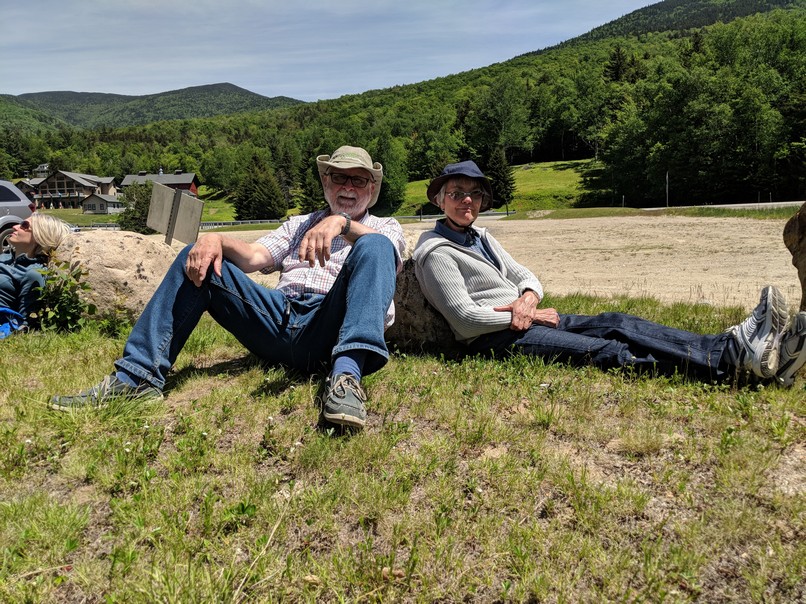
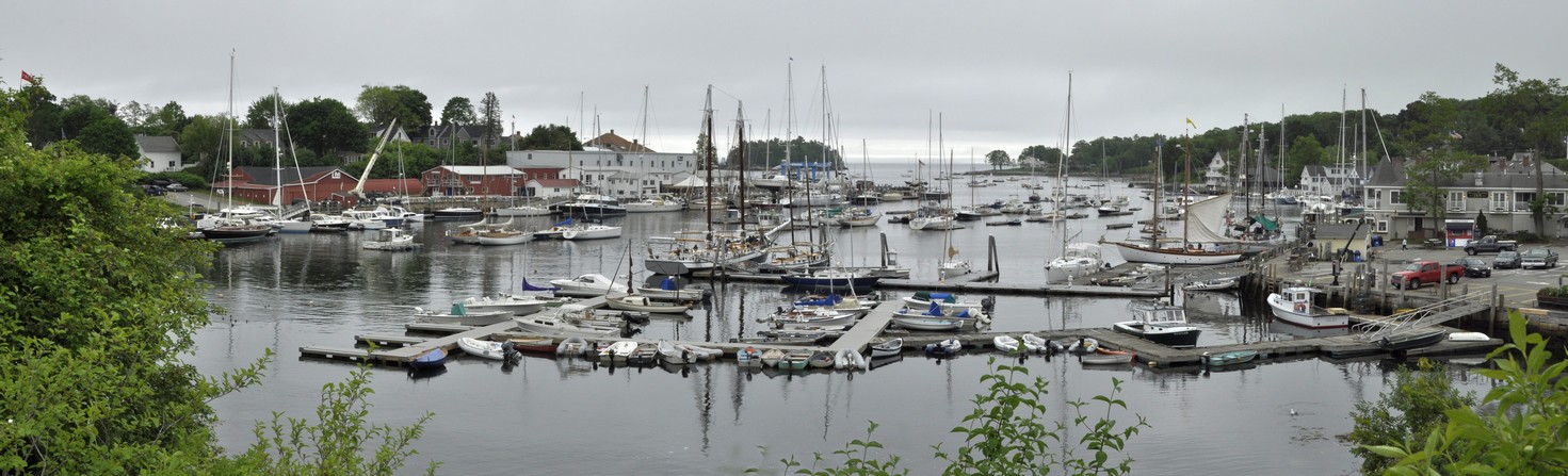
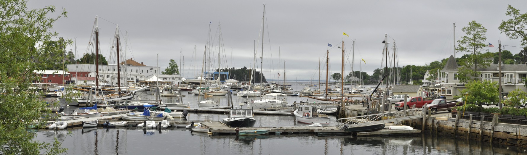
That was 2017. Last year we drove from Massachussetts to Minnesota (there is a link to the other four posts in this series), crossing Vermont, New Hampshire, Maine, New York, Pennsylvania, Ohio, Indiana, Michigan, and Wisconsin.


So what does 2019 hold in store. We’d like to explore the Deep South: Alabama, Mississippi, and Louisiana, but also taking in Arkansas, Oklahoma, and south as far as San Antonio (and The Alamo) in Texas. But we have no firm plans yet. It all depends on how the UK leaves the European Union (Brexit!) at the end of March, and whether this affects our ability to travel easily. There are so many unknowns, but we are not booking any flights or car rental until the situation is clearer.

I think we would fly into Atlanta, and head southwest into Alabama. I’d like to visit Vicksburg in Mississippi (site of an important siege during the American Civil War), and on to New Orleans of course. We wouldn’t try and drive back to Minnesota; it would be too far, so we’ll need to look into flights from San Antonio to MSP. Another consideration is when to travel. Mid-summer would be too hot and humid; not comfortable at all. So I guess it could be in September or early October, but will we come up against the hurricane season?

Although I have visited Washington, DC many times, I’ve never really toured the city. Steph hasn’t visited. So a visit there and to Virginia (Williamsburg, Monticello, and Mount Vernon), the Civil War battlefields of Virginia, Pennsylvania (Gettysburg), and Maryland, and the other Atlantic states (Delaware and New Jersey) is another trip we must plan.


At the beginning of this post I mentioned that the USA is beautiful, fascinating, diverse, challenging, bewildering, and huge country.

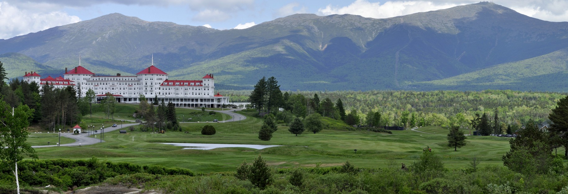
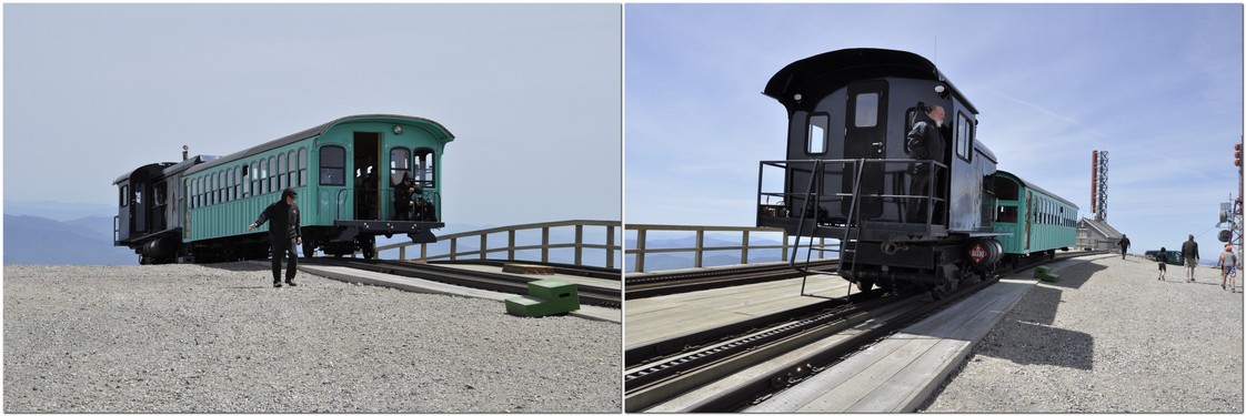
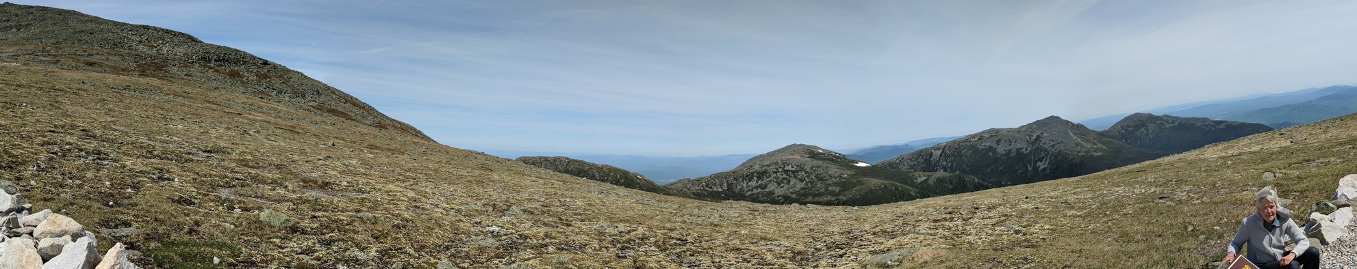
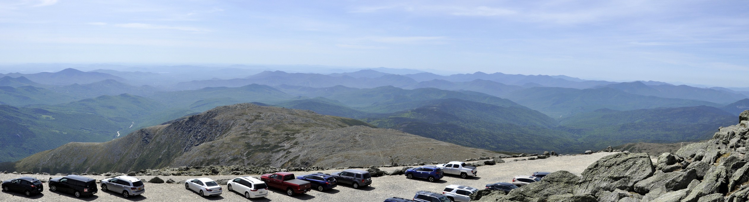
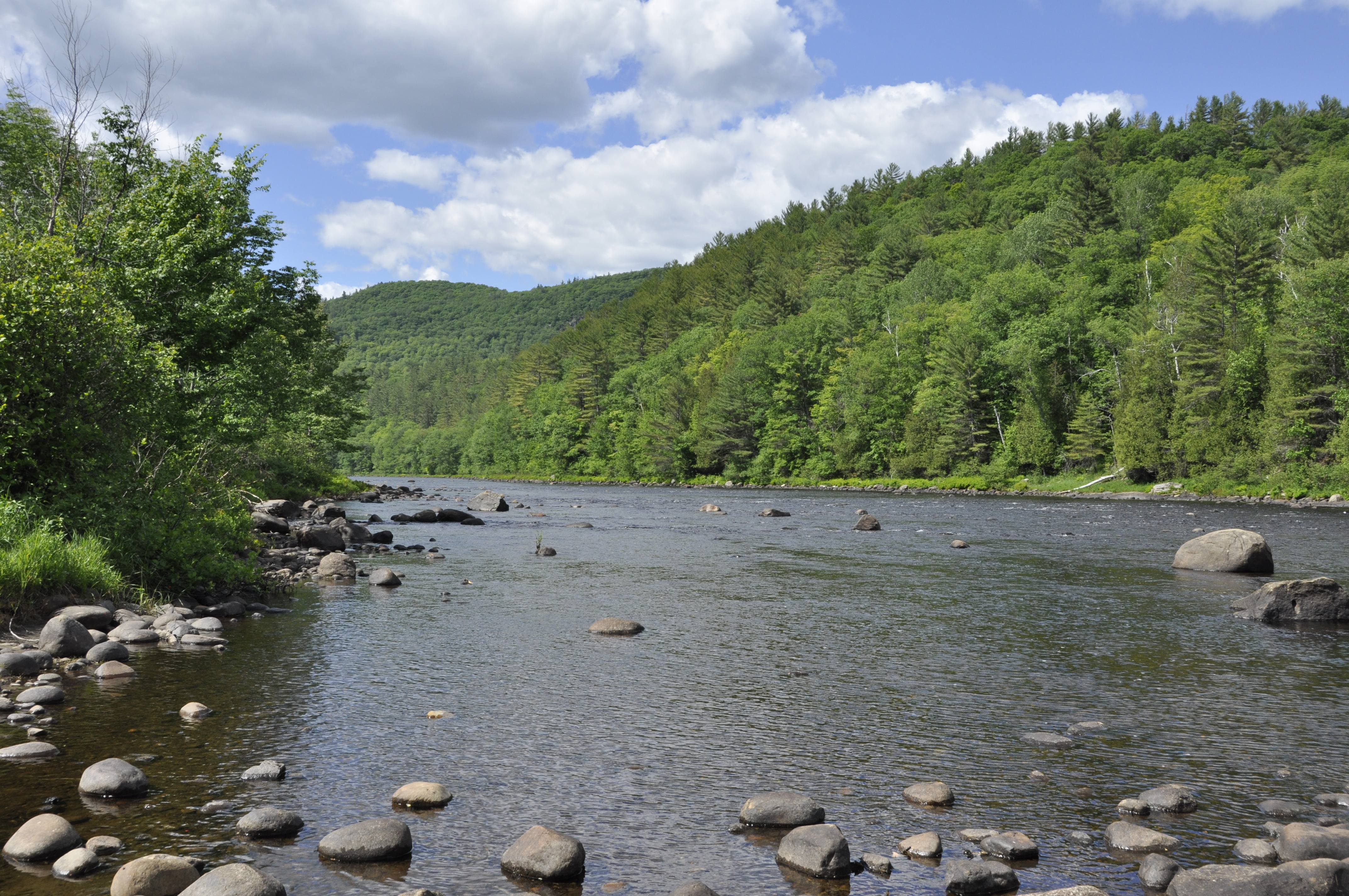
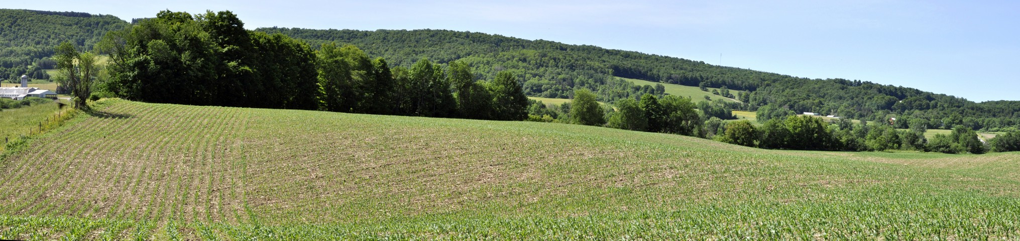
From the distances we have traveled there’s no doubt about just how huge the country is; the landscapes go on forever. These landscapes—forests, river valleys, mountains, plains, deserts, and coasts—are stunningly beautiful. In fact, I find it hard to describe them, so will let my photography speak for me.

The USA is so many countries rolled into one. The people are so different from one region to another, with very different perspectives on life. And challenging perspectives for me as an outsider, on religion (which plays such an important, and perhaps overly so, role in daily life), the love affair with guns, and the election of someone as President who is clearly not fit to hold that office. A political system that permits a president to be elected although losing the popular vote by 3 million votes or more seems bizarre (not that the first past the post parliamentary constituency system in the UK has much to commend it right now).

But it’s the paradoxes of the USA that I find bewildering.

We always enjoy returning to Minnesota however, and although we have mostly visited during the summer months, we did experience a Minnesota winter at Christmas 2007. Apart from the winters, Minnesota and Minnesotans are mellow!


One last point. If I had to choose to return to just one of places we have visited, which would it be?

Without a doubt – the Canyon de Chelly. It was one of the most remarkable places I have ever visited. The closest town is Chinle, and that’s in Navajo Reservation territory. No alcohol in the restaurants, so I’d have to make sure I brought some cold beers along. It was quite a shock when we visited in 2011 and I couldn’t order a beer with my steak.
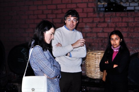


A botanical field trip to the south of Peru . . . 45 years ago

In 1976, a paper appeared in the scientific journal Flora, authored by University of St Andrews botanist Peter Gibbs¹ (now retired), on the breeding system of a tuber crop, oca (Oxalis tuberosa), that is grown by farmers throughout the Andes of Peru and Bolivia.

Like a number of Oxalis species, oca has a particular floral morphology known as heterostyly that promotes outcrossing between different plants. In his 1877 The Different Forms of Flowers on Plants of the Same Species, Charles Darwin had illustrated (in Fig. 11) the particular situation of tristyly in ‘Oxalis speciosa‘, the same floral morphology that is found in oca. In this illustration taken from Darwin’s publication, the ‘legitimate’ pollinations are shown; stigmas can only receive pollen from stamens at the same level in another flower.

Anyway, to cut a long story short, Peter had visited Peru in early 1974 (hard to believe that it’s 45 years ago), made collections of oca from a number of localities, particularly one village, Cuyo Cuyo, in the Department of Puno in the south of Peru (just north of Lake Titicaca), and then studied the breeding system of the oca varieties that he’d collected. His 1976 paper in Flora emanated from that field trip.


But there’s more to that story (and publication) than meets the eye. It was also tied up with the research I was carrying out on potatoes in the Peruvian Andes at that time. Peter and I made that field trip together, spending at least three weeks on the road, before flying back to Lima from Cuzco.

I don’t recall precisely when I first met Peter. We were obviously in touch when planning the trip south, but I simply can’t remember whether, during 1973, Peter had passed through Lima where I was working at the International Potato Center (CIP) in La Molina since January that year, or he had contacted CIP’s Director General Richard Sawyer asking if the center could provide logistical support and the DG had passed that request on to me. Whatever the course of events, Peter and I came to an agreement to make a field trip together to the south of Peru.

This is the route of more than 2000 km that we took.

While working as an Associate Taxonomist at CIP I was also registered for a PhD in potato biosystematics (under potato expert Professor Jack Hawkes at The University of Birmingham) which I was expected to complete by 1975. My work, studying the breeding relationships of potato varieties with different chromosome numbers was similar, in some respects, to that Peter envisaged with oca.

I’d been looking for suitable field locations where it might be possible to study the dynamics of potato cultivation in an ‘unspoiled’ area where mostly traditional potato varieties were cultivated rather than varieties bred and released on the market in recent years. At the back end of 1973 I made a short visit to Puno on the shore of Lake Titicaca to explore several possible field sites. Then, Peter proposed we visit the remote village of Cuyo Cuyo, around 250 km north of Puno. He’d come across a paper (either one by AW Hill in 1939 or another by WH Hodge in 1951 – both are cited by Peter in his Flora paper) that described widespread oca cultivation at Cuyo Cuyo on a series of ancient terraces, but also of potato varieties. I wasn’t sure if this was the location I was looking for, but agreed that we could explore Cuyo Cuyo first before heading north towards Cuzco in search of other likely sites.


Our journey south to Puno took at least three days if memory serves me correctly. Our trusty chariot was a short wheelbase Land Rover, with a canvas hood.

Not the most secure vehicle if you have to park up overnight in an unprotected lot. Nor the most comfortable; very sturdy suspension. But an excellent vehicle otherwise for ‘driving’ out of tricky situations.

We headed south on the Panamericana Sur, stopping at Ica or Nazca on the first night south of Lima, then on to Arequipa on the second day.

The Panamericana hugs the coast through the southern desert, crossing river valleys that flow down from the Andes to meet the Pacific Ocean. Along these, and in the area of Camana (where the road heads inland to Arequipa) quite a lot of rice is grown.

From Arequipa it must have taken another day to travel to Puno across the altiplano.

We then had another night to recoup in Puno, enjoying a comfortable bed, some good food, and perhaps one too many algarrobina cocktails (made from pisco) that Peter had taken a shine to.

Along the shore of Lake Titicaca near Puno


It took a day to travel to Cuyo Cuyo, across the altiplano (>4000 masl), fording rivers, and then, as we approached the village from the south, dropping into a steep-sided valley, the Sandia Gorge.

We hit a cloud layer, obscuring views of the valley, but also coming across a landslide that had to be cleared before we could make progress.

Once past that barrier, the cloud cleared and we began to see something of the majesty of the Cuyo Cuyo valley, with the steep valley sides covered in ancient terraces that, as we discovered over the next few days, were still be farmed communally as they had been for generations apparently. On the descent into Cuyo Cuyo, the banks alongside the road were also covered in masses of a beautiful begonia (Begonia clarkei Hook.) with large white flowers about 3-4 inches in diameter.


Where to stay? There was no hotel or pensión in Cuyo Cuyo. We did however have some camping gear with us such as camp beds, sleeping bags and the like. Plus all our other equipment for collecting (and drying) herbarium samples, and flowers and flower buds for pollen and chromosome studies.

After some enquiries we met Sr Justo Salas Rubín (who was, if I remember correctly, the local postmaster – seen with Peter below) who gave us space in one of the rooms of his home (the ‘post office’?) to set up ‘camp’. We also soon became quite a curiosity for the local children (and some animal friends as well).

I was not disappointed that we chose Cuyo Cuyo first. It was an extraordinary location where we could interact with potato and oca farmers who grew a wide range of varieties, and who were open to collaborate with us. Since that visit in 1974 several other botanists (and anthropologists) have made field studies at Cuyo Cuyo on the agricultural terraces that I described here.

While Peter set about collecting samples in the many oca fields (mainly beside the river on the valley floor), I set off up the terraces to study a couple of fields for their varietal composition, the ploidy (or chromosome number) of these varieties, and the factors that led farmers to accept or reject varieties. I was interested to see how triploid varieties (sterile forms with 36 chromosomes that can only be formed following hybridization between varieties with 48 and 24 chromosomes) could enter farmer systems, and at what frequency.

I also looked at the methods used to cultivate potatoes, and the tools used.²

On the left is a foot plough, about 4 feet in length, known in Cuyo Cuyo as a ‘huire’ (most often ‘chaqui taccla’ in other parts of Peru). Its component parts are: A. ‘calzada’ that rests on the shoulder; B. ‘huiso’ or hand grip; C. ‘lazo’ or leather binding fastening the parts together; D. ‘taquillpo’ or foot rest; and E. the ‘reja’ or blade. On the right is a hand tool used for harvesting potatoes (and presumably oca as well) called the ‘lawccana’, as well as other cultivations during the growing season. Its component parts are: A. the ‘ccalo’ or handle; B. the ‘lazo’, a leather thong holding the blade C. or ‘chonta’ on to the handle.

My paper on potatoes at Cuyo Cuyo was finally published in 1980 in the journal Euphytica. And that’s a tale in itself.³

Peter was keen to make herbarium sheets of many of the varieties he’d collected. We set up a dryer in the house where we were staying. But there was a problem. Most of the samples were pretty wet to begin with, as we experienced intermittent rain during our stay in Cuyo Cuyo. Oca stems are very fleshy, and despite our best efforts, they just didn’t dry out. Even when we got them back to Lima, and Peter prepared them for shipping back to St Andrews, many of the samples were still showing signs of life.

Indeed, after he returned to Scotland, Peter was able to take cuttings from his herbarium samples and grow plants to maturity in the glasshouse, thus continuing his studies there.


After three or four days in Cuyo Cuyo, we retraced our steps to Puno, then headed north towards Cuzco and further study sites near Chinchero.

At these, I was particularly interested in taking flower bud samples from different potato fields. In the area we chose, farmers grew a combination of bred varieties for sale in the local markets of Cuzco and, around their homes, native varieties for home consumption. In this photo, large plantings of commercial varieties stretch into the distance. Around the homes in the foreground, in walled gardens, farmers grew their native varieties.

As I was busy looking at different varieties, these two women came by, and one sat down to breastfeed her baby. They are wearing the traditional dress of that region of Cuzco.

On another day we set out to study potato (and oca) fields a little more remote, so had to hire horses to reach our destination.

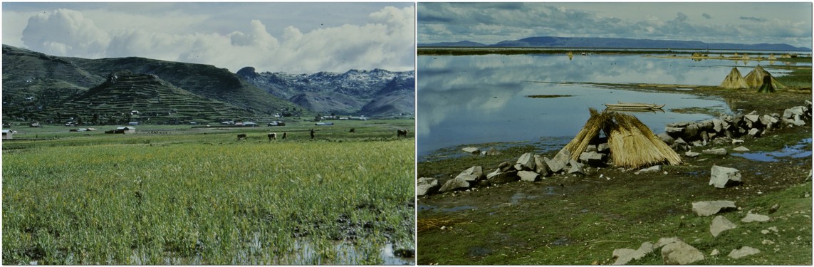
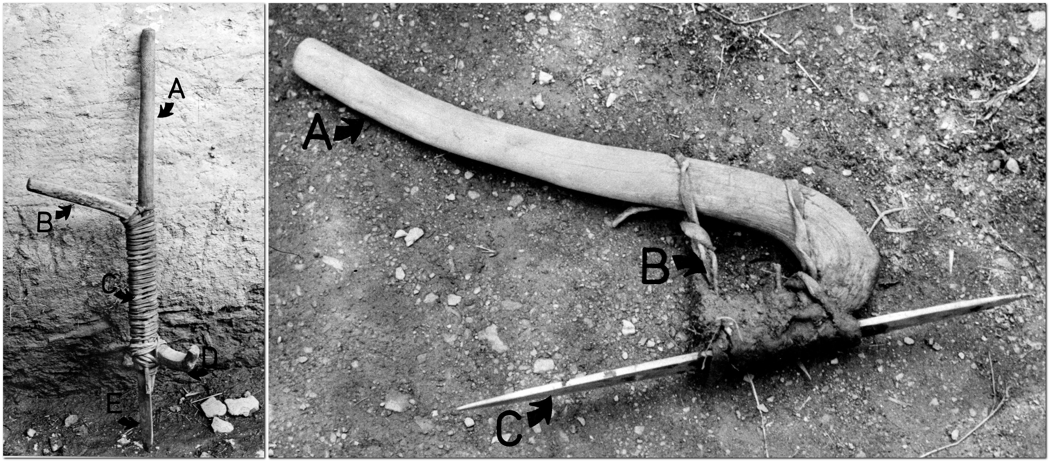
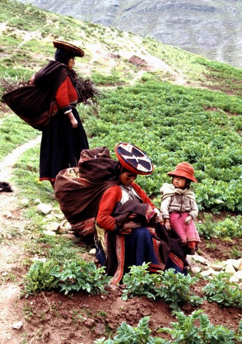
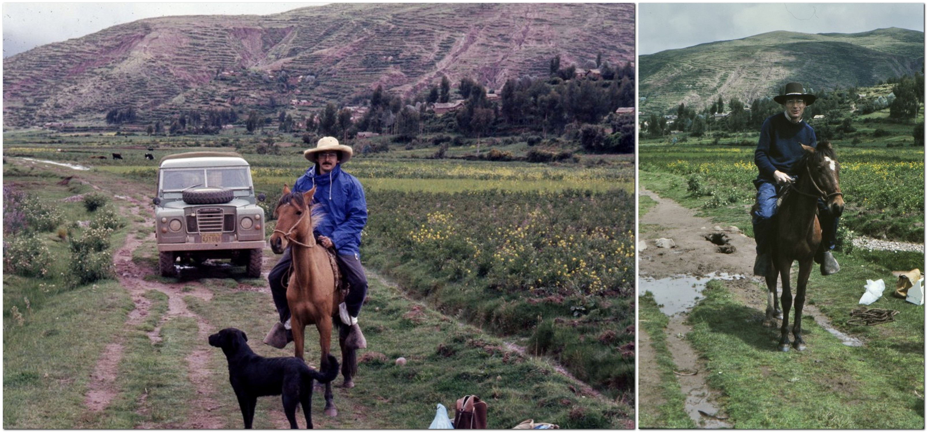
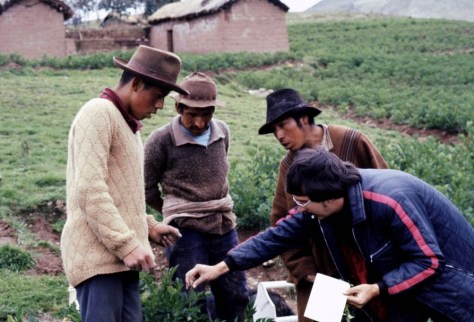
Field work complete, Peter and I spent a couple of days resting up in Cuzco before flying back to Lima. We left the Land Rover there for one of my colleagues Zósimo Huamán to pick up, as he planned to undertake some fieldwork as well before driving back to Lima.

During the couple of days in Cuzco we paid a call on Prof. César Vargas, a renowned Peruvian botanist (and close friend of my PhD supervisor Jack Hawkes), who I’d met once before in January 1973 not long after I arrived in Peru. Prof Vargas’s daughter Martha studied for her MSc degree in botany at the University of St Andrews.

L to R: my wife Steph, Peter, and Martha Vargas

All in all, we had a successful field trip to the south of Peru. It’s hard to believe it all took place 45 years ago next month. But it remains, in my mind’s eye, quite a significant trip from the years I spent in Peru.


¹ Peter graduated in botany from the University of Liverpool, and completed his PhD in 1964 there under the supervision of Professor Vernon Heywood, who moved to the University of Reading to become head of that university’s Department of Botany a couple of years later. Peter and I had a lot to talk about, because in 1969-70, when I was an undergraduate at the University of Southampton, Vernon Heywood gave a series of 20 lectures on flowering plant taxonomy over 10 weeks to Southampton botanists, because Leslie Watson, Southampton’s taxonomy lecturer had moved to Australia. Vernon and I renewed our acquaintance some years later, in 1991, when he and I attended a genetic resources meeting at the Food and Agriculture Organization of the United Nations (FAO) in Rome just before I moved to the Philippines to join the International Rice Research Institute (IRRI).

² One interesting piece of information that didn’t make it into my thesis but which I remember clearly was the incidence of geophagy among some residents of Cuyo Cuyo. I was taken to a location where farmers would excavate small quantities of a hard clay, that would be ground to a powder and mixed with water to form a slurry or soft paste. They would then dip recently harvested boiled potatoes in the clay as this, apparently, would decrease the slightly ‘spicy’ flavor of some of the varieties. I’m not sure how widespread this behavior was, but it’s something that has stuck in my mind all these years. I think I once had photos but they are long lost, more’s the pity.

³ I completed my PhD in December 1975, and shortly afterwards moved to Costa Rica to continue working for CIP, in potato breeding and agronomy. I started to prepare three manuscripts from my thesis for publication in Euphytica. The first, on varietal diversity, was submitted in February 1977, and published later the same year. The second, on breeding relationships, was published in 1978, having been submitted in July 1977. The third, on the ethnobotany of potato cultivation in Cuyo Cuyo finally appeared in print in 1980, having been submitted to Euphytica in February 1979.

But Euphytica had not been the first choice for this third paper. I actually produced a manuscript for the journal Economic Botany, and it included more details of the cropping systems and varietal choices made by farmers. My paper was received by the journal and acknowledged, but then I heard nothing more, for months and months. Eventually I wrote to the editor asking about the status of my manuscript. And I received a very strange reply.

It seemed that the editor-in-chief had retired, and his replacement had found, on file, manuscripts that had been submitted up to 20 years earlier, but had never been published! I was asked how I wanted to proceed with my manuscript as there was no guarantee it would appear in print any time soon. But about the same time, I received a nice letter from the then editor of Euphytica, Dr AC Zeven, complimenting me on my PhD thesis (which he had read in the library at Wageningen University in the Netherlands) and encouraging me to publish my work on the ethnobotany of potatoes – if I hadn’t already done so. I withdrew my manuscript from Economic Botany, and after some reformatting to fit the Euphytica style, sent it to Dr Zeven. He requested some deletions of the more descriptive sections on ethnobotany, and published my paper in 1980.


One last thing: I also remember was the novel that Peter was reading throughout the trip. Watership Down by Richard Adams, first published in 1972, that went on to become a literary sensation. I did read it myself at some point, but whether I borrowed Peter’s copy immediately after the trip, or some time later, I don’t recall. I know I didn’t think it would become the phenomenon that it did. What do I know?


9 February 2023
Today I received the news that Peter passed away, at home in St Andrews, on 6 February. That would be almost 49 years to the day since we set out from Lima on our expedition to the south of Peru. Rest in peace, Peter.


A year full of heritage

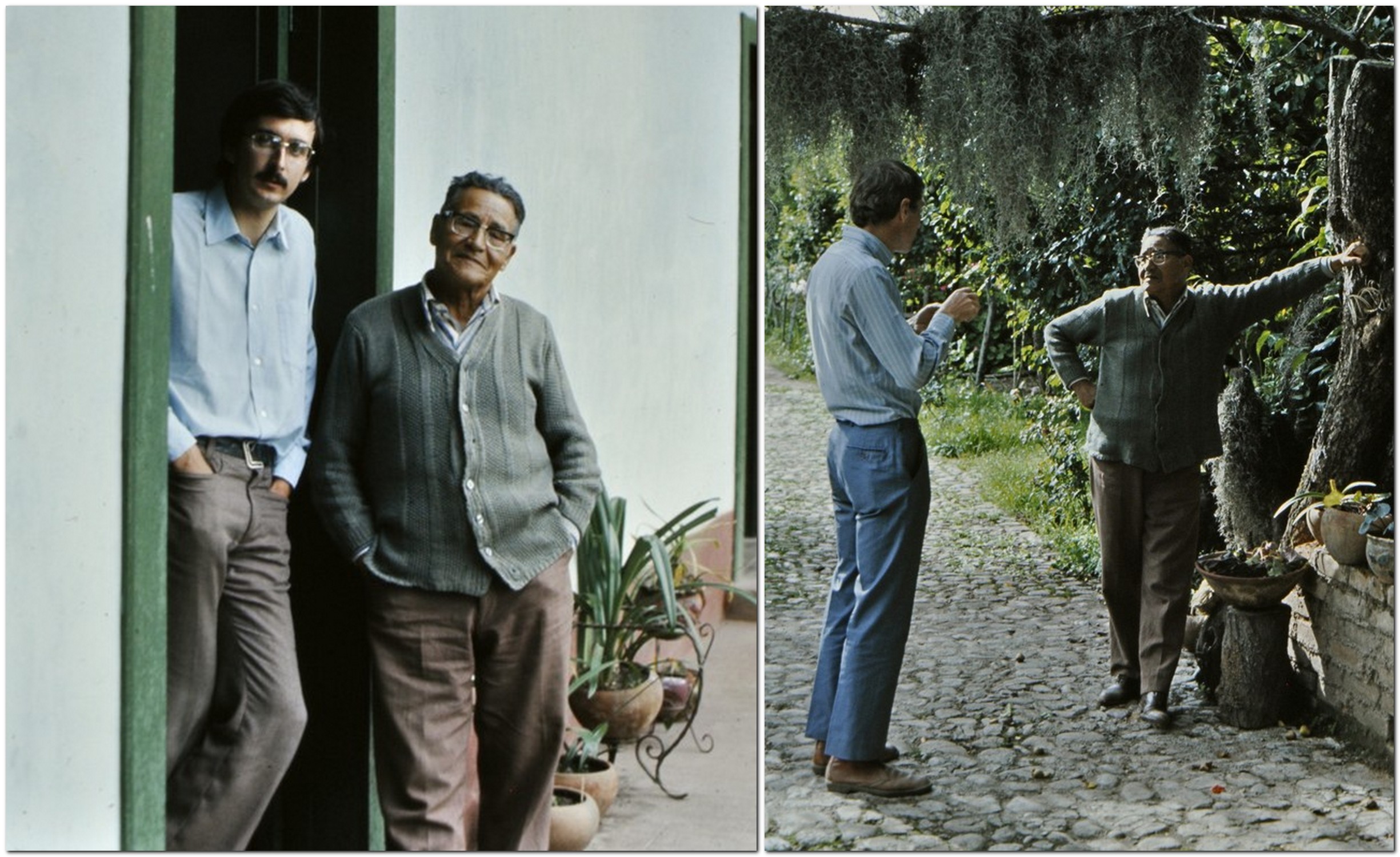
Steph and I have been members of the National Trust since 2011. Following our first visit to one of the Trust’s properties in February that year (to Hanbury Hall, just 7 miles from home), we have tried each year to get out and about as often as we can. After 5 years membership, we were offered a special senior citizen joint membership: such great value for money; so many interesting houses, landscapes, and gardens to visit, and enjoy a cup of coffee (and an occasional flapjack) in one of the NT cafes.

These visits give purpose to our excursions. We’ve now explored 97 National Trust properties in England and Northern Ireland (as well as as few maintained by the National Trust for Scotland). And we have enjoyed many country walks as well around parkland and through gardens.

Click on the various links to open stories I have posted during the year, or an album of photos.

We are fortunate that close to us (we’re just south of Birmingham in northeast Worcestershire) there are half a dozen properties that take 30 minutes or less to reach. The closest is Hanbury Hall, and we often visit there to enjoy a walk around the park – four times this year – or take one of the many paths to the canal, up to Hanbury church, and back into the park. I particularly enjoy seeing how the parterre changes through the seasons. It is a very fine example.

The parterre at Hanbury in August

The other houses close to home are Charlecote Park ( in July), Croome (August), Packwood House (August), Baddesley Clinton (October), and Coughton Court (April and November).

Coughton Court in April

Our National Trust year began in February with a return visit to Newark Park, 58 miles south in Gloucestershire, to see the carpets of snowdrops, for which the garden is famous. We first visited the house in August 2015.

A week later we traveled 20 miles southwest from home to the birthplace of one of England’s greatest composers, Sir Edward Elgar. It was a sparkling day. We even managed a picnic! After visiting the house, The Firs, and the visitor center, we took the circular walk from the site that lasted about 1 hour. I found watching a short video about Elgar’s life to the accompaniment of Nimrod quite emotional.

Then a week later, we decided on a walk in the Wyre Forest, about 17 miles west from Bromsgrove, to find Knowles Mill, a derelict flour mill in the heart of the forest.

April saw us take in three properties (besides Coughton Court): Dudmaston (which we first visited in 2013); Kinwarton Dovecote; and Southwell Workhouse (a fascinating visit).

In May, I had to obtain an international driving permit, and the closest post office was in the center of Birmingham. That was just the excuse we needed to book a tour of the Back-to-Backs on the corner of Inge and Hurst Streets. What an eye-opener, and one NT property that should be on everyone’s bucket list.

Closer to home, in fact less than 4 miles from home, is Rosedene, a Chartist cottage that was one of a number erected in the area of Dodford in the 19th century. It’s open infrequently, so looking to the weather forecast we booked to view the property on Sunday morning. Unfortunately, the NT guides were unable to unlock the front door, so we never got to see inside, just peer through the windows.

We had returned to Upton House in Warwickshire at the beginning of the month to enjoy the walk along the escarpment overlooking the site of the 1642 Battle of Edgehill, and then around the garden. We had first visited in July 2012.

We were away in the USA during June and July, and just made some local visits in August. We were preparing for a week of NT and English Heritage (EH) visits in Cornwall during the second week of September.

What a busy week! We stopped at Barrington Court in Somerset on the way south, and Knightshayes in Devon on the way home a week later. You can read about those visits here.

Barrington Court

Knightshayes

We visited four more houses in Cornwall: Lanhydrock, Cotehele, St Michael’s Mount, and Trerice, and I wrote about those visits here.

Then there were the coastal visits, to The Lizard, Cape Cornwall, and Levant Mine (check out the stories here).

While on the north coast (visiting Tintagel Castle – see below), we stopped by Tintagel Old Post Office.

Cornwall has some fine gardens, and we visited these: Glendurgan, Godolphin, Trelissick, and Trengwaintonread about them here.

October was a quiet month. I can’t remember if we took a walk at Hanbury, but we did enjoy a long one along the Heart of England Way at Baddesley Clinton.

November saw us in the northeast, with a return visit to Seaton Delaval Hall (that we first visited in August 2013), and also to Penshaw Monument that is such an imposing sight over the Durham-Tyneside landscape.

In mid-November it was 70th birthday, and Steph and I spent a long weekend in Liverpool. One of the highlights was a visit to the Beatles Childhood Homes of John Lennon and Paul McCartney – rather emotional.

We completed our National Trust year by enjoying Christmas at Coughton Court on 30 November.


We have been members of English Heritage (EH) since 2015. Our daughters gifted us membership at Christmas 2014. Witley Court in Worcestershire is the nearest property to home, and we have been visiting there since the 1980s when we first moved to Bromsgrove. But not during 2108. Here’s a story from September 2017.

In April we were in the northeast and enjoyed a visit to Warkworth Castle near Alnwick on the Northumberland coast (map) with grandsons Elvis and Felix. Since it was close to St George’s Day, there was a tournament entertainment for the children.

Warkworth Castle

While in the northeast, we visited Rievaulx Abbey, somewhere I had first visited as a student in the summer of 1968, and then again in the mid-1980s on holiday with the family on the Yorkshire coast.

Towards the South Transept and the east end of the church from the southeast.

During our trip to Cornwall in September, we got to visit Chysauster Ancient Village, Pendennis Castle, Restormel Castle, and Tintagel Castle, which I have written about here.

The steps leading up to the castle gate.

Then in November, on the way home from Newcastle, we stopped off at Mount Grace Priory, that is owned by the National Trust but managed by English Heritage.

It was a bright and calm November morning, lots of color in the trees, and we were enchanted by the peace of this wonderful site. On our trips to Newcastle we have passed the entrance to the Priory many times, but never had found the time (or the weather) to stop off. It was well worth the wait.


This has been our heritage 2018. We have barely scratched the surface of NT and EH properties. We look forward to spreading our wings further afield in 2019.

With The Beatles . . .

Last weekend, Steph and I spent a couple of days in Liverpool where, in the 1960s, there was an explosion of musical talent—the ‘Mersey Sound‘ (a somewhat patronizing video)—that had been influenced by and built on the late 1950s skiffle music of Lonnie Donegan, among others.

The greatest among greats to emerge from the ‘Mersey Sound’ have to be The Beatles – Paul McCartney, George Harrison, Ringo Starr, and John Lennon.

It was my 70th birthday on the 18th and, in celebration, we planned this special trip to Liverpool to take in The Beatles’ Childhood Homes and The Beatles Story, among other sights. A full album of photos can be viewed here.

We originally intended to drive to Liverpool. Not difficult in itself, you might imagine: a mere 109 miles. But as most of that journey is along the notorious M6 motorway, potentially it would have been 109 miles of traffic hassle, and long stretches of roadworks. And although the weather has been quite mild recently, November can be foggy and frosty. These were the points we considered when finalizing our travel plans in late August. So we opted to travel by rail from Bromsgrove to Liverpool-Lime Street (via Birmingham New Street).

As it turned out, we had a weekend of the most wonderful weather—clear skies, bright and sunny. No rain whatsoever.

Although our train from Birmingham departed about 20 minutes late, we still arrived to Lime Street before 13:00, and after a 20 minute walk to the hotel, we were out and about exploring well before 14:00.

Our hotel was the 4-star Jurys Inn, located right on the Liverpool Waterfront, just across the road from the Royal Albert Dock, home to The Beatles Story. It was also starting point for the National Trust tour of The Beatles’ Childhood Homes. Right beside the hotel are the 60 m (196 ft) Wheel of Liverpool, the Echo Arena, and convention centre.

We used Emirates Airlines airmiles (Rocketmiles) that were about to expire and a small cash supplement to pay for the hotel.


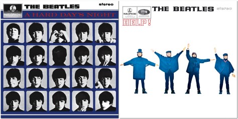
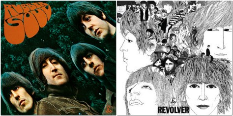
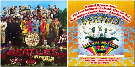
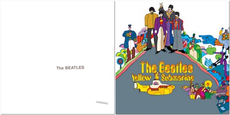
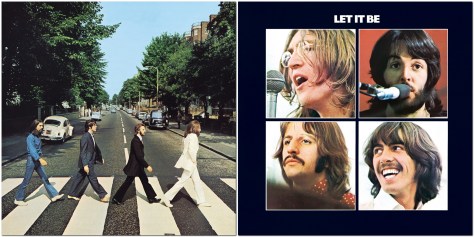
To begin with, let me take you back to late June 1967.

Just a month earlier, The Beatles had released their eighth and iconic Sgt. Pepper’s Lonely Hearts Club Band album. Little did I realize then that I’d be regularly visiting the home of The Beatles in the coming weeks.

Having just left school, I was waiting for my exam results and hoping I’d done well enough to secure a coveted place to study botany and geography, from October, at The University of Southampton. As I couldn’t spend the summer kicking my heels around my parent’s home, I found a temporary job for the next couple of months working for a local Leek company, Adams Butter (which I’ve written about elsewhere), as driver’s mate on the company’s fleet of trucks.

Adams Butter took raw, unsalted butter (mostly from Australia and New Zealand), blended and packed it into household packs, and distributed it to supermarkets and other retail outlets all over the country. Having emptied a truck of 25 tons of butter (in 26lb boxes), we’d head off to the nearest port to load up with another 25 tons of frozen butter, in 56lb boxes, to transport back to the dairy in Leek.

That first week saw me in Liverpool twice, and over eight or nine weeks or so, I must have gone back there a dozen times or more. But I haven’t been back there since, apart from a half-day visit around 2000, when I was invited to give a seminar at The University of Liverpool. Until last weekend, that is.

Fifty years on and Liverpool is a transformed city. Gone is the frenetic activity of the docks; there were no containers then. Once the River Mersey and port were bustling with ships from all over the world; a huge labor force of dockers manhandled produce off the ships. By the 1980s many of the docks along the Liverpool Waterfront were closed, and warehouses were derelict.

Now the Waterfront is a World Heritage Site, a place for everyone to enjoy. And also home to The Beatles Story, Tate Liverpool, the Museum of Liverpool, shops, cafes, and restaurants. During our visit, there were funfair rides set up along the Waterfront, as well as an ice rink, and some sections of the German market, all part of Liverpool’s run up to Christmas.


Our tour of the Beatles’ Childhood Homes started at 10:00 when the National Trust driver, Joe, met us in the lobby of Jurys Inn. We were an international party of just 13 persons (5 UK, 1 Irish, I Czech, I French, 1 Maltese, 1 Australian, and 3 Malaysian). The drive to the first property, John Lennon’s home, took just over 15 minutes. Once we were all strapped in and ready for the off, Joe turned on the music: Love Me Do, and it was Beatles songs all throughout the tour. What a way to start! And, as it turned out, three quite emotional hours.

‘Mendips’. 251 Menlove Avenue, Woolton (a desirable suburb of Liverpool) is a 1930s semi-detached house (that has retained many of its original design features). John was born in October 1940. When his mother Julia separated from father Alfred in 1945, John went to live with Julia’s oldest sister Mimi and her husband George at ‘Mendips’. It was felt that a two-room flat in a rough part of the city near the cathedral was not a suitable place to raise a young boy.

It seems that John had limited contact with Julia as he was growing up. But by the time he was 17 (in 1958), he had begun to see her more regularly. Tragically, however, she was hit by a car on Menlove Avenue, and died from her injuries. She was just 44.
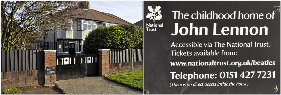
I have no photographs inside the house. As with the McCartney home, visitors’ cameras and mobile phones are locked away for the duration of their visit. It’s both for security and copyright reasons.

It was a powerful and emotional experience walking round John’s childhood home. I could feel a tear or two welling up every now and then. There were his school reports and lots of photos; also his bedroom where he wrote some of his early songs. And the porch where he and Paul tried out some of their songs. The National Trust guide encouraged us to go into the porch to test the acoustics. I didn’t sing but just clapped my hands; the acoustics were excellent. Apparently Paul has said he’d like to record some songs there.

John bought a bungalow for Aunt Mimi in Sandbanks in Dorset. ‘Mendips’ was never modernized after Aunt Mimi moved out. When the house came on the market in 2002, it was purchased by Yoko Ono and donated to the National Trust. The letter that Yoko Ono wrote to the National Trust explaining why she had bought the house is framed and lies on John’s bed.

On another level it was emotional for Steph in particular. So much of the layout and features of ‘Mendips’ reminded her of 30 Hillway, her parents’ home in Westcliff-on-Sea, Essex. That was a 1930s detached house.

We came away from ‘Mendips’ after an hour, to head to the McCartney home at 20 Forthlin Road, Allerton [1], just over a mile west from John’s house. John would visit Paul on his bicycle, cutting across the Allerton Manor Golf Club.

20 Forthlin Road is a terraced, former council house, to which the McCartney family, dad Jim, mother Mary, Paul, and younger brother Mike (Mike McGear) moved in 1956, from their home in the Speke. Forthlin Road was a step up.

Initially Paul and Mike shared a bedroom, but Paul eventually moved into a small front bedroom on his own. He continued to live there until 1963, after the other Beatles had already moved to London, and the band were already becoming a phenomenon.

Sitting in the front parlor, our guide Sylvia told us about how the McCartney family would make music together around the piano (I’m not sure if the piano there today is the original, but I think so; I tinkled the ivories), and singing in harmony. So when The Beatles started recording, singing in harmony with John was second nature to Paul (just watch the We Can Work It Out video at the end of this post). Paul originally played the trumpet, but dropped it to learn the guitar – which he had to modify and re-string because he is left-handed.

Paul’s mother Mary passed away from cancer in 1956, aged 47. Paul wrote Let It Be as a tribute to his mother.
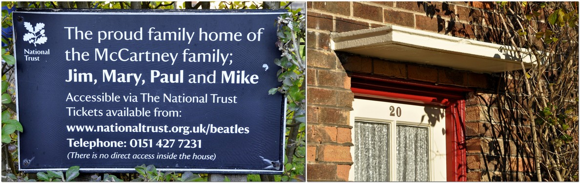
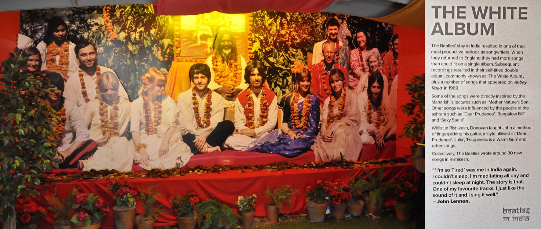
Dad Jim raised the boys with the help of relatives including Uncle Albert (remembered on Paul and Linda McCartney’s album Ram, released in 1971). Paul bought his father a house across the Mersey on the Wirral to which he retired; Paul still owns the house and uses it when visiting Liverpool.

Around No 20 there are many original and iconic photos of Paul and John writing and singing their songs in the same front parlor where we were sitting, taken by Paul’s brother Mike (who has the copyright, this being the reason why photography is not permitted inside).

Then after an hour there, we traveled back to Jurys Inn, to the accompaniment of more Beatles songs. What a marvellous way to spend the morning of my 70th birthday!


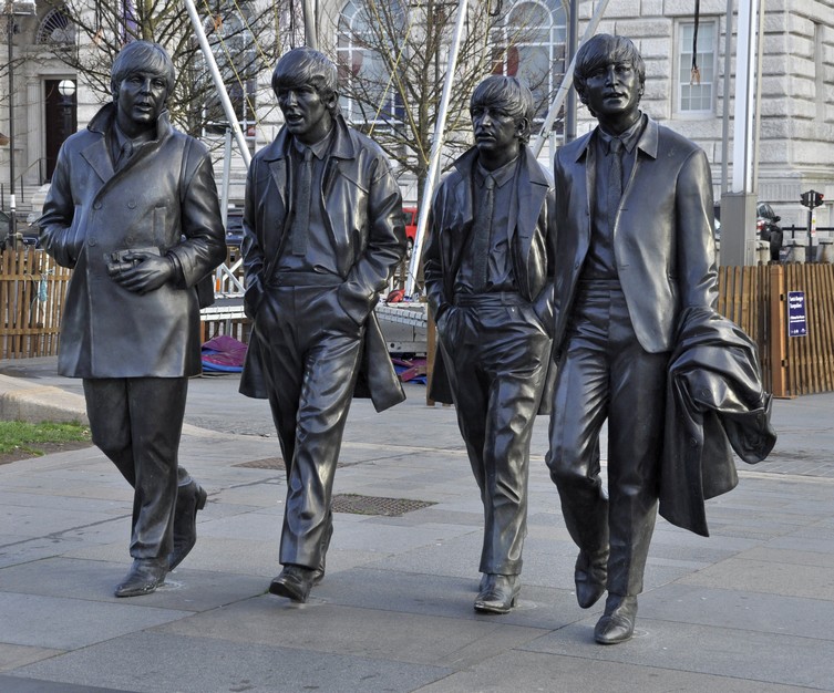
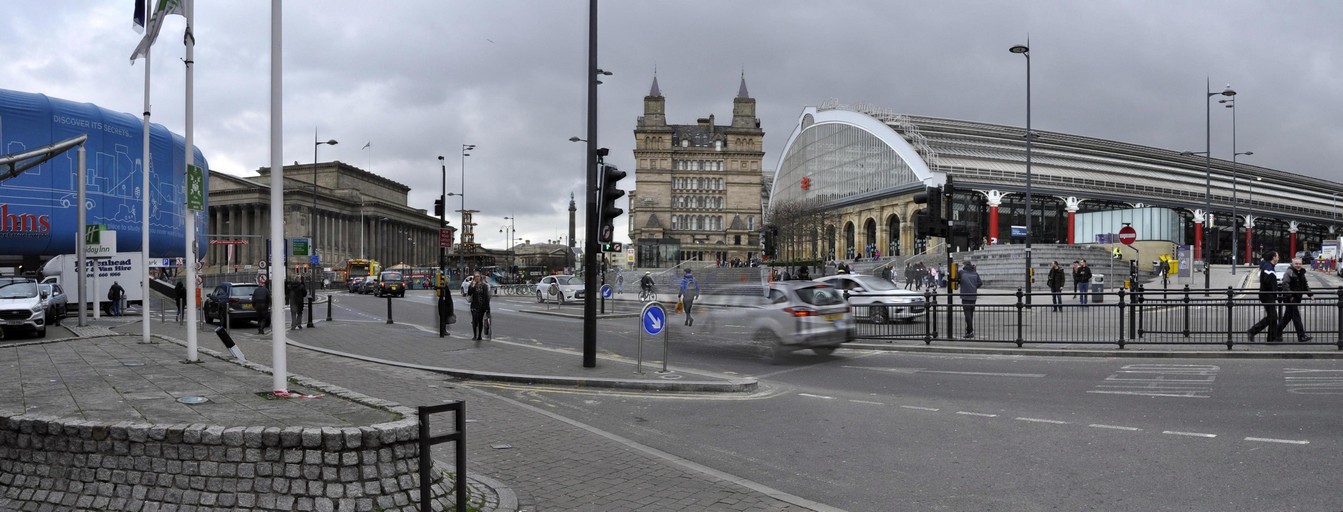
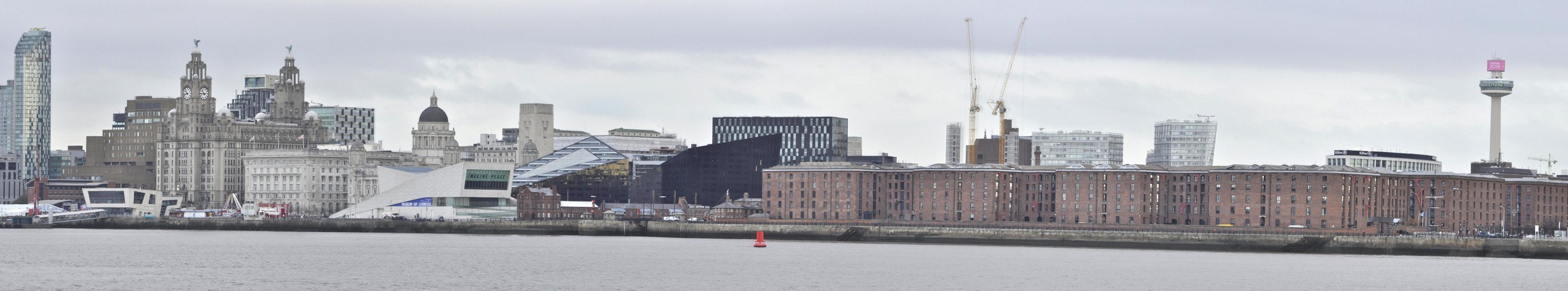
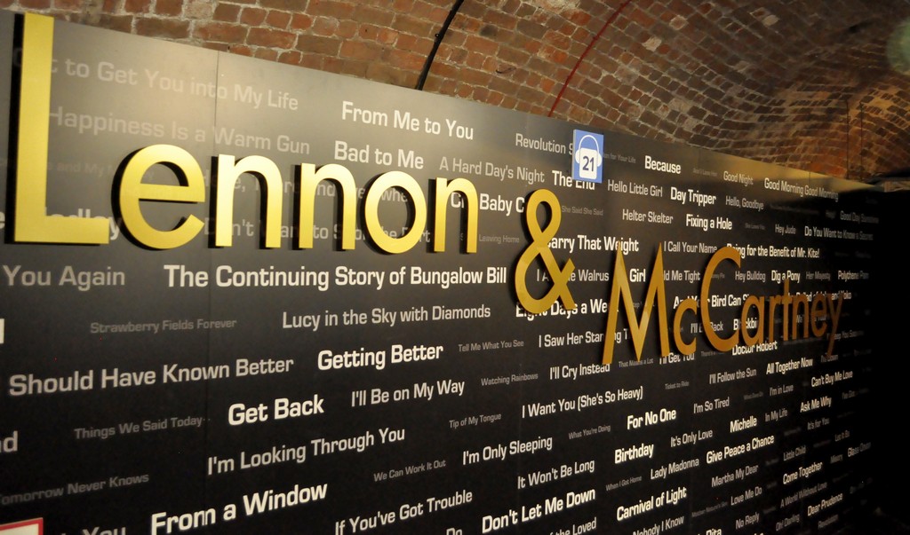
After a reviving cup of tea back at the hotel, we crossed the road to visit The Beatles Story exhibition. The story of The Beatles is told there through displays of memorabilia and photographs; it opened in May 1990.

From an early date until sometime in the past year, one particular display near the entrance explained the influence of the 1950s skiffle movement on The Beatles’ early musical careers. John Lennon played in a skiffle group called The Quarrymen which Paul McCartney and George Harrison later joined.

The display in question showed two boys, my elder brother Ed and me, playing guitar and tea-chest bass, entertaining our mother and two friends, Geoff and Susan Sharratt. That display has now been taken down, so I never got to see myself in The Beatles Story. But here’s my great-nephew Sammy standing in front of the display a year or so back.

The exhibition takes you through the band’s time in Hamburg at the turn of the sixties, their ‘residence’ at The Cavern, and onwards through their worldwide success.

There are so many iconic things to see and read about. It’s quite overwhelming. Here’s just a small selection; you can also see many more photos in the album I mentioned earlier.


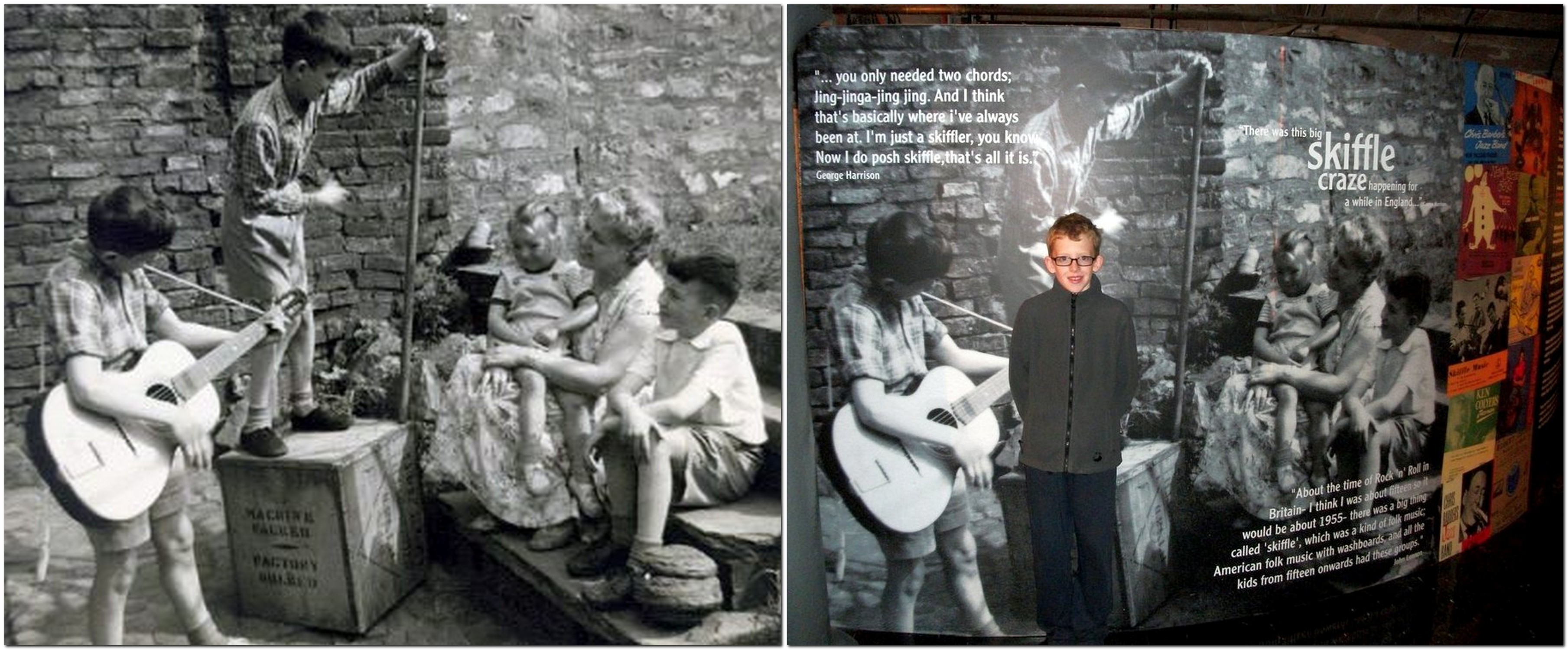
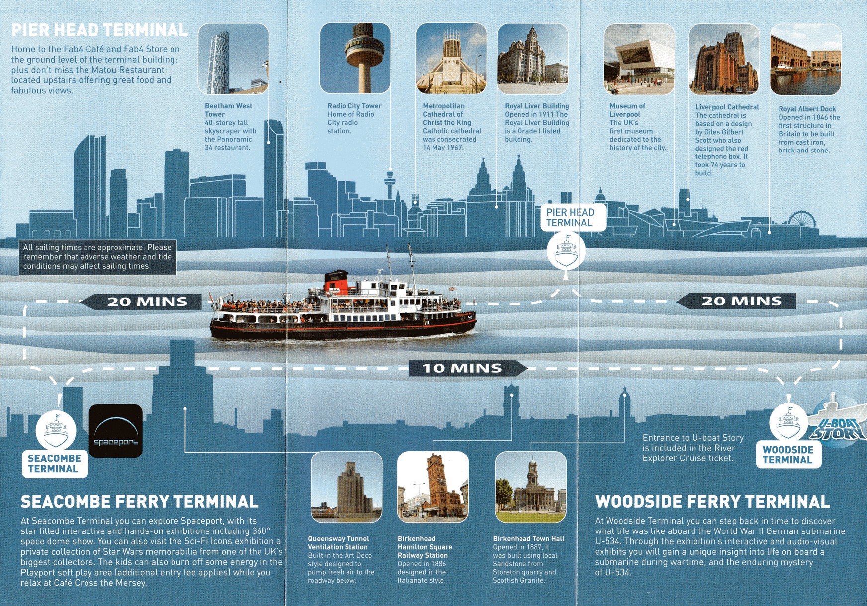
We returned home to Bromsgrove just after noon on Monday. But before that, we took a 50 minute river cruise on the Mersey ferry, Royal Iris, from the Pier Head Terminal, across to the Seacombe Terminal on the Wirral, and then to Woodside Terminal at Birkenhead, before returning to the Pier Head. Here’s a short video I made, with Gerry & The Pacemakers (courtesy of a YouTube video) providing the appropriate soundtrack.

It was a relaxing way to enjoy the Liverpool skyline. And the weather still kept fine for us even though the cloud built up later, and there was some rain before we departed from Liverpool.

Then it was a brisk walk back to Lime Street in time to catch our train just after 12:30.

We arrived home, on time, just after 15:30, and there was a very nice surprise waiting. My bank had sent me a bottle of Moët & Chandon Impérial Brut champagne for my 70th! What a treat to end a great weekend. I can’t stop singing all those Beatles songs.

But there is a postscript to this Beatles adventure . . .


Fifty years ago today, 22 November, The Beatles released their ninth studio album, The Beatlesalso known as the White Album.

Many of the songs that appeared on this album (and some on Abbey Road in 1969) were penned while The Beatles were experimenting with transcendental meditation under the Maharishi Mahesh Yogi at his ashram in Rishikesh, India.

In 1968 (just a couple of months into my second year at the University of Southampton), I celebrated my 20th birthday by purchasing a copy of the White Album, which I had pre-ordered some weeks earlier. I believe I was the first person in our student residence, South Stoneham House, to have a copy. Word soon got around and it wasn’t long before my room on the 13th floor became the focus of White Album sessions.

This is how the album was reviewed in 1968; here is a current reappraisal. A re-mastered version of the album was released just over a week ago.

You can hear more about Giles Martin’s work on the album here.

What’s your favorite track? There are so many to choose from. But if I had to name just one, it has to be George Harrison’s While My Guitar Gently Weeps, on which Eric Clapton was invited by George to play a solo.

Anyway, enjoy this ethereal version that was released on Love – a 2006 remix album (by George Martin and son Giles) that accompanied a Cirque du Soleil show of the same name.

In the ultimate tribute to George Harrison, here is a multi-talented band, led by two of Harrison’s Traveling Wilburys band mates, Jeff Lynne and the late Tom Petty (and including Harrison’s son Dhani), interpreting this song; there’s a superb guitar solo from Prince.


The first Beatles vinyl I bought was Rubber Soul, released in December 1965. I remember that quite distinctly, because I held a small Christmas party for school friends in Leek, and Rubber Soul was the soul of that party.

I never owned the early albums. I didn’t really like their music until A Hard Day’s Night was released in 1964. After Rubber Soul, I acquired all the other albums on vinyl, but these were lost in a burglary in 1978 when we lived in Turrialba, Costa Rica. I replaced them on CD in the 1990s.

Compared to modern bands, look at how prolific The Beatles were, given the short periods between release dates of their albums. These are the albums I currently have.

Released in July 1964 and August 1965

Released in December 1965 and August 1966

Released in May 1967 and November 1967

Released in November 1968 and January 1969

Released in September 1969 and May 1970

And I also have these two compilations: Past Masters Vol. 2 and Love that I have already referred earlier.

Released in March 1988 and November 2006

No-one can deny the genius that is Sgt. Pepper’s Lonely Hearts Club Band. But if I had to choose just one album, I think it would be Revolver. And an overall favorite Beatles track? Probably We Can Work It Out (although I don’t like the ending particularly) that was released on a double A-side single (with Day Tripper) in December 1965 (and features on Past Masters Volume 2).

Happy memories!


[1] 2 August 2020. I came across this video today on the Facebook page of a former IRRI colleague. It’s James Corden’s Carpool Karaoke with Paul McCartney, driving around Liverpool, and ending up at Paul’s childhood home. It’s great to see and hear Paul describe his early years there. And playing on the piano in the front parlor (on which even I managed to touch the ivories).

A ‘heavenly’ icon of the North

Viewed by thousands of motorists every day as they head into Newcastle upon Tyne or further north on the A1, the iconic Angel of the North spreads its (her?) welcoming wings on the southern outskirts of Gateshead. It was commissioned by Gateshead Council, and erected in February 1998.

Designed by British sculptor Sir Antony Gormley¹(who also created Another Place of 100 iron figures on the beach at Crosby near Liverpool), the Angel of the North stands over 20 m tall, and has a wingspan of 54 m. Overall, the Angel’s statistics are something to behold.

The construction details are also rather interesting.But why choose an angel as such an emblem for the North? Here’s what Antony Gormley said.

Driving north at 60-70 mph you only get a brief glimpse of the Angel off to the right, or a receding image in the rear-view mirror. So having seen the Penshaw Monument (just 8½ miles east) last Sunday, and with improving afternoon sunshine, we decided to grab the opportunity to view the Angel up close and personal. And we were not disappointed. It/She is a wonderful piece of sculpture of which Gateshead (and the Northeast) should be justifiably proud. So, if you’re headed towards the Northeast, don’t just drive by as we had for years, but leave the A1 at the A167 junction for Gateshead (map) and see for yourselves why this sculpture has become such a ‘heavenly’ icon. It’s well signposted.


¹ Antony Gormley website: http://www.antonygormley.com/


‘Acropolis’ of the North

Sitting atop 136 m Penshaw Hill, dominating the surrounding landscape and visible for miles, Penshaw Monument is quite an icon in the northeast of England, on the southwest outskirts of Sunderland (map).

Although not quite on the scale of the illustrious original overlooking Athens, the Penshaw Monument in not the less impressive for all that. It’s actually a half-size replica of the Temple of Hephaestus, not the Acropolis.

There are, according to my grandsons, 159 steps from the road where we parked the car up to the Monument.

It was built in 1844 and dedicated to John George ‘Radical Jack’ Lambton, Ist Earl of Durham (1792-1840). Lambton was the first governor of the Province of Canada, author of an important 1838 report to seek direction on how best the British Empire should manage its colonies around the globe.

The design of the monument is Doric tetrastyle. It is 20 m high, 30 m long, and 16 m wide. The columns measure 2 m at their base. Inside one of the columns is a spiral staircase to the roof that is (since 2011) once again open to the public. I had a chat with a National Trust volunteer who told me there had been just one fatality, in 1926, when a 15-year old boy fell to his death.

When we visited last Sunday it was overcast and blowing a gale (the remnants of Hurricane Oscar that recently devastated the east coast of the USA). But the views were still impressive, and on a clearer and brighter day, would be something special. There is an unbroken landscape to the east and the North Sea. To the south, Penshaw Monument overlooks Herrington Country Park, the site of the former Herrington Colliery, (owned by the Earls of Durham) which closed in 1985.

We must return in better weather, and as it’s just a mile or so from the A19 (the main route we take when visiting Newcastle upon Tyne), we’ll be able to drop by on a whim.


Penshaw Monument stands less than five miles by road (half that distance as the crow flies) from Washington Old Hall, the ancestral home of George Washington (POTUS #1), which we visited four years ago.

Governed by the rule of St Benedict (updated)*

Nestling under the Cleveland Hills in North Yorkshire, about half way between Thirsk and Middlesbrough along the A19 (map), Mount Grace Priory has stood proudly overlooking this beautiful landscape for over 600 years. It is owned by the National Trust, but managed by English Heritage.

Founded in 1398 by Thomas Holland, 1st Duke of Surrey, Mount Grace is a walled Carthusian priory or Charterhouse, of which there were several throughout England. It’s regarded as the best preserved. The priory was finally closed down in 1539 at the time of the dissolution of the monasteries under King Henry VIII.


* Recently I received a comment that questioned the reference to St. Benedict:

It is entirely incorrect to say that the Carthusians follow the Rule of Saint Benedict. They follow the constitutions laid down by Guigo who succeeded St. Bruno as their head of the order in the twelfth century. The way of life of the Carthusians, with its combination of eremitical [i.e. solitary or hermitic] and cenobitic [i.e. community] practices, bears little resemblance to that of the Benedictines and other followers of St Benedict’s rule, for example the Cistercians.

It appears that English Heritage might have got this wrong.


Built from a beautiful yellow stone that glowed in the early winter sun last Sunday when we visited, Mount Grace was a community to fewer than 20 monks, living more or less as hermits each in his own cell (6). Actually, these cells must have been the 15th century equivalent of a ‘des-res’. These surrounded a large cloister (5), were two storey buildings, with piped in water, outside latrine, and a garden that each monk attended. By the entrance door there is a large niche through which food and other necessities were passed to each monk. One of the cells (8) has been reconstructed.

As we entered the cloister the air was filled with the eerie sound of pheasants calling among the trees on the surrounding hillside.

The priory was dedicated to the Assumption of the most Blessed Virgin in Mount Grace, and an small but impressive ruined church (4) lies at the center of the priory compound.

More photos of the priory ruins, and a little more history can be viewed in this album.

The site was acquired in the mid-17th century by Thomas Lascelles, and then in the 1740s to the Mauleverer family. The priory guest house became the heart of the manor house we see today. But its current aspect was the work of a wealthy industrialist at the end of the 19th century, Sir Lowthian Bell.

Just a few rooms are open to the public. A carpet designed by William Morris is on loan to Mount Grace, and is laid in one of the ground floor rooms.

The coat of arms of the Bell family is displayed above the fireplace in another room on the ground floor.

The west facade of the manor house is covered in Virginia creeper, glowing red in its full autumn glory, overlooking a small, but carefully laid out terraced garden, leading to several pools that were used by the monks to raise fish. It was nice to see plant name labels throughout the garden.

Mount Grace Priory, house, and gardens were a true delight. We’ve often passed the entrance on our way north to visit our younger daughter Philippa and her family in Newcastle. But this time we were determined, weather-permitting, to stop off and explore the site. And that’s how we spent a very enjoyable three hours last Sunday morning, before hitting the road again, heading south to home in north Worcestershire.


We made a second visit here on 16 June 2021, mainly to see the gardens in full bloom. I have combined the photos I took then with an earlier album. You can view the whole set here.

Summer has returned . . . for one day only

Yesterday, I was reminded of that great radio broadcaster, Alistair Cooke (1908-2004) who presented Letter from America, a weekly 15-minute broadcast on the BBC from March 1946 to February 2004.

2,869 episodes! In each, Cooke presented a topical issue in the USA, tying together different strands of observation and anecdote and often ending on a humorous or poignant note.

Growing up, my family would listen faithfully to Letter from America, and that habit stayed with me as I moved on to university, and even while I was working overseas. Cooke had an excellent broadcasting voice, and always had something worthwhile and erudite to impart.

Originally from the UK, he moved to the USA in the 1930s and became a US citizen in 1941.

So why did Cooke drop into my mind yesterday, 10 October? It was one of those bright and sunny days, warm even, that we come to hope for in October, but rarely expect or experience. It was certainly a typical ‘Indian summer’ day, around 22-24°C, not a cloud in the sky.

When I was at university in the late 1960s, I remember listening to one particular Letter from America (I’m unable to track down the broadcast or transcript, although many are available online) in which Cooke waxed lyrical about Fall in New England, and went on to discuss the origin of the term ‘Indian summer‘. He described the unseasonably warm and dry days with clear, sunny skies that can occur around this time of year, often accompanied by misty mornings. It’s from this phenomenon, Cooke suggested, that the term was derived. The early colonists were aware that Native Americans would take advantage of this weather to hunt, and often attack their settlements under the cover of these misty mornings.

Yesterday’s weather pulled a memory of that broadcast, stored away for about 50 years, from the recesses of my mind.

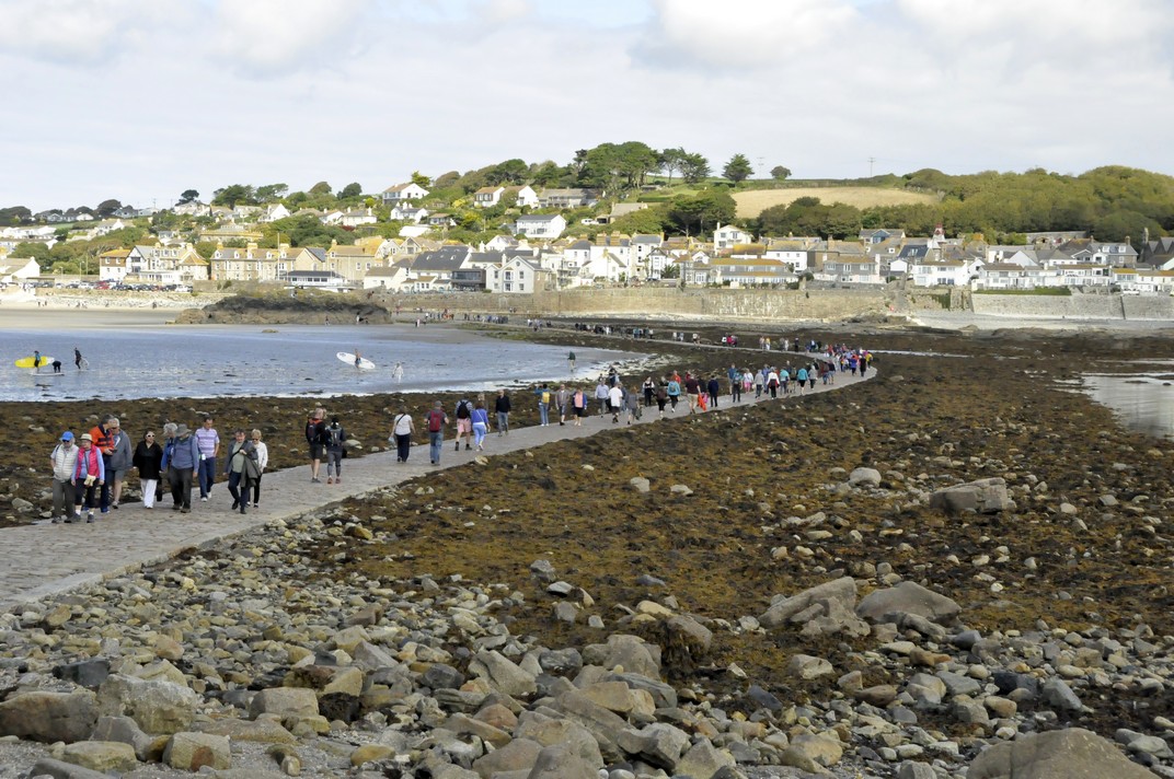
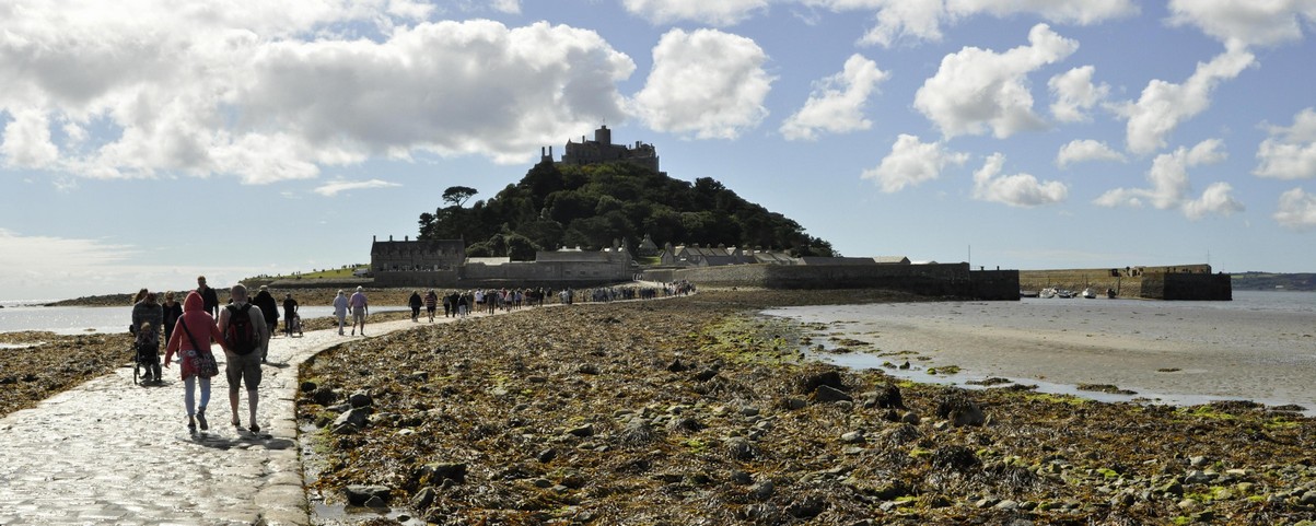
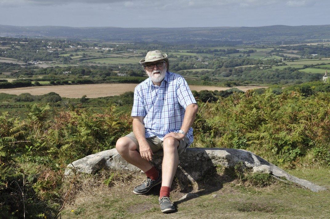
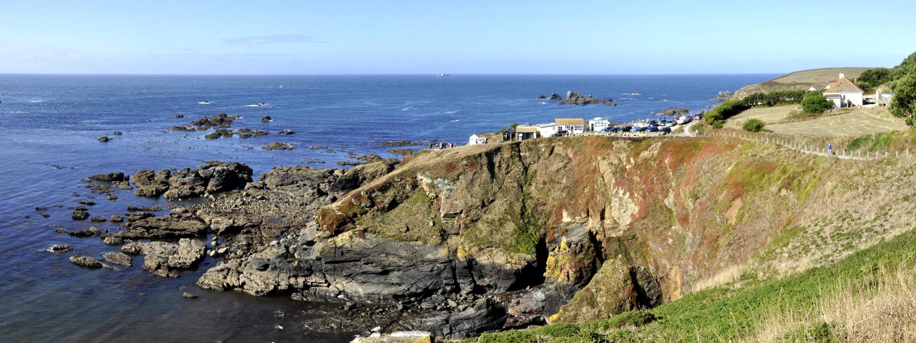
Steph and I took full advantage to walk a stretch of the Heart of England Way, starting at the National Trust’s Baddesley Clinton in Warwickshire (just under 20 miles east of Bromsgrove, and about 30 minutes from home by car). I even had to retrieve my summer shorts from the drawer where I had put them away for the winter.

Described as An easy walk along country lanes and field paths, taking in Baddesley Clinton, Rowington Church and the Heart of England Way, it’s listed at under 3 miles in length, although according to my pedometer it was more like 3.8 miles.

We arrived at Baddesley Clinton just before 10:30 and, not having seen much traffic heading to the property, were rather surprised to encounter a very full car park. The place was heaving! We decided to take our walk before lunch, and then visit the gardens afterwards.

The weather was glorious, the rolling Warwickshire landscape stretching to the horizon, leaves changing color on trees all around, and also full of berries. I’ve never seen so many holly berries.

We set off through the churchyard of St Michael’s Church (1), and along the gravel road to turn right (2) on to Haywood Lane, and then, after about a mile, right on to Rowington Green.

A little distance along Rowington Green, the walk leaves the road and crosses fields (3) — along the Heart of England Way — to Rowington (4). We took a short break in the churchyard of the 12th century Church of St Lawrence (or St Laurence).

From Rowington, the walk heads north, along a public bridleway (5), and ending back at St Michael’s. I guess the walk took a couple of hours; we never rush.

Baddesley Clinton is a moated house, first built in the 1400s. One of the original owners was Nicholas Brome, Lord of the Manor of Baddesley Clinton, and is buried in St Michael’s Church. The house passed to the Ferrer family who occupied it for the next 500 years.

We didn’t visit the house yesterday, but decided to take a look at the garden – and we were not disappointed. There was a magnificent display of dahlias in one of the borders inside the walled garden.

Thank goodness we did take advantage of the exceptional weather. Today’s weather could hardly be more different. It’s windy, overcast, and all morning it has been spitting with rain. It’s a little cooler than yesterday, but going to go downhill as we progress into tomorrow and the weekend. That’s because Storm Callum is due to sweep in from the Atlantic overnight tonight, bringing a lot of rain. Climate change? What climate change? I wonder how long it will take for the remnants of Hurricane Michael to reach us?

Kernow a’gas dynergh – Welcome to Cornwall (5): Magnificent mansions

Cornwall is home to several National Trust jewels. We visited these four:

  • St Michael’s Mount, on an island in Mount’s Bay off Marazion in the south of the county
  • Lanhydrock, close to the A30 near Bodmin
  • Cotehele House and Quay, overlooking the River Tamar, north of Plymouth
  • Trerice, close to Newquay on the north coast

Knowing how popular St Michael’s Mount can be (even slightly out of season, as we were), Steph and I decided to head to Marazion early on the day of our visit, so we could easily find a parking place. I guess we must have been there before 9:30 am, and knew we’d have to take the boat over to the island as the tide was still ebbing then and the causeway was still covered.

Parking was no problem. However, when we returned from our visit to the island just before 2 pm, visitors were streaming across the open causeway in the hundreds, and it seemed as if every parking place was already taken in the several car parks along the sea front.

Just before 10 the first passenger boat of the day pulled up alongside the jetty, and about eight persons clambered aboard. Since the sea was calm, there being no waiting queue of visitors, and it being the first boat, the boatman suggested going right round the island instead of just across directly to the harbor on the island. What a treat, as we had many different views of the island and buildings that would not have seen on a normal crossing.

St Michael’s Mount (the Cornish equivalent of Mont Saint-Michel in Normandy, although not quite so grand perhaps) was originally home to a 12th century priory, and there is evidence of human occupation over several thousand years. It has a rich history.  It became the home of the St Aubyn family in the late 17th century, and the family continues to occupy the Victorian wing. in the 19th century there was a village and thriving community of several hundred residents living below the castle.

A visit to St Michael’s Mount includes not only a tour of the house, and its magnificent views over Mount’s Bay, but the gardens below the castle that have been built into and cling to the cliff face. We were told by our boatman that the four resident gardeners are also qualified abseilers! It’s quite a steep climb up to the castle, but well worth the effort.

By the time the causeway had opened and hundreds of visitors were pouring across, access to the house was becoming difficult. We had made the tour earlier, and even then passing the narrow entrance caused significant tailbacks.

Nevertheless, no visit to Cornwall would be complete without a visit to St Michael’s Mount. Its inaccessibility for half of the day just adds to its attraction. Check out more photos of the interiors and gardens here.


Lanhydrock, just a mile or so off the A30 near Bodmin) is special for two reasons: so many of the rooms (>50) are open to the public, and the Long Gallery in the north wing) and its magnificent 17th century plastered ceiling survived the 1881 fire that gutted most of the rest of house. The house is U-shaped; an east wing was demolished in the 18th century. It has been the family home of the Robartes for four centuries.

The weather for our visit was overcast with a little drizzle. As we wanted to visit Restormel Castle in nearby Lostwithiel later in the day, we decided to forego a walk around the park, just viewing the gardens and parterre close to the house.

You can take a virtual tour of the house and gardens here. There’s no doubt that Lanhydrock is one of the National Trust’s ‘premier’ properties full of exquisite objects that passed to the Trust when it acquired ownership in 1953. Definitely one of the properties that should be on everyone’s National Trust bucket list.


The first question I asked one of the volunteers when we arrived at Cotehele House was how to pronounce ‘Cotehele’. It’s ‘cot-eel’ apparently.

And it’s also one of the National Trust gems, having so many exquisite tapestries on display. The house dates from the late 15th century but then had 16th century Tudor additions, and is built I guess from local granite, a lovely soft grey color. It was the home of the Edgcumbe family. Passing through a small courtyard, you enter the Great Hall, on to the chapel, and up to the treasures of the first floor and above.

Cotehele has terraced gardens beside the house, and others slightly further away. The Valley Garden follows a steep-sided valley from the terraces to the River Tamar, and Cotehele Quay and Mill.

Have a look at more Cotehele treasures here.


Trerice is an Elizabethan, 16th century manor situated a few miles inland from Newquay on Cornwall’s north coast. We visited this delightful house on our last day in Cornwall, on the way back to our holiday home after a visit to Tintagel Castle.

The Arundell family inherited Trerice more than 700 years ago. It passed to the Aclands in the late 17th century. In the 20th century, the Elton family took on a lease from the National Trust and carried out some major refurbishments, including replacing the roof.

There is some particularly smart plasterwork in several rooms, as well as impressive oil paintings.

Outside there is an attractive knot garden, and other horticultural attractions like a 1km mowhay.

An archaeological dig was underway behind the house on the day of our visit.

More photographs of this dig and exterior/interior views of the house are available in this album.


These are the other four stories in this Cornwall series:

Kernow a’gas dynergh – Welcome to Cornwall (1): The journey south . . . and back

Kernow a’gas dynergh – Welcome to Cornwall (2): Coast to coast

Kernow a’gas dynergh – Welcome to Cornwall (3): Stepping back in time

Kernow a’gas dynergh – Welcome to Cornwall (4): An impressive horticultural legacy


For those interested in photography, I use a Nikon D5000 DSLR, with a Nikon AF-S DX Nikkor 18-200 mm f/3.5-5.6 GII ED VR lens.

Flash photography is not permitted inside National Trust properties, so that means shooting with the slowest speed I can get away with, since all my photos are hand held. Often I’m shooting as slow as 1/15, and 3200 ASA. All the interiors at these four properties were photographed in this way. It’s remarkable how the colors of the tapestries at Cotehele, for example, are revealed. I’m getting quite the dab hand at holding my breath as I’m about to press the shutter.

Kernow a’gas dynergh – Welcome to Cornwall (4): An impressive horticultural legacy

Gardens. How many were designed and planted decades, even centuries ago, that can only now be fully appreciated? They were never seen in all their glory by their visionary originators. What a horticultural legacy they bequeathed to later generations.

The National Trust manages four important gardens in Cornwall which we were delighted to visit during our recent break there. Of course, many of the houses which the NT owns have their own gardens. But the four we visited are ‘marketed’ as gardens in their own right:

  • Glendurgan Garden, on the east coast, just south of Falmouth
  • Trelissick, at the head of Carrick Roads near Truro
  • Godolphin, an important medieval garden east of Penzance
  • Trengwainton Garden, northwest of Penzance.

All lie south of 50.2°N, and so there are many exotic species like tree ferns and bamboos that thrive under these conditions. And although these gardens would have been in their prime earlier in the year, with rhododendrons, camellias, and magnolias in flower, we saw enough during our exploration of these gardens to appreciate how they might look in another season.


Glendurgan Garden was the first on our list. Having enjoyed a walk at Lizard Point earlier on this bright, sunny day, we looked forward to a pleasant stroll around the garden.

The garden was planted in the 1820s and 1830s by Alfred Fox, and occupies a steep-sided valley down to the fishing village of Durgan, below Glendurgan House, home of the Fox family (not open to the public).

We followed the red trail down to Durgan village, and came back up the brown trail on the left, taking in a viewing platform overlooking the maze (that was planted in 1833).

Check out more photos here.


It was a mizzly sort of day when we stopped by Trelissick on our way back to our holiday cottage after visiting another NT property northwest of Plymouth, Cotehele House. So we were never going to fully appreciate one of the triumphs of Trelissick: the panorama from the terrace in front of the house down to the shores of the River Fal estuary.

Trelissick was the family home of the Copeland family, owners of the Spode China factory in Stoke on Trent (I used to pass nearby everyday on my way to grammar school in Trent Vale in the 1960s). Just a few rooms on the ground floor are currently open to the public. It was passed to the National Trust in 1955.

From the terrace, we made our way south through the garden, taking in the views (such as they were) from the tennis lawn (8) and the parkland (9) that did provide nice views back to the house. From Jack’s summer house (at the tip of the garden) we worked our way back up on the eastern side, crossing over the bridge into Carcaddon (11), then back towards the house across the main lawn (4).

Take a look at the rest of the photos here.


Godolphin has a particular claim to fame. In its various gardens, the King’s Garden (5) and Side Garden (14), it seems little has changed since at least the 16th century, maybe earlier.

The Godolphins derived their wealth from some of the most important mines in Cornwall, the remains of which can still be seen dotted around the estate.

The main entrance of Godolphin House (9)

The Undercroft (8)

On the day of our visit just the King’s Room was open to the public. The National Trust has a holiday let here at Godolphin, and mostly the house is off-limits to the general public apart from certain days per year.

The Side Garden (14) from the Dry Ponds (16)

One of the two Dry Ponds (16)

More photos of the garden can be viewed here.

We also enjoyed the 1.5 mile walk to the top of Godolphin Hill, from where there is a 360° panorama to be enjoyed.

Looking towards Land’s End from the top of Godolphin Hill.


Northwest of Penzance, Trengwainton Garden offers magnificent views over Mount’s Bay, towards St Michael’s Mount in the east and Land’s End in the west.

Only the garden, full of exotic shrubs (particularly bamboos and tree ferns) is open to the public, although there is access to the terrace (R) below the house from where the panorama can be enjoyed.

Once again we were too late for many of the shrubs that flowered earlier in the year, but nevertheless our stroll through these leafy glades was rewarded by the view from the terrace.

There is also an impressive walled garden, divided into several ‘rooms’ growing vegetables and ornamentals. On the day of our visit there was an exhibition of scarecrows made by local schoolchildren to celebrate the centenary of women getting the vote in the UK.

More photos are included in this album.


We enjoyed this horticultural tour of Cornwall, and of course the gardens at the various houses we also visited: St Michael’s Mount, Lanhydrock, Cotehele House, and Trerice. We decided not to visit the Lost Gardens of Heligan (which must also be included in Cornwall’s horticultural heritage) having more than enough on our itinerary of National Trust and English Heritage sites to add another.


These are the other four stories in this Cornwall series:

Kernow a’gas dynergh – Welcome to Cornwall (1): The journey south . . . and back

Kernow a’gas dynergh – Welcome to Cornwall (2): Coast to coast

Kernow a’gas dynergh – Welcome to Cornwall (3): Stepping back in time

Kernow a’gas dynergh – Welcome to Cornwall (5): Magnificent mansions

Kernow a’gas dynergh – Welcome to Cornwall (3): Stepping back in time

Almost 2000 years.

English Heritage preserves several important sites in Cornwall, and during our week long break there, we got to visit four that span about 2000 years of British history, from the Roman occupation of these islands, through the Dark Ages, the 12th century under the Normans, and from the Tudors until the Second World War:

  • Chysauster Ancient Village, on the Land’s End Peninsula
  • Tintagel Castle, on Cornwall’s north coast
  • Restormel Castle, near Bodmin
  • Pendennis Castle, overlooking Carrick Roads near Falmouth

Chysauster Ancient Village (pronounced ‘chy-soyster’, with ‘ch’ as in church)
Sylvester’s House. That’s what Chysauster means; ‘chy’ is Cornish for house or home. But whether Sylvester ever lived there and who he was I guess we’ll never know. Because the remains of this Iron Age village date from Romano-British times, some 1800-2000 years ago.

The Romans never really penetrated into Cornwall, apparently. Thus Chysauster, with its unique courtyard houses (found only in Cornwall and the Scilly Isles), is a very important site in the nation’s history. Courtyard houses are found in several locations, but the village at Chysauster is one of the best preserved.

As I walked on to the site I had this feeling that the village had once been a thriving community. I could imagine children playing among the houses, smoke rising from each roof. A busy place.

We spent about an hour walking from one building to the next, fascinated by the layout of each house with its rooms off the central courtyard, and even a backdoor.

Take a look at more photos here. This is the link to English Heritage.


Tintagel Castle
Did King Arthur live here? Did he even exist? Whatever the truth of the myth, Tintagel Castle will forever be linked with his name. It’s certainly an iconic site jutting out into the North Atlantic, battered constantly by winds and storms. It was quite windy on the day of our visit, but thankfully dry.

Tintagel Castle from the Upper Mainland Courtyard (4)

Click here to download a phased plan of the castle, which shows its occupation over almost a thousand years.

Geoffrey of Monmouth has a lot to answer for, because much of what we ‘know’ of our history prior to the 12th century is a mixture of fact and fiction that he wrote in his History of the Kings of Britain.

Among the many myths that he conjured up is the tale of King Arthur and his links with Tintagel Castle where, claimed Geoffrey, Arthur was conceived.

Tintagel Castle was once home to a thriving community of more than 300 persons. But since much of its history derives from the so-called Dark Ages (the period between the exodus of the Romans in the 5th century AD and the arrival of the Normans in the 11th). Tintagel Castle island is dotted with the remains of many houses.

We arrived at Tintagel just before 09:30. I wanted to be sure of a parking place knowing that it can become very busy. The castle opened at 10:00, so we took a slow walk down to the entrance, about half a mile, and quite steep in places. We opted for the Land Rover ride (at £2 each) back up to the car park after our visit.

The cafe was just opening, so we enjoyed a quick coffee before registering for our visit, and getting some wise advice about how to tackle the site. There are lots (and I mean lots) of steps at Tintagel, some very steep indeed. The person on the ticket counter advised us to enter the site through the upper entrance (just before 1), and straight into the mainland courtyards (3 and 4) that overlook the main entrance and island courtyard and Great Hall (6).

There is a set of extremely steep steps down the cliff to then cross a bridge and climb into the main ruins. The walk up to the upper entrance and courtyards was certainly gentler than had we visited the main island first then returned to view the courtyards (and climb that set of stairs) as we saw many other visitors doing later one. And by visiting the courtyards first, we had a panorama over the island ruins to get our bearings.

What goes down must go up . . .

The island courtyard and Great Hall (6)

Check out the full album of photographs. It takes about an hour and a half to walk round the ruins and appreciate everything that Tintagel has to offer. The views over the cliffs, north and south down the coast are typical Cornwall, and you’re left wondering how a community managed to survive for so long in this rather desolate spot.


Restormel Castle
Moving forward to the 12th century, Restormel is a Norman castle alongside the River Fowey in Lostwithiel. Its circular shell keep is unusual (the round tower at Windsor Castle is also a shell keep), built on a mound surrounded by a dry (and quite deep) ditch. The ruins are remarkably well preserved, and in addition to wandering through the various rooms at ground level, English Heritage has provided access to the battlements, from which there is a good panoramic view over the surrounding countryside.

You can read a detailed history of Restormel here.


Pendennis Castle
Guarding the approaches to Falmouth, Pendennis Castle has proudly stood on a peninsula overlooking Carrick Roads since the time of Henry VIII in the sixteenth century. And it remained an important fortress right up to the Second World War when guns were installed to combat any threat from German naval vessels.

Across the estuary is another Tudor fortress, St Mawes Castle, a mirror image of Pendennis. During Tudor times, the guns from each could reach half way across the estuary, this protecting Falmouth and its harbor from both sides.

In July 2016 we visited Calshot Castle, that guards the approaches to The Solent near Southampton, and is another of Henry VIII’s coastal fortresses.

Pendennis has a fine collection of cannons inside and also on the battlements, as well as the Second World War guns at Half Moon Battery.

Looking southwest to the mouth of the Helford River

At Half Moon Battery

The castle is not just the round tower. There are extensive 18th century barracks and parade grounds enclosed within major earthworks, ramparts constructed during the reign of Elizabeth I.

Earthworks leading to the main entrance (and below as well)

The barracks (on the right) and guardhouse on the left, from the roof of the Tudor round tower.

Check out more photos here.


These are the other four stories in this Cornwall series:

Kernow a’gas dynergh – Welcome to Cornwall (1): The journey south . . . and back

Kernow a’gas dynergh – Welcome to Cornwall (2): Coast to coast

Kernow a’gas dynergh – Welcome to Cornwall (4): An impressive horticultural legacy

Kernow a’gas dynergh – Welcome to Cornwall (5): Magnificent mansions

Kernow a’gas dynergh – Welcome to Cornwall (2): Coast to coast

On reflection, I’m not completely sure our choice of holiday accommodation was appropriate.

It was located in the far south of Cornwall, just north of Helston, excellent for visiting the coast around the Lizard and Land’s End Peninsulas, but not so handy for any of the other sites we wanted to visit in the north of the county. So on two or three days we had 100 mile plus round trips. Maybe we should have looked harder to find a cottage in the center of the county.

Nevertheless, it was very comfortable, and in terms of facilities and cost, it was just what we were looking for. And we were very happy with our week’s stay there.

Having traveled more than 250 miles south on the Saturday to reach Cornwall, we decided to spend the first two days, Sunday and Monday, exploring the coast in the far south. In any case, perusal of the weather forecast indicated that these two days would be favored by warm and sunny weather, ideal for enjoying the coast.

First port of call was Lizard Point (owned by the National Trust), the most southerly point on the British mainland. We always hear about John o’ Groats to Land’s End. But I think it should be Dunnet Head, the most northerly point on the mainland, in Caithness (which we visited in 2015) to Lizard Point.

Lizard Point, from the east

Having found the National Trust car park, we set off east along the cliff path towards Lion’s Den, a hole in the cliff created when a cave collapsed in the mid-1800s, overlooking Housel Bay.

The cave fall lies immediately in front, overlooking Housel Bay

Just as we approached Lion’s Den, I saw two black birds take to the air from a field to the side of the path, and fly down into Lion’s Den. Could those be choughs, I asked myself.

I hadn’t seen the distinctive reddish-orange curved bill and legs, but their call and size were different from either crows or jackdaws that were common in the area, especially jackdaws.

A local naturalist confirmed they were choughs, a resident pair that had nested at the Lizard in 2018. A few minutes later and he showed us a photo he’d just managed to take (with a super telephoto lens) of one of the birds deep down inside Lion’s Den.

So we returned to the spot, a few meters away where he took the photo, and waited. We could hear them calling. Our patience was rewarded, for after a couple of minutes, one of the birds hopped on to a ledge in full sunlight, and I had a brilliant view of this remarkable rare bird. Once common in Cornwall, choughs only returned to the Lizard in 2001, although more can be seen on the north coast of the county. We’d seen the Lizard’s only choughs! Needless to say, we were chuffed! Magic!

Returning to Lizard Point, we heard this eerie crying, wailing almost, coming from Enoch Rock just offshore. Talk about mermaids enticing unsuspecting sailors to their doom, shipwrecked on hidden rocks (no wonder the lighthouse was built there). A group of Atlantic grey seals was basking in the midday sunshine and calling to one another.

We enjoyed a coffee, overlooking Polpeor Cove, at Britain’s most southerly cafe, before heading west to follow the path towards Old Lizard Head through Pistil Meadow. On the way there were great views of the old lifeboat station, home to the RNLI’s biggest rescue in March 1907.

The following day, we headed to the north coast of the Land’s End peninsula, and the National Trust’s Levant Mine and Beam Engine (that had just shut down when we arrived there).

Levant Mine is located on Cornwall’s ‘Tin Coast’ (part of the Cornish Mine World Heritage Site), west of Lower Boscaswell (map). The 1840s beam engine has been fully restored. Both copper and tin were mined here, and the mine stretched for 1.6 miles out sea, and more than 500 of feet below the seabed. The mine closed in 1930.

There’s a small museum providing a window into the past and who were the miners and their families (particularly young women) who worked at the mine, underground and at the surface sorting and cleaning the ore. The coast path passes by the mine, but we didn’t walk too far; it was just too blustery and at the end of the day (after several other visits) we were feeling a little tired. The landscape is dotted with the remains of engines houses and chimneys of mines and their shafts long abandoned.

Continuing round the coast near St Just, we ended the day at Cape Cornwall (map). We had already decided to give Land’s End a miss: too commercialized. Cape Cornwall in the late afternoon sun was more than an adequate substitute. What glorious views west over the Atlantic Ocean (next stop: North America); and south to Land’s End, jutting just that little further out into the Atlantic, with the Longships Lighthouse just over a mile offshore.

At the end of our week in Cornwall, we visited Marazion and its the sandy beach before crossing over to St Michael’s Mount.

St Michael’s Mount at Marazion at low tide

And to Tintagel on the north coast, where (after visiting the castle and the Old Post Office) we enjoyed a picnic lunch overlooking the Atlantic from the National Trust’s car park at Glebe Cliff beside the Church of St Materianna, that can be seen from Tintagel Castle.

There’s no doubt that Cornwall has a spectacular coastline; cliffs and beaches, waves for even the bravest surfer. The places we chose fitted in with our National Trust and English Heritage itinerary – and didn’t disappoint.


These are the other four stories in this Cornwall series:

Kernow a’gas dynergh – Welcome to Cornwall (1): The journey south . . . and back

Kernow a’gas dynergh – Welcome to Cornwall (3): Stepping back in time

Kernow a’gas dynergh – Welcome to Cornwall (4): An impressive horticultural legacy

Kernow a’gas dynergh – Welcome to Cornwall (5): Magnificent mansions

Kernow a’gas dynergh – Welcome to Cornwall (1): The journey south . . . and back

Steph and I began planning a short, one week break in Cornwall way back in the Spring. As followers of my blog will know by now, we are avid members of the National Trust and English Heritage, and throughout the year we try to make as many visits as the weather and other commitments permit. In Cornwall, we wanted to explore as many NT and EH properties as we could fit into the six days, and the two days of travel. Eighteen was our tally!

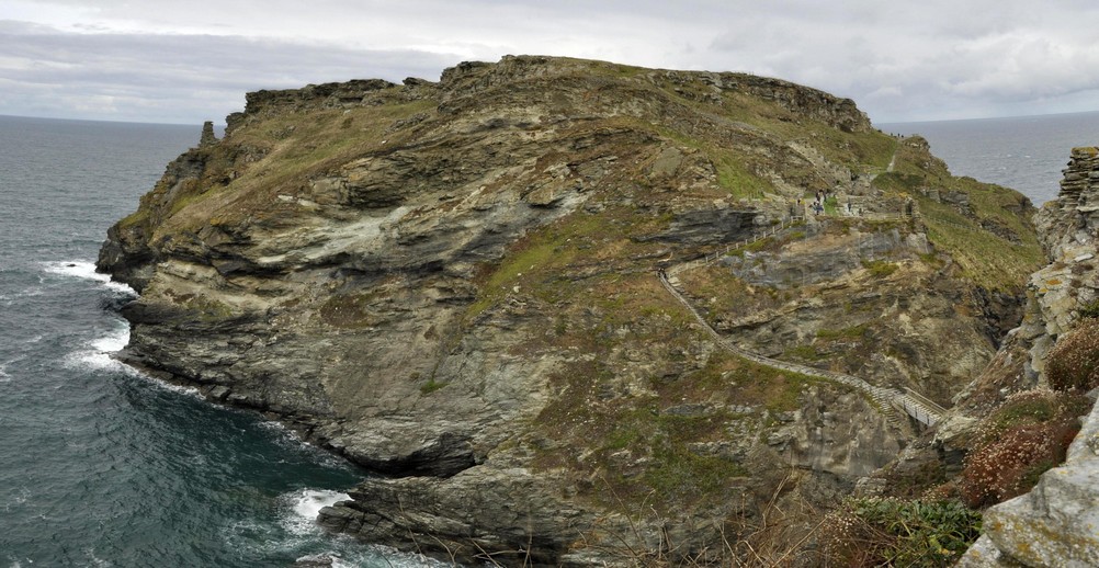
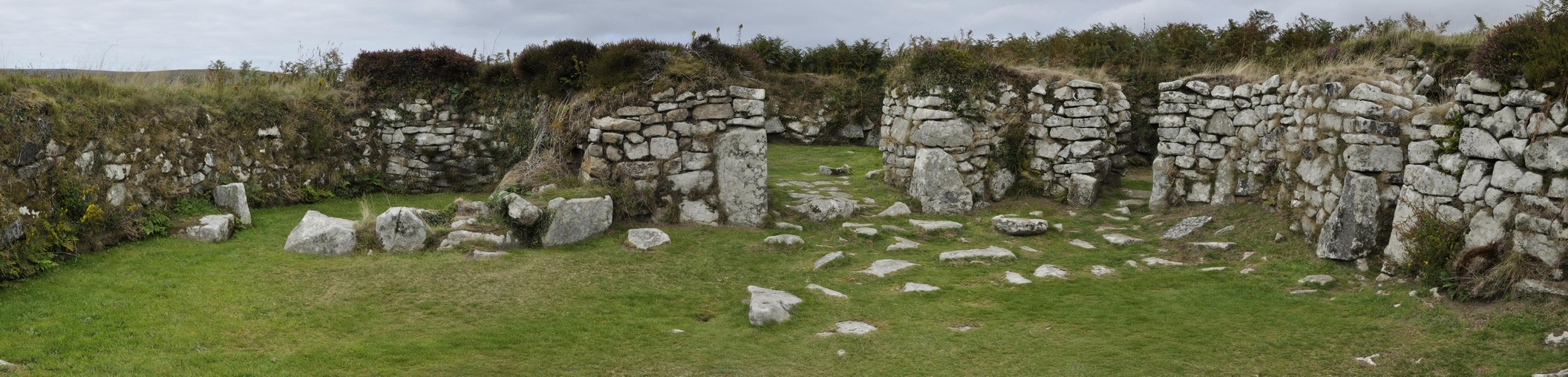
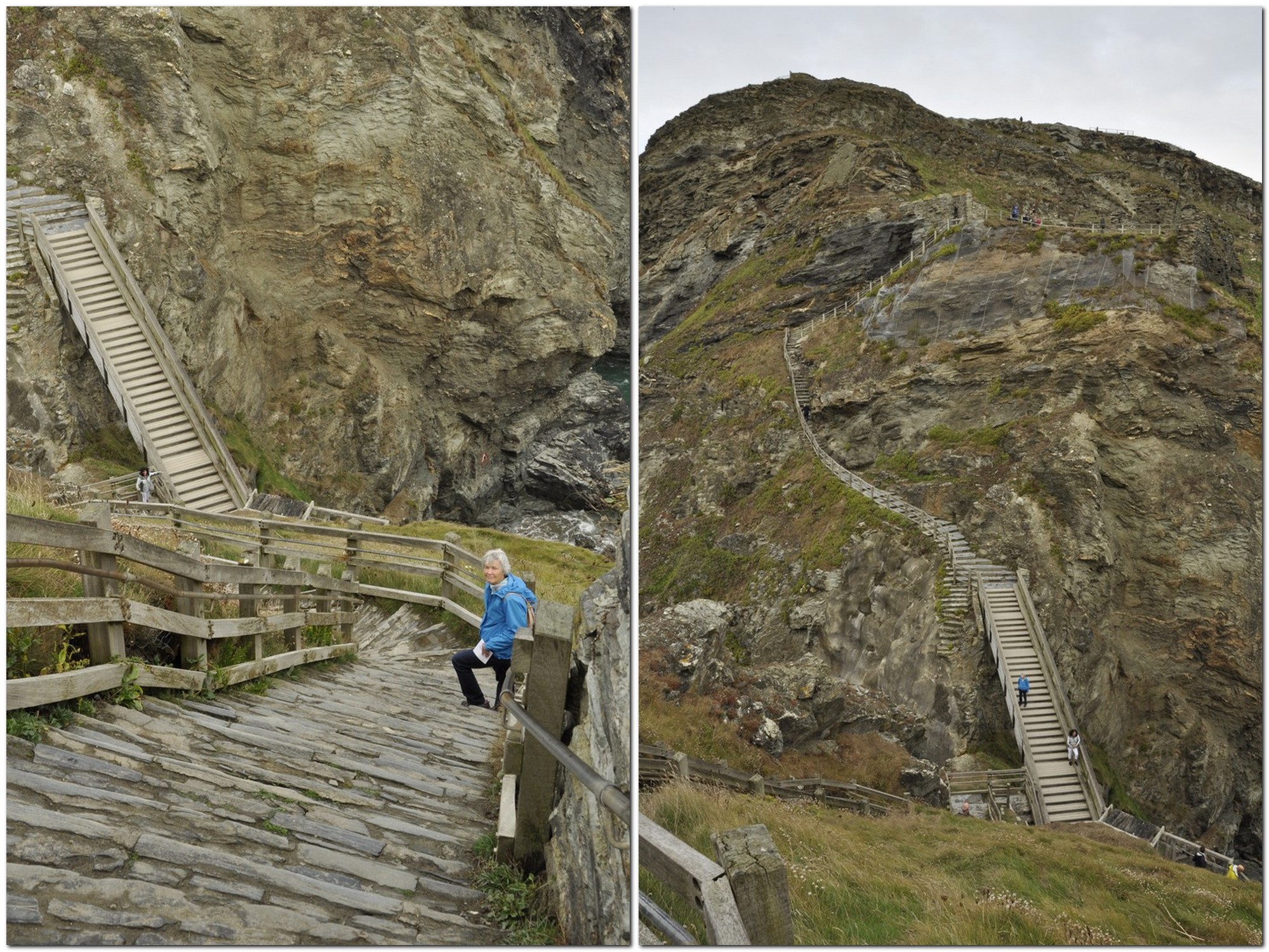
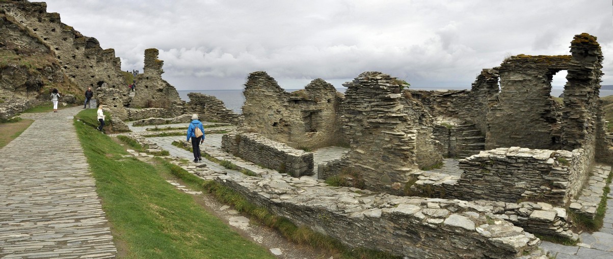
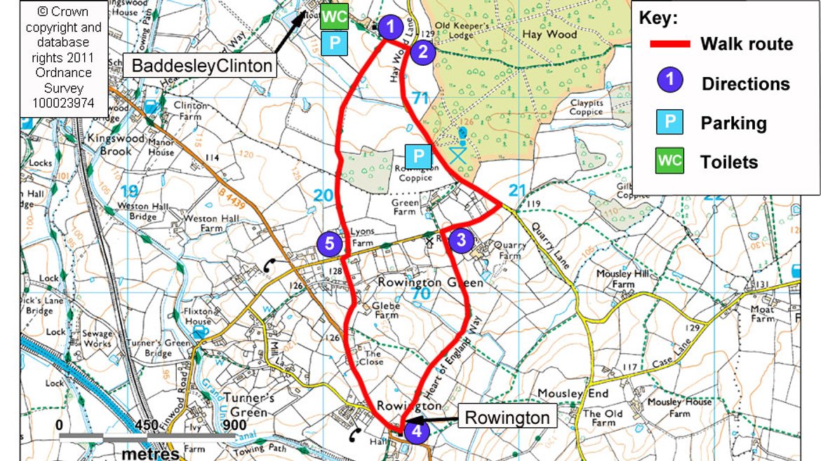
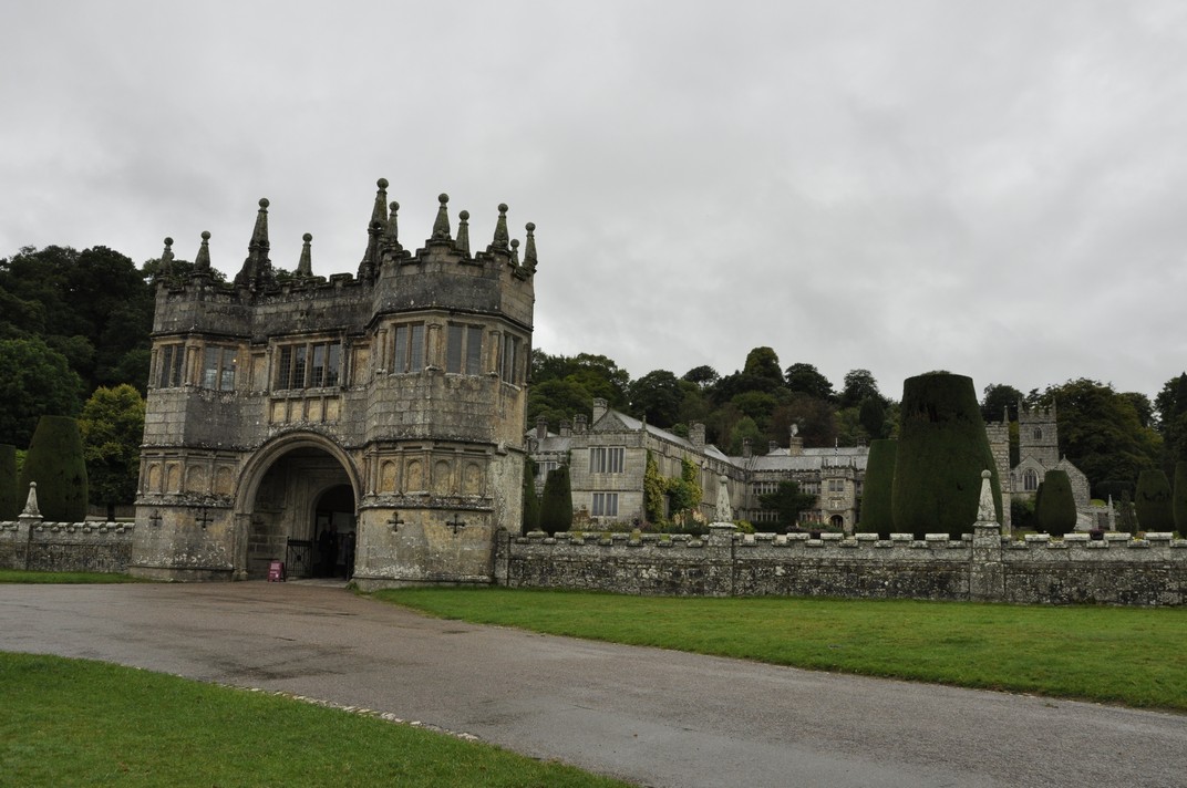
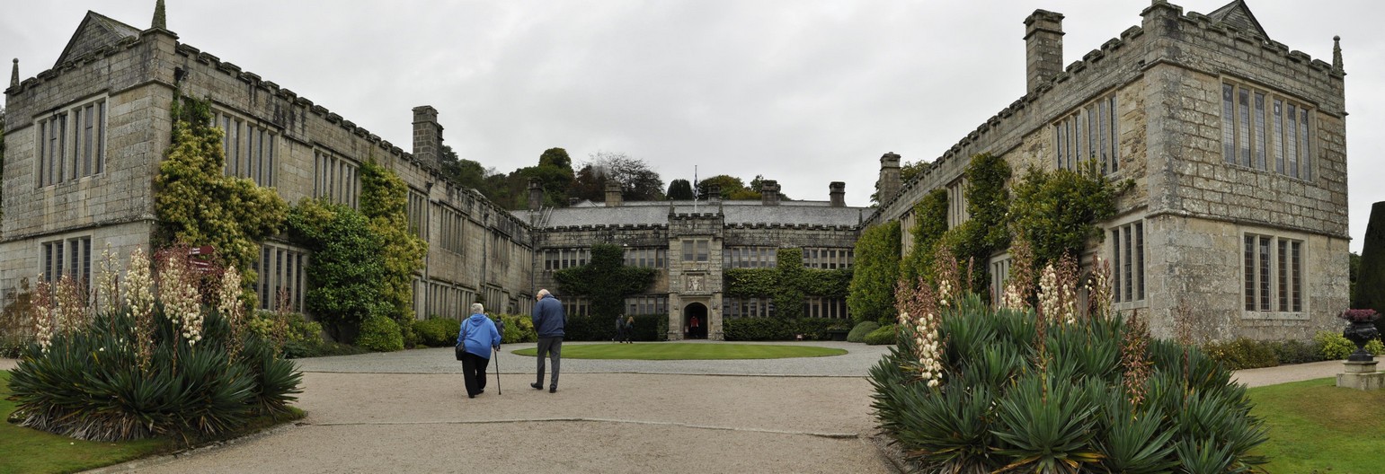
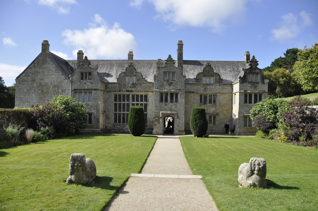
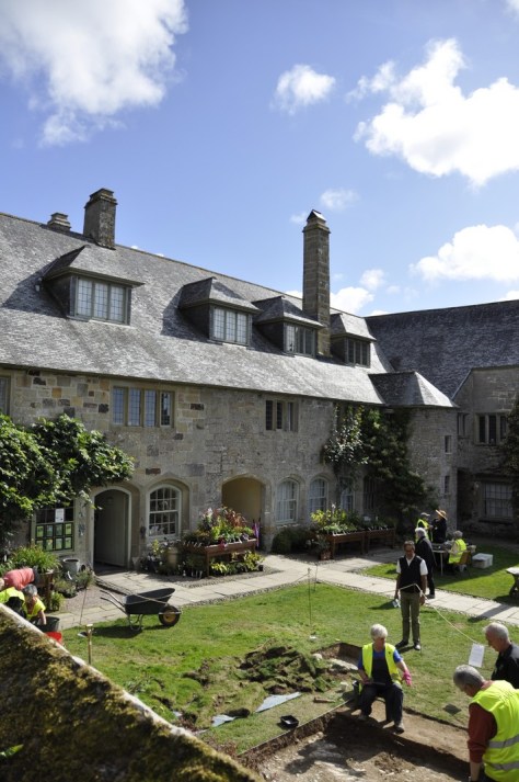
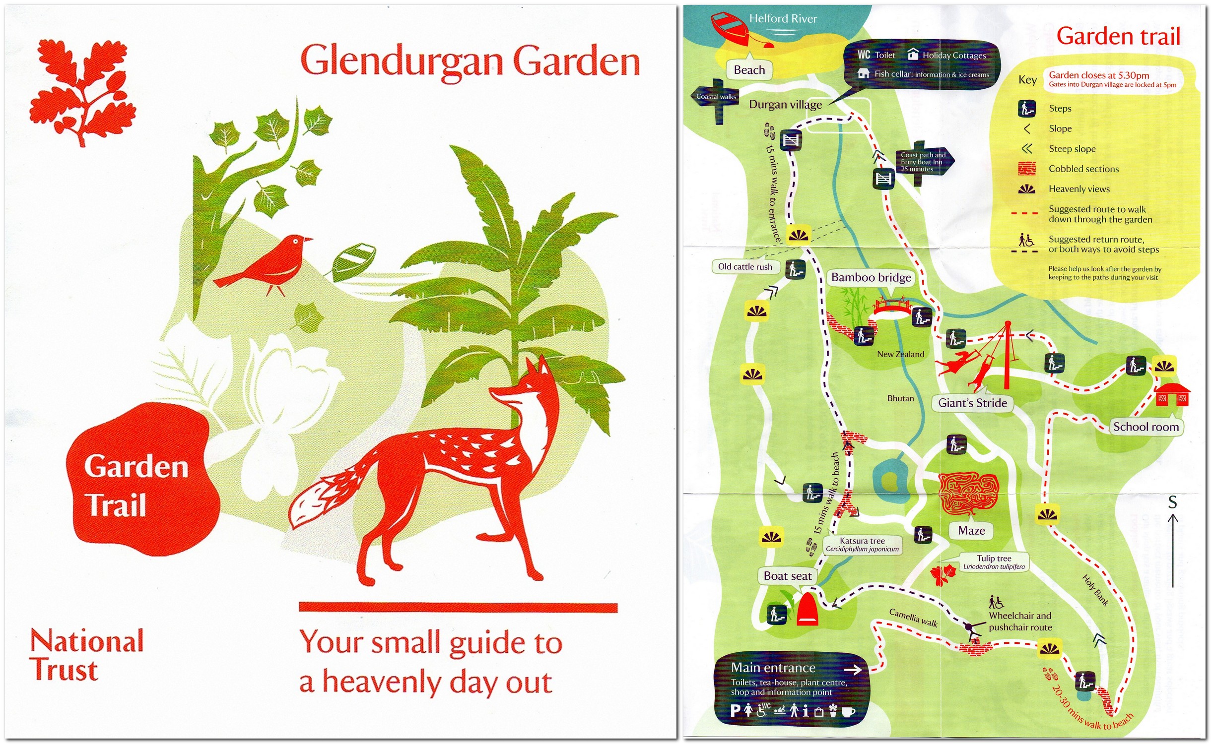
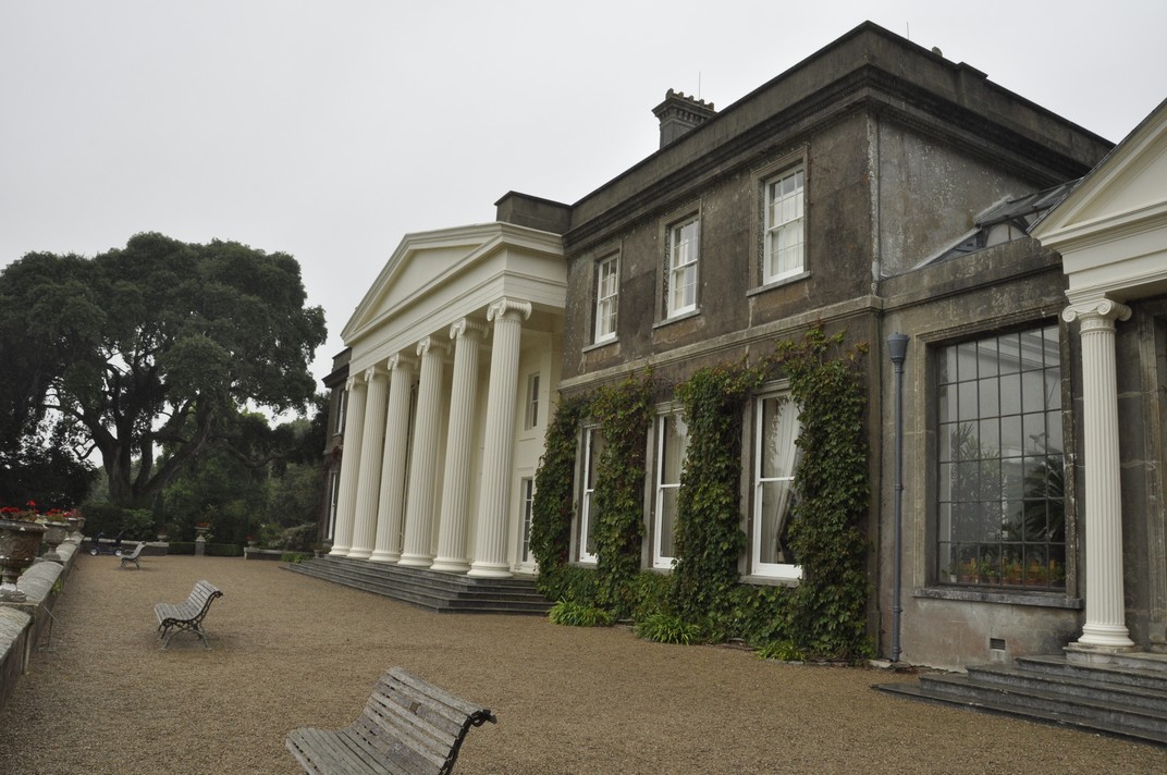
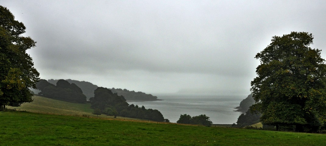
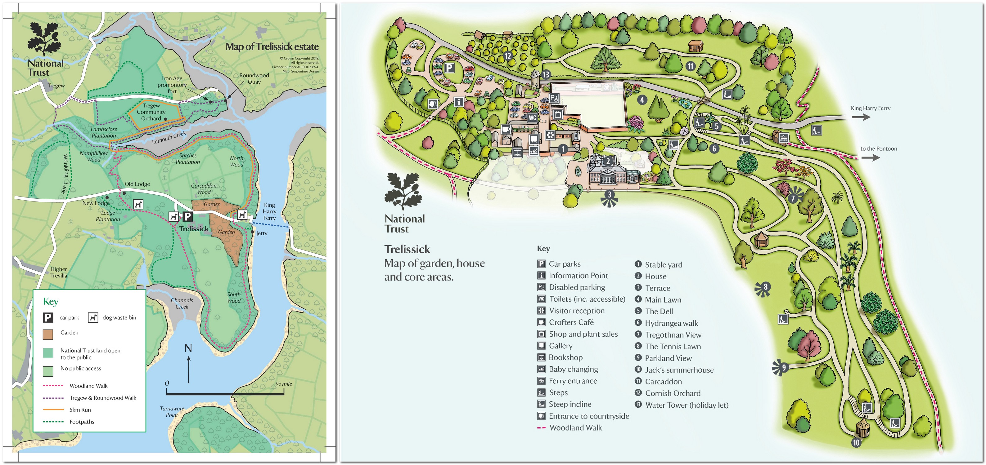
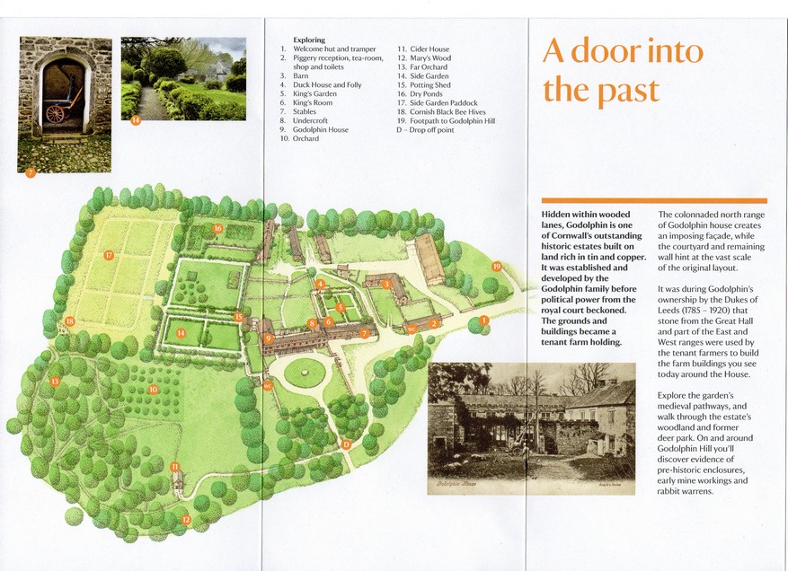
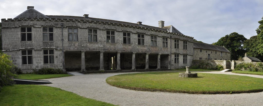
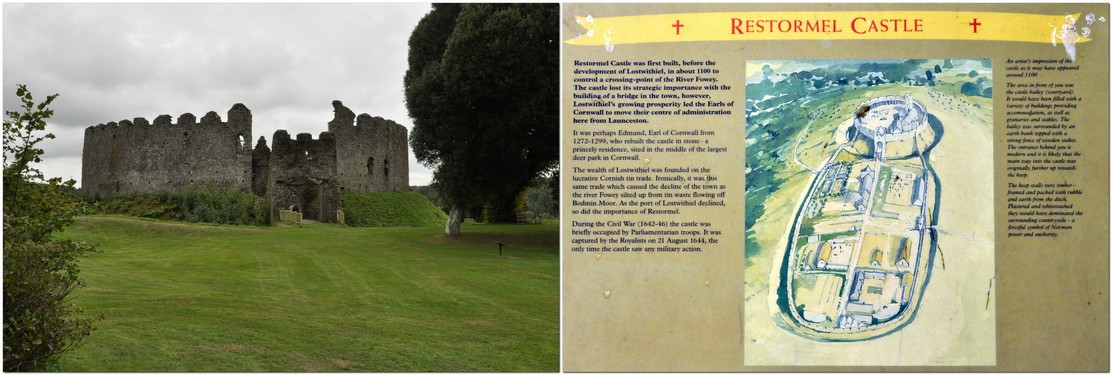
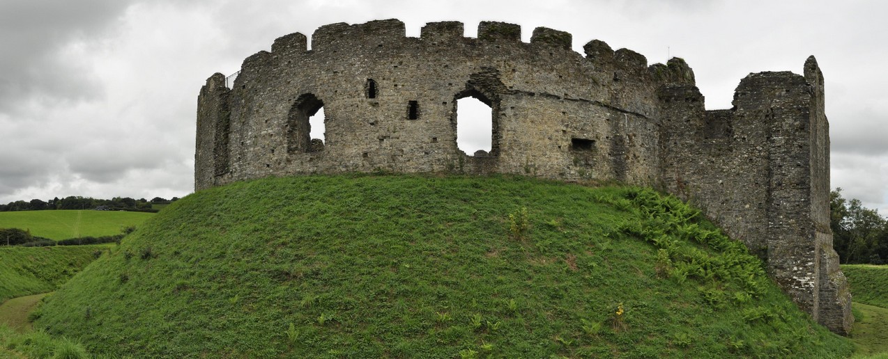
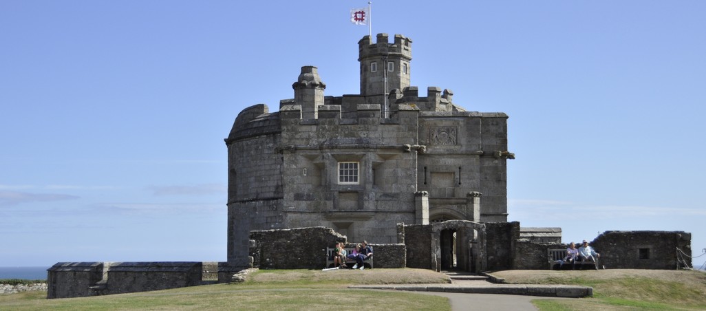
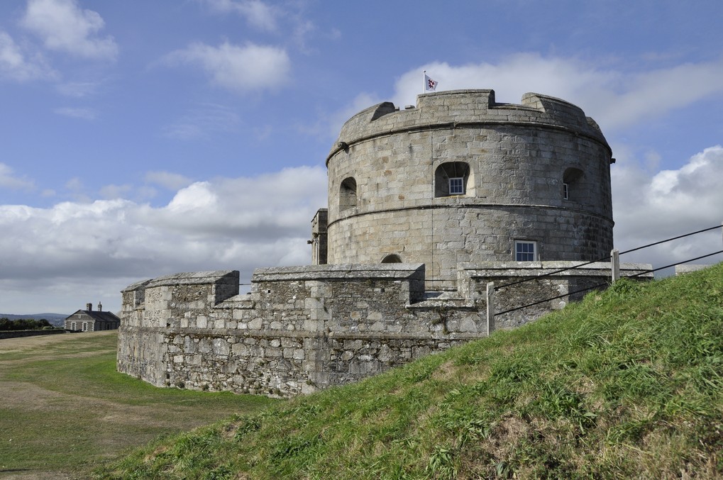
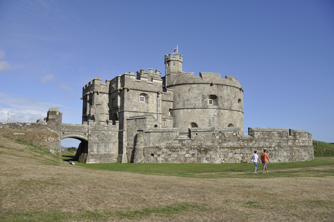
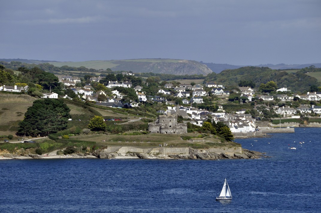
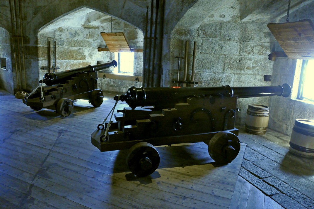
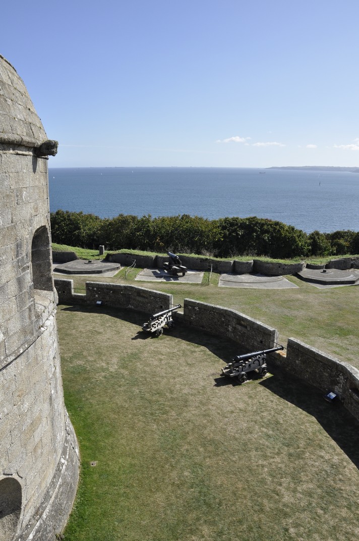
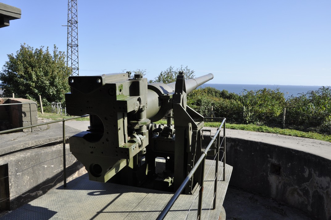
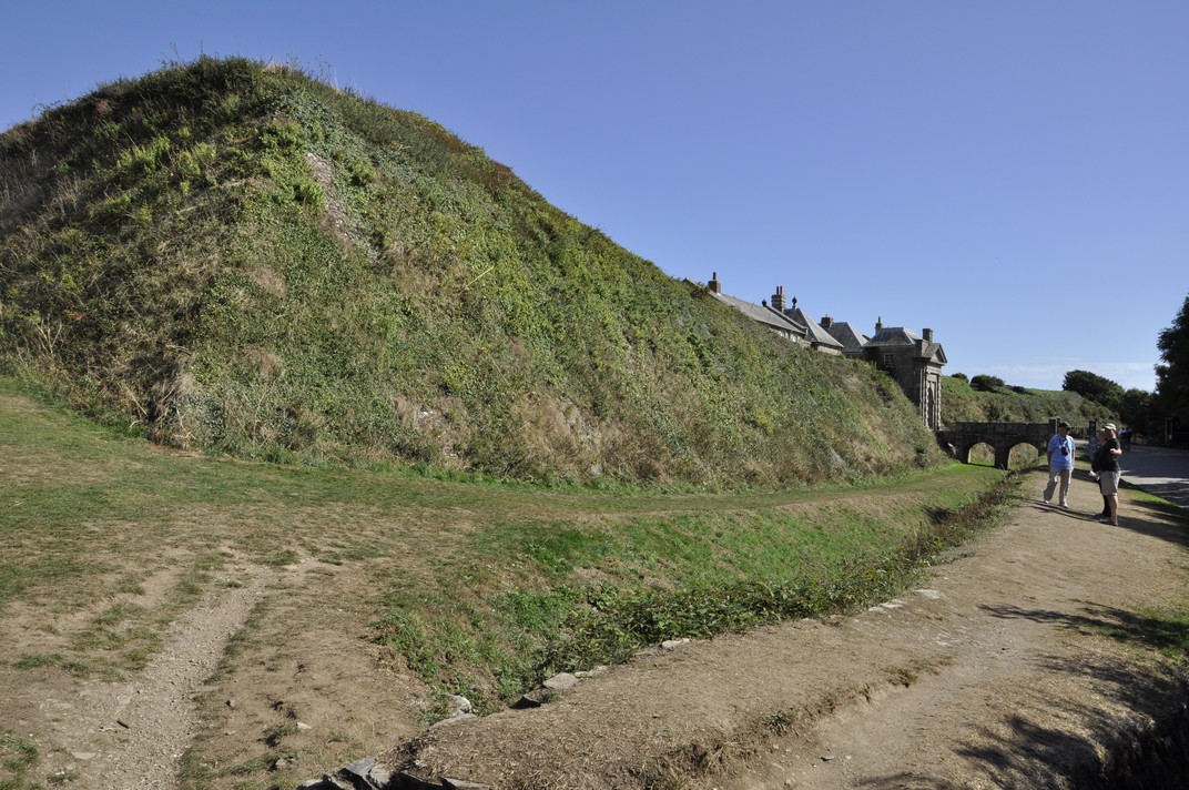
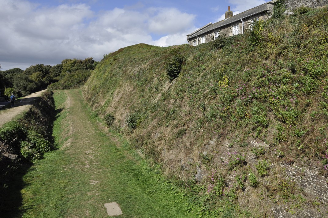
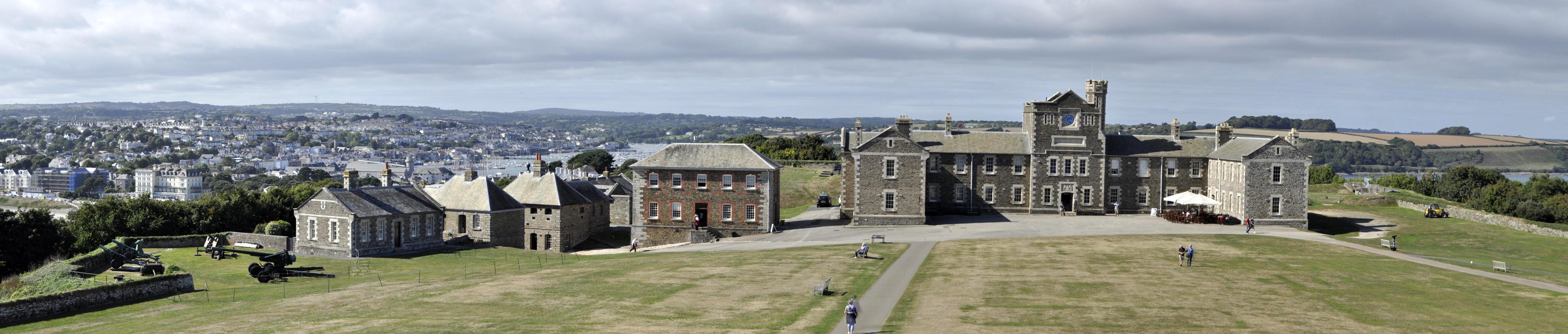
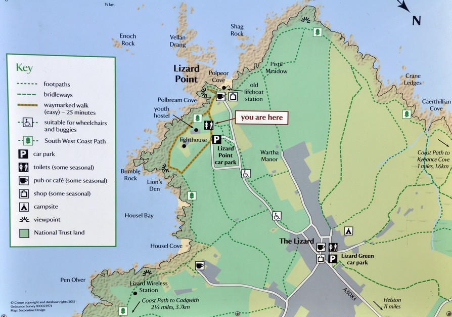
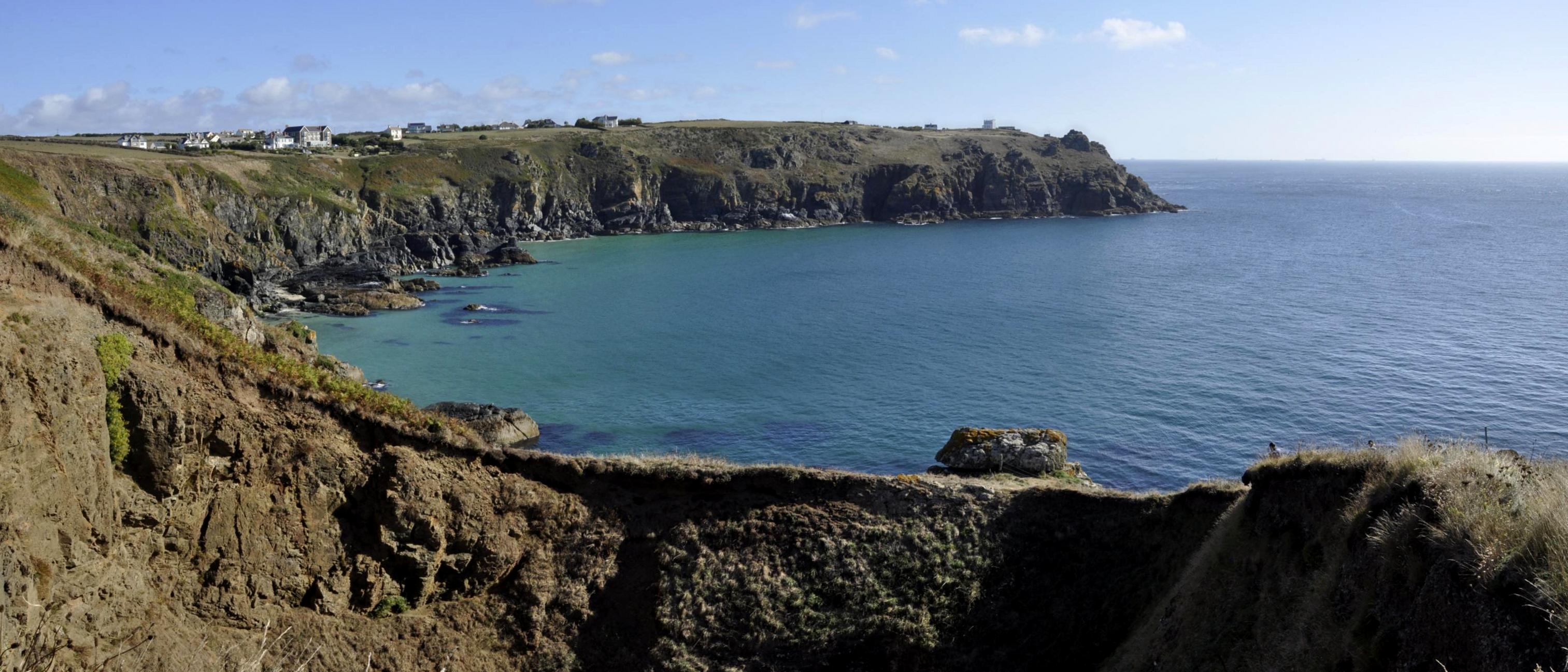
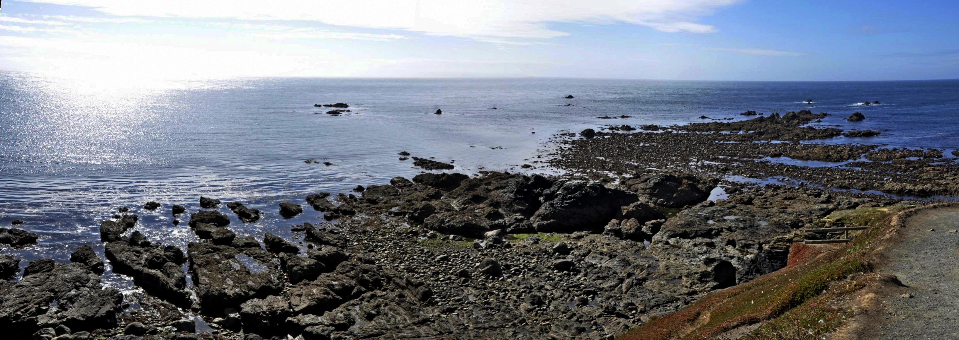
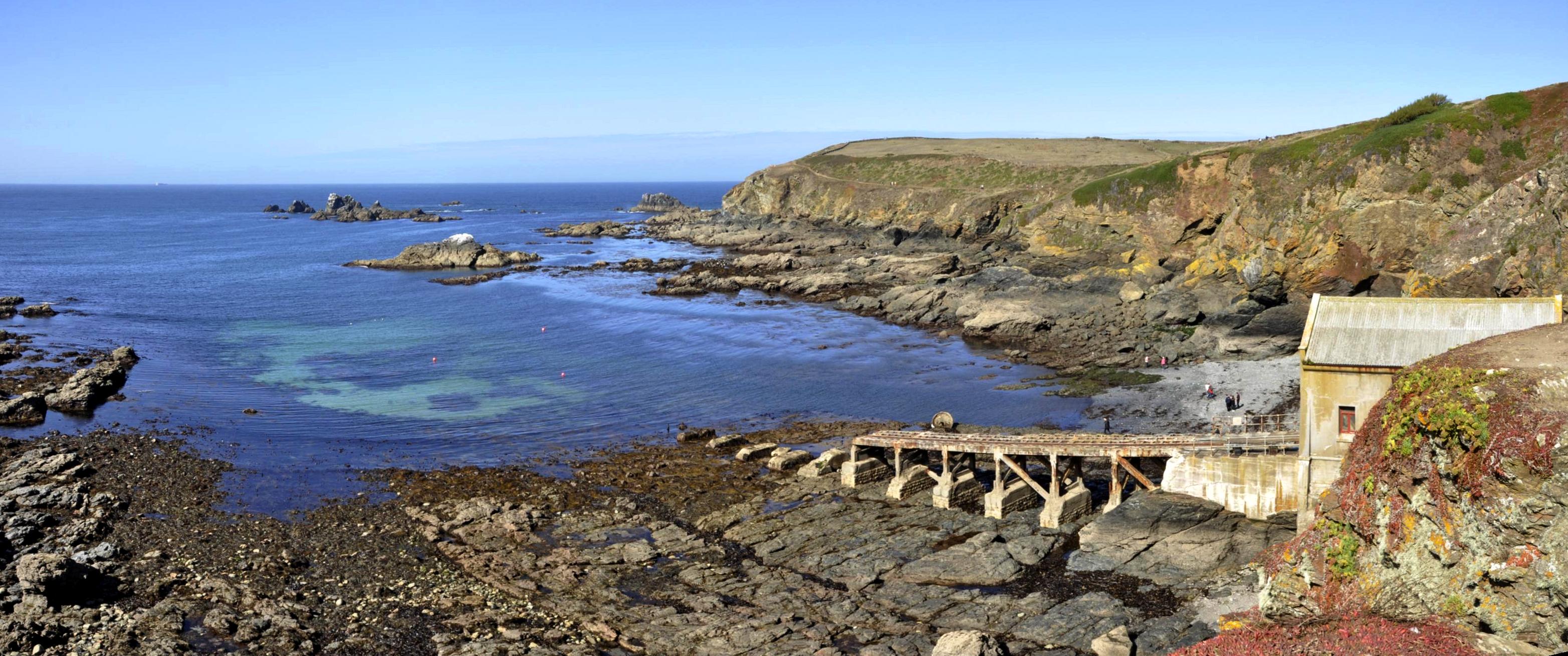
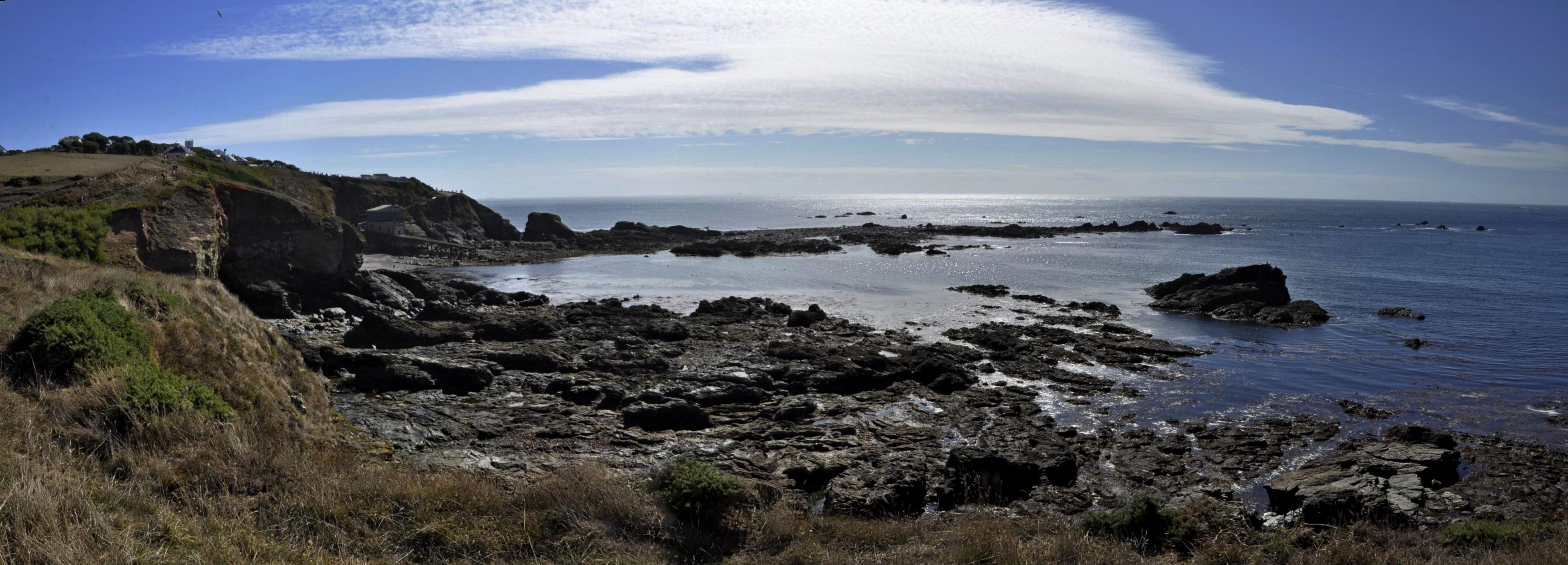
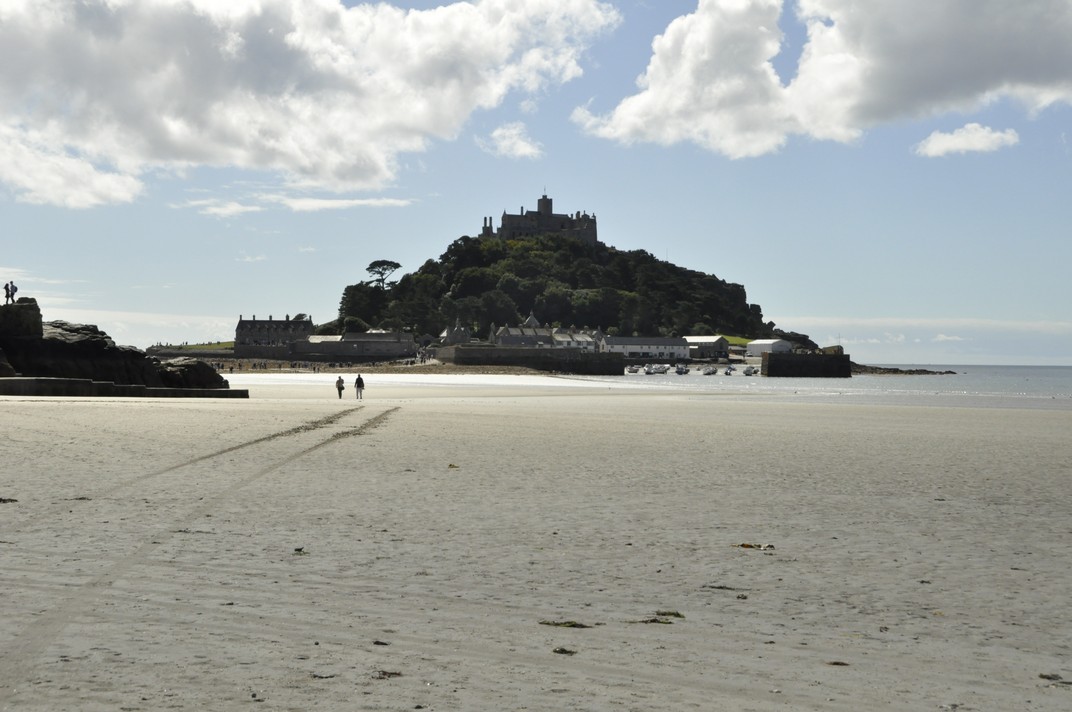
We chose a small studio cottage, suitable for a couple, just north of Helston on the south coast, a round trip of more than 500 miles (including the side trips to a couple of National Trust properties on the way there and back – see map). Dovecote Cottage was located at the end of a 2 mile drive down a narrow lane (with passing places), next to a former farmhouse. It was very peaceful, and comfortable.

Dovecote Cottage

Our home (in Bromsgrove, in northeast Worcestershire) is less than 5 miles from the M5 motorway, the main arterial to the southwest. The M5 and roads south into Cornwall like the A30 can be notoriously busy during the summer, and delays of many hours are not uncommon as lines of motorists (many towing caravans) snake their way to the coast and sunshine. On the way south we had a traffic-free journey, but on our return on the following Saturday we had to make one detour to avoid a jam at road works near Tiverton (on our way to Knightshayes), and we also hit a long queue of traffic attempting to navigate the bridge over the River Avon, backing up about 10 miles although constantly moving.

During the six days touring Cornwall we clocked up another 500 miles, for a total of 1086 miles for the whole holiday.


Heading south, and just 12 miles east of the M5 near Taunton, we visited Barrington Court, a Tudor manor house built between 1538 and the 1550s. It was the first house acquired by the National Trust (in 1907) and became the residence of Col. Abram Arthur Lyle (of the sugar refining company Tate & Lyle) who refurbished the property, installing his collection of historic woodwork, and converting the next door 17th century stable block, Strode House, into a residence. Check details of Barrington Court on the National Trust website.

The south face of Barrington Court (on the right) and Strode House on the left. The connecting corridor between the two can be clearly seen.

Barrington Court is unfurnished, but that also permits better appreciation perhaps of the fine woodwork. The long gallery on the top floor is particularly impressive.

In several of the bathrooms, reclaimed Delft tiles surround baths and wash basins.

During the 1920s refurbishment Lyle had asked Gertude Jekyll to design a series of formal gardens surrounding the house. In the eventuality not all were constructed, but what there are now are beautiful accompaniments to an elegant house.

A full album of photographs of Barrington Court can be opened here.


A week later, and we were headed north to take in Knightshayes, an imposing Gothic Revival mansion standing on a hillside overlooking Tiverton in Devon.

Knightshayes is a late Victorian house (built between 1869 and 1874), designed by William Burges, whose design excesses never made it completely into the interior of the house (although the National Trust has refurbished one room following his designs). The gardens were designed by Edward Kemp.

It was the home of the Heathcoat-Amory family for more than 100 years, and was handed over to the national Trust in 1972. The last occupants, Sir John Heathcoat-Amory and Lady Joyce carried out extensive work on the gardens in the 1950s and 1960s; both were awarded Gold Medals by the Royal Horticultural Society. Lady Joyce (née Wethered) was a world class golfer with many titles to her name.

The interiors at Knightshayes are impressive indeed.

The woodwork and decoration on the ceilings in many rooms is quite stunning.

A few photographs displayed here cannot do justice to Knightshayes, so please take a look at a more complete (and annotated) album of photographs here.

Knightshayes also has one of the largest walled gardens we have ever seen, and on the day of our visit there was a ‘heritage tomato event’.

One of the paintings on display at Knightshayes was recently featured in BBC Four’s Britain’s Lost Masterpieces. A small painting, not much more than 12 x 15 inches perhaps has been attributed to Rembrandt. Using the tool beloved of all art historians, a torch, we could highlight and see the detail in this beautiful small painting.

Rembrandt as a young man – self portrait attributed to the artist

But is it a Rembrandt? Perhaps.


These are the other four stories in this Cornwall series:

Kernow a’gas dynergh – Welcome to Cornwall (2): Coast to coast

Kernow a’gas dynergh – Welcome to Cornwall (3): Stepping back in time

Kernow a’gas dynergh – Welcome to Cornwall (4): An impressive horticultural legacy

Kernow a’gas dynergh – Welcome to Cornwall (5): Magnificent mansions

Relaxing in Minnesota

Following our epic drive in mid-June from Maine to Minnesota (after already having crossed Massachusetts, Vermont, and New Hampshire, and explored parts of western Maine for six days), Steph and I settled into a couple of weeks of relaxation with our elder daughter Hannah and family in St Paul, MN before heading back to the UK on 10 July.

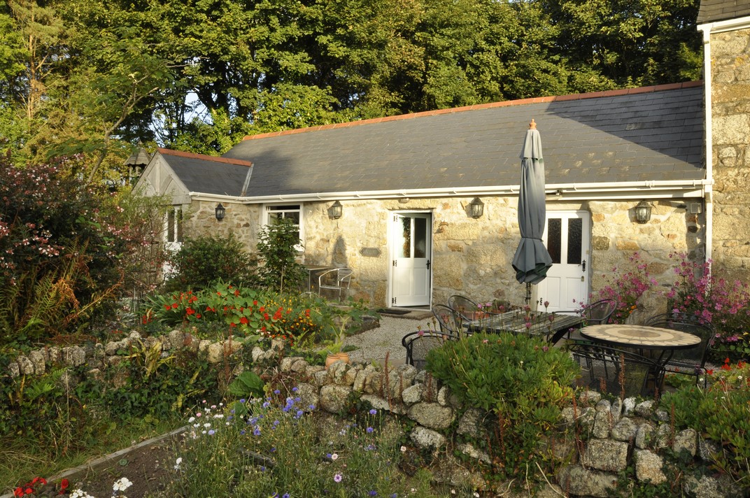
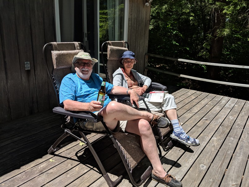
My son-in-law, Michael, is – like me – a beer aficionado, and keeps a well-stocked cellar of many different beers. It’s wonderful to see how the beer culture has blossomed in the USA, no longer just Budweiser or Coors. I had opportunity to enjoy a variety of beers. Those IPAs are so good, if not a little hoppy sometimes. However, my 2018 favorite was a Czech-style pilsener, Dakota Soul from the Summit Brewing Company based in St Paul.

Relaxing in St Paul was also an opportunity catch up with some of my blogging, while Steph spent time in Hannah’s garden making sure everything was coping with the very hot weather. Notwithstanding the regular watering, we did experience a couple of quite spectacular downpours the like of which I haven’t seen for some time.

And our lively grandchildren, Callum (eight just two days ago) and Zoë (6) kept us on our toes. For one of the two weeks we stayed in St Paul, I was their summer camp chauffeur, dropping them off at the bus just after 8 am each day, and picking them up late in the afternoon. We were also ‘babysitters’ over six days and five nights. That’s the first time we’ve taken on this role; it was the first time that Hannah and Michael left the children with grandparents for more than just an overnight stay, while they celebrated their 40th birthdays with a visit to California’s Napa Valley.

Outcome? I think Callum and Zoë survived us – no permanent harm done!

There’s quite a lot of ambiguity associated with looking after someone else’s children – and they know it! Even though it was made clear to both that ‘Grandad and Grandma were in charge’, you’re often faced with situations asking yourself how Mum and Dad would react. Obviously we haven’t looked after small children for more than three decades since Hannah and Philippa were small. Although we had TV in the 1980s, there were no video games, or subscription channels like Netflix offering up a continuous menu of cartoons.

Both Hannah and Philippa had quite a large circle of friends within easy distance of home, some just a few doors away. So whenever the weather was fine – or even if it was not – one or the other would be round a friend’s house, or the friends at ours. It’s a sign of the times but ‘play dates’ have to be arranged for both Hannah’s and Philippa’s children. This is not only a reflection of busy lives for Mums and Dads, but also that no friends live next door.

We had fun with Callum and Zoë, although they might not perhaps reflect well on the occasions when I had to ‘lay down the law’. We went bike riding (they did the riding while we followed on foot), and explored the fascinating glacial potholes at the Interstate State Park 53 miles northeast from St Paul beside the St Croix River at Taylors Fall.

Afterwards we spent time at a splendid children’s playground at Stillwater. We ate out one night, went out for breakfast on the Sunday, and had a BBQ. Here are some more photos of that outing.

Grandma Mary (Michael’s mother) took the children to the Minnesota Zoo one day so Steph and I could enjoy a day at the Minnesota Landscape Arboretum (here are the 2018 photos), somewhere we have visited a couple of times in the past.

Beautiful echinaceas, a typical species of the prairies

And any visit to St Paul would not be complete without checking out the Marjorie McNeely Conservatory at Como Park (map).

We’ve been going there since 2006 when it was the venue for Hannah and Michael’s wedding. The floral displays change with the seasons, and we always enjoy seeing what the gardeners have prepared for their many visitors. This summer’s display was much more subdued compared to other years.

May 2006

December 2007

July 2016

June 2017

June 2018

I would certainly recommend a visit to Como Park  if you’re ever in St Paul. There is also a small zoo and fun fair, very popular with the children.

The Mississippi River is just 50 m from Hannah’s front door, but at least 50 m below. There are some lovely walks and parks along the river, Hidden Falls Regional Park, about a mile from Hannah’s, being one of them. But the river was high this year, with flooding closing several of the walks nearby. The St Croix River at Stillwater was the highest we have ever experienced.

Beside the Mississippi at Hidden Falls Regional Park.

The St Croix River at Stillwater. That’s Wisconsin on the far (east) bank.

Finally, this commentary about relaxing in Minnesota would not be complete without mention of Hobbes, a lovely ginger rescue cat who has his moments, going from sweet and docile to full on attack mode at the drop of a feather. But over our time at Hannah and Michael’s he did begin to relax with us and, more often than not, this is how he spent much of his time.

Blown away by Mt Washington . . .

Or, rather, blown away on top of Mt Washington.

Compared to the mountain ranges in the west of the USA, Mt Washington (at 6288 ft – 1917 m) and nearby peaks in the Presidential Range of New Hampshire’s White Mountains are mere foothills. From their base, however, they still look pretty impressive. Mt Washington is the highest mountain in the northeastern USA and experiences some pretty spectacular weather.

Steph and I got our first glimpse of Mt Washington as we crossed New Hampshire recently on the first part of our road trip that also took us through Massachusetts and Vermont on our way to Maine to spend a week there with our elder daughter Hannah and her family, who had flown in from Minnesota.

I’d chosen a route from Burlington, VT taking us north towards the Canadian border, then dipping down to the southeast through the White Mountains close to Bretton Woods, site of the momentous 1944 conference that aimed at regulat[ing] the international monetary and financial order after the conclusion of World War II. The conference led to the founding of the World Bank (or International Bank for Reconstruction and Development) and the International Monetary Fund.

Having worked for many years for two of the centers funded through the Consultative Group on International Agricultural Research (CGIAR), that had been established in 1971 under the auspices of the World Bank, I was interested to see the location where it had all started, so to speak.

And as we skirted a bend on US302, heading southeast, there was the famous hotel off to the left, nestling under the Presidential Range. In the middle was Mt Washington (just left of center in the photo below), clearly higher than surrounding peaks, and on which we could just make out some infrastructure we later discovered to be part of an observation station.

During our week in Maine we made several excursions, and one of those was the seven mile drive on the Mt Washington Auto Road that takes you to just below the summit, from 1500 ft the park entrance west off NH16 (White Mountain Road).

Amazingly, construction of the Auto Road (originally the Carriage Road) commenced in 1854, and was completed in 1861, opening to the public on 8 August that year. Over the past 157 years, more than 4 million tourists have reached the summit.

The fastest ascent on foot (in 2004) took just a few seconds short of 57 minutes (and only seven minutes quicker by bike). By car, Mt Washington has been climbed in just 6 minutes 9 seconds (in 2014). We took rather longer, at least 30 minutes, as we stopped whenever possible to enjoy the spectacular views, as well as negotiating some of the curves rather gingerly.

The road is paved most of the way, although near the summit there is a short gravel section.

The summit can also be reached by a cog railway! The train ascends on the western flank of the mountain; the station is situated a short distance beyond the hotel at Bretton Woods.

The cog railway, heading ‘vertically’ up the mountain can be seen just right of center.

Apparently the summit is hidden in clouds for about 60% of the year. Not so on the day of our visit. We couldn’t have asked for better weather, and the views, in all directions, were just awesome.

That’s Bretton Woods in the distance . . .

It wasn’t too windy either, blowing between 40-60 mph. Even so, we struggled to keep upright at the summit signpost.

60 mph is nothing on Mt Washington. On 12 April 1934 the world record wind speed (observed by humans) was recorded at 231 mph! Can you imagine that? Besides a small cafeteria, there is a small but interesting exhibition at the summit, with some of the instruments used and observations recorded on that momentous day 84 years ago.

I guess we spent a little under two hours at the summit, enjoying the panoramas in all directions. We couldn’t have hoped for a better day. Once we were down, there was time to relax in the sun, enjoy a picnic, and even take forty winks. We were even given a certificate for ascending the mountain.

So, if you are ever in the vicinity, and the weather looks half decent, I’d recommend the drive up the Auto Road. We weren’t disappointed.

~~~~~~~~~~~~~~~~~~~~~~~~~~~~~~~~~~~~~

Here is a link to a bigger album of photos taken at Mt Washington.

Planning a USA road trip

Steph and I like to explore.

Since 2011, we have made five major road trips across the USA, and two of shorter duration.

That first year, we headed for Arizona and New Mexico, taking in the Grand Canyon, Canyon de Chelly and other interesting sites in those dry climates.

We decided to stay closer to home (home being where our daughter Hannah and her family live in St Paul MN) in 2012, just visiting the Boundary Waters Wilderness Region and the Gun Flint Trail of northern Minnesota .

2013 saw us on the Pacific coast of Oregon, and a trip as far south as Sacramento in California, taking in Oregon’s Crater Lake and the Californian redwoods on the way.

We headed west from St Paul across the prairies in 2014, the first of our really long trips, taking in the Badlands and Mt Rushmore in South Dakota, Devil’s Tower in Wyoming, the Bighorn Battlefield in Montana, and Yellowstone National Park.

We toured Scotland in May-June 2015 so decided not to make any road trip in the USA, instead choosing to take Amtrak to Chicago for three days.

I broke my leg in January 2016, so any long road trip was out of the question. However, we made a short trip north of the Twin Cities to find the source of the Mississippi River.

The Appalachians called us in 2017, so we flew into Atlanta and drove back to Minnesota through Georgia, South Carolina, North Carolina, Tennessee, Virginia, West Virginia,Kentucky, Illinois, Missouri, and Iowa.

We were equally ambitious this year, taking in New England (Massachusetts, Vermont, New Hampshire, and Maine) before heading west to Niagara Falls in New York, and then south and west through Pennsylvania, Ohio, Kentucky and Indiana, before heading north into Michigan, crossing Lake Michigan on the car ferry, and driving across Wisconsin to end up, once again, in the Twin Cities.

Until this year, I had planned our trips using various maps. For the Arizona/New Mexico and Oregon/California trips in 2011 and 2013, and for trips around Minnesota, I purchased a DeLorme Atlas & Gazetteer for each state. These are very detailed and comprehensive, and show even the most minor of roads. Since we like to take highways and byways (US roads, state highways, and even county roads) as much as possible and avoid the busy Interstates, these DeLorme publications allowed me to draw up quite detailed itineraries.

But they are heavy! And once we planned to drive from Georgia to Minnesota in 2017, carrying around a DeLorme Atlas for each state was not an option.

Instead, I purchased Rand McNally road maps for each state, and plotted a route using Google maps, then transferring it to the map itself, as shown in the image below. I also verified the route using Google Street View, especially to check out the various road junctions.

Steph was the navigator – which had the unfortunate consequence that she had to have her head in a map day in and day out. To assist with navigation I also drew up detailed route instructions on separate cards for each day. One of these is shown in the upper image above. These provided information on the road numbers (roads in the US can carry more than one number as roads combine for short or long distances), junctions, and any other special feature or attraction that we had decided to visit.

However, at Christmas 2017, I received a Garmin DriveSmart™ 51 LMT‑S GPS Navigator with a 5″ display, which came with UK and Ireland maps installed (that are regularly updated).

One of the features I really like is the accompanying BaseCamp software installed on my laptop that allows me to plan routes, with any degree of detail, and transfer them to the sat nav. Once I’d got the hang of its idiosyncrasies, I began plotting routes from home in the UK, finding the best options, and at the same time learning the various features of the sat nav itself.

In BaseCamp I found the easiest way to plot a route was to choose the starting and destination waypoints, and let the software ‘find’ the optimum route. In this example below, I plotted a route from Niagara Falls NY to Canton OH, which was the third day of our recent trip after leaving Maine.

As you can see if you open a larger image, the route calculated would have taken us on the interstate close to the shore of Lake Erie. But I wanted to cut across country and travel through the Allegheny Forest of Pennsylvania.

BaseCamp allows you to shape any route by adding ‘via points’, as many as needed to develop an unambiguous route when it is recalculated by the sat nav itself once transferred.

Then, once all the via points have been added, your final route, below, is transferred to the sat nav.

My Garmin proved invaluable during this trip, especially when we did travel on the Interstates, and these merged with one another, giving me advice when lane changes were necessary, changes to speed limits, and always anticipating any junctions half a mile ahead.

We only had a couple of glitches. Once, after we’d arrived at our hotel, I discovered the reason why the sat nav had asked me to make a U-turn on one street earlier in the day. I’d programmed in the same via point twice. Another time, in deepest Ohio, one of the roads I’d chosen was closed some miles ahead, so we had to follow a set detour. The sat nav didn’t like that, urging me to make a U-turn, or turn at the next junction. Having completed the detour, our original route appeared on the screen, and on we continued. On another occasion, crossing Kentucky along the Ohio River, we had to make another detour, and suddenly the icon for the vehicle was moving across a blank screen – until we reached another road that it recognized. I think we had been diverted on to a new road that wasn’t programmed into the USA maps I’d bought before the trip.

With the installed UK and Ireland maps, I receive updates all the time. The USA (and Canada and Mexico) maps are a one-time purchase, not particularly cheap, but well worth it. It’s just a pity that Garmin does not offer regular updates for these purchased add-on maps as well.

The sat nav is great, but we also found it useful to have a map to refer to see the bigger picture. We were able to find road maps for some states in hotel receptions or at state information centers.

And one of the biggest advantages of using a sat nav? Steph no longer has to navigate hour after hour, and can enjoy looking at the changing landscapes. I wouldn’t say I was particularly stressed on any of my earlier road trips. But with the sat nav I did find that my anticipation level was much lower, and I could also enjoy seeing the countryside we were passing through, knowing that I would be navigated safely to our destinations, especially through built-up areas.

Massachusetts to Minnesota (4): heading west through NY, PA, OH, KY and IN, then on to MN

Leaving Niagara Falls via the Niagara Scenic Parkway on the Sunday morning, we headed south, skirting Buffalo and the eastern shore of Lake Erie towards Pennsylvania, and the Allegheny National Forest. Our destination was Canton in Ohio, just south of Akron, a journey of 313 miles.

Along the Niagara Scenic Byway, there are two impressive bridges across the Niagara River on I-190.

There was little traffic around Buffalo, fortunately, even though it was a fine morning for Father’s Day. Soon enough we were outside the city limits and heading south into Pennsylvania.

Pennsylvania was a ‘new’ state for us (as were OH and IN), and I particularly wanted to travel through the Allegheny National Forest.

We travel on the interstates as little as possible, taking US highways and county roads in preference. You get to see a lot more of rural America that way. But roads are none too wide with few places to stop. And certainly no easy stops for photography. So on these two days we have little to show, photographic-wise, for our long days on the road.

The next morning we had an early start as we decided to cover the whole route that I’d planned, some 447 miles south through Ohio, crossing the Ohio River into Kentucky, before crossing the river again further west into Indiana to reach our next destination, Bloomington.

The drive through OH took us through some delightful towns and villages, and productive agricultural landscapes. Although we saw road signs to be aware of Amish buggies on the road, we only saw a couple.

Somerset is a small town about 110 miles south of Canton. In the middle of its impressive town square (which had a very English feel to it) there was a statue to a famous son of Somerset, Union General Phil Sheridan.

We also passed by Dover OH, home to infamous Confederate guerilla leader William Clarke Quantrill (I just bought a biography to read), and also Bainbridge, home to the first dental school in the USA, opened in 1825.

Eventually we reached the Ohio River at Aberdeen OH. The Ohio is a very impressive river and as I commented in a post after last year’s road trip, its flow is greater than the Mississippi. No wonder that rivers like the Ohio were used to open up the interior of the country.

This is the bridge that carries US68 into Kentucky. We crossed a little further west on the William H Harsha Bridge, carrying US62.

Aberdeen is also the terminus of Zane’s Trace, the first continuous road through Ohio, from 1798.

Crossing into northern Kentucky, we were less than 50 miles north of where we had driven through the state in 2017. Then it was over the Ohio again, and into southeast Indiana. Our good friend and former IRRI colleague Bill Hardy (a native born Hoosier) told us that we should see the southern part of the state, since the northern half was flat and rather uninteresting, maize upon mile of maize. He was right. The drive into Bloomington was delightful in the early evening sunshine, with Highway 46 weaving through the trees, up and down dale.

After a restful night in Bloomington (yet another Comfort Inn!) we set off the next day for the penultimate sector of our trip that would take us to Ludington on Lake Michigan in the state of that name. This was another long drive, over 400 miles, north to Gary IN, and then wending our way north along the eastern shore of the lake.

Just over the state line into Michigan we stopped to have a quick picnic lunch at a rest area (and Michigan information center) on I-94. We were very impressed with the amount of tourist literature and maps available at the information center; Michigan certainly knows how to sell itself.

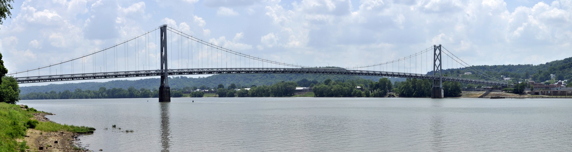
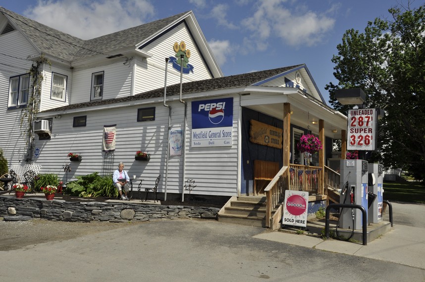
Just north of the state line we took a short detour to
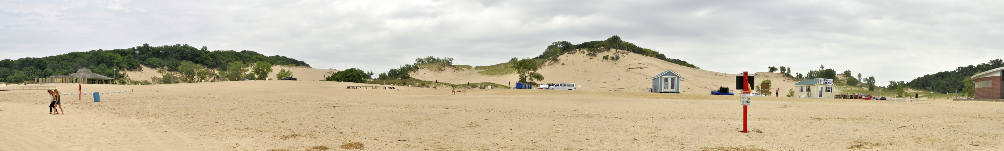
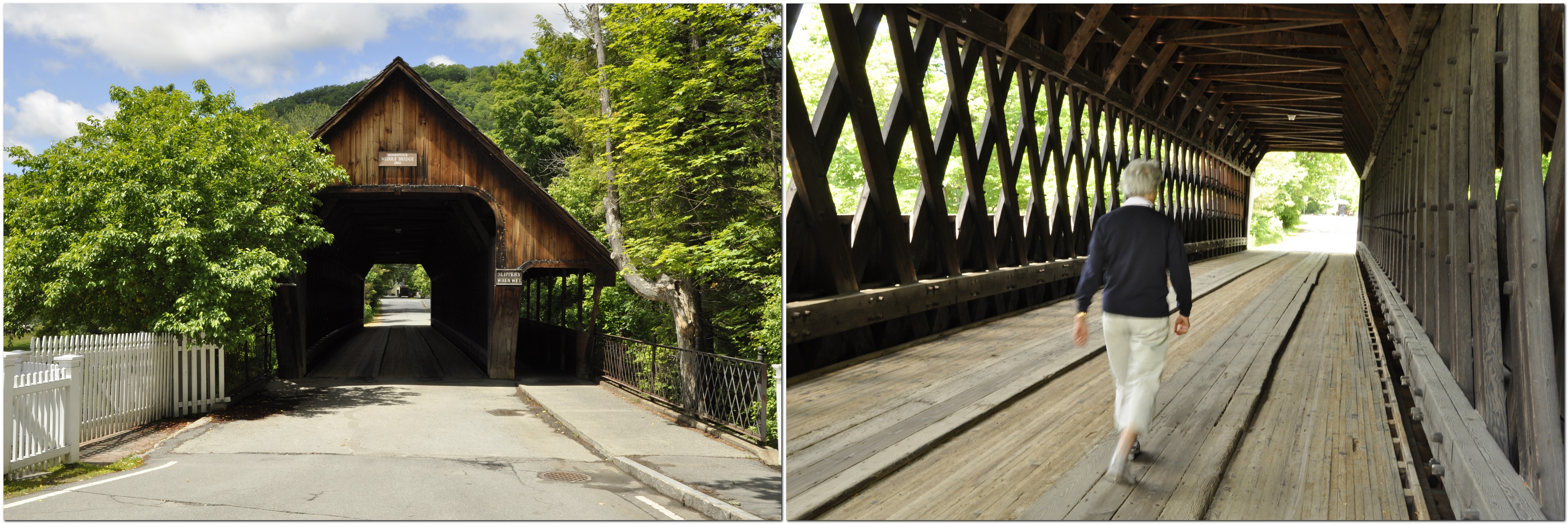
 Warren Dunes State Park. Lake Michigan is like a vast internal sea, and along its shores, certainly the eastern shore, there are huge sand dunes, now covered with mature woodland. The sand is extremely soft, and hard to walk across. Just like being at the seaside, and although the day was overcast, enough brave souls were enjoying beach to the maximum.

This is Tower Hill Dune that rises to more than 230 feet above Lake Michigan.

Then it was back on the road again, heading for our last night stop of the trip, at Ludington, before taking the ferry across Lake Michigan the next morning to Manitowoc on the Wisconsin shore.

The ferry, SS Badger, across Lake Michigan is operated by LMC – Lake Michigan Carferry. Badger is the last coal-fired ferry operating in the world.

It is 393 feet long, and has a beam of almost 60 feet. It was built in 1953 in Sturgeon Bay, WI. Its sister ship, Spartan, has been laid up in Ludington for many years. Originally the ferries carried rail cars.

The 60 mile crossing of the lake takes four hours, but you gain 1 hour moving from Eastern Standard Time to Central Time. As it was a Wednesday in mid-June, before the height of the tourist season, the boat was far from busy. The slow, easy-paced crossing was just my opportunity to catch up on some sleep, in readiness for the final push into the Twin Cities from Manitowoc across Wisconsin, some 321 miles.

We were at the dockside a little after 07:30, and they started to board the vehicles shortly afterwards for an on-time departure from Ludington at 09:00. Vehicles are driven on board by company staff. So before we sailed we had a good look around the vessel.

Soon enough we were headed out of Ludington harbor.

And before we knew it, Manitowoc was coming into view, and everyone was getting ready to disembark.

I had planned a route across Wisconsin that took us from Manitowoc through Stevens Point on US10. We took I-43 north for a couple of miles or so, then came off to take US10, only to see a sign stating that the road was closed some miles ahead. With that, I changed the settings on my satnav to take the quickest route to St Paul, rejoining I-43 around Green Bay, and west on Highway 29, until we joined I-94 west of Chippewa Falls for the final 75 miles into the Twin Cities. Highway 29 was a nightmare. Although a dual carriageway (a divided highway) it just went on and on, unrelentingly, in a straight line across Wisconsin. However, we did arrive to Hannah and Michael’s almost an hour earlier than anticipated.

Thus ended our 2018 road trip across twelve states: MA, VT, NH, ME, NY, PA, OH, KY, IN, MI, WI, and MN.

In nine days we covered 2741 miles, plus another 477 miles in Maine itself during the six days we stayed at the cabin. We used 133 gallons of gasoline, at a cost of $384 ($2.89/gallon, less than half of what we would have to pay in the UK for the same amount of fuel), at an average consumption of 24.19 mpg.

I’m already planning for 2019; Georgia to Texas through the southern states seems a distinct possibility.

~~~~~~~~~~~~~~~~~~~~~~~~

See the other posts in this series:

Massachusetts to Minnesota (1): the first three days in MA, VT and NH

Massachusetts to Minnesota (2): a week in Maine

Massachusetts to Minnesota (3): onwards to Niagara Falls

Massachusetts to Minnesota (3): onwards to Niagara Falls

Leaving Waterford, ME for Niagara Falls early on the morning of 15 June, we allowed two days for this sector of our trip, 366 miles on the first day, and 289 on the second.

We headed west to the Kancamagus Highway through the southern part of the White Mountains of New Hampshire, and a slow climb to reach the the pass at 2855 feet. The cloud level was quite low, and at some scenic overlooks there was sometimes very little to see. But luck was on our side, and we did have some spectacular views in all directions, particularly at Pemigewasset Overlook northwards.

There were many road signs warning of the presence of moose along the highway throughout much of the trip in New England. But we saw neither hide nor hair, not even an antler. Roadkill raccoons were two a penny. This road sign (courtesy of Trip Advisor) warns drivers at the start of the Kancamagus Highway.

Once across the mountains, we turned south for about 30 miles on I-93, to join US4 to cross Vermont, a section we had more or less traveled the week before.

About 10 miles south on I-93 we saw a sign for road works ahead, and we could see the traffic slowing. But then I could also see vehicles moving beyond the ‘obstruction’, one at a time. Funny situation, I thought to myself. Anyway, to cut a long story short, agents (maybe 20 or more, plus dogs) of the US Customs & Border Protection were checking all vehicles for occupants. And, having British passports, we were asked to pull over while I retrieved our passports from a suitcase in the back. Once checked, we were waved on our way. By coincidence, I had read earlier that day a story about these ‘border checks’ miles and miles from any international border (with Canada in our case, or in the south with Mexico).

Once in Vermont we passed through a pretty town named Woodstock. No, not that one – that’s in NY. There was an interesting covered bridge, constructed in 1969 to replace an iron one that had been put across the river in 1877. Apparently this wooden construction was cheaper than other options.

Our destination for this night was Herkimer, NY, about 10 miles east of Utica. Crossing from Vermont into New York, we headed north into the Adirondacks Regions and west around Indian Lake, following for the first part, the valley of the Hudson River.

The following day, we headed west from Herkimer towards Ithaca (home of Cornell University). We passed through many delightful villages, among them Sauquoit where Steph spotted a memorial plaque. I regret not stopping, since it commemorated Asa Gray, born 18 November 1810 (same birthday as me), who is considered the preeminent American botanist of the 19th century.

We enjoyed the rolling landscape, dotted with small farms, the chapels in the villages.

St Paul’s Church, Paris Hill, established in 1797. This is the oldest parish in Western New York, from 1838.

At Ithaca, we stopped to have a picnic lunch beside Lake Cayuga, one of the Finger Lakes that characterize this part of upstate New York.

This is also wine country, and the views across Lake Seneca heading north towards Geneva were stunning. Wineries everywhere!

As we had a prior engagement in Niagara Falls NY that evening, I changed our route, joining I-90 west just north of Geneva rather than cutting across country (a much longer route) as I originally intended.

We arrived in Niagara Falls just before 5 pm, and after checking into our hotel close to the city center and the Falls, we decided to stretch our legs by taking the short walk to the American Falls. The light was just right, and although it was quite busy, I’m sure later in the season this site could be heaving with tourists.

So what was this prior engagement? We had arranged to meet my cousin Patsy and her husband David, who had driven down from Ottawa the day before and were staying on the Canadian side. They had never been to Niagara Falls before either. I had met Patsy just once, in the summer of 1972 a few months before I headed off to Peru. Patsy (just 12 then) and her elder sister Karen had come over to the UK with their mother Bridie, one of my Mum’s younger sisters, to meet the Healy side of the family.

We had arranged to meet for dinner at a small Italian restaurant, La Cuccina Di Mamma on Rainbow Boulevard. What a lovely time we had: great company, good food, and heaps of reminiscing! Steph and David were most indulgent towards Patsy and me.

The next day we were up early to take advantage of the good weather, and to view the Horseshoe Falls from Terrapin Point on Goat Island, and the American Falls in the other direction from Luna Island.

The best views of the Falls (mist permitting) are from the Canadian side, but we decided not to cross over. Instead, Patsy sent me these two photos of the American and Horseshoe Falls from their side of the border.

And this short (<3 minute video) illustrates the awesome power of the falls, with a flow of 675,000 gallons/second over the Horseshoe Falls, and 75,000 gallons/second over the American Falls (both relating to summer daytime flow).

Around 10 am, we’d explored all that we wanted, and so set off on the next stage of our journey, 760 miles over two days southwest through New York into Pennsylvania, Ohio, a brief stretch through Kentucky along the Ohio River, and on to Bloomington, Indiana.

~~~~~~~~~~~~~~~~~~~~~~~~

See the other posts in this series:

Massachusetts to Minnesota (1): the first three days in MA, VT and NH

Massachusetts to Minnesota (2): a week in Maine

Massachusetts to Minnesota (4): heading west through NY, PA, OH, KY and IN, then on to MN

Massachusetts to Minnesota (2): a week in Maine

It has been great to meet up with our elder daughter, Hannah, and her family (Michael, Callum, and Zoë) for a week in a cabin at Waterford in Maine, taking a short break in our road trip. They flew in from St Paul (Minnesota) three days after we landed in the USA, and on the day that we drove over from Burlington in Vermont, crossing the White Mountains in New Hampshire.

And what fun we have all had together. It’s wonderful to see them again. It has been a year since we were last over on this side of the Atlantic.

On Saturday we decided not to stray far from the cabin, just the short distance to Hawk Mountain to take in the breathtaking panoramas south and west of Waterford.

Sunday was Michael’s 40th birthday so we celebrated by a visit to Attitash Mountain Resort, about 50 miles west of the cabin along US302. This map shows all the excursions we made during the six days we spent in Maine.

I’d been expecting huge crowds, and long queues for the rides. But no! Although school was out in some areas, the resort was quiet, and we could take as many rides up and down the mountain as we liked, and no waiting.

There were two rides that we enjoyed: the Alpine Coaster, and the Alpine slide. Never having experienced either, Steph decided to ride with Hannah on her Coaster ride; I took Zoë. Callum rode with Michael.

I’d seen videos on YouTube of alpine coasters around the USA. The one at Attitash is advertised as the longest. This is what it looks like.

Michael managed to capture me on his cellphone during one of my descents.

The Coaster was quite a bone shaker. More fun for us ‘oldies’ was the mile long and awesome descent on the Alpine Slide. It’s a bit like the Olympic luge. And we could all take our own carts, even Callum and Zoë.

Here’s what it looks like from a rider’s perspective, from a video I found on YouTube.

To begin the ride, it was necessary to take the chairlift up the mountain, about a 10 minute ride, with incredible views over the surrounding mountains.

And when it all got too much, it was nice just to sit back, relax in the sun, and watch the others having the time of their lives.

Being Michael’s special day, we stopped off for dinner at a recommended restaurant, where he enjoyed lobster, and the rest of us something not quite so exotic. The end to a great day.

After all the excitement of the previous day, we decided to take it easy on the Monday. So Hannah and Michael took the children around McWain Pond in a canoe.

Meanwhile, this was a great opportunity for me to enjoy yet another cold beer in the sunshine, and Steph to knock off another couple of chapters of the book she’d brought with her.

On the Tuesday we set off for Mt Washington, at 6228 feet the highest mountain in the northeast of the USA, and where the highest wind speed was recorded in the 1930s.

We passed by Mt Washington near Bretton Woods on the west side of the mountain while traveling across New Hampshire the week before.

It’s a seven mile drive up to the summit, and we enjoyed a 360° panorama at the top. We were lucky. For more than 60% of days, the summit is completely fogged in. While it was windy (40-60 mph), it was just about manageable.

There’s also a cog railway that climbs to the top, bringing even more tourists who don’t relish the drive. While we were at the summit several trains arrived, and I was fortunate to capture this shot of three at the summit.

After the slow descent, and heating of the brakes, we found a nice spot to enjoy a picnic, let the car cool down, and a rest for ourselves.

On the way back to Waterford, we finally came across one of New England’s famous covered bridges – at Jackson, NH! They really are fascinating, and from what I could tell from various plaques and information online, they are really cherished.

Wednesday and Thursday were our big excursion to the coast, to Camden on Penobscot Bay for an all-day sail around the bay on Sailing Vessel Owl with Capt Aaron (Lincoln) at the helm, a direct descendant of folks who came to the USA in the 1680s.

Michael used to sail these waters with his mother and stepfather when he was a boy, and was keen for Callum and Zoë to enjoy the same experience. We left the cabin by 06:30, and were ready for boarding the Owl around 09:30.

We set off east into the bay, arriving at the passage between North Haven and Vinalhaven (map) by lunchtime, in time for a short shore excursion on a small island. Until our return it had been warm and sunny, and mostly smooth. But as we set sail for the return to Camden, the wind got up, the waves increased and the temperature fell.

After a long day at sea, about 9 hours, we arrived back in the harbor, and enjoyed a welcome meal of freshly caught haddock. Since the drive from the cabin had taken about 2½ hours, we had already decided to spend the night in Camden, returning mid-morning the next day.

But before we left, we took a stroll around this pretty town and its harbor. In a small park overlooking the harbor there is a statue memorial to soldiers who fell in the American Civil War of the 1860s, referred to interestingly as The Great Rebellion.

There’s considerable wealth in Camden, given the large houses and boats moored in the harbor, owned by some of America’s most illustrious families.

Before heading back to the cabin at Waterford, Steph and I decided to take a look around Rockport, just a couple of miles south of Camden. On the point of a peninsula east of the town, the simple and beautiful Vesper Hill Chapel was built in 1962, and is dedicated to all young people who found God in their lives.

Then it was time to head west so that we would have enough time to pack, and prepare for the long trip even further westwards the next day.

Such was our week in Maine, enjoying time with Hannah and Michael, and the grandchildren. Callum and Zoë took everything in their stride, full of beans, and always ready for the next adventure. They keep us young!

~~~~~~~~~~~~~~~~~~~~~~~~

See the other posts in this series:

Massachusetts to Minnesota (1): the first three days in MA, VT and NH

Massachusetts to Minnesota (3): onwards to Niagara Falls

Massachusetts to Minnesota (4): heading west through NY, PA, OH, KY and IN, then on to MN

Massachusetts to Minnesota (1): the first three days in MA, VT and NH

It’s that time of the year, and here we are, on the road again in the USA. Another potentially daunting road trip that will take us from Boston, Massachusetts (MA) to St Paul, Minnesota (MN) via Vermont (VT), New Hampshire (NH), Maine (ME), New York (NY), Pennsylvania (PA), Ohio (OH), Kentucky (KY), Indiana (IN), Michigan (MI), and Wisconsin (WI), including a ferry crossing of Lake Michigan from MI to WI. This year I’m using my new Garmin DriveSmart 51 sat-nav, for which I purchased the USA-Canada maps. It saves Steph having to navigate, state by state, map by map, as in previous years, so she can enjoy looking at the passing scenery.

We are also spending a week near Waterford in western Maine, with our daughter Hannah and family (Michael, Callum, and Zoë) at a cabin on the shore of McWain Pond, one of the many small lakes that dot the landscape.

Anyway, it all started last Wednesday morning, very early, when a taxi picked us up from home at 04:00 to take us to Birmingham Airport (BHX) for our 06:00 KLM flight to Amsterdam Schipol (AMS), connecting with Delta 259 at 11:15 to Boston Logan International Airport (BOS).

Apart from a rather rude Delta ground agent at Schipol, our connection was uneventful, as was boarding (Sky Priority), and I was soon enjoying my first G&T on the 6 hour 55 minute flight, on a comfortable Airbus A330-300. When we landed in BOS there was a delay of more than 20 minutes while the ground crew figured out how to connect the air-bridge to the aircraft. But soon enough, we were checked through immigration on one of the newfangled automated passport control (APC) machines. I still had to pass through regular immigration (and facing another rude official who even queried me about any visits I’d made to the Middle East). Before long, luggage in hand, we were at the car rental center and picking up our SUV from Budget. The Mitsubishi we had been assigned had a flat battery, so Budget upgraded us to a full-size SUV, a Dodge Journey V6—rather larger than we needed, but extremely comfortable nevertheless, if a little heavy on fuel (about 25 mpg). But at USD3 a gallon, that’s not really an issue. It would be in the UK, however, where gasoline is more than twice the price!

We successfully navigated our way out of the airport and through the tunnels under Boston city center on I-90, after finally getting the sat-nav to behave itself. Our Wednesday night stop was in Hadley, in central MA, just over 100 miles west of Boston, and southwest by a handful of miles of Amherst.

Over the next two days we took in northwest MA, the Green Mountains of VT as far north as Burlington, and then over the White Mountains of NH, to arrive at our cabin destination in Waterford, ME.

Heading northwest from Hadley on Thursday, it was slow-going for the first 20 miles or so as we encountered school traffic and people heading to work. But soon we were in open country, on scenic byway 112 and often had the road to ourselves for long stretches (as we have enjoyed in past road trips). After about an hour we joined MA2, the Mohawk Trail, and followed that until North Adams where we turned north and crossed over into VT.

There was a glorious view south from Whitcomb Summit, and some miles further on, just short of North Adams, there is a spectacular view north into southern Vermont, reminding us of the views we saw when exploring the Appalachians in 2017.

Vermont is a beautiful state, with forested hills and mountains as far as the eye can see.

North of Wilmington, VT we stopped at a general store and deli to buy sandwiches and were intrigued with the Mini Cooper parked outside with an interesting registration plate BONKS. There was also a Golden Retriever with a Union Jack collar. We discovered that the proprietor was British, from Guildford in Surrey (near London)!

We spent Thursday night on the east side of Burlington, conveniently located for the next day’s travel northeast into New Hampshire and Maine, beginning around 08:00.

Most of the small communities we passed through have a general store or two, offering a whole range of produce, and many selling fresh sandwiches from a deli counter. We enjoyed a coffee in the sun at Westfield in the far north of the state, just south of the border with Canada.

Crossing into New Hampshire, we headed towards the White Mountains and were not disappointed with the fantastic view of the Presidential Range and the Mt Washington Hotel Resort at Bretton Woods. That’s Mt Washington just left of center, at 6288 ft the highest mountain in the northeast USA.

But Bretton Woods also has special significance for me. Why? Well, I worked for 27 years at two international agricultural centers, CIP and IRRI,  sponsored by the CGIAR (Consultative Group on International Agricultural Research). The CGIAR was founded in 1971 under the auspices of the World Bank. In July 1944, an international conference was held at the hotel to plan for a post-war world, following which the World Bank and the International Monetary Fund were created.

Stopping at Conway to pick up a supply of groceries, we finally reached the cabin around 17:00. A long enough day, followed by a couple of cold beers, an early night, but still far short of some of the travel we have yet to make.

Watch this space!

~~~~~~~~~~~~~~~~~~~~~~~~

See the other posts in this series:

Massachusetts to Minnesota (2): a week in Maine

Massachusetts to Minnesota (3): onwards to Niagara Falls

Massachusetts to Minnesota (4): heading west through NY, PA, OH, KY and IN, then on to MN