We couldn’t have asked for better weather yesterday. Even though a little on the cool side, accompanied by a blustery wind, there was hardly a cloud in the sky. A perfect early Spring day.
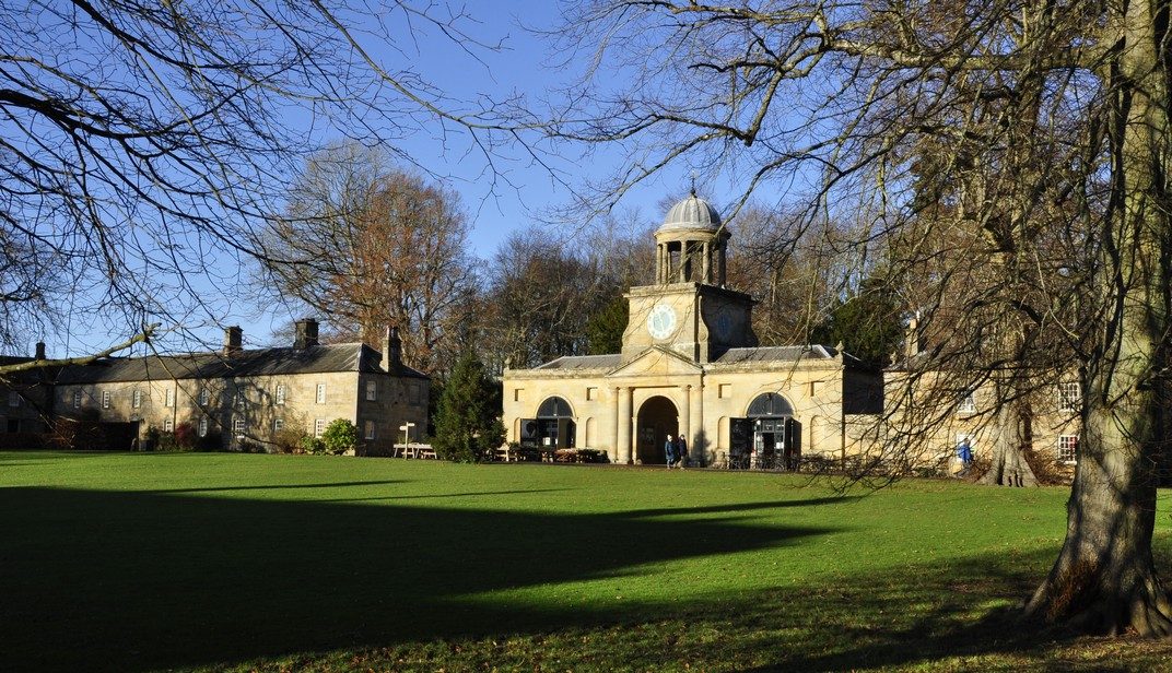
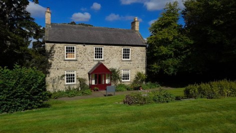
So we headed for the National Trust’s Gibside estate, about 11½ miles southwest from where we live in North Tyneside, as the crow flies (or just over 15 miles by road).
Covering 600 acres (just over 240 hectares), Gibside provides excellent walking. While the old house lies in ruins, and the chapel is not open every day, there’s plenty to explore on foot. We covered almost five miles.
Taking my trusty binoculars along (a pair of Swift Saratoga 8×40 that I’ve had for about 60 years) we hoped there might be some interesting wildlife to observe. On one of our previous visits, we’d come across a pair of roe deer among the pine trees. I was hopeful there might be some interesting birds along the River Derwent, the northern boundary of the Gibside estate.
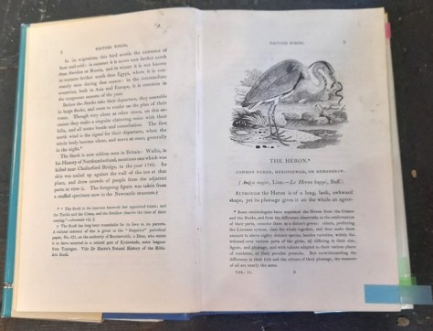
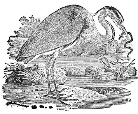
And we weren’t disappointed. As we were leaving the Trust cafe after enjoying a refreshing regular Americano, a solitary grey heron flew low overhead, buffeted by the gusting winds, and crabbing to make headway. It’s one of the largest birds in this country, and doesn’t look designed for flying in high winds.
Grey heron
Then, as we walked down to the banks of the Derwent, we came across a pair of dippers on a shallow cascade; and further on, a pair of goosanders in full breeding plumage. What a magnificent sight!
Dipper
Goosanders
We’d seen a dipper a few weeks back alongside Seaton Burn in Holywell Dene close to home, the first I’d encountered in more than 20 years. And I’d seen my first ever goosander just a couple of months back on a local pond, so seeing a breeding pair yesterday was a real delight.
At the bird hide we watched great, blue, coal, and long-tailed tits, and as we sat having a picnic in the early afternoon sun (quite warm out of the breeze), beside the fish pond below the 18th century Banqueting Hall (not National Trust), we enjoyed the antics of a trio of little grebes, another species I’m not sure I’ve ever seen before.
Little grebe
Then, as Steph was finishing her lunch, and I was taking a photo of the view, a red kite swooped overhead; we saw another one later in the walk.
Red kite
Then, just before we continued on our walk, I happened to look up at the Banqueting Hall and spotted a single roe deer grazing in front of the building. What luck!
Since moving to North Tyneside from the West Midlands around 18 months ago, I have revived my interest in and enjoyment of bird watching.
Compared with our garden and surrounding countryside in north Worcestershire (some 230 miles south of where we now live)—and which I wrote about in one of my early blog posts in May 2012—there seem to be more birding opportunities here in the northeast: in the garden, on the coast (which is less than five miles as the crow flies), and the river valleys, moors, and hills of Northumberland.
Close to where we now live, the land has slowly recovered over the last four decades since the coal mines were closed. A mosaic of streams, hedgerows, scrub land, reed beds, ponds, arable and grassland, not to mention woodlands in various stages of development, has now replaced what had been a desolate industrial landscape, supporting an abundance of bird life and even some large mammals like roe deer. The routes of the former mine railways—the waggonways—have been left as footpaths and bridleways, serving as excellent wildlife corridors across North Tyneside and connecting urban sites with the surrounding countryside.
Source (for all photos in gallery): MTJ
Upper Coquetdale
Lordenshaws Iron Age Hill Fort
To date, my northeast bird list comprises about 80 species observed and one, a grasshopper warbler, heard but not seen (according to a more experienced birder than me).
Some species, like goldfinches (left below) or bullfinches (right) which I saw only occasionally down south, are quite common here, often in flocks of 20-30 birds.
Goldfinch
Bullfinch
Herring and black-headed gulls are ‘as common as sparrows’ (which we don’t actually see very often, although I did come across the more scarce tree sparrow just a week ago while on one of my walks).
House sparrow (L) and tree sparrow
Rather than describe all the birds on my current list, do go back to that earlier post to see many of the birds that we see regularly here. I’ll just highlight some of those that have particularly caught my attention.
When we moved into our new house just over a year ago, the rear and front gardens were just patches of grass. Calling them ‘lawns’ would be an exaggeration. Steph worked hard from the end of April 2021 to design and build a new garden, hopefully attracting more insect and bird life.
Certainly the insects increased in number and type, with many different types of bees visiting the range of flowering plants that we introduced.
Throughout the summer and into autumn, there was a family of five or six pied wagtails (right) that we saw in the garden almost everyday. They disappeared during the coldest weeks of the winter, but have once again started to show up in the garden.
And when we took a trip in July to the headwaters of the River Coquet and the Cheviot Hills, we saw many pied wagtails flitting back and forth along the banks of the river.
Upper Coquetdale
Another surprising visitor to the garden, just once, was an uncommon mistle thrush (right), a much larger cousin of the song thrush.
Song thrush numbers have declined dramatically, but they were a common presence in my younger days, over 60 years ago. However, over the past week, I’ve seen three song thrushes and heard them belting out their glorious songs.
Close to home is an overflow pond for the local stream or burn that has its source less than half a mile away to the west.
Surrounded by lush vegetation, particularly knapweed and bulrushes closer to the water’s edge, this pond hosts several species like mallards and moorhens. Throughout most of last year, and until quite recently, there was a semi-resident grey heron. I hope he will return as the frog population grows in the Spring. Recently, however, a little egret has made an appearance over a couple of days.
Little egret
And in the summer months, the site hosts a thriving population of reed warblers, reed buntings, and whitethroats.
Reed warbler
Reed bunting
Whitethroat
The goldfinches have an autumn feast when the knapweed seed heads ripen.
On the coast we see the usual range of waders such as oystercatchers, ringed plovers, sanderling, dunlin, and turnstones. One of my favorites however is the redshank (right), easily spotted because of its bright orange-red bill and legs. And, of course, several species of gull.
Another new species is the golden plover that I’ve seen on local farmland during the winter as well as at the coast foraging among the rocks. In summer it can be found inland on the hills and moors.
Golden plover
On the cliffs just south of the River Tyne (south of our home) and further north at Dunstanburgh Castle near Craster on the Northumberland coast are colonies of kittiwakes (below) and cormorants.
Source: MTJ
Source: MTJ
Cormorants on the coast south of the River Tyne at Whitburn.
We’ve also seen other cliff-dwelling species like guillemots and razorbills surfing on the waves, but we’re waiting on a trip out to the Farne Islands later in May to really get a look at these up-close.
But perhaps the most impressive sight, to date, have been flocks of pink-footed geese. We saw them first in a field (together with a small flock of about 30 curlews) near Seaton Sluice back in the Autumn. Then, on a walk close to home I could hear them honking in the distance and, gaining some height on the spoil heap at the former Fenwick Colliery, we could see a flock of several hundred grazing in a nearby field.
Pink-footed goose
But it wasn’t until about a month ago, when we were sat enjoying a picnic lunch just south of Amble, that I saw a murmuration of large birds which I’m pretty certain were pink-footed geese even though I didn’t have a clear sight as they were too far away to the west and I was looking into the sun. There must have been 1000 birds or more (based on my rough and ready count), flying this way then that, and finally spiraling down one after the other to land close to Hauxley Reserve. Until I have experienced a starling murmuration, this one will have to suffice, even though it was less frenetic than the starling version.
As in that earlier post, most of the bird images here were taken by amateur photographer Barry Boswell (below), based in Northamptonshire.
Barry has accumulated an impressive portfolio of bird photos. It’s remarkable how digital photography has revolutionized this particular hobby. When I see images of this quality I do wonder where he (and others with the same passion) get their patience, and indeed bird-spotting luck. Patience has never been one of my virtues.
Unlike the 500 mm lens (and Canon bodies) that Barry is sporting in the image above, I only have an 18-200 mm telephoto lens on a Nikon D5000 DSLR body.
The Lincoln Highway. America’s first transcontinental highway, opened in October 1913. Three thousand, three hundred and eighty-nine miles!
If you’re traveling east to west, it begins in Times Square in New York and, originally crossing twelve states, ends at Lincoln Park in San Francisco on the west coast in California. Originally there was a ‘Colorado Loop’, removed in 1915, and in 1928, the route was realigned to take in northern West Virginia.
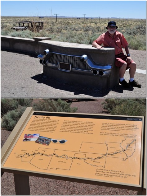
Over the years, however, the Lincoln Highway was subsumed into the US numbered highway system, with much of the section between Pennsylvania and Wyoming becoming part of US 30. Nowadays, I-80 west of Chicago follows much the same route as far as I can determine, although in places to the south of US 30.
So what’s this interest in the Lincoln Highway, and US 30?
Well, I’ve just finished reading The Lincoln Highway by Amor Towles, published in 2021. It’s an unusual tale of three teenagers and an eight year old boy who travel from Nebraska to New York. However, from the outset, the intention was for Emmett Watson and younger brother Billy (the main characters), to take the Lincoln Highway westwards to California in search of their mother who had abandoned the family some years earlier. And the only idea of where she might be is a series of postcards sent over nine days after she departed, from locations along the Lincoln Highway.
But instead of trying to explain the rationale of the book, let author Amor Towles tell you himself.
Towles’ previous books, Rules of Civility and A Gentleman in Moscow were published in 2011 and 2016, respectively, to considerable acclaim. I found The Lincoln Highway somewhat of a strange read, even though several reviewers gave it high praise. I decided to take it up after a friend posted a comment on Twitter about her enjoyment of this book.
I’m not so sure. About one third of the way through, I had to put it to one side for a while. I found the pace, and the literary tangents, not to my liking. Although, on reflection, it’s precisely those tangential narratives that are the mainstay of the novel. I guess I’d been expecting to read a more traditional travelogue about the Lincoln Highway. In many respects it is, but not the one I ‘hoped’ for. And since the narrative commences in Nebraska, about half way along the Highway, it emphasizes the in medias res approach of the author (and his characters), where the narrative skips forwards and back.
At the end of the novel we finally see Emmett and Billy heading to Times Square to commence that long journey westwards: the whole route, not just the western half that was promised at the beginning.
I try not to read too much into any novel that I take up. I had enough of literary analysis when I studied English Literature in high school for my pre-university exams. I like a narrative to take me along, and I particularly like to see how an author uses language to paint literary images. Amos Towle has a most acceptable writing style.
However, there’s another aspect of the Lincoln Highway that grabbed my attention. Being of a geographic bent, I went online to discover more about this particular transcontinental artery.
Since 2011, Steph and I have made some special road trips across America, and in the last one, in 2019, before the Covid pandemic prevented our return to the USA, we traveled from Massachusetts, through New England, around New York, down through New Jersey, across Pennsylvania, and south through Maryland and Virginia, before flying on to Minneapolis-St Paul from Baltimore.
Much of our route through Pennsylvania was on US 30, and indeed during earlier road trips we had crossed or traveled short distances along the same route in Ohio (at Canton), in Indiana, and Iowa. Now, we didn’t make our road trips in a vintage Studebaker like Emmett and Billy (and their ‘companions’ Duchess and Woolly). But, when I saw the cover of The Lincoln Highway, it took me back to the road trip Steph and I made to the American Southwest in 2011, when we checked out that other iconic highway, Route 66, near Holbrook and the Petrified Forest National Park in Arizona.
Perhaps it’s just the call of wide open spaces, but American road trip narratives have almost become a genre of their own, and one that I would like to contribute to more myself, given half the chance.
You can check out some more of our road trips under ‘USA’ on this page.
Led Zeppelin formed when I was an undergraduate student in 1968, and were probably at their height of fame during the 1970s when I was away in South and Central America. The band just didn’t figure on my musical radar. And by the time I returned to the UK in 1981, Led Zeppelin were no longer active. Of course I knew about them, but their music, (whatever genre it was, heavy metal or not) never found favor with me.
I knew all about lead singer Robert Plant, long mane of blond hair, bare chest and the like. I never paid much attention to his ability as a vocalist. Until October 2007 that is.
In an extraordinary collaboration, Plant teamed up with multi-Grammy Award winner bluegrass singer and musician Alison Krauss, releasing Raising Sand to wide acclaim.
I’d first encountered the music of Alison Krauss around 2008 when I was on home leave that year, and later wrote about her and Union Station in 2012 (one of the first posts I wrote). But I’d not come across Raising Sand then. It wasn’t until I retired and returned to the UK that I first came across that album. And in the intervening years, it has become a firm favorite. The second track, Killing the Blues, is my favorite track, and here are Plant and Krauss performing on the BBC show, Later . . . with Jools Holland.
Now, fourteen years later, they have renewed their distinctive collaboration with the release of Raising the Roof in November 2021. Both albums were produced by T Bone Burnett.
This album was a present from my wife last Christmas. I’m still working through it, and not certain yet which is my favorite track. Nevertheless, Raising the Roof is as good as Raising Sand, and has also been widely praised. The fifth track, Searching for my Love, is a perfect vehicle for Plant’s vocals.
The ninth track, Last Kind Words Blues is a good example of how Krauss and Plant cross genres. It was written and originally recorded by country blues singer Geeshie Wiley in 1930.
Yesterday, I’d come across an iPod Nano that I had misplaced for more than a year. I normally use that iPod in the car, so decided to copy Raising the Roof on to it (and another iPod Classic).
It was mid-afternoon, almost 15:30. I was sitting in the living room, reading one of Ann Cleeves’ Shetland series novels, and listening to Raising the Roof. My cellphone was on charge across the room, but I did hear the distinctive ping of a WhatsApp message but didn’t immediately bother to check it out.
It was from my elder daughter Hannah who lives in St Paul, Minnesota. It would have been almost 09:30 over there. Sitting at her desk (working from home for the past two years during the Covid pandemic) she had been listening to public radio, and heard an item about Raising the Roof.
As you can see from my reply, it was quite a coincidence that I should be listening to that album (probably the eleventh track Going Where the Lonely Go) at the very moment she sent me the message.
I was born in November 1948. Clement Attlee was the Labour Prime Minister, and the National Health Service (NHS) had been launched just a few months earlier, on 5 July. I was the 160,000th baby born under the NHS, or thereabouts.
I’m now 73, and don’t deny that I probably spend more time than is good for me reflecting on things past. Inevitable I guess, since I look ahead to fewer years than those I’ve already enjoyed.
During my lifetime there have been some remarkable—many tragic—events that historians will analyze and write about for years to come. What world (and local) events have found a place in the recesses of your mind? Where were you at the time? How many of my memories appear on your list?
I grew up in Congleton, Cheshire. For obvious reasons I don’t remember anything about the first couple years or so of my life. In July 1950 the Korean War broke out and continued until an armistice was signed at the end of July three years later. And we’re still living with the fallout from that conflict seven decades later!
On 6 February 1952, King George VI passed away, and his elder daughter Elizabeth (then away in Kenya with her husband Philip, Duke of Edinburgh) ascended the throne as Queen Elizabeth II. I have no recollection whatsoever of that event, and hardly any of the coronation on 2 June 1953. But I do have photographic proof, however, because all the children in our neighborhood in Congleton dressed up for the occasion. The Queen’s accession is topical right now, as she celebrates her Platinum Jubilee, the longest-serving monarch in the country’s history.
Coronation Day, 2 June 1953; at the bottom of Howey Lane. Back Row L → R : Margaret Jackson; Jennifer Duncalfe; Josie Moulton; Meg Moulton; Susan Carter; Ed Jackson; Richard Barzdo; NK: Peter Duncalfe; NK; George Foster; David Hurst; Stephen Carter; Martin Jackson. Front Row L → R : NK; Carol Brennan; NK: Alan Brennan: Robert Barzdo; NK; Mike Jackson.
We moved to Leek ( a market town in North Staffordshire just 12 miles southeast of Congleton) in April 1956. I’d celebrated my 7th birthday the previous November. The defining event perhaps of 1956 was the Suez Crisis, which lasted for just over a week from 29 October, leading to the humiliation of the United Kingdom and France that jointly had tried to regain authority over the Suez Canal from Egypt. The events of that week mean little to me now, but the one thing that I do remember very clearly was petrol (gasoline) rationing, which began in mid-December and lasted for four months. Handing over coupons in exchange for fuel made quite an impression on my young mind.
Rationing was lifted in May 1957. During the energy crisis of the early 1970s (after I’d already moved to Peru) the UK government contemplated introducing petrol rationing once again, but this did not materialize.
Incidentally, general rationing introduced during World War II lasted until July 1954. I can just about remember running errands for my mother to the corner shop near our house in Moody Street in Congleton, and handing over ration coupons.
Khrushchev and Kennedy (Source: Wikipedia).
October 1962. The Cuban Missile Crisis. Just a month before my 14th birthday. Was that standoff between Soviet First Secretary Nikita Khrushchev and President Kennedy the closest the world came to full-scale nuclear war? I think the consensus is Yes! I remember that fateful day, 22 October if my memory serves me right when Khrushchev and the Soviets blinked first, and the stand-off between these two nuclear powers began to de-escalate. I was in high school, and there was certainly an air of anticipation, anxiety even, as the deadline approached. We all breathed a sigh of relief when no mushroom clouds appeared on the horizon. That’s how seriously we believed the situation to be, naive or otherwise.
A couple of things jog my memory from August 1963. Yeah, yeah, yeah! On the 23rd, The Beatles released She Loves You, perhaps the hit single that signaled their meteoric rise to fame and fortune.
Having seen them ‘performing’ She Loves You on a Saturday TV program, I realized this was something special. I was fourteen, and staying with an aunt and uncle who kept a pub in Staines.
Only a couple of weeks earlier, one of the most notorious (but badly planned and incompetently executed) robberies took place in Buckinghamshire when a gang held up a Royal Mail train, stealing more than £2.6 million (=£56 million at today’s value). Known as The Great Train Robbery, it was a daring raid and has, over the decades, been absorbed into popular culture. The morning after the robbery, the airwaves were broadcasting nothing but accounts of the previous night’s event, and how the police were already tracking the gang down. Most were eventually brought to justice, although several did flee overseas.
President Kennedy with wife Jacqueline in Dallas shortly before his assassination.
However the assassination of President Kennedy in Dallas, Texas on 22 November 1963, 12:30 CST (18:30 GMT) was surely one of the life-defining moments of the 20th century. Everyone knows where they were when his assassination was announced. The whole world was stunned. I had been watching early evening television, when the program was interrupted, maybe a little after 19:00 to announce Kennedy’s death. For the rest of the night there were no further broadcasts, just solemn music, and a static image. It was, undoubtedly, a turning point in American politics. Kennedy’s successor, Lyndon Johnson won re-election in 1964, and introduced far-reaching civil rights legislation. The Civil Rights Movement suffered a significant loss with the assassination of 39 year old Martin Luther King in April 1968. By then the right-wing backlash against the Johnson liberal agenda had begun, and when he decided not to contest the 1968 election, that opened the door to Nixon (and Reagan at the end of the decade after Jimmy Carter’s one-term presidency).
In June 1967, the Six Day War between Israel and a coalition of Arab states (Egypt, Syria, and Jordan) ended in victory for Israel and its annexation of and expansion into Palestinian lands on the West Bank. Almost 55 years on and the world sees this as yet another unresolved conflict and a potential tinderbox in the future. I am unable to offer any support for the Israelis as they continue to expand their stranglehold over the Palestinian territories.
What was the significance in my life? Well, I was studying for and beginning to sit my Advanced Level (university entrance) exams, and my exam anxiety was certainly increased as uncertainty about the outcome of the war, and possible involvement of the superpowers, was contemplated around the world.
Earthrise, taken by William Anders. (Source: Wikipedia)
During the Christmas 1968 vacation, I was home in Leek from the University of Southampton. As during previous Christmas breaks, I had a temporary job with the Post Office, delivering the Christmas mail. Quite a bit of snow fell during those days, and it was not particularly pleasant trudging around the streets with a heavy sack of mail over my shoulder. Also, I was keen to get back home to watch the latest news from the Apollo 8 mission to the Moon, captained by Frank Borman, and the first crew to leave Earth orbit.
It’s also remarkable to remember that only seven months (and three missions later) that Apollo 11 landed two men on the surface of the Moon in July. I was away in Norfolk on a botany field course. And, much against the wishes of the course tutors, we rented a TV so that we could watch the first steps live.
Richard Nixon had been re-elected POTUS in the November 1972 general election, only to see his presidency unravel in 1973 and 1974 as the Watergate scandal caught up with him, and leading to his resignation in August 1974. After I moved to Peru in January 1973, I did not have day-to-day access to news in English but I did subscribe weekly to Time and Newsweek. I didn’t throw any of the magazines away, not even in August that year when Steph and I decided to move apartments. The pile of magazines came with us. And it was after Nixon’s resignation, and we were thinking about moving once again, that I decided to have another look through all those copies. The American political cartoonists had Nixon’s number from very early on in the scandal, and each week, some of the very best were published. I made a scrapbook of all those cartoons; here’s a link.
Closer to home were The Troubles in Northern Ireland, with a surge in violence in the early 1970s and beyond. Bloody Sunday (on 30 January 1972) was, in some ways, the beginning of the worst of the sectarian violence over three decades until the Good Friday Agreement of 1998.
Four days before I departed for Lima, on 1 January 1973, the United Kingdom joined the European Economic Community(EEC) only to leave 47 years later (more of Brexit below).
In April 1975 the Vietnam War effectively came to an end when the army of North Vietnam rolled into Saigon in the south. Three images epitomize the horrors of that war: naked 9 years old Phan Thị Kim Phúc running down the road following a napalm attack on her village (there is a happy ending); the execution of a suspected Vietcong official in Saigon; and the chaotic evacuationof the US embassy in Saigon (reminiscent of the evacuation recently from Kabul)
I was back in the UK by April 1981, launching my second career as a lecturer at the University of Birmingham. In late March 1982 I took a party of MSc students to Israel to attend a two week course on crop wild relatives and their conservation. It was while we were there that Argentina invaded the Falkland Islands (Islas Malvinas) in the South Atlantic, claiming that they were sovereign Argentinian territory. We had lots of discussions how the British government would respond, with several of my students dismissing any idea that there would (or could) be any military response so many thousands of miles from the UK. They (and the Argentinians) hadn’t reckoned with The Iron Lady, Prime Minister Margaret Thatcher. The response was swift, and on reflection, quite brutal. The Falklands War lasted a mere ten weeks, ending with defeat for Argentina. It was a war that should never have started. It did however cement Margaret Thatcher’s legacy.
What about the Chernobyl nuclear accident of 26 April 1986 in the Ukraine? To what extent did this have any impact on your community? The whole area around Chernobyl remains a safety exclusion zone. The disaster reminds us of the dangers of lax regulation of a nuclear industry, at a time when countries are looking to disinvest in fossil fuels. The effects were felt as far west as the UK where radioactive caesium-137 was detected in upland areas of Scotland, Northern Ireland, and northern England, affecting the movement of livestock.
One of the most infamous occurrences of the Cold War must surely be the erection of the Berlin Wall in August 1961, and its aftermath, brutally dividing the citizens of that city. But that all changed in November 1989 when the wall came tumbling down, signalling the collapse over the next few years of the Eastern Bloc of Communist countries, in particular the Soviet Union in December 1991. I passed through the wall on a visit to East Germany in March 1990. Given the current dangerous situation on the Ukraine-Russia border there are those within the Russian hierarchy who wish to turn the clock back.
At the same time, Yugoslavia began to break up between June 1991 and 1992 with the inexorable slide to war in the Balkans between 1992 and 1995. I was working abroad again at that time, and didn’t have regular access to TV news bulletins, so perhaps was ‘spared’ some of the daily horrors of that war even though we were aware of atrocities like the Srebrenica massacre of July 1995.
And talking of moving abroad, there was an event in June 1991 that almost put paid to my travel plans. In the Philippines, the eruption of Mount Pinatubo was the second most powerful eruption of the 20th century. And combined with the arrival of Typhoon Yunya, the towns and villages surrounding the volcano were deluged with volcanic ash and that, mixed with rain, formed a concrete-like layer (lahar) that buried some communities meters deep. Ash fell on Manila 91 km to the southeast and closed the international airport. Ash even fell on Los Baños (my destination) a further 70 km south. With the closure of the airport I did wonder when I might be able to travel to the Philippines to begin my new job at the International Rice Research Institute (IRRI).
The spread of the ash cloud between 14 and 25 April 2010.
Ironically, the eruption of another volcano 19 years later almost delayed my return to the UK after retiring from IRRI. Between 20 March and 23 June 2010, the Icelandic Eyjafjallajökull volcano spewed an enormous ash cloud over much of Europe closing down aviation for several weeks. We left the Philippines on 2 May arriving home the following day.
It must have been mid-morning, 1 September 1997, and Steph and I were shopping in the US embassy commissary in Manila. Another British couple arrived and asked if we’d heard the news that Diana, Princess of Wales had died in a automobile accident in Paris some hours earlier. I can’t deny that I had little time for this rather shallow woman, but she was an iconic celebrity on the world stage. What took me by surprise was the overt outpouring of grief, not only in the UK but in many in the countries around the world. I was amazed how my Filipino staff reacted to her death. Quite extraordinary scenes in London during her funeral.
Another tragic natural disaster was the 26 December 2004 earthquake and tsunami that affected 14 countries surrounding the Indian Ocean, with more than 227,000 persons losing their lives. One aspect of the reporting of the disaster in the British media particularly disgusted me. By then we’d already had daily access to BBC news broadcasts. And as was typical of reporting on disasters around the world, it was assessed by the number of British citizens who lost their lives. It seemed as though all the other deaths were somehow collateral and didn’t matter. It certainly affected the psyche of millions in the region. The Tōhoku earthquake and tsunami in Japan on 11 March 2011 was Mother Nature’s repeat performance, but one that was extensively captured on video the destructive power of tidal waves for the first time. It also led to the Fukushima nuclear disaster.
(Source: Wikipedia – official White House photo by Pete Souza).
Let’s, for just a moment, turn to something far more positive and uplifting. What could that be? The election of Barack Obama as the 44th POTUS, the first black American to hold that post was not only a momentous occasion in the United States but worldwide. After eight years of Dubya, Obama’s elevation to the highest office in the land was a breath of fresh air. His empathy, charisma, and oratory to inspire set him so apart from his predecessor. Of course he didn’t get everything right. But in light of what was to come after Obama, GW Bush does not, in hindsight, seem to have been the appalling POTUS that many perceived or implied during his eight year occupancy of the White House.
And so to the 2016 general election, when Donald J Trump, Cockwomble-in-Chief became Number 45. What an unmitigated (and dangerous) outcome for the USA.
For many of us in the UK (48% of those who voted) 2016 was also a disastrous year, with the referendum on membership of the European Union (EU) leading to our exit: Brexit! And still Brexiters are trying to conjure up advantages and opportunities of leaving the EU when all the data point in the opposite direction.
As I conclude this post, we are still in the throes of the Covid-19 pandemic, although the government here in the UK would have us believe otherwise. So many invocations of British exceptionalism over the past two years make me almost ashamed to claim British nationality. Boris Johnson‘s government is mired in scandal and corruption and one can only wonder how he’s managed to hang on this long.
Just at the time when we need a strong government to help rebuild the economy and society as the pandemic wanes (hopefully), and in the face of Russian aggressive moves on Ukraine’s eastern frontier. It seems that we are closer to a wider conflict in Europe than since the Second World War. For f***s sake, what does Vladimir Putin think he’s playing at? While also recognizing that the NATO alliance hasn’t got everything right either, this warmongering on both sides is, to me at least, inexplicable. It’s not as though the world doesn’t have enough issues to confront: emergence from the Covid pandemic, regional conflicts, and climate change to mention just three. I’m sorry to end this post on such a depressing note. I wish I could be more optimistic. Hope springs eternal, but is certainly being challenged right now.
I published my first blog post exactly ten years ago today.
It was a modest piece, just 131 words (the average is now 10x longer), plus one image, a link to a Wikipedia article, one to a video I placed on YouTube, and another two on the BBC News website, about a visit Steph and I had made to an early 19th century steam-fired pumping station along the Kennet and Avon Canal in Wiltshire.
Modest beginnings, indeed. Just click on the image below to take a peek.
I began toying with the idea of a personal blog around September 2011. I’ve always enjoyed writing, but the thought of staring at a blank piece of paper and beginning at Day 1, so to speak, was rather daunting. I think it was Hannah who suggested I should think about writing a blog. So I did. And it would allow me to combine writing with my other interest: photography.
I did some background research on possible blog platforms and did a few test runs on one or two before settling on WordPress. It appeared to offer the sort of flexibility (and ease of editing) that I was looking for, being able to combine text and images, and hyperlinks to other sites and the like. So for a couple or months I dabbled with different ‘themes’ and color schemes, before settling on the Dusk to Dawn theme. It was originally a design in various shades of blue until I settled on the scheme I’m using today. But that can always change.
And, of course, I had to give my blog a name. That wasn’t so easy. You see, I’d decided that I wasn’t going to limit my blog to just a single theme. I wanted to write about anything that took my fancy: my work experiences, genetic resources, science, music, travel, politics. Hardly any sport, though. I’m not really a sporty type. Anyway, you name it, I think by now I’ve written about it.
I’m not quite sure how I came up with A Balanced Diet, and I’m sure I must have disappointed even a few foodies who landed on my blog seeking words of nutritional or culinary wisdom.
Anyway, since that first blog, things have moved on rather a lot:
I have published (including this one), 635 posts, more than one a week.
I’ve written more than 705,000 words.
I’ve uploaded almost 15,000 images most of which are my own, 83 videos (although I’ve linked to many more on YouTube), 213 documents, and 64 audio files.
There have been 138,761 visitors from 207 ‘countries’, but for 56 of these there were 10 or fewer visitors. Since there are only 193 member states of the UN, WordPress also lists separately places like Jersey and Guernsey in the UK, the EU (Brussels presumably) and some others that are not independent (like some of the French overseas territories). Even so, quite impressive.
I link to Wikipedia for a lot of background information (and yes, I do make an annual subscription to Wikipedia) or original websites. This permits me to give just a broad outline on many topics without having to go into great detail that can be found elsewhere.
Now I mentioned that I’m not a sporty type, yet the most visited post is one ostensibly about cricket. This is Jackson’s Top 10:
My story about 1970 Nobel Peace Prize Laureate, Dr Norman Borlaug, is number 11.
Some of the posts I’ve enjoyed writing most have been about potatoes and rice, or genebanks. And travel, especially our road trips across the USA. Then there are the visits we have made to National Trust and English Heritage properties here in the UK since 2011 and which must account, I guess, for a significant amount of the UK traffic. Just check out the archive or page links on the right hand panel.
At the back end of 2021, I guess from about October onwards, I suffered my first serious writer’s block, and had little enthusiasm for sitting down at my laptop. I’ve only written 10 posts since then.
But now, at last, I feel the muse beginning to grab my attention once again, and hopefully my output will increase.
I started this blog for my own amusement. Others have found some of the stories interesting. I hope you will continue to return to A Balanced Diet. Here’s to the next 705,000 words!
That’s right. Eat ’em to conserve ’em. Sounds counter-intuitive? Well, the answer is not what you might expect.
On a recent BBC Two program, Lisa, a pig breeder from North Yorkshire of rare—and very hairy—Hungarian Mangalica pigs, told one of the presenters (who’d wondered if he might turn vegetarian after seeing the cuteness of Mangalica piglets): “We need you to eat the meat, because if you don’t eat the meat, then farmers won’t breed them, and that’s how you lose them“.
Regular viewers of BBC One’s Countryfile (broadcast on Sunday evenings) will be familiar with the preservation of rare breeds in the UK. One of the presenters is Cotswold farmer Adam Henson, whose father Joe founded the Rare Breeds Survival Trust (RBST) in 1973. The RBST supports the UK National Livestock Gene Bank where semen and embryos are stored.
Joe Henson also set up the Cotswold Farm Park in 1971 on his farm near Guiting Power that Adam and his business partner continue to run, where the public can see different breeds of cattle, sheep, pigs, horses, and poultry, most of which no longer play any significant role in commercial agriculture. They only survive because of the interest and efforts of farmers like Adam and the RBST. While preservation of rare breeds is one of Adam’s passions, he frequently acknowledges that they have to pay their way. So, for many farmers like pig breeder Lisa, keeping rare breed livestock is a commercial enterprise. And there is a growing interest in and demand for rare breed meat.
What are the parallels in crops?
For decades now crops (and their wild relatives) have been conserved in genebanks around the world. Scientists in the 1960s acknowledged that unless these crop varieties were collected they might be lost forever. So the good news is that important genebank collections were established, crop varieties and diversity preserved, and used to create more productive varieties for farmers to grow.
Conservation in genebanks or seed banks (often referred to as ex situ conservation, and the plant equivalent of semen and egg or embryo storage) ensures that genetic diversity is protected over the long term, subject of course to the best genebank management practices. However, there are crops, like potatoes that reproduce vegetatively by tubers (important for maintaining specific varietal identity), and others that either don’t produce seeds, or which are short-lived and cannot be stored in a seed bank.
In the UK there are several important genebank collections: the Commonwealth Potato Collection (CPC) at the James Hutton Institute, Dundee; the Germplasm Resource Unit (GRU, with important collections of wheat, barley, oat, and pea) at the John Innes Centre in Norwich; and the UK Vegetable Genebank(UKGVB) at the Warwick Crop Centre, Wellesbourne.
And the centers of the CGIAR around the world manage some of the largest and genetically most diverse genebank collections anywhere. I have been involved with two of these: for rice at the International Rice Research Institute, in Los Baños, in the Philippines, and for potatoes at the International Potato Center, in Lima, Peru. The Svalbard Global Seed Vault provides an extremely important safety backup to these and many national genebank collections.
However, what is the situation on farms? Do farmers continue to grow the varieties that have sustained their communities for generations? Is it feasible to conserve varieties on farm? And how many would opt to grow new varieties if these were available?
Just like livestock, crop varieties can only survive if farmers continue to care for them, and they are consumed. Eat ’em to conserve ’em.
Now many of these farmer varieties (often referred to as landrace or ‘heirloom’ varieties) are found in subsistence farm systems where the full impact of modern bred varieties has yet to be felt.
Take the situation of rice in the northern part of Laos in southeast Asia, for example. Many of the rice varieties grown there are upland rices, and modern rice breeding has produced fewer improved varieties for these agricultural systems. Farmers (many of them women) continue to grow hundreds of rice varieties. While I was head of genetic resources at the International Rice Research Institute in the Philippines during the 1990s, I spear-headed an international project to collect and conserve these varieties in Laos and many other countries, and one of my colleagues, Dr Seepana Appa Rao spent five years in Laos assisting local scientists there.
‘Heirloom’ rice varieties are an important cultural foundation of many societies throughout Asia (and Africa). But farmers need to make a living, aspire to a better life, producing food for their families, and generate income if possible to pay for their children’s education. Many farmers want something better than the drudgery of agriculture for their children.
Is it possible to make a profitable living from these varieties? What are the opportunities to make the old varieties more commercially appealing? To commodify them. Certainly if these traditional varieties could generate an income, then farmers would be more willing to grow them. And, in the process, fulfill an important objective of on-farm or in situ conservation in a sustainable manner, rather than having to rely on farmer-conservators or subsidies (which can always be taken away).
Nollie Vera Cruz
The Heirloom Rice Project (HRP) was a collaboration between the Philippines Department of Agriculture and the International Rice Research Institute (IRRI, coordinated by my former colleague, Dr Casiana ‘Nollie’ Vera Cruz) to enhance the productivity and enrich the legacy of ‘heirloom’ or traditional rice through empowered communities in unfavorable rice-based ecosystems. It focused on traditional rice varieties found only in the Cordillera Region provinces of Ifugao, Mountain Province, Benguet, and Kalinga or northern Luzon island.
As explained in onestory, ‘heirloom’ rice varieties come in grains of astonishing colors: brown, black, pink, purple, and pearly white; fragrant, nutty in taste, high in fiber; healthy to eat; a gourmet’s delight. Yet for all their captivating look and taste, they thrive in the most fragile places, on mountain tops, where dew, rain, and air are their only means of sustenance.
Rice terraces at Banaue, Ifugao Province, Philippines.
Furthermore . . . ‘heirloom’ rice varieties have been grown on the terraces of the Cordillera Mountains of Luzon, Philippines [for centuries], terroirs known for their significant historical, cultural, and aesthetic values. However, heritage ‘heirloom’ rice farming is gradually being abandoned, mainly because of its lower productivity and the struggle of the sector to create a sustainable niche market for heirloom rice by branding its cultural, social, and nutritional values.
One of the important outcomes was to link farmers with markets so that these special rice varieties could find a particular niche in the market, even exported during the course of the project to the USA. And it’s those linkages that were so important.
Let’s now to cross to South America where there is a wealth of potato varieties grown throughout the Andes of Peru and Bolivia in particular, mainly (until now) for home consumption.
As I have seen for myself, as long ago as 1974 near Cuzco in southern Peru, farmers successfully combined the cultivation of commercial varieties for the market while cultivating the ‘old’ varieties in small plots close to the farmstead, the basis of household food security.
In this photo, northwest of Cuzco, large commercial plantings of improved varieties can be seen in the distance, while inside the wall surrounding the farmstead only native varieties were grown.
Have farmers found a way to make these ‘heirloom’ varieties more commercial? Well, there’s a very interesting initiative in Peru that has spread across quite a large part of the country.
Potato farmers have formed AGUAPAN(Asociación de Guardianes de la Papa Nativa del Centro del Perú) that is supported by Grupo Yanapai, an NGO that has considerable experience in participatory research.
Farmers commercialize their varieties directly to households in Lima, even delivered directly to the door, as mixtures (chaqru) under the trade name Miski Papa.
What is particularly interesting about the project is that individual farmers are identified, and the commercialization strategy is geared towards understanding their roles and the varieties they grow. See how Sra. Guerrero grows 180 different varieties!
Now look at these other photos (on AGUAPAN’s Facebook page) showing different farmers and their varieties.
AGUAPAN has taken the opportunity to increase farmer incomes through this project and at the same time ensuring farmers continue to grow ‘heirloom’ varieties. There is an interesting paper published in 2021 by a former colleague of mine at CIP, Andre Devaux (and others) that describes how these potato varieties have become a culinary sensation and a market innovation.
These two projects on rice and potatoes (there must be more around the world on the same and other crops) show how two objectives can be met:
Enhancement of farmer livelihoods through market innovations with native ‘heirloom’ varieties;
On-farm (in situ) conservation that permits the dynamics of farmer management to prosper, and exposing genetic diversity to environmental challenges, so important under a changing climate.
Personally, until now, I have had some doubts about the wisdom of prioritizing on-farm conservation for crop genetic resources. Certainly in the 1990s there was quite a push to promote in situ conservation, and in the rice biodiversity project that I referred to at the beginning of the post, we learned a great deal about the choices farmers make on a daily basis. And that is what on-farm conservation should be all about: allowing farmers to make informed choices, to change their varieties, to discard some, adopt others. Even though some farmers take on a role of conservators, I’ve never believed that subsidies paid to farmers to ‘conserve’ their varieties was a viable, long-term option. With the commercialization initiatives I’ve described here, there are now excellent opportunities to ensure the long-term survival of ‘heirloom’ varieties in the systems where they originated.
Over recent weeks, Steph and I have been enjoying the latest series of Digging for Britain on BBC2, hosted by Alice Roberts who is Professor of Public Engagement in Science at the University of Birmingham. In this ninth series (as in the earlier programs) she visited digs all over the UK where archaeologists were busy uncovering our distant (and not-so-distant) past, and the lives of the people who lived there.
In one program she visited a (secret) site in Rutland (England’s smallest county in the East Midlands) where, in a farmer’s field, the most remarkable Roman mosaic floor had been uncovered, depicting scenes from the Trojan War. This was only one of many treasures that were ‘discovered’ during the series.
The British landscape has been transformed by multiple waves of immigration and conquest over thousands of years. But scrape away the surface, as archaeologists are wont to do, and fascinating histories begin to emerge, from prehistoric times through to the arrival of the Romans in AD 43, and in the centuries afterwards.
Sites like Stonehenge or the Avebury Stone Circle remind us that humans were living in and modifying these landscapes thousands of years before the Romans arrived on these shores.
Avebury Stone Circle.
Northumberland in the northeast of England (where I now live) is particularly rich in Roman remains. Besides the iconic Hadrian’s Wall, forts like Housesteads or Chew Green, and towns like Corbridge and Vindolanda are a visible reminder that these islands were once under the military control of an empire the like of which the world had never seen before. Northumberland was the northwest frontier.
And after the Romans departed in the 5th century AD, northern tribes such as by Angles, Saxons, and Jutes from continental Europe made these islands their home.
However, I often view our landscape as essentially post-Norman (that is, after 1066) since the Normans (and their descendants) left so many statements of their hegemony: magnificent castles (such as Prudhoe, Warkworth, and Dunstanburgh that stand as proud ruins even today), manor houses, churches and abbeys, and royal hunting parks.
I guess our appetite for the archaeological past was whetted when we moved to Peru in 1973. Within two weeks of landing in Lima in January I had already visited Machu Picchu while attending a meeting in Cuzco. Then, after Steph arrived in Lima in July, we spent many weekends exploring the coast and heading off into the numerous valleys that lead inland from Lima. In December, I took her to Machu Picchu (for a delayed honeymoon!)
Over the three years we spent in Peru, five in Central America, and more recently in the southwestern United States, we have visited a number of iconic pre-Columbian archaeological sites, and others less well known.
It’s not just the remains that various cultures have left behind, however. It’s also understanding their connection with the environment, the types of agriculture practiced for example, and the crops that were domesticated and brought into cultivation (a particular interest of mine).
So permit me to take you on a brief archaeological travelogue through the Americas.
Hiram Bingham III
As I’ve already mentioned Machu Picchu, perhaps I should start there. I guess it’s not only the location of this Incan refuge, but something of the mystery that surrounds it until it was ‘discovered’ by Hiram Bingham III in 1911 (although there are earlier claimants).
But tales of a lost city in Peru certainly caught the public imagination, and soon Machu Picchu was a notable tourist destination. In 1973, the rail journey between Cuzco and Machu Picchu was slow and left early in the morning. Nowadays the line has been upgraded and beside the river (way below the ruins) a small town has sprung up to accommodate the multitude of tourists who descend on Machu Picchu daily from all over the world.
I made just a day visit there in January 1973. However, Steph and I were lucky to reserve a room at the turista hotel that once stood just outside the ruins. So, once most tourists had returned to Cuzco late in the afternoon, we (and a handful of other hotel guests) had the ruins to ourselves. Next morning we breakfasted early to watch the sun rise, and enjoy the peace and quiet of this iconic site until, late morning, it was thronging once again with a trainload of tourists.
In many ways it’s not surprising that Machu Picchu remained ‘undiscovered’ for so long, five centuries after the last Inca took refuge there. Other ruins, further out into the jungle, have been uncovered in recent years, like Choquequirao, a two day hike from Cuzco.
What is remarkable about Cuzco, the Inca capital before the Spaniards arrived in the 16th century, is the juxtaposition of Incan and colonial architecture, in many places the latter built over the former. The beautiful Incan stonework is epitomized, for example, in the 12-sided stone in Calle Jatun Rumiyoc, east of the Plaza de Armas (the city’s main square).
Or the foundations of the Qorikancha temple (right) on which the colonizing Spaniards built the Santo Domingo convent five centuries ago.
Outside and overlooking Cuzco from the north is the impressive Inca fortress Sacsayhuamán (below). It’s not only its size, but especially the precision with which the stones have been placed together, some stones (like that shown below) weighing tens of tons at the very least.
Just 32 km to the northeast of Cuzco, and standing at the head of the Sacred Valley of the Incas is the market town of Pisac. Even in 1973 it was a major tourist attraction, even though it had changed little from almost 40 years previously when my PhD supervisor Professor Jack Hawkes had visited as a young man of 24. Check out these photos I took in 1973, and compare them with scenes in the film that Jack made in 1939 (after minute 25:25).
Above the town, 15th century terraces or andenes stretch up the hillside, where there are also temple remains; due to limited time we didn’t have an opportunity of exploring those nor travel further down the valley to Ollantaytambo where there are also impressive Inca remains.
Andenes above the town of Pisac.
But what is particularly remarkable about the Incas is the relative short period (perhaps a little over 300 years until the Spanish conquest in the mid-16th century) in which they held domain over many of the other cultures that had gone before them. Not only in the mountains, but on the coast as well, as I shall describe a little later.
But talking of terraces, I was fortunate to visit the small town of Cuyo Cuyo in Puno in the far south of Peru, in February 1974 while undertaking some fieldwork for my PhD research. Agricultural terraces built centuries ago are still being farmed communally today (at least when I visited almost 50 years ago).
Potato terraces at Cuyo Cuyo, Puno in southern Peru.
While some terraces had fallen into disrepair, the majority were still being carefully tended, and planted with a rotation of potatoes-oca (a minor Andean tuber crop)-barley or beans-fallow over about an eight year period. Impressive as they are, terraces like those at Cuyo Cuyo can be seen in many valleys all over Peru, but perhaps not so actively farmed as there.
Puno is one of the highest cities in the world, at just over 3800 m (12,556 ft), alongside Lake Titicaca, the highest navigable lake.
On a peninsula overlooking a lake about 33 km northwest of Puno stands a cluster of rather peculiar round towers, known as chullpas, of the most exquisite masonry, mostly ruined. Some of these stand 12 m tall. This is Sillustani, a pre-Incan Aymara cemetery site.
It seems that once this area came under Inca control, many of the chullpas were redressed with Incan masonry, much of what we see today.
One could be forgiven for imagining that the coastal desert of Peru is one huge cemetery, such is the extent of the burial sites where Moche (AD 100 -AD 800) and Chimú civilizations (AD 900 until about AD 1470 when the Incas arrived on the scene), and others, held sway leaving behind a vast array of artefacts that tell us so much about them. Having no written language, their pottery tells us much about the crops they grew, the animals they kept, even their sex lives.
Mummy bundles have been excavated in their thousands, and many of the contents are now carefully stored in one of Lima’s most prestigious museums, with just a fraction on display at any one time. Take a moment to read about the museum and its contents that I published in 2017.
All along the coast there are temples built of mud bricks, like the one below. I don’t remember exactly where this was located, but I think maybe in one of the valleys inland from the coast, 4-500 km north of Lima.
One of the more important ones lies just 40 km (or 25 miles) south of Lima. Pachacamac covers about 240 hectares, and was continuously occupied from about AD 100 until the Spanish conquest, 1300 years later.
North of Lima there are two interesting sites.
Just outside the coastal city of Casma (about 350 km or 165 miles north of Lima) stand the unusual remains of Cerro Sechín, an archaeological complex covering many hectares, and one of the oldest sites in Peru, dating back about 4000 years. The striking elements of this site are the bas-reliefs etched into the stonework depicting war-like scenes, of warriors, mutilation and the like. It really is a most unusual site. Steph and I visited there (with our CIP friends John and Marian Vessey) in 1974.
At Sechín, as at other coastal sites, the archaeological evidence shows that not only did the inhabitants practice agriculture (maize and beans being the domesticated staples) but depended on the abundant marine resources close by.
Further north, outside the city of Trujillo stand the degraded remains of Chan Chan, once the great Chimú capital covering 20 km², and built of adobe bricks. It’s regarded as the largest adobe-built city in the world. The complex comprises plazas and citadels, and because of the extremely arid conditions, many of the walls (and their carvings of animals, birds and marine life) have survived to the present.
While the coastal desert is one of the driest in the world, it does rain heavily from time-to-time, and when we visited the walls were being protected from further rain erosion.
Unfortunately, I never got to view the world-famous Nazca Lines from the air. As you cross the Nazca plain (over 400 km south of Lima) you can see some of the lines stretching into the distance but with no comprehension of what they might represent. Furthermore, indiscriminate vehicular access to this area in the past (even army manoeuvres!) has left indelible tracks across the desert, desecrating some of the incredible figures there.
The Nazca Plain from the Panamericana Sur. You can see vehicle tracks heading off into the desert.
The monkey on the Nazca lines.
On the southeastern side of the Cordillera Blanca in the Department of Ancash the ruins at Chavín de Huántar, a site that was occupied over 3000 years ago, and regarded as the oldest highland culture in Peru.
I visited there in May 1973 when collecting potatoes in that part of Peru, and again with Steph and the Vesseys a year later.
Just outside the highland city of Cajamarca (2750 m, about 180 km inland from the coast between Trujillo and Chiclayo) are the Ventanillas de Otuzco, and ancient necropolis (over 2000 years old) carved in the rock face.
Steph and I lived in Costa Rica in Central America for almost five years from April 1976. There are few remains of indigenous cultures around the country (unlike Guatemala or Mexico for instance).
However, just under 20 km north of Turrialba (where we lived) lie the enigmatic remains of Guayabo National Monument, which I wrote about in October 2017.
There’s good evidence however that this site was first occupied over 2000 years ago, until the beginning of 15th century.
In the jungle of northeast Guatemala stands the ruins of ancient Tikal, a Mayan complex dating back more than 2400 years, surely one of the most iconic archaeological sites on the planet (and which even featured in the very first Star Wars movie).
Steph and I flew there in 1977, on an Aviateca DC3, spending one night in one of the lodges. Back in the day it was possible to reach Tikal only by air, but the whole region has now opened up via roads and even an international airport in the nearby city of Flores, just 64 km to the south. I guess the site must now be overrun to some extent by tourists, much like has happened at Machu Picchu. We were fortunate to visit here, as with many of the sites I have described, before they appeared on the everyday tourist routes.
We spent hours wandering around this huge site, and managing to see just a fraction probably. It’s hard to imagine just how steep the temple steps are. No wonder Steph was out of breath. We later learned that she was pregnant when we were there.
It seems that Tikal was conquered, around the 4th century AD, from Teotihuacán from the valley of Mexico. And it’s there, north of present day Mexico City that the important temple complex of Teotihuacán can be found. Its famous Temple of the Sun and others are significant Mesoamerican pyramids standing on a site that covers 21 km². We visited there in April 1975 on our way back to the UK, staying with our friends John and Marian Vessey who had left CIP to join a sister research center, the International Maize and Wheat Improvement Center (CIMMYT) that is located not far from Teotihuacán. I’ve been back there a couple of times in the 1990s and 2000s.
Our elder daughter Hannah moved to Minnesota in 1998 to complete her undergraduate degree at Macalester College in St Paul, then registered at the University of Minnesota for her PhD in psychology. In 2006 she married Michael, and they set up home in St Paul. Grandchildren Callum and Zoë came along in 2010 and 2012, respectively. And since I retired from IRRI in 2010 and returned to the UK, Steph and I have visited them every year, and made some pretty impressive road trips across many parts of the USA. That is until Covid 19 put paid to international travel for the time being.
In 2011, we had the opportunity of fulfilling a lifetime ambition: to travel to the Grand Canyon in Arizona. So we flew from Minneapolis-St Paul (MSP) to Phoenix (PHX) to take in the Grand Canyon, and travel extensively through Arizona and New Mexico. We visited three sites on this trip, but only one, the Canyon de Chelly, was a pre-trip destination. We fortunately came across the other two during the course of our travels.
We stopped in Flagstaff on our first night, having traveled north from Phoenix through the Sedona valley and having our first taste of the magnificent red-rock buttes. Then, the following day as we headed north on US89, we saw a sign to Sunset Crater Volcano National Monument.
Checking the map, I saw that we could make a useful diversion, and also taking in further north Wupatki National Monument, a 100-room pueblo and other buildings in the surrounding small ‘canyons’. It is believed that peoples first gathered here around 1100 AD, just a century after the Sunset Crater Volcano erupted. Even today, Wupatki is revered by the Hopi, Zuni, and Navajo tribes.
After a couple of nights at the Grand Canyon (South Rim), and a detour to Monument Valley we found ourselves in Chinle, in northeast Arizona.
In the heart of the Navajo Nation, Chinle is the gateway to the Canyon de Chelly National Monument. Occupied for thousands of years, Canyon de Chelly is a very special place, and somewhere in the USA that I would return to tomorrow, given half the chance.
It was settled by ancient Puebloans at least 4000 years ago, finding the steep-sided canyon an ideal place to settle, raise their families in a safe environment, and raise their crops. These included, after the Spanish arrival in the Americas in the 16th century, peaches that were destroyed during reprisal raids by the US Army in the late 19th century, led by Indian agent and Army officer Kit Carson. In fact, it was reading a biography of Kit Carson in February 2011 that was the impetus to visit Canyon de Chelly.
We viewed the canyon from the rim only. Access to the canyon floor is limited to just one access point to visitors on foot, who can climb the long way down (800-1000 feet) to view houses built into the cliff face. We could see that from the rim, as well as two others at different locations and at different heights on the canyon wall. The Navajo must have felt they were safe from invaders, but unfortunately not, making a last stand at the tall pillar Spider Rock that you can see in one of the images below.
Spider Rock
The Navajo do provide guided tours into the canyon, and if I ever return, I’ll spend several days there and take the tour.
On the penultimate day of our road trip, passing through Los Alamos (where the first atom bombs were designed) in New Mexico, we’d seen signposts to Bandelier National Monument. There’s good evidence of human settlement in this area over 10,000 years ago; ancestral Puebloan peoples settled here 2000 years ago, but had moved on by the mid-16th century.
Rooms were carved into the soft rock or tuff, with ladders used to scale the cliff face. In a few places rock art can be seen. There is also good evidence of agriculture based on the staple triumvirate of maize, beans, and squashes, as well as hunting for deer. Since we had to make progress towards Albuquerque for the last night before flying back to MSP, we were not able to spend as much time exploring the site as we wanted.
Nevertheless, with our visits to Wupatki, Canyon de Chelly, and Bandelier, we gained an appreciation of ancient lives in these desert environments. Of course there’s more to see and learn about the Chaco culture that thrived in New Mexico. Ancient settlements are scattered all over Arizona, New Mexico, and Colorado.
A year after returning from collecting in Ancash and La Libertad (as described in Part 1) I was heading north once again, this time to the Department of Cajamarca. In a long wheelbase Land Rover, a donation from the British government to CIP. But alone this time, almost. By May 1974 I was already quite fluent in Spanish, and had done more travelling around the country. It was assumed therefore I could look after myself, so we decided I should travel with just one of the CIP drivers, Octavio. I regret I cannot recall his surname.
Just about to head out (May 1974)
Parked on the side of the Panamericana Norte highway north of Lima
Cajamarca is also the capital city of the department, and is one of my favorite places in Peru. At 2700 m elevation, the city lies in a broad valley among rolling hills. The landscape of Cajamarca has a much gentler feel to it than the high peaks of Ancash or further south around Cuzco, or the altiplano surrounding Puno.
We must have split the journey to Cajamarca city. It’s almost 900 km and even today, on better roads, the journey is estimated to take more than 14 hours. North of the coastal city of Trujillo, the road to Cajamarca diverges east from the Panamericana Norte, winding through a lush river valley in the desert, and climbing into the mountains. Dropping down the other side, you eventually are treated to views of the city unfolding in the distance. The climate is spring-like, the food is good (the leche asada or caramel custard is a local treat), and the architecture of the (unfinished) cathedral on the main square of Plaza de Armas is a wonder.
We spent around three weeks travelling to remote areas, but were able to return from time to time to Cajamarca to enjoy the comforts of the Turista Hotel, and the Inca baths and their hot springs.
As with our collecting the previous year, we stopped to chat with farmers, ask about the varieties they and their neighbors cultivated, and requesting a sample of healthy tubers of each variety.
The market town of Bambamarca, 100 km or so north of Cajamarca was particularly interesting. It was a colorful, vibrant scene with many wearing their typical tall sombreros and russet-red ponchos, typical of Cajamarca.
On one day we stopped to chat with one farmer and his wife who became very interested why we were collecting potato varieties, and what we would do with them once back in Lima. They were so pleased to show me this particular variety with its large tubers. It’s one of my favorite images from my time in Peru.
There was even a little time for some sightseeing. Just 10 km northeast from the Plaza de Armas in Cajamarca stands an unusual archaeological site, the Ventanillas de Otuzco, a pre-Inca necropolis with more than 300 niches carved in the rock face. We even found wild tomatoes growing there.
If I have one abiding image of Cajamarca—city and landscape—it would be this one. Having eaten an early breakfast, Octavio and I headed north from the city, climbing above the valley. We stopped almost at the summit so I could take this photo of the Cajamarca valley. If you look carefully you can see the steam rising from the Inca baths in the distance.
Octavio and I got along quite well. He’d never traveled to that part of Peru before and, as a driver from the big city, had very little knowledge of potatoes. We had just the one falling-out, if you can call it that. He would insist in driving downhill along quite treacherous roads in high gear, or even in neutral, relying solely on the brakes alone to control our speed. I had to insist he use low gear to slow the vehicle or he wouldn’t be driving any more until we reached the coast and the Panamerican highway. Anyway, we arrived back in Lima after an incident-free trip.
Later on that year, I returned to Cajamarca with my wife Steph and two English friends from CIP. Again in 1988, as a member of a CIP project review team, I spent a few days in the city and surrounding countryside looking at seed production and storage systems.
When I visited CIP in 2016 as part of a review of the genebank, the staff showed me some herbarium sheets from some of the varieties I had collected on that trip to Cajamarca.
Earlier in 1974, in February, I traveled to Puno and Cuzco in the south of the country with Dr Peter Gibbs from the University of St Andrews, Scotland. He was studying the floral biology of another Andean tuber crop known as oca (Oxalis tuberosa). He had contacted CIP’s Director General to see if anyone might be headed south for fieldwork with whom he could travel.
I’d already decided to carry out some field studies of potato varietal mixtures and was looking for suitable locations. Peter suggested that we might head to Cuyo Cuyo, a municipality just under 250 km northeast of Puno and Lake Titicaca. Famous for its agricultural terraces or andenes, there had been one study in 1951 describing the cultivation of oca in the valley. Peter convinced me that it was worth heading in that direction. Which is precisely what we did.
On this trip we drove a short wheelbase Land Rover, another donation to CIP from the British government. It had a separate cab; the rear was covered with a canvas hood, not the most secure vehicle for venturing into remote parts.
Heading south down the Panamericana Sur, we had a road trip of almost 1300 km ahead of us. I know we stopped in Nazca on the first night, after driving 447 km. From there to Arequipa was another 568 km, and the final leg into Puno was 295 km. I think we must have made it to Arequipa on the second day, resting up before the climb to the altiplano on the third day.
In Puno, we rested for a couple of days, checking our gear, and meeting with some officials from the Ministry of Agriculture for further advice before setting off for Cuyo Cuyo. Peter had developed a taste for algarrobina, a popular Peruvian cocktail, a bit like egg-nog, but with a kick, especially after one too many. We weren’t in the best shape to head off across the altiplano the next day.
Each time I crossed the altiplano it was hard to understand just how people managed to survive in such a harsh environment: flat, cold, and often over 4000 m. Yet we passed farms, growing the bitter and frost-resistant potatoes that are processed to make chuño as well as herding llamas and alpacas. Crossing several rivers, we finally reached the head of the Cuyo Cuyo valley and, descending into the cloud, encountered workmen struggling to clear a landslide. However that gave an opportunity for some impromptu botany, finding a beautiful begonia with flowers as large as saucers.
Once clear of the landslide, and out of the cloud, the most amazing vista opened up before us. The whole valley was terraced and, as we learned over the next few days, supported a rotation system involving potatoes, oca, barley and faba beans (both imported by the Spanish in the 16th century), and a fallow.
Arriving in the village it was important to find somewhere to stay. We hadn’t thought to make any enquiries before setting out for Cuyo Cuyo. There was no hotel, but the postmaster offered us space to set up our camp beds and herbarium drying equipment, and there we stayed for about five days. We were certainly a curiosity with the village children.
Peter set about collecting samples of oca with different floral structures for his study, and to make herbarium specimens to take back to St Andrews. At the time of our visit many of the oca fields were planted in the lower levels of the valley often close to the river. I set off on my own, guided by a local farmer, to potato terraces higher up the valley to study the varietal mixtures and to learn more about the agricultural system. That study was finally published in the journal Euphytica in 1980 and can be read here.
Peter’s oca samples were the devil to dry because of their fleshy stems. When he finally made it back to St Andrews a couple of months later, he found that his ‘dry’ specimens were still alive. So he planted them in a university glasshouse, and had the best of both worlds being able to continue his study with living plants.
Leaving Cuyo Cuyo, we headed back to Puno staying one night there before setting off for Cuzco some 385 km to the northwest.
I was interested in locating another site for study, and we settled on a community near Chinchero outside Cuzco. We hired horses to reach remote fields, and there I collected flower buds (for chromosome counts) from several fields.
It was interesting to find large commercial cultivation of potatoes (for sale in markets like Cuzco) alongside smaller plots of native varieties that farmers grew for home consumption. As I was collecting samples from one field, two women stopped close-by and one of them crouched down to feed her baby. Both were dressed in the typical costume of that region.
Soon we had all the information we thought we needed (in hindsight I would have done things very differently, and at Cuyo Cuyo), and headed back to Cuzco where we left the vehicle to be collected by Zósimo Huamán who was heading south for his own field studies, and who would drive it back to Lima.
While we in Cuzco, we visited the home of Professor César Vargas, a renowned Peruvian botanist, who I had first met in January 1973 when Jack Hawkes introduced me to him. Jack first met Vargas when he was working in Colombia between 1948 and 1951. Also, Vargas’ daughter Martha was an MSc student at St Andrews so it was a good opportunity for Peter also to meet him.
I only made one field trip with Jack Hawkes, in March 1981 just a few weeks before I left CIP to return to the UK and take up a lectureship at The University of Birmingham.
Jack was in Lima on his way back to the UK having led yet another expedition to collect potatoes in Bolivia. He suggested that we take a long weekend to head up into the mountains and see what wild species of potato could be found. A CIP colleague, potato breeder Juan Landeo, came along for the trip.
On the first day, we set off east up the Carretera Central, over Ticlio at 4800 m and on to the smelting town of La Oroya, before heading north to the important mining center of Cerro de Pasco (4330 m), one of the highest (and bleakest) cities in the world.
The next morning we continued north, finally descending to the warmth of Huánuco, a lovely city at just 1880 m. We spent the night there.
I don’t recall if we split the journey back to Lima (or the exact route) or traveled from Huánuco in one day, stopping every now and then to collect potatoes.
Early in the day we came across some farmers using the traditional foot plough or chaqui tacclla. This is an iconic image.
We passed through some awesome landscapes. Even encountering a significant landslide that blocked our path. Closer to the coast the mountains were lost in the clouds as we made our way down the side of the valley.
I learned one very important lesson from Jack Hawkes: that a sound knowledge of the ecology of the species was very important (a point emphasized by Israeli geneticist Gideon Ladizinsky when I took a party of Birmingham students to a genetic resources course near Tel Aviv in 1982).
We’d be driving along, when Jack would suddenly ask us to pull over, saying that we’d find potatoes in the vicinity. Even naming which species we’d be likely to find. And I don’t remember him ever being wrong. It was fascinating to see how his deep knowledge guided his approach to collecting wild potatoes.
This is the only photo of me in the field with Jack, as we collected Solanum multiinterruptum (or was it S. multidissectum?).
It was a great experience, learning more about wild species in the field, from the master. These are memories that will stay with me for years to come.
Professor Jack Hawkes examines a specimen of the wild potato species Solanum raphanifolium in the ruins of Sacsayhuaman outside Cuzco, January 1973
Potatoes are native to the Americas; the wild Solanum species are found from Colorado in the United States, south through Mexico and Central America, and throughout the Andes as far south as northern Argentina. They even grow on the plains of Argentina, Uruguay and Brazil. Different forms of potato were domesticated thousands of years ago in the Andean region and southern Chile. Even today, farmers in the Andes grow (and conserve) a wonderful range of potato varieties.
Over many decades potato scientists made expeditions to the Americas to collect wild and cultivated potatoes, to learn about their biology and ecology, and how they might be used to enhance potato productivity through plant breeding. Among the potato pioneers was my friend, colleague, and mentor, the late Professor Jack Hawkes, a world-renowned expert on potato diversity and taxonomy and a leading light in the genetic resources conservation movement that emerged in the 1960s.
The wonder of potato diversity
I began my own studies on potato under Jack’s tutelage in September 1971 at The University of Birmingham, after graduating with an MSc degree in genetic resources conservation. Jack took me under his wing, so to speak, to teach me about potatoes and prepare me for a posting at the International Potato Center (CIP) in Lima, Peru where (from January 1973) I worked as an Associate Taxonomist for three years. I had just turned 24 the previous November.
Jack made his first trip to South America in 1939 at the age of 23, turning 24 during the course of the expedition in June that year, as a member of the Empire Potato Collecting Expedition to South America and spending nine months collecting wild and cultivated potatoes along the Andes of Argentina, Bolivia, Peru, Ecuador, and Colombia.
Returning to Cambridge in December 1939, just after the Second World War broke out, Jack continued to study the materials collected on the Empire expedition, completing his PhD in 1941. He remained at Cambridge until 1948 when he was seconded by the Government of Colombia to set up a research station for potatoes near Bogota.
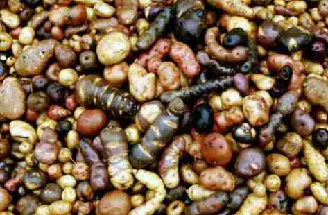
In 1952, he returned to the UK, joining The University of Birmingham as a lecturer in the Department of Botany, but he returned to the Americas many times over the next four decades to collect potatoes. Awarded a personal chair in taxonomic botany in 1961, he became Mason Professor of Botany and head of department in 1967.
In 1969 he launched the one year MSc course I referred to earlier, and that’s when I first met him a year later. It would be no exaggeration to state that Jack Hawkes played an incredibly important role in shaping my subsequent career in international agricultural research and academia.
In December 1970, just three months after I arrived in Birmingham, Jack joined his Danish colleague Peter Hjerting on an expedition to collect wild potatoes in Bolivia, accompanied by Jack’s research assistant and PhD candidate Phil Cribb.
Richard Sawyer
The expedition received support from the newly-established International Potato Center (CIP) in Lima whose Director General, Dr Richard Sawyer kindly loaned a four-wheel drive vehicle. Joining the expedition was a young Peruvian scientist, Zósimo Huamán who had been hired by CIP to manage its large germplasm collection of native potato varieties.
While in Lima, Jack was asked to accept Zósimo on the Birmingham MSc course in September 1971. And then Sawyer asked Jack if he could recommend someone to join CIP on a one-year posting to cover for Zósimo while away in Birmingham. Apparently, so Jack later told me, my name immediately came to mind. Perhaps I’d mentioned that I had a burning ambition to visit South America and, in any case, I would graduate just when Zósimo was expected in the UK.
Anyway, to cut a long story short, immediately on his return to Birmingham at the end of February 1971, Jack told me about the opportunity at CIP. Was I interested? There was no question about it.
Zósimo and Jack in a potato field in Bolivia standing beside a variety of S. ajanhuiri
As it turned out, my departure to Peru was delayed by 15 months while different funding options for my posting were finalized. I began my PhD study, and after he graduated with his MSc in September 1972, Zósimo also registered for a PhD, studying the evolution of a frost-resistant form of cultivated potato known as Solanum ajanhuiri that he and Jack had collected at high altitude in Bolivia.
I departed for Lima on 4 January 1973, and by the beginning of April that year Zósimo had also returned to Peru having completed the first six month residency requirement for his PhD at Birmingham.
With hardly any time to get himself sorted after being outside Peru for 18 months, Zósimo and I organized a trip in May to collect potato varieties from two departments to the north of Lima: Ancash and La Libertad.
To say that I found the experiences beyond my expectations would be an understatement. Peru was everything I hoped it would be when I spent hours poring over a map of the country as a young boy. It is an extremely beautiful country, even if (at least in the 1970s) it was not the easiest country to travel around.
After 49 years, and without access to any notes we made, reports we wrote, or the books in which we recorded the germplasm samples collected, I am unable to detail the routes we took with any degree of confidence, except in the most broad terms. We were away from Lima for almost a month, and explored much of these two departments as best we could: by road, on foot, and on horseback.
At the end of the road, preparing to walk into a distant village; and below, riding back from a side-trip to a village
This was the first collecting trip that I had made. Time to put theory into practice. I bowed to Zósimo’s better knowledge, not only of potatoes and the terrain, but because he was a native Spanish speaker and after just a few months in Peru my Spanish was rudimentary to say the least. Also, as I mentioned earlier, Zósimo already had experience of collecting, having joined the Hawkes-led expedition to Bolivia in 1971.
We headed north on the Panamerican highway, destination Huaraz, the capital of Ancash located in the Callejón de Huaylas, a long north-south valley between the Cordillera Blanca to the east with the highest snow-covered peaks in the country and the Cordillera Negra to the west. Our aim was to explore regions right round these mountain ranges, and we certainly found ourselves in some remote locations.
We moved north into La Libertad, spending a little less time there than in Ancash before heading back to Trujillo on the coast for a well-deserved shower and rest at a good hotel, and better food before heading south to Lima, a journey of 575 km. I don’t recall if we attempted that last sector in one day or made an overnight stop about half way. In any case the journey would have taken about 10 hours or more, and given an incident on the way south that I’ll explain below, maybe we did split the journey.
In 1973, the Peruvian government was led by left-wing-leaning military junta headed by General Juan Velasco Alvarado who came to power in 1968 following a coup d’état. We encountered military checkpoints frequently on our travels in the mountains, often manned by young recruits or conscripts, teenagers even, armed with automatic weapons. Coming from a country where the police never carried firearms (at least then) nor were the armed forces deployed on the streets (that would change in Northern Ireland in the 1970s) I found it extremely disconcerting to be faced with soldiers pointing weapons at me and wondering if their discipline was as tight as I hoped. Needless to say we never encountered any specific threats or hostility.
What particularly struck me during this trip (and others that I made in 1974 and 1975, which I describe in Part 2) was the generosity of almost everyone we met. Farmers were generous with the potato varieties and knowledge they shared with us. Each potato variety collected was carefully labeled with a unique number inscribed on each tuber, and on the paper bags in which they were stored. All the details were recorded in a small booklet; I wonder if these are still archived in the CIP genebank in Lima.
Often we were invited to share a meal with a family, and only on one occasion did I baulk at what was put in front of me: fried cuy or guinea-pig (which are native to Peru and most households keep a small herd of them running around the house ready for the pot). I just couldn’t bring myself to tuck in. Guinea-pigs, to my mind, were furry pets. Needless to say that, as I grew older, such inhibitions diminished.
Despite being memory-deficient when it comes to the route or the places we stayed, there are several anecdotes that are still fresh today.
One experience was particularly emotional. Just 57 km north of Huaraz lies the town of Yungay, and a few kilometers closer to Huaraz, the town of Ranrahirca. On 31 May 1970 a powerful earthquake off the coast west of here, dislodged a massive landslide, a mixture of ice and rocks, that fell from Huascarán, Peru’s highest mountain.
Looking north along the Callejón de Huaylas towards the twin peaks of Huascarán
Travelling at speeds up to 335 kph the landslide quickly reached and obliterated both towns, killing tens of thousands. In Yungay, when we visited almost three years later, the only remains of the town still standing were the cemetery mound with a statue of Christ with outstretched arms, and four palm trees. They had survived, yet everywhere else the landscape was dotted with crosses marking where houses used to stand and presumably families perished. What a sobering sight indeed.
The statue of Christ in the site of Yungay, May 1973
This was the site of Ranrahirca where the town had been obliterated by boulders the size of houses, May 1973
We followed the road south from Huaraz and round to the east of the Cordillera Blanca, to Chavín de Huántar.
A stone tenon head, one of the iconic features of the ruins at Chavín
The next day we headed north up a steep and extremely muddy road, slipping and sliding from side to side. Fortunately the road was wide and there were no drop-offs, until we reached the highest point. The road levelled off, snaking along the side of the valley, barely wide enough for our Toyota Landcruiser. It was also quite muddy there as well.
We could see there was a drop-off, but given that we were in cloud, couldn’t see more than about 50-100 m ahead. It was only on the return journey and checking our maps that we saw that the side of the road plunged about 1000 m to the valley below. Talk about a stressful situation.
Having enjoyed a good bistek in Chavín that evening, we both got very drunk on Ron Pomalca, regretting sincerely the following morning that we had imbibed so freely. Incidentally, Zósimo found that the rum was also a useful liniment after several hours on horseback, and kept a bottle for that purpose.
On one occasion, we drove as far as we could before walking to two villages some kilometers away. When we arrived at the first village, we found everyone celebrating the jubilee of its founding (and were informed that the next village was also in fiesta mode). We were made welcome, offered refreshments, and talked with village officials before explaining that we had to push on to the next village before it got dark. There we found almost everyone in an advanced state of inebriation, especially the schoolteacher, who spoke a little English.
As special guests on that auspicious day, the mayor invited us to a reception, where the whole village crammed into the town hall. Speeches were made, with Zósimo translating for me. It was clear we would have to respond, especially me as a representative of La Reina Isabel. I frantically whispered to Zósimo how to say such and such in Spanish, writing his translations on the palm of my hand. When it was my turn to make a short speech, I nervously complimented the village on its anniversary and how pleased we were to be there. On sitting down, everyone in that room, at least a hundred men and women, maybe more, came and shook my hand. What a memory.
Zósimo (on the right) beside the teacher, his wife and child in front of his house where we spent the night
Later in the trip in La Libertad, we arrived in one village looking for a hotel. There were two: one had been opened not many months before our arrival there; the other was quite run down. We chose the new hotel, ignoring ‘advice’ that it was flea-infested. Surely that couldn’t be the case? How wrong could we be, waking next morning covered in flea bites and itching madly. Those pesky fleas got everywhere, so we had to endure several days of purgatory until we reached the coast and could send all our gear for cleaning. And take a welcome shower.
Finally, on the return journey south on the Panamerican Highway south of Trujillo, there was a puncture in the rear nearside tyre. We quickly replaced it with the spare, and resumed our journey, hoping to find a grifo or garage soon where the tyre could be repaired. I was driving. Suddenly there was a bang, and the vehicle lurched wildly. I managed to bring it under control, even though the rear was touching the ground. You can imagine our surprise when the wheel passed beside us, travelling at speed ahead. Zósimo and I had each thought the other made a final check of the wheel nuts. They just worked their way loose until the wheel fell off. Our humble jack was not powerful enough to lift the vehicle, but we flagged down a truck driver who used his more robust jack. We retrieved the wheel several hundred meters down the road, and even located all four wheel nuts scattered across the highway. What luck! Fortunately there were no further incidents before we reached CIP’s headquarters in the La Molina district of the Lima.
What an experience, and despite some stressful incidents (and occasional differences of opinion with Zósimo) we returned to Lima after a successful collecting trip. Maybe there were a couple of hundred samples or more to add to CIP’s germplasm collection. That collection eventually grew to around 15,000 samples or accessions but was reduced to its current more manageable size of around 4000 accessions after possible duplicate samples were removed (although converted to botanical or true seed samples before discarding the tubers). On his trips to Peru after 1973 Jack would spend time in the collection at CIP’s high altitude station in Huancayo (3100 m), a six-hour drive east of Lima, working through the germplasm samples and giving his advice about their conservation status. In the photo below, taken in early 1974, I briefly left off my own research to join Jack as he studied different varieties.
In Part 2, I write about the trips I made to Cuyo Cuyo in the south of Peru in February 1974, then to Cajamarca in May the same year. Finally, I describe the trip over a long weekend I made in March 1981 with Jack and a CIP colleague to collect wild potatoes in the mountains northeast from Lima. This was the only time that I went collecting with Jack, but even in that short journey I learned so much.
Laughter, so they say, is the best medicine. Until it (almost) kills you! Like the other day. I could hardly breathe I was laughing so hard. It was painful. I had to close the video clip I was watching and get my breath back.
So who nearly brought about my demise?
Billy Connolly, of course. The Big Yin! Comedian, story-teller, musician, actor, artist, documentary maker, Knight of the Realm! And one of the funniest persons (in my opinion) to grace our TV screens. There are many clips from his one man shows on YouTube, and I delve into them from time-to-time if I need cheering up. I find myself laughing just as much after watching for the umpteenth time as I did the first. There are few comedians who really make me laugh, and laugh out loud. Billy Connolly never fails.
Born in Glasgow in 1942, he grew up in the tenements of the Anderston area of the city that were demolished in the 1970s and residents moved out to barren housing estates on the outskirts of the city.
He became a welder in the Glasgow shipyards after leaving school, but knew that there was a brighter life beckoning him. Turning to folk music, he paired up with fellow Scot and singer-song writer Gerry Rafferty to form The Humblebums. But, as Billy himself acknowledged, it was his patter between songs that began to attract interest from the audience. Thus began his transition to stand-up comedian and story-teller.
And that’s how I see him, a raconteur rather than as a traditional stand-up. Yes, he tells jokes (perhaps much more in his early career), but his act developed much more depth than that. He weaves stories, narratives, heading off at a tangent almost to the absurd, before reining the tale back in to its original direction. He is a brilliant master of story telling. That’s all I can say. Watching his performances, it’s clear he holds his audience in the palm of his hand. Given his propensity for using his Glaswegian vernacular (rather a lot of swearing) no-one would attend one of his shows if they were about to be offended.
He got his big break nationally appearing on the BBC’s Parkinson, a weekly chat show hosted by journalist Michael Parkinson, in 1975, telling this joke. And over the years he made 15 appearances on that show before it came to an end in 2007.
I still haven’t seen Connolly alongside Dame Judi Dench (as Queen Victoria) in Mrs Brown, the 1997 film that cast him as John Brown, a servant of the Queen and believed to have had a relationship with her. From the clips I’ve viewed, Connolly’s performance was outstanding, and he did receive nominations for several acting awards.
In recent year, documentaries of his travels throughout the USA, Australia and New Zealand, as well as his native Scotland have been widely acclaimed.
He was made a Knight Bachelor in the 2017 Queen’s Birthday Honours for services to entertainment and charity.
In 2013 he was diagnosed with Parkinson’s Disease and has become increasingly frail. In this clip he talks about the challenges he faces.
Anyway, enough of my musings. Sit back and watch (if you dare) some of the videos by Sir Billy Connolly that I’ve enjoyed recently.
WARNING: If you are offended by strong language, take care.
This is is the video that got me going on Christmas Day. It was the balsamic vinegar . . .
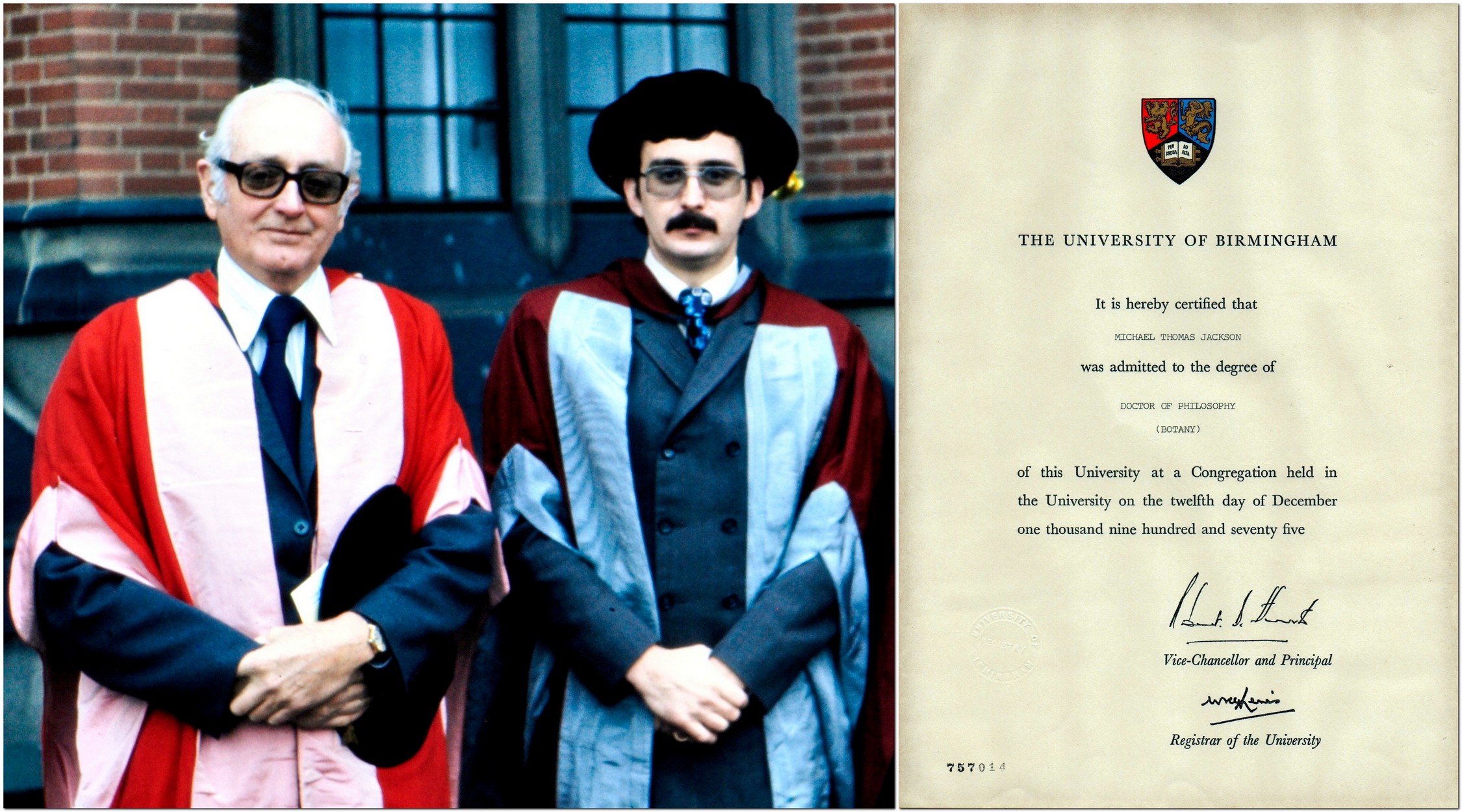
years ago today (Friday 17 December 1971) I received my MSc degree in Conservation and Utilization of Plant Genetic Resources from the University of Birmingham. Half a century!
With my dissertation supervisor Dr (later Professor) Trevor Williams, who became the first Director General of the International Board for Plant Genetic Resources (now Bioversity International).
I hadn’t planned to be at the graduation (known as a congregation in UK universities). Why? I had expected to be in Peru for almost three months already. I was set to join the International Potato Center (CIP) (which has just celebrated its 50th anniversary) as an Associate Taxonomist after graduation, but didn’t actually get fly out to Lima until January 1973. Funding for my position from the British government took longer to finalize than had been envisaged. In the meantime, I’d registered for a PhD on the evolution of Andean potato varieties under Professor Jack Hawkes, a world-renowned potato and genetic resources expert.
So let’s see how everything started and progressed.
1970s – potatoes
Having graduated from the University of Southampton in July 1970 (with a BSc degree in Environmental Botany and Geography), I joined the Department of Botany at Birmingham (where Jack Hawkes was head of department) in September that year to begin the one year MSc course, the start of a 39 year career in the UK and three other countries: Peru, Costa Rica, and the Philippines. I took early retirement in 2010 (aged 61) and returned to the UK.
Back in December 1971 I was just relieved to have completed the demanding MSc course. I reckon we studied as hard during that one year as during a three year undergraduate science degree. Looking back on the graduation day itself, I had no inkling that 10 years later I would be back in Birmingham contributing to that very same course as Lecturer in Plant Biology. Anyway, I’m getting ahead of myself.
Arriving in Lima on 4 January 1973, I lived by myself until July when my fiancée Steph flew out to Peru, and join CIP as an Associate Geneticist working with the center’s germplasm collection of Andean potato varieties. She had resigned from a similar position at the Scottish Plant Breeding Station near Edinburgh where she helped conserve the Commonwealth Potato Collection.
Later that year, on 13 October, Steph and I were married in Miraflores, the coastal suburb of Lima where we rented an apartment.
At PolleríaLa Granja Azul restaurant, east of Lima, after we were married in Miraflores.
My own work in Peru took me all over the Andes collecting potato varieties for the CIP genebank, and conducting field work towards my PhD.
Collecting potato tubers from a farmer in the northern Department of Cajamarca in May 1974.
In May 1975, we returned to Birmingham for just six months so that I could complete the university residency requirements for my PhD, and to write and successfully defend my dissertation. The degree was conferred on 12 December.
With Professor Jack Hawkes
Returning to Lima just in time for the New Year celebrations, we spent another three months there before being posted to Turrialba, Costa Rica in Central America at the beginning of April 1976, where we resided until November 1980. The original focus of my research was adaptation of potatoes to hot, humid conditions. But I soon spent much of my time studying the damage done by bacterial wilt, caused by the pathogen Ralstonia solancearum (formerly Pseudomonas solanacearum).
Checking the level of disease in a bacterial wilt trial of potatoes in Turrialba, July 1977.
Each year I made several trips throughout Central America, to Mexico, and various countries in the Caribbean, helping to set up a collaborative research project, PRECODEPA, which outlasted my stay in the region by more than 20 years. One important component of the project was rapid multiplication systems for potato seed production for which my Lima-based colleague, Jim Bryan, joined me in Costa Rica for one year in 1979.
My two research assistants (in blue lab-coats), Moises Pereira (L) and Jorge Aguilar (R) demonstrating leaf cuttings to a group of potato agronomists from Guatemala, Panama, the Dominican Republic, and Costa Rica, while my CIP colleague and senior seed production specialist, Jim Bryan, looks on.
There’s one very important thing I want to mention here. At the start of my career with CIP, as a young germplasm scientist, and moving to regional work in Costa Rica, I count myself extremely fortunate I was mentored through those formative years in international agricultural research by two remarkable individuals.
Roger Rowe and Ken Brown
Dr Roger Rowe joined CIP in July 1973 as head of the Breeding and Genetics Department. He was my boss (and Steph’s), and he also co-supervised my PhD research. I’ve kept in touch with Roger ever since. I’ve always appreciated the advice he gave me. And even after I moved to IRRI in 1991, our paths crossed professionally. When Roger expressed an opinion it was wise to listen.
Dr Ken Brown joined CIP in January 1976 and became Director of the Regional Research Program. He was my boss during the years I worked in Central America. He was very supportive of my work on bacterial wilt and the development of PRECODEPA. Never micro-managing his staff, I learned a lot from Ken about people and program management that stood me in good stead in the years to come.
1980s – academia By the middle of 1980 I was beginning to get itchy feet. I couldn’t see myself staying in Costa Rica much longer, even though Steph and I enjoyed our life there. It’s such a beautiful country. Our elder daughter Hannah was born there in April 1978.
To grow professionally I needed other challenges, so asked my Director General in Lima, Richard Sawyer, about the opportunity of moving to another region, with a similar program management and research role. Sawyer decided to send me to Southeast Asia, in the Philippines, to take over from my Australian colleague Lin Harmsworth after his retirement in 1982.
However, I never got to the Philippines. Well, not for another decade. In the meantime I had been encouraged to apply for a lectureship at the University of Birmingham. In early 1981 I successfully interviewed and took up the position there in April.
Thus my international potato decade came to an end, as did any thoughts of continuing in international agricultural research. Or so it seemed at the time.
For three months I lodged with one of my colleagues, John Dodds, who had an apartment close to the university’s Edgbaston campus while we hunted for a house to buy. Steph and Hannah stayed with her parents in Southend on Sea (east of London), and I would travel there each weekend.
It took only a couple of weeks to find a house that suited us, in the market town of Bromsgrove, Worcestershire, about 13 miles south of the university. We moved in during the first week of July, and kept the house for almost 40 years until we moved to Newcastle upon Tyne in the northeast of England almost 15 months ago. However we didn’t live there continually throughout that period as will become apparent below.
Our younger daughter Philippa was born in Bromsgrove in May 1982. How does the saying go? New house, new baby!
With Brian when we attended a Mediterranean genetic resources conference in Izmir, Turkey in April 1972. Long hair was the style back in the day.
I threw myself into academic life with enthusiasm. Most of my teaching was for the MSc genetic conservation students, some to second year undergraduates, and a shared ten-week genetic conservation module for third year undergraduates with my close friend and colleague of more than 50 years, Brian Ford-Lloyd.
I also supervised several PhD students during my time at Birmingham, and I found that role particularly satisfying. As I did tutoring undergraduate students; I tutored five or six each year over the decade. Several tutees went on to complete a PhD, two of whom became professors and were recently elected Fellows of the Royal Society.
One milestone for Brian and me was the publication, in 1986, of our introductory text on plant genetic resources, one of the first books in this field, and which sold out within 18 months. It’s still available as a digital print on demand publication from Cambridge University Press.
This was followed in 1990 by a co-edited book (with geography professor Martin Parry) about genetic resources and climate change, a pioneering text at least a decade before climate change became widely accepted. We followed up with an updated publication in 2014.
The cover of our 1990 book (L), and at the launch of the 2014 book, with Brian Ford-Lloyd in December 2013
My research interests in potatoes continued with a major project on true potato seed collaboratively with the Plant Breeding Institute in Cambridge (until Margaret Thatcher’s government sold it to the private sector) and CIP. My graduate students worked on a number of species including potatoes and legumes such as Lathyrus.
However, I fully appreciated my research limitations, and enjoyed much more the teaching and administrative work I was asked to take on. All in all, the 1980s in academia were quite satisfying. Until they weren’t. By about 1989, when Margaret Thatcher had the higher education sector firmly in her sights, I became less enthusiastic about university life.
And, in September 1990, an announcement landed in my mailbox for a senior position at the International Rice Research Institute (IRRI) in the Philippines. I applied to become head of the newly-created Genetic Resources Center (GRC, incorporating the International Rice Genebank), and joined IRRI on 1 July 1991. The rest is history.
I’ve often been asked how hard it was to resign from a tenured position at the university. Not very hard at all. Even though I was about to be promoted to Senior Lecturer. But the lure of resuming my career in the CGIAR was too great to resist.
1990s – rice genetic resources I never expected to remain at IRRI much beyond 10 years, never mind the 19 that we actually spent there.
Klaus Lampe
I spent the first six months of my assignment at IRRI on my own. Steph and the girls did not join me until just before the New Year. We’d agreed that it would be best if I spent those first months finding my feet at IRRI. I knew that IRRI’s Director General, Dr Klaus Lampe, expected me to reorganize the genebank. And I also had the challenge of bringing together in GRC two independent units: the International Rice Germplasm Center (the genebank) and the International Network for the Genetic Evaluation of Rice (INGER). No mean feat as the INGER staff were reluctant, to say the least, to ever consider themselves part of GRC. But that’s another story.
Elsewhere in this blog I’ve written about the challenges ofmanaging the genebank, of sorting out the data clutter I’d inherited, investigating how to improve the quality of seeds stored in the genebank, collaborating with my former colleagues at Birmingham to improve the management and use of the rice collection by using molecular markers to study genetic diversity, as well as running a five year project (funded by the Swiss government) to safeguard rice biodiversity.
I was also heavily involved with the CGIAR’s Inter-Center Working Group on Genetic Resources (ICWG-GR), attending my first meeting in January 1993 in Addis Ababa, when I was elected Chair for the next three years.
The ICWG-GR at its meeting hosted by ILRI (then ILCA) in Addis Ababa, in 1993.
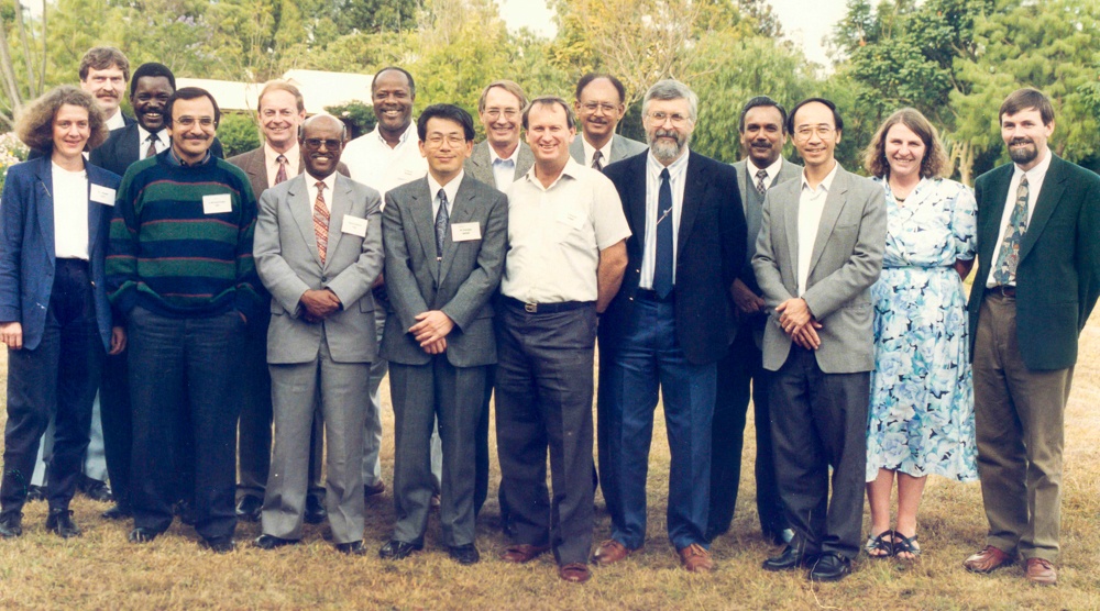
In that role I oversaw the development of the System-wide Genetic Resources Program (SGRP), and visited Rome several times a year to the headquarters of the International Plant Genetic Resources Institute (IPGRI, now Bioversity International) which hosted the SGRP Secretariat.
But in early 2001 I was offered an opportunity (which I initially turned down) to advance my career in a totally different direction. I was asked to join IRRI’s senior management team in the newly-created post of Director for Program Planning and Coordination.
The 2000s – management It must have been mid-January 2001. Sylvia, the Director General’s secretary, asked me to attend a meeting in the DG’s office just after lunch. I had no idea what to expect, and was quite surprised to find not only the DG, Dr Ron Cantrell, there but also his two deputies, Dr Willy Padolina (DDG-International Programs) and Dr Ren Wang, DDG-Research.
To cut a long story short, Cantrell asked me to leave GRC and move into a new position, as one of the institute’s directors, and take over the management of resource mobilization and donor relations, among other responsibilities (after about one year I was given line management responsibility for the Development Office [DO], the Library and Documentation Services [LDS], Communication and Publications Services [CPS], and the Information Technology Services [ITS]).
With my unit heads, L-R: me, Gene Hettel (CPS), Mila Ramos (LDS), Marco van den Berg (ITS), Duncan Macintosh (DO), and Corinta Guerta (DPPC).
In DPPC, as it became known, we established all the protocols and tracking systems for the many research projects and donor communications essential for the efficient running of the institute. I recruited a small team of five individuals, with Corinta Guerta becoming my second in command, who herself took over the running of the unit after my retirement in 2010 and became a director. Not bad for someone who’d joined IRRI three decades earlier as a research assistant in soil chemistry. We reversed the institute’s rather dire reputation for research management and reporting (at least in the donors’ eyes), helping to increase IRRI’s budget significantly over the nine years I was in charge.
With, L-R, Yeyet, Corinta, Zeny, Vel, (me), and Eric.
I’m not going to elaborate further as the details can be found in that earlier blog post. What I can say is that the time I spent as Director for Program Planning and Communications (the Coordination was dropped once I’d taken on the broader management responsibilities) were among the most satisfying professionally, and a high note on which to retire. 30 April 2010 was my last day in the office.
Since then, and once settled into happy retirement, I’ve kept myself busy by organizing two international rice research conferences (in Vietnam in 2010 and Thailand in 2014), co-edited the climate change book I referred to earlier, and been the lead on a major review of the CGIAR’s Genebank Program (in 2017). Once that review was completed, I decided I wouldn’t take on any more consultancy commitments, and I also stepped down from the editorial board of the Springer scientific journal Genetic Resources and Crop Evolution.
As I said from the outset of this post, it’s hard to imagine that this all kicked off half a century ago. I can say, without hesitation and unequivocally, that I couldn’t have hoped for a more rewarding career. Not only in the things we did and the many achievements, but the friendships forged with many people I met and worked with in more than 60 countries. It was a blast!
After Storms Arwen and Barra that battered us recently, a dusting of snow and icy pavements, and the endless rain, it was a delight yesterday to wake up to clear skies, and the promise of a fine day. Although rather cold. In fact the temperature didn’t climb much past 6°C all day, although it did feel warmer out of the breeze and in direct sunlight.
We’d already planned to get out and about should the weather hold. And that’s what we did, heading back to the National Trust’s Wallington in central Northumberland, just under 25 miles west from home.
The south front of Wallington
Ever since we joined the National Trust in 2011, we have tried to visit one of its properties around Christmas time, since many receive a delightful Christmas makeover. And we were not disappointed at the Christmas offerings Wallington had in store.
This was our third visit to Wallington, having first been there in July 2013, and again almost to the day a year ago. Last year the house was closed because of Covid restrictions. However, it was open yesterday, but most of the extensive grounds and woodland were closed to the public. Storm Arwen had torn through the estate, and brought down a large number of majestic old trees. In fact, some of the strongest winds of the storm (around 100 mph) were recorded just a few miles to the east of Wallington. National Trust staff were busy clearing paths of fallen timber and generally making access safe for the public. It will be some weeks, I fear, before everything is ship-shape and Bristol fashion once again.
We couldn’t have asked for a nicer day yesterday, and on our arrival just before 11 am, the clocktower at the entrance to the courtyard was bathed in bright winter sunshine.
After fortifying ourselves with a welcome of coffee in the excellent Clocktower Cafe, we headed to the Walled Garden, about a 15 minute walk from the house. We were surprised to find the conservatory open, and the lovely display of flowering plants was a feast for the eyes. My glasses and camera lens steamed up and it was some minutes before I could fully appreciate the displays in front of me.
Only the ground floor of the house was open but Christmas was on display from the entrance hall onwards.
Each room thereafter from the dining room, the drawing room, library, study, to the parlour, had festive trimmings to raise the spirit. Quite beautifully—and tastefully—decorated by the staff.
Dining room
Drawing room
Library
Study
Parlour
Along the North Corridor, one room is full of Dolls’ Houses. I don’t remember seeing these before. It was fun looking inside at the miniature worlds.
But the jewel in Wallington’s Christmas crown must be the Central Hall, with its tall and magnificently decorated tree. Once open to the sky, the Hall was roofed in the 1850s at the behest of Pre-Raphaelite John Ruskin. Now it’s a haven of tranquility. I’m sure it wasn’t always like that at Christmases past.
Although inspired by others, the Hall was very much the creation of Pauline, Lady Trevelyan whose bust can be seen on the left hand pillar above. I have written elsewhere about the artist William Bell Scottwho painted many of the murals. In between the large paintings the pillars are decorated with paintings of flowers. Quite stunning. The only unfinished one (bottom row, left) was by Ruskin himself.
Walking around Wallington, I could imagine the Trevelyan family gathered round the dining table on Christmas Day, beside the piano in the drawing room, children rushing excitedly about in the hall. I wonder if they sang carols around the piano. They must have. But did they sing In the Bleak Midwinter (a favorite of mine), originally a poem composed by Wallington visitor Christina Rossetti (and sister of Dante Gabriel Rossetti, who founded the Pre-Raphaelite Brotherhood) and set to music by Gustav Holst and also by Harold Darke? I prefer the Holst version.
Here is a link to a complete album of photos taken yesterday.
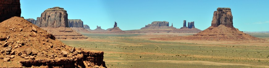
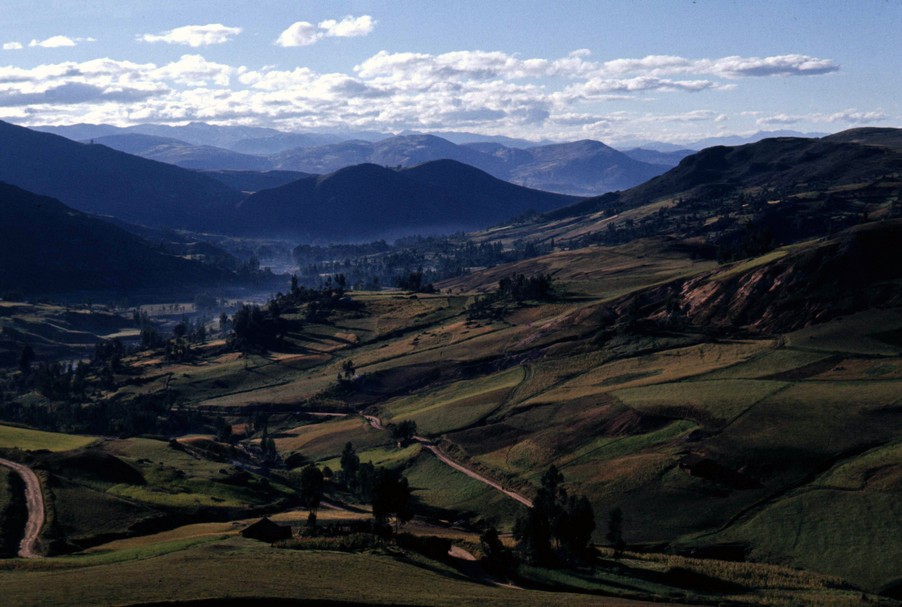
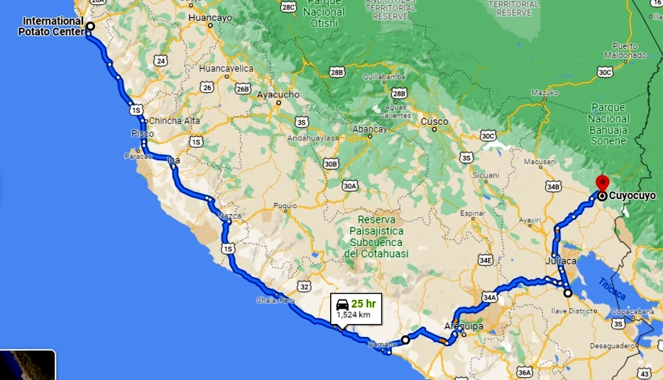
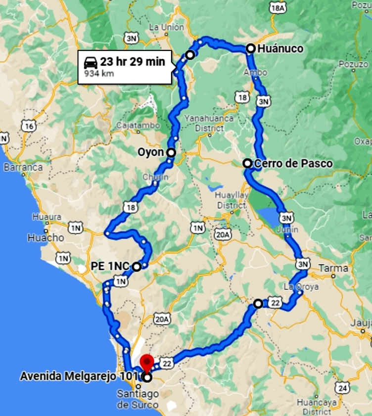
Not any more. Just take a look at Google Maps Streetview either side of the A53 Leek New Road from around Norton Lane west into Hanley in The Potteries of North Staffordshire. I wrote about that transformation in a blog post in September 2013.
A typical North Staffordshire coalfield landscape, at Longton in The Potteries.
Where once there were towering slag heaps from the adjacent collieries, now there is an undulating landscape that has been converted to parks and nature reserves, like the Whitfield Valley Nature Reserve and, of course, reclaimed for housing. Once where there was a huge slag heap that had spontaneously combusted surrounded by black—very black—desolation, now there is greenery and wildlife. Incidentally, that particular slag heap was on fire when I traveled daily in the 1960s past it on my way to school in The Potteries from my home in Leek 14 miles to the northeast. It took decades to bring that fire under control.
The railway lines that fed the collieries have been ripped up and to some extent part of our industrial heritage has been lost as well. Nevertheless, it is good to see the reclamation of these disused landscapes that are now providing innumerable benefits for local communities.
I left the grime of The Potteries behind almost 55 years ago when I moved away to university. And having retired in 2010, it took another decade to finally make the decision to move from our home in northeast Worcestershire to the northeast of England, another area that has a fine industrial past, also based on coal.
We moved to Newcastle upon Tyne, and have settled near the village of Backworth to the northeast of the city center, and just a handful of miles from the North Sea coast, and mile upon mile of the most fantastic beaches you could ever want to walk along. No swimming for me, though. The North Sea is far too cold. And, in any case, I have been spoiled by too many years in the Tropics, and almost two decades of scuba diving in the warm waters surrounding the Philippines in the Far East.
There’s a housing boom in Newcastle, that has been going on for forty years or more. Once the last of the coal mines was closed in the 1980s (and before), parts of mining villages were bulldozed to make way for better housing. And land reclaimed from the collieries has been developed for new housing. Everywhere you look there are new housing developments, and where Steph and I chose to settle is no different.
The Backworth collieries were part of the Northumberland coalfield, and among the deepest. The Maude Pit, sunk in 1872 had coal seams reached by shafts almost 1400 feet (more than 400 m) deep. In looking into the history of the area, I’ve not yet been able to find a map of the present day landscape with all the abandoned pits marked thereon. And another confusing aspect is that the names of the pits changed over the years.
What I can say is that within a mile or so of where I’m now living there must have been almost a couple dozen pits. By the 1980s all had been closed (some much earlier) and the process to erase them from the landscape begun.
The Maude Pit at Backworth Colliery (looking south), with the colliery workshops along the road, and about half a mile (as the crow flies) from where I now live.
The colliery site today, looking northwest towards the old colliery workshops, and the capped mine shafts.
But not entirely, however. It’s quite a feat to landscape the thousands and thousands (millions probably) of tons of waste that accompanied coal mining.
The remains of the Seghill slag heap, north of Backworth.
And, in contrast to the situation in The Potteries, the coal mining legacy of North Tyneside can be seen in the miles of waggonways that criss-cross the area: the routes of the railways that carried coal from the mines down to special wharfs (known as staithes) on the River Tyne from where it was exported worldwide. The photos below (courtesy of Debbie Twiddy on Facebook) show coal trains crossing the area close to home, a landscape that has long been lost.
This landscape has changed in other ways, apart from the various housing developments in the area. New roads have been pushed through like the A186 bypass to the village of Shiremoor, so that it’s not easy to entirely reconcile old photos with the reality on the ground today. Also, and unlike The Potteries, many of the industrial sites have been allowed to re-wild. After 40 to 50 years of growth there is now an impressive cover of mature trees, brush and scrub that has become a haven for wildlife, big and small. Just the other day we saw a fine pair of roe deer just a short distance from home. The waggonways are important wildlife corridors that connect different sites across North Tyneside.
This is what it looks like today.
I’ve only just begun to scratch the surface of Backworth’s coal mining heritage, and there must be lots more to uncover. This is a useful website that I have yet to mine in detail.
Without appreciating it before we moved north 14 months back, we have now settled in a remarkable and fascinating landscape that we will take great pleasure in exploring and uncovering more interesting facts about its heritage.
Have you read—or even heard of—a novella called The Little Prince? No? Me neither. The Little Prince was first published in English and French in 1943. Remarkably it is one of the best selling and most translated books ever. In fact I knew nothing about it or its author (French impoverished aristocrat, pioneer aviator, and writer Antoine de Saint-Exupéry) until just the other day when I began a book, The Prince of the Skies, a historical novel by Spanish author Antonio Iturbe, and published in English earlier this year, in a translation by Melbourne-based Dr Lilit Žekulin Thwaites.
The Prince of the Skies first appeared in 2017 as A Cielo Abierto (not to be confused with the 2000 Spanish movie of that name), and tells the story of three French pioneer aviators from 1922 to their deaths in the 1930s and 1940s, but from the perspective of Saint-Exupéry.
Besides Saint-Exupéry (1900-1944), the other two aviators were Jean Mermoz (1901-1936), and Henri Guillaumet (1902-1940).
L-R: Saint-Exupéry, Mermoz, and Guillaumet
The book opens in 1922 with Saint-Exupéry, a sublieutenant in the French air force, taking to the sky over Paris in primitive biplane. He dreamed of being as free as a bird, and indeed much of the book reflects the freedom that he and the other aviators felt once they were airborne.
All three took positions with a company that carried the mail between southern France and Spain, and on to North Africa, following the desert and coast south to Senegal. Flying was hazardous, particularly over the Pyrenees, arduous, and not without considerable danger. The death toll among pilots was not inconsiderable. The companies they worked for were the forerunners of Air France and Aerolineas Argentinas, among others.
But Saint-Exupéry, Mermoz, and Guillaumet led, for a while, charmed lives but not without aviation upsets.
All three were posted to Argentina to open up air mail routes between Brazil and Buenos Aires, and south through Patagonia. Saint-Exupéry was charged with opening a route between Buenos Aires and Santiago de Chile, flying high over the Andes at the limits of aviation in those early years. In 1930 Guillaumet crashed at over 3000 m on his 92nd flight on this route, and extraordinarily took a week to climb and walk out of the mountains.
Mermoz set about establishing a non-stop service between Dakar in Senegal and Natal in northeast Brazil, the shortest crossing of the South Atlantic, but not without its challenges as the route crosses the Intertropical Convergence Zone, well known (and respected) for its turbulent weather. The crossing from Dakar would take 15 hours or more, with just one pilot. Initially flown by seaplanes, aviation technology soon developed to permit land-based aircraft to make the trip. But it was on what would be his last flight in December 1936 that Mermoz’s plane disappeared fours hours after departing from Dakar. He and his mechanic were never found.
Henri Guillaumet joined the Free French Air Force at the outbreak of war in 1939, and was shot down and killed over the eastern Mediterranean in 1940.
Saint-Exupéry was a dreamer and a reluctant writer who agonized, it seems, over every word and paragraph. Nevertheless his work was spotted by influential writers and publishers, and his books won prestigious prizes.
His personal life was complicated. Originally engaged to society beauty and writer Louise Lévêque de Vilmorin, he never got over the breakdown in their relationship having been cast aside, not deemed worthy enough by her family. He married Salvadoran writer and artist Consuelo Suncín de Sandoval in Buenos Aires in 1930 and their somewhat turbulent marriage did survive until his death.
Louise Lévêque de Vilmorin (L) and Consuelo Suncín de Sandoval (R)
After spending a couple of years in the USA from 1940, Saint-Exupéry joined the Free French Air Force in North Africa. He crashed in mysterious circumstances off the coast of the South of France in 1944. His body was never recovered.
The Little Prince was eventually published posthumously in France after the liberation in August 1944. Saint-Exupéry’s books had been banned in Vichy France.
I enjoyed this book, which I selected on spec from our local public library. Iturbe has really brought the chief protagonists to life, and has certainly shown how much we—who take aviation for granted as we criss-cross the globe (pandemic permitting nowadays)—owe to the early aviators who trail-blazed air routes across the continents in the flimsiest and often unreliable (as well as uncomfortable) aircraft. All three aviators are celebrated today in various memorials in France, in literature, and cinema.
Obviously I haven’t read the book in its original Spanish, but translator Žekulin Thwaites has a neat turn of phrase throughout which makes for an easy and enjoyable read.
The Prince of the Skies is published by Macmillan (ISBN 978-1-5290-6333-2).
It’s hard to believe that 40 years have flown by since ABBA released their last studio album, The Visitors, at the end of November 1981.
And here we are, in late 2021, eagerly waiting for the release (on 5 November) of a new—and 10th—album, Voyage. It sounds as though they never went away. Actually, to my ears, it sounds as though they just got better, matured, as of course they have done, being slightly older and younger than me (I’m coming up to 73 in mid-November).
How can I say this? Well, in a smart marketing move, ABBA released a double A-side single with accompanying videos on YouTube. I Still Have Faith In You and Don’t Shut Me Down (Tracks 1 and 4 on Voyage) may not have climbed as high in the charts worldwide as might have been expected (although they did rather well in some countries), fans have been quite emotional about the release. From comments I’ve read on Facebook and Twitter, and left on YouTube, the reception by ABBA fans has been ecstatic.
So, how do I (as a dedicated ABBA fan – I wrote about them in January this year) feel about these two tracks? Equally ecstatic I have to admit. Indeed, I reckon that if these are but a sample of the new album overall, then we really are in for an ABBA feast.
But don’t take my word for it. Have a look and listen to these new tracks.
Fronted by Anni-Frid, I Still Have Faith In You commences as a quiet ballad, but builds in a crescendo to a wonderful chorus, filled with ABBA pizzazz. Her voice has become a little deeper, and perhaps warmer. But it still reaches the heights when joined by Agnetha in the lovely harmonies typical of ABBA. Changes of pace, of key and beautiful musical arrangement throughout, I Still Have Faith In You is a fitting composition with which to launch ABBA’s return, albeit for this once-in-a-lifetime album only.
With this track, and the next, Don’t Shut Me Down, Benny and Björn clearly demonstrate what a formidable song-writing duo they are. These two songs, as with all their compositions, are written for the voices of Anni-Frid and Agnetha, not adapted to their voices. And this is what makes them so powerful.
Don’t Shut Me Down begins with Agnetha setting the scene, in ballad format, before the pace explodes in a riot of funky bass. I could find myself easily dancing to this one. The musical arrangement is breathtaking, layers of music, composition at its finest. Just have a close listen to the track, and the other, to see the musical magic that Benny has woven among the lyrics.
And talking of the lyrics, both these tracks have a story to tell. It never ceases to amaze me how clever their lyric composition is and has always been, especially given that Benny and Björn are composing in their second language. It’s sophisticated stuff.
Critical reception of these tracks has been good, and I think everyone is waiting for the 5th when we can get to enjoy the other eight tracks on Voyage.
ABBA have already indicated there won’t be another album. After 40 years, ABBA has brought some joy into the lives of countless fans around the world, especially at a time when everything was looking rather grey.
I now have two ear worms, one for each ear, and I find myself singing along in my head, familiar with the lyrics already AND the fancy musical arrangements. I couldn’t hum them aloud if I tried, but within the recesses of my mind they are perfect replicas. And they make me happy.
There were days, a little over a year ago, when I thought that the sale of our house in Worcestershire would never be completed. It was a really stressful time, not made any easier by the solicitors ‘managing’ the house sale chain.
Even today I find it slightly surreal that we finally managed to sell our house and move 226 miles to Newcastle upon Tyne in the northeast of England (map), in the middle of a pandemic. But, at just after 12:30 on 30 September last year, that’s what we did, closing the front door of our home of 39 years for the final time.
Since we hadn’t found anywhere to buy in the Newcastle area—the pandemic restricting any travel plans we initially had to view properties for sale—we took a six month rental on a three bedroom house in the West Allotment-Shiremoor area of the city, about six miles northeast of the city center towards the North Sea coast, moving in on 1 October.
After taking a little over a week to settle in and familiarize ourselves with the local area and shopping, we began the search for a new home to buy, armed with a list of properties that I’d already lined up through online searches of estate agent (realtor) websites.
The search didn’t take long at all. On 14 October our offer on a two-year old house in the Backworth area (just under a mile from where we were renting) was accepted. However, the actual sale didn’t complete until the first week of February this year, and we finally moved in on 6 March.
Moving out of Cloverfield on 6 March
Moving into our new home
Having spent so little time searching for somewhere to live, we could then sit back and relax, so to speak, and explore the local North Tyneside area and Northumberland more widely.
We already knew something about the county. In 1998 during one of our home leaves, Steph and I spent a week traveling around Northumberland. Then, our younger daughter Philippa commenced her degree course at Durham University in October 2000, and afterwards she moved permanently to Newcastle. So for 20 years or more we’ve had good reason to come back to this neck of the woods.
Northumberland is one of the most beautiful counties in the country, located just south of the border with Scotland, with Cumbria (and the Lake District) to the west, and North Yorkshire (and the North Pennines Area of Outstanding Natural Beauty, or AONB) to the south. There are so many interesting and beautiful locations to visit, and keep up our interest in properties owned and managed by the National Trust and English Heritage. And it’s a county with a long and illustrious history.
The Backworth area was, until 40 years ago, home to several collieries. After they were closed, the buildings demolished, rail tracks lifted, and spoil heaps leveled, the whole area has re-wilded, and the routes of the former rail links (the waggonways) to the coal depots or staithes on the River Tyne to the south have opened as footpaths and bridleways. There are miles and miles of waggonways. The plant and animal and bird life is incredible. I try to get out most days for a 2-3 mile walk along the waggonways.
Along the Cramlington Waggonway, West Allotment
Just a few miles to the east of Backworth is the North Sea coast. Northumberland boasts of some of the finest beaches in the country. Our closest is at Seaton Sluice, and many times since we moved north we have headed there for a bracing walk along the beach, weather permitting.
This interactive map (with links to other blog posts or photo albums) shows all the places we have visited over the past 12 months. And although it looks as though we have been quite busy, there’s just so much more to explore for the first time or renew our acquaintance from previous visits to Northumberland.
Being a new build house, there were only a few things that needed my attention inside and they were quickly dealt with over a few weeks. Outside was a different prospect, and a project that has kept us busy—well, kept Steph busy— ever since: the creation of a new garden. Both the front and rear of the house only had lawns. So Steph came up with a design and we called in a small company at the end of April to remove the surplus turf. Then we set about planting all the materials we’d brought from Bromsgrove and carefully nurtured over the winter.
Quite a difference for just five months. But Steph has lots more plans.
As we have for exploring Northumberland and the wider region in the coming months and years.
There is only circumstantial evidence that the Roman Emperor Septimius Severus (AD 145-211, ruling from AD 193) ever visited Coria (that we know today as Corbridge Roman town) in Northumberland. However he arrived in Britannia in AD 208 to suppress uprisings in Caledonia (Scotland).
The route to the north lay along the Roman road Dere Street. And Dere Street passed through Coria. After campaigning for three years he took ill, withdrew to Eboracum (York), and died there in 211.
Coria claims to be the most northerly town in the Roman Empire, founded almost 2000 years ago. I can’t vouch for that, but it was certainly the most northerly Roman town in Britannia, just a few miles south of Chesters Roman FortandHadrian’s Wall, the northern boundary between Roman civilization and barbarism to the north.
The remains of Corbridge Roman town lie just under 20 miles due west from Newcastle upon Tyne city center. Steph and I took our two grandsons, Elvis and Felix, there a few weeks past.
Any visitor to Corbridge can’t help but be impressed when entering the ruins, especially taking into account what is actually on display, and what is not. English Heritage has domain over only a small section of the entire Corbridge site. It stretches much further out in all directions. Just south of the site is the River Tyne where there was once a crossing. Much of the site has been excavated, but large areas were covered over once the excavations were complete, over a century ago.
Entrance to the site passes through a fine museum chronicling the history and timeline of the town, with many impressive artefacts on display from the mighty to the mundane. Among the most notable of these is the Corbridge Lion that was discovered more than a century ago inside a water tank.
Just outside the museum are the remains of two large granaries with their vaulted floors that allowed heated air to flow and keep grains dry.
These granaries stand next to the impressively wide high street that bisected the town.
Around the site are the remains of walls that have become bowed through subsidence yet impressively retained their integrity.
Another feature of the site which interested me were the sophisticated drainage channels, some covered, along the streets and connecting different buildings, presumably some carrying clean water into dwellings.
In the southwest corner of the site is a deep, wall-lined pit that apparently was the strongroom.
There’s so much to explore at Corbridge Roman town that I don’t think I did the site justice during this first visit. Another visit is surely on the cards come the Spring.
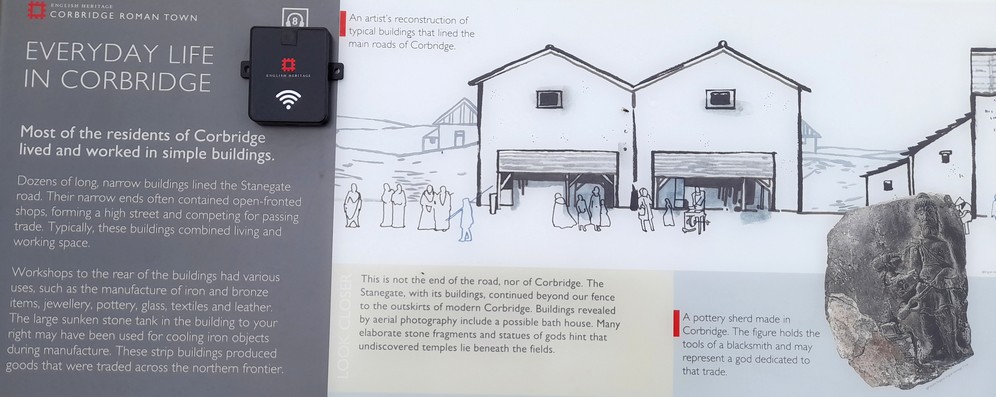
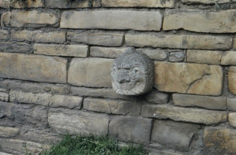
One of Northumberland’s most famous sons was artist and naturalist Thomas Bewick who became England’s finest wood-engraver.
Born in 1753 at Cherryburn in the village of Mickley beside the River Tyne, 12 miles west of Newcastle upon Tyne, Thomas was apprenticed in October 1767, aged 14, to Newcastle silver and copper engraver Ralph Beilby(1743-1817), who quickly (though reluctantly, so it is said) recognized Thomas’s skill as an engraver, particularly of wood. After his seven year apprenticeship, Thomas went into partnership with Beilby, and eventually took over the business.
Thomas was the eldest of nine children of John Bewick and his wife Ann Toppin. A younger brother John also became a renowned engraver and was apprenticed to Thomas. Click on the genealogy chart below to enlarge.
Thomas married Isabella Elliot in April 1786, and they had four children: Jane, Robert, Isabella, and Elizabeth. None of his children married and so Thomas has no direct descendants. Robert (also an artist) was apprenticed to his father; he became an accomplished player of the Northumbrian pipes.
Last week, Steph and I traveled the 20 miles from our home to Cherryburn that is now owned and managed by the National Trust.
National Trust Thomas Bewick’s home at Cherryburn
A couple of rooms in the old farmhouse can be viewed, and are sparsely furnished with period pieces, much as it would have appeared, I imagine, in the late 18th century. The fireplace is particularly impressive.
Across the cobbled farmyard is a more recent house, from the 1820s that became the family home of Thomas’s brother.
This houses a small museum displaying many Bewick artefacts such as original boxwood blocks and prints from two of Thomas’s most accomplished works: A General History of Quadrupeds (published in 1790), and The History of British Birds (published in two volumes in 1797 and 1804).
There is a gallery of engravings from his major publications on the website of The Bewick Society, and is well worth a look. They are simply beautiful.
Perhaps one of the best known of Bewick’s engravings is that of The Chillingham Bull (1789) as a single sheet print (7¼ x 9¾ inches). It was commissioned by Marmaduke Tunstall, of Wycliffe in North Yorkshire. Just look at the remarkable detail.
At the rear of the house, one room has now been converted into a printing shop, with a single sheet printing press (made in Edinburgh) that would have been similar to the type that Thomas Bewick was familiar with, although this particular press was not contemporaneous with Bewick. One of the National Trust volunteers was on hand to demonstrate just how these single sheet prints were made, with a copy wood block depicting the heron that appears in his book of British birds. The resulting print was a souvenir of our visit to Cherryburn.
Before his death in 1828, Bewick had campaigned for a bridge across the River Tyne, something that was not completed until 55 years later in 1883. It is a single carriageway bridge and footbridge connecting Prudhoe on the south bank with Ovingham on the north.
Crossing the River Tyne at Ovingham
And it’s in the churchyard of St Mary the Virgin in Ovingham (a 13th century building with a Saxon tower) where Bewick and his wife are buried on the west side of the tower. A stone memorial that was originally on the outside wall of the church now sits inside the porch, and there is a more recent one on the south wall near the altar. Memorials to Bewick’s three daughters and his wife, and his artist brother John can also be seen outside the porch.
As you can see from the photos in this post, the weather was beautiful on the day of our visit to Cherryburn, affording superb views north over the Tyne into the Northumberland countryside. It’s no wonder that Thomas Bewick was inspired by the nature all around him. Who wouldn’t be? They are images forever engraved on my mind.
Steph and I enjoy a pot of freshly-brewed coffee (two parts No. 3 Lazy Sunday and one part No. 5 After Dark, from Taylors of Harrogate) just a couple of times a week, when we have a more leisurely—and usually cooked—breakfast. And yesterday, Sunday, was one of those days.
Normally I make the coffee while Steph practices her yoga, and take a cup upstairs to my ‘office’ (a spare bedroom), check my email and social media accounts, and browse the news websites.
Not yesterday, however. I got behind myself, and only started to boil the water once Steph had finished her yoga. But there was still time to pour myself a first cup, and spend a few minutes in an armchair waiting for the sun to break through the ever-present bank of cloud that had dogged this part of the country for the past week, putting temperatures well below what they should be for this time of year.
As usual I tuned into my favorite Internet station, Radio Paradise, and sat there thinking about nothing in particular. Until . . .
A track by the TexMex group Chingon was the second song played. It was so familiar, yet unfamiliar at the same time. It was a song that I’d come across for the first time only a few months back, and yet Chingon‘s interpretation was so different.
And the song? Malagueña Salerosa.
I’d come across it in a YouTube video, from an October 2016 broadcast of Live from Here with Chris Thile (now cancelled), an early Saturday evening show broadcast on Minnesota Public Radio but available nationwide, and successor to Garrison Keillor’s A Prairie Home Companion.
Performed by Guatemalan singer-songwriter Gaby Moreno I was immediately captivated by the song and the singer. What a voice! What a vocal range! What emotion!
It seems that Malagueña Salerosa has almost become her signature song. Her performances are essentially the same, but as with all talented artists, her interpretation varies just slightly from one to another.
So, how different is the version by Chingon? Well, here’s a link to the recorded version that I heard on Radio Paradise, as well as a live performance. See for yourself. It’s a combination of rock, mariachi and the like. Very upbeat compared to the Gaby Moreno interpretation.
Chingon contributed a performance of Malagueña Salerosa to Quentin Tarantino’s 2004 film Kill Bill Volume 2.
In the song, the vocalist must hold a high note, as long as possible. That’s one of the differences between the versions by Gaby Moreno and Chingon: they perform that vocal feat on different lyrics. Impressive.
Anyhow, having now heard two versions of this particular song, I was intrigued to know a little more about it, who wrote it and when.
Malagueña Salerosawas apparently written by Elpidio Ramírez and Pedro Galindo, although this has been disputed. What we do know is that it was published in 1947, and perhaps the first well-known recording was by Mexican singer and film star Miguel Aceves Mejía, ‘King of the Falsetto’, who died in 2006 aged 90. Malagueña Salerosa was one of his greatest hits.
Another version I’ve come across features former Spanish child singer Joselito and Mexican star Antonio Aguilar in the 1952 film El Caballo Blanco (The White Horse).
There is one more recording that I’ve encountered, by operatic tenor Placido Domingo, released in 1999, but not one that I warmed to. He does, however, hold the high notes pretty well.
So, there you have it. One later-than-usual cup of coffee has led to all these background searches on the Interweb. It’s been an interesting endeavor.
Incidentally, writing about cover versions, I also heard recently on Radio Paradise a cover version of Sting’s 1993 Fields of Gold, by American singer and guitarist Eva Cassidy. She passed away in 1996 from cancer at the early age of 33 less than a year after this recording was released. I’d never heard of her before this lovely version of Fields of Gold was broadcast on Radio Paradise.
That’s the title and first line of a comic song, composed and first performed by New York vaudeville comedian Joseph J Sullivan in 1888.
It came to mind yesterday when I opened an articlein The Guardian online newspaper that asked readers to answer this simple question: When and why did men stop wearing hats?
Cary Grant, taken by my father on board a trans-Atlantic liner in the 1930s
There were some interesting answers: changing fashion (more leisure styles); availability of warmer clothing so no need to wear a hat; the influence of President Kennedy (who’d been interviewed not wearing a hat) and celebrities; and cars, among the many responses.
Just take a look at the image below, tweeted by San Francisco resident @edannunziatta in July 2018, commenting that “Everybody used to wear hats. Then suddenly everybody stopped wearing hats! Weird, right?”
This image was probably taken in the 1930s or 40s
Check out photos of mill or shipyard workers for example from a century ago or earlier, and all the men are wearing flat caps (and the majority are also sporting impressive moustaches). Fashions change.
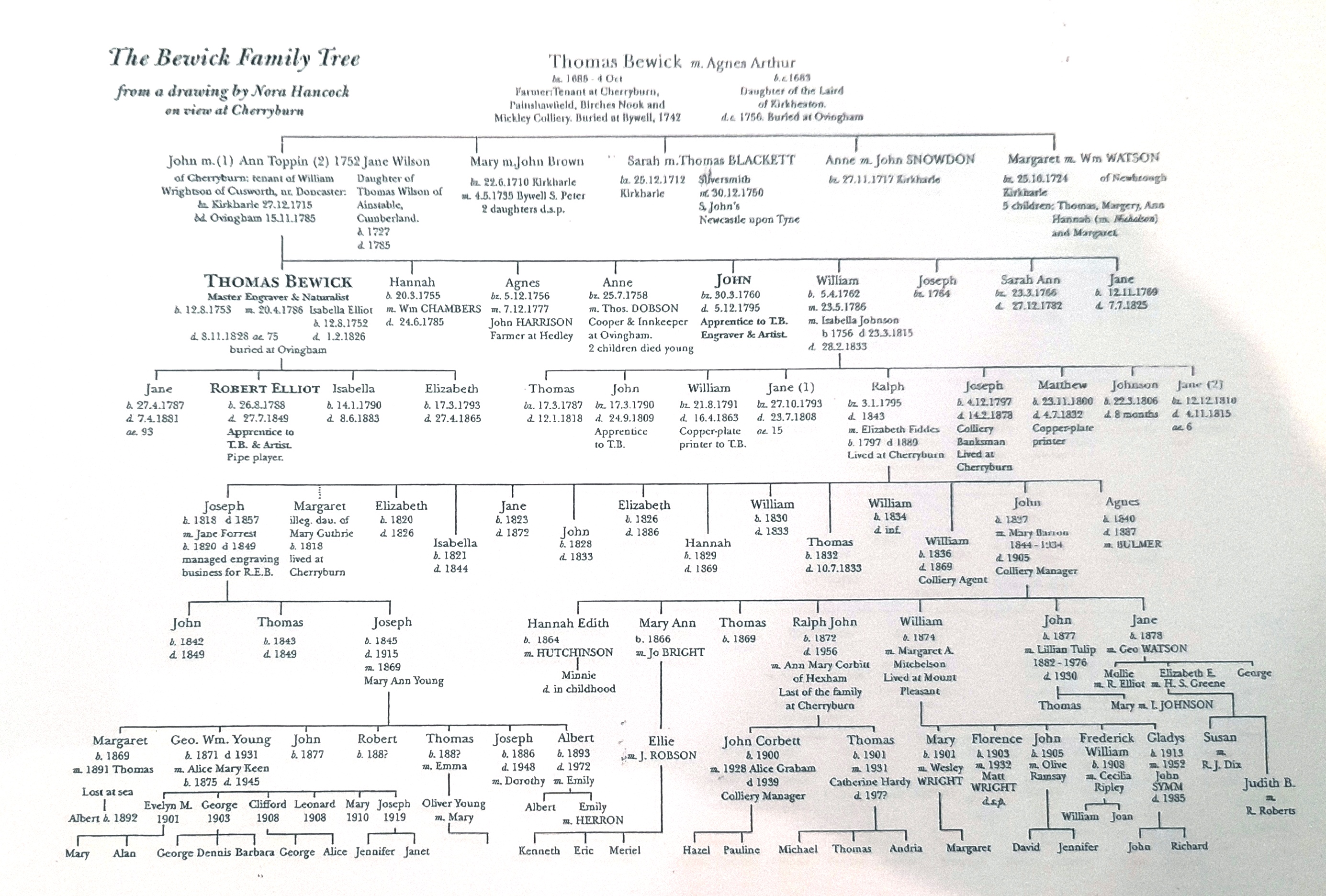
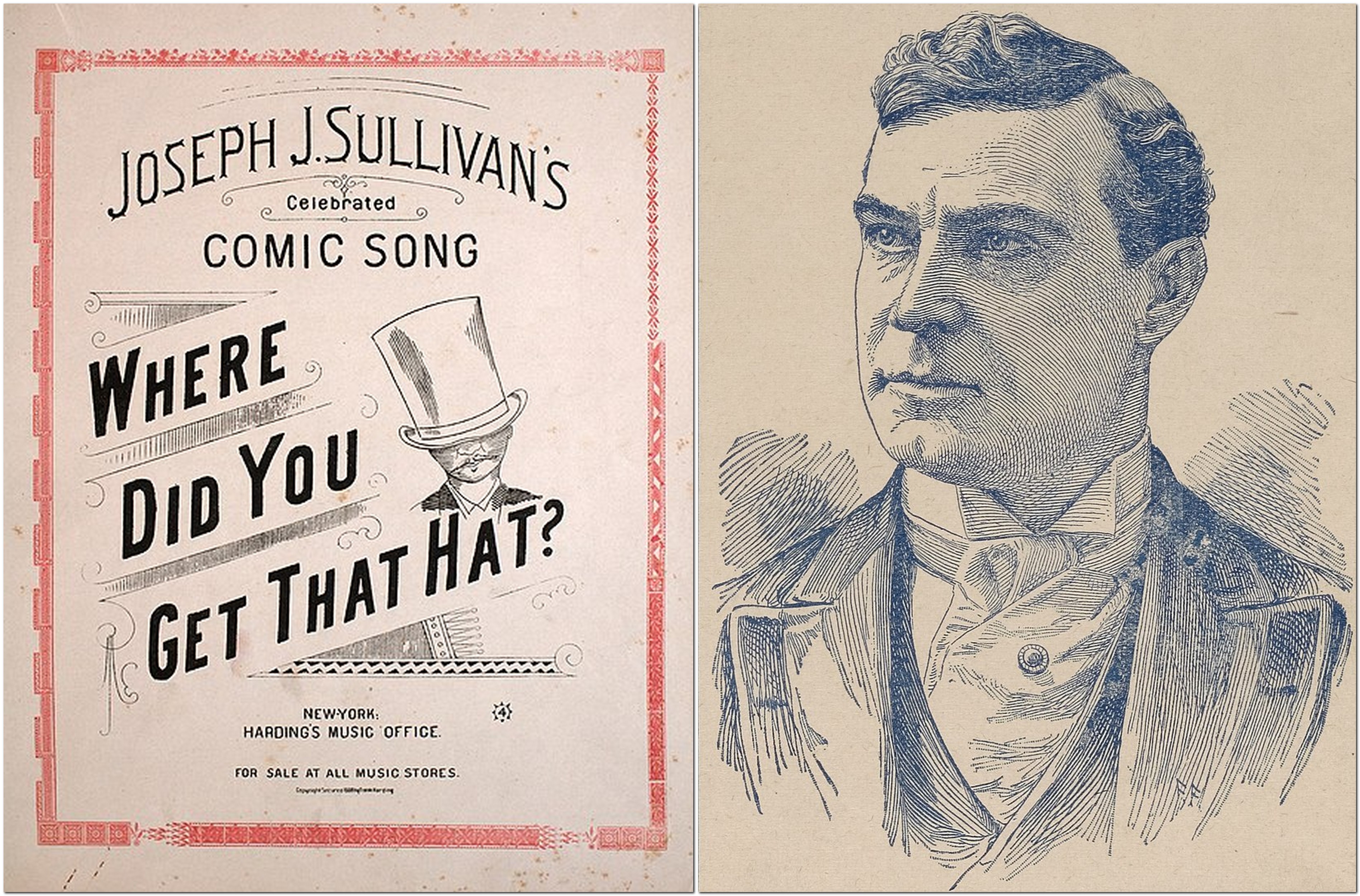
Did you ever see an outdoors photo of Winston Churchill without a hat? Hats were almost as much a signature as his ubiquitous cigar.
But it did get me wondering, and when I searched online for more information, there was a wealth of articles and videos explaining why there had been this change of fashion over the decades. Here’s one video (about 20 minutes long) that provides a lot of explanations, and four main reasons why hats are, in general, no longer en vogue.
I don’t remember my father ever wearing a hat, except for an exceptionally cold winter’s day when he would dig out an old fur hat that he kept squirreled away somewhere.
I never really knew my mother’s parents, and I never saw my paternal grandfather ever wear a hat (he was almost 76 when I was born in 1948). However, in these photos of my mother, in 1936, after she returned to the UK from the USA, and met with her parents (Martin and Ellen Healy, on the left) and her future in-laws (Tom and Alice Jackson, on the right), both my grandfathers wore hats, my Healy grandfather sporting perhaps a more upmarket bowler or similar.
As for me, I love hats, and I rarely take my daily walk without some sort of titfer on my head. That wasn’t always the case, however. From the ages of five to sixteen I was obliged wear a cap to school, but always removed it at the earliest opportunity. Indeed it was a punishable ‘offence’ at my high school to be caught without a cap, not something that would be widely countenanced today (unless you attend the likes of Eton or Harrow, perhaps).
I have a photo of me (aged seven or eight) somewhere—although I can’t lay my hands on it right now—wearing this huge sombrero that was part of the costume of a large doll (Matilda was her name, if my memory serves me well¹) owned by my sister Margaret.
And talking of sombreros . . .
Just after I arrived in Peru in January 1973, and having spent several hours for the first time under the tropical sun at the beach I realized that I did need some sort of hat for protection. On my first trip into the Andes east of Lima, we stopped by a hat stand selling straw hats. I wore it on all my germplasm excursions across the Andes, and even after we moved to Costa Rica three years later.
Near Cuzco in southern Peru, 1974
I took it back to the UK in 1981, and then it accompanied me to the Philippines in 1991 when we moved there.
In the field at IRRI in the Philippines around 2008
And, on occasion, I still wear it from time to time today. And this is why it has survived all these years. First, it is has a fine weave. Second, it can be rolled up, then ‘revived’ within seconds by holding under warm water.
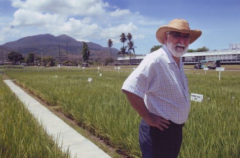
But today, I generally wear a more fashionable straw hat (courtesy of the National Trust) in the summer months because my optician advised me to protect my eyes (incipient cataracts). It’s not a Panama, and I now regret not picking one up in either Cali airport in Colombia or Panama later the same day when traveling there in July 2016.
On other work trips I’ve often used a floppy cotton hat from IRRI, or one given to me by good friend Dyno Keatinge when he was Director General of the World vegetable Center (AVRDC) in Taiwan. I sometimes wore a baseball-style hat although those are by no means my favorite.
Come winter, then other measures are called for. When Steph and I lived in the Philippines we spent Christmas 2007 in Minnesota. As you can imagine the difference in temperature was extreme, from around 30°C on departure to -20°C on arrival in the USA. Severe measures were called for, and I quickly acquired a woolly hat that I still use today.
2007 on the left, 2020 on the right
And to keep the rain off, and because I like the look and feel of both, I have a tweed flat cap (that I bought in Minnesota on one of my work trips) and a dark blue felt fedora that has been my pride and joy for about five years.
One thing is certain, when I’m out and about au chapeau, I see very few other men similarly attired, apart from the odd baseball cap or woolly hat.
Despite the general lack of hat popularity these days, I fortunately don’t attract comments like “Where did you get that hat?” Thank goodness!
¹ My eldest brother Martin has confirmed that the doll was actually named Lola!