Chartwell: a family home where history was written (updated 30 March 2020)

A recent visit to Chartwell, the family home of wartime Prime Minister Winston Churchill (he became Sir Winston, a Knight of the Garter, only in 1953) has left a deep impression on me.

It’s not that I’m unfamiliar with Churchill’s contribution to national life and politics over decades. His life must be one of the most thoroughly documented of any statesman in this country. Not least because of the various memoirs that he wrote, from his early adventures as an army officer in India and South Africa to his long life in politics, and the many biographies penned about him.

At Chartwell, that history becomes tangible. So many personal possessions, awards, and other memorabilia fill the house. There’s a real sense of connection with the great man.

During his lifetime Churchill attracted his fair share of controversy, and in some respects that has not waned. I’m no apologist for Winston Churchill. What is incontrovertible, however, is the crucial role that he played in securing victory over Nazi Germany during the Second World War. He took the helm of government when the nation demanded decisive leadership. Oh, for such a leader today!


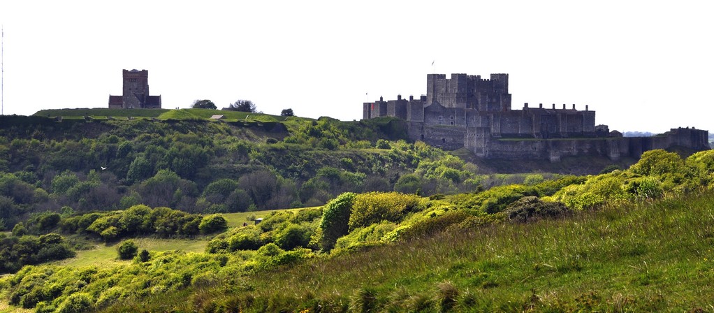
A visit to Chartwell was at the top of the list of National Trust properties during our recent holiday in Kent and East Sussex.

Chartwell lies on the southern outskirts of Westerham in Kent, just five miles west of Sevenoaks (see map).

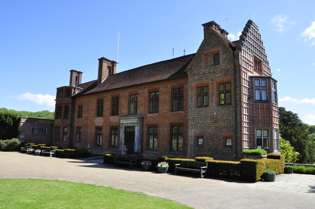
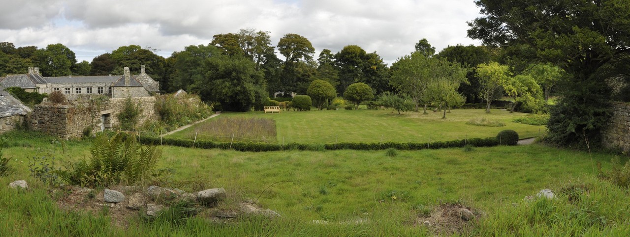
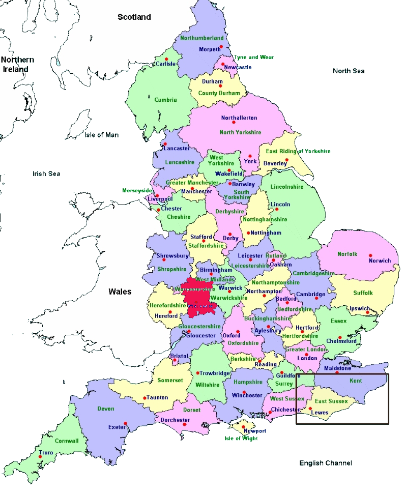
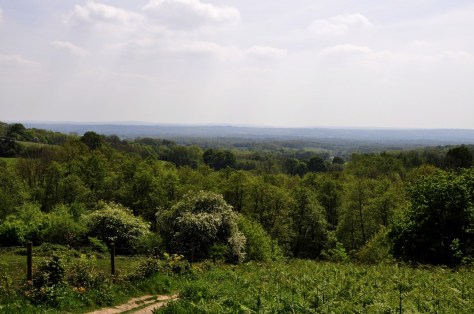
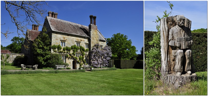
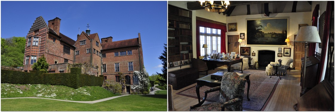
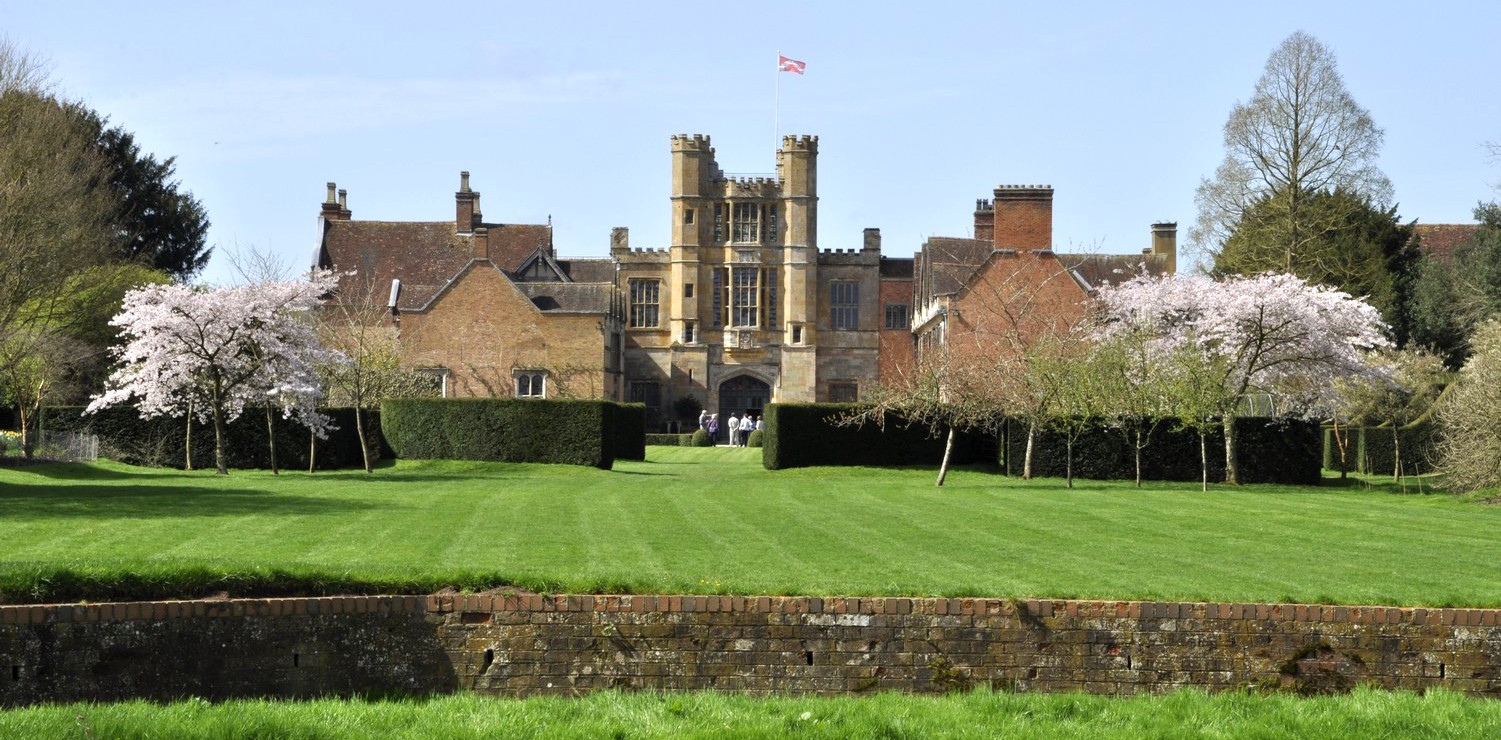
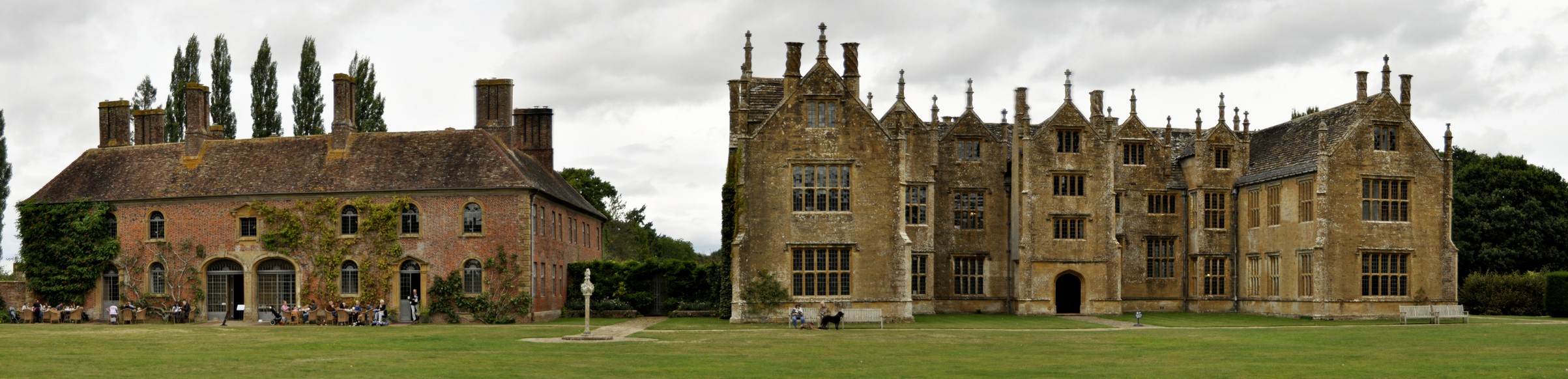
Chartwell is a rather unprepossessing redbrick house. I’m sure the Churchills did not purchase it (in 1922) for its ‘looks’. More for the views south over the Kent countryside from the terrace (off Lady Churchill’s sitting room on the ground floor), or from the walled garden, which are truly spectacular on a fine day.

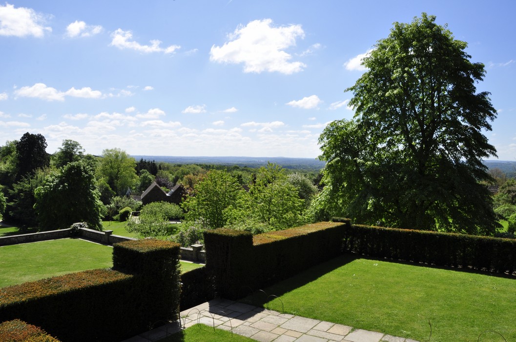
The view from the Terrace, overlooking Churchill’s studio, and further southeast over the Weald.

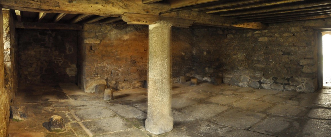
However, there was once feature of the house that did catch my attention. From a distance, the columns either side of the front door look like stone. On closer inspection, they are clearly carved from wood.

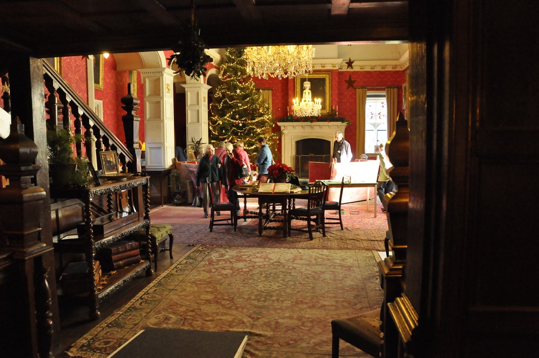
Inside Chartwell, however, is a different matter. This was a family home, and we can see it today more or less as the Churchill family lived there in the 1930s. Lady Churchill and one of her daughters advised the National Trust how the rooms should be presented. Much of the furniture is apparently original to the house.

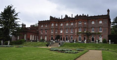
On the ground floor, there are three rooms open to the public: Lady Churchill’s Sitting Room; the Drawing Room; and the Library.

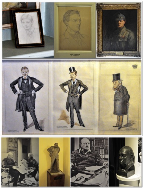
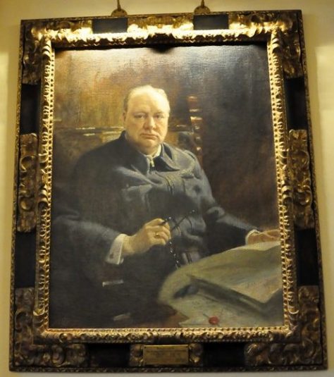
Above the fireplace in Lady Churchill’s Sitting Room is a fine oil painting of her husband of 57 years, one of many paintings and sketches around the house.

There’s a door leading out on to the Terrace from this sitting room.

The Drawing Room is the ‘jewel’ of Chartwell, and it’s not hard to imagine the Churchills entertaining the great and the good in this room.

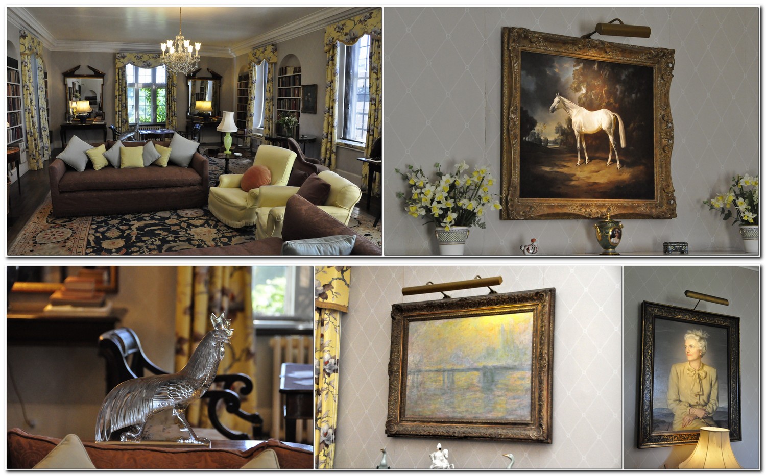
Over the fireplace is a painting of Colonist II, the French grey thoroughbred colt that Churchill purchased in 1949 when it won its first race for him, and seventeen more during its twenty-four race career.

On the opposite wall, a 1902 painting, Charing Cross Bridge, by Claude Monet, was gift to Churchill. There is also a large painting of Lady Churchill. On a side table behind the sofa stands a large crystal cockerel (probably made by the famous French glassmaker René Lalique) that was a gift to Lady Churchill from Charles de Gaulle.

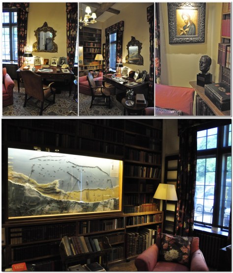
Also on the ground floor is the Library (not a large room), with two significant exhibits: a bust of US President Franklin D Roosevelt, and a large model (hanging on the wall) of the Port of Arromanches, one of the artificial harbours that played an important role in the Allied invasion of Europe in 1944.

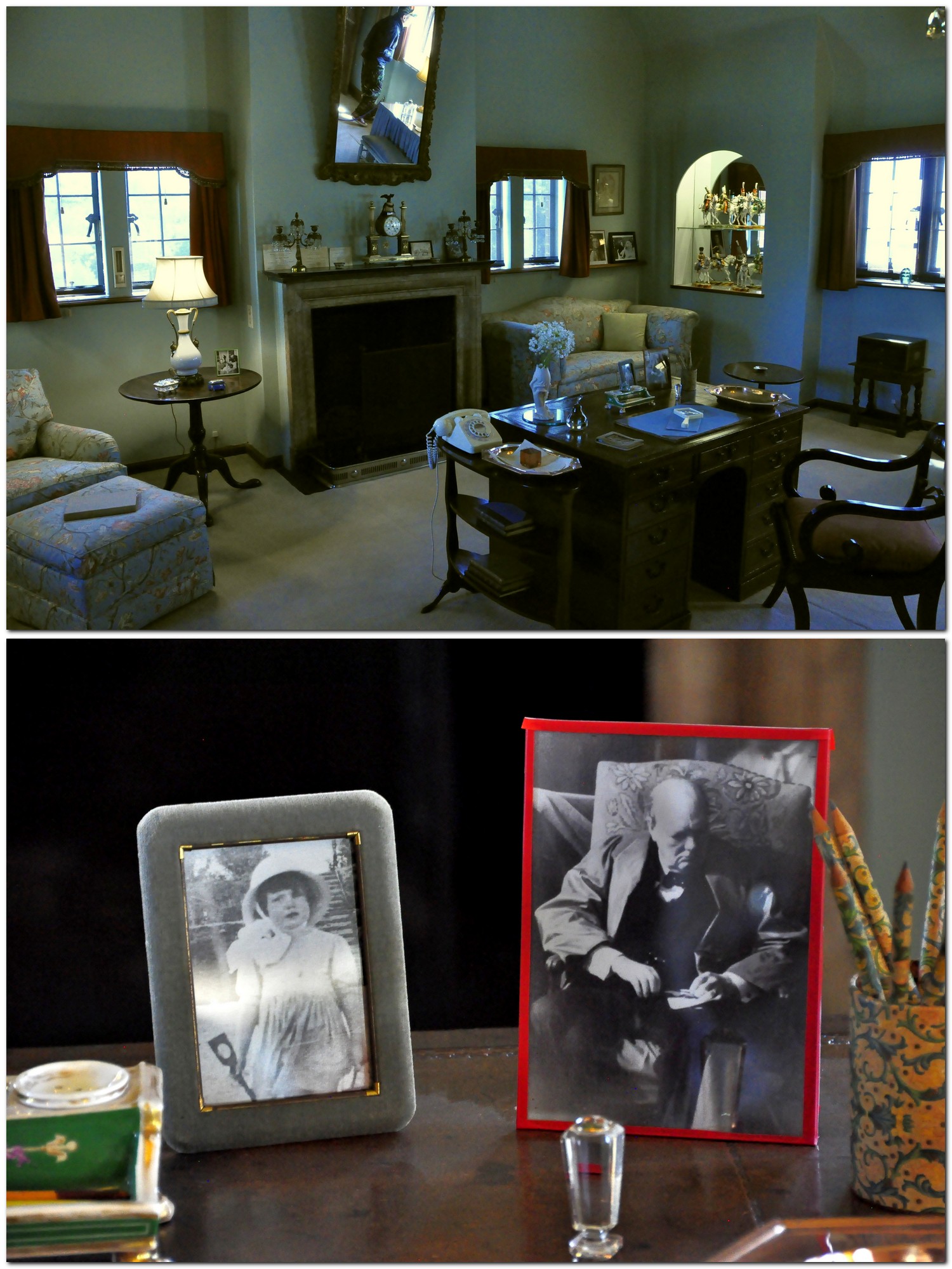
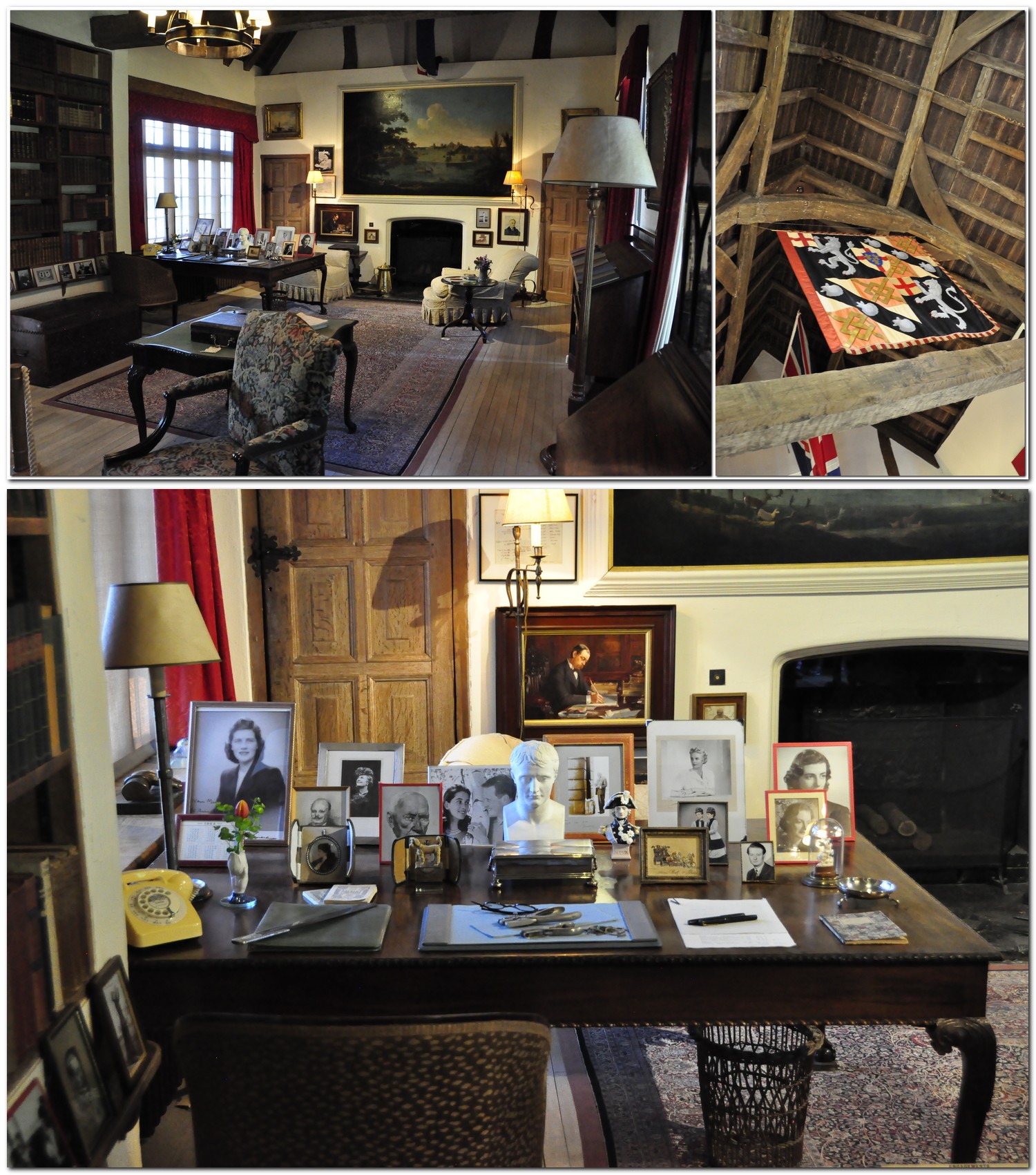
Moving to the first floor, two rooms, Lady Churchill’s Bedroom and Churchill’s study are open to the public. Two other rooms contain exhibits of the many awards and gifts that Churchill received, and the uniforms he wore.

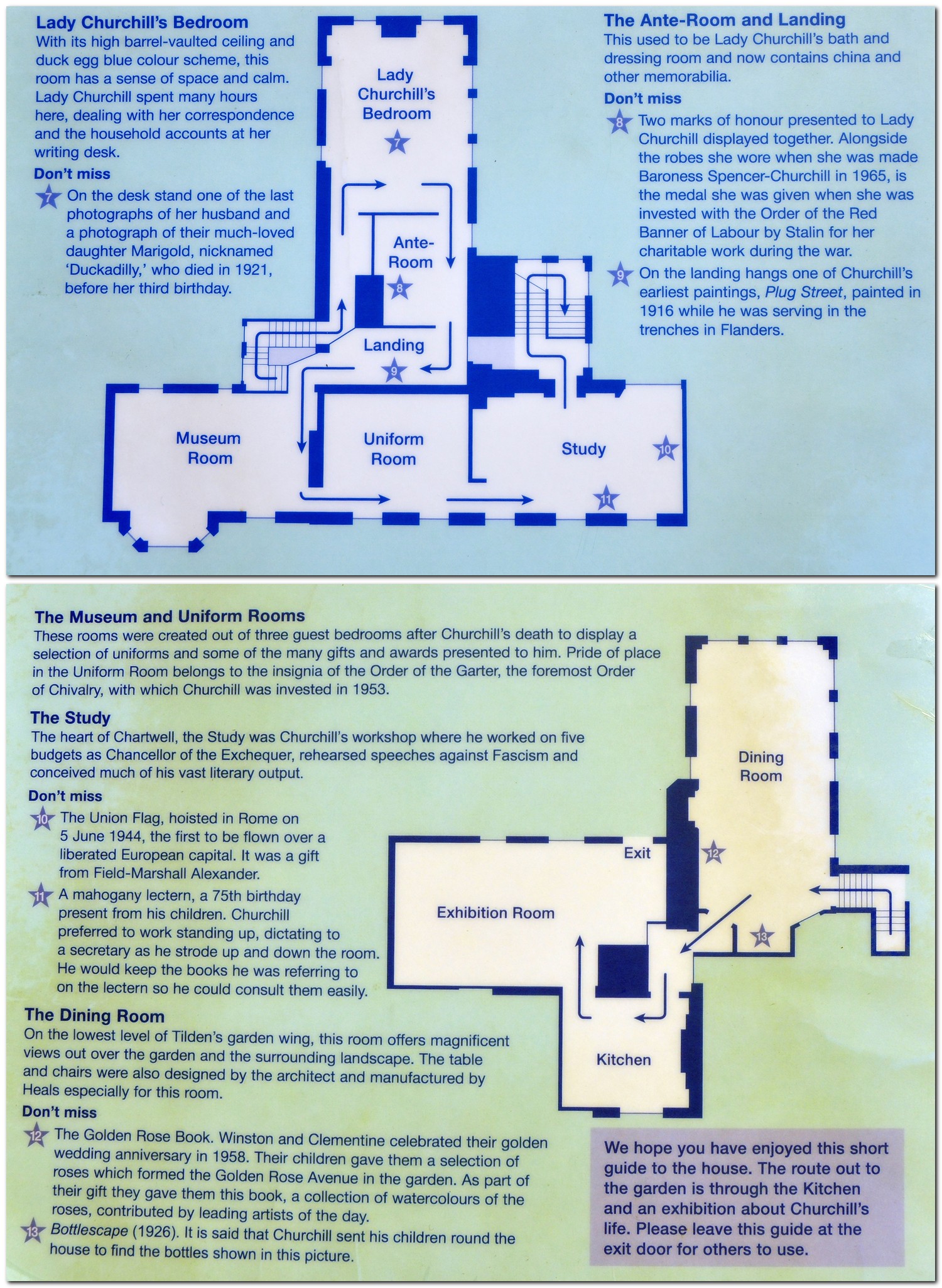
There are some exquisite Potschappel porcelain figures in the bedroom, but what caught my eye in particular, on a desk at the foot of the bed, are two small framed photographs. One shows his third daughter, and fourth child, Marigold who died in 1921 aged two. The other, equally small photograph is purported to be the last photo taken of Churchill shortly before he died in 1965.

In an Anteroom outside the bedroom there’s a cabinet of Dresden porcelain (one with a portrait of Napoleon, a face seen throughout the house; Churchill was a great admirer of Napoleon), and a wall covered in signed photos. I managed to take photos of two significant figures from the war: General (later Field Marshal) Sir Bernard Montgomery and General Charles de Gaulle.

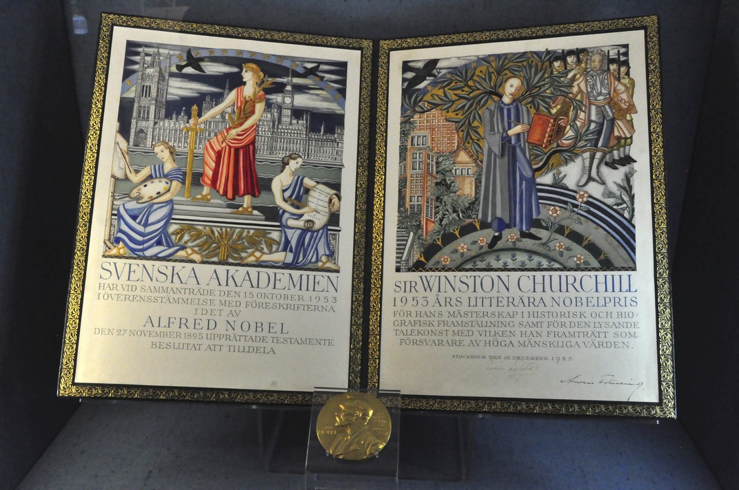
In the Museum Room, Churchill’s Nobel Prize for Literature (1953) citation and medal, his Honorary US citizenship, and many, many other awards and gifts, too many to mention individually are on display.

Napoleon sits proudly in the center of Churchill’s desk in the Study. On one side of the room, against the wall, stands a mahogany lectern at which Churchill would work, standing up, dictating to one of his secretaries. He apparently had a small army or researchers helping him with his prodigious literary output. Among the most precious artefacts, hanging from the ceiling, is a Union Jack flag, given to Churchill by Earl Alexander of Tunis, who became Supreme Allied Commander Mediterranean. This flag was hoisted over Rome, the first Allied flag flown over a liberated city in Europe.

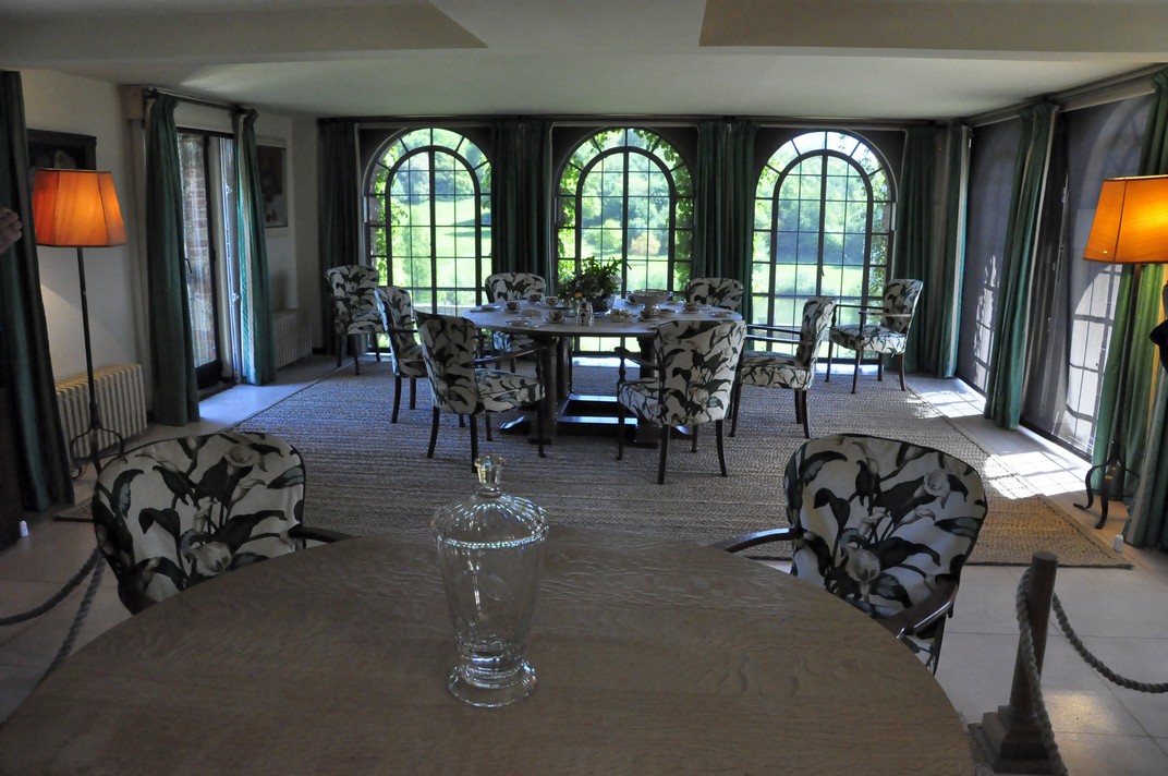
The Dining Room, on the lower ground floor, overlooking the garden, is simply furnished, with two round tables. Churchill insisted on round tables as they encouraged conversation. I commented to another visitor that we could do with a few more round tables in Parliament these days.

Lord Camrose

There is also a painting of William Ewart Berry, Viscount Camrose. Why?

In July 1945, even before the war with Japan had ended victoriously for the Allies, a General Election was held in the UK. Churchill was booted out of office. Extraordinary really, considering the experiences of the previous five years. Worse still for Churchill personally was that he was bankrupt. And to sort his financial predicament he was faced with selling his beloved Chartwell. That’s when an anonymous group of seventeen wealthy individuals¹, headed by Lord Camrose, came to the rescue, and purchased Chartwell for the nation, with the proviso that the Churchills could live there as long as they wished. The names of these benefactors were eventually published in a newspaper; there’s also a plaque with their names at Chartwell.

The National Trust took over Chartwell in 1946/47


Churchill’s studio just below the house is full of many of his oil paintings. This became a serious hobby, and after leaving office in 1945 he thought of selling up and moving to the south of France, and paint all day long.

Many of his paintings that line the studio walls depict Mediterranean scenes.


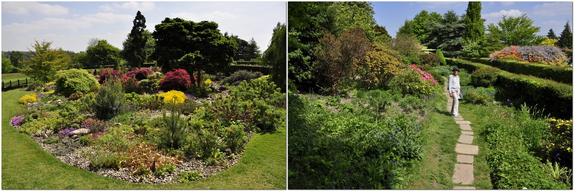
The gardens and grounds are extensive.

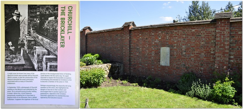
Another of Churchill’s hobbies was brick laying, and he constructed part of one of the walls of the Walled Garden near the Studio.

From the terrace at the top of the Walled Garden is one of the best viewpoints in the whole of Chartwell.


We had arrived to Chartwell just after the café opened at 10 am, and enjoyed a welcome cup of coffee before exploring the gardens. Entry to the house itself is by timed ticket. We opted for the 11 am entry. This system ensures that, with a normal flow of visitors through the house, nowhere becomes particularly congested.

I was amazed that photography was permitted throughout the house and studio. Please look at the more extensive album of photos that I took.


Chartwell had long been on my bucket-list since I read (about 15 years ago or so) an excellent biography of Churchill by Roy Jenkins. Mission accomplished!

The visit to Chartwell was undoubtedly the highlight of our holiday in East Sussex and Kent. The NT staff and volunteers were very welcoming—as always—and knowledgeable. Always ready and keen to answer any question, however mundane. They make each visit so much more interesting and worthwhile.


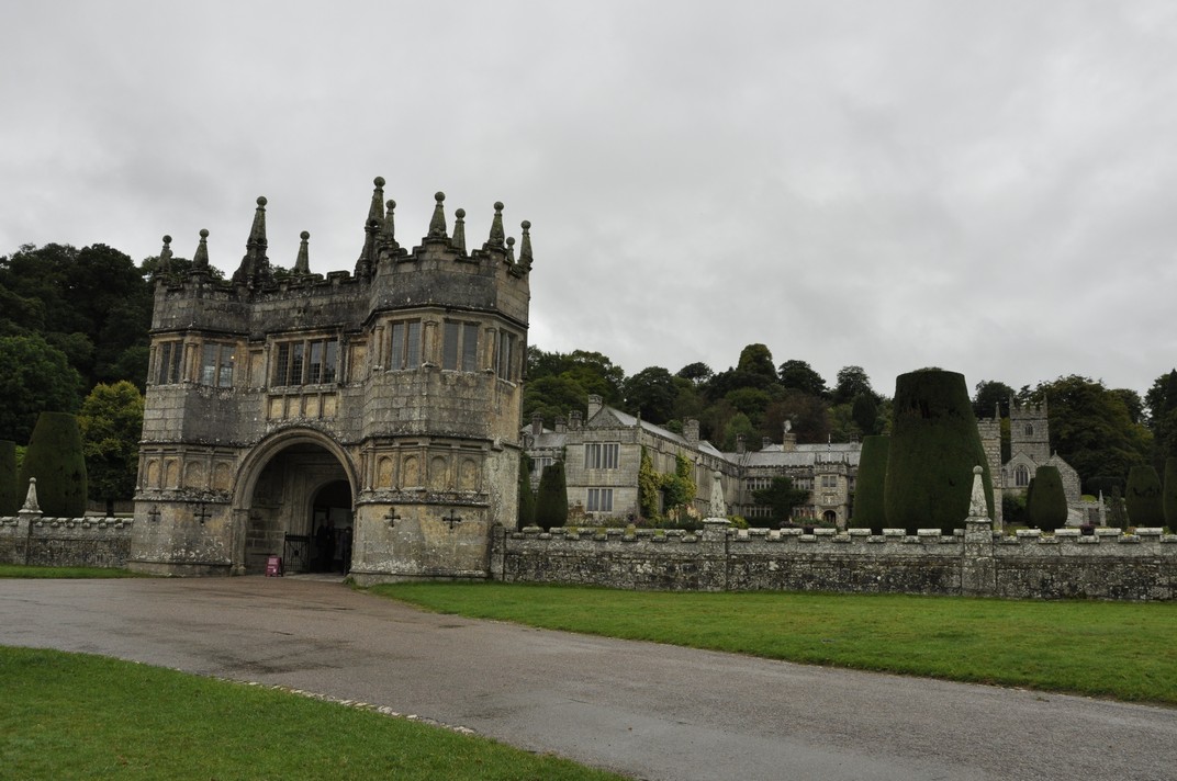
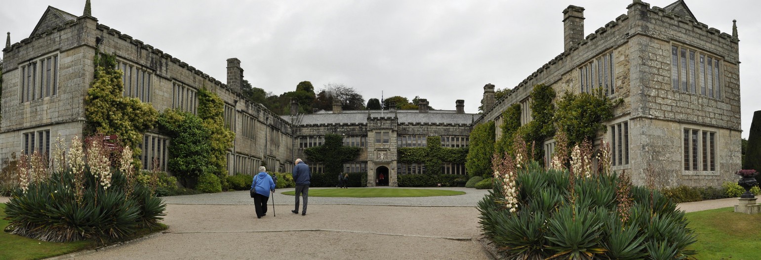
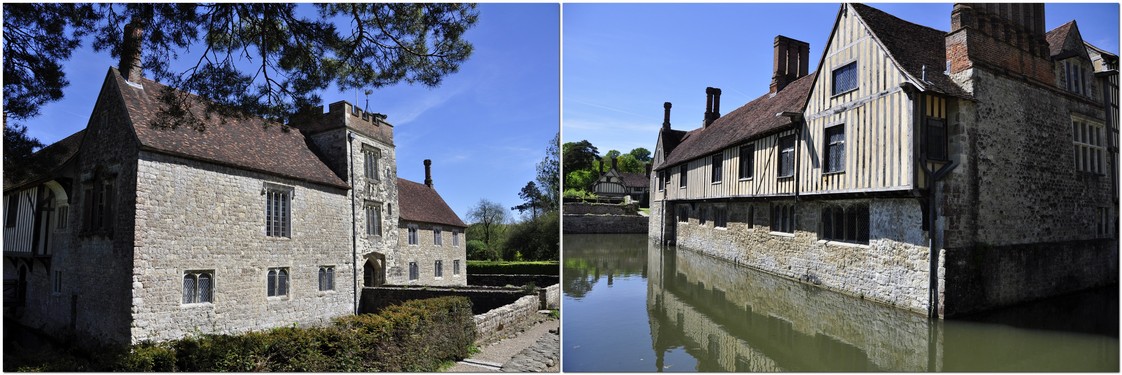
Quebec House in Westerham
After we left Chartwell, en route to Ightham Mote, we stopped briefly at Quebec House in the village of Westerham, less than two miles north from Chartwell.

Quebec House was the childhood home (then known as ‘Spiers’) of General James Wolfe, victor of the Battle of the Plains of Abraham, also known as the Battle of Quebec in 1759 in which he lost his life. It was a major turning point in the Seven Years’ War.

Quebec House was closed unfortunately, but we did manage to wander around the exterior and take in the splendour of this 16th century town house. Its current look dates from the mid-1600s.


¹Lord Camrose
Lord Bearstead
Lord Bicester
Sir James Caird
Sir Hugo Cunkiffe-Owen
Lord Catto
Lord Glendyne
Lord Kenilworth
Lord Leathers
Sir James Lithgow
Sir Edward Mountain
Lord Nuffield
Sir Edward Peacock
Lord Portal
J. Arthur Rank
James de Rothschild
Sir Frank Stewart

From the Second World War to the Cretaceous: exploring East Sussex and Kent over 84 million years

We live in the northeast of Worcestershire, shown in red, 180 miles from Robertsbridge.

. . . as well as corners of West Sussex and Buckinghamshire.

Steph and I have just returned from a week’s holiday in the southeast of England, a part of the country neither of us is familiar with, where we rented a one bedroom cottage near Robertsbridge in East Sussex (just 10 miles north of Hastings). This was our base for visits to National Trust (NT) and English Heritage (EH) properties. It lies at the heart of the High Weald Area of Outstanding Natural Beauty.

There are so many NT and EH properties to visit in the southeast, far too many for just one week. In the end we took in eighteen, including one on the trip south (to Down House, home of Charles Darwin in Kent), and Hughenden Manor north of High Wycombe in Buckinghamshire, the home of Victorian Prime Minister Benjamin Disraeli, on the return journey. And, during the week, we crossed briefly into West Sussex, to Standen House near East Grinstead.

Check out this map for more details, including links to the NT and EH web sites for each property. I’ll also be writing about our visits to these properties in several posts over the next week or so.

What a week! Great weather. Lots of history, and beautiful landscapes, from the chalk cliffs at Dover and the Seven Sisters at Birling Gap, to the heavily wooded High Weald.

The view southwest over the Weald from Emmetts Garden.

At Langdon Hole on the White Cliffs of Dover; and the Seven Sisters at Birling Gap.

Our holiday home, Hop Cottage, was situated at the end of a half mile unpaved road, set among trees alongside a couple of other cottages. We had the site to ourselves.

And what a feast of bird song to entertain us. I’ve not heard a song thrush (right) for a long time. But, each morning, we awoke to one singing his heart out, perched high in the early morning sun. I thought I’d try my luck recording his song on my smart phone. Just click here to listen to my short (2 minutes) recording. Not bad for a first attempt.


As an evolutionary biologist, I couldn’t resist calling at Down House on the way south, the house Charles and Emma Darwin called home for many decades, and where they raised their large family.

It’s where he wrote his seminal On the Origin of Species, published to acclaim—and controversy—in 1859. We had free range of the gardens, but photography was not permitted inside the house except for a reconstructed bedroom on the first floor. Most of the items on display downstairs still belong to the Darwin family.

The Sandwalk (at the far end of his garden), where Darwin walked daily and pondered his ideas about natural selection and evolution.

While it was a great privilege to wander around Darwin’s house and garden, seeing many of his treasured possessions, his journals, we came away feeling there had been something lacking. I felt no emotional attachment to Down House as I have experienced at other properties, and which I did later in the week when we visited Chartwell, for example, the home of wartime Prime Minister Sir Winston Churchill, or Hughenden.


Our longest excursion, on the first full day, took us to Dover to explore Dover Castle, after which we continued on to the famous White Cliffs.

Built in the late 12th century by King Henry II, the first Plantagenet king and great grandson of William the Conqueror (see below for comments about the 1066 Battle of Hastings), Dover Castle has been occupied continuously in the intervening centuries, right up to the Second World War (1939-45). We didn’t visit any of the WWII tunnels at the castle or defences further along the White Cliffs. But on the day after our return home we learned all about them in a Channel 4 program about Dover and its defences, presented by Professor Alice Roberts.

Henry II was not the first to fortify Dover. There’s a Saxon church within the castle walls and, alongside that, the ruin of a lighthouse that the Romans built almost 2000 years ago. In a chain of defences along the south coast Dover Castle has always been one of the most important, and throughout the castle, its long history of protecting England’s coast is on display.

We only walked a short distance from the NT car park along the White Cliffs as far as Langdon Hole. Just above the cliffs, near the Coastguard Station, two original radar towers from WWII (on the left), are still standing.

As the hazy conditions over the English Channel improved, we could clearly see the coast of France, just 20 miles due east of where we were standing. Such a short distance yet such a cultural chasm.

On our way back to Robertsbridge, we made a detour via Dungeness, a large shingle beach jutting out into the English Channel. I’ve always wanted to visit Dungeness. It’s a unique landscape of pebbles with scattered vegetation. A small hamlet has grown up along the shingle, and its most notable house is Prospect Cottage, once occupied by film director Derek Jarman.

Prospect Cottage

You can see more photos from Dungeness here.

The old lighthouse and decommissioned nuclear power station at Dungeness.

But what I hoped to see at Dungeness, perhaps more than anything else, was the 15 inch Romney, Hythe and Dymchurch Railway. We’d crossed the tracks a couple of times while driving to the end of the road at Dungeness. While there was a diesel-pulled train just departing as we arrived, a few minutes later, Hercules steamed into the station.

Then, as you will see in the short video, we saw another train, pulled by three locomotives heading for Dungeness. As we were stopped at a level crossing, I had to quickly jump out of the car and hope I’d catch the action as the train passed by. Unfortunately I didn’t attach the lens hood properly, so part of the image is obscured – much to my annoyance.


Later on in the week, we had the opportunity to look into the lives of two literary giants, Rudyard Kipling and Winston Churchill, both Nobel Laureates in Literature (in 1907 and 1953, respectively) when we visited Batemans and Chartwell.

Rudyard Kipling and Winston Churchill

Batemans, just a few miles from our holiday cottage, is a delightful Jacobean house that Kipling bought in 1902 and remained there until his death in 1936.

Looking around his study on the first floor and an exhibition room, it’s remarkable just how many possessions from his India days have been preserved. I was particularly impressed by a set of six first edition novels, from Allahabad in 1888, in one display cabinet.

What can I say about Chartwell? I was overwhelmed. I was amazed at how many of Churchill’s belongings were on display. Priceless treasures of national importance. A great tribute to a great man. And one of nation’s greatest Prime Ministers? He certainly was a man of his times, and in the right place at the right time.

Most of the rooms have original furniture, and the layout is the same as when the family lived there. I was also amazed—and very pleased—that photography was permitted throughout the house, and in Churchill’s studio where many of his oil paintings are on display.

The house from Churchill’s studio, and his study where he wrote, standing up, at a desk along the right hand wall.

Undoubtedly, this visit to Chartwell was one of the best NT visits we have made.

Benjamin Disraeli was, apparently, Queen Victoria’s favorite Prime Minister. She certainly held him in high regard, given the number of gifts from her that are on display at Hughenden Manor.

The red brick house is not particularly attractive from the exterior, but as one walks through the various rooms open to the public there is certainly a sense of history that was experienced there.

His study, on the first floor, is the most complete of all the rooms at Hughenden. As custom dictated, Queen Victoria did not attend Disraeli’s funeral in April 1881. However, she did visit Hughenden a few days later, left a wreath of promises on his tomb, and spent a short while alone in his study.

Besides being a prominent politician, it should also be remembered that Disraeli was a prolific author, publishing more than a dozen novels besides political tomes as well.


Leaving Chartwell, we had to pass through the small town of Westerham, so decided to take a look at Quebec House, the boyhood home General James Wolfe, the 18th century army officer who defeated the French in Canada in 1759.

I’d not done my homework carefully enough. Quebec House was closed, but we could walk round the house and small garden.


Continuing the literary theme, we visited three properties connected with the Bloomsbury Set, a group of associated English writers, intellectuals, philosophers and artists in the first half of the 20th century: Sissinghurst (home of Vita Sackville-West and Harold Nicholson), Monk’s House, the home of Virginia Woolf and her husband Leonard, and Knole, ancestral home of the Sackville family since the late 16th century.

The images below show Vita’s Tower from the garden created by Vita and Harold at Sissinghurst (left), Virginia Woolf’s writing room (A Room of Her Own) at Monk’s House, and the majestic entrance to Knole outside Sevenoaks in Kent.

Vita Sackville-West was the daughter of the 4th Lord Sackville. She could not inherit Knole on his death. Instead, Knole passed to her cousin ‘Eddy’ who became the 5th Lord Sackville. In his rooms in the Gatehouse, there are original guest books with the names of many of the Bloomsbury Set who were frequent visitors. One of Vita’s ancestors, Cicely Sackville (nee Baker, died 1615) married into the Sackville family becoming Countess of Dorset. She was originally from Sissinghurst.

When Vita and Harold purchased Sissinghurst it was derelict. They turned it into a family home and created one of the most renowned gardens visited by multitudes of gardening aficionados annually. It was quite busy on the day of our visit, but manageable.

Vita and Virginia Woolf were lovers. The various permutations of relationships are not ignored in various displays at these three properties.

No photography of the wealth of treasures at Knole is permitted as they are still owned by the family. All I can say is that they are remarkable – paintings, furniture (some silver, a gift from Louis XIV of France), and many other items.


Going a little further back in time, we visited Battle Abbey and site of the Battle of Hastings in 1066, where the Normans under William, Duke of Normandy (who came to be known, infamously, as William the Conqueror) defeated the Saxon king Harold Godwinson.

After his victory, William established the abbey at Battle, and the site of the high altar in the abbey church (no longer standing) is said to mark the spot where Harold was slain on Senlac Hill (where the Saxon shield wall had been formed). While the church has disappeared, many other buildings with fine vaulted ceilings adorn the site.

Just 16 miles northwest from Battle (less as the crow flies), Bayham Old Abbey lies in ruined splendour, one of the finest examples of a Premonstratensian monastery type in southern England. It was founded around 1207, and flourished until it was closed during the reign of Henry VIII.


Three moated properties were on our itinerary: Ightham Mote, a fine manor house built around 1320; Bodiam Castle (built by Sir Edward Dallingridge to defend against a possible French invasion) in 1385; and finally, Scotney Castle a fortified manor house that was built around 1380.

Ightham Mote

Bodiam Castle

The ‘old castle’ at Scotney Castle


There are, however, two houses at Scotney. The ‘old castle’ was abandoned a long time ago, and in 1837 another was built in the Elizabethan style for the Hussey family. Scotney also has extensive gardens.

From the terrace of the house you can see the round tower of the old house in the valley below.

Standen House and Garden date from the 1890s, created by James and Margaret Beale, and decorated throughout in the Arts and Crafts style by the design firm Morris & Co. Throughout the gardens there are fine views over the surrounding countryside.

The layout of the rooms today is more or less as the family would have enjoyed them in the 1920s.

Finally, we enjoyed a visit to the Edwardian garden, Emmetts (’emmett’ is a local word for ant), created by banker and scientist (and keen plantsman) Frederick Lubbock. After his death in 1927, it was taken over by American geologist Charles Boise.


A week passed by all too soon. We couldn’t have asked for better weather, and apart from a few brief holdups on the M25 motorway on the return journey, we met with no traffic problems at all.

However, I think we have only scratched the surface of what the National Trust and English Heritage have to offer in this part of England, and I’m sure we’ll be returning at some future date to explore and take in the beauty and heritage of the southeast.


Do check these photo albums:

National Trust properties
Batemans
Birling Gap
Bodiam Castle
Chartwell
Emmetts Garden
Hughenden
Ightham Mote
Knole
Monk’s House
Quebec House
Scotney Castle
Sissinghurst
Standen House
White Cliffs of Dover

English Heritage properties:
Battle Abbey and Battlefield
Bayham Old Abbey
Dover Castle
Down House


Around the world through 191 airports . . . and counting

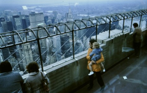
I took my first flight, in the summer of 1966 when I was seventeen. Fifty-three years ago.

It was a short hop, just 137 nm and less than one hour, on a four-engine Vickers Viscount turboprop from Glasgow Airport (GLA, then known as Abbotsinch) to the low-lying island of Benbecula (BEB) in the Outer Hebrides, between North and South Uist. These two airports are shown with purple symbols on the map below. I was to spend a week there bird-watching at the RSPB’s newly-established Balranald reserve.

In the intervening years, Glasgow Airport has become an important international hub for the west of Scotland. In 1966, Benbecula had just one small building, almost a hut, serving as the terminal. When I passed by a few years ago during a vacation in Scotland, it didn’t look as though it had grown much.

Since that first flight I have taken hundreds more and, as far as I can recall, taken off from or landed at a further 189 airports worldwide. Navigate around the map below, or use this link to open a full screen version to see which ones.

Each airport is also identified using its three letter IATA code. Just click on any symbol to see the full name, a photograph, and a Wikipedia link for more details on each airport.

The airports I have departed from or traveled to are shown as dark red symbols. But pink symbols are a subset of those airports I have used at least 20 times or more. The airports (actually quite a small number) where there was an intermediate stop, where I changed flights to the same airline or another one, but did not leave the airport itself, are coded blue.

Several  airports (shown in yellow) have since closed. In Hong Kong, the infamous Kai Tak airport in Kowloon was closed in July 1998 when operations moved to Chek Lap Kok, west of the city. The site is being redeveloped. Airports that were operational during the years I was flying regularly, but have now been superseded by new ones such as in Kuala Lumpur (Malaysia), Bangkok (Thailand), Hyderabad (India), and Durban (South Africa), to name just four cities are listed in this category.

When I visited the Caribbean island of Montserrat in November 1979, we landed on a small strip on the east coast. It now lies under several meters of volcanic ash following the disastrous eruption of the Soufrière Hills volcano between 1995 and 1999.

Another, at the Mayan city of Tikal in the rainforest of northeast Guatemala, is no longer operational. I can see from a satellite image on Google Maps that buildings now line either side of what appears to have been the runway. Steph and I flew there in August 1977 on an Aviateca DC-3. Nowadays, I assume that visitors to Tikal must either travel by road (there were none in 1977) or fly into the international airport (FRS) at Flores, a city north of Tikal.

An Aviateca DC-3 at Tikal in 1971.

Finally, several airstrips are shown in green. These were airfields or landing strips not served by commercial flights where I traveled by light aircraft.

Steph and I flew from San Ramon (SPRM) on the east side of the Andes to Puerto Bermudez on this Cessna. We didn’t have seats, and on the return flight sat on empty beer crates, sharing the cabin with three dead pigs!


The second flight I took, in early 1969, was back to GLA from London Heathrow (LHR) to attend a student folk dance festival at Strathclyde University in that city.

My third flight (and first outside the UK), in April 1972, was to Izmir, Turkey to attend an international conference on plant genetic resources. With my friend and former colleague, Brian Ford-Lloyd, we flew from Birmingham (BHX) via LHR to Izmir (IGL – now replaced by a new airport south of the city) through Istanbul’s Atatürk Airport (ISL) formerly known as Yeşilköy Airport. On the return journey, Brian and I almost missed our flight from Istanbul to London. With all the ambient noise in the terminal and inadequate tannoy, we hadn’t heard the flight departure announcement and were blithely sitting there without a care in the world. Eventually someone from Turkish Airlines came looking for us, and escorted us across the apron to board the 707 through a rear door. Embarrassed? Just a little.


The first long-distance flight I took (5677 nm, and only my fourth flight) was in January 1973, to Lima to join the International Potato Center (CIP) as an Associate Taxonomist. On a Boeing 707 operated by BOAC (the predecessor of British Airways), this was a long flight, with intermediate stops in Antigua (ANU) in the Caribbean, Caracas (CCS) in Venezuela, Bogota (BOG) in Colombia, before the final sector to Lima’s Jorge Chávez International Airport (LIM).

Steph joined me in Peru in July 1973, and flew the same route (but starting at LHR), only her second flight (the first being school trip to France in the 1960s).


In compiling this list of airports, I’m also reminded of the many flights that passed through them, and my impressions of each terminal and facilities. After all, transit through an airport is an important part of the overall trip experience. In some instances you can spend almost as much time in the airport as in the air, having to cope with the hassle (challenges in some cases) of checking in, passing through security, the boarding process (which can go smoothly or not depending on how ‘friendly’ the ground staff are) on departure, and immigration, baggage pickup (always stressful), and finally, customs control on arrival. So many steps. So many opportunities for something to go awry. I think we tend to almost discount trips when everything goes to plan. It’s what we hope for, expect even.

However, let’s have a look at the particular challenges of some airports, based just on where they are located, and their difficulty for pilots. Now I’ve never landed in Paro (PBH) in Bhutan (regarded as one of the most ‘dangerous’ airports in the world, flown visually throughout (check out this video to see what I mean), or the gateway to Mt Everest, Lukla (LUA) in Nepal.

But landing at Hong Kong’s Kai Tak¹ was always interesting (even when there were no weather issues), and that I’ve seen referred to as the ‘heart attack’ approach, banking steeply to the right on final, and seemingly skimming the roof tops.

While in Lima (1973-1976) I made a few internal flights but nothing international.

I flew into Cuzco (CUZ) a couple of times. It is surrounded by mountains, and flights can only land from and take off to the east. A new international airport is being built (controversially) at Chinchero north of the city, an important area for indigenous agriculture (potatoes and maize!) and cultural heritage.

The airport at Juliaca (JUL, for Puno on Lake Titicaca) lies at 12,500 feet (or 3800 m), and has one of the longest runways in Latin America. I’ve been there two or three times.

It wasn’t until I moved to Costa Rica (1976-1980) to lead CIP’s research program, that I began to travel more regularly around my ‘patch’ from Mexico to Panama and out into the Caribbean Islands.

San José’s Juan Santamaría International Airport (SJO) is surrounded by volcanic peaks up to 3000 m. This was my local airport for almost five years (we lived in Turrialba, 82 km to the east), and it could be quite badly fogged in from time to time. I remember one time returning from Guatemala City on the late evening Pan Am 707 flight. We had to circle overhead the airport for more than half an hour, until the fog cleared. However, just as we were about to touch down, the Captain applied full power and aborted the approach. At the last moment, the fog had obscured his view of the runway. He banked away steeply to the left and, according to the driver who came to pick me up, our aircraft skimmed the terminal building!

One could always expect a white knuckle approach into Tegucigalpa’s Toncontín  International Airport (TGU) in Honduras. Just before landing, aircraft have to bank steeply to the left then skim a hill at the end of the runway, before dropping quickly on to the runway and braking hard to avoid skidding off the end of the runway (which has happened several times). Here’s a B-737 cockpit view of landing there, the aircraft (but generally the 737-100 or 737-200) I often flew into TGU.

The take-off roll at Mexico City (MEX) can last a minute or more, because of the altitude of the airport (7300 feet, 2230 m). The airport has parallel runways almost 4 km long. In 1979, I was returning to Guatemala City with a colleague, and we boarded an Aviateca B-727, a new aircraft. The take-off seemed to last forever. In fact, the Captain lifted the nose just before the end of the runway, and we skimmed the landing lights by only a small height. Then, on landing at Guatemala City’s La Aurora International Airport (GUA, also surrounded by several volcanoes which can make for a tricky approach) we burst a tyre and skidded off the runway, coming to a halt some distance from the terminal building.

Turbulence always makes me nervous. The airspace around the approach to Tokyo’s Narita International Airport (NRT) is always busy, and often subject to bumpy air. Many’s the time I’ve bounced into and out of NRT, but fortunately never experiencing the very severe turbulence affecting some flights.


It wasn’t until I moved to the Philippines in 1991 (until April 2010) that I began to fly on a regular basis, mostly intercontinental flights to the USA or Europe, but also around Asia.

My first foray into Asia was in 1982 when I attended a conference in the Indonesian capital Jakarta, flying into the old Halim Perdanakusuma International Airport (HLP) on a KLM B-747 from Amsterdam’s Schipol Airport (AMS).

AMS and Frankfurt (FRA) became hubs for many of my flights, business and pleasure, until I discovered Emirates (EK) in 2000 when they commenced flights out of Manila to Dubai (DXB) and on to BHX, on a wide-bodied B-777.

And it was during these years that I got to travel into Africa for the first time. In January 1993 I flew to Addis Ababa (ADD) from Manila (MNL) via the old Bangkok Don Mueang International Airport (DMK) on an Ethiopian Airlines flight. On another occasion I took Singapore Airlines from MNL to Johannesburg (JNB) via Singapore (SIN), with a South African Airways (SAA) connection in JNB to Lusaka (LUN), Zambia. It was 27 April 1994, and South Africa was holding its first democratic election, won by Nelson Mandela’s African National Congress (ANC) Party. Having traveled on Business Class, I was settling into the the SAA lounge at JNB when a bomb was detonated in the departure hall above my head. We were all evacuated on to the grass outside, passing through the devastated hall on the way, until we were allowed back into the terminal after several hours. Fortunately it was a fine autumn morning, bright and sunny although a little chilly.

Arrival at Lagos Murtala Muhammed International Airport (LOS) was, for many years, quite stressful. Greeted on arrival with sinister looking individuals not in uniform demanding one’s passport was one thing, but on departure there was always pressure from immigration and security staff at every point in the departure demanding to look through one’s hand-luggage and ‘ask’ for a bribe, a token of ‘friendship’. It didn’t matter what the item might be, one was always faced with the same old question: ‘What have you got for me in your case?’ Invariably I would answer: ‘A nice big friendly smile’ and passed on with no further toll levied. By the time I made my last visit in the early 2000s, those practices had more or less disappeared.

I’ve always found immigration into the United States somewhat intimidating. Whether immigration officers are told to be generally difficult, I don’t know, but they do ask some rather strange questions. On one occasion, in September 1978, when our elder daughter Hannah was just four or so months old, we flew back to the UK from Costa Rica via Miami (MIA). This was Hannah’s first flight – and she nearly didn’t make it.

In those days, MIA (and probably many other ports of entry into the USA) did not have a transit facility. Even if just changing flights, you had to pass through immigration requiring a US visa. Hannah was registered in Steph’s passport, and we did not realize that Steph’s visa did not cover Hannah as well. At first, the immigration officer was reluctant to allow us to pass, but after discussing the situation for more than 30 minutes, she did allow us to proceed to our next flight. Needless to say I had to get Hannah a separate visa at the US Embassy in San Jose on our return, attending an interview on Hannah’s behalf to answer all those silly visa application questions. No, Hannah had never been a Communist, or convicted of war crimes.

This transit situation reminds me of another instance when I was traveling with a Peruvian colleague to the Caribbean islands from Santo Domingo (SDQ) in the Dominican Republic via San Juan (SJU) in Puerto Rico. I had a US visa, Oscar did not. We had a lay-over of several hours between flights in SJU. Eventually Oscar was permitted to join me in the airport terminal, on the condition that he was accompanied by an armed guard at all times.


In 2005 I was caught up in a major strike at Northwest Airlines (NWA, now absorbed into Delta Air Lines). I had a business trip to the USA, to attend a meeting in Houston, Texas. By then, Hannah had been living in St Paul, Minnesota for several years, and I’d schedule any trip to the US at a weekend via Minneapolis–Saint Paul International Airport (MSP) so I could spend time with her and Michael (now my son-in-law). The day after I arrived in St Paul, a strike was called at NWA that lasted for some weeks, causing my travel plans to be thrown into considerable confusion. Fortunately, NWA handled the situation well, and transferred me on to other airlines, mainly United. I flew to George Bush Intercontinental Airport (IAH) in Houston via St Louis (STL). From Houston, I traveled to New York (JFK) for meetings at UNDP. But because of the NWA strike, there was no flight home to the Philippines from MSP. Instead, I flew direct to Chicago O’Hare (ORD) to connect with a United non-stop flight to Hong Kong (HKK, at Kai Tak). And that’s how I came take the world’s longest flight in those days: 17½ hours, 6773 nm. The flight was full. I already had a First Class upgrade from NW that was honored by United, so was rather more comfortable than those in the back over such a long flight. But would we make the flight non-stop? That was the concern raised by our Captain as we taxied out to the runway. He told us that because of the length (and weight) of the full flight, and expected headwinds, there was a 30% chance we might have to land in Beijing (PEK) to refuel. In the eventuality we must have glided on empty from PEK to HKG. Then, in HKG, I transferred to a Canadian Airlines flight for the last sector into MNL.

The whole trip covered more than 17,000 nm.

Then in November 2016, when making a review of genebanks, Brian Ford-Lloyd and I flew to Melbourne (MEL), Australia for four nights, on EK from BHX via DXB. The DXB-MEL sector was the second longest flight I have ever taken at 14 hours or so, and 6283 nm, fortunately on the great A380. This trip was, in total, longer than the US trip I just described above, at 18,625 nm.

Enjoying a wee dram at the bar at the rear upper deck of the A380.


Recently, I came across an item on the CNN travel website, listing Singapore’s Changi Airport (SIN) as No. 1 on its list for 2019, the seventh year in a row that it had received the accolade. Even LHR was on the list, at No. 8. That surprised me, given the problems it has experienced in terms of processing incoming passengers through immigration. It’s an airport I have avoided for many years.

When I first began flying, five decades ago, airport terminals were quite rudimentary in many respects, and even until recently some international airports have failed to make the grade. Many airports didn’t even have air bridges to board the aircraft, and you had to walk to the aircraft in all weathers, or be bused out to the aircraft.

Airports have become prestige projects for many countries, almost cities with many opportunities to fleece us of our hard won cash, flaunting so many luxury products.

It’s no wonder that SIN is No. 1. It’s a fabulous airport, almost a tourist attraction in its own right. As are airports like Dubai (DXB), the airport I have traveled through frequently on home leave. EK via DXB also became my airline of choice for flights into Europe on business.

Some like Dallas-Fort Worth (DFW) are so huge, there’s an internal transportation system to move from one part of the airport to another. New York’s John F. Kennedy International Airport (JFK) is large – and badly designed. I remember one time arriving there on American Airlines (AA, from MEX I think) to connect with a British Airways (BA) flight to BHX. All the terminals at JFK are arranged around a circle, and there were shuttle buses—in one direction only—connecting them. I arrived in the American terminal which was next door to the BA terminal, but to its right. There was no way to walk from the AA terminal to the BA one. I had to take the shuttle bus all the way round, stopping at every terminal on the way to drop-off and pick-up passengers. It was a busy afternoon. It took almost 90 minutes, and I thought I was going to miss my flight, that was, in any case, delayed. I haven’t been to JFK for a couple of decades so don’t know if this set-up is the same.

On these long-haul flights, we were permitted to fly in Business Class. Having picked up so many air miles I could, on occasion, upgrade my seat to First Class. What a privilege. Flying Business Class also meant access to airline lounges where one could escape to a more relaxing environment before boarding. Given the parlous state of many airport terminals (especially the toilets) this really was a boon.


And to wrap up this post, I’ve been thinking of some of my favorite airports. On clear days, the approaches into SJO or CUZ could be marvelous, with fantastic views over the surrounding mountains. Likewise GUA. In Asia, the approach to Luang Prabang (LPQ) was scenically very beautiful.

But I guess the airports that have caught my attention are those that just worked, like SIN or DXB, BHX even. Manila’s Ninoy Aquino International Airport or NAIA (MNL) Terminal 1 (which we used throughout our 19 years in the Philippines, before the new Terminal 3 opened to international traffic in 2011) lacked many facilities, with little space for passengers to wait comfortably for their flights. However, I have to admit it was one of the fastest and easiest I’ve ever transited in terms of immigration procedures. In 1996, I flew back to the Philippines with our younger daughter Philippa on a KLM flight from AMS. We touched down, on time, around 16:30, and we were leaving the airport with four bags, having taxied to the terminal, disembarked, passed through immigration and customs, within fifteen minutes. That’s right, fifteen minutes! That must be a record. But that was NAIA for you. I was only delayed seriously on one occasion in all those years.

So many airports, so many flights. So many memories, also. And, on reflection, mostly good. After all, that’s what has allowed me to explore this interesting world of ours.


¹ It’s also noteworthy how many of the aircraft shown in the video are B-747s, a plane that is becoming an increasingly rare sight at many airports around the world, many having been pensioned off and replaced by more fuel efficient twin-engined aircraft like the B-777 and B-787 from Boeing, or the A330 and A350 from Airbus.

Walking with my mobile: [3] Water and steel

Milestone, near the Queen’s Head pub, a couple of miles south of Tardebigge.

It’s 1807, and fields around Tardebigge, a small settlement east of Bromsgrove in northeast Worcestershire, are swarming with hundreds if not thousands of workmen, known as navvies (from the name by which canals were also known at the end of the 18th century: ‘navigations’) facing their next challenge in the construction of the 29 mile Worcester and Birmingham Canal that would finally open in 1815 after reaching Worcester on the River Severn. That’s what I imagine it must have been like.

Tardebigge is almost equidistant between Birmingham and Worcester. It had already taken 15 years just to dig this first level section of the canal, on the same level as Birmingham (at 453 feet above sea level).

While engineers had avoided building any locks as far as Tardebigge, they had to construct four tunnels, the longest (at 2726 yards) taking the canal under the Lickey Hills (the Wast Hills Tunnel). North of Tardebigge they also constructed the Bittell Reservoirs, to feed the canal.

The Tardebigge Tunnel entrance.

South from Tardebigge the engineers and surveyors had to drop the canal almost 430 feet over the next 15 miles to Worcester, constructing 56 narrow (7 foot) locks, and two larger ones at Worcester where the canal meets the River Severn.

The Tardebigge Flight south of the Tardebigge Reservoir.

Tardebigge Bottom Lock near Stoke Pound.

Immediately below Tardebigge there is a flight of 30 locks, the longest in the country, in the space of under three miles. And another reservoir, and a pumping house (now converted to luxury apartment).

Following the Tardebigge flight is one of my favorite walks. On 11 April, I made a walk of just over six miles, covering much of the same route I described in an earlier post. On this latest walk, I went beyond the Tardebigge Reservoir, leaving the towpath where London Road crosses the canal, and less than half a mile from the last lock of the flight, Tardebigge Top Lock (the deepest of all the 56 narrow locks).

Take a look at the route of this walk. There is an image (or more than one) linked to each of the red via points.

Overlooking the canal at Tardebigge is the late 18th century church of St Bartholomew. From there one can see  the spire of 12th century St John’s Church in the center of Bromsgrove itself. In the image below, the spire can be seen just to the right of the chimney on the right. Click to enlarge the image.

Looking east to Tardebigge church and the canal, from Dusthouse Lane.

What I find myself thinking about, as I walk the towpath, is just what it took to dig the canal, and construct the locks. How did they achieve all this without recourse to machinery? Each of the locks is brick-lined, and some are edged with large and beautifully dressed sandstone blocks. Were the bricks made on site, or transported to each lock? Where did the sandstone come from? And the lock gates (double on the lower side, single on the upper), made from huge oak beams, weighing (when assembled) over a tonne? You can’t help wondering how they managed to position all these into place. On many sections there are no nearby roads linking with the canal. How many navvies were injured, or killed even, during the whole construction.


For 25 years, the Worcester and Birmingham Canal had no competition. However, in June 1840 the railway came to Bromsgrove with the opening of its station on the Birmingham and Gloucester Railway, linking Birmingham with the Bristol and Gloucester Railway at Gloucester. Constructed just east of Bromsgrove town center, the line climbs the famous Lickey Incline, a gradient of 1 in 37.7 over a distance of two miles, that begins immediately north of Bromsgrove station.

My walk route also parallels the rail line south to Stoke Pound, crosses underneath there, and again at Finstall on the north side. Approaching the line one cannot but be impressed by the engineering needed to raise level embankments over undulations in the landscape, yet climb the gradient of the Incline to its summit north at Barnt Green.

How many more thousands of navvies swarmed once again into Bromsgrove and surrounding areas while the line was being constructed?

Today the line through Bromsgrove carries commuter services on the recently-electrified Cross City extension (of West Midlands Railways) from Birmingham (and connecting with Lichfield in Staffordshire), or on diesel units south to Hereford via Worcester and Malvern. CrossCountry services hurtle through Bromsgrove (as seen above) on their way south to Penzance at the tip of Cornwall, via Bristol, or north to Aberdeen in the northeast of Scotland, via Birmingham, York, Newcastle, and Edinburgh.

So much industrial history to absorb, and so much to think about while enjoying the tranquility and beauty of this north Worcestershire landscape. I never ceased to be awed by what was achieved.

Around the world in 40 years . . . Part 23: An Anglo-Italian connection

I’ve twice traveled by train, in 2004 and 2006, from my home in Bromsgrove in northeast Worcestershire to Rome in central Italy. And if I had my way, I’d travel everywhere by train, if that were possible.

When visiting government agencies that provided financial support to the International Rice Research Institute (IRRI) when I was Director for Program Planning & Communications (DPPC), I tried to combine as many visits into a single trip as possible, thus making the best use of my time on the road. In Europe, traveling by train was by far the most convenient (and comfortable) way of visiting several cities on the way, rather than hopping on and off planes for relatively short flights. Not to mention the inconvenience of additional waiting time at airports and the hassle of actually getting to and from them.

Train travel in many European countries is reliable and, compared to the UK, competitively priced. Purchasing a Eurail pass was by far the cheapest option, even for First Class tickets, and could be bought online from the Philippines.

This was my itinerary on both occasions:

  • Bromsgrove – Birmingham New Street – London Euston (into Birmingham on London Midland—now operated by West Midlands Trains—then Virgin Trains to London; around 2 hours or so; map)
  • London Waterloo (Eurostar now operates from London St Pancras) – Brussels Midi (on Eurostar; around 2 hours; map)
  • Brussels Midi – Cologne – Bonn Central (on the Thalys to Cologne, and Deutsche Bahn, DB; just over 2 hours; map)
  • Bonn Central – Basel – Bern (Deutsche Bahn to Basel, then Swiss Federal Railways, or SBB/CFF/FFS), along the Rhine Valley (around 5½ hours; map)
  • Bern – Milan Central (on Swiss Federal Railways; around 4½ hours; map)
  • Milan Central – Rome Termini (on Trenitalia; 3 hours; map)

On the second trip I traveled with IRRI Director General Bob Zeigler (and his wife Crissan) to visit donor agencies in Brussels (Directorate General for International Cooperation or DGCI of Belgium, and the European Union, EU), the Federal Ministry for Economic Cooperation and Development (BMZ) in Bonn, the Swiss Development Cooperation (SDC) in Bern (and a side trip to Basel where Bob gave a seminar at the Syngenta Foundation), and finally, the International Fund for Agricultural Development (IFAD, an agency of the United Nations) in Rome – all members of the Consultative Group on International Agricultural Research or CGIAR.

Crissan and Bob Zeigler


We met at London’s Waterloo station for the Eurostar service to Brussels, arriving there mid-afternoon. Since no meetings had been arranged that same day, we enjoyed the warm afternoon sunshine for a stroll around La Grand-Place (a UNESCO World Heritage Site), before enjoying our dinner at one of the many cafes close by.

Bob and Crissan feasted on one of the local delicacies: moules (mussels).

I like mussels, but in moderation, just a few added to a fish pie or a fish soup. Not a whole meal. In any case, our meal was accompanied, of course, by several glasses of excellent Belgian beer.


The day after our meetings, we caught the Thalys (the Belgian TGV) to Cologne, and then a regional service for the short hop to Bonn. We had just one day of meetings in Bonn, with the German aid ministry (BMZ), and then spent an excellent day touring the vineyards of the Ahr Valley just south of Bonn. Our main contact was my old friend Marlene Diekmann who I’d known for many years before she joined the BMZ when she was a plant pathologist at the International Plant Genetic Resources Institute (IPGRI, now Bioversity International) in Rome.

On previous visits to Bonn, in all weathers, Marlene and I had gone walking along the terraces of the Ahr Valley, as I described in this blog post. On this current trip with the Zeiglers, as in the past, we sampled some of the fruits of the vintner’s art. And very good it was.

Each time I have visited the Ahr Valley I have never failed to be impressed at the cultivation of the vines on such steep slopes. In the early evening we headed to Rheinbach (map) to join Dr Hans-Jochen de Haas, who was Germany’s representative to the CGIAR, and became a good friend.

I’d last seen him the previous year in Bonn and presented him with a book on rice culture.

A few years later (and before I retired in 2010) he sadly passed away after contracting Creutzfeldt-Jakob disease or CJD.

Bob and I (with Marlene) also made a one-day visit to Hannover (again by train) to visit the Volkwagen Foundation to try and tempt them to support a research project on rice and climate change involving a German scientist seconded to IRRI.

Commitments in Germany completed, Switzerland was our next stop, so we took the train along the River Rhine to Basel, and transferring to Swiss railways to Bern.


I first visited Switzerland in July 1984 when I attended the 9th Triennial Conference of the European Association for Potato Research (EAPR), that was held in Interlaken in the heart of the Bernese Oberland.

A group of us from the UK flew from London Gatwick to Bern (Switzerland’s capital city) on a Swissair BAe 146, and then taken the train for the 1 hour rail journey to Interlaken. There are no flights to Bern nowadays; Switzerland is served by two major international airports in Geneva (in the west) and Zurich (in the north central part of the country). And, in any case, rail services across the country are frequent, convenient, and comfortable.

In 1984, I’d taken a trip up to Wengen (1274 m) from Interlaken, with the last leg on the funicular railway from Lauterbrunnen. The Zeiglers and I repeated this trip. And after lunch in Wengen, we took the cable car up to Männlichen (2343 m), before dropping to Grindelwald (1034 m) on Europe’s longest gondola cableway (and third longest in the world).

At Männlichen there are fabulous views of the Eiger, Jungfrau and other mountains.

Watch this video that I found on YouTube of the cable car ride to Männlichen and the gondola cableway down to Grindelwald.

All too soon, our Swiss visit was over, and we took the train to Milan, an impressive journey through the Alps and the Italian lakes.

In Milan, we transferred to the high speed train to Rome. That was an interesting journey. In 2006, the 18th FIFA World Cup was hosted by Germany. Although Mexico had been eliminated from the competition by then, our train was full of supporters from Mexico on their way to Rome to enjoy the sights. Bob, Crissan and I all spoke Spanish. Bob and Crissan had actually lived in Mexico for a few years before returning to IRRI in 2005. So we had a great time with the Mexicans, and our fast train journey to Rome (a city I have visited numerous times) passed even faster it seemed.


You can do better than this, Network Rail (updated 18 February & 14 April)

I’ve got a bee in my bonnet, and it won’t go away. Buzz, buzz, buzz. Let me explain. Please bear with me.

My home town, Bromsgrove, lies at the foot of the Lickey Hills in north Worcestershire (map). The rail mainline from Birmingham to the southwest (through Worcester and Cheltenham, on to Bristol and the West Country) passes to the east of the town, having descended the Lickey Incline, ‘the steepest sustained main-line railway incline in Great Britain. The climb is a gradient of 1 in 37.7 (2.65% or 26.5‰ or 1.52°) for a continuous distance of two miles (3.2 km)’.

A new station was opened in 2016, and the line was subsequently electrified.

The new electric trains (operated by West Midlands Railways in their bright gold and silvery grey livery) came into service in July 2018 as part of the Cross City line connecting Bromsgrove with Lichfield to the north of Birmingham.

I wrote a blog post about the station in 2016, and updated it last November.

There are three bridges over the railway near the new station, one to the south (at a housing development known as Breme Park that had been built on the site of the former Garringtons Ltd or United Engineering Forgings), and two to the north (one over St Godwald’s Road, and the other over the B4184, Finstall Road), indicated by arrows on the map below. All three bridges are owned by Network Rail, which ‘own[s] and operate[s] the railway infrastructure in England, Wales and Scotland on behalf of the nation. That’s 20,000 miles of track, 30,000 bridges and viaducts and thousands of tunnels, signals, level crossings and points’.

Until recently these bridges were great vantage points to watch rail traffic up and down the Lickey Incline. No longer. During the installation the overhead electrification it wasn’t necessary to raise any of the three bridges in Bromsgrove. However, as a safety feature to prevent anyone leaning over the parapets, steel cladding was erected on both sides of each bridge, as illustrated in this photo to the right. I didn’t manage to take any photos of the bridges with all this cladding, but you can now imagine what it must have looked like. Very unsightly.

Now the cladding has been replaced on all three bridges—for better or worse. That’s why a bee is busy buzzing. Let me show you, bridge by bridge.

To the south of the station, there is a steel and brick bridge that connects with public footpaths on the east side. It’s just a muddy track, but wide enough for a vehicle to cross. From here was the perfect spot to watch trains approaching, at speed, round the bend from the south. Almost all the steel cladding has gone, except at each end of the bridge on both sides. I cannot understand why Network Rail would leave the bridge with four sets of steel cladding, unless workmen will return at a later date to replace the remain panels. Click on each image to enlarge.

In the center and right below, can be seen the view, north and south from the bridge, from the ends of the bridge. On the left is the view south towards the bridge from the station platform.

Just north of the station (close to where the old station was sited until 2016), a concrete bridge crosses St Godwald’s Road. On the top of the parapet has been placed a single course of ‘plastic bricks’. Since the parapet itself is flat, Network Rail made a better job here. It wasn’t so complicated. Yet, on the rail side of the north parapet, there is much to be desired, as the ‘bricks’ don’t appear to be fully secured.

Then there is the bridge further north carrying the B4184 Finstall Road over the mainline. This is actually a concrete structure, but the parapets were faced with pink sandstone blocks that have weathered over the decades, and are in keeping with the surrounding area.

But what a botched job Network Rail has made of placing a course of ‘bricks’ on the top of each parapet. This a view of the bridge from the south (rail) side.

On the bridge itself, south and north sides, it’s hard to believe that anyone signed off on this as a completed job, well done. Just look at how they have placed the ‘bricks’. Let’s look at the south side first.

And on the north side, it’s almost as bad. And in the process, some of the stonework has been damaged.

On one of my walks a couple of weeks ago (on 21 January to be precise), I took a few photos on my mobile and sent a couple of tweets to Network Rail:

https://twitter.com/mikejackson1948/status/1087312114325311488

To their credit, Network Rail did reply within an hour, and through emails they have now referred this issue to a local team to investigate: Your service request has been assigned to our RAM Structures team to investigate further. They will report back shortly with their findings and your local contact and communities team will be in contact to confirm the next steps in due course. There’s even a job number, #190121-000205.

Nothing has happened yet, but I’ll keep monitoring the situation—and bugging Network Rail—until the buzzing has gone away*.

But why have I become so incensed about this situation? The casual use of resources is unacceptable in these difficult fiscal times. But maybe I’m just becoming a grumpy old fart.

I have no idea what budget was allocated to, firstly, install the steel cladding, and secondly, the replacement panels and ‘bricks’. Thousands of pounds, undoubtedly. How many person-days so far? And, for the bridge on the Finstall Road, because there is a pavement on only one side (the south) the road had to be partially closed (with traffic signals) for about three weeks, disrupting traffic for the local community.

But as I’ve already said, I can’t imagine how anyone could think that this workmanship was acceptable, up to standard. And that goes against my sensibilities of doing something right the first time!

These are the only views now possible from the bridge on St Godwald’s Road. The middle image below was taken from the car park of the old station, and shows a West Midlands Railways train departing from Platform 3, and then crossing over on to the up line. Diesel trains (shown here) to and from Hereford via Worcester stop at Bromsgrove.


* On 12 February, I received a further update from Network Rail, which I reproduce here in full:

Dear Mr Jackson,

Thank you for your recent communication to our National Helpline on the 21 January 2019.

As part of the scope of works of the Bromsgrove electrification, our project team have had to ensure that at all bridges over the railway a minimum of 1.8 metre high parapets have to be in place to protect users of the bridge from the presence of live electrification equipment below. From July 2018 this was permanently energised at 25,000 volts.
In some cases (such as the new Bromsgrove station footbridge and newly-reconstructed bridges in the Barnt Green and Blackwell areas), this height separation has been provided from new. At bridges which have not needed to be reconstructed, we have raised the heights of the parapets, there being three such structures in the Bromsgrove area.

The designs for parapet height extension have gone through a number of approval processes, which have taken some time. Temporary steel screening has been installed at the bridges – including Finstall Road – to provide the necessary separation in the interim between energisation of the electrification and the approval and delivery of the permanent works. Planning consent has been sought and received, with an inert colour incorporated into the material used (GRP).

Volker Rail is the contractor undertaking the works (under subcontract to MPB), and over a number of weekends has progressively installed the cladding and when able, removed the temporary steel cladding. As per the photos supplied by you the temporary gaps left between the GRP panels, some of which were filled in the interim with plywood panels, were of work still in progress whilst the GRP ones were being fabricated.

While I appreciate this may not be the answer that you were hoping for, and there may still be some work outstanding, the work to date is as per the design.

For the rest of your enquiry about the costs involved in this project, if you would like to pursue this information, we would kindly request for you to make a separate enquiry as this would require a Freedom of Information request.

Kind Regards
Community Relations

Now, there’s a couple of points I’d like to make. First, I have never questioned the necessity of meeting health and safety issues by installing raised parapets. I completely see the need for these, while feeling disappointed (along with many others, I’m sure) that the views up and down the Lickey Incline have now been reduced or lost. Second, the reply from Network Rail is ambiguous whether the job at the bridges is a ‘work in progress’ and yet to completed, or whether this is now the finished article, so to speak. If it’s a ‘work in progress’ I’m surprised that Network Rail did not agree with the contractor (Volker Rail) a more convenient start date when all the materials necessary for the job had been assembled. If the contractor has to return that will mean more expense and road closure inconvenience perhaps.


Update (14 April 2019)
While out for a short walk yesterday I decided to check if any more work had been carried out on the bridge on the Finstall Road. I’d noticed that the parapet on the south side had been repaired a week earlier. And I was pleasantly surprised to see that the north side had also now been brought up to standard.

Parapets on the south side of the bridge.

On the north side.

After I’d downloaded the images from my phone, I decided to send a tweet to Network Rail:

https://twitter.com/mikejackson1948/status/1117032349496168448

Network Rail seemed pleased with my tweet.


Around the world in 40 years . . . Part 21: Taking in Tokyo (and Tsukuba)

I recently wrote about a trip to Bali in 2005 when the IRRI Board of Trustees (BoT) held one of its biannual meetings there.

Four years later, in September 2009,  Steph joined me when I attended the BoT meeting in Japan that was held in Tsukuba, the science city just over 60 km or so northeast of Tokyo, followed by a couple of days in Tokyo itself. Since  the meeting was held in the week before Steph’s 60th birthday, we decided to stay on an extra couple of nights and see something of Tokyo. I had been in Tokyo just once before¹, around 1994; Steph had never visited. However, we’d both passed through Tokyo’s Narita airport many times while flying to the USA.

In the good old days, before Northwest Airlines merged with and was taken over by Delta. Narita was a major hub for NW flights to and from the USA, as is the case now with Delta.

Leaving Manila for Tokyo on the early morning flight (a very early start from Los Baños to check-in three hours ahead of the flight) was not without its challenges, and we weren’t entirely certain we’d be able to fly. The Philippines had been hit the day before by Typhoon Ketsana (known in the Philippines as Ondoy), the first of two typhoons to hit the country within one week. There was extensive flooding in parts of Manila (which we saw as the Delta 747 climbed out of the city). At Manila’s Ninoy Aquino International Airport or NAIA there was chaos at the check-in and in the departure areas. Many flights had failed to leave the previous day, and with so many passengers with nowhere else to go, the airport was heaving with people hoping to get a flight out.

Since Steph was traveling with me, I used air miles to upgrade our booking to Business Class as a special treat. The flight to Narita takes four hours. On arrival at Narita, we had a short wait for the bus to Tsukuba, around an hour northwest from the airport. We stayed at the Okura Frontier Hotel (the square building on the right) in the center of the city.

The Board and IRRI Management (and scientists as needed) met for three and a half days at the Tsukuba International Conference Center (just over a five minute walk south from the hotel).

The entrance to the Tsukuba International Conference Center.

Meanwhile, Steph joined the other spouses for several excursions in the surrounding region, as well as into Tokyo, to visit markets, see local handicrafts, take part in traditional Japanese flower arranging, a tea ceremony, and the like.

Then, after four days in Tsuskuba, we all decamped to central Tokyo, to the the Sheraton Miyako Hotel where, close-by, several events were organized by IRRI’s Japanese partner organization, the Japan International Research Center for Agricultural Sciences or JIRCAS.

The Sheraton Miyako Hotel (on the left) in the Minato district of Tokyo.

As I mentioned earlier, Steph and I stayed on for an extra couple of nights, so we could explore parts of Tokyo at the weekend, on Saturday 3 October, departing for Manila on the Sunday evening flight.

I’ve marked the places we visited on the map below.

We took full advantage of the extensive Tokyo subway system. We were able to purchase day tickets that gave access to the whole of the Tokyo subway system, over both the Toei Line and the Tokyo Metro Line. However, our first challenge was to purchase two tickets using the ticket machines. Eventually a very kind Japanese gentleman saw we were having a little difficulty, and helped us successfully navigate the menu.

The entrance to Shirokanedai subway station.

Starting at Shirokanedai Station (station I02, center bottom left on the map) on the Mita Line (Toei Line system), we traveled to the commercial district of Akihabara (I08), well known for its many electronics outlets. From there we visited Hibiyakōen (via Hibiya station, I08/H07), a park (near the Imperial Palace) where an agricultural exhibition was being held, that also featured a booth for the Consultative Group on International Agricultural Research (including IRRI). Then it was on to the Shinjuku Gyoen National Garden (via Shinjuku-Gyoemmae station, M10), and back to the hotel.

One thing struck us quite forcefully during this day excursion: how quickly one could get away from the hustle and bustle of Tokyo at the Shinjuku Gyoen National Garden. It was a haven of peace and tranquility. Early October was perhaps not the best time of the year to see the garden. But it was lovely, nevertheless, and being enjoyed by locals with their families, although not at all busy.

Here is a 17 minute video that I made of the day.

One day is surely not enough to explore a city the size of Tokyo, but we did get to visit three areas that we had chosen. Getting around Tokyo was much easier than I anticipated, and more so than I remembered from my visit in the 1990s.

Of course there are many other places in Japan that we never had the opportunity and maybe one day we will return. The only other city I have seen—from the airport constructed on an artificial island—is Osaka.


¹ During that trip, when I was hosted by a former member of IRRI’s Board of Trustees, and another who was currently serving on the Board, I visited both Tsukuba and Tokyo. In  Tokyo I met officials at the Ministry of Agriculture, Forestry, and Fisheries (MAFF), and there I came across one of my former students, Yoshi Nishikawa, who attended the University of Birmingham plant genetic resources MSc course in 1987-88.

Around the world in 40 years . . . Part 20: Volcanoes, temples, and rice in Bali

During the 19 years I worked at the International Rice Research Institute (IRRI) in the Philippines, I traveled to most of the countries in Asia, some repeatedly (Laos, for example) and others (such as Sri Lanka) just the once.

I must have visited Indonesia half a dozen times, mostly to Jakarta (on the island of Java) and to Bogor, about 64 km south of the capital, where one of IRRI’s sister centers, the forestry institute CIFOR, has its headquarters.

My first visit to Asia, in 1982, was to Indonesia. I stayed in Bogor for a couple of nights at the famous botanical garden there before returning to Jakarta to attend a genetic resources conference. However, it wasn’t until 2005 that I experienced the beauty of Bali for the first and only time.

Bali’s landscapes are dominated by three volcanoes in the north and northeast, the highest of which is Mt Agung, active since 2017.

These landscapes have been molded by generations of rice farmers who built and still maintain terraces to grow their precious crops. The soils, volcanic in origin, are fertile, and appear very productive.

IRRI’s Board of Trustees (BoT) meets twice a year. One meeting, in April, is always held at the institute’s headquarters in Los Baños, some 70 km south of Manila. The other meeting is often co-hosted by one of the institute’s national program partners with which IRRI collaborates to develop better rice technologies. Such joint meetings are often the opportunity for Board members (who come from a wide range of backgrounds, not necessarily agricultural) to better understand national rice production issues, and to see first hand how technologies are being tested, and disseminated to and adopted by farmers to increase agricultural productivity.

Rice varieties on display (above) and technologies (below) at a field day for IRRI’s Board of Trustees.

In 2005, the September BoT meeting was held at the Pan Pacific Nirwana Bali Resort 27 km west of Bali’s capital Denpasar. Steph joined me on this trip for only the second time (she did join me on a trip to Laos in 1997, then to Japan in 2009). We flew from Manila via Singapore on Singapore Airlines.

The BoT meeting lasted three days, and while we were locked away in presentations and discussions, the group of IRRI wives who had come along for the trip took various excursions around the island. Fortunately, we scientists and management also got to see something of Bali, the fertile volcanic landscapes, and rice agriculture on the picturesque and iconic rice terraces typical of the island.

Bali has a thriving tourist industry, but at the Nirwana resort we saw very little of the multitudes that flock to Bali each year. In any case most tourists stick close to Denpasar and its nightlife, in resorts located to the east and south of the capital. The coast west of Denpasar still remains unspoiled and uncrowded, however, according to an article that appeared in The Guardian today.

The hotel was very comfortable, and we enjoyed a large room with a balcony overlooking the restless Indian Ocean (next stop south: Antarctica!). The resort lies in the middle of an 18 hole golf course, interspersed with rice fields and lotus ponds, so there were ample opportunities for long walks at sunset. Several bars and restaurants are dotted around the complex, most with views over the golf course or the ocean. There were several pools to relax in.

Lotus ponds

Once the IRRI Board meeting was done and dusted, Steph and I decided to extend our stay over a long weekend.Just a short distance along the coast from the resort stands the famous and revered 16th century Hindu temple at Tanah Lot with access along the beach.

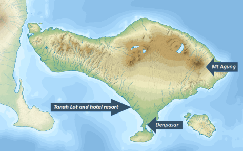
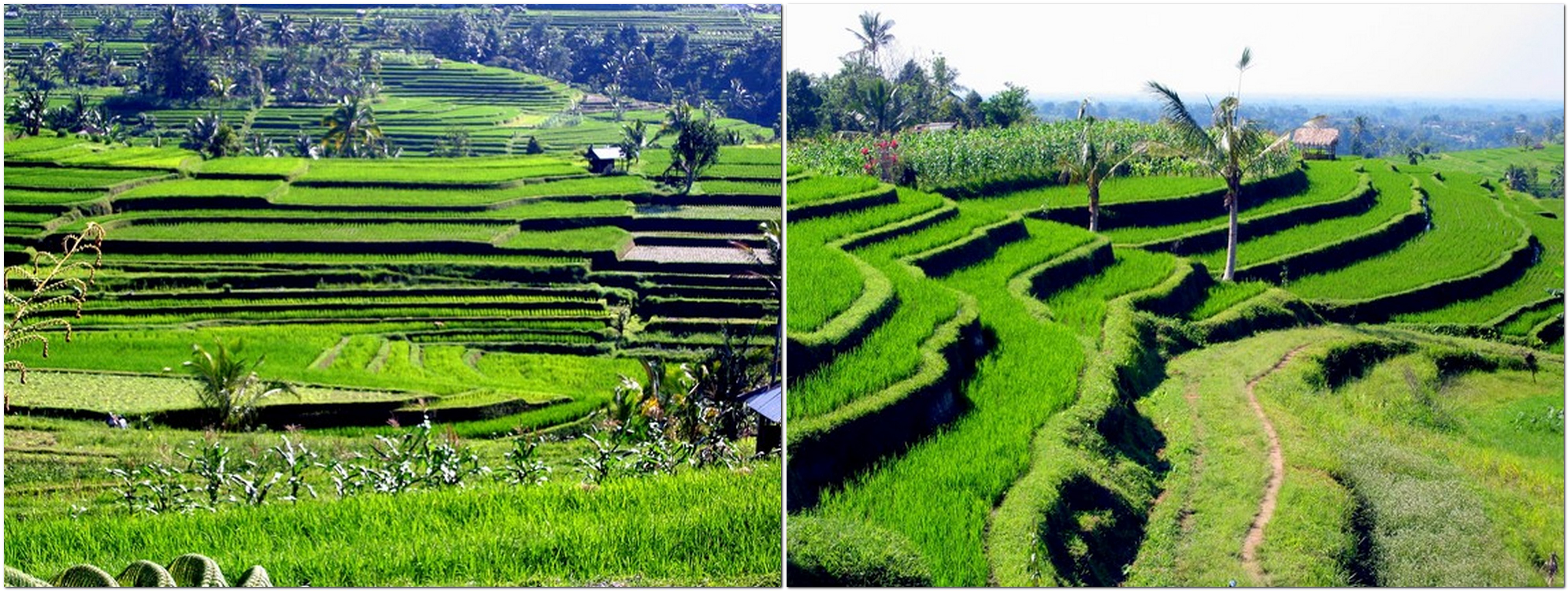
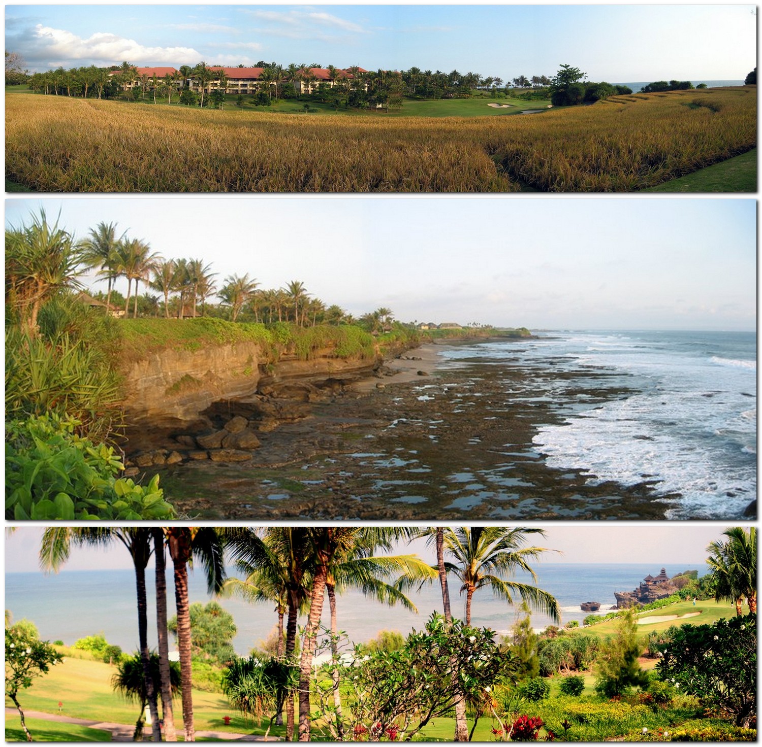
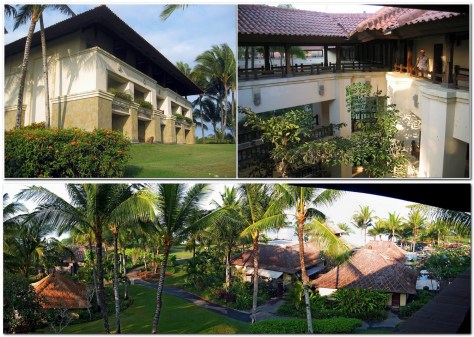
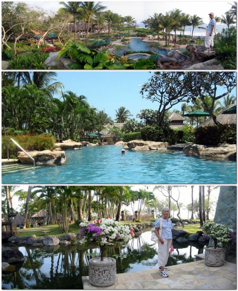
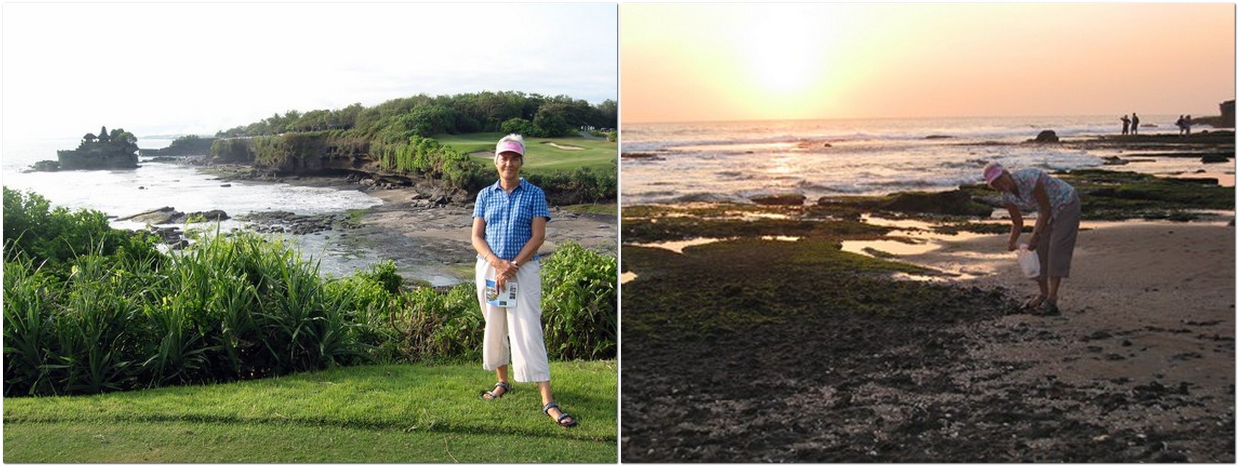
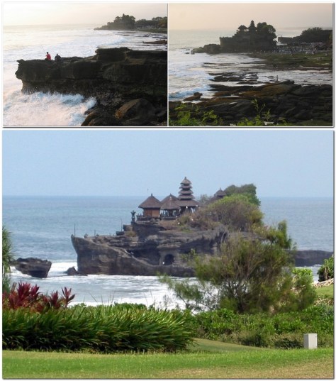
Unlike much of Indonesia (which is the world’s largest Muslim nation), Bali is primarily Hindu, and that is reflected in its culture, dances, and customs, some of which we experienced at a reception one evening.

In just over a week, we just sampled the flavor of Bali, but it would take an extended stay to become immersed in its vibrant culture. While I would like to return, one day, there are so many other places that I just have to explore first, given the opportunity.


Around the world in 40 years . . . Part 19: O’er the land of the free and the home of the brave!

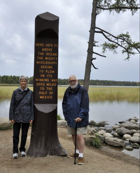
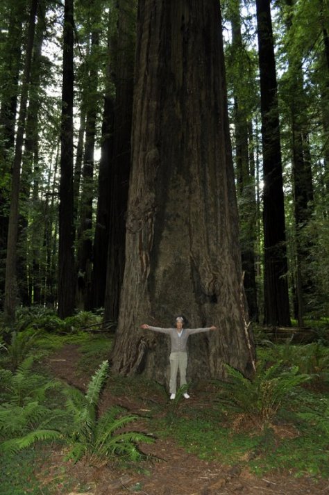
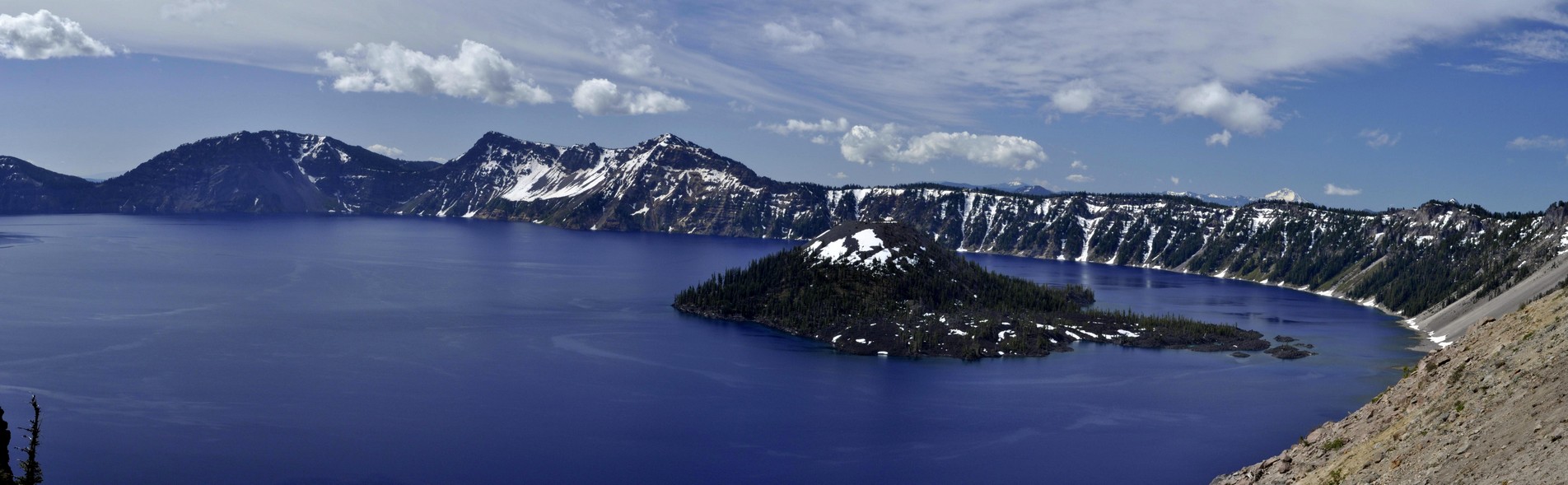
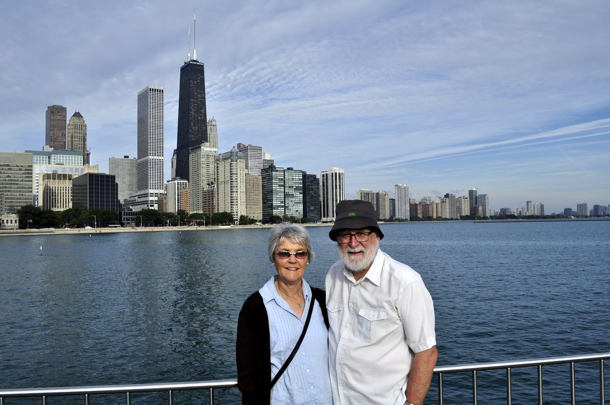
Steph and I really enjoy our visits to the USA. Over the years, we have experienced much of what this beautiful, fascinating, diverse, challenging, often bewildering (to the outsider, at least), and HUGE (or should that be ‘yuge’?) country has to offer.
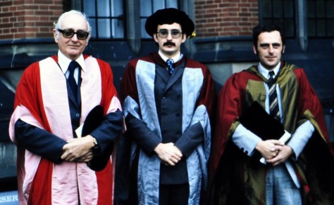
And now that we have family there (our elder daughter Hannah studied in Minnesota, was married there in 2006, and she and her family live in St Paul), there’s an added incentive to visit the USA annually.

Since retiring in 2010, we have made some spectacular road trips to explore the country. In fact there are now few states (shown in white) that we have not visited, and just two (Nevada and Alaska) where sitting in an airport was as close as I got. Just click the various links below to open earlier blog posts or photo albums.

On one flight from Japan to the USA on Delta Airlines, we were diverted to Anchorage, Alaska because of a medical emergency, then spent three hours or so on the tarmac before continuing our journey. In Las Vegas, Nevada we transferred to a domestic flight having arrived from the Philippines.

The first time we ever set foot in the USA was in April 1975, but that was only to transfer flights in New York’s JFK airport. Steph and I had left Peru about a week or so earlier on our way back to the UK where I would write and present my PhD thesis at The University of Birmingham later that year.

I was working at the International Potato Center (CIP) in Lima, and the center’s Director General, Richard Sawyer, had offered me a postdoctoral position (provided I successfully defended my thesis) and a posting in Central America. So our trip home took us to Costa Rica for about 3-5 days (via an overnight stop in Panama City), a brief stopover of about the same length in Mexico to visit former CIP friends, and then on to New York on an Eastern Airlines Lockheed L-1011 TriStar, the first wide-bodied aircraft we had flown. From New York we took British Airways (on our first Boeing 747) to Manchester.

In April 1976 Steph and I moved to Costa Rica and remained there until November 1980. As CIP’s Regional Representative (and potato production specialist), I worked throughout Mexico, Central America, and several countries of the Caribbean. Travel from Costa Rica out to the Caribbean islands (mainly the Dominican Republic, but occasionally other islands where potatoes figured in the agricultural cycle for at least some period of the year) inevitably involved flights through Miami in Florida, and I soon got to know Miami International Airport intimately. Because transit through Miami was a good opportunity to stock up on items we couldn’t readily purchase in Costa Rica, I would always try and schedule my return flights via Miami, arriving there in the early morning and taking the late LACSA flight to San José, giving me several hours for shopping in one of the nearby malls in Dade County. Each year when we flew back to the UK on our annual leave, we took flights via Miami to London.


However, the first big challenge of any visit to the USA is actually entering the country. The immigration experience is not always a pleasant or easy one.

When traveling in the 1970s, unlike today when we enjoy visa-free ESTA travel (unless Brexit changes that), it was necessary to have a visa to enter the USA, even if only transferring flights, as was frequently the case in Miami. There were no transit facilities.

In September 1978, when our elder daughter Hannah was about five months, we traveled to the UK on leave. Things started to go pear-shaped on presentation at the immigration desk in Miami. Although Hannah was registered in Steph’s passport she apparently needed her own visa; Steph’s visa was not good for the both of them. After some intense discussion for perhaps 30 minutes or more, we were finally allowed to enter the USA (and headed straight to a day room in the airport hotel), but with the advice/warning that Hannah’s visa needed to be sorted in London.

To cut a long story short, we chanced our arm on the return journey without a visa for Hannah, and I sorted that soon after at the US embassy in San Jose. I had to take six month old Hannah for an ‘interview’ and answer, on her behalf, all the nonsensical questions that one has to answer, about ever being a Communist or a Nazi. I felt like providing sarcastic responses to these, but held my tongue. All babies are communist, right?

On another occasion I traveled with a Peruvian colleague, Oscar Hidalgo (who was based in Mexico), to the Dominican Republic, and from there to St Kitts and Barbados, starting our trip in Nicaragua. If memory serves me well, we took a flight operated by the Spanish airline Iberia from Managua to Santo Domingo. So far, so good.

But to travel on to St Kitts, we had to transit in San Juan, Puerto Rico. I had a US visa; Oscar did not. Our transit time was about four hours, and although Oscar was eventually permitted to enter the airport, he had an armed guard by his side throughout the whole period, ensuring that he didn’t become an illegal immigrant!


Steph and Hannah at the Golden Gate Bridge, on the north side in Marin County, in July 1979

In July 1979, I attended the annual meeting of the Potato Association of America in Vancouver, and Steph and Hannah (then 15 months) came along for the ride. Flying from Costa Rica via Guatemala City (a hub for American airline Panamerican in those days), we took a short break of about three days for sight seeing in San Francisco, our first and only visit to that extraordinary city.

From Vancouver we drove to Edmonton, then flew down to Madison, Wisconsin where I visited the university for a couple of days, and also the USDA Potato Introduction Station at Sturgeon Bay in Door County alongside Lake Michigan in the northeast of the state.

In March 1981, after I had resigned from CIP to return to an academic post in the UK, we flew to New York (on a Lufthansa DC-10), spending three nights there before heading on to London with British Airways.

Steph and Hannah at the top of the Empire State Building in New York, in March 1981

During the 1980s, I visited the USA only once, to attend a scientific conference in St Louis, Missouri, held at the Missouri Botanical Garden in the summer of 1982. This was the first time that I saw the Mississippi River, and also the Missouri a few miles upstream where we had a conference dinner at a restaurant on its southern bank. I had no inkling then that the Mississippi would eventually become a regular feature of our visits to the USA.


When we moved to the Philippines in 1991, my work with the International Rice Research Institute (IRRI) took me the USA on a regular basis, to visit the USDA genebank in Fort Collins, Colorado, to attend meetings at the World Bank in Washington, DC (a city I visited many times), or scientific conferences in Seattle (Washington), Minneapolis (Minnesota), Charlotte (North Carolina), Baltimore (Maryland), Stuttgart (Arkansas), and Salt Lake City (Utah).

Steph and I also visited old friends in Seattle in May 2000, and toured the Olympic Peninsula with them.

L: Sea stack at Ruby Beach on the Pacific coast of the Olympic Peninsula; R: snowfield at Hurricane Ridge on the north of the Olympic Peninsula.

When Hannah joined Macalester College in St Paul in the autumn of 1998, I would, as far as possible, route my trips via the Twin Cities, and got to know the area quite well.


But it wasn’t until after I had retired that Steph and I really set about exploring the country.

Our first road trip in May-June 2011 took us to canyon country in Arizona and New Mexico, beginning in Phoenix, AZ and ending in Albuquerque, NM taking in the Grand Canyon, Monument Valley, Canyon de Chelly, the Painted Desert, and Bandolier National Monument, among a number of locations.


A year later we explored the Minnesota Riviera along Lake Superior, and north to the Boundary Waters Wilderness Area.


In 2016, after I’d broken my leg in January, we made just a short trip to find the source of the Mississippi in central Minnesota.


June 2013 saw us on the Oregon coast, spending time with Hannah and family in a house overlooking the spectacular coastline at Oceanside just south of Cape Meares, where the photo below was taken.

Then Steph and I headed south into northern California to take in the coastal redwoods. But not before stopping off at Crater Lake, OR.

Crater Lake, OR


In 2014 we made the first of three road trips of more than 2500 miles. Heading west from St Paul, we took in the Badlands and Mount Rushmore of South Dakota, Devil’s Tower in Wyoming, the Little Bighorn Battlefield in Montana, before heading up the Beartooth Highway (America’s most beautiful?) to enter Yellowstone National Park from the north.


In September 2015, having made a long tour of Scotland in May, we decided on just a mini-break in the Windy City, Chicago, and traveled there by train from St Paul on Amtrak’s Empire Builder.


In 2017, we made the long road trip from Atlanta in Georgia to St Paul, taking in eleven states: South Carolina, North Carolina, Tennessee, West Virginia, Virginia, Kentucky, Illinois, Missouri, Iowa, and back into Minnesota. Among the many attractions were the streets and parks of Savannah, the Appalachians, Mammoth Cave National Park in Kentucky, the confluence of the Mississippi and Ohio Rivers, and following the meandering Mississippi north through Illinois, Missouri, and Iowa.


That was 2017. Last year we drove from Massachussetts to Minnesota (there is a link to the other four posts in this series), crossing Vermont, New Hampshire, Maine, New York, Pennsylvania, Ohio, Indiana, Michigan, and Wisconsin.


So what does 2019 hold in store. We’d like to explore the Deep South: Alabama, Mississippi, and Louisiana, but also taking in Arkansas, Oklahoma, and south as far as San Antonio (and The Alamo) in Texas. But we have no firm plans yet. It all depends on how the UK leaves the European Union (Brexit!) at the end of March, and whether this affects our ability to travel easily. There are so many unknowns, but we are not booking any flights or car rental until the situation is clearer.

I think we would fly into Atlanta, and head southwest into Alabama. I’d like to visit Vicksburg in Mississippi (site of an important siege during the American Civil War), and on to New Orleans of course. We wouldn’t try and drive back to Minnesota; it would be too far, so we’ll need to look into flights from San Antonio to MSP. Another consideration is when to travel. Mid-summer would be too hot and humid; not comfortable at all. So I guess it could be in September or early October, but will we come up against the hurricane season?

Although I have visited Washington, DC many times, I’ve never really toured the city. Steph hasn’t visited. So a visit there and to Virginia (Williamsburg, Monticello, and Mount Vernon), the Civil War battlefields of Virginia, Pennsylvania (Gettysburg), and Maryland, and the other Atlantic states (Delaware and New Jersey) is another trip we must plan.


At the beginning of this post I mentioned that the USA is beautiful, fascinating, diverse, challenging, bewildering, and huge country.

From the distances we have traveled there’s no doubt about just how huge the country is; the landscapes go on forever. These landscapes—forests, river valleys, mountains, plains, deserts, and coasts—are stunningly beautiful. In fact, I find it hard to describe them, so will let my photography speak for me.

The USA is so many countries rolled into one. The people are so different from one region to another, with very different perspectives on life. And challenging perspectives for me as an outsider, on religion (which plays such an important, and perhaps overly so, role in daily life), the love affair with guns, and the election of someone as President who is clearly not fit to hold that office. A political system that permits a president to be elected although losing the popular vote by 3 million votes or more seems bizarre (not that the first past the post parliamentary constituency system in the UK has much to commend it right now).

But it’s the paradoxes of the USA that I find bewildering.

We always enjoy returning to Minnesota however, and although we have mostly visited during the summer months, we did experience a Minnesota winter at Christmas 2007. Apart from the winters, Minnesota and Minnesotans are mellow!


One last point. If I had to choose to return to just one of places we have visited, which would it be?

Without a doubt – the Canyon de Chelly. It was one of the most remarkable places I have ever visited. The closest town is Chinle, and that’s in Navajo Reservation territory. No alcohol in the restaurants, so I’d have to make sure I brought some cold beers along. It was quite a shock when we visited in 2011 and I couldn’t order a beer with my steak.


A botanical field trip to the south of Peru . . . 45 years ago

In 1976, a paper appeared in the scientific journal Flora, authored by University of St Andrews botanist Peter Gibbs¹ (now retired), on the breeding system of a tuber crop, oca (Oxalis tuberosa), that is grown by farmers throughout the Andes of Peru and Bolivia.

Like a number of Oxalis species, oca has a particular floral morphology known as heterostyly that promotes outcrossing between different plants. In his 1877 The Different Forms of Flowers on Plants of the Same Species, Charles Darwin had illustrated (in Fig. 11) the particular situation of tristyly in ‘Oxalis speciosa‘, the same floral morphology that is found in oca. In this illustration taken from Darwin’s publication, the ‘legitimate’ pollinations are shown; stigmas can only receive pollen from stamens at the same level in another flower.

Anyway, to cut a long story short, Peter had visited Peru in early 1974 (hard to believe that it’s 45 years ago), made collections of oca from a number of localities, particularly one village, Cuyo Cuyo, in the Department of Puno in the south of Peru (just north of Lake Titicaca), and then studied the breeding system of the oca varieties that he’d collected. His 1976 paper in Flora emanated from that field trip.


But there’s more to that story (and publication) than meets the eye. It was also tied up with the research I was carrying out on potatoes in the Peruvian Andes at that time. Peter and I made that field trip together, spending at least three weeks on the road, before flying back to Lima from Cuzco.

I don’t recall precisely when I first met Peter. We were obviously in touch when planning the trip south, but I simply can’t remember whether, during 1973, Peter had passed through Lima where I was working at the International Potato Center (CIP) in La Molina since January that year, or he had contacted CIP’s Director General Richard Sawyer asking if the center could provide logistical support and the DG had passed that request on to me. Whatever the course of events, Peter and I came to an agreement to make a field trip together to the south of Peru.

This is the route of more than 2000 km that we took.

While working as an Associate Taxonomist at CIP I was also registered for a PhD in potato biosystematics (under potato expert Professor Jack Hawkes at The University of Birmingham) which I was expected to complete by 1975. My work, studying the breeding relationships of potato varieties with different chromosome numbers was similar, in some respects, to that Peter envisaged with oca.

I’d been looking for suitable field locations where it might be possible to study the dynamics of potato cultivation in an ‘unspoiled’ area where mostly traditional potato varieties were cultivated rather than varieties bred and released on the market in recent years. At the back end of 1973 I made a short visit to Puno on the shore of Lake Titicaca to explore several possible field sites. Then, Peter proposed we visit the remote village of Cuyo Cuyo, around 250 km north of Puno. He’d come across a paper (either one by AW Hill in 1939 or another by WH Hodge in 1951 – both are cited by Peter in his Flora paper) that described widespread oca cultivation at Cuyo Cuyo on a series of ancient terraces, but also of potato varieties. I wasn’t sure if this was the location I was looking for, but agreed that we could explore Cuyo Cuyo first before heading north towards Cuzco in search of other likely sites.


Our journey south to Puno took at least three days if memory serves me correctly. Our trusty chariot was a short wheelbase Land Rover, with a canvas hood.

Not the most secure vehicle if you have to park up overnight in an unprotected lot. Nor the most comfortable; very sturdy suspension. But an excellent vehicle otherwise for ‘driving’ out of tricky situations.

We headed south on the Panamericana Sur, stopping at Ica or Nazca on the first night south of Lima, then on to Arequipa on the second day.

The Panamericana hugs the coast through the southern desert, crossing river valleys that flow down from the Andes to meet the Pacific Ocean. Along these, and in the area of Camana (where the road heads inland to Arequipa) quite a lot of rice is grown.

From Arequipa it must have taken another day to travel to Puno across the altiplano.

We then had another night to recoup in Puno, enjoying a comfortable bed, some good food, and perhaps one too many algarrobina cocktails (made from pisco) that Peter had taken a shine to.

Along the shore of Lake Titicaca near Puno


It took a day to travel to Cuyo Cuyo, across the altiplano (>4000 masl), fording rivers, and then, as we approached the village from the south, dropping into a steep-sided valley, the Sandia Gorge.

We hit a cloud layer, obscuring views of the valley, but also coming across a landslide that had to be cleared before we could make progress.

Once past that barrier, the cloud cleared and we began to see something of the majesty of the Cuyo Cuyo valley, with the steep valley sides covered in ancient terraces that, as we discovered over the next few days, were still be farmed communally as they had been for generations apparently. On the descent into Cuyo Cuyo, the banks alongside the road were also covered in masses of a beautiful begonia (Begonia clarkei Hook.) with large white flowers about 3-4 inches in diameter.


Where to stay? There was no hotel or pensión in Cuyo Cuyo. We did however have some camping gear with us such as camp beds, sleeping bags and the like. Plus all our other equipment for collecting (and drying) herbarium samples, and flowers and flower buds for pollen and chromosome studies.

After some enquiries we met Sr Justo Salas Rubín (who was, if I remember correctly, the local postmaster – seen with Peter below) who gave us space in one of the rooms of his home (the ‘post office’?) to set up ‘camp’. We also soon became quite a curiosity for the local children (and some animal friends as well).

I was not disappointed that we chose Cuyo Cuyo first. It was an extraordinary location where we could interact with potato and oca farmers who grew a wide range of varieties, and who were open to collaborate with us. Since that visit in 1974 several other botanists (and anthropologists) have made field studies at Cuyo Cuyo on the agricultural terraces that I described here.

While Peter set about collecting samples in the many oca fields (mainly beside the river on the valley floor), I set off up the terraces to study a couple of fields for their varietal composition, the ploidy (or chromosome number) of these varieties, and the factors that led farmers to accept or reject varieties. I was interested to see how triploid varieties (sterile forms with 36 chromosomes that can only be formed following hybridization between varieties with 48 and 24 chromosomes) could enter farmer systems, and at what frequency.

I also looked at the methods used to cultivate potatoes, and the tools used.²

On the left is a foot plough, about 4 feet in length, known in Cuyo Cuyo as a ‘huire’ (most often ‘chaqui taccla’ in other parts of Peru). Its component parts are: A. ‘calzada’ that rests on the shoulder; B. ‘huiso’ or hand grip; C. ‘lazo’ or leather binding fastening the parts together; D. ‘taquillpo’ or foot rest; and E. the ‘reja’ or blade. On the right is a hand tool used for harvesting potatoes (and presumably oca as well) called the ‘lawccana’, as well as other cultivations during the growing season. Its component parts are: A. the ‘ccalo’ or handle; B. the ‘lazo’, a leather thong holding the blade C. or ‘chonta’ on to the handle.

My paper on potatoes at Cuyo Cuyo was finally published in 1980 in the journal Euphytica. And that’s a tale in itself.³

Peter was keen to make herbarium sheets of many of the varieties he’d collected. We set up a dryer in the house where we were staying. But there was a problem. Most of the samples were pretty wet to begin with, as we experienced intermittent rain during our stay in Cuyo Cuyo. Oca stems are very fleshy, and despite our best efforts, they just didn’t dry out. Even when we got them back to Lima, and Peter prepared them for shipping back to St Andrews, many of the samples were still showing signs of life.

Indeed, after he returned to Scotland, Peter was able to take cuttings from his herbarium samples and grow plants to maturity in the glasshouse, thus continuing his studies there.


After three or four days in Cuyo Cuyo, we retraced our steps to Puno, then headed north towards Cuzco and further study sites near Chinchero.

At these, I was particularly interested in taking flower bud samples from different potato fields. In the area we chose, farmers grew a combination of bred varieties for sale in the local markets of Cuzco and, around their homes, native varieties for home consumption. In this photo, large plantings of commercial varieties stretch into the distance. Around the homes in the foreground, in walled gardens, farmers grew their native varieties.

As I was busy looking at different varieties, these two women came by, and one sat down to breastfeed her baby. They are wearing the traditional dress of that region of Cuzco.

On another day we set out to study potato (and oca) fields a little more remote, so had to hire horses to reach our destination.

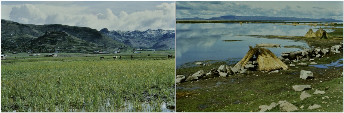
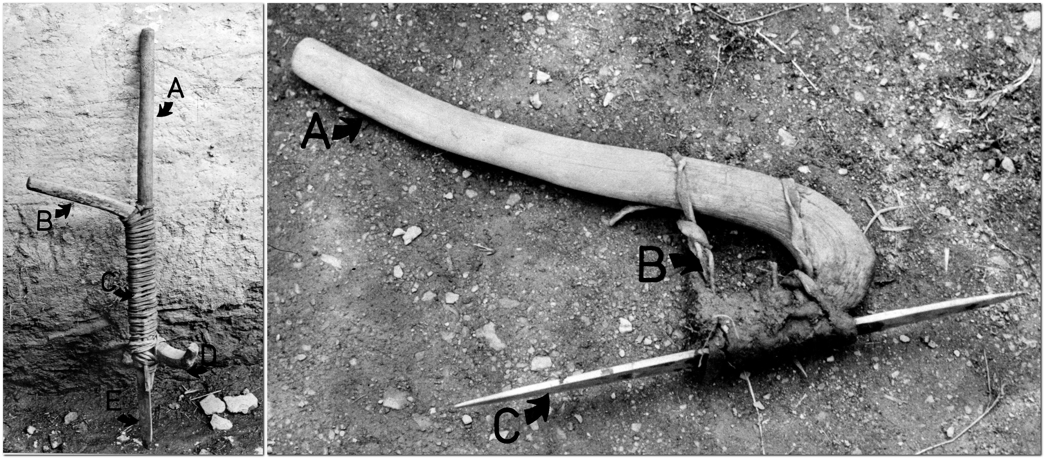
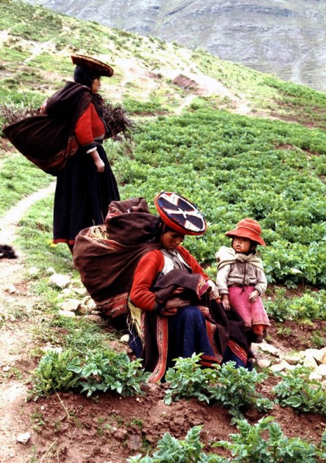
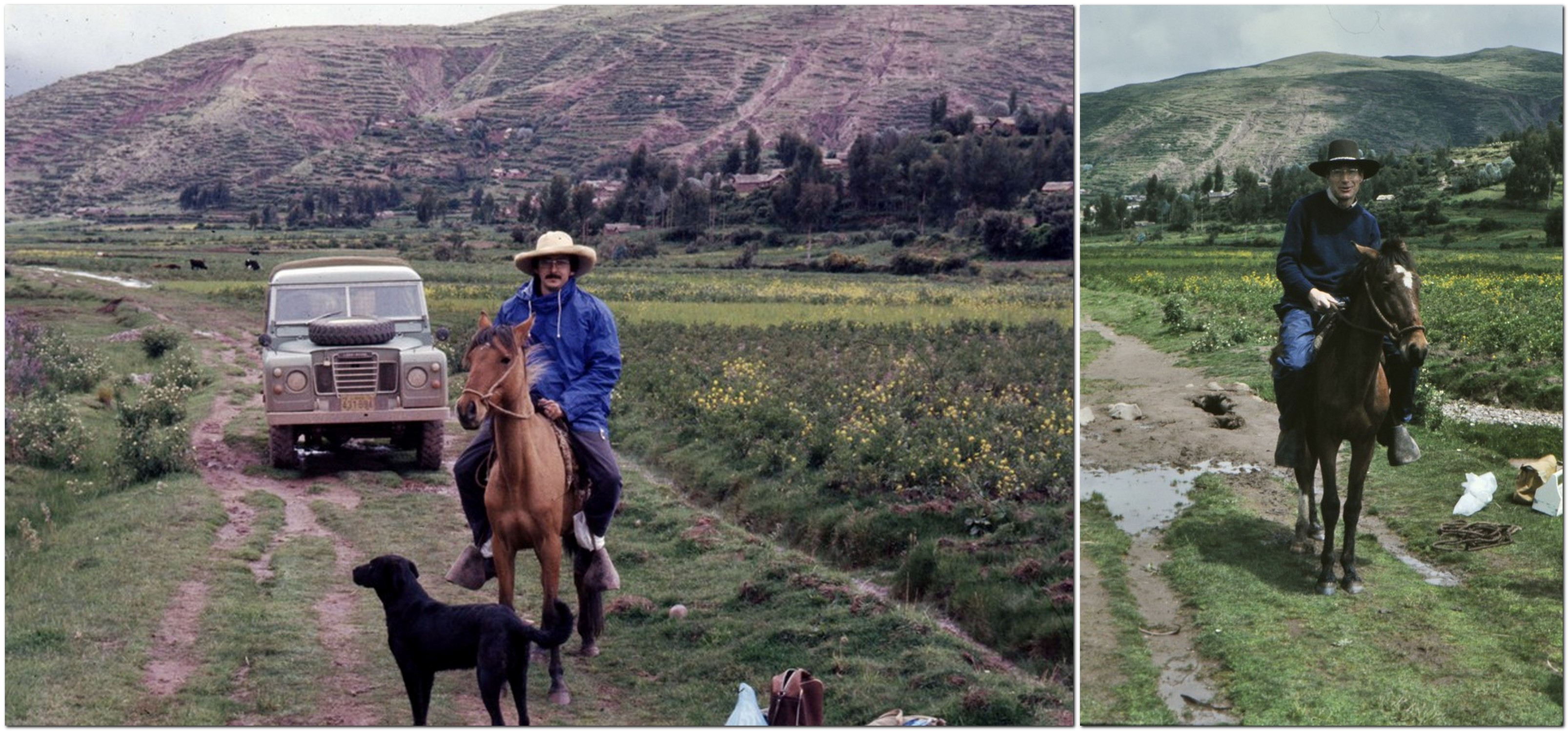
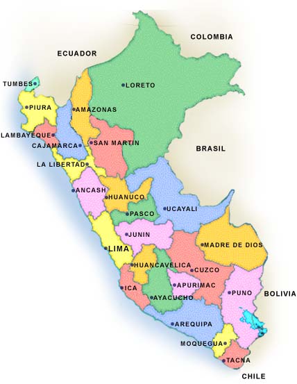
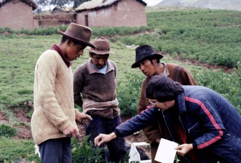
Field work complete, Peter and I spent a couple of days resting up in Cuzco before flying back to Lima. We left the Land Rover there for one of my colleagues Zósimo Huamán to pick up, as he planned to undertake some fieldwork as well before driving back to Lima.

During the couple of days in Cuzco we paid a call on Prof. César Vargas, a renowned Peruvian botanist (and close friend of my PhD supervisor Jack Hawkes), who I’d met once before in January 1973 not long after I arrived in Peru. Prof Vargas’s daughter Martha studied for her MSc degree in botany at the University of St Andrews.

L to R: my wife Steph, Peter, and Martha Vargas

All in all, we had a successful field trip to the south of Peru. It’s hard to believe it all took place 45 years ago next month. But it remains, in my mind’s eye, quite a significant trip from the years I spent in Peru.


¹ Peter graduated in botany from the University of Liverpool, and completed his PhD in 1964 there under the supervision of Professor Vernon Heywood, who moved to the University of Reading to become head of that university’s Department of Botany a couple of years later. Peter and I had a lot to talk about, because in 1969-70, when I was an undergraduate at the University of Southampton, Vernon Heywood gave a series of 20 lectures on flowering plant taxonomy over 10 weeks to Southampton botanists, because Leslie Watson, Southampton’s taxonomy lecturer had moved to Australia. Vernon and I renewed our acquaintance some years later, in 1991, when he and I attended a genetic resources meeting at the Food and Agriculture Organization of the United Nations (FAO) in Rome just before I moved to the Philippines to join the International Rice Research Institute (IRRI).

² One interesting piece of information that didn’t make it into my thesis but which I remember clearly was the incidence of geophagy among some residents of Cuyo Cuyo. I was taken to a location where farmers would excavate small quantities of a hard clay, that would be ground to a powder and mixed with water to form a slurry or soft paste. They would then dip recently harvested boiled potatoes in the clay as this, apparently, would decrease the slightly ‘spicy’ flavor of some of the varieties. I’m not sure how widespread this behavior was, but it’s something that has stuck in my mind all these years. I think I once had photos but they are long lost, more’s the pity.

³ I completed my PhD in December 1975, and shortly afterwards moved to Costa Rica to continue working for CIP, in potato breeding and agronomy. I started to prepare three manuscripts from my thesis for publication in Euphytica. The first, on varietal diversity, was submitted in February 1977, and published later the same year. The second, on breeding relationships, was published in 1978, having been submitted in July 1977. The third, on the ethnobotany of potato cultivation in Cuyo Cuyo finally appeared in print in 1980, having been submitted to Euphytica in February 1979.

But Euphytica had not been the first choice for this third paper. I actually produced a manuscript for the journal Economic Botany, and it included more details of the cropping systems and varietal choices made by farmers. My paper was received by the journal and acknowledged, but then I heard nothing more, for months and months. Eventually I wrote to the editor asking about the status of my manuscript. And I received a very strange reply.

It seemed that the editor-in-chief had retired, and his replacement had found, on file, manuscripts that had been submitted up to 20 years earlier, but had never been published! I was asked how I wanted to proceed with my manuscript as there was no guarantee it would appear in print any time soon. But about the same time, I received a nice letter from the then editor of Euphytica, Dr AC Zeven, complimenting me on my PhD thesis (which he had read in the library at Wageningen University in the Netherlands) and encouraging me to publish my work on the ethnobotany of potatoes – if I hadn’t already done so. I withdrew my manuscript from Economic Botany, and after some reformatting to fit the Euphytica style, sent it to Dr Zeven. He requested some deletions of the more descriptive sections on ethnobotany, and published my paper in 1980.


One last thing: I also remember was the novel that Peter was reading throughout the trip. Watership Down by Richard Adams, first published in 1972, that went on to become a literary sensation. I did read it myself at some point, but whether I borrowed Peter’s copy immediately after the trip, or some time later, I don’t recall. I know I didn’t think it would become the phenomenon that it did. What do I know?


9 February 2023
Today I received the news that Peter passed away, at home in St Andrews, on 6 February. That would be almost 49 years to the day since we set out from Lima on our expedition to the south of Peru. Rest in peace, Peter.


A year full of heritage

Steph and I have been members of the National Trust since 2011. Following our first visit to one of the Trust’s properties in February that year (to Hanbury Hall, just 7 miles from home), we have tried each year to get out and about as often as we can. After 5 years membership, we were offered a special senior citizen joint membership: such great value for money; so many interesting houses, landscapes, and gardens to visit, and enjoy a cup of coffee (and an occasional flapjack) in one of the NT cafes.

These visits give purpose to our excursions. We’ve now explored 97 National Trust properties in England and Northern Ireland (as well as as few maintained by the National Trust for Scotland). And we have enjoyed many country walks as well around parkland and through gardens.

Click on the various links to open stories I have posted during the year, or an album of photos.

We are fortunate that close to us (we’re just south of Birmingham in northeast Worcestershire) there are half a dozen properties that take 30 minutes or less to reach. The closest is Hanbury Hall, and we often visit there to enjoy a walk around the park – four times this year – or take one of the many paths to the canal, up to Hanbury church, and back into the park. I particularly enjoy seeing how the parterre changes through the seasons. It is a very fine example.

The parterre at Hanbury in August

The other houses close to home are Charlecote Park ( in July), Croome (August), Packwood House (August), Baddesley Clinton (October), and Coughton Court (April and November).

Coughton Court in April

Our National Trust year began in February with a return visit to Newark Park, 58 miles south in Gloucestershire, to see the carpets of snowdrops, for which the garden is famous. We first visited the house in August 2015.

A week later we traveled 20 miles southwest from home to the birthplace of one of England’s greatest composers, Sir Edward Elgar. It was a sparkling day. We even managed a picnic! After visiting the house, The Firs, and the visitor center, we took the circular walk from the site that lasted about 1 hour. I found watching a short video about Elgar’s life to the accompaniment of Nimrod quite emotional.

Then a week later, we decided on a walk in the Wyre Forest, about 17 miles west from Bromsgrove, to find Knowles Mill, a derelict flour mill in the heart of the forest.

April saw us take in three properties (besides Coughton Court): Dudmaston (which we first visited in 2013); Kinwarton Dovecote; and Southwell Workhouse (a fascinating visit).

In May, I had to obtain an international driving permit, and the closest post office was in the center of Birmingham. That was just the excuse we needed to book a tour of the Back-to-Backs on the corner of Inge and Hurst Streets. What an eye-opener, and one NT property that should be on everyone’s bucket list.

Closer to home, in fact less than 4 miles from home, is Rosedene, a Chartist cottage that was one of a number erected in the area of Dodford in the 19th century. It’s open infrequently, so looking to the weather forecast we booked to view the property on Sunday morning. Unfortunately, the NT guides were unable to unlock the front door, so we never got to see inside, just peer through the windows.

We had returned to Upton House in Warwickshire at the beginning of the month to enjoy the walk along the escarpment overlooking the site of the 1642 Battle of Edgehill, and then around the garden. We had first visited in July 2012.

We were away in the USA during June and July, and just made some local visits in August. We were preparing for a week of NT and English Heritage (EH) visits in Cornwall during the second week of September.

What a busy week! We stopped at Barrington Court in Somerset on the way south, and Knightshayes in Devon on the way home a week later. You can read about those visits here.

Barrington Court

Knightshayes

We visited four more houses in Cornwall: Lanhydrock, Cotehele, St Michael’s Mount, and Trerice, and I wrote about those visits here.

Then there were the coastal visits, to The Lizard, Cape Cornwall, and Levant Mine (check out the stories here).

While on the north coast (visiting Tintagel Castle – see below), we stopped by Tintagel Old Post Office.

Cornwall has some fine gardens, and we visited these: Glendurgan, Godolphin, Trelissick, and Trengwaintonread about them here.

October was a quiet month. I can’t remember if we took a walk at Hanbury, but we did enjoy a long one along the Heart of England Way at Baddesley Clinton.

November saw us in the northeast, with a return visit to Seaton Delaval Hall (that we first visited in August 2013), and also to Penshaw Monument that is such an imposing sight over the Durham-Tyneside landscape.

In mid-November it was 70th birthday, and Steph and I spent a long weekend in Liverpool. One of the highlights was a visit to the Beatles Childhood Homes of John Lennon and Paul McCartney – rather emotional.

We completed our National Trust year by enjoying Christmas at Coughton Court on 30 November.


We have been members of English Heritage (EH) since 2015. Our daughters gifted us membership at Christmas 2014. Witley Court in Worcestershire is the nearest property to home, and we have been visiting there since the 1980s when we first moved to Bromsgrove. But not during 2108. Here’s a story from September 2017.

In April we were in the northeast and enjoyed a visit to Warkworth Castle near Alnwick on the Northumberland coast (map) with grandsons Elvis and Felix. Since it was close to St George’s Day, there was a tournament entertainment for the children.

Warkworth Castle

While in the northeast, we visited Rievaulx Abbey, somewhere I had first visited as a student in the summer of 1968, and then again in the mid-1980s on holiday with the family on the Yorkshire coast.

Towards the South Transept and the east end of the church from the southeast.

During our trip to Cornwall in September, we got to visit Chysauster Ancient Village, Pendennis Castle, Restormel Castle, and Tintagel Castle, which I have written about here.

The steps leading up to the castle gate.

Then in November, on the way home from Newcastle, we stopped off at Mount Grace Priory, that is owned by the National Trust but managed by English Heritage.

It was a bright and calm November morning, lots of color in the trees, and we were enchanted by the peace of this wonderful site. On our trips to Newcastle we have passed the entrance to the Priory many times, but never had found the time (or the weather) to stop off. It was well worth the wait.


This has been our heritage 2018. We have barely scratched the surface of NT and EH properties. We look forward to spreading our wings further afield in 2019.

With The Beatles . . .

Last weekend, Steph and I spent a couple of days in Liverpool where, in the 1960s, there was an explosion of musical talent—the ‘Mersey Sound‘ (a somewhat patronizing video)—that had been influenced by and built on the late 1950s skiffle music of Lonnie Donegan, among others.

The greatest among greats to emerge from the ‘Mersey Sound’ have to be The Beatles – Paul McCartney, George Harrison, Ringo Starr, and John Lennon.

It was my 70th birthday on the 18th and, in celebration, we planned this special trip to Liverpool to take in The Beatles’ Childhood Homes and The Beatles Story, among other sights. A full album of photos can be viewed here.

We originally intended to drive to Liverpool. Not difficult in itself, you might imagine: a mere 109 miles. But as most of that journey is along the notorious M6 motorway, potentially it would have been 109 miles of traffic hassle, and long stretches of roadworks. And although the weather has been quite mild recently, November can be foggy and frosty. These were the points we considered when finalizing our travel plans in late August. So we opted to travel by rail from Bromsgrove to Liverpool-Lime Street (via Birmingham New Street).

As it turned out, we had a weekend of the most wonderful weather—clear skies, bright and sunny. No rain whatsoever.

Although our train from Birmingham departed about 20 minutes late, we still arrived to Lime Street before 13:00, and after a 20 minute walk to the hotel, we were out and about exploring well before 14:00.

Our hotel was the 4-star Jurys Inn, located right on the Liverpool Waterfront, just across the road from the Royal Albert Dock, home to The Beatles Story. It was also starting point for the National Trust tour of The Beatles’ Childhood Homes. Right beside the hotel are the 60 m (196 ft) Wheel of Liverpool, the Echo Arena, and convention centre.

We used Emirates Airlines airmiles (Rocketmiles) that were about to expire and a small cash supplement to pay for the hotel.


To begin with, let me take you back to late June 1967.

Just a month earlier, The Beatles had released their eighth and iconic Sgt. Pepper’s Lonely Hearts Club Band album. Little did I realize then that I’d be regularly visiting the home of The Beatles in the coming weeks.

Having just left school, I was waiting for my exam results and hoping I’d done well enough to secure a coveted place to study botany and geography, from October, at The University of Southampton. As I couldn’t spend the summer kicking my heels around my parent’s home, I found a temporary job for the next couple of months working for a local Leek company, Adams Butter (which I’ve written about elsewhere), as driver’s mate on the company’s fleet of trucks.

Adams Butter took raw, unsalted butter (mostly from Australia and New Zealand), blended and packed it into household packs, and distributed it to supermarkets and other retail outlets all over the country. Having emptied a truck of 25 tons of butter (in 26lb boxes), we’d head off to the nearest port to load up with another 25 tons of frozen butter, in 56lb boxes, to transport back to the dairy in Leek.

That first week saw me in Liverpool twice, and over eight or nine weeks or so, I must have gone back there a dozen times or more. But I haven’t been back there since, apart from a half-day visit around 2000, when I was invited to give a seminar at The University of Liverpool. Until last weekend, that is.

Fifty years on and Liverpool is a transformed city. Gone is the frenetic activity of the docks; there were no containers then. Once the River Mersey and port were bustling with ships from all over the world; a huge labor force of dockers manhandled produce off the ships. By the 1980s many of the docks along the Liverpool Waterfront were closed, and warehouses were derelict.

Now the Waterfront is a World Heritage Site, a place for everyone to enjoy. And also home to The Beatles Story, Tate Liverpool, the Museum of Liverpool, shops, cafes, and restaurants. During our visit, there were funfair rides set up along the Waterfront, as well as an ice rink, and some sections of the German market, all part of Liverpool’s run up to Christmas.


Our tour of the Beatles’ Childhood Homes started at 10:00 when the National Trust driver, Joe, met us in the lobby of Jurys Inn. We were an international party of just 13 persons (5 UK, 1 Irish, I Czech, I French, 1 Maltese, 1 Australian, and 3 Malaysian). The drive to the first property, John Lennon’s home, took just over 15 minutes. Once we were all strapped in and ready for the off, Joe turned on the music: Love Me Do, and it was Beatles songs all throughout the tour. What a way to start! And, as it turned out, three quite emotional hours.

‘Mendips’. 251 Menlove Avenue, Woolton (a desirable suburb of Liverpool) is a 1930s semi-detached house (that has retained many of its original design features). John was born in October 1940. When his mother Julia separated from father Alfred in 1945, John went to live with Julia’s oldest sister Mimi and her husband George at ‘Mendips’. It was felt that a two-room flat in a rough part of the city near the cathedral was not a suitable place to raise a young boy.

It seems that John had limited contact with Julia as he was growing up. But by the time he was 17 (in 1958), he had begun to see her more regularly. Tragically, however, she was hit by a car on Menlove Avenue, and died from her injuries. She was just 44.
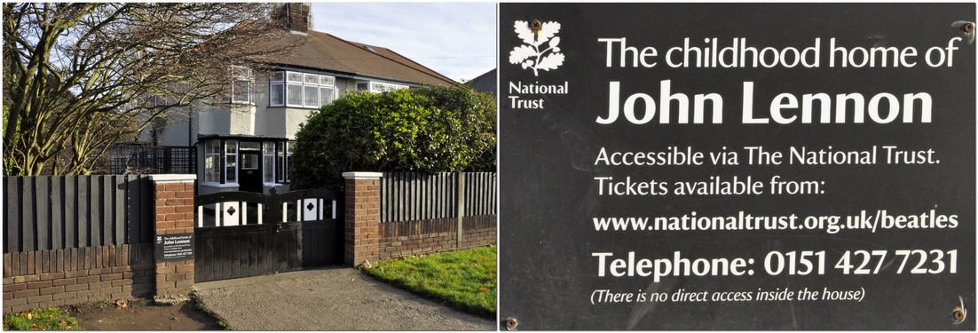
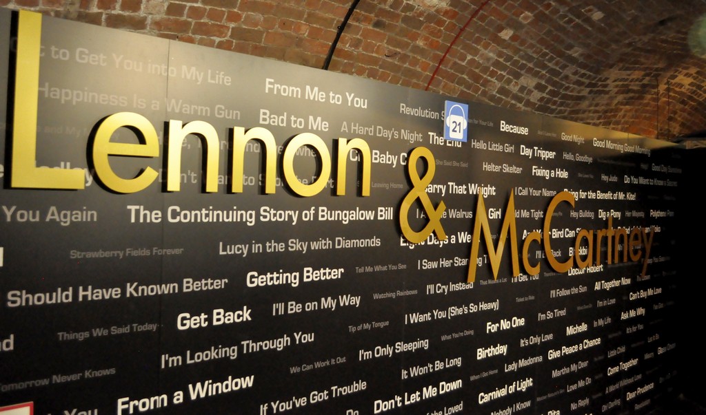
I have no photographs inside the house. As with the McCartney home, visitors’ cameras and mobile phones are locked away for the duration of their visit. It’s both for security and copyright reasons.

It was a powerful and emotional experience walking round John’s childhood home. I could feel a tear or two welling up every now and then. There were his school reports and lots of photos; also his bedroom where he wrote some of his early songs. And the porch where he and Paul tried out some of their songs. The National Trust guide encouraged us to go into the porch to test the acoustics. I didn’t sing but just clapped my hands; the acoustics were excellent. Apparently Paul has said he’d like to record some songs there.

John bought a bungalow for Aunt Mimi in Sandbanks in Dorset. ‘Mendips’ was never modernized after Aunt Mimi moved out. When the house came on the market in 2002, it was purchased by Yoko Ono and donated to the National Trust. The letter that Yoko Ono wrote to the National Trust explaining why she had bought the house is framed and lies on John’s bed.

On another level it was emotional for Steph in particular. So much of the layout and features of ‘Mendips’ reminded her of 30 Hillway, her parents’ home in Westcliff-on-Sea, Essex. That was a 1930s detached house.

We came away from ‘Mendips’ after an hour, to head to the McCartney home at 20 Forthlin Road, Allerton [1], just over a mile west from John’s house. John would visit Paul on his bicycle, cutting across the Allerton Manor Golf Club.

20 Forthlin Road is a terraced, former council house, to which the McCartney family, dad Jim, mother Mary, Paul, and younger brother Mike (Mike McGear) moved in 1956, from their home in the Speke. Forthlin Road was a step up.

Initially Paul and Mike shared a bedroom, but Paul eventually moved into a small front bedroom on his own. He continued to live there until 1963, after the other Beatles had already moved to London, and the band were already becoming a phenomenon.

Sitting in the front parlor, our guide Sylvia told us about how the McCartney family would make music together around the piano (I’m not sure if the piano there today is the original, but I think so; I tinkled the ivories), and singing in harmony. So when The Beatles started recording, singing in harmony with John was second nature to Paul (just watch the We Can Work It Out video at the end of this post). Paul originally played the trumpet, but dropped it to learn the guitar – which he had to modify and re-string because he is left-handed.

Paul’s mother Mary passed away from cancer in 1956, aged 47. Paul wrote Let It Be as a tribute to his mother.
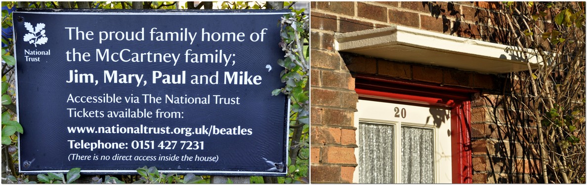
Dad Jim raised the boys with the help of relatives including Uncle Albert (remembered on Paul and Linda McCartney’s album Ram, released in 1971). Paul bought his father a house across the Mersey on the Wirral to which he retired; Paul still owns the house and uses it when visiting Liverpool.

Around No 20 there are many original and iconic photos of Paul and John writing and singing their songs in the same front parlor where we were sitting, taken by Paul’s brother Mike (who has the copyright, this being the reason why photography is not permitted inside).

Then after an hour there, we traveled back to Jurys Inn, to the accompaniment of more Beatles songs. What a marvellous way to spend the morning of my 70th birthday!


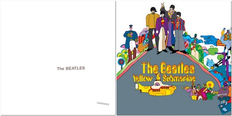
After a reviving cup of tea back at the hotel, we crossed the road to visit The Beatles Story exhibition. The story of The Beatles is told there through displays of memorabilia and photographs; it opened in May 1990.

From an early date until sometime in the past year, one particular display near the entrance explained the influence of the 1950s skiffle movement on The Beatles’ early musical careers. John Lennon played in a skiffle group called The Quarrymen which Paul McCartney and George Harrison later joined.

The display in question showed two boys, my elder brother Ed and me, playing guitar and tea-chest bass, entertaining our mother and two friends, Geoff and Susan Sharratt. That display has now been taken down, so I never got to see myself in The Beatles Story. But here’s my great-nephew Sammy standing in front of the display a year or so back.

The exhibition takes you through the band’s time in Hamburg at the turn of the sixties, their ‘residence’ at The Cavern, and onwards through their worldwide success.

There are so many iconic things to see and read about. It’s quite overwhelming. Here’s just a small selection; you can also see many more photos in the album I mentioned earlier.


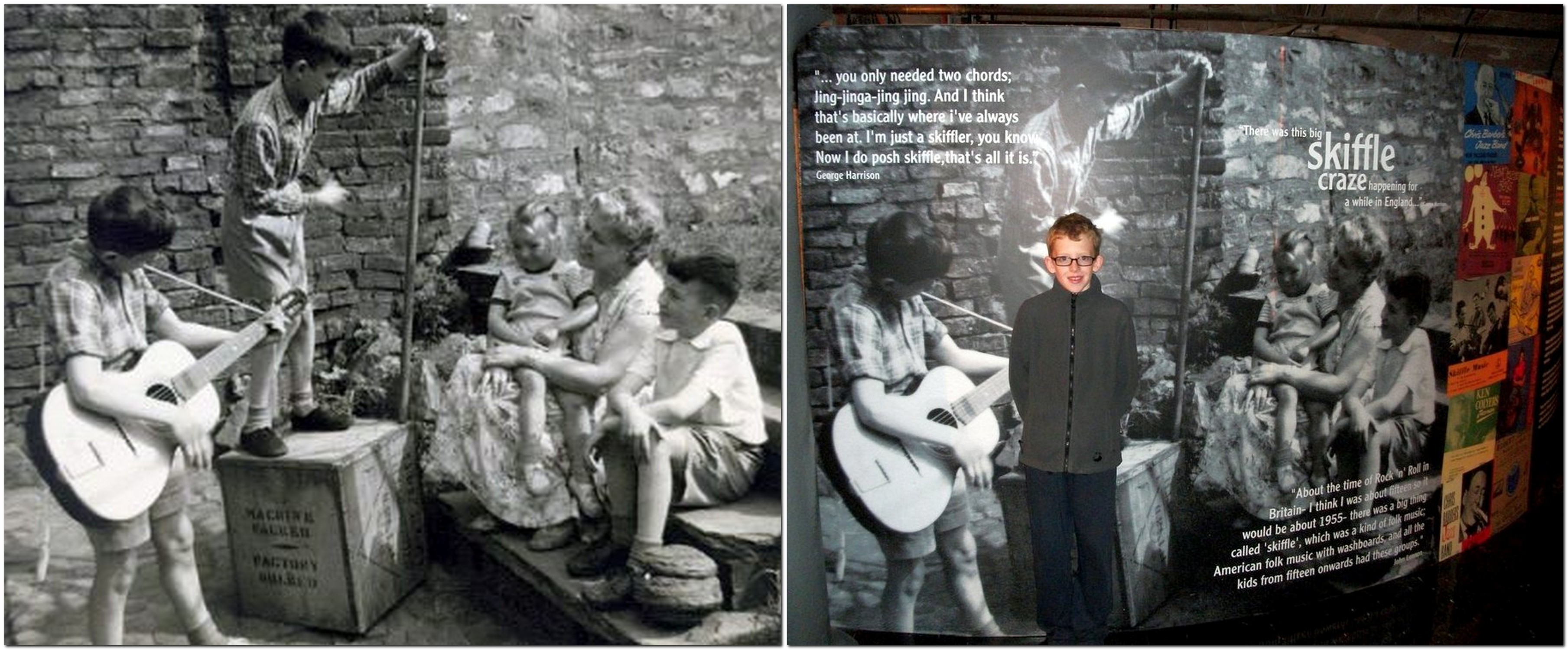
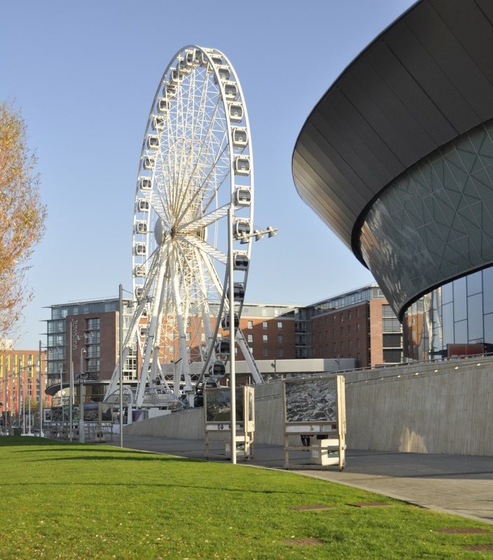
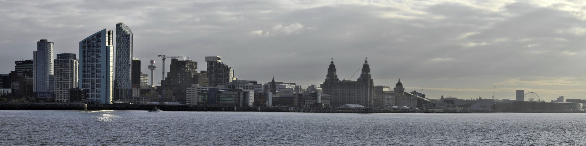
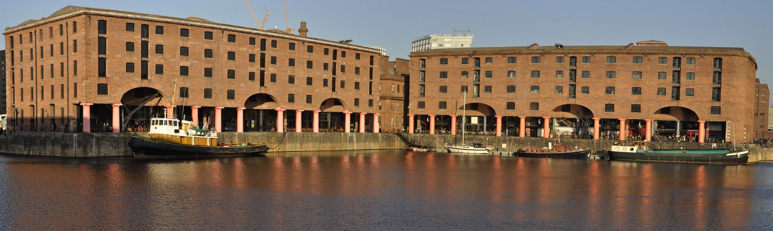
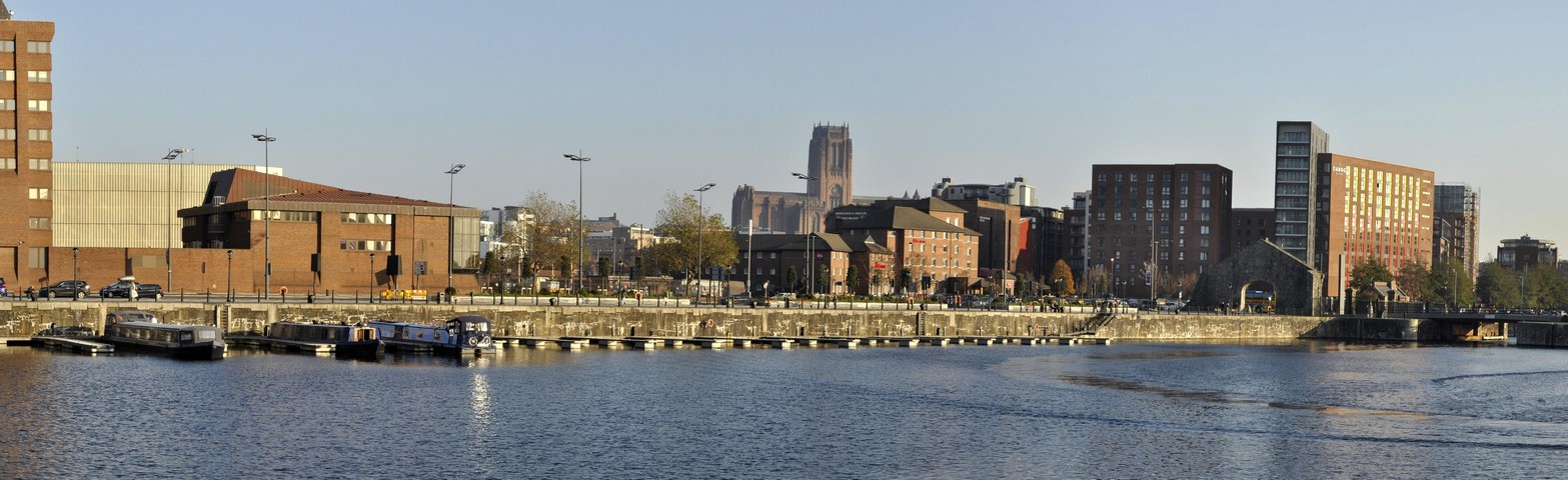
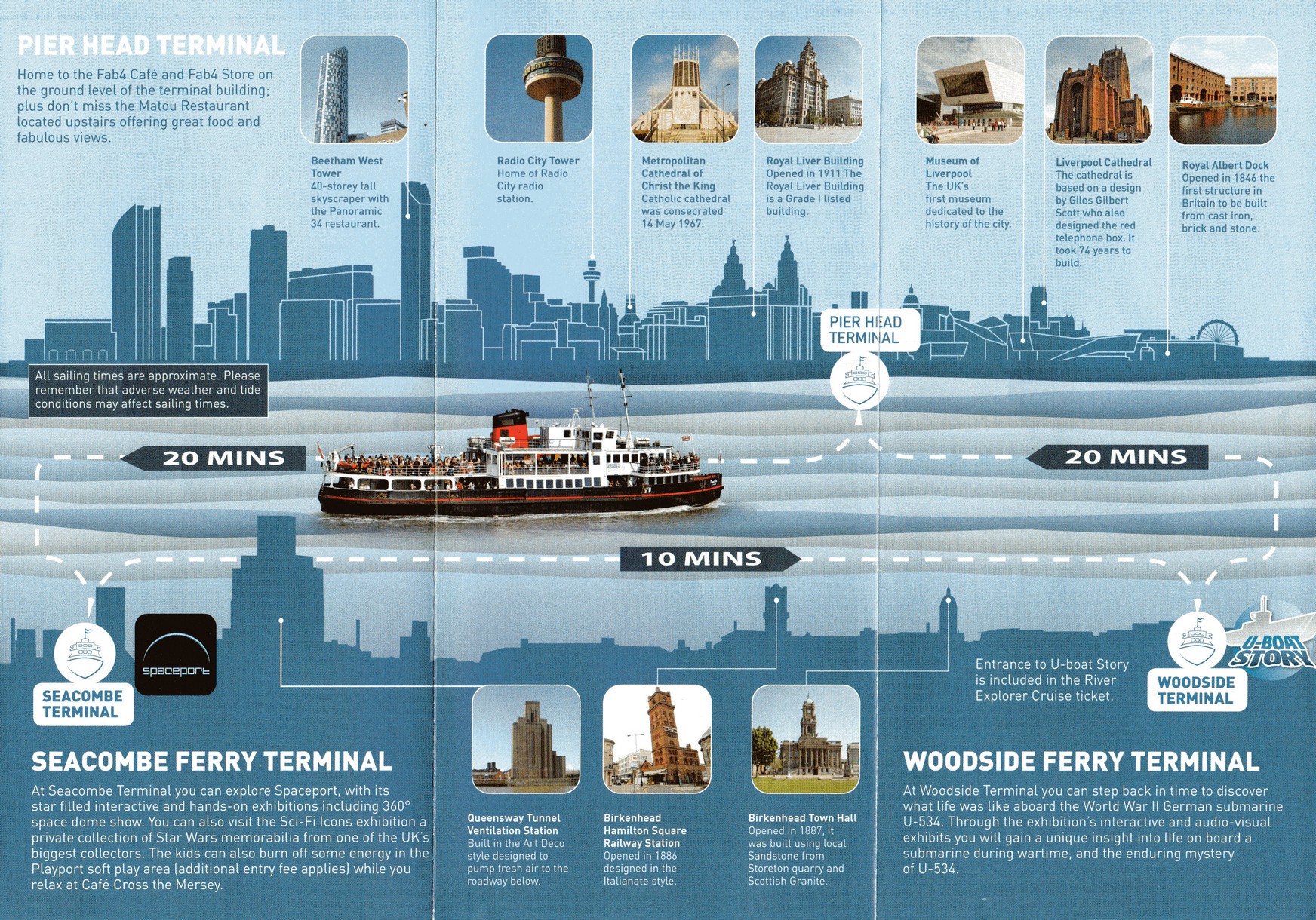
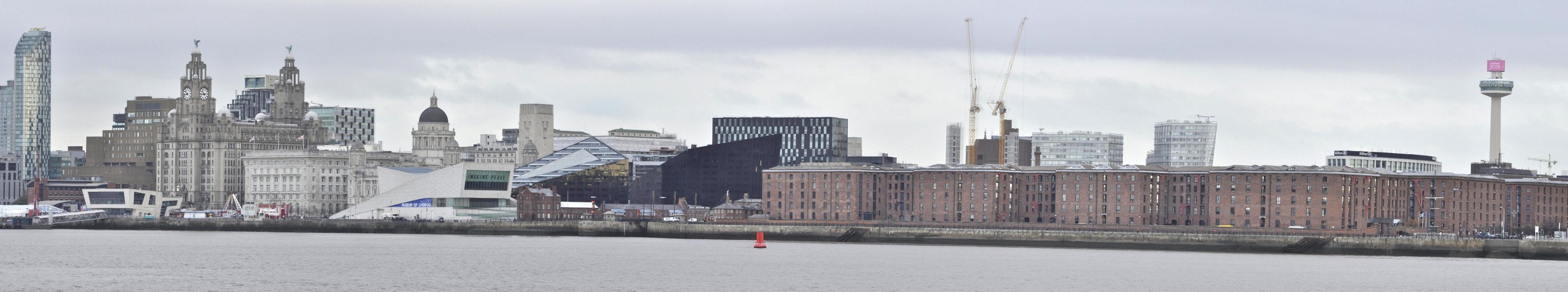
We returned home to Bromsgrove just after noon on Monday. But before that, we took a 50 minute river cruise on the Mersey ferry, Royal Iris, from the Pier Head Terminal, across to the Seacombe Terminal on the Wirral, and then to Woodside Terminal at Birkenhead, before returning to the Pier Head. Here’s a short video I made, with Gerry & The Pacemakers (courtesy of a YouTube video) providing the appropriate soundtrack.

It was a relaxing way to enjoy the Liverpool skyline. And the weather still kept fine for us even though the cloud built up later, and there was some rain before we departed from Liverpool.

Then it was a brisk walk back to Lime Street in time to catch our train just after 12:30.

We arrived home, on time, just after 15:30, and there was a very nice surprise waiting. My bank had sent me a bottle of Moët & Chandon Impérial Brut champagne for my 70th! What a treat to end a great weekend. I can’t stop singing all those Beatles songs.

But there is a postscript to this Beatles adventure . . .


Fifty years ago today, 22 November, The Beatles released their ninth studio album, The Beatlesalso known as the White Album.

Many of the songs that appeared on this album (and some on Abbey Road in 1969) were penned while The Beatles were experimenting with transcendental meditation under the Maharishi Mahesh Yogi at his ashram in Rishikesh, India.

In 1968 (just a couple of months into my second year at the University of Southampton), I celebrated my 20th birthday by purchasing a copy of the White Album, which I had pre-ordered some weeks earlier. I believe I was the first person in our student residence, South Stoneham House, to have a copy. Word soon got around and it wasn’t long before my room on the 13th floor became the focus of White Album sessions.

This is how the album was reviewed in 1968; here is a current reappraisal. A re-mastered version of the album was released just over a week ago.

You can hear more about Giles Martin’s work on the album here.

What’s your favorite track? There are so many to choose from. But if I had to name just one, it has to be George Harrison’s While My Guitar Gently Weeps, on which Eric Clapton was invited by George to play a solo.

Anyway, enjoy this ethereal version that was released on Love – a 2006 remix album (by George Martin and son Giles) that accompanied a Cirque du Soleil show of the same name.

In the ultimate tribute to George Harrison, here is a multi-talented band, led by two of Harrison’s Traveling Wilburys band mates, Jeff Lynne and the late Tom Petty (and including Harrison’s son Dhani), interpreting this song; there’s a superb guitar solo from Prince.


The first Beatles vinyl I bought was Rubber Soul, released in December 1965. I remember that quite distinctly, because I held a small Christmas party for school friends in Leek, and Rubber Soul was the soul of that party.

I never owned the early albums. I didn’t really like their music until A Hard Day’s Night was released in 1964. After Rubber Soul, I acquired all the other albums on vinyl, but these were lost in a burglary in 1978 when we lived in Turrialba, Costa Rica. I replaced them on CD in the 1990s.

Compared to modern bands, look at how prolific The Beatles were, given the short periods between release dates of their albums. These are the albums I currently have.

Released in July 1964 and August 1965

Released in December 1965 and August 1966

Released in May 1967 and November 1967

Released in November 1968 and January 1969

Released in September 1969 and May 1970

And I also have these two compilations: Past Masters Vol. 2 and Love that I have already referred earlier.

Released in March 1988 and November 2006

No-one can deny the genius that is Sgt. Pepper’s Lonely Hearts Club Band. But if I had to choose just one album, I think it would be Revolver. And an overall favorite Beatles track? Probably We Can Work It Out (although I don’t like the ending particularly) that was released on a double A-side single (with Day Tripper) in December 1965 (and features on Past Masters Volume 2).

Happy memories!


[1] 2 August 2020. I came across this video today on the Facebook page of a former IRRI colleague. It’s James Corden’s Carpool Karaoke with Paul McCartney, driving around Liverpool, and ending up at Paul’s childhood home. It’s great to see and hear Paul describe his early years there. And playing on the piano in the front parlor (on which even I managed to touch the ivories).

Three score and ten . . .

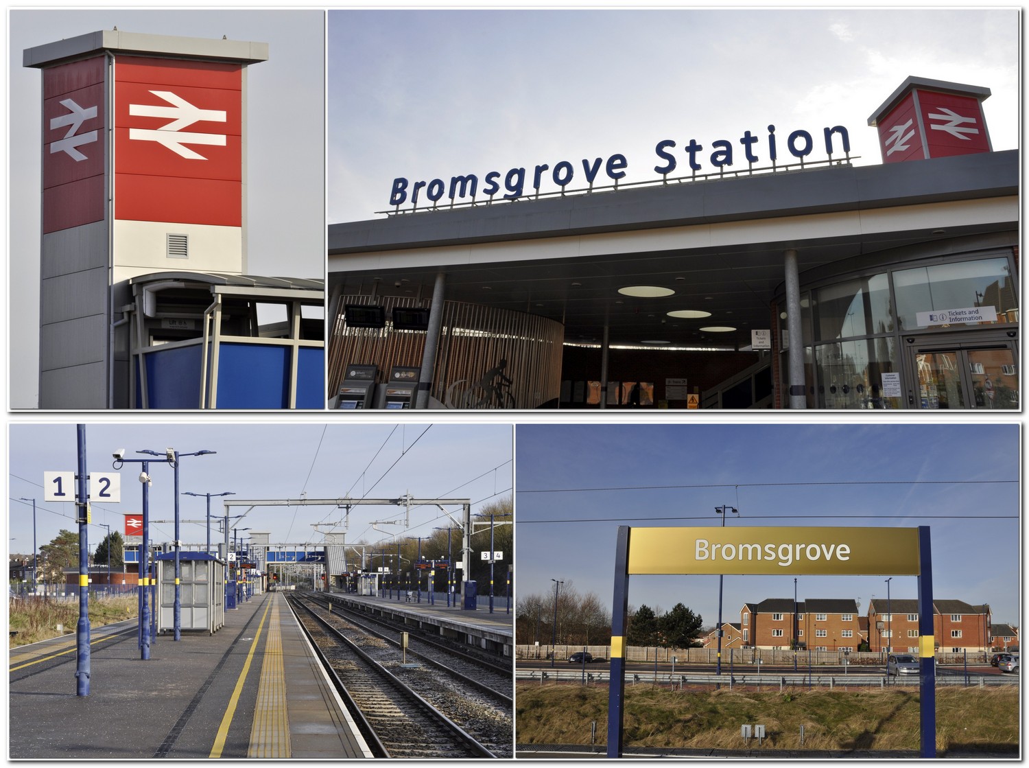
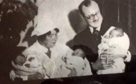
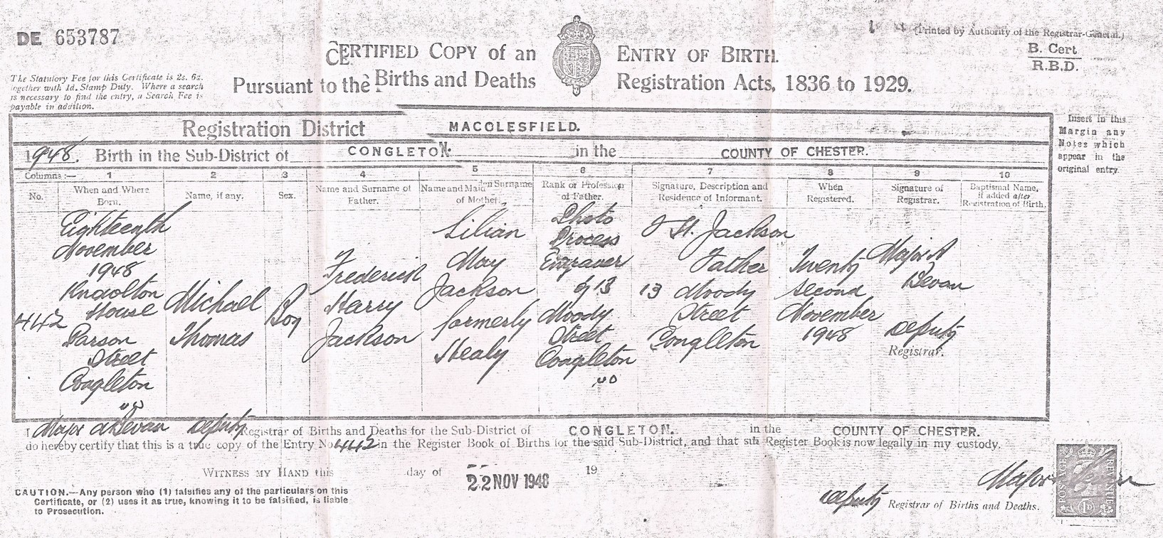
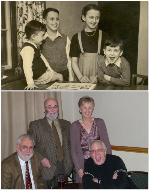
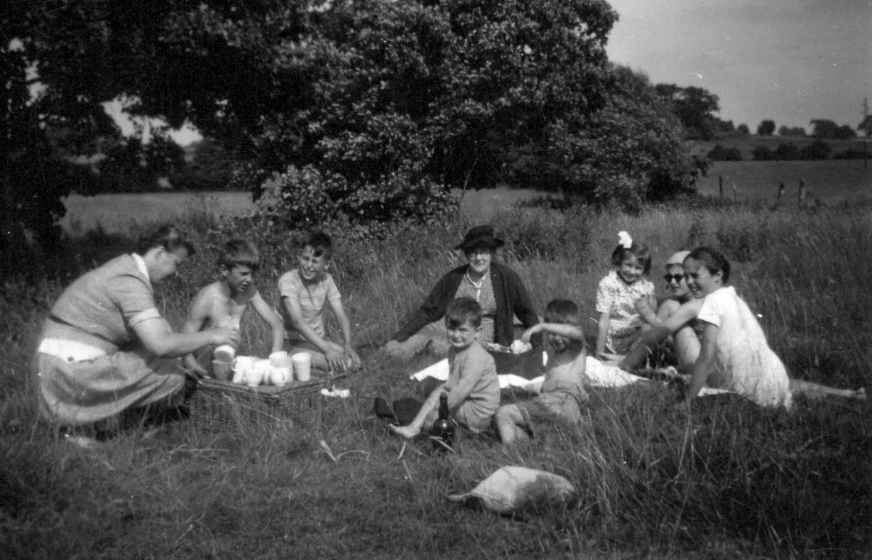
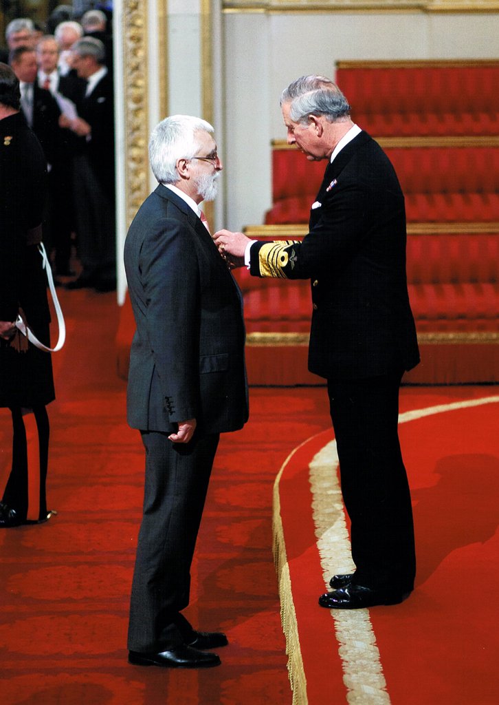
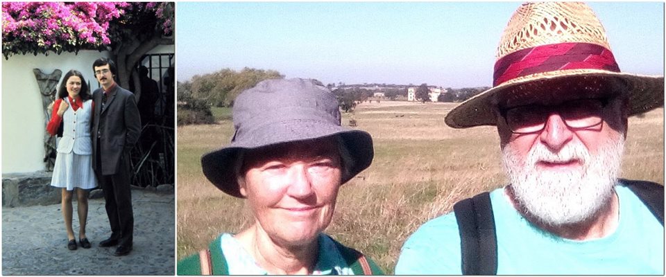
18 November 1948. Today is my 70th birthday. Septuagenarian. The Biblical three score and ten (Psalm 90:10)!

Steph and I have come away for the weekend to celebrate my birthday with The Beatles in Liverpool.

We are staying for a couple of nights at Jurys Inn close to the Albert Dock. Later this morning we’ve booked to visit the National Trust-owned Beatles’ Childhood Homes (of John Lennon and Paul McCartney). And after lunch, we will tour The Beatles Story where I’m hoping to see, displayed there, something special from my childhood.

How the years have flown by. Just a month ago, Steph and I celebrated our 45th wedding anniversary. And I find it hard to believe that I started university over 50 years ago.

That got me thinking. I’ve written quite a lot in this blog about the years after I graduated, my time working overseas, about travel, and what Steph and I have been up to since retiring in 2010.

However, I written much less about my early years growing up in Cheshire and Staffordshire. This is then an appropriate moment to fill some gaps.

A son of Cheshire
I was born in Knowlton House nursing home in Congleton, Cheshire (map), third son and fourth and youngest child of Frederick Harry Jackson (aged 40), a photo process engraver, and Lilian May Jackson, also aged 40, housewife.

Mum and Dad, around 1959/60 after we had moved to Leek

My eldest brother Martin has been able to trace our family’s ancestry (mainly on my father’s side) back to someone named Bull, who was my 13th great-grandfather, born around 1480 on the Staffordshire/ Derbyshire border, just one of my 32,000 plus direct ancestors then. I must be related to royalty in one way or another (as are most of us), although looking at the occupations noted for many of them in various official documents (birth and marriage certificates, census data), we came a long way down the pecking order. Definitely below the salt! We’re Irish on my mother’s side of the family.

A punk before it was fashionable!

I am also a child of the National Health Service (NHS) that was founded in July 1948. In fact, I’m (approximately) the 190,063rd baby born under the NHS!

Knowlton House on Parson Street in Congleton – it’s no longer a nursing home.

I wonder who assisted at my birth? It could well have been our family Dr Galbraith, or Nurses Frost and Botting.

Dr Galbraith (R) was our family doctor, who (with his partner Dr Ritchie) often attended births at Knowlton House, and is seen here with resident midwife Nurse Rose Hannah Frost, who assisted at more than 3000 births. There is a very good chance either Nurse Frost or Nurse May Botting (who ran the nursing home) assisted at my birth. In this photo from 1936, Dr Galbraith and Nurse Frost are holding the Nixon triplets. Photo courtesy of Alan Nixon, who was apparently named after Dr Galbraith.

My dad registered my birth¹ on 22 November (Entry No. 442). There are few ‘Michaels’ in the family; Thomas is my paternal grandfather’s name.

My eldest brother Martin was born in September 1939, just a couple of days before war was declared on Germany. My sister Margaret was born in January 1941. Martin and Margaret spent much of WWII with my paternal grandparents in rural Derbyshire. My elder brother Edgar (‘Ed’) is, like me, one of the baby boomer generation, born in July 1946.

The difference of around 55 years – 1951/52 and 2006

I’ve often wondered what sacrifices Mum and Dad had to make to give us all such a good start in life.

Growing up in Congleton, we lived at 13 Moody Street, close to the town center’s High Street.

There’s not much to tell about my first couple of years, other than what I can surmise from a few photographs taken around that time when I was still in my pram or just beginning to walk. Two things I do remember clearly, though. The hens my father used to keep, and even the large henhouse he constructed at the bottom of the garden. And our female cat, Mitten, and all her kittens. That must have been the start of becoming an ailurophile (cat lover).

My best friend was Alan Brennan, a year younger, who lived a little further up Moody Street at No. 23 (and with whom I reconnected through this blog, after a gap of around 60 years!).

With Alan and his parents (and friends) at Timbersbrook, in 1955. I clearly remember Mr Brennan’s Vauxhall car – a Wyvern I believe.

We didn’t go to the same primary school. Like my brothers and sister before me, I was enrolled (in September 1952 or April 1953, maybe as late as September 1953) at the small Church of England school on Leek Road in Mossley, south of the town. By then, Martin had moved on to grammar school in Macclesfield; Margaret had also transferred to secondary school in Congleton.

Each morning, Ed and I would catch the bus in the High Street together for the short, 1½ mile ride to Mossley. And even as young as five, I would sometimes walk home alone from school during the summer months, along Leek Road and Canal Road/Street. How times change!

I remember the headteacher, Mr Morris, as a kind person. My class teachers were Mrs Bickerton (on the left) and Mrs Johnson (on the right). Courtesy of Liz Campion.

There was a real community of children around Moody Street, Howie Lane/Hill, and Priesty Fields. In summer, we’d all wander up to play on the swing bridge over the Macclesfield Canal (beyond the cemetery – where we would also play in a WWII air raid shelter). The bridge has long been replaced, but from comments on a Congleton Facebook group I belong to, it seems that over the generations, many children enjoyed the swing bridge as much as we did.

In winter, we had fun in the snow at Priesty Fields just round the corner from Moody St. And, as you can see below, we enjoyed dressing up. Happy days!

In the upper image, taken on Coronation Day in 1953, I’m fifth from the right (carrying the stick). Alan Brennan is the little by to the left of the ‘clown’, and in front of the ‘pirate’, my elder brother Ed. The lower image was taken on May Day, probably 1953 or 54. I’m on the left, carrying the sword, uncertain whether to be a knight or a cowboy.

c. 1955. L-R: Veronica George, Carol Brennan, Jessica George, my elder brother Ed, me, Margaret Moulton, and Alan Brennan. Taken in the garden of No 13 Moody St. The George sisters lived at No. 21 Moody St.

I often joined my father when he went out on photographic assignments for the Congleton Chronicle (where he was Chief Photographer), often to Biddulph Grange when it was an orthopedic hospital, also to Astbury, and out into the beautiful Cheshire countryside.

I remember one outing in particular, to Little Moreton Hall in May 1954. This is my father’s photo of Manley Morris Men dancing there, an image that stuck in my mind for many years. So much so that when I went to university in the later 1960s, I helped form a morris dancing side, the Red Stags, that’s still going strong (albeit in a slightly different form) 50 years later.

The Manley Morris Men at Little Moreton Hall on 8 May 1954.

For family holidays I remember those in North Wales, at a caravan park or, on one occasion, a camping coach, a converted railway carriage alongside the mainline to Holyhead next to the beach at Abergele.

During these early years, until July 1954, rationing was still in place that had come into effect at the start of the Second World War. I often wonder how my parents managed to raise four children during these difficult years. One thing I do recall, however, is how we shared things, particularly confectionery. No individual treats. My father would buy a Mars bar (I’m sure they were bigger then) and cut it into six pieces. Funny how these things stick in one’s memory.


The move to Leek
April 1956. A big change in my life. My family upped sticks and moved 12 miles southeast to the market town of Leek in north Staffordshire, where my father took over a retail photography business. As I was only 7½ when we moved, I’ve come to regard Leek as my home town. My parents lived there for the rest of their lives. My father passed away in 1980, and after my mother had a stroke in 1990, only then did she move away from Leek to spend her last couple of years in a care home near my sister in South Wales.

We lived at No. 65, St Edward Street, and within a couple of days of arriving there, I’d made friends with three boys who lived close by: Philip Porter (next door), Geoff Sharratt – whose father was publican at The Quiet Woman pub a few doors away, and David Phillips who lived over the road. Geoff’s younger sister Susan sometimes joined in our games, as did Philip’s sister Jill. We were the ‘St Edward Street Gang’.

Here we are in the late 1950s (probably 1958), in the yard of The Quiet Woman pub. L-R: Sue, Geoff, me, Philip, and Dave. And again in 2018.

Geoff was my best friend, and we spent a lot of time playing together. There were several upstairs rooms at The Quiet Woman, one of which was the Lodge of the Royal Antediluvian Order of Buffaloes (RAOB, the Buffs, a fraternal organization somewhat similar to the Freemasons). During inclement weather, we often took refuge in the Lodge, playing among the benches and high chairs.

Playing with my Hornby ‘O’ gauge clockwork train at ‘Congleton’ station – it would be a collectors’ item today. Taken around 1958.

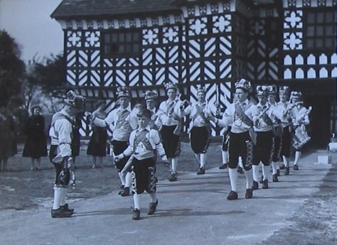
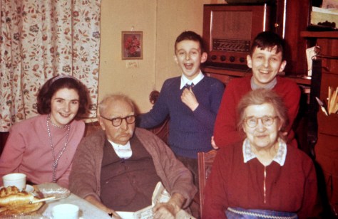
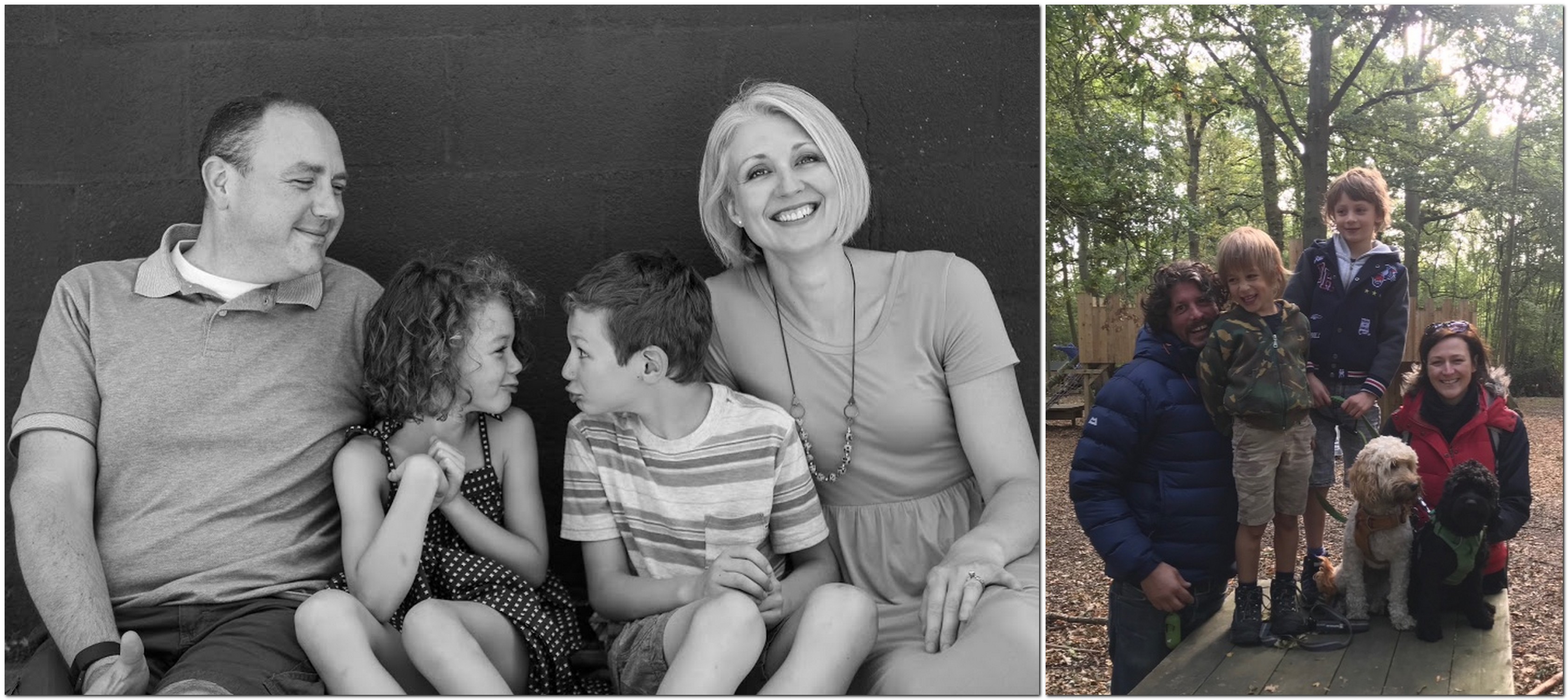
I was also a cub scout, as was Ed.

Around 1960, the lease on No. 65 came due, so my father decided to to find a better location for his business. First, he moved across St Edward’s St to No. 56 (while we lived in a flat at the top of the Market Place). In 1962/63 my father acquired No. 19 Market Place as premises for his photographic business, with living accommodation above. This was just what he had been looking for, centrally located in the town, lots of footfall. But the whole property had to be refurbished; there was only one water tap – in the cellar. He did much of the refurbishment himself. I’ve never ceased to be amazed at his DIY talents, something I sadly have not inherited to the same degree. My parents remained at No. 19 until they retired in 1976.

Sandwiched between Jackson the Optician (no relation) on the left, and Victoria Wine on the right, No 19 Market Place was my parents home for 14 years.

Around the same time, Geoff’s parents left The Quiet Woman and moved elsewhere in the town. I was also traveling every day to school to Trent Vale on the south side of Stoke-on-Trent (a round trip of about 28 miles), while Geoff continued his education in Leek. As a consequence, we drifted apart, but through my blog we reconnected in 2012.

Mr Smith

My mother’s family were Irish Catholics, and although we had not been brought up in the faith while in Congleton, both Ed and myself were enrolled in St. Mary’s RC primary school on Cruso Street, a short walk away from home. We were taught by Sisters of Loreto nuns. Headmistress Mother Elizabeth or my class teacher, Mother Bernadine, were never averse to wrapping us across the knuckles with the sharp edge of a ruler. In my final year at St Mary’s (1959-60), we were taught by Mr Smith. But my recollections don’t tally so much with many others who also attended St Mary’s. And I have been horrified at some accounts of how unhappy they were at the school in the 1950s and 60s.

In the late 50s and early 60s, just Ed and I would join our parents for holidays in Wales, most often camping or in our own caravan.

Some of my happiest memories though come from our visits to my grandparents² (my father’s parents) in Hollington, a small Derbyshire village between Ashbourne and Derby. My grandfather was almost 76 when I was born; Grandma was 68.

Family picnic at Hollington, c. 1952, with cousins. Grandma in the center, my mum is on the left. I’m center front ‘guarding’ the bottle.

With Grandad and Grandma Jackson, and our cousin Diana, c. 1959 at Ebenezer Cottage.

Grandma and Grandad celebrated their Golden Wedding in 1954, the occasion of a large gathering of family and friends in Hollington.


Enduring high school
I passed my 11 Plus exam to attend a Roman Catholic grammar school, St Joseph’s College, at Trent Vale on the south side of Stoke-on-Trent. Founded by Irish Christian Brothers in 1932, the school took boys only (but is now co-educational). I had to be on the bus by 07:50 each morning if I was to get to school by 09:00. This was my daily routine for the next seven years.

On reflection, I can’t say that I found the school experience satisfying or that the quality of the education I received was worth writing home about. Yes, there were some good teachers who I looked up to, but much of the teaching was pretty mediocre. I’ve written elsewhere about the gratuitous use of corporal punishment at the school.

Perhaps one of the school’s claims to fame was the priest who attended to our ‘spiritual needs’. He was Father John Tolkien, son JRR Tolkien, the author of Lord of the Rings and The Hobbit. My first impressions of Fr Tolkien were not favorable. He came across as cold and authoritarian. When I got to know him later on, however, I found he was a warm person with a good sense of humor. I was saddened to learn that his last years were blighted by accusations of abuse, later dropped.


On to university . . . and faraway places
I was lucky to secure a place in October 1967 at the University of Southampton to study botany and geography, beginning three of the happiest years of my life. I’ve already blogged about various aspects of my time at Southampton, and you can read them here. Little did I think that I would have a career in botany, and that would lead me to fulfill one of my ambitions: to visit Peru.

Even though I graduated in 1970 with only an average BSc degree, that didn’t hold me back. I had ambitions.

I was fortunate to be accepted into graduate school at the University of Birmingham, where I completed MSc and PhD degrees in plant genetic resources, and returned there in 1981 for a decade as Lecturer in Plant Biology.

After my PhD graduation at The University of Birmingham on 12 December 1975 with my PhD supervisor, Prof. Jack Hawkes (L) and Prof. Trevor Williams (R) who supervised my MSc dissertation.

My international career in plant genetic resources conservation and agriculture took me to Peru and Costa Rica from 1973-1981, to work on potatoes for the International Potato Center (CIP). And then in July 1991, I moved to the Philippines to join the International Rice Research Institute (IRRI) for the next 19 years as head of the genebank then as Director for Program Planning and Communications.

I had good opportunities to publish my research over the years, in terms of journal articles, books and book chapters, and presentations at scientific conferences.

I retired in April 2010, at the age of 61. But I haven’t rested on my laurels. Scientifically I have:

In the 2012 I was honored to be made an Officer of the Most Excellent Order of the British Empire, or OBE, for services to international food science (in the New Year’s Honours).

I set up this blog in February 2012, and have written more than 460 stories for a total of around 470,000 words since then, and posted thousands of images, most of which I have taken myself.


Family
Steph and I were married on 13 October 1973 in Lima, Peru. We’d met at Birmingham during 1971-72, and after I’d moved to Lima in January 1973, she joined me there in July and also worked at CIP.

At La Granja Azul restaurant near Lima (on the left) after our wedding in 1973. And on the right, exactly 45 years later during one of our walks at Croome Court in Worcestershire.

Hannah, our elder daughter was born in Costa Rica in April 1978. Philippa was born in Bromsgrove in May 1982, a year after we had moved back to the UK (in March 1981). When we moved to the Philippines in 1991, they both attended the International School Manila, and then went on to university in the USA (Macalester College in Minnesota) and Durham in the UK, respectively. In 2006 and 2010, they completed their PhD degrees in psychology, respectively at the University of Minnesota and Northumbria University.

PhD graduands! On the left, Hannah is with her classmates in Industrial-Organizational Psychology at the University of Minnesota, Emily and Mike, on 12 May 2006. Philippa (on the right) is with one of her PhD supervisors, Prof. David Kennedy of the Brain, Performance and Nutrition Research Centre in the Dept. of Psychology at Northumbria University on 7 December 2010.

In those same years Hannah married Michael, and Phil married Andi. We now have four wonderful grandchildren: Callum (8), Elvis (7), Zoë (6), and Felix (5). The family came together for the first time in a New Forest holiday in July 2016.

On holiday in the New Forest in July 2016. L-R (sitting): Callum, Hannah, Zoë, me, Steph, Elvis, Felix, and Philippa. Standing: Michael and Andi

The 2018-19 school year started for Callum and Zoë in August, and for Elvis and Felix in September. It was also Felix’s first day at school.

In September, Steph and I spent a week in Cornwall exploring many National Trust and English Heritage properties around the county.

Foldes and Fenner family photos in July and September


So, as I look back on the past 70 years, I can’t say I have much to complain about. Steph and I have a beautiful family. An interesting career took me to more than 65 countries (and Steph to some of those). We’ve lived and worked in three countries and made some wonderful friends.

Je ne regrette rien

At 70, though, what does life have in store?

I think Fleetwood Mac (one of my favorite bands) sum it up quite nicely. If it was fine for Bill Clinton, it’s good enough for me.

Retirement is sweet. Who could ask for more?


¹ I no longer have my original birth certificate. That now sits in an archive somewhere in the Miraflores Municipality building in Lima, Peru. When Steph and I married there in October 1973 we had to present our original birth certificates, not realizing these would be filed away in perpetuity and never returned to us.

² I did not really know my mother’s parents, who died before my sixth birthday. They lived in Epsom, Surrey.

Riding a big wave of nostalgia for Peru

I recently posted a link on a Facebook group to a photo album that shows many of the places Steph and I visited when we lived in Peru in the early 1970s. We worked at the International Potato Center (CIP) in Lima. One friend and former colleague expressed her surprise that we’d lived there only three years.

In 1976, after we moved to Costa Rice (but still working for CIP), I continued to visit Peru regularly, at least once a year for CIP’s annual science review meetings. Then, after I left the center in 1981 to return to the UK, I visited Peru several times during the 1980s in connection with my potato research at the University of Birmingham. I also had a consultancy in the late 1980s to help the UK chocolate industry scope a cocoa (Theobroma cacao) conservation project [2] in the northeast of Peru, similar to the one it had supported in eastern Ecuador [3] some years earlier.

Moving to the Philippines in 1991, my genetic resources and CGIAR system-wide management roles at IRRI took me back to Lima on at least a couple of occasions. And the last time I was there was July 2016; and how Lima had changed!


Every day I am reminded of the brief time we spent in Peru.

I find my nostalgia for Peru can be quite overwhelming sometimes. I’d had such a strong ambition to visit Peru from an early age that I sometimes wonder if, almost 46 years since I first landed there (on 4 January 1973) it was, after all, just a dream. But no, it was for real. Steph and I were even married in Lima, in October 1973.

Just take a look at all the stories I have written about Peru in this blog, which highlight its beauty and diversity: the landscapes, people, cultures and heritage, history, and archaeology. And not least, its fascinating agriculture and indigenous crops. Peru is the full monty! [1]

Why not listen to a haunting melody, Dolor indio, played on the Peruvian flute or quena by Jaime Arias Motta (with Ernesto Valdez Chacón on charango and guitar, and Elias Garcia Arias on bass) while reading the rest of this post.


Each morning I wake to see these three watercolors on the wall opposite. I’ve experienced scenes just like these so many times in my travels around the country.

Our home is graced with many other reminders. In the kitchen/diner we have a number of ornaments that we picked up at ferias and markets.

In our living room, there are several iconic pieces that you just can’t miss. On one wall we have two framed cushion covers from Silvania Prints. And, of course, finely-carved gourds from Huancayo, and a copper church


The centerpiece, however, is an oil painting hanging above the fireplace. For me, this painting evokes so many memories. I have seen that image in so many places, a family walking to market perhaps. Although I bought this painting in Miraflores (at the Sunday market there) it depicts a family, probably from Cajamarca in the north of the country. You can tell that by the style of hat.


After I’d posted the link to that photo album on a ex-CIP Facebook group, another member commented that I’d probably seen more of the country than many Peruvians. And 45 years ago that was probably the case.

Then, travel around Peru was rather difficult. Few roads were paved, although gravel roads were passable under most circumstances. Landslides commonly affected many roads (such as the main road to the Central Andes from Lima, the Carretera Central) during the rainy season, between December and May. And improving the roads can’t take away that particular risk.

Many of the people I knew in Lima had never traveled much around Peru, at least not by road. I guess this will have changed as communications improved in the intervening years. Air travel to distant cities, such as Cuzco was the preferred mode of transport for many.

However, that point got me thinking. So I searched for a map of Peru showing the major administrative districts or Departments as they are known; Peru has twenty-four.

I’ve visited them all except seven: Tumbes, Piura, and Amazonas in the north; Ucayali and Madre de Dios in the east-southeast; and Moquegua and Tacna in the south. But I’m not really sure about Moquegua. I was checking the road from Arequipa to Puno, and if it still takes the same route across the altiplano as it did more than 40 years ago, it cuts across the northwest corner of Moqegua for a distance of about 3 km. So technically, I guess, I can say I’ve been to that department. But in all the others I have done some serious traveling. Well, most of them.


Steph and I took the opportunity whenever we had free time to jump in the car and explore the Santa Eulalia valley, east of Lima. Steph had (has) an interest in cacti and succulents, and this was a great place for some relaxed botanizing. Further up the valley, at higher altitudes wild potatoes were quite common by the side of the road.

And it was in relation to several extensive trips that I made to collect native potato varieties that I got to see parts of Peru that perhaps remain quite isolated even today. In May 1973, my colleague Zosimo Huaman and I spent almost a month traveling around the Departments of Ancash and La Libertad. A year later, I went by myself (with a driver) to explore the Department of Cajamarca. I was so impressed with what I saw in all three that I took Steph and a couple of friends back there. But my work-related travels took me off the beaten track: by road as far as the roads would take us, and then on foot or on horseback. Again, take a look at the Peru stories and photo album to marvel at beauty of the landscapes and sights we experienced, the archaeology we explored, the botanizing we attempted.

Steph and I drove around central Peru in Ayacucho, Junin, and down to the selva lowlands to the east. In the south we drove to Arequipa and Puno (where my potato collecting work also took me to Cuyo Cuyo), as well as to Cuzco (by air) and Machu Picchu of course.

My cocoa consultancy took me to Tarapoto in San Martin (proposed site of the cocoa field genebank), and to Iquitos where I crossed the two mile-wide Amazon in a small motorboat to reach a site of some very old cocoa trees (the ‘Pound Collection‘) on the far bank.

I’ve written also about Peru’s cuisine and its famous pisco sour. Lima now boasts some of the world’s most highly acclaimed restaurants.

And talking of food and drink, Steph and I loved to dine at La Granja Azul, a former monastery on the eastern outskirts of Lima along the Carretera Central. We had our wedding lunch there. The restaurant only served chicken grilled on the spit; and the most delicious chicken liver kebabs or anticuchos. These were served while waiting in the bar for dinner to be served. And, in the bar, there were (and still is) the most cocktails. We often enjoyed a particular one: Batchelor’s Desire. I don’t recall all its ingredients, but I think it had a base of gin, with kirsch among other ingredients. What a kick! Its signature however was a small ceramic statue of a naked female embellishing the cocktail. It must have made an impression, as we still have one of the figures displayed in a cabinet! From the image I just saw on the restaurant website, the naked lady is no longer part of the experience. Very 1970s perhaps.

Peru is a country that should be on the bucket list of anyone with a hankering for travel. Don’t take my word for it. Go and and experience it for yourself.


[1] A British slang phrase of uncertain origin. It is generally used to mean everything which is necessary, appropriate or possible; ‘the works’.

[2] The project never got off the ground. The political situation in Peru had deteriorated, the terrorist organization Sendero Luminoso or Shining Path was in the ascendant nationwide, and drug traffickers (narcotraficantes) were active in the region of Peru (near Tarapoto) where it was hoped to establish the field genebank.

[3] In that context, a story in The Guardian recently is quite interesting, putting back the domestication of cacao some 1500 years, and to Ecuador not Central America and the Mayas as has long been surmised.

A ‘heavenly’ icon of the North

Viewed by thousands of motorists every day as they head into Newcastle upon Tyne or further north on the A1, the iconic Angel of the North spreads its (her?) welcoming wings on the southern outskirts of Gateshead. It was commissioned by Gateshead Council, and erected in February 1998.

Designed by British sculptor Sir Antony Gormley¹(who also created Another Place of 100 iron figures on the beach at Crosby near Liverpool), the Angel of the North stands over 20 m tall, and has a wingspan of 54 m. Overall, the Angel’s statistics are something to behold.

The construction details are also rather interesting.But why choose an angel as such an emblem for the North? Here’s what Antony Gormley said.

Driving north at 60-70 mph you only get a brief glimpse of the Angel off to the right, or a receding image in the rear-view mirror. So having seen the Penshaw Monument (just 8½ miles east) last Sunday, and with improving afternoon sunshine, we decided to grab the opportunity to view the Angel up close and personal. And we were not disappointed. It/She is a wonderful piece of sculpture of which Gateshead (and the Northeast) should be justifiably proud. So, if you’re headed towards the Northeast, don’t just drive by as we had for years, but leave the A1 at the A167 junction for Gateshead (map) and see for yourselves why this sculpture has become such a ‘heavenly’ icon. It’s well signposted.


¹ Antony Gormley website: http://www.antonygormley.com/


‘Acropolis’ of the North

Sitting atop 136 m Penshaw Hill, dominating the surrounding landscape and visible for miles, Penshaw Monument is quite an icon in the northeast of England, on the southwest outskirts of Sunderland (map).

Although not quite on the scale of the illustrious original overlooking Athens, the Penshaw Monument in not the less impressive for all that. It’s actually a half-size replica of the Temple of Hephaestus, not the Acropolis.

There are, according to my grandsons, 159 steps from the road where we parked the car up to the Monument.

It was built in 1844 and dedicated to John George ‘Radical Jack’ Lambton, Ist Earl of Durham (1792-1840). Lambton was the first governor of the Province of Canada, author of an important 1838 report to seek direction on how best the British Empire should manage its colonies around the globe.

The design of the monument is Doric tetrastyle. It is 20 m high, 30 m long, and 16 m wide. The columns measure 2 m at their base. Inside one of the columns is a spiral staircase to the roof that is (since 2011) once again open to the public. I had a chat with a National Trust volunteer who told me there had been just one fatality, in 1926, when a 15-year old boy fell to his death.

When we visited last Sunday it was overcast and blowing a gale (the remnants of Hurricane Oscar that recently devastated the east coast of the USA). But the views were still impressive, and on a clearer and brighter day, would be something special. There is an unbroken landscape to the east and the North Sea. To the south, Penshaw Monument overlooks Herrington Country Park, the site of the former Herrington Colliery, (owned by the Earls of Durham) which closed in 1985.

We must return in better weather, and as it’s just a mile or so from the A19 (the main route we take when visiting Newcastle upon Tyne), we’ll be able to drop by on a whim.


Penshaw Monument stands less than five miles by road (half that distance as the crow flies) from Washington Old Hall, the ancestral home of George Washington (POTUS #1), which we visited four years ago.

Governed by the rule of St Benedict (updated)*

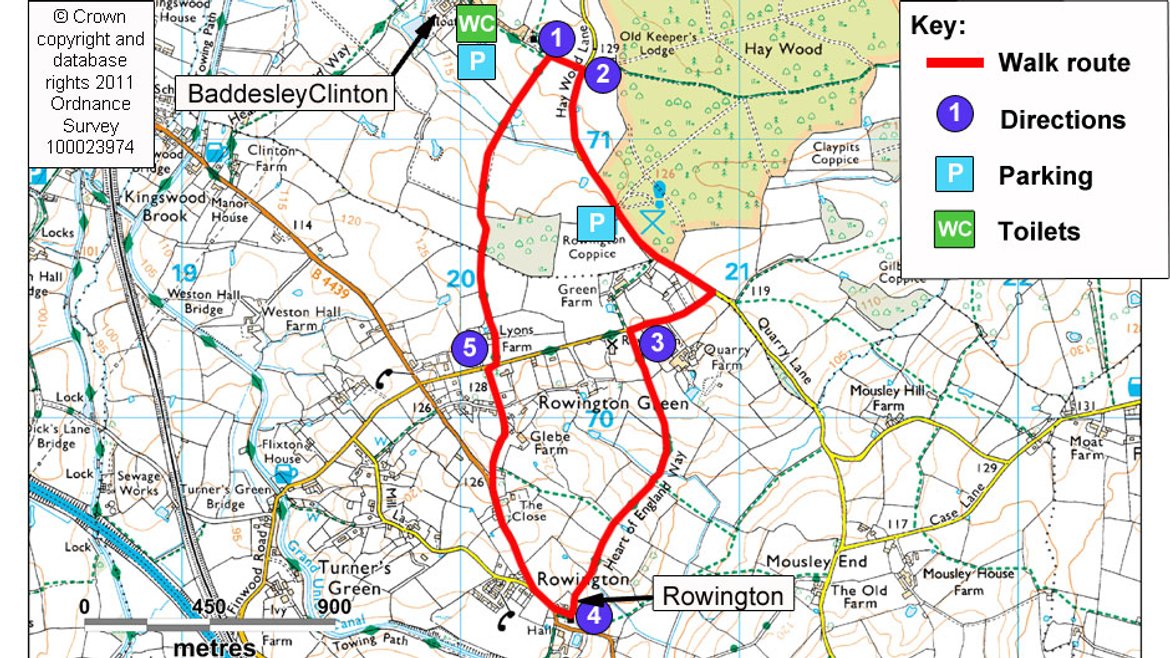
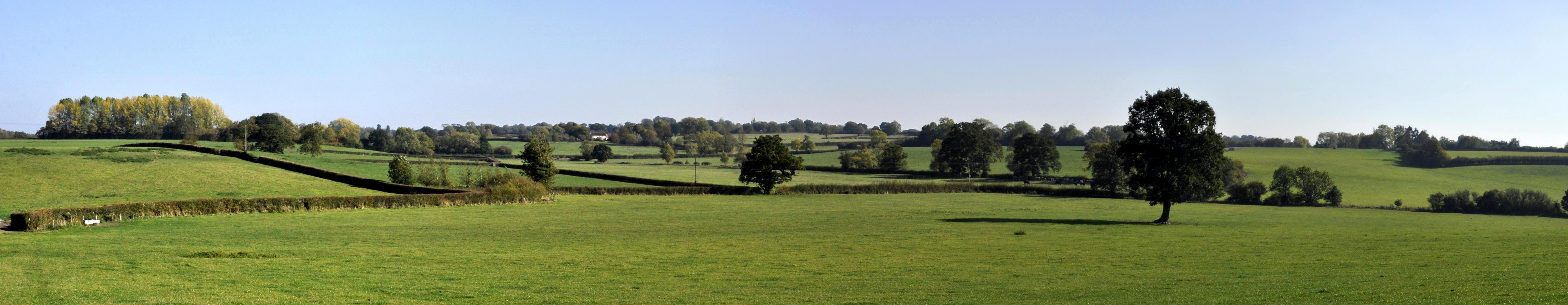
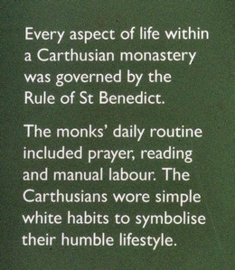
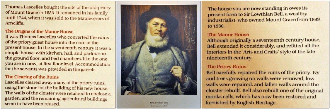
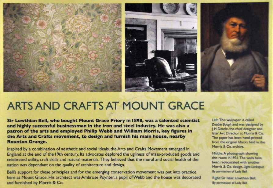
Nestling under the Cleveland Hills in North Yorkshire, about half way between Thirsk and Middlesbrough along the A19 (map), Mount Grace Priory has stood proudly overlooking this beautiful landscape for over 600 years. It is owned by the National Trust, but managed by English Heritage.

Founded in 1398 by Thomas Holland, 1st Duke of Surrey, Mount Grace is a walled Carthusian priory or Charterhouse, of which there were several throughout England. It’s regarded as the best preserved. The priory was finally closed down in 1539 at the time of the dissolution of the monasteries under King Henry VIII.


* Recently I received a comment that questioned the reference to St. Benedict:

It is entirely incorrect to say that the Carthusians follow the Rule of Saint Benedict. They follow the constitutions laid down by Guigo who succeeded St. Bruno as their head of the order in the twelfth century. The way of life of the Carthusians, with its combination of eremitical [i.e. solitary or hermitic] and cenobitic [i.e. community] practices, bears little resemblance to that of the Benedictines and other followers of St Benedict’s rule, for example the Cistercians.

It appears that English Heritage might have got this wrong.


Built from a beautiful yellow stone that glowed in the early winter sun last Sunday when we visited, Mount Grace was a community to fewer than 20 monks, living more or less as hermits each in his own cell (6). Actually, these cells must have been the 15th century equivalent of a ‘des-res’. These surrounded a large cloister (5), were two storey buildings, with piped in water, outside latrine, and a garden that each monk attended. By the entrance door there is a large niche through which food and other necessities were passed to each monk. One of the cells (8) has been reconstructed.

As we entered the cloister the air was filled with the eerie sound of pheasants calling among the trees on the surrounding hillside.

The priory was dedicated to the Assumption of the most Blessed Virgin in Mount Grace, and an small but impressive ruined church (4) lies at the center of the priory compound.

More photos of the priory ruins, and a little more history can be viewed in this album.

The site was acquired in the mid-17th century by Thomas Lascelles, and then in the 1740s to the Mauleverer family. The priory guest house became the heart of the manor house we see today. But its current aspect was the work of a wealthy industrialist at the end of the 19th century, Sir Lowthian Bell.

Just a few rooms are open to the public. A carpet designed by William Morris is on loan to Mount Grace, and is laid in one of the ground floor rooms.

The coat of arms of the Bell family is displayed above the fireplace in another room on the ground floor.

The west facade of the manor house is covered in Virginia creeper, glowing red in its full autumn glory, overlooking a small, but carefully laid out terraced garden, leading to several pools that were used by the monks to raise fish. It was nice to see plant name labels throughout the garden.

Mount Grace Priory, house, and gardens were a true delight. We’ve often passed the entrance on our way north to visit our younger daughter Philippa and her family in Newcastle. But this time we were determined, weather-permitting, to stop off and explore the site. And that’s how we spent a very enjoyable three hours last Sunday morning, before hitting the road again, heading south to home in north Worcestershire.


We made a second visit here on 16 June 2021, mainly to see the gardens in full bloom. I have combined the photos I took then with an earlier album. You can view the whole set here.

Summer has returned . . . for one day only

Yesterday, I was reminded of that great radio broadcaster, Alistair Cooke (1908-2004) who presented Letter from America, a weekly 15-minute broadcast on the BBC from March 1946 to February 2004.

2,869 episodes! In each, Cooke presented a topical issue in the USA, tying together different strands of observation and anecdote and often ending on a humorous or poignant note.

Growing up, my family would listen faithfully to Letter from America, and that habit stayed with me as I moved on to university, and even while I was working overseas. Cooke had an excellent broadcasting voice, and always had something worthwhile and erudite to impart.

Originally from the UK, he moved to the USA in the 1930s and became a US citizen in 1941.

So why did Cooke drop into my mind yesterday, 10 October? It was one of those bright and sunny days, warm even, that we come to hope for in October, but rarely expect or experience. It was certainly a typical ‘Indian summer’ day, around 22-24°C, not a cloud in the sky.

When I was at university in the late 1960s, I remember listening to one particular Letter from America (I’m unable to track down the broadcast or transcript, although many are available online) in which Cooke waxed lyrical about Fall in New England, and went on to discuss the origin of the term ‘Indian summer‘. He described the unseasonably warm and dry days with clear, sunny skies that can occur around this time of year, often accompanied by misty mornings. It’s from this phenomenon, Cooke suggested, that the term was derived. The early colonists were aware that Native Americans would take advantage of this weather to hunt, and often attack their settlements under the cover of these misty mornings.

Yesterday’s weather pulled a memory of that broadcast, stored away for about 50 years, from the recesses of my mind.

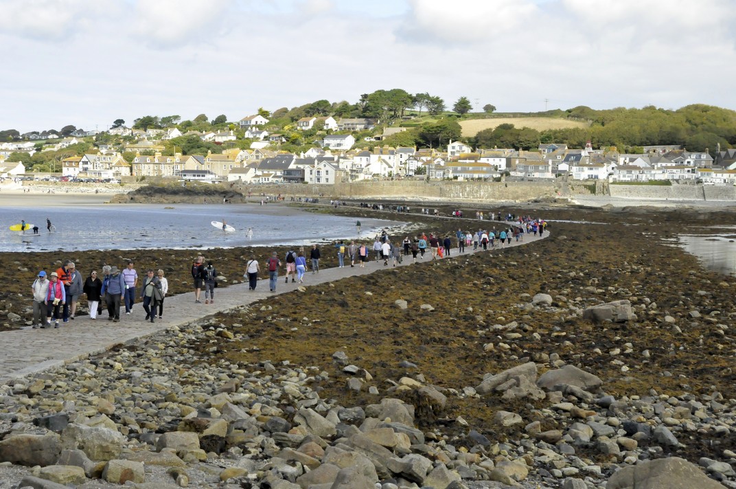
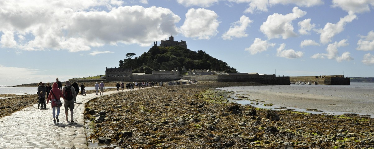
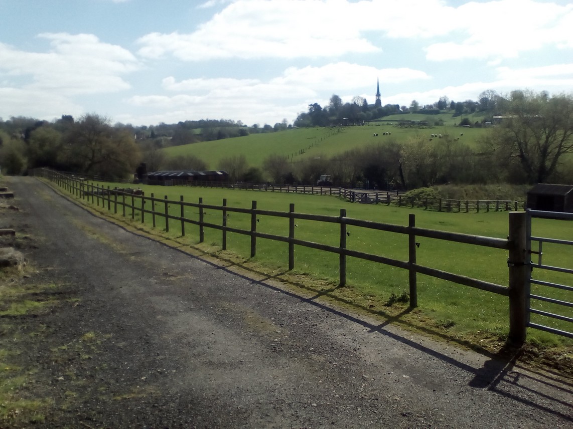
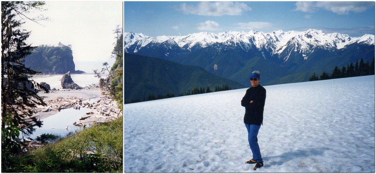
Steph and I took full advantage to walk a stretch of the Heart of England Way, starting at the National Trust’s Baddesley Clinton in Warwickshire (just under 20 miles east of Bromsgrove, and about 30 minutes from home by car). I even had to retrieve my summer shorts from the drawer where I had put them away for the winter.

Described as An easy walk along country lanes and field paths, taking in Baddesley Clinton, Rowington Church and the Heart of England Way, it’s listed at under 3 miles in length, although according to my pedometer it was more like 3.8 miles.

We arrived at Baddesley Clinton just before 10:30 and, not having seen much traffic heading to the property, were rather surprised to encounter a very full car park. The place was heaving! We decided to take our walk before lunch, and then visit the gardens afterwards.

The weather was glorious, the rolling Warwickshire landscape stretching to the horizon, leaves changing color on trees all around, and also full of berries. I’ve never seen so many holly berries.

We set off through the churchyard of St Michael’s Church (1), and along the gravel road to turn right (2) on to Haywood Lane, and then, after about a mile, right on to Rowington Green.

A little distance along Rowington Green, the walk leaves the road and crosses fields (3) — along the Heart of England Way — to Rowington (4). We took a short break in the churchyard of the 12th century Church of St Lawrence (or St Laurence).

From Rowington, the walk heads north, along a public bridleway (5), and ending back at St Michael’s. I guess the walk took a couple of hours; we never rush.

Baddesley Clinton is a moated house, first built in the 1400s. One of the original owners was Nicholas Brome, Lord of the Manor of Baddesley Clinton, and is buried in St Michael’s Church. The house passed to the Ferrer family who occupied it for the next 500 years.

We didn’t visit the house yesterday, but decided to take a look at the garden – and we were not disappointed. There was a magnificent display of dahlias in one of the borders inside the walled garden.

Thank goodness we did take advantage of the exceptional weather. Today’s weather could hardly be more different. It’s windy, overcast, and all morning it has been spitting with rain. It’s a little cooler than yesterday, but going to go downhill as we progress into tomorrow and the weekend. That’s because Storm Callum is due to sweep in from the Atlantic overnight tonight, bringing a lot of rain. Climate change? What climate change? I wonder how long it will take for the remnants of Hurricane Michael to reach us?

Kernow a’gas dynergh – Welcome to Cornwall (5): Magnificent mansions

Cornwall is home to several National Trust jewels. We visited these four:

  • St Michael’s Mount, on an island in Mount’s Bay off Marazion in the south of the county
  • Lanhydrock, close to the A30 near Bodmin
  • Cotehele House and Quay, overlooking the River Tamar, north of Plymouth
  • Trerice, close to Newquay on the north coast

Knowing how popular St Michael’s Mount can be (even slightly out of season, as we were), Steph and I decided to head to Marazion early on the day of our visit, so we could easily find a parking place. I guess we must have been there before 9:30 am, and knew we’d have to take the boat over to the island as the tide was still ebbing then and the causeway was still covered.

Parking was no problem. However, when we returned from our visit to the island just before 2 pm, visitors were streaming across the open causeway in the hundreds, and it seemed as if every parking place was already taken in the several car parks along the sea front.

Just before 10 the first passenger boat of the day pulled up alongside the jetty, and about eight persons clambered aboard. Since the sea was calm, there being no waiting queue of visitors, and it being the first boat, the boatman suggested going right round the island instead of just across directly to the harbor on the island. What a treat, as we had many different views of the island and buildings that would not have seen on a normal crossing.

St Michael’s Mount (the Cornish equivalent of Mont Saint-Michel in Normandy, although not quite so grand perhaps) was originally home to a 12th century priory, and there is evidence of human occupation over several thousand years. It has a rich history.  It became the home of the St Aubyn family in the late 17th century, and the family continues to occupy the Victorian wing. in the 19th century there was a village and thriving community of several hundred residents living below the castle.

A visit to St Michael’s Mount includes not only a tour of the house, and its magnificent views over Mount’s Bay, but the gardens below the castle that have been built into and cling to the cliff face. We were told by our boatman that the four resident gardeners are also qualified abseilers! It’s quite a steep climb up to the castle, but well worth the effort.

By the time the causeway had opened and hundreds of visitors were pouring across, access to the house was becoming difficult. We had made the tour earlier, and even then passing the narrow entrance caused significant tailbacks.

Nevertheless, no visit to Cornwall would be complete without a visit to St Michael’s Mount. Its inaccessibility for half of the day just adds to its attraction. Check out more photos of the interiors and gardens here.


Lanhydrock, just a mile or so off the A30 near Bodmin) is special for two reasons: so many of the rooms (>50) are open to the public, and the Long Gallery in the north wing) and its magnificent 17th century plastered ceiling survived the 1881 fire that gutted most of the rest of house. The house is U-shaped; an east wing was demolished in the 18th century. It has been the family home of the Robartes for four centuries.

The weather for our visit was overcast with a little drizzle. As we wanted to visit Restormel Castle in nearby Lostwithiel later in the day, we decided to forego a walk around the park, just viewing the gardens and parterre close to the house.

You can take a virtual tour of the house and gardens here. There’s no doubt that Lanhydrock is one of the National Trust’s ‘premier’ properties full of exquisite objects that passed to the Trust when it acquired ownership in 1953. Definitely one of the properties that should be on everyone’s National Trust bucket list.


The first question I asked one of the volunteers when we arrived at Cotehele House was how to pronounce ‘Cotehele’. It’s ‘cot-eel’ apparently.

And it’s also one of the National Trust gems, having so many exquisite tapestries on display. The house dates from the late 15th century but then had 16th century Tudor additions, and is built I guess from local granite, a lovely soft grey color. It was the home of the Edgcumbe family. Passing through a small courtyard, you enter the Great Hall, on to the chapel, and up to the treasures of the first floor and above.

Cotehele has terraced gardens beside the house, and others slightly further away. The Valley Garden follows a steep-sided valley from the terraces to the River Tamar, and Cotehele Quay and Mill.

Have a look at more Cotehele treasures here.


Trerice is an Elizabethan, 16th century manor situated a few miles inland from Newquay on Cornwall’s north coast. We visited this delightful house on our last day in Cornwall, on the way back to our holiday home after a visit to Tintagel Castle.

The Arundell family inherited Trerice more than 700 years ago. It passed to the Aclands in the late 17th century. In the 20th century, the Elton family took on a lease from the National Trust and carried out some major refurbishments, including replacing the roof.

There is some particularly smart plasterwork in several rooms, as well as impressive oil paintings.

Outside there is an attractive knot garden, and other horticultural attractions like a 1km mowhay.

An archaeological dig was underway behind the house on the day of our visit.

More photographs of this dig and exterior/interior views of the house are available in this album.


These are the other four stories in this Cornwall series:

Kernow a’gas dynergh – Welcome to Cornwall (1): The journey south . . . and back

Kernow a’gas dynergh – Welcome to Cornwall (2): Coast to coast

Kernow a’gas dynergh – Welcome to Cornwall (3): Stepping back in time

Kernow a’gas dynergh – Welcome to Cornwall (4): An impressive horticultural legacy


For those interested in photography, I use a Nikon D5000 DSLR, with a Nikon AF-S DX Nikkor 18-200 mm f/3.5-5.6 GII ED VR lens.

Flash photography is not permitted inside National Trust properties, so that means shooting with the slowest speed I can get away with, since all my photos are hand held. Often I’m shooting as slow as 1/15, and 3200 ASA. All the interiors at these four properties were photographed in this way. It’s remarkable how the colors of the tapestries at Cotehele, for example, are revealed. I’m getting quite the dab hand at holding my breath as I’m about to press the shutter.

Kernow a’gas dynergh – Welcome to Cornwall (4): An impressive horticultural legacy

Gardens. How many were designed and planted decades, even centuries ago, that can only now be fully appreciated? They were never seen in all their glory by their visionary originators. What a horticultural legacy they bequeathed to later generations.

The National Trust manages four important gardens in Cornwall which we were delighted to visit during our recent break there. Of course, many of the houses which the NT owns have their own gardens. But the four we visited are ‘marketed’ as gardens in their own right:

  • Glendurgan Garden, on the east coast, just south of Falmouth
  • Trelissick, at the head of Carrick Roads near Truro
  • Godolphin, an important medieval garden east of Penzance
  • Trengwainton Garden, northwest of Penzance.

All lie south of 50.2°N, and so there are many exotic species like tree ferns and bamboos that thrive under these conditions. And although these gardens would have been in their prime earlier in the year, with rhododendrons, camellias, and magnolias in flower, we saw enough during our exploration of these gardens to appreciate how they might look in another season.


Glendurgan Garden was the first on our list. Having enjoyed a walk at Lizard Point earlier on this bright, sunny day, we looked forward to a pleasant stroll around the garden.

The garden was planted in the 1820s and 1830s by Alfred Fox, and occupies a steep-sided valley down to the fishing village of Durgan, below Glendurgan House, home of the Fox family (not open to the public).

We followed the red trail down to Durgan village, and came back up the brown trail on the left, taking in a viewing platform overlooking the maze (that was planted in 1833).

Check out more photos here.


It was a mizzly sort of day when we stopped by Trelissick on our way back to our holiday cottage after visiting another NT property northwest of Plymouth, Cotehele House. So we were never going to fully appreciate one of the triumphs of Trelissick: the panorama from the terrace in front of the house down to the shores of the River Fal estuary.

Trelissick was the family home of the Copeland family, owners of the Spode China factory in Stoke on Trent (I used to pass nearby everyday on my way to grammar school in Trent Vale in the 1960s). Just a few rooms on the ground floor are currently open to the public. It was passed to the National Trust in 1955.

From the terrace, we made our way south through the garden, taking in the views (such as they were) from the tennis lawn (8) and the parkland (9) that did provide nice views back to the house. From Jack’s summer house (at the tip of the garden) we worked our way back up on the eastern side, crossing over the bridge into Carcaddon (11), then back towards the house across the main lawn (4).

Take a look at the rest of the photos here.


Godolphin has a particular claim to fame. In its various gardens, the King’s Garden (5) and Side Garden (14), it seems little has changed since at least the 16th century, maybe earlier.

The Godolphins derived their wealth from some of the most important mines in Cornwall, the remains of which can still be seen dotted around the estate.

The main entrance of Godolphin House (9)

The Undercroft (8)

On the day of our visit just the King’s Room was open to the public. The National Trust has a holiday let here at Godolphin, and mostly the house is off-limits to the general public apart from certain days per year.

The Side Garden (14) from the Dry Ponds (16)

One of the two Dry Ponds (16)

More photos of the garden can be viewed here.

We also enjoyed the 1.5 mile walk to the top of Godolphin Hill, from where there is a 360° panorama to be enjoyed.

Looking towards Land’s End from the top of Godolphin Hill.


Northwest of Penzance, Trengwainton Garden offers magnificent views over Mount’s Bay, towards St Michael’s Mount in the east and Land’s End in the west.

Only the garden, full of exotic shrubs (particularly bamboos and tree ferns) is open to the public, although there is access to the terrace (R) below the house from where the panorama can be enjoyed.

Once again we were too late for many of the shrubs that flowered earlier in the year, but nevertheless our stroll through these leafy glades was rewarded by the view from the terrace.

There is also an impressive walled garden, divided into several ‘rooms’ growing vegetables and ornamentals. On the day of our visit there was an exhibition of scarecrows made by local schoolchildren to celebrate the centenary of women getting the vote in the UK.

More photos are included in this album.


We enjoyed this horticultural tour of Cornwall, and of course the gardens at the various houses we also visited: St Michael’s Mount, Lanhydrock, Cotehele House, and Trerice. We decided not to visit the Lost Gardens of Heligan (which must also be included in Cornwall’s horticultural heritage) having more than enough on our itinerary of National Trust and English Heritage sites to add another.


These are the other four stories in this Cornwall series:

Kernow a’gas dynergh – Welcome to Cornwall (1): The journey south . . . and back

Kernow a’gas dynergh – Welcome to Cornwall (2): Coast to coast

Kernow a’gas dynergh – Welcome to Cornwall (3): Stepping back in time

Kernow a’gas dynergh – Welcome to Cornwall (5): Magnificent mansions