
I have been very fortunate. There’s no denying. Since I made my first trip outside the UK, to the west coast of Ireland for a botany field course in July 1968, followed a year later, in September 1969 to participate in a folk festival in Czechoslovakia, I’ve had so many opportunities to travel around the globe—to more than 60 countries (sometimes on vacation, but mostly on business associated with my work in international agricultural research).

Morris dancing at the folk festival in Strakonice, Czechoslovakia in 1969. That’s me on the extreme right.
I’ve lived and worked in three countries (besides the UK of course): Peru (1973-76); Costa Rica (1976-1980); and the Philippines (1991-2010). I’ve visited several countries multiple times, and others just the once. Whenever I was traveling on business, I would also try to fit in some tourism over a weekend if possible. I have so many memories over those 55 years. Here are some that spring to mind.
The Americas
![]() I guess I should begin this section with Peru. In 1971 I was thrilled to be offered a job in Peru, at the newly-founded International Potato Center (CIP), although I didn’t actually travel there until January 1973.
I guess I should begin this section with Peru. In 1971 I was thrilled to be offered a job in Peru, at the newly-founded International Potato Center (CIP), although I didn’t actually travel there until January 1973.

13 October 1973
So many memories. Steph and I were married in Lima in October 1973.
My work took me all over the Andes collecting native varieties of potatoes (and some of the hundreds of wild species of potato that are indigenous to Peru). And Steph and I made several road trips to the north, central, and southern Andes. I visited Machu Picchu twice, and we saw some remarkable sights and sites.


It’s almost impossible to choose any one aspect that stands out. The diversity of landscapes, with desert on the coast, the high Andes, and the jungle on the eastern side. The long history of agriculture in difficult environments, and the archaeology of civilizations that go way back before the invasion by the Spanish in the 16th century.
Then we moved to Costa Rica in April 1976, living in Turrialba, about 70 km east of the capita, San José. Once again I was working on potatoes and with farmers.
We enjoyed our five years in that beautiful country, and our elder daughter Hannah was born there in April 1978.
A land of volcanoes (some very active), Costa Rica is a verdant country, and there are national parks everywhere. The bird and plant life is extraordinary, so I guess this is what stands out for me in particular.


")


My work took me to all the countries of Central America, as well as to Mexico where, until 1977, CIP’s regional headquarters was based just outside Mexico City at Toluca. And also out into the Caribbean islands, to Haiti and the Dominican Republic, to Jamaica, St Kitts, Antigua, Montserrat, Barbados, and Trinidad.
In Mexico, most of my visits were to Toluca. But on one visit there, I joined the participants of a potato training course to study potato production in Mexico State, Michoacán, Puebla, Jalisco, and Guanajuato. Later, in the 1980s I also visited Nuevo Leon in the north, and Morelos south of Mexico City.
But if I had to choose one highlight, it would be the pyramids at Teotihuacán, northeast of Mexico City that Steph and visited in 1975 when we visited some friends at CIMMYT (a sister center to CIP) on our way back to the UK.

Guatemala is a fascinating and beautiful country, and I was a regular visitor. A land of lakes and volcanoes, it has a high indigenous population, who wear the most colorful fabrics.


In 1977, Steph and I flew into the Mayan city of Tikal, deep in the jungle, for an overnight stay.

On another trip I spent a few days in Belize, first in Belize City on the coast, then in Belmopan, the smallest capital city in the Americas.
The overriding memory I have of Honduras was the white-knuckle landings in Tegucigalpa. How they managed to land jets there is beyond me. What pilot skill!
I visited El Salvador and Nicaragua just once each, and then only overnight. They had virtually no potato sector.
Flying in and out of Panama City was quite a regular occurrence. It was a transit for Costa Rica from South America. The main potato area was in the west of the country near the frontier with Costa Rica (map), north of the city of David at Volcán and Boquete. A region of deep volcanic soils, it was very good potato-growing country, and one I traveled to by road from my base in Turrialba on a couple of occasions.

Potato fields in Boquete, northern Panama
It was only after I moved to the Philippines in 1991 that my work took me back to Costa Rica for the first time in about 15 years, and one other country, Venezuela, which I’d not visited before although landing at Caracas airport on several occasions. This airport is located on the Caribbean coast north of the city, and is connected by a 27 km motorway that crosses the mountains, a spectacular drive over what I assume is a northern extension of the Andes.
In the 1990s I spent a week in Caracas attending a potato network meeting, but seeing very little of the city, just the metro from hotel to meeting venue and back!
Another international agricultural research center in Cali, Colombia is CIAT (map), supported in the same way as CIP and CIMMYT (and the rice institute, IRRI, in the Philippines, that I joined in 1991). Located in the Cauca Valley, CIAT is surrounded by huge plantations of sugar cane, but the rice-growing area is nearby as well. The last time I was there (and in Peru and Mexico) was in July 2016 conducting a review of the CIAT genebank.
I was in Chile just the once, for a week in Santiago in July 1979. I’d flown down from Costa Rica to join two colleagues from Lima to carry out a short review of the Chilean potato program. Two things come to mind: wine and ABBA. Wine, because we were taken to dinner at Enoteca, a fine restaurant overlooking the city on Camino Real, where all the wines produced in Chile were on display, and we were invited to sample many of them. On one evening, while out enjoying some souvenir shopping, I heard (for the first time) the refrains of Chiquitita by ABBA emitting from one of the shops. My visit to Santiago will always be associated with ABBA.
What can I say about Brazil? It’s huge. My first visit there was in 1979 when I attended a potato conference at Poços de Caldas in Minas Gerais (map), followed by a couple of nights in Rio de Janeiro. On another occasion I attended a conference in Foz do Iguaçu (in Paraná state) close to the border with Argentina and Paraguay, and site of the impressive Iguazu Falls.

I’ve been to Brasilia twice, and once upon a time, that nearly became home for Steph and me when CIP’s Director General deliberated whether to post me to Brazil or the Philippines. In the event we returned to the UK in 1981 when I joined the faculty of the University of Birmingham.
I guess the most impressive thing I’ve experienced in Brazil is the statue of Christ at Corcovado, high above Rio de Janeiro, with the most spectacular views over the city. My dad was there in the 1930s.


I’ve been to Canada twice, the first time in 1979 (with Steph and 15 month-old Hannah) when I attended a potato conference in Vancouver, then we drove across the Rockies to meet up with my late elder brother Ed and his wife Linda in Edmonton, AB.

In the early 2000s, I made a short visit to Ottawa to meet with representatives of Canadian overseas development assistance agencies, and managed to spend a day getting to know the city, before heading back to the USA.

Parliament Hill from the banks of the Ottawa River
Over the decades I’ve traveled to the USA many times, and have now visited all states and DC except Hawaii, Alaska (although one flight touched down in Anchorage), Idaho, Nevada (I changed flights in Las Vegas), Oklahoma, Kansas, North Dakota, Louisiana, Mississippi, and Alabama. It’s such a vast country, but since 2011, Steph and I have managed several mega road trips and seen so many wonderful sights. It’s hard to pick any one. I have written about these trips and you can find a link here; just scroll down to the USA section).
But what highlights do I choose? The Oregon coast, Crater Lake, or the redwoods of northern California? Or would it be canyon country in Arizona? How about Yellowstone National Park, the Appalachians, the Mississippi River, Mt Washington in New Hampshire, or the coast of Maine? What about the Civil War sites like Gettysburg?
However, I’ve often said since we made the visit there in 2011, that if I ever got the opportunity to return, it would be to Canyon de Chelly in northeast Arizona. It’s a special place.


There’s not a lot of potatoes grown throughout the Caribbean, with only the Dominican Republic having any significant potato program, in the central highlands close to the border with Haiti. The Dominican Republic became one of the founder members of a regional potato program, PRECODEPA, set up in 1978, so I guess I must have traveled there five or six times.
I was just the once in Haiti, in the late 1970s attending a conference for about a week. We stayed in a nice hotel overlooking Port-au-Prince, and ventured out into the city just the once. Even then the city was not a safe place to wander round, and following the disastrous 2010 earthquake followed by the cholera outbreak, the country has become even more ungovernable, and not somewhere I would want to visit again. It’s one of the poorest countries in the Western Hemisphere.
I also paid short visits to Jamaica, St Kitts, Montserrat (which had a small but thriving potato sector before the Soufrière Hills volcano erupted in 1995, covering half the island with ash), Barbados, and Trinidad. Before long-haul jets could make the flight direct from Europe to South America, Antigua was a refuelling stop, which I made a couple of times. And after being being bumped off a flight to Montserrat, I spent the night in Antigua at a luxury resort (the only hotel bed I could find on the island!) and enjoying a delicious lobster dinner for the same price as a steak.
Asia
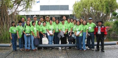
![]() Let’s turn to Asia now. I spent almost 19 years in the Philippines, joining the International Rice Research Institute (IRRI) in 1991, first as head of the Genetic Resources Center (GRC, and managing the world’s largest genebank for rice) until 2001, when I became the institute’s Director for Program Planning and Communications (DPPC). In both roles my work took me all over the world. But let’s focus on the countries in the region to begin with.
Let’s turn to Asia now. I spent almost 19 years in the Philippines, joining the International Rice Research Institute (IRRI) in 1991, first as head of the Genetic Resources Center (GRC, and managing the world’s largest genebank for rice) until 2001, when I became the institute’s Director for Program Planning and Communications (DPPC). In both roles my work took me all over the world. But let’s focus on the countries in the region to begin with.
My first trip to Asia, to Indonesia in fact, was in the early 1980s, when I attended a genetic resources meeting in Jakarta, but spending a weekend at the Bogor Botanical Garden beforehand. The oil palm tree on the right below is one of the original trees introduced into Asia and became the foundation of the oil palm industry.


Over the 19 years I spent living in the Philippines, I returned to Indonesia several times, the most memorable being in September 2005 when the IRRI Board of Trustees held one of it bi-yearly meetings there. Steph was able to join me on that trip, and along with excursions into the Bali countryside, we also enjoyed a long weekend break at our hotel before returning to the Philippines.

Bali landscape, Indonesia
In the Philippines, we lived in Los Baños, some 60 km south of Manila, where IRRI had its research center.

On the IRRI experiment station, with Mt Makiling (a dormant volcano) in the background.
Although we didn’t travel much around the Philippines (and apart from one short trip to Cebu, we didn’t wander beyond the island of Luzon), we went to the beach most months, and in March 2009, Steph joined me and my DPPC staff when we took an office outing over five days to the rice terraces in the mountains north of Manila. Very impressive.

Looking south towards Banaue town center.
In 1993 I learnt to scuba dive, one of the best things I’ve ever done, opening up a totally new world for me. The Philippines has some of the best diving in the world, especially at Anilao south of Manila.

Diving at Anilao, Philippines
But one of the best things about the Philippines? The Filipinos! Always smiling. Such friendly people. And I had great Filipino colleagues working with and for me in both the roles I took on at IRRI.
The ‘IRRI All Stars’ who helped during the IRRI Day in October 2002.

Colleagues from the Genetic Resources Center.
In 1995, I launched a major rice biodiversity project (funded by the Swiss government), and one of my staff, Dr Seepana Appa Rao was recruited to help the national rice program in Laos to collect native varieties of rice. Over five years, I visited Laos at least twice a year, taking part several times in a baci ceremony to welcome me to the country, and other visitors as well. Steph joined me on one trip, and here we are during one such ceremony at the house of my colleague, the late Dr John Schiller.

On that particular trip, we took a weekend off, flying to Luang Prabang and enjoying a river trip on the Mekong.

Mekong River, nr. Luang Prabang, Laos
IRRI had a country program in Cambodia, and I visited a couple of times to discuss rice germplasm conservation, and stayed in Phnom Penh. But after Christmas 2000, Steph and I were joined by our younger daughter Philippa (who had just begun her undergraduate studies at the University of Durham in the UK) for a mini-break in Cambodia (and Singapore).
We flew from Phnom Penh to Siem Reap, and spent three nights there visiting the amazing Angkor Wat temple complex, and a boat trip on the Tonle Sap, before flying back to the capital for one night, and back to Singapore.


We celebrated the New Year in Singapore, taking in the beautiful botanic gardens. Work has taken me to Singapore on several occasions, and Changi airport has to be one of the world’s aviation destinations. How it must have changed since I was last there.
Work took me to Seoul in South Korea on several occasions, and Japan. Steph joined me on one trip to Japan in September 2009 when the IRRI Board of Trustees met in Tsukuba north of Tokyo. We stayed on for a long weekend sightseeing in Tokyo, although she got to see more than I did earlier in the week, when a series of excursions for IRRI and Trustee wives were organised from Tsukuba.

Narita airport was also a hub for Northwest Airlines (now Delta) for flights from Manila to the USA, so I would fly through there at least a couple of times a year, also Osaka.
I’ve been to Beijing in China a couple of times, taking in the Great Wall during my first visit in 1995.

With my colleague, Bao-Rong Lu (middle) on the Great Wall, north of Beijing
On that trip we also took in Hangzhou and Guangzhou. I was in Beijing again around 2005 for a meeting, and in 2004, Steph and I flew to Hong Kong over Christmas and New Year. We also crossed to Macau on that trip.

The view from Victoria Peak, Hong Kong

Ruins of St Paul’s, Macau
Again, Hong Kong was one of those hub airports that I passed through many times, first at the old Kai Tak airport alongside Kowloon harbor (an interesting approach), and later at the new airport reclaimed from the sea.
I’ve only been to India a handful of times, always to meetings, and only then to Delhi and Hyderabad, so I can’t say that I’ve ever seen much of the country. There’s no doubt it’s a fascinating country, but I’m not sure it’s really on my bucket list – except if I could travel on one of those luxury trains, perhaps.
The same goes for Bangladesh, with just a couple of visits to Dhaka so I can’t say that I’ve ever known the country.
I was in Sri Lanka just the once, spending most of my time in Kandy. The hotel where I stayed was outside the city, on a hill, with breath-taking views over the surrounding hills. And I remember waking up early one still morning, and listening to the bird calls echoing all around. Magic!

I been to the north and south of Vietnam. On my first trip, I traveled to Can Tho in the Mekong Delta, and on the return journey to the airport in Ho Chi Minh City, I had to cross the river in a small boat (the bridge was down) and flag down a tuk-tuk for the last 20 km or so. I caught my flight!
Then I was in Hanoi several times in connection with the rice biodiversity project, but in 2010 I was the chair of the science committee for the 3rd International Rice Congress held in that city.

Myanmar has been closed off to visitors for many years, but I was able to visit just the once in the late 1990s, to the rice genebank at Yezin, about 250 miles north of the old capital Yangon. The train ride was interminable, and the sleeper on the return journey left a lot to be desired in terms of comfort and cleanliness. Nevertheless it was an interesting visit, but compared to the cuisine of other countries in the region (especially Thailand and Indonesia) the food was not inspiring: served quite cold and swilling in oil.

I’ve been in Bangkok many times, as it where I would change flights for Vientiane in Laos, having to spend one night to catch the early morning flight on Thai or Lao Airlines. But I never got to know the country, just a couple of visits to Chiang Mai in the north (again for meetings but no tourism). The same goes for Malaysia, with meetings in Kuala Lumpur and Penang.
![]() In 2014 IRRI once again asked me to chair the science committee for the 4th International Rice Congress that was held in Bangkok, so I made several visits there (and on to the Philippines) before the congress was held in November.
In 2014 IRRI once again asked me to chair the science committee for the 4th International Rice Congress that was held in Bangkok, so I made several visits there (and on to the Philippines) before the congress was held in November.
Australia
I’ve been in Australia four times. As a family, Steph, our elder daughter Hannah, Philippa and I flew from the Philippines just after Christmas 1998 to Sydney, spending just under a week there, enjoying a trip up into the Blue Mountains, and watching the awesome fireworks display over Sydney Harbour on New Year’s Eve.
I made a work trip there around 2001, taking in Canberra, the rice-growing area in the Riverina, Adelaide, and Melbourne.
In December 2003, Steph and I drove from Sydney to Melbourne over the course of a week, taking the train back to Sydney, where we enjoyed a harbour dinner cruise.
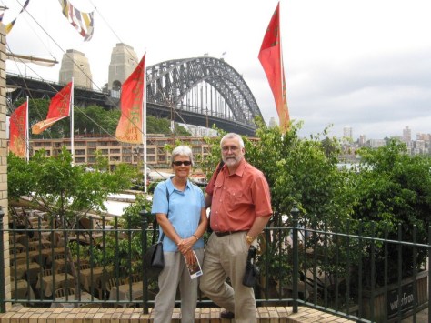
At the Sydney Harbour Bridge during our Christmas vacation in Australia in December 2003
We spent New Year’s Eve on the south coast near Melbourne.

Next stop: Antarctica
The last time I was there was November 2016, when my friend and former colleague, Professor Brian Ford-Lloyd flew from Birmingham to Melbourne for three days as part of a review of genebanks.

Enjoying a stiff one on the Emirates A380 flight from Melbourne to Dubai.
Africa
Africa now, where I have visited Morocco in the north, Ghana, Ivory Coast, and Nigeria in West Africa, Ethiopia and Kenya in East Africa, and Zambia, South Africa, Mozambique, and Madagascar in southern Africa. I wrote this general account in 2013.
There are several international agricultural research centers in Africa: ILRI (a livestock center) in Kenya and Ethiopia; World Agroforestry (ICRAF) in Kenya; IITA in Ibadan, Nigeria; and Africa Rice (WARDA) in Bouaké, Ivory Coast. I have attended meetings there on several occasions. In Ethiopia, the ILRI campus is located in Addis Ababa, and during my first visit there, in January 1993, I had the opportunity of traveling down into the Rift Valley. What I most remember about that trip, and the stay in Addis, was the incredible bird life. An ornithologist’s paradise. Likewise on the campus of IITA in Nigeria. IITA has a 1000 ha campus, and part of it has been left as pristine rainforest with its assemblage of species, some of them crop wild relatives.

Looking for wild yams on the IITA Forest Reserve.
I made my first visit to Nigeria and Ivory Coast after the genetic resources meeting in Addis Ababa in 1993. For security reasons, visitors to IITA who arrive in Lagos in the afternoon and evening spend the night there, before being escorted to Ibadan, around 2 hours by road to the northeast. I always enjoyed my visits to IITA. But Lagos airport was another thing. The situation there did improve, but throughout the 1990s, I always felt uneasy passing through, as officials (some in uniform, others in plain clothes) would often ask for a bribe.
I must have visited Ivory Coast a couple of times, the first time flying from Abidjan (the capital) to Bouaké on the national airline, a Boeing 727 that had once been the presidential aircraft! I made those visits before the disastrous civil wars of 2002-2004 and 2010-2011.
Africa Rice had to abandon its research center in Bouaké for many years, although the institute has now returned there. I planted a tree during my first visit. I wonder if it’s still there?

With Deputy Director General Perter Matlon at the tree planting.
On another occasion, I was in Ghana for a week, attending a planning meeting, and didn’t see much of Accra outside my hotel.
I’ve been in Kenya probably half a dozen times, straddled the Equator, and enjoyed the wildlife in the Nairobi National Park.

With my dear friend from CIMMYT, the late Sir Bent Skovmand (from Denmark), wheat pathologist and then head of the CIMMYT wheat genebank.


In October 2005, I was in Marrakech, Morocco to attend the annual meeting of the CGIAR, the consortium of donors and international centers. I got sick, and I had to work on a project proposal so spent much of my time in my hotel room, with just one excursion to the souk for some souvenir shopping.

Looking for silver beads for Steph.
In southern Africa, I spent several days in Lusaka, Zambia visiting the SADC genebank there. I’ve passed through Johannesburg several times, and on my transit there (on my way to Lusaka) was caught up in a car bomb incident on the day of the election that first brought Nelson Mandela to power in April 1994. On another occasion I spent a week in Durban (meetings once again) with a side trip to Pietermaritzburg, almost 90 km inland from Durban,
IRRI had a country program in Mozambique, and I was there a couple of times. The rice program joined our biodiversity project, and the CGIAR held its annual meeting there in 2009.
I was in Madagascar just the once, staying in the capital Antananarivo on the east coast, and traveling along dreadful roads north to the rice experiment station. Madagascar also participated in the rice biodiversity project.

At a training course on rice genetic resources in Madagascar in 1998.
Middle East
I had the opportunity of visiting Izmir in Turkey in April 1972, one of my first overseas trips from Birmingham, to attend a genetic resources conference. There was an excursion to Ephesus.

On another visit (also to Izmir) in the late 1970s, I spent a day in Istanbul before taking an evening flight to the UK, enjoying the Topkapi Palace and various mosques.

The Blue Mosque
I was fortunate to travel to Syria several times, to Aleppo, before the civil war pulled the country apart. Another agricultural research center, ICARDA, had its headquarters there and genebank. I even went for a job interview once. It’s a beautiful country, and I guess many of the beautiful almond orchards have probably been destroyed in the fighting. I also spent some time in Damascus, visiting the famous souk there.
In 1982, I took a party of graduate students from the University of Birmingham to Israel for a two week course on genetic resources of the Mediterranean. I wrote about that visit here.

And then there’s Dubai in the United Arab Emirates. I’ve spent a few nights there in between flights but never had enough time to explore the city. When Emirates Airlines began a service from Manila (MNL) to Dubai (DXB), and on to Birmingham (BHX), we flew that route each year on home leave, and Emirates also became my airline of choice for trips into Europe. In the 1990s it had either been with Lufthansa into Frankfurt (FRA) or KLM into Amsterdam (AMS).
Europe
Steph and I have been married almost 50 years but we’ve never taken a vacation on mainland Europe. But my work has taken me there quite often, and to three countries, Germany, Switzerland and especially Italy, several times a year between 1991 and 2010.
On that first trip to Czechoslovakia in 1969, we traveled by road, through the Netherlands, southern German, and into Czechoslovakia.
![]() I was next in Germany in the late 1980s, when I visited agricultural research institute near Hannover (also taking in the scenic town of Celle), before crossing into East Germany. I spent several interesting days at the genebank in Gatersleben (now part of The Leibniz Institute of Plant Genetics and Crop Plant Research), before flying on to Warsaw in Poland.
I was next in Germany in the late 1980s, when I visited agricultural research institute near Hannover (also taking in the scenic town of Celle), before crossing into East Germany. I spent several interesting days at the genebank in Gatersleben (now part of The Leibniz Institute of Plant Genetics and Crop Plant Research), before flying on to Warsaw in Poland.
 There I gave a series of seminars on crop evolution and genetic conservation (focusing on potatoes) to staff of the agricultural research institute (IHAR). My hosts took me to the family home of Frédéric Chopin west of Warsaw. As we walked around the gardens, we could hear several of Chopin’s piano pieces broadcast over speakers there. His Mazurka in D Major has remained a firm favorite ever since (here interpreted by acclaimed pianist Vladimir Horowitz), and is always a reminder of that visit whenever I hear it.
I also took in Cracow in the south of the country, a most elegant city.
While I was DPPC at IRRI, my work with the institute’s donors took me many times into Europe, particularly to Germany (Bonn and Frankfurt), to Switzerland (at Bern), and to Rome in Italy.
I had a good friend, plant pathologist Dr Marlene Diekmann, who lived near Bonn, and who worked for one of the German aid agencies. Whenever I was in Bonn, we’d try and spend some time walking the wine terraces of the Ahr Valley south of Bonn.

The last time I was in Bonn was 2016 during the genebank review I mentioned earlier.
I love trains, and have often traveled that way from one European capital to another. In fact I have traveled from my former home of Bromsgrove in Worcestershire to Rome, with stops in Belgium, Germany, and Switzerland on the way.
 One of the best trips I made was to view the Matterhorn in Switzerland near Zermatt. I had a free weekend before I had to travel on to Rome, so I took the opportunity of a day excursion from Bern.
My trips to France have taken in Paris, where I spent a very wet weekend once walking around the city. But it was worth it. And to Montpellier on the Mediterranean coast several times, the last being in 2016.
Brussels (in Belgium) has a beautiful central square, but I’ve never had much time to explore there.

For many years, Amsterdam was a hub airport for home leave flights back to the UK. In the Netherlands, I’ve spent time in the university town of Wageningen (east of Amsterdam), in the capital, The Hague, and in Amsterdam itself. A boat tour of the canals is well worth it.
My donor trips took me to Lisbon in Portugal and Madrid in Spain, which I wrote about in this blog post from 2019. Then in 2012, Steph and I visited my late eldest brother Martin and wife Pauline at their beautiful home in Tomar, north of Lisbon. What a glorious 10 days.

Central square in Tomar
I was in the Canary Islands (part of Spain) a couple of times, collecting various wild crop relatives. Steph, the girls, and me had a holiday there in 1989.

On the north coast of Tenerife

Looking over the Tenerife landscape.
However, the country I have visited most in Europe is Italy, and Rome in particular. I was once in the Po Valley southwest of Milan, looking at the rice research there. The Food and Agriculture Organization of the United Nations (FAO) has its headquarters in Rome, as does Bioversity International (formerly the International Plant Genetic Resources Institute, IPGRI). I guess over the 19 years I spent in the Philippines, I must have traveled to Rome at least once a year for one meeting or another, and up to five times in one year. It’s a magnificent place, although my elder daughter Hannah who has just spent a few days there commented on how dirty it was, and full of tourists. But I’ve always enjoyed my stays there, and have had ample opportunity to enjoy the history and archaeology, and the fantastic cuisine.

I’ve only been in Austria, Norway, and Denmark on one occasion each, and in the capitals Vienna, Oslo, and Copenhagen. In Vienna, I spent a week at the International Atomic Energy Agency (where they have a program in mutation breeding) consulting on germplasm databases. I visited donor agencies in Norway and Denmark, but had no time for any tourism in Oslo. It was a different situation in Copenhagen where I looked round the pretty city over a weekend.


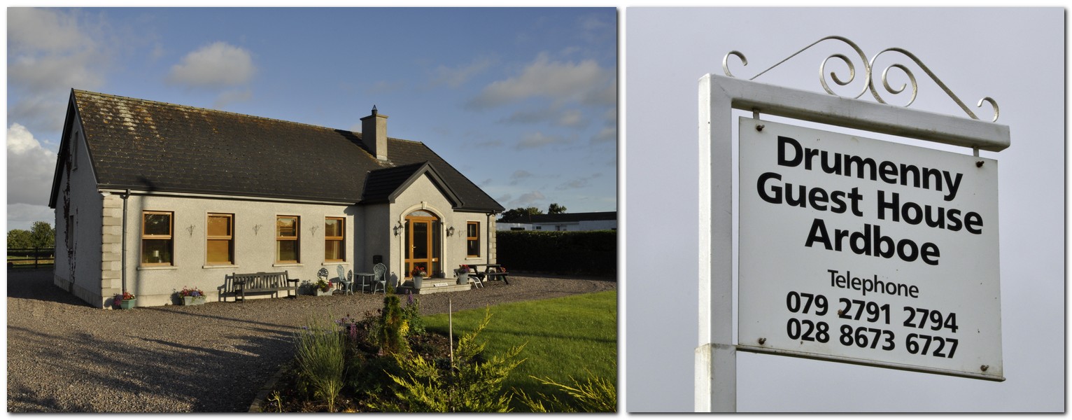
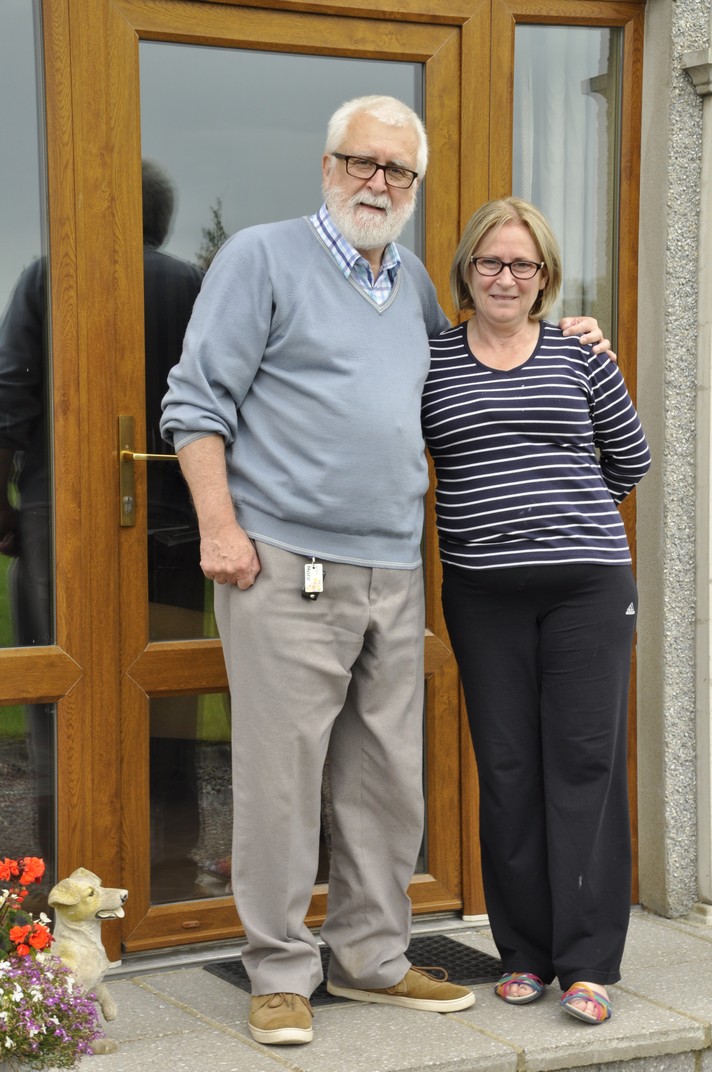
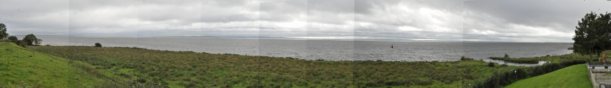
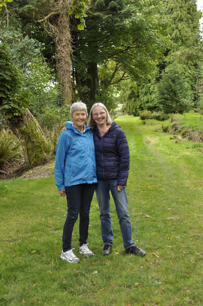
I started this blog post in the Republic of Ireland, and Steph and I have returned there three times, two with Hannah and Philippa in the 1990s, and also in 2017 after we’d spent a little over a week touring Northern Ireland.
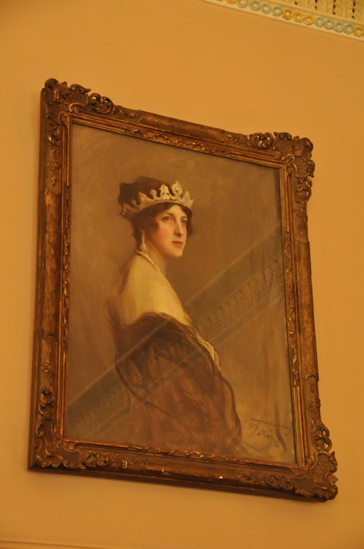
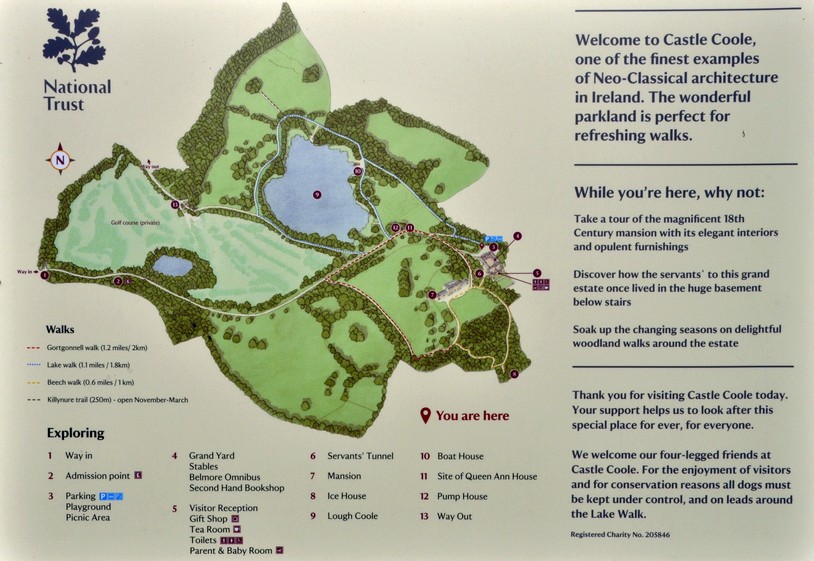
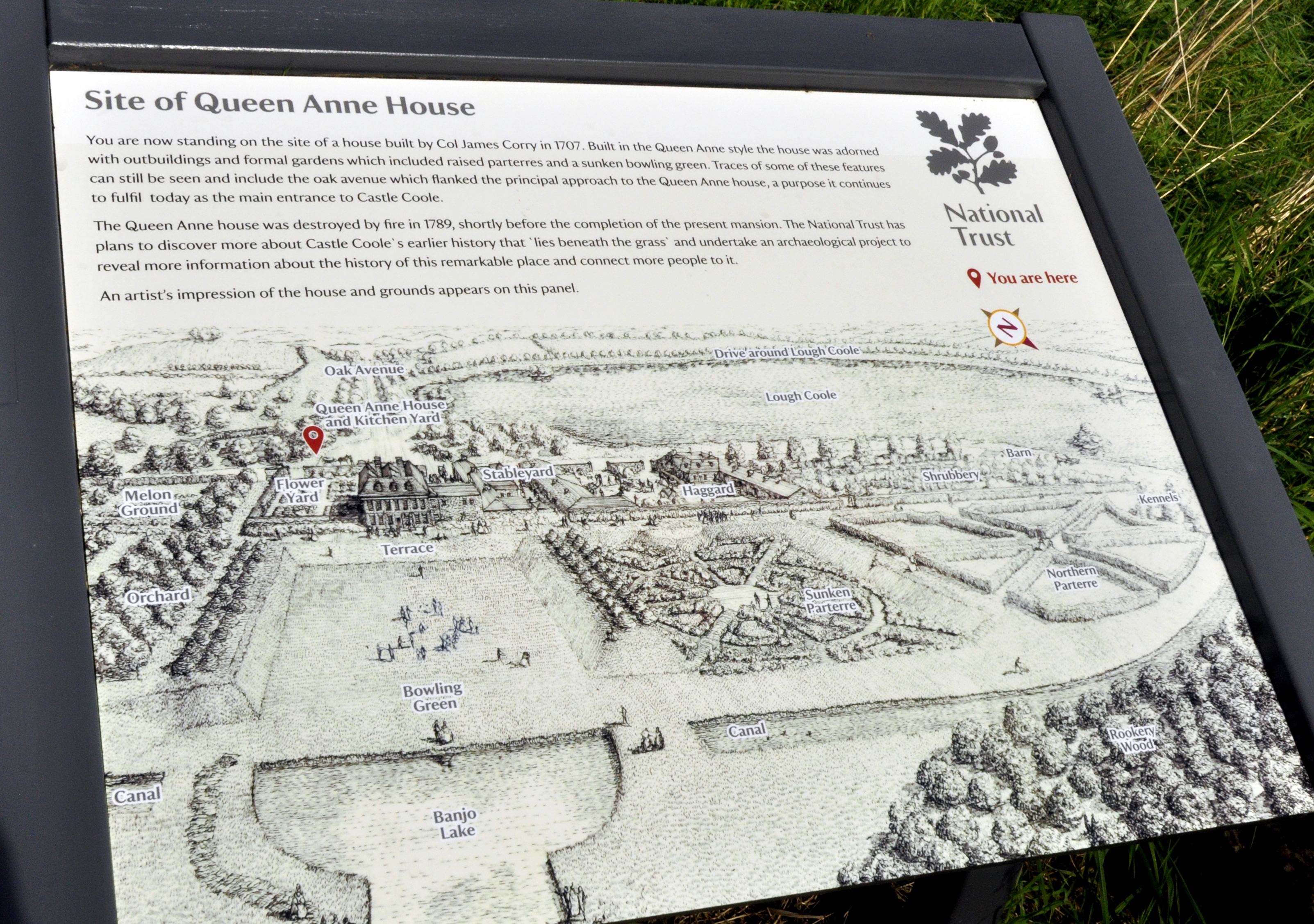
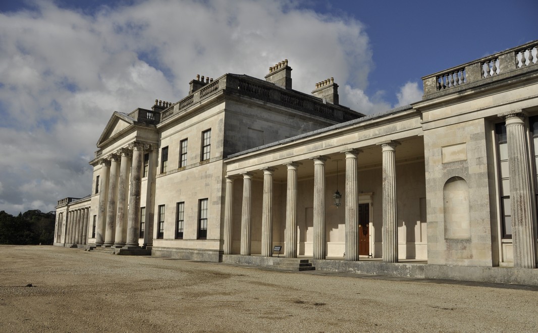
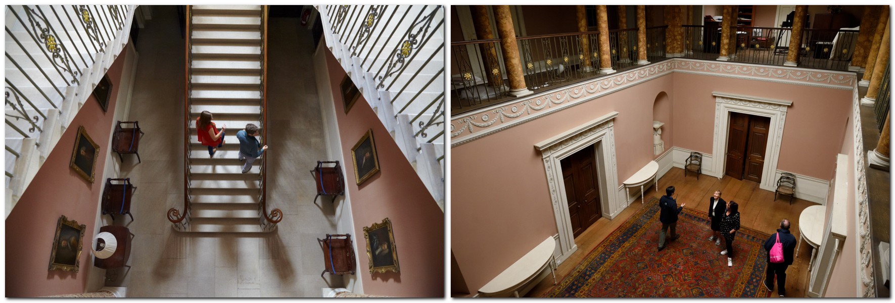
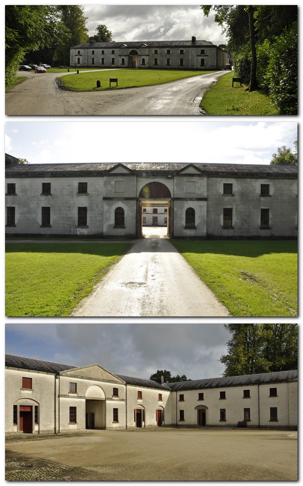
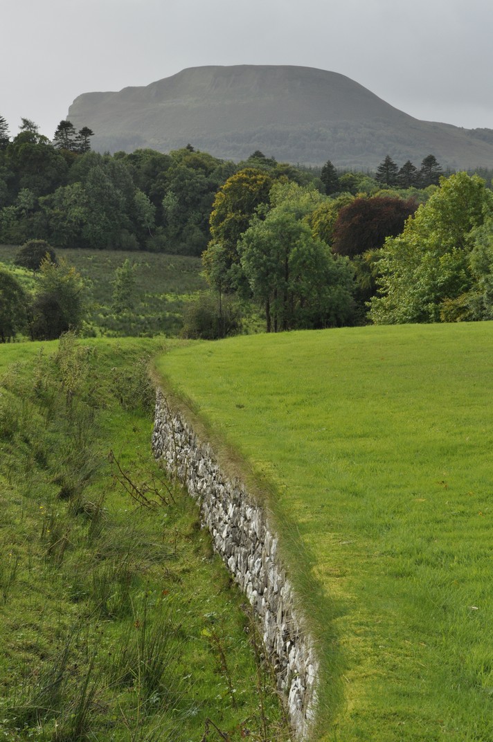
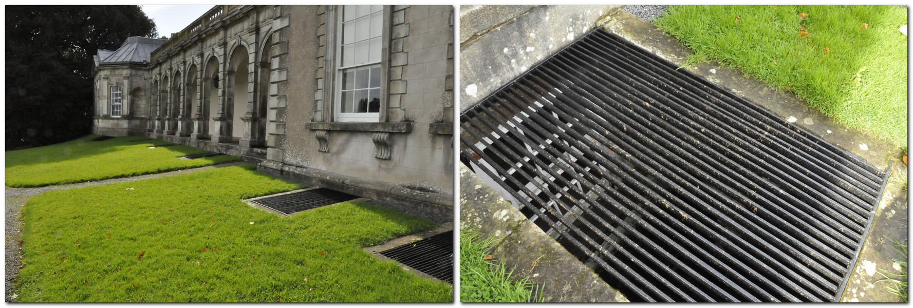
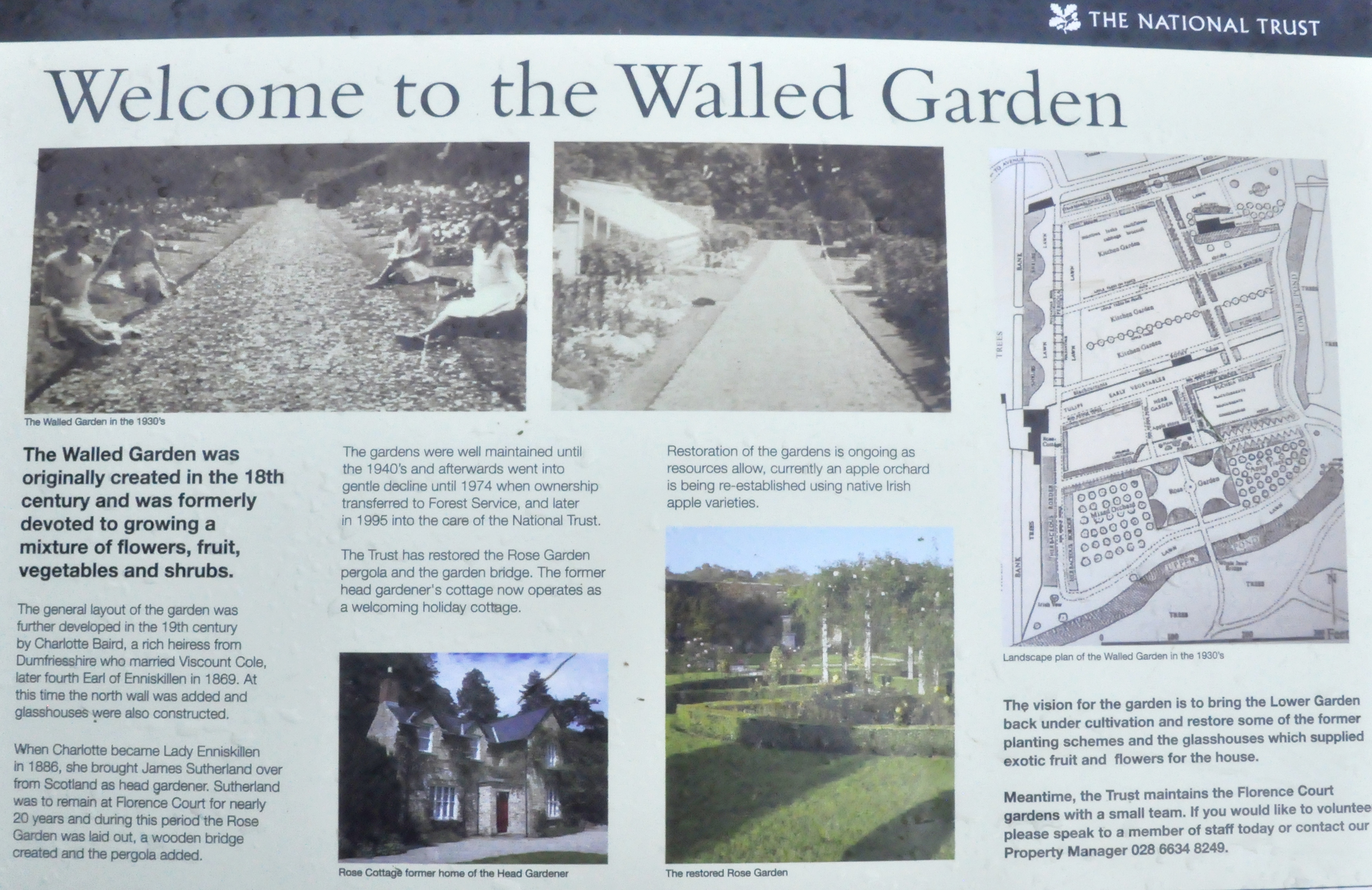
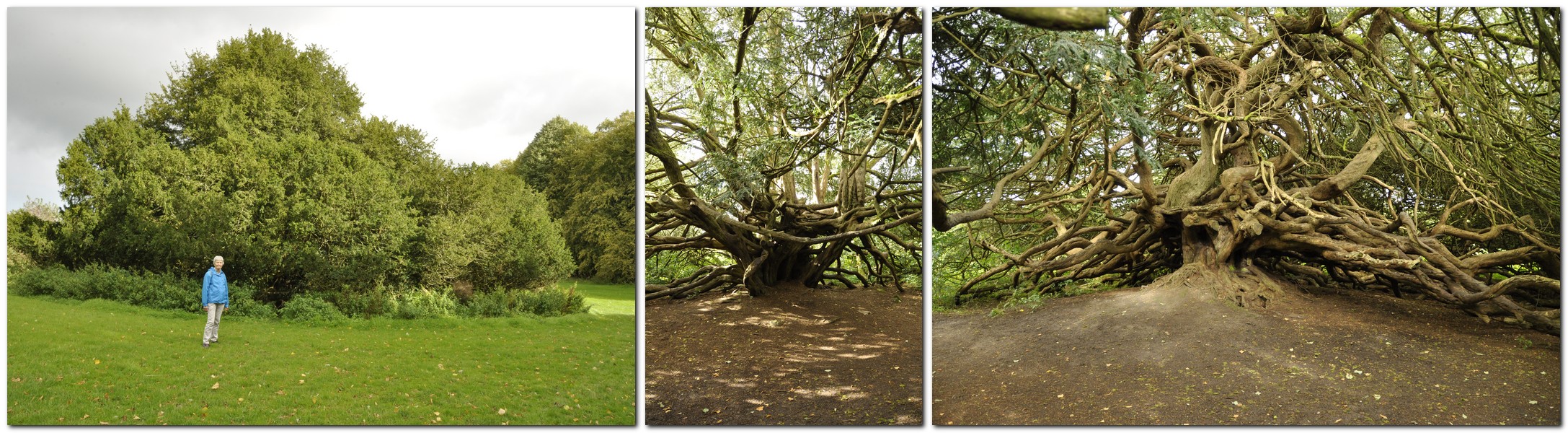
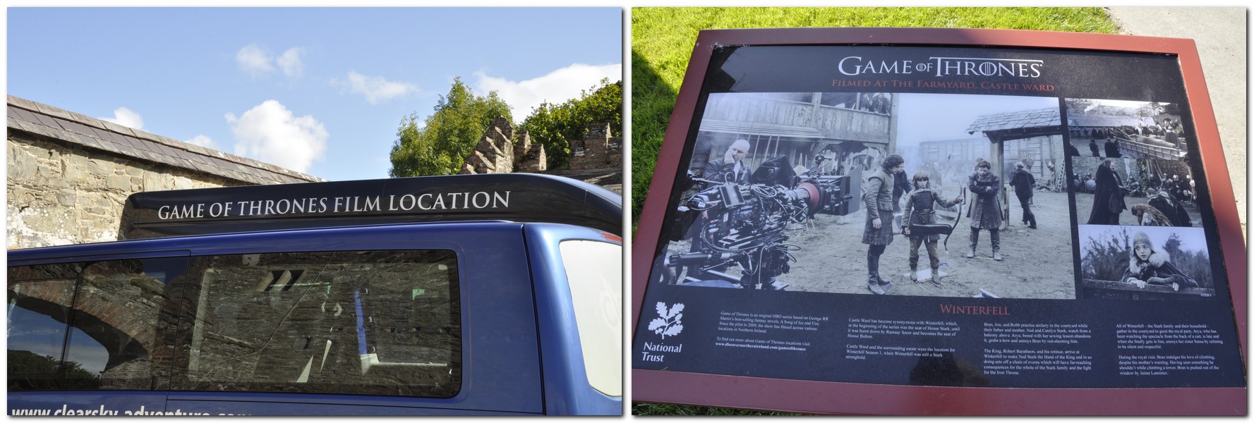
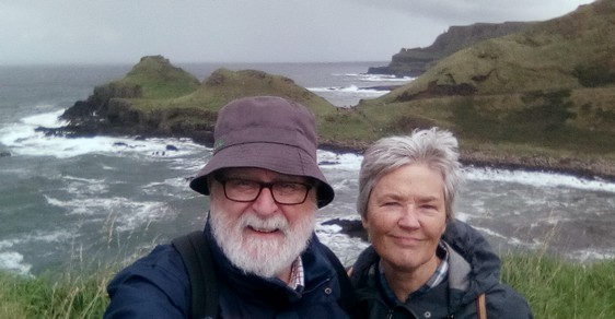
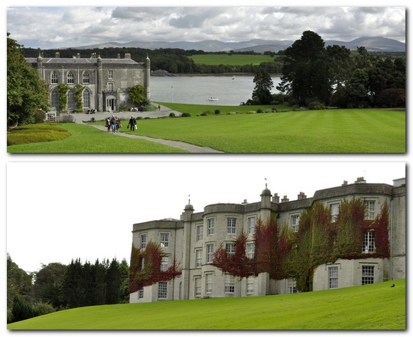
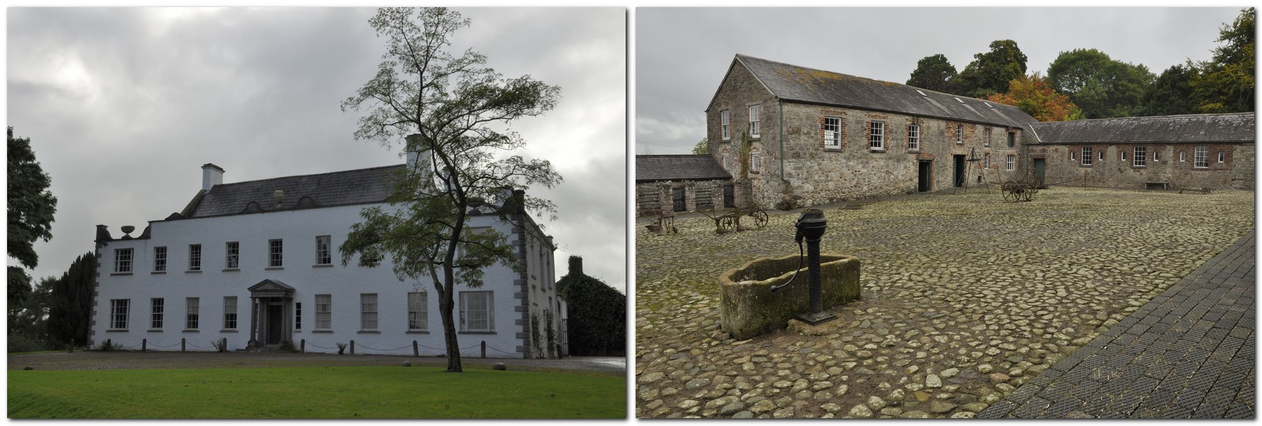
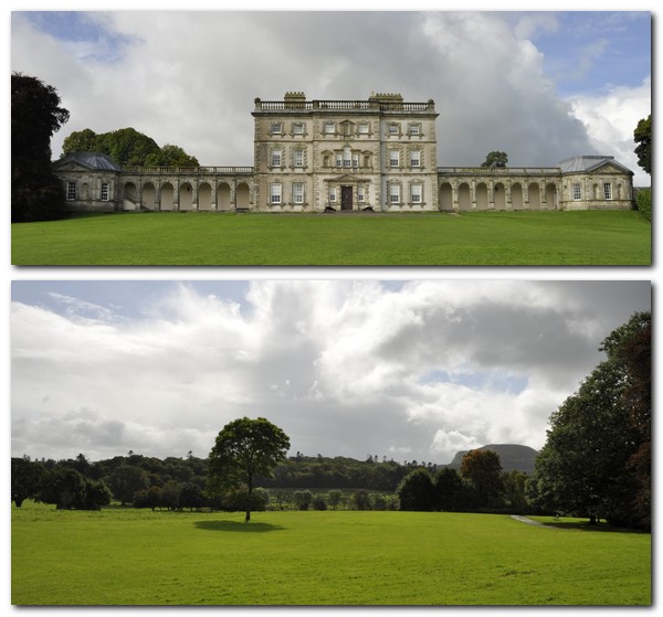
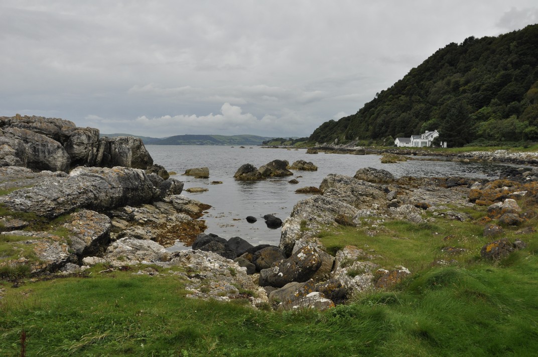
Northern Ireland was a revelation. Prosperous, and beautiful. We visited many National Trust properties over there, and I wrote about our 10 days there afterwards, with links in the post to many of the properties we visited.
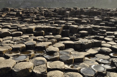
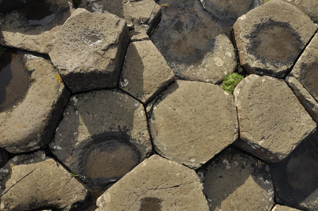
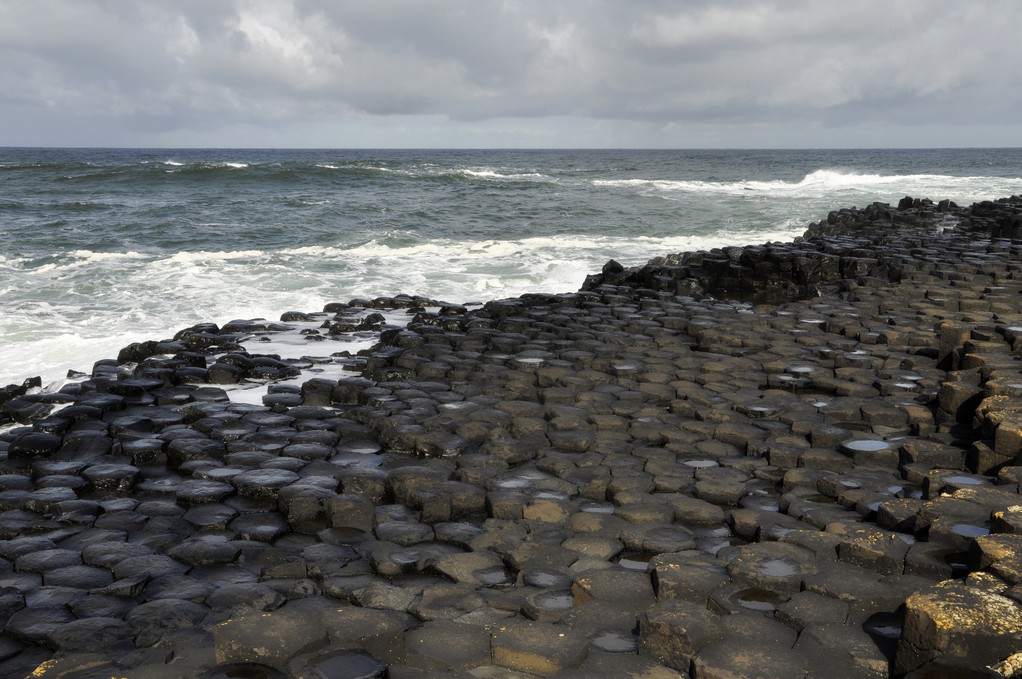
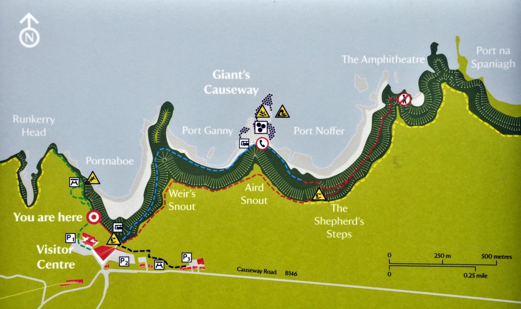
Giant’s Causeway, Northern Ireland
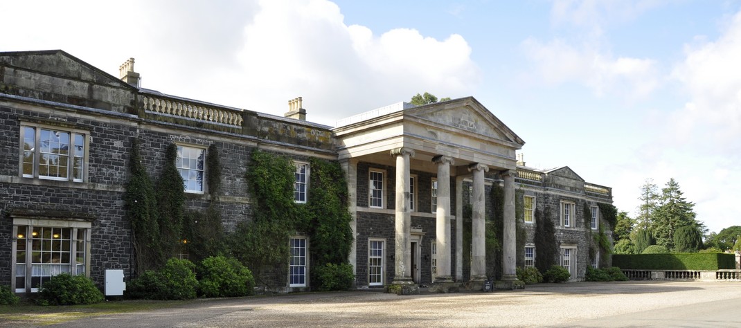
In Great Britain (United Kingdom minus Northern Ireland), Steph and I have visited so many National Trust and English Heritage properties around the country. This link gives a complete list (and maps) of all those we have visited.
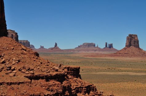
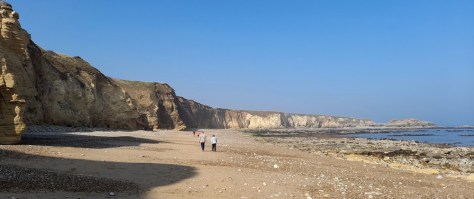
Since we returned to the UK in 2010, we have toured Scotland, spent time in the south and southeast of England, and in Cornwall.


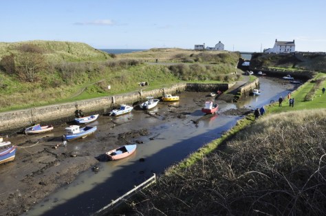
Now that we are living in the northeast of England, we have spent time exploring Northumberland, including its incredible Roman heritage.

The Whin Sill along Hadrian’s Wall
As a small boy, I spent many holidays with my parents in different parts of Wales, and Steph and I will be returning there at the beginning of September to renew our acquaintance with North Wales after so many decades.
So, there we have it. Fifty-five years of travel. So many special experiences.

")


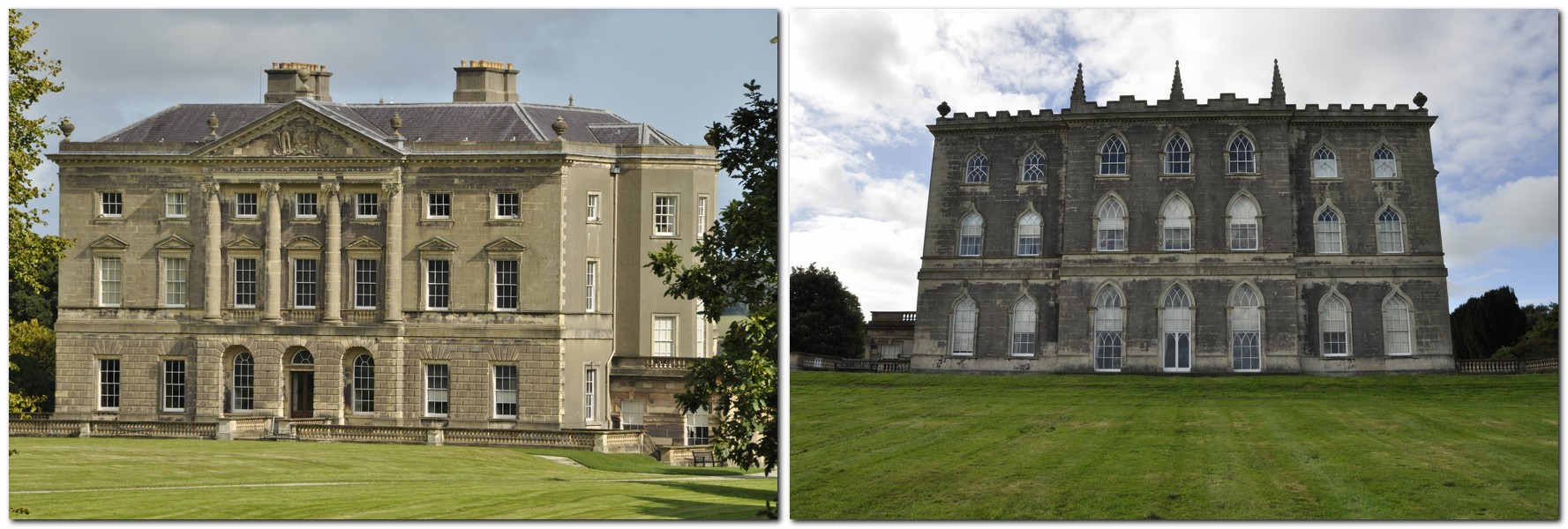
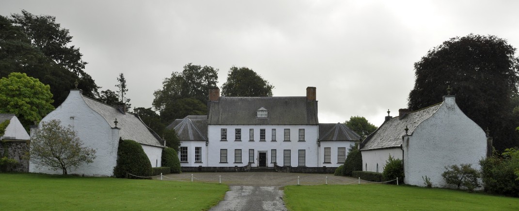
 Florence Court sits well in its landscape, the estate nestling below


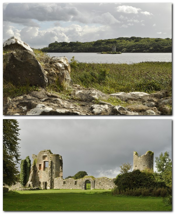
 There is privately-owned castle (not open to the public) on the Crom Estate, home to the Creighton (or Chrichton) family,


 Ward’s son


 But there is one place, much closer to home, that I wanted to see as long as I can remember. And that place is the


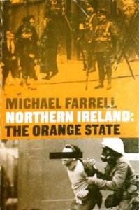 Northern Ireland: The Orange State is a comprehensive account of how partition and its aftermath shaped political, cultural and economic development in Northern Ireland, and how the domination of the Catholics by the majority Protestant Unionists or Loyalists was bound – eventually – to culminate in