For many years, Steph and I toyed with becoming members of the National Trust. But as we were living overseas, and only coming back to the UK each year on leave for just a few weeks, we didn’t think it was worth the membership cost.
However, when I retired in April 2010 and we moved back to the UK, we became members in February 2011. Since then, we have visited 153 properties, mostly historic houses and gardens, but also some of the most beautiful landscapes protected by the Trust, such as the White Cliffs of Dover and the Durham coast.
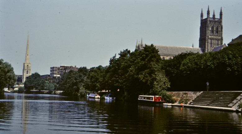
We received gift membership of English Heritage (which cares for 400 historic places) at Christmas 2014, and made our first visits as members by April 2015. We had visited Witley Court, Worcestershire near our home in Bromsgrove several times before becoming members, and Belsay Hall, Dunstanburgh Castle, and Rievaulx Abbey when visiting our younger daughter in the northeast of England. Now that we live near Newcastle upon Tyne, we have in fact explored more English Heritage sites than National Trust locally; compared to further south, there are relatively few National Trust properties here.
Visiting these heritage sites gives us a purpose to get out of the house, benefit our physical and mental welfare, and to explore and learn more about the history of this nation of ours.
Over recent years, we have also taken week-long breaks or longer in various parts of the country to visit many of the heritage properties there. Such as Scotland in 2015, Northern Ireland in 2017, Cornwall in 2018, Kent and East Sussex in 2019, Hampshire and West Sussex in 2022, North Wales in 2023, and East Anglia in 2024.
This map shows all the National Trust and English Heritage properties we have now visited. You will have to zoom in to see more of the detail. There are also links to properties managed by partner organizations like the National Trust for Scotland, Historic Environment Scotland, and Cadw in Wales, as well as a few other sites not affiliated to any of these.
On this page, you can find a list of all 239 properties we have visited, by region, with links to a blog post I wrote, perhaps a photo album, or the official website. In any case, my blog posts are lavishly illustrated by my own photographs. There are also regional maps.
Just under a year ago, I wrote about some of the favorite places we had visited. Today’s blog updates the numbers somewhat.
The National Trust was the vision of its three founders in 1885: Octavia Hill, Canon Hardwicke Rawnsley, and Sir Robert Hunter.
Last week, on 12 January to be precise, the National Trust celebrated its 130th anniversary, and launched a 10-year strategy to 2035, People and Nature Thriving.
Today, the National Trust looks after more than 250,000 hectares of farmland, 780 miles of coastline and 500 historic places, gardens and nature reserves.
And despite the best (or worst) efforts of campaign group and forum Restore Trust to undermine the credibility, management, and success of the National Trust as a charity, the National Trust is overwhelmingly supported by its members (as evidenced from the support at last November’s AGM held in Newcastle), and provides a warm welcome for its thousands of members and visitors at all its sites.
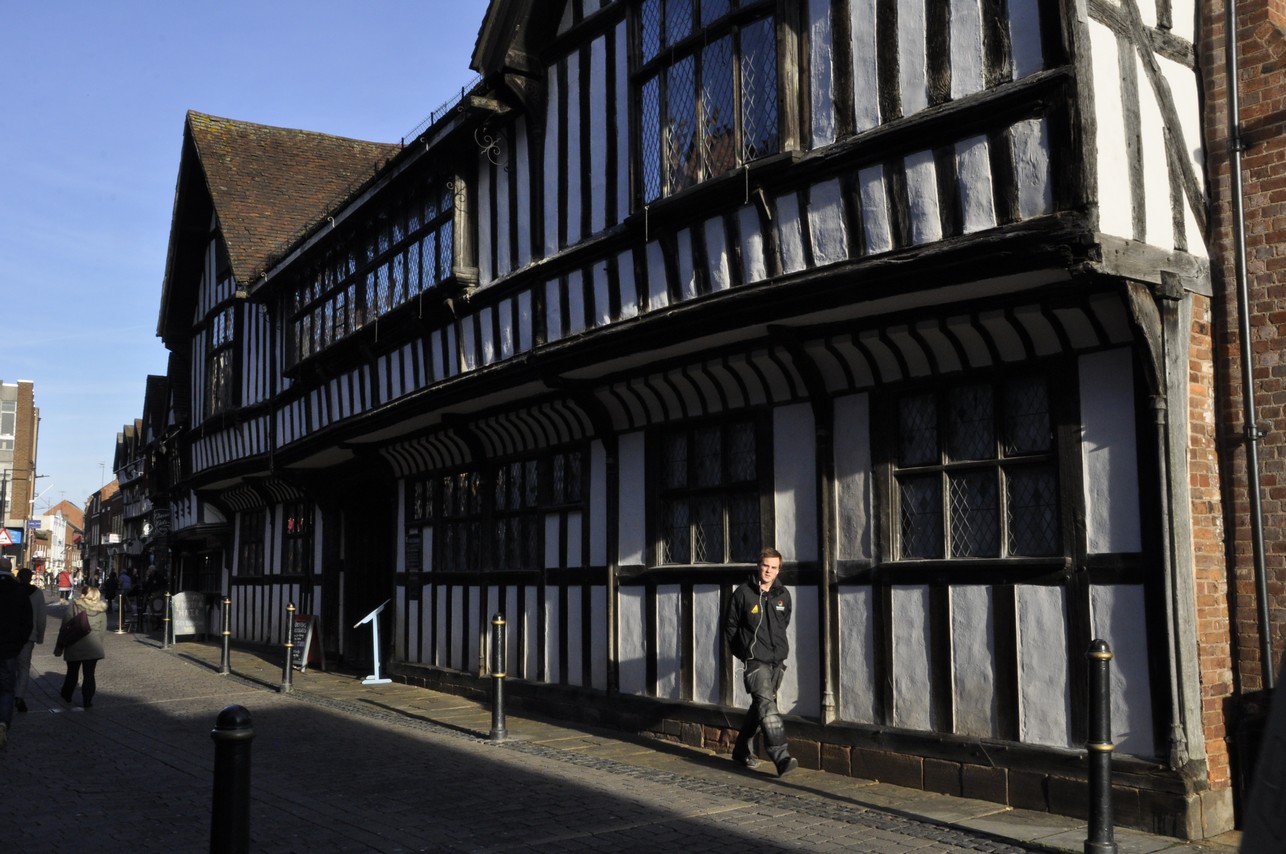
As I was drafting this post, I realised that I’d first visited a couple of properties, Dovedale in Derbyshire and Little Moreton Hall near Congleton, in Cheshire more than 70 years ago, and another, Biddulph Grange, decades before the National Trust acquired the garden.
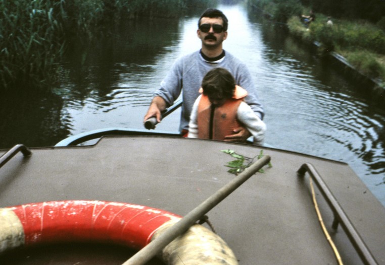
The Stepping Stones in Dovedale. That’s me, on the right beside my mother, along with my brothers and sister and cousins. I reckon this photo was taken around 1951.
My father was the staff photographer at the Congleton Chronicle, and I remember visiting Little Moreton Hall with him when he took this photo and others of the Manley Morris men in 1954.
The Manley Morris Men at Little Moreton Hall on 8 May 1954.
As to Biddulph Grange, Dad (and Mum) would visit the hospital on Christmas Day and take photos of Santa visiting the wards. Even after we moved to Leek in 1956 and Dad was no longer with the Congleton Chronicle, they would return to Biddulph Grange each Christmas until the early 1960s.
And attend some of the social functions held there for staff and friends. When Steph and I visited Biddulph Grange together for the first time in 2011, there was on display an album of photos about the previous history of the property as a hospital. I recognised many as taken by my Dad. Including this one at a staff summer dance. My mother is standing, fifth from the left, on the fourth row. I snapped this one on my phone.
Over the past 14 years, Steph and I have made several awesome road trips across the USA, covering 36 states and visiting many national parks and national monuments. I can’t decide which trip I enjoyed most, but the two we made to the American Southwest stand out for the amazing desert landscapes and the fascinating archaeology there.
The ‘three-sisters’ of indigenous American agriculture.
The Ancestral Puebloans (formerly known as the Anasazi) inhabited the southwest in a region known as the Four Corners (where Arizona, New Mexico, Colorado, and Utah meet) from about 500 CE and were known for their pit houses, and cliff dwellings constructed in alcoves along the walls of sandstone canyons.
Where did these people come from, who taught them subsistence agriculture (based on the ‘three sisters‘ polyculture of corn, beans, and squashes), and why did they abandon many of their settlements around 1300 CE?
Since corn (Zea mays) was domesticated in southern Mexico, thousands of years earlier, the Ancestral Puebloans must have had links with other peoples to the south with whom they traded.
I’m still trying to understand North American indigenous cultures, so I’m not going to make any attempt here to explain the Ancestral Puebloans as such. But I have included links where you can find more information.
In 2011, we spent about 10 days exploring Arizona and New Mexico. This past May, over seven days, we drove from Las Vegas, NV to Denver, CO across Utah.
We first came across Ancestral Pueblo settlements on that 2011 trip when, heading north from Flagstaff, AZ to the Grand Canyon, we took a diversion east and visited Wupatki National Monument, and three different sites there: Wukoki Pueblo, Wupatki Pueblo, and Box Canyon. It was a bustling community at its zenith in the 12th century CE, but had been largely abandoned by the first quarter of the 13th.
Wupatki
Box Canyon
Then it was on to Canyon de Chelly National Monument in northeast Arizona. We viewed three settlements from the rim of the canyon. Mummy Cave, high on the canyon wall (upper image below), was occupied for a thousand years from about 300 CE, so I have read. Antelope House (middle image), and another, White House ruin (lower image, built in the early 11th century CE), nearer the canyon floor, and the only ruin accessible (from the canyon rim) to tourists on foot. Other visits to the canyon have to be organized with local Navajo tour guides.
On that same trip we drove into New Mexico, passing nearby but not visiting two World Heritage sites: Chaco Culture National Historical Park, a major center of Ancestral Puebloan culture dating between 850 and 1250 CE, and Taos Pueblo, home to Native Americans for over a thousand years. Near Los Alamos, we did visit Bandelier National Monument, a site dated to a later Ancestral Puebloan era, from around 1150 CE to 1600 CE, with rooms carved into the cliff face.
This year, however, Mesa Verde National Park in southwest Colorado (some 35 miles west of Durango) was very much on our itinerary. Ancestral Puebloan remains there span the whole 750 year occupation from about 550 CE up until c. 1300 CE.
The route I’d planned south to Durango took us from Grand Junction in northwest Colorado over the Million Dollar Highway, a 25 mile section of US 550 between Ouray and Silverton in the San Juan Mountains. I had expected the 165 mile drive to take all day, and had planned accordingly, since the Million Dollar Highway is claimed to be one of the most challenging—and dangerous—highways in the USA. In many places there are no guard rails. You can view the route in a couple of videos here. Just scroll down to ‘Day 5’.
However, it took only half a day, so we decided to head to Mesa Verde that same afternoon rather than waiting for the next morning. I guess we must have arrived at the Visitor Center by about 3 pm. Like our visit to Bryce Canyon a few days earlier, arriving mid-afternoon was really quite fortuitous. Many visitors were already leaving and none of the parking lots at the various sites along the park drive was busy, making for a tranquil appreciation of all the park had to offer. And, as an added bonus, visiting Mesa Verde that afternoon freed up time the next day for the 260 mile drive east to Cañon City.
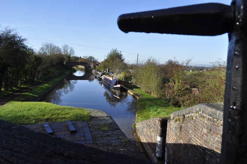
From the Visitor Center it’s a 23 mile drive to the southernmost point on the Mesa Top Loop where some of the most complete ruins are located. The park has 5000 known archaeological sites, and over 600 cliff dwellings. Although famous for its cliff dwellings, these were occupied for a short period, not long before the people abandoned Mesa Verde for reasons not fully understood, and moved south. Click on the map below to open an enlarged version.
The park road climbs steeply on to the mesa top, which lies around 7-8000 ft above sea level. So, in summer it’s blisteringly hot, and bitingly cold in winter. No wonder it was a challenge to live here.
On the way south, one of our first stops was the Montezuma Valley Overlook, from where there is an impressive view of the landscape west into Utah. Click on this image to open a larger version.
I recently came across the video below, posted by explorer and YouTuber Andrew Cross (Desert Drifter – more later). On a recent visit to southeast Utah in Montezuma Canyon, a group from The Archaeological Conservancy explored the extensive settlements there.
The first Ancestral Puebloans lived in pit houses on the mesa tops, and constructed partially underground. The earliest date from the 6th century CE.
Then, several centuries later, larger villages were established (like those we saw at Wupatki) but also the cliff dwellings comprised of multiple houses and rooms, and round, ceremonial courtyards known as kivas, and which can also be seen in the Bandelier images above.
Two of the sites on the Mesa Top Loop, the Cliff Palace and Balcony House are only accessible on a guided tour, which we didn’t take. In any case, access to both requires scrambling up ladders, which I would not have managed (I’m currently using a stick due to an on-going back problem). The Cliff Palace and several other buildings close by can be viewed from an overlook. All very impressive.
Mesa Verde NP
Mesa Verde NP
The Ancestral Puebloans gained access to the cliff dwellings through handholds in the rock face, or using ropes. Certainly their difficult accessibility must have been a key feature for defence.
So, from the original sparsely settled villages of pit houses, to the more densely populated cliff dwellings, it’s estimated that Mesa Verde was once home to thousands of families. But by about 1300 CE they had upped sticks and moved on. Why? No-one really knows but it could have been due to drought affecting agricultural productivity. Or maybe conflicts had broken out, thus the reasons for more defensive villages in the cliff dwellings. The Ancestral Puebloans certainly left a strong legacy behind.
Earlier I mentioned Andrew Cross (right) and his Desert Drifter channel. It’s certainly worth a watch. His videos document his backpacking trips into canyon country looking for signs of the Ancestral Puebloans (and other indigenous peoples) that he has discovered through careful study of Google Earth images.
And he has come across some remarkable settlements, often sufficient to support just one or two families at most, who left behind evidence of their occupancy 1000 years ago in the form of pottery shards (typically black stripes on a white background), arrow heads, various tools for grinding corn, and ancient corn cobs as well. And the Puebloans also left behind incredible pictographs (paintings) and petroglyphs (etched into the rock surface) of fantastical humans, animals, and symbols. Hand prints are common everywhere.
The day after visiting Mesa Verde, we set off early from Durango to cross the mountains east of Pagosa Springs, before heading northeast to Cañon City.
About 16 miles short of Pagosa Springs we saw a road sign to Chimney Rock National Monument, which was just under 4 miles south from the main highway, US 160. I hadn’t noticed this when planning the trip, but as we now had extra time, we decided to explore. We were not disappointed.
Chimney Rock, an outlier from the Chaco Canyon Regional system, ‘. . . covers seven square miles and preserves 200 ancient homes and ceremonial buildings, some of which have been excavated for viewing and exploration: a Great Kiva, a Pit House, a Multi-Family Dwelling, and a Chacoan-style Great House Pueblo. Chimney Rock is the highest in elevation of all the Chacoan sites, at about 7,000 feet above sea level.’
From the Visitor Center, it’s a a 2½ mile drive, on a gravel road, to a parking lot just below the summit of the mesa, and the ruins there. From the parking lot, it’s a steady climb over about a quarter of mile to reach the summit, at 7620 feet.
The panorama there takes in the Rockies to the east, and southwest into New Mexico towards Chaco Canyon, about 90 miles away.
Our visits to these extraordinary sites have, for me, generated more questions than answers. I need to spend some time researching human expansion across North America over the millennia. And the story of how agriculture developed in this region of the Four Corners continues to fascinate me.
Well, after our road trip in 2019 I ‘promised’ myself that would be the last one. And although enjoyable, maybe I pushed myself a little too much; I found it rather tiring.
Tuesday 14 May. And here we were preparing to jet off to Las Vegas to begin another trip, this time across Utah and Colorado over the next seven days.
It was an early start to the airport for the 07:00 flight to LAS.
As I mentioned in my recent post, I already had a route planned and all our hotels booked. But the route was always subject to change, and that’s precisely what happened once we were on the road and could see the progress we made each day.
Now back in Minnesota I’ve been editing >1100 images and have placed them in photo albums at the end of this post.
I also used my dashcam throughout the whole trip, so I’m busy editing >222 GB of footage into short videos, some of which are included in the narrative below.
When I was planning this trip, and in touch with my old friend and former colleague, Roger Rowe, he suggested I should play Willie Nelson’s On the Road Again as a background theme to our travels.
Well, I’m not a particular Willie Nelson fan, but his words certainly resonated each morning as we set out on each leg of the trip, that I’ve documented here with maps and descriptions of the many interesting places we visited along the way, over more than 1600 miles. And, my British readers will be surprised to learn, at a gasoline cost of only £0.06 (6p) per mile.
Day 1: 14 May – Las Vegas, NV to St George-Washington, UT via the Hoover Dam (185 miles)
After a three hour flight from Minneapolis-St Paul (MSP) we landed in Las Vegas on time just after 08:00 and, having only hand luggage, were quickly out of the terminal, catching the shuttle bus to the car rental center south of the airport. Which was a good location for us as we were headed southeast to the Hoover Dam.
I’d booked an intermediate SUV through Alamo, and the pickup in LAS was quick and efficient. Choosing a VW Tiguan (with California plates) among several options on offer, we must have been on the road just after 09:00, heading for a supermarket en route to pick up supplies of drinking water, fruit, and other snacks for the trip.
Construction of the Hoover Dam, straddling the Nevada-Arizona state line, began over 90 years ago, and it was commissioned in 1935. What a magnificent example of engineering expertise of the time. Walking across the dam, and taking in its art deco features, you can’t help wonder at the sheer scale of its construction. And the Mike O’Callaghan-Pat Tillman Memorial Bridge, which opened in 2010, is the second highest in the USA and carries Interstate 11 and US Route 93 over the Colorado River. You can really appreciate the scale of this bridge in this video.
We arrived late morning, parked in the covered car park (worth it, at $10 a time, since the temperature was approaching 100°F). Later on we drove across the dam to the Arizona side (and a different time zone) to eat our lunch overlooking Lake Mead, and noting just how low the water level had become.
Hoover Dam
Hoover Dam
Then it was time to head north for our first stop of the trip in St George-Washington just over the Arizona-Utah state line.
Day 2: 15 May – St George-Washington to Bryce Canyon City via Zion National Park and Bryce Canyon N.P. (207 miles)
First stop of the day was Kolob Canyons, part of Zion National Park, some 30 miles north of St George-Washington.
There’s just a 5 mile road from the Visitor Center to an overlook point over the canyons to the east. This was our first introduction to ‘canyon country’ on this trip (we’d visited the Grand Canyon and Monument Valley in 2011).
Zion was heaving with tourists and this wasn’t by any stretch of the imagination the peak season. All campgrounds were full, and there was no parking available at the Visitor Center.
Zion NP
Zion NP
Zion NP
It was never our intention to take the shuttle into the canyon itself, but just drive through. And what a drive it was with magnificent red sandstone cliffs rising all around.
Even though we took our time to drive through the park, we realised that we would reach Bryce Canyon by mid-afternoon. And, rather than delay that visit until the following morning, decided to enter the park there and then, and actually benefitted by seeing some of the more iconic landscapes in the late afternoon sun. Landscapes to make your heart sing. As the park brochures states: Red rocks, pink cliffs, and endless vistas! The sandstone pillars reminded me of China’s Terracotta Army.
Bryce Canyon NP
Bryce Canyon NP
Day 3: 16 May – Bryce Canyon City to Moab, UT via Grand Staircase – Escalante National Monument (290 miles) We set out early on Day 3, knowing we had one of the longest drives of the trip to reach Moab. As we had originally planned to tour Bryce Canyon that morning, I had chosen a route to Moab taking in the major roads, knowing it was likely to be faster. But with the whole day to reach Moab, and discovering that the route across the desert, Scenic Byway Route 12 (SR-12), through the Grand Staircase-Escalante National Monument, is also designated as an All-American Road, and not as remote as I had imagined just looking at a highways map.
What an experience, and definitely a must-travel route if you are ever in that area.
Look out for the ‘Hogback’, where the road has sheer drops on both sides, just after 18 minutes in the video below.
Reaching I-70 by mid-afternoon, we made good progress to Moab as the speed limit on this interstate was 80 mph. A mostly boring drive, but with one spectacular section.
Day 4: 17 May – Moab to Grand Junction, CO via Arches N.P. and Canyonlands N.P. (231 miles)
Arches National Park is just a few miles north of Moab, and beyond the park entrance, there’s an impressive climb along the cliff face to enter the park proper. Admission to the park is by timed tickets, and I’d reserved a slot for 08:00 as soon as they became available in early April.
Arches is a ‘closed’ park, with entrance and exit the same, with a drive of about 18 miles to the furthest point, the Devil’s Garden Trailhead. I was quite surprised how fast and determined many drivers seemed to be heading there, until we also arrived there about three hours later and found there were no parking spaces at all.
But that didn’t bother us, as we were more than happy to potter along, stopping wherever we could and just taking in the most incredible scenery, and views of the La Salle Mountains to the southeast.
Arches NP
Arches NP
We spent most time walking up to the Two Windows arches and Turret Arch (I guess a little over a mile in total), where there were wonderful views over the park.
Arches NP
We saw the free-standing Delicate Arch from a lower viewpoint. The walk to the arch, about a mile, up a steep cliff face, and in the blistering heat was beyond our capabilities by that point.
After a picnic lunch at Panorama Point, we headed out of the park north to where UT 313 peels west from US191, towards the entrance gate to Canyonlands National Park. It’s a 34 mile drive southwest to the furthest point at Grand View Point.
Canyonlands is the Grand Canyon on a smaller scale, overlooking the Colorado and Green Rivers and their confluence to the south. It’s so vast it was hard to take it all in.
Canyonlands NP
Canyonlands NP
Late afternoon, and we headed north again to re-join I-70 for the remaining 81 miles to Grand Junction, CO and our next hotel stop.
Day 5: 18 May – Grand Junction to Durango via the ‘Million Dollar Highway’ and Mesa Verde N.P. (291 miles) This was always going to be the most challenging day of driving, crossing several passes in the San Juan Mountains, on the‘Million Dollar Highway’ between Ouray and Silverton.
I’d already done my research about the ‘Million Dollar Highway, read reports, and watched various videos on YouTube. Almost all said the highway was not for the faint-hearted, because of the gradients, sharp curves, and steep and deep drop-offs with no guard rails. Had it been raining heavily (we only had a short shower as we left Ouray), foggy, or icy I probably would have chosen another route to Durango.
However, looking back on this section of our trip, it was not as challenging as others would have you believe. We went slowly, and I used semi-automatic use of low gears whenever necessary. Frightening? No, it was exhilarating, crossing three passes at over 10,000 feet, the highest being Red Mountain Pass at 11,013 feet (or 3358 m).
There were few places to stop to take photos, although I was able to capture stills from the video footage.
Ouray and the start of the Million Dollar Highway
The Million Dollar Highway
The Million Dollar Highway
Having left Grand Junction by 08:00, and even taking into consideration the slower traverse of the mountains, we arrived in Durango by early afternoon, so decided to continue on to Mesa Verde National Park, about 35 miles west, rather than leaving the visit for the following morning.
The park is a World Heritage Site, where communities of Ancestral Pueblo people lived for over 700 years, building dwellings on the mesa and cliffs. It’s hard to imagine what drove these Ancestral Puebloans to choose such sites for their houses and temples half way up sheer cliff faces. Caught in the late afternoon sunshine they were indeed impressive.
Mesa Verde NP
Mesa Verde NP
One location we stopped at was the Montezuma Valley Overlook (map). In July 1958, while leading an expedition to collect wild potato species in the USA, Mexico, and Central America, my PhD supervisor and mentor, Professor Jack Hawkes, stopped here and took the photo on the left below. Here I am at the same spot almost 66 years later.
Then it was back into Durango for the night, just in time to catch one of the best grass-fed beef burgers I’ve tasted in a long while.
Day 6: 19 May – Durango to Cañon City, CO via Chimney Rock National Monument (272 miles) I’d chosen Cañon City as our next destination as I wanted to view the Royal Gorge Bridge (‘America’s Bridge’, and the highest in the country) standing 955 feet (or 291 m) above the Arkansas River.
This was just a travel day, with no scheduled stops. That is until we saw a sign, about 29 miles east of Durango, that the Chimney Rock National Monument was just 26 miles ahead. Well I’d never heard of this location, nor had spotted it on the maps I had prepared for the trip.
Anyway, at the turn-off, we noted that the monument was just a handful of miles south from the main road US-160E. What a find!
Chimney Rock National Monument is an Ancestral Puebloan site, with an impressive kiva on the summit of the mesa, and just a stone’s throw from the twin peaks, Chimney Rock and Companion Rock, that give the site its name. Fortunately there’s a dirt road almost to the summit of the mesa, and from there to the buildings is a quarter mile walk, and 200 foot ascent (which I did very carefully).
But what a view from the summit, all the way into New Mexico.
Chimney Rock National Monument
At Chimney Rock, we’d hardly dented our journey to Cañon City, and having spent just under two hours there, with more than 200 miles more to travel (and over several mountain ranges), we didn’t reach our destination until around 19:00. And we were lucky to find somewhere to dine, as it was a Sunday evening.
This next video shows the ascent into the mountains on US-160 beyond Pagosa Springs, crossing Wolf Creek Pass summit at 10,856 feet, and descending towards South Fork.
Day 7: 20 May – Cañon City to Denver via Royal Gorge Bridge and the Florissant Fossil Beds National Monument (184 miles) Built in just six months in 1929, the Royal Gorge Bridge used to carry a road over the gorge, but is now closed to traffic. It stands within a resort and theme park, and pedestrians are allowed to cross – if they dare! It wouldn’t suit me; I suffer from vertigo.
I failed to find an unofficial viewpoint that would have given us a great view down the deep gorge, so had to make do with those from the resort car park.
Then it was off to the Florissant Fossil Beds National Monument, just under 50 miles north, one of the richest and most diverse fossil deposits in the world. Petrified redwood stumps up to 14 feet wide and thousands of detailed fossils of insects and plants reveal the story of a very different, prehistoric Colorado.
Even though off the beaten track, so to speak, we were somewhat surprised how many other visitors showed up shortly after we arrived a few minutes after the opening time of 10:00.
The fossilised redwood trees are indeed impressive, buried in a volcanic mudflow or lahar 34 million years ago, as was the revelation that the monument is probably one of the fossil hotspots in the world. Here’s a film from the National Parks Service about the site.
We took the Petrified Forest Trail (about 1½ miles), viewing some of the redwoods, including Big Stump.
Then, we headed to Denver for our last night on the road, at a hotel near the airport, just as a major storm hit town with hailstones the size of marbles. In fact the last 60 miles after we joined US-285 and then I-70 once again, with several lanes of fast moving traffic, were quite a shock to the system after driving along relatively deserted rural roads for the previous week.
But we reached Denver safely, enjoyed a good night’s sleep before departing for the car rental center around 08.15, in order to catch our flight back to Minnesota at 11:15.
It’s quite illuminating to compare the landscapes around Denver (big agriculture, and very flat with the Rockies to the far west of Denver) with the arrival into leafy Minneapolis-St Paul.
What a wonderful trip! It’s quite hard to choose the highlights, but from a landscape point of view I’d have to choose Bryce Canyon, and the ‘Million Dollar Highway’ and other routes over the Rockies.
Hotels were variable. We always choose a budget or mid-range chain. All we want is a clean room, bed, and bathroom before moving on the next day. What we did notice, however, is how much more expensive hospitality and accommodation has become in the US.
So that’s that for 2024, abroad at least. We are having a week away in East Anglia in the UK during September.
Will we make another US road trip in 2025? Maybe, but currently we’re more inclined towards a three day break in New Orleans, a city we’ve wanted to visit for a long time.
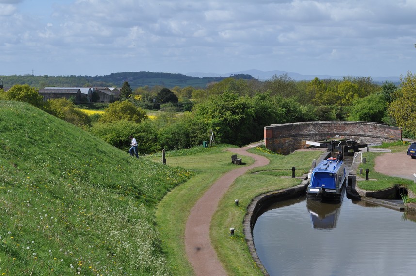
Steph and I are enthusiastic members of the National Trust (NT, since 2011) and English Heritage (EH, since 2015). And we have now visited 145 National Trust properties, and 43 from English Heritage. As well as a smattering of others owned by the National Trust for Scotland, Historic Environment Scotland, and the Welsh heritage organization, Cadw, as well as some not affiliated with any of these organizations.
On this map, I have included all of these properties. You can also expand the map to full screen by clicking on this icon [ ] in the top right corner of the map. Just zoom in to explore in more detail, and click on each icon for more information. They are also listed by region as well on this page.
Until three years ago, we lived in north Worcestershire, and visited many (almost all?) of the NT and EH properties within a 50 mile radius. Since 2020, we have lived in North Tyneside and have been exploring what the northeast has to offer. The NT has fewer properties close to home here in the northeast, although it does manage some spectacular stretches of coastline (as elsewhere in the country).
As you can see from the map, there are several regions of the country that we have yet to explore in any detail. We’ve still to visit the Lake District where the NT is well represented. English Heritage has more properties here in the northeast, but we’ve hardly scratched the surface yet.
Later this year we will spend a week in Norfolk and Suffolk, and have already planned which NT and EH properties to make a beeline for.
It’s hard to choose which have been my favorite visits over the past 13 years. Nevertheless, here are a few choices according to some rather arbitrary categories. The web links will take you to the stories I posted on this blog after each visit or to albums of my own photos.
Our heritage organizations are custodians of many fine properties, which frequently reflect the history of wealth accumulation over the centuries by the families that built and lived in them. As the National Trust is increasingly showing (and rightly so in my opinion, although it’s an approach not unanimously appreciated) how such wealth was accumulated, often off the back of nefarious activities like slavery. Also, even since we became members of the National Trust, visitors now have much more access than before, and photography (without flash) is now widely permitted. And that has made my visits all the more enjoyable.
So, here goes . . .
If I had to choose one property for its ostentation, it would have to be Waddesdon Manor, the former family home of the Rothschild family, near Aylesbury in Buckinghamshire. We visited in August 2014.
The North Front and main entrance
Waddesdon Manor, home of the Rothschilds
The Parterre from the first floor
What a treasure trove! Magnificent! It’s quite easy to be overwhelmed.
However, coming close behind must surely be Kingston Lacy in Dorset, Belton House in Lincolnshire, and Mount Stewart in Northern Ireland. And, of course, there’s Penrhyn Castle outside Bangor in North Wales that we visited for the first time last September.
Many of the houses have quite spectacular interiors, and I’ve taken quite an interest in those architectural features and furnishings. In 2016, we took a trip south from Bromsgrove to Claydon House in Buckinghamshire.
On arrival I discovered that, due to copyright considerations (the Verney family still live in one part of the property and own many of the furnishings), photography is not permitted inside the house. However, after a chat with the National Trust house manager, and explaining my blog and interest in design features of the house, I was given permission to photograph these and never published any photo until I’d been given clearance.
The carvings throughout the house are some of the finest in the country and work of 18th century carver and stonemason Luke Lightfoot (1722-1789).
In terms of carved woodwork, examples of the exquisite craftsmanship of Grinling Gibbons (1648-1721) can be seen at Petworth in West Sussex, Lyme in Cheshire, Belton House, and Sudbury Hall in Derbyshire.
Many properties have significant collections of paintings. There’s one that has particularly attracted my attention. It’s the enclosed courtyard at Wallington, where bright Pre-Raphaelite murals by Victorian painter William Bell Scott, several depicting local scenes and personalities, cover the walls. They are simply exquisite.
Over the many visits we’ve made, I’ve taken an interest in wallpapers, particularly those designed by William Morris. I guess one of the best examples has to be Wightwick Manor near Wolverhampton, which we visited in 2014.
I don’t have any photos from there since photography inside the house was not permitted. But here are some examples from Standen House in West Sussex.
During our visit to Northern Ireland in 2017, we spent a week visiting as many National Trust properties as possible. And there’s no doubt about it. Castle Ward, overlooking Strangford Lough, must be the most architecturally quirky anywhere across the nation.
Built in the 1760s by the 1st Viscount Bangor, he and his good lady wife were unable to agree on architectural style. So the southwest face is Classical Georgian while the northeast is Gothic. And this is repeated throughout the house. Quite extraordinary.
If I had to choose any others, it would be for the eclectic possessions accumulated by their owners and never discarded, at Erddig near Wrexham and Calke Abbey in Derbyshire. Or the active collecting of Charles Paget Wade at Snowshill Manor in the Cotswolds (below).
All of these heritage properties have claim to historic fame in one way or another. Where history was written. On reflection I have given that accolade to Chartwell, near Sevenoaks in Kent, the home of former Prime Minister Sir Winston Churchill. What a life lived!
I wasn’t sure quite what to expect, but was quite overwhelmed at the access visitors had to all areas of the house, to a huge number of Sir Winston’s possessions, and those of his wife Lady Clementine. Even Sir Winston’s huge collection of paintings. It was quite overwhelming.
Being a scientist, I’d always wanted to visit two properties in particular: Down House in Kent, the home of Charles Darwin; and Woolsthorpe Manor near Grantham in Lincolnshire, the birthplace of 17/18th century polymath, Sir Isaac Newton.
I was a little disappointed with the Down House visit. I felt that English Heritage hadn’t made as much of presenting the property as they might have.
And, due to Darwin family restrictions, photography was not permitted inside. Nevertheless, as a student of evolution, it was a privilege to wander around the house and gardens, knowing this was where Darwin formulated his theory of the origin of species.
The legacy of 18th century landscape architect Lancelot ‘Capability’ Brown (right) can be seen at multiple properties across the country. He was born in Kirkharle, Northumberland, just over 19 miles (30 km) northwest of where we now live.
For me, there are two standout landscapes that Brown designed, one of them—at Croome Court in Worcestershire—being among his earliest commissions. The other is at Stowe in Buckinghamshire.
The parkland at Croome has the Croome River that was hand dug over several years, against the backdrop of the Malvern Hills. Quite spectacular, and being one of our ‘local’ heritage sites, Croome became a favorite of ours when we lived in Bromsgrove.
Looking east along the ha-ha to the Church of St Magdalene
We visited Stowe just the once, but there’s no doubt that it is one of the finest examples of so-called ‘natural’ gardening that flourished under Capability’s supervision.
The view from in front of the East Lake Pavilion across the Octagon Lake to Stowe House
Looking west down the Grecian Valley from the Fane of Pastoral Poetry
The Temple of Concord and Victory
The Palladian Bridge from the west
The Palladian Bridge
The Temple of Ancient Virtue taken from in front of the Temple of British Worthies
Steph is a very keen gardener, so our garden visits are always a pleasure. I guess Sissinghurst in Kent, designed by Vita Sackville-West and her husband, would be at the top of our list.
A close second has to be the Arts and Craft garden at Hidcote Manor on the northern edge of the Cotswolds, the inspiration of Lawrence Johnston. Since there are so many fine heritage gardens it almost seems unfair to choose just a couple.
Cragside, near Rothbury in Northumberland was the first house to be powered by hydroelectricity. Home of William, 1st Baron Armstrong (a wealthy engineer and industrialist, eminent scientist, inventor and philanthropist), Cragside has many other innovations throughout the house. And equally impressive, 150 years later, is the estate of trees from around the world that have now matured into such magnificent specimens.
National Trust Cragside
Cragside
Cragside
And while I’m on the topic of technology, I guess anyone has to be impressed by the industrial technology that led to the construction of the bridge across the River Severn at Ironbridge in Shropshire in 1779.
Also Thomas Telford’s suspension bridges at Conwy (below) and over the Menai Strait, both completed in 1826.
Over the years, I’ve become quite an aficionado of parterres that were popular design features at many country houses. My favorite is the one at Hanbury Hall in Worcestershire, which was the heritage property closest to our home when we lived in Bromsgrove, just seven miles. We’d often pop over to Hanbury for a walk in the parkland, and take a look at the parterre in all seasons. It certainly is a credit to the garden staff and volunteers who keep it in such fine shape.
A number of properties have literary links, and a couple were the homes of Nobel Literature Laureates. Of course, I’m referring to Rudyard Kipling at Bateman’s and Sir Winston Churchill at Chartwell.
The front door and garden (7)
The House (6) from the Rose Garden (12)
The Hall
Rudyard Kipling was named after the village of Rudyard in North Staffordshire, just a few miles from my home town of Leek. Kipling’s parents had met there.
Bateman’s is an elegant Jacobean mansion in the East Sussex countryside, acquired by Kipling in 1902 and remained the family home until his death in 1936. Our visit to Bateman’s in May 2019 inspired me to reach into Kipling’s novels, which I hadn’t before, and subsequently enjoyed.
I found visits to a couple of National Trust properties quite emotional, sufficient to bring tears to my eyes. In November 2018 I celebrated my 70th birthday, and Steph and I spent a long weekend in Liverpool, taking in The Beatles Childhood Homes of John Lennon and Paul McCartney.
When I was inside John Lennon’s home at ‘Mendips’, 251 Menlove Avenue in the Woolton suburb, I was suddenly overcome with a powerful emotion. Hard to explain, but I felt myself welling up. As a teenager in the 1960s, The Beatles were very much part of my formative years.
The other place where this has happened was at The Firs, the birthplace of that great English composer Sir Edward Elgar. We’d toured the cottage, looked round the small garden, then headed back to the fascinating museum. It was when we were watching a short documentary film about Elgar to the accompaniment of one of his most memorable compositions, Variation IX commonly known as Nimrod from the Enigma Variations, that I once again felt tears coming. Music can be such a powerful stimulus.
I wrote recently about a successful birding walk around the parkland and woods at Wallington in Northumberland. But there’s one site where the birding opportunities are out of this world. In the Farne Islands just off the Northumberland coast.
Puffins, with guillemots closer to the cliff edge.
Steph and I visited there in 1998, and have plans to revisit again this year. The islands have been closed to visits for the past couple of years because of bird flu that had seriously depleted some of the colonies. We also look forward to birding on the Suffolk coast at Orford Ness later this year.
All the heritage charities maintain an impressive portfolio of castles, some more complete than others. The northeast is particularly rich in castles. Many were reduced to ruins, or slighted, centuries ago following conflicts.
But if I had to choose a couple to put at the top of my list, they would be Caernarfon Castle, owned by Cadw, and which we visited last September during an enjoyable week’s holiday exploring North Wales, and Dover Castle, owned by English Heritage.
Caernarfon (below) is one of four castles built by King Edward I in the late 13th century.
Of the four (the others being Conwy, Beaumaris, and Harlech), Caernarfon is the most complete, and Cadw allows access to much of the castle. Although it was a grey day when we visited, there were relatively few other tourists and we easily had access to all parts.
Speaking of access, English Heritage has innovatively opened up Kenilworth Castle and Hardwick Old Hall (below) by constructing internal stairways and viewing platforms that just expand one’s appreciation of these buildings.
The Derbyshire landscape west of Hardwick Old Hall.
Looking down six floors in the Old Hall. And the magnificent plasterwork on the walls.
Of the many ruined abbeys and priories we have visited, Rievaulx Abbey in North Yorkshire stands out for me (closely followed by Fountains Abbey and Whitby Abbey). I guess it must be to do with Rievaulx’s location in the valley of the River Rye. The monks knew just where to build!
View of the Abbey from Rievaulx Terrace
View of the Abbey from Rievaulx Terrace
The Day Room
The Day Room
Tiers of gothic windows
Rievaulx Abbey
However, there is one church where worship is still celebrated today, and is quite outstanding. That has to be St Mary’s Church in the village of Kempley in Gloucestershire. The interior walls are decorated with beautiful frescoes.
St Michael and the Virgin.
The north wall with its paintings of the Wheel of Life, and those of St Anthony of Egypt and St Michael and the Virgin, either side of window.
Six of the 12 apostles on the north wall of the chancel., St Mary’s Kempley
The British landscape is blessed with the remains of ancient cultures going back thousands of years, from various standing stones (like Stonehenge and the Avebury Ring), ancient villages (Chysauster in Cornwall), and Iron Age settlements and hill forts.
Impressive as Stonehenge and Avebury are, there’s something about the Calanais Stones in the Isle of Lewis in the Outer Hebrides. I first came across these standing stones in the summer of 1967, and Steph and I visited them during our tour of Scotland in 2015.
Of all the Roman remains throughout these islands, Hadrian’s Wall (and all its associated forts and watchtowers) has to the number one attraction. And it’s on our doorstep.
Housesteads from the air (Source: English Heritage)
Hadrian’s Wall, near Housesteads fort
Underfloor heating at Chester’s Roman Fort (English Heritage)
Underfloor heating
In February 2022, on a bright but sunny day, we decided to walk a short length of the Wall, from Steel Rigg Car Park to Sycamore Gap (below). And we saw the iconic tree before it was maliciously felled in 2023.
Undoubtedly there are so many more properties to choose from, and I’m sure my choices won’t be to everyone’s taste. But the heritage is out there to explore and enjoy, and that’s what Steph and I will continue to do, come rain or shine.
Born around 1122/25, he is widely regarded as one of the most powerful of Khmer monarchs, and ruled the vast Khmer Empire between 1181 and 1218. He was the first Khmer king to fully embrace Buddhism (earlier kings had been Hindu).
The empire was founded at the beginning of the 9th century, and at its zenith in the 12th century had subjugated much of Southeast Asia. By the middle of the 15th century however it had disappeared. All the temples and surrounding buildings were reclaimed by the jungle, and not uncovered again until the 19th century, mainly by French archaeologists. Archaeology is thriving in Cambodia today, and new discoveries are being made.
Southeast Asia circa 900 CE, showing the Khmer Empire in red.
At the heart of the empire was the capital, Angkor, with its principal temple Angkor Wat, now one of the most visited heritage sites worldwide. Angkor Wat features on the national flag of Cambodia.
Steph and I (with our younger daughter Philippa) had the privilege of visiting Angkor Wat in December 2000.
Angkor Wat was actually built by Suryavarman II(ruled 1113– c.1150) as a Hindu temple, and took almost 30 years to construct. Under Jayavarman II, it gradually became a Buddhist one. The king was also responsible for one of the most beautiful temples, Bayon (below), at Angkor.
And he established an impressive network of more than 100 hospitals throughout his empire, and other temples and cities that are now only being intensively studied in the northwest of Cambodia close to the frontier with Thailand.
Last Saturday Steph and I watched (on Channel 4) the third and final part of Lost Temples of Cambodia, fronted by British archaeologist Pauline Carroll (about whom I can find no information other than she worked on the dig in Leicester that discovered the remains of King Richard III in 2012). Click on the image below to access each of the programs.
Filmed at Angkor Wat and other close-by sites, the programs also explored newly-discovered sites to the north west close to the frontier with Thailand. And, as with Angkor Wat, the temples at Banteay Chhmar (and another recently-discovered a short distance away at Banteay Toap) are revealing much about the king who built them.
As we watched the programs, it was hard not to pinch ourselves that we had been so lucky to have visited Angkor Wat before it became overrun with tourists. We had flown to Siem Reap from the Philippines (where I was working at the International Rice Research Institute) via Singapore on Silk Air, and spent three nights there. Which gave us two full days to explore the many Angkor sites and take a boat ride on the large lake nearby, the Tonlé Sap.
Just click on each of the icons on the Angkor map below to explore a photo album for each, and zoom out to see the location of other sites in the northwest of Cambodia that were featured in the Channel 4 programs.
We didn’t join any tour to explore Angkor. Through one of my IRRI colleagues based in Phnom Penh we arranged for a driver to pick us up at the airport, and then stay with us over the next two and a half days. Once we had toured one of the sites, the driver quickly whisked us off to the next, finding the best locations to start from. Such as at Banteay Kdei (photo album), where he dropped us at one entrance, and picking us up on the far side of the site once we had walked through at our own pace, and not one dictated by any tour guide.
Even at Angkor Wat itself it’s quite remarkable how many photos I was able to take with only a smattering (if any) of other tourists (photo album).
As we watched the TV programs, it brought back to us how beautiful are the many bas-reliefs and stone carvings in general through the Angkor complex. Absolutely exquisite! And to some extent, those at Banteay Chhmar and Banteay Toap (more recent than Angkor Wat although constructed by Jayavarman II) are even finer.
Here is just a small selection of those we saw.
Taking the Angkor complex in total (and the many other sites across Cambodia) the construction of temples and other buildings would have required millions of tons of sandstone that had to be quarried some distance away and transported to the sites.
The stone came from Phnom Kulen, a range of hills to the northeast of Angkor Wat by about 30 miles. A series of canals was constructed to float the millions of stone blocks to the construction sites, on rafts pulled by elephants. Evidence for the canals was first gleaned from satellite images, and verified at ground level.
The construction must have involved a very large population. It has been estimated that perhaps as many 1 million people lived at Angkor, making it one of the largest cities in the ancient world. And they would have to be fed. But on what? Rice, of course, and that crop remains the staple in Cambodia today, thriving in the hot humid lowland climate, even in seasonally deep-water sites.
Eventually the Khmer Empire declined. Was it due to overpopulation, climate change affecting agricultural productivity, or warfare both internal and foreign? Certainly the Khmer faced threats and invasion from Thailand and Vietnam. Probably it was a combination of many factors.
But as new sites are discovered and recovered from the jungle, the history of this once thriving empire is being revealed in ever more detail.
There were a few things that caught my attention in the three program series on Channel 4.
I mentioned that Pauline Carroll was an unknown entity before now. And yet, she didn’t ‘front’ the series in quite the way you might expect in such programs. There was a background narrative, from restaurateur and presenter of The Great British Bake Off, Prue Leith. What a strange choice as narrator! Instead, Pauline Carroll was left to wander around the various sites, ask a few questions of local archaeologists, and occasionally speak to camera.
Second, as with many documentary programs nowadays, considerable use was made of drones to capture aerial shots, which certainly enhanced appreciation of the scope and scale of Angkor Wat and the other sites. In the past, such aerial photography would have required helicopters, but even low-cost drones can provide high quality output, and reaching areas inaccessible to helicopters.
And the final point I would like to make is about the healthy state, it seems, of Cambodian archaeology. Pauline Carroll met and spoke with several knowledgeable Cambodian archaeologists who have taken on the role of revealing their nation’s cultural history. And this is even more remarkable and encouraging considering it’s not that many decades since the appalling Cambodian genocide perpetrated by the murderous regime of Pol Pot in the 1970s, when millions of lives were sacrificed, particularly from the intelligentsia.
I was born in November 1948. Clement Attlee was the Labour Prime Minister, and the National Health Service (NHS) had been launched just a few months earlier, on 5 July. I was the 160,000th baby born under the NHS, or thereabouts.
I’m now 73, and don’t deny that I probably spend more time than is good for me reflecting on things past. Inevitable I guess, since I look ahead to fewer years than those I’ve already enjoyed.
During my lifetime there have been some remarkable—many tragic—events that historians will analyze and write about for years to come. What world (and local) events have found a place in the recesses of your mind? Where were you at the time? How many of my memories appear on your list?
I grew up in Congleton, Cheshire. For obvious reasons I don’t remember anything about the first couple years or so of my life. In July 1950 the Korean War broke out and continued until an armistice was signed at the end of July three years later. And we’re still living with the fallout from that conflict seven decades later!
On 6 February 1952, King George VI passed away, and his elder daughter Elizabeth (then away in Kenya with her husband Philip, Duke of Edinburgh) ascended the throne as Queen Elizabeth II. I have no recollection whatsoever of that event, and hardly any of the coronation on 2 June 1953. But I do have photographic proof, however, because all the children in our neighborhood in Congleton dressed up for the occasion. The Queen’s accession is topical right now, as she celebrates her Platinum Jubilee, the longest-serving monarch in the country’s history.
Coronation Day, 2 June 1953; at the bottom of Howey Lane. Back Row L → R : Margaret Jackson; Jennifer Duncalfe; Josie Moulton; Meg Moulton; Susan Carter; Ed Jackson; Richard Barzdo; NK: Peter Duncalfe; NK; George Foster; David Hurst; Stephen Carter; Martin Jackson. Front Row L → R : NK; Carol Brennan; NK: Alan Brennan: Robert Barzdo; NK; Mike Jackson.
We moved to Leek ( a market town in North Staffordshire just 12 miles southeast of Congleton) in April 1956. I’d celebrated my 7th birthday the previous November. The defining event perhaps of 1956 was the Suez Crisis, which lasted for just over a week from 29 October, leading to the humiliation of the United Kingdom and France that jointly had tried to regain authority over the Suez Canal from Egypt. The events of that week mean little to me now, but the one thing that I do remember very clearly was petrol (gasoline) rationing, which began in mid-December and lasted for four months. Handing over coupons in exchange for fuel made quite an impression on my young mind.
Rationing was lifted in May 1957. During the energy crisis of the early 1970s (after I’d already moved to Peru) the UK government contemplated introducing petrol rationing once again, but this did not materialize.
Incidentally, general rationing introduced during World War II lasted until July 1954. I can just about remember running errands for my mother to the corner shop near our house in Moody Street in Congleton, and handing over ration coupons.
Khrushchev and Kennedy (Source: Wikipedia).
October 1962. The Cuban Missile Crisis. Just a month before my 14th birthday. Was that standoff between Soviet First Secretary Nikita Khrushchev and President Kennedy the closest the world came to full-scale nuclear war? I think the consensus is Yes! I remember that fateful day, 22 October if my memory serves me right when Khrushchev and the Soviets blinked first, and the stand-off between these two nuclear powers began to de-escalate. I was in high school, and there was certainly an air of anticipation, anxiety even, as the deadline approached. We all breathed a sigh of relief when no mushroom clouds appeared on the horizon. That’s how seriously we believed the situation to be, naive or otherwise.
A couple of things jog my memory from August 1963. Yeah, yeah, yeah! On the 23rd, The Beatles released She Loves You, perhaps the hit single that signaled their meteoric rise to fame and fortune.
Having seen them ‘performing’ She Loves You on a Saturday TV program, I realized this was something special. I was fourteen, and staying with an aunt and uncle who kept a pub in Staines.
Only a couple of weeks earlier, one of the most notorious (but badly planned and incompetently executed) robberies took place in Buckinghamshire when a gang held up a Royal Mail train, stealing more than £2.6 million (=£56 million at today’s value). Known as The Great Train Robbery, it was a daring raid and has, over the decades, been absorbed into popular culture. The morning after the robbery, the airwaves were broadcasting nothing but accounts of the previous night’s event, and how the police were already tracking the gang down. Most were eventually brought to justice, although several did flee overseas.
President Kennedy with wife Jacqueline in Dallas shortly before his assassination.
However the assassination of President Kennedy in Dallas, Texas on 22 November 1963, 12:30 CST (18:30 GMT) was surely one of the life-defining moments of the 20th century. Everyone knows where they were when his assassination was announced. The whole world was stunned. I had been watching early evening television, when the program was interrupted, maybe a little after 19:00 to announce Kennedy’s death. For the rest of the night there were no further broadcasts, just solemn music, and a static image. It was, undoubtedly, a turning point in American politics. Kennedy’s successor, Lyndon Johnson won re-election in 1964, and introduced far-reaching civil rights legislation. The Civil Rights Movement suffered a significant loss with the assassination of 39 year old Martin Luther King in April 1968. By then the right-wing backlash against the Johnson liberal agenda had begun, and when he decided not to contest the 1968 election, that opened the door to Nixon (and Reagan at the end of the decade after Jimmy Carter’s one-term presidency).
In June 1967, the Six Day War between Israel and a coalition of Arab states (Egypt, Syria, and Jordan) ended in victory for Israel and its annexation of and expansion into Palestinian lands on the West Bank. Almost 55 years on and the world sees this as yet another unresolved conflict and a potential tinderbox in the future. I am unable to offer any support for the Israelis as they continue to expand their stranglehold over the Palestinian territories.
What was the significance in my life? Well, I was studying for and beginning to sit my Advanced Level (university entrance) exams, and my exam anxiety was certainly increased as uncertainty about the outcome of the war, and possible involvement of the superpowers, was contemplated around the world.
Earthrise, taken by William Anders. (Source: Wikipedia)
During the Christmas 1968 vacation, I was home in Leek from the University of Southampton. As during previous Christmas breaks, I had a temporary job with the Post Office, delivering the Christmas mail. Quite a bit of snow fell during those days, and it was not particularly pleasant trudging around the streets with a heavy sack of mail over my shoulder. Also, I was keen to get back home to watch the latest news from the Apollo 8 mission to the Moon, captained by Frank Borman, and the first crew to leave Earth orbit.
It’s also remarkable to remember that only seven months (and three missions later) that Apollo 11 landed two men on the surface of the Moon in July. I was away in Norfolk on a botany field course. And, much against the wishes of the course tutors, we rented a TV so that we could watch the first steps live.
Richard Nixon had been re-elected POTUS in the November 1972 general election, only to see his presidency unravel in 1973 and 1974 as the Watergate scandal caught up with him, and leading to his resignation in August 1974. After I moved to Peru in January 1973, I did not have day-to-day access to news in English but I did subscribe weekly to Time and Newsweek. I didn’t throw any of the magazines away, not even in August that year when Steph and I decided to move apartments. The pile of magazines came with us. And it was after Nixon’s resignation, and we were thinking about moving once again, that I decided to have another look through all those copies. The American political cartoonists had Nixon’s number from very early on in the scandal, and each week, some of the very best were published. I made a scrapbook of all those cartoons; here’s a link.
Closer to home were The Troubles in Northern Ireland, with a surge in violence in the early 1970s and beyond. Bloody Sunday (on 30 January 1972) was, in some ways, the beginning of the worst of the sectarian violence over three decades until the Good Friday Agreement of 1998.
Four days before I departed for Lima, on 1 January 1973, the United Kingdom joined the European Economic Community(EEC) only to leave 47 years later (more of Brexit below).
In April 1975 the Vietnam War effectively came to an end when the army of North Vietnam rolled into Saigon in the south. Three images epitomize the horrors of that war: naked 9 years old Phan Thị Kim Phúc running down the road following a napalm attack on her village (there is a happy ending); the execution of a suspected Vietcong official in Saigon; and the chaotic evacuationof the US embassy in Saigon (reminiscent of the evacuation recently from Kabul)
I was back in the UK by April 1981, launching my second career as a lecturer at the University of Birmingham. In late March 1982 I took a party of MSc students to Israel to attend a two week course on crop wild relatives and their conservation. It was while we were there that Argentina invaded the Falkland Islands (Islas Malvinas) in the South Atlantic, claiming that they were sovereign Argentinian territory. We had lots of discussions how the British government would respond, with several of my students dismissing any idea that there would (or could) be any military response so many thousands of miles from the UK. They (and the Argentinians) hadn’t reckoned with The Iron Lady, Prime Minister Margaret Thatcher. The response was swift, and on reflection, quite brutal. The Falklands War lasted a mere ten weeks, ending with defeat for Argentina. It was a war that should never have started. It did however cement Margaret Thatcher’s legacy.
What about the Chernobyl nuclear accident of 26 April 1986 in the Ukraine? To what extent did this have any impact on your community? The whole area around Chernobyl remains a safety exclusion zone. The disaster reminds us of the dangers of lax regulation of a nuclear industry, at a time when countries are looking to disinvest in fossil fuels. The effects were felt as far west as the UK where radioactive caesium-137 was detected in upland areas of Scotland, Northern Ireland, and northern England, affecting the movement of livestock.
One of the most infamous occurrences of the Cold War must surely be the erection of the Berlin Wall in August 1961, and its aftermath, brutally dividing the citizens of that city. But that all changed in November 1989 when the wall came tumbling down, signalling the collapse over the next few years of the Eastern Bloc of Communist countries, in particular the Soviet Union in December 1991. I passed through the wall on a visit to East Germany in March 1990. Given the current dangerous situation on the Ukraine-Russia border there are those within the Russian hierarchy who wish to turn the clock back.
At the same time, Yugoslavia began to break up between June 1991 and 1992 with the inexorable slide to war in the Balkans between 1992 and 1995. I was working abroad again at that time, and didn’t have regular access to TV news bulletins, so perhaps was ‘spared’ some of the daily horrors of that war even though we were aware of atrocities like the Srebrenica massacre of July 1995.
And talking of moving abroad, there was an event in June 1991 that almost put paid to my travel plans. In the Philippines, the eruption of Mount Pinatubo was the second most powerful eruption of the 20th century. And combined with the arrival of Typhoon Yunya, the towns and villages surrounding the volcano were deluged with volcanic ash and that, mixed with rain, formed a concrete-like layer (lahar) that buried some communities meters deep. Ash fell on Manila 91 km to the southeast and closed the international airport. Ash even fell on Los Baños (my destination) a further 70 km south. With the closure of the airport I did wonder when I might be able to travel to the Philippines to begin my new job at the International Rice Research Institute (IRRI).
The spread of the ash cloud between 14 and 25 April 2010.
Ironically, the eruption of another volcano 19 years later almost delayed my return to the UK after retiring from IRRI. Between 20 March and 23 June 2010, the Icelandic Eyjafjallajökull volcano spewed an enormous ash cloud over much of Europe closing down aviation for several weeks. We left the Philippines on 2 May arriving home the following day.
It must have been mid-morning, 1 September 1997, and Steph and I were shopping in the US embassy commissary in Manila. Another British couple arrived and asked if we’d heard the news that Diana, Princess of Wales had died in a automobile accident in Paris some hours earlier. I can’t deny that I had little time for this rather shallow woman, but she was an iconic celebrity on the world stage. What took me by surprise was the overt outpouring of grief, not only in the UK but in many in the countries around the world. I was amazed how my Filipino staff reacted to her death. Quite extraordinary scenes in London during her funeral.
Another tragic natural disaster was the 26 December 2004 earthquake and tsunami that affected 14 countries surrounding the Indian Ocean, with more than 227,000 persons losing their lives. One aspect of the reporting of the disaster in the British media particularly disgusted me. By then we’d already had daily access to BBC news broadcasts. And as was typical of reporting on disasters around the world, it was assessed by the number of British citizens who lost their lives. It seemed as though all the other deaths were somehow collateral and didn’t matter. It certainly affected the psyche of millions in the region. The Tōhoku earthquake and tsunami in Japan on 11 March 2011 was Mother Nature’s repeat performance, but one that was extensively captured on video the destructive power of tidal waves for the first time. It also led to the Fukushima nuclear disaster.
(Source: Wikipedia – official White House photo by Pete Souza).
Let’s, for just a moment, turn to something far more positive and uplifting. What could that be? The election of Barack Obama as the 44th POTUS, the first black American to hold that post was not only a momentous occasion in the United States but worldwide. After eight years of Dubya, Obama’s elevation to the highest office in the land was a breath of fresh air. His empathy, charisma, and oratory to inspire set him so apart from his predecessor. Of course he didn’t get everything right. But in light of what was to come after Obama, GW Bush does not, in hindsight, seem to have been the appalling POTUS that many perceived or implied during his eight year occupancy of the White House.
And so to the 2016 general election, when Donald J Trump, Cockwomble-in-Chief became Number 45. What an unmitigated (and dangerous) outcome for the USA.
For many of us in the UK (48% of those who voted) 2016 was also a disastrous year, with the referendum on membership of the European Union (EU) leading to our exit: Brexit! And still Brexiters are trying to conjure up advantages and opportunities of leaving the EU when all the data point in the opposite direction.
As I conclude this post, we are still in the throes of the Covid-19 pandemic, although the government here in the UK would have us believe otherwise. So many invocations of British exceptionalism over the past two years make me almost ashamed to claim British nationality. Boris Johnson‘s government is mired in scandal and corruption and one can only wonder how he’s managed to hang on this long.
Just at the time when we need a strong government to help rebuild the economy and society as the pandemic wanes (hopefully), and in the face of Russian aggressive moves on Ukraine’s eastern frontier. It seems that we are closer to a wider conflict in Europe than since the Second World War. For f***s sake, what does Vladimir Putin think he’s playing at? While also recognizing that the NATO alliance hasn’t got everything right either, this warmongering on both sides is, to me at least, inexplicable. It’s not as though the world doesn’t have enough issues to confront: emergence from the Covid pandemic, regional conflicts, and climate change to mention just three. I’m sorry to end this post on such a depressing note. I wish I could be more optimistic. Hope springs eternal, but is certainly being challenged right now.
Over recent weeks, Steph and I have been enjoying the latest series of Digging for Britain on BBC2, hosted by Alice Roberts who is Professor of Public Engagement in Science at the University of Birmingham. In this ninth series (as in the earlier programs) she visited digs all over the UK where archaeologists were busy uncovering our distant (and not-so-distant) past, and the lives of the people who lived there.
In one program she visited a (secret) site in Rutland (England’s smallest county in the East Midlands) where, in a farmer’s field, the most remarkable Roman mosaic floor had been uncovered, depicting scenes from the Trojan War. This was only one of many treasures that were ‘discovered’ during the series.
The British landscape has been transformed by multiple waves of immigration and conquest over thousands of years. But scrape away the surface, as archaeologists are wont to do, and fascinating histories begin to emerge, from prehistoric times through to the arrival of the Romans in AD 43, and in the centuries afterwards.
Sites like Stonehenge or the Avebury Stone Circle remind us that humans were living in and modifying these landscapes thousands of years before the Romans arrived on these shores.
Avebury Stone Circle.
Northumberland in the northeast of England (where I now live) is particularly rich in Roman remains. Besides the iconic Hadrian’s Wall, forts like Housesteads or Chew Green, and towns like Corbridge and Vindolanda are a visible reminder that these islands were once under the military control of an empire the like of which the world had never seen before. Northumberland was the northwest frontier.
And after the Romans departed in the 5th century AD, northern tribes such as by Angles, Saxons, and Jutes from continental Europe made these islands their home.
However, I often view our landscape as essentially post-Norman (that is, after 1066) since the Normans (and their descendants) left so many statements of their hegemony: magnificent castles (such as Prudhoe, Warkworth, and Dunstanburgh that stand as proud ruins even today), manor houses, churches and abbeys, and royal hunting parks.
I guess our appetite for the archaeological past was whetted when we moved to Peru in 1973. Within two weeks of landing in Lima in January I had already visited Machu Picchu while attending a meeting in Cuzco. Then, after Steph arrived in Lima in July, we spent many weekends exploring the coast and heading off into the numerous valleys that lead inland from Lima. In December, I took her to Machu Picchu (for a delayed honeymoon!)
Over the three years we spent in Peru, five in Central America, and more recently in the southwestern United States, we have visited a number of iconic pre-Columbian archaeological sites, and others less well known.
It’s not just the remains that various cultures have left behind, however. It’s also understanding their connection with the environment, the types of agriculture practiced for example, and the crops that were domesticated and brought into cultivation (a particular interest of mine).
So permit me to take you on a brief archaeological travelogue through the Americas.
Hiram Bingham III
As I’ve already mentioned Machu Picchu, perhaps I should start there. I guess it’s not only the location of this Incan refuge, but something of the mystery that surrounds it until it was ‘discovered’ by Hiram Bingham III in 1911 (although there are earlier claimants).
But tales of a lost city in Peru certainly caught the public imagination, and soon Machu Picchu was a notable tourist destination. In 1973, the rail journey between Cuzco and Machu Picchu was slow and left early in the morning. Nowadays the line has been upgraded and beside the river (way below the ruins) a small town has sprung up to accommodate the multitude of tourists who descend on Machu Picchu daily from all over the world.
I made just a day visit there in January 1973. However, Steph and I were lucky to reserve a room at the turista hotel that once stood just outside the ruins. So, once most tourists had returned to Cuzco late in the afternoon, we (and a handful of other hotel guests) had the ruins to ourselves. Next morning we breakfasted early to watch the sun rise, and enjoy the peace and quiet of this iconic site until, late morning, it was thronging once again with a trainload of tourists.
In many ways it’s not surprising that Machu Picchu remained ‘undiscovered’ for so long, five centuries after the last Inca took refuge there. Other ruins, further out into the jungle, have been uncovered in recent years, like Choquequirao, a two day hike from Cuzco.
What is remarkable about Cuzco, the Inca capital before the Spaniards arrived in the 16th century, is the juxtaposition of Incan and colonial architecture, in many places the latter built over the former. The beautiful Incan stonework is epitomized, for example, in the 12-sided stone in Calle Jatun Rumiyoc, east of the Plaza de Armas (the city’s main square).
Or the foundations of the Qorikancha temple (right) on which the colonizing Spaniards built the Santo Domingo convent five centuries ago.
Outside and overlooking Cuzco from the north is the impressive Inca fortress Sacsayhuamán (below). It’s not only its size, but especially the precision with which the stones have been placed together, some stones (like that shown below) weighing tens of tons at the very least.
Just 32 km to the northeast of Cuzco, and standing at the head of the Sacred Valley of the Incas is the market town of Pisac. Even in 1973 it was a major tourist attraction, even though it had changed little from almost 40 years previously when my PhD supervisor Professor Jack Hawkes had visited as a young man of 24. Check out these photos I took in 1973, and compare them with scenes in the film that Jack made in 1939 (after minute 25:25).
Above the town, 15th century terraces or andenes stretch up the hillside, where there are also temple remains; due to limited time we didn’t have an opportunity of exploring those nor travel further down the valley to Ollantaytambo where there are also impressive Inca remains.
Andenes above the town of Pisac.
But what is particularly remarkable about the Incas is the relative short period (perhaps a little over 300 years until the Spanish conquest in the mid-16th century) in which they held domain over many of the other cultures that had gone before them. Not only in the mountains, but on the coast as well, as I shall describe a little later.
But talking of terraces, I was fortunate to visit the small town of Cuyo Cuyo in Puno in the far south of Peru, in February 1974 while undertaking some fieldwork for my PhD research. Agricultural terraces built centuries ago are still being farmed communally today (at least when I visited almost 50 years ago).
Potato terraces at Cuyo Cuyo, Puno in southern Peru.
While some terraces had fallen into disrepair, the majority were still being carefully tended, and planted with a rotation of potatoes-oca (a minor Andean tuber crop)-barley or beans-fallow over about an eight year period. Impressive as they are, terraces like those at Cuyo Cuyo can be seen in many valleys all over Peru, but perhaps not so actively farmed as there.
Puno is one of the highest cities in the world, at just over 3800 m (12,556 ft), alongside Lake Titicaca, the highest navigable lake.
On a peninsula overlooking a lake about 33 km northwest of Puno stands a cluster of rather peculiar round towers, known as chullpas, of the most exquisite masonry, mostly ruined. Some of these stand 12 m tall. This is Sillustani, a pre-Incan Aymara cemetery site.
It seems that once this area came under Inca control, many of the chullpas were redressed with Incan masonry, much of what we see today.
One could be forgiven for imagining that the coastal desert of Peru is one huge cemetery, such is the extent of the burial sites where Moche (AD 100 -AD 800) and Chimú civilizations (AD 900 until about AD 1470 when the Incas arrived on the scene), and others, held sway leaving behind a vast array of artefacts that tell us so much about them. Having no written language, their pottery tells us much about the crops they grew, the animals they kept, even their sex lives.
Mummy bundles have been excavated in their thousands, and many of the contents are now carefully stored in one of Lima’s most prestigious museums, with just a fraction on display at any one time. Take a moment to read about the museum and its contents that I published in 2017.
All along the coast there are temples built of mud bricks, like the one below. I don’t remember exactly where this was located, but I think maybe in one of the valleys inland from the coast, 4-500 km north of Lima.
One of the more important ones lies just 40 km (or 25 miles) south of Lima. Pachacamac covers about 240 hectares, and was continuously occupied from about AD 100 until the Spanish conquest, 1300 years later.
North of Lima there are two interesting sites.
Just outside the coastal city of Casma (about 350 km or 165 miles north of Lima) stand the unusual remains of Cerro Sechín, an archaeological complex covering many hectares, and one of the oldest sites in Peru, dating back about 4000 years. The striking elements of this site are the bas-reliefs etched into the stonework depicting war-like scenes, of warriors, mutilation and the like. It really is a most unusual site. Steph and I visited there (with our CIP friends John and Marian Vessey) in 1974.
At Sechín, as at other coastal sites, the archaeological evidence shows that not only did the inhabitants practice agriculture (maize and beans being the domesticated staples) but depended on the abundant marine resources close by.
Further north, outside the city of Trujillo stand the degraded remains of Chan Chan, once the great Chimú capital covering 20 km², and built of adobe bricks. It’s regarded as the largest adobe-built city in the world. The complex comprises plazas and citadels, and because of the extremely arid conditions, many of the walls (and their carvings of animals, birds and marine life) have survived to the present.
While the coastal desert is one of the driest in the world, it does rain heavily from time-to-time, and when we visited the walls were being protected from further rain erosion.
Unfortunately, I never got to view the world-famous Nazca Lines from the air. As you cross the Nazca plain (over 400 km south of Lima) you can see some of the lines stretching into the distance but with no comprehension of what they might represent. Furthermore, indiscriminate vehicular access to this area in the past (even army manoeuvres!) has left indelible tracks across the desert, desecrating some of the incredible figures there.
The Nazca Plain from the Panamericana Sur. You can see vehicle tracks heading off into the desert.
The monkey on the Nazca lines.
On the southeastern side of the Cordillera Blanca in the Department of Ancash the ruins at Chavín de Huántar, a site that was occupied over 3000 years ago, and regarded as the oldest highland culture in Peru.
I visited there in May 1973 when collecting potatoes in that part of Peru, and again with Steph and the Vesseys a year later.
Just outside the highland city of Cajamarca (2750 m, about 180 km inland from the coast between Trujillo and Chiclayo) are the Ventanillas de Otuzco, and ancient necropolis (over 2000 years old) carved in the rock face.
Steph and I lived in Costa Rica in Central America for almost five years from April 1976. There are few remains of indigenous cultures around the country (unlike Guatemala or Mexico for instance).
However, just under 20 km north of Turrialba (where we lived) lie the enigmatic remains of Guayabo National Monument, which I wrote about in October 2017.
There’s good evidence however that this site was first occupied over 2000 years ago, until the beginning of 15th century.
In the jungle of northeast Guatemala stands the ruins of ancient Tikal, a Mayan complex dating back more than 2400 years, surely one of the most iconic archaeological sites on the planet (and which even featured in the very first Star Wars movie).
Steph and I flew there in 1977, on an Aviateca DC3, spending one night in one of the lodges. Back in the day it was possible to reach Tikal only by air, but the whole region has now opened up via roads and even an international airport in the nearby city of Flores, just 64 km to the south. I guess the site must now be overrun to some extent by tourists, much like has happened at Machu Picchu. We were fortunate to visit here, as with many of the sites I have described, before they appeared on the everyday tourist routes.
We spent hours wandering around this huge site, and managing to see just a fraction probably. It’s hard to imagine just how steep the temple steps are. No wonder Steph was out of breath. We later learned that she was pregnant when we were there.
It seems that Tikal was conquered, around the 4th century AD, from Teotihuacán from the valley of Mexico. And it’s there, north of present day Mexico City that the important temple complex of Teotihuacán can be found. Its famous Temple of the Sun and others are significant Mesoamerican pyramids standing on a site that covers 21 km². We visited there in April 1975 on our way back to the UK, staying with our friends John and Marian Vessey who had left CIP to join a sister research center, the International Maize and Wheat Improvement Center (CIMMYT) that is located not far from Teotihuacán. I’ve been back there a couple of times in the 1990s and 2000s.
Our elder daughter Hannah moved to Minnesota in 1998 to complete her undergraduate degree at Macalester College in St Paul, then registered at the University of Minnesota for her PhD in psychology. In 2006 she married Michael, and they set up home in St Paul. Grandchildren Callum and Zoë came along in 2010 and 2012, respectively. And since I retired from IRRI in 2010 and returned to the UK, Steph and I have visited them every year, and made some pretty impressive road trips across many parts of the USA. That is until Covid 19 put paid to international travel for the time being.
In 2011, we had the opportunity of fulfilling a lifetime ambition: to travel to the Grand Canyon in Arizona. So we flew from Minneapolis-St Paul (MSP) to Phoenix (PHX) to take in the Grand Canyon, and travel extensively through Arizona and New Mexico. We visited three sites on this trip, but only one, the Canyon de Chelly, was a pre-trip destination. We fortunately came across the other two during the course of our travels.
We stopped in Flagstaff on our first night, having traveled north from Phoenix through the Sedona valley and having our first taste of the magnificent red-rock buttes. Then, the following day as we headed north on US89, we saw a sign to Sunset Crater Volcano National Monument.
Checking the map, I saw that we could make a useful diversion, and also taking in further north Wupatki National Monument, a 100-room pueblo and other buildings in the surrounding small ‘canyons’. It is believed that peoples first gathered here around 1100 AD, just a century after the Sunset Crater Volcano erupted. Even today, Wupatki is revered by the Hopi, Zuni, and Navajo tribes.
After a couple of nights at the Grand Canyon (South Rim), and a detour to Monument Valley we found ourselves in Chinle, in northeast Arizona.
In the heart of the Navajo Nation, Chinle is the gateway to the Canyon de Chelly National Monument. Occupied for thousands of years, Canyon de Chelly is a very special place, and somewhere in the USA that I would return to tomorrow, given half the chance.
It was settled by ancient Puebloans at least 4000 years ago, finding the steep-sided canyon an ideal place to settle, raise their families in a safe environment, and raise their crops. These included, after the Spanish arrival in the Americas in the 16th century, peaches that were destroyed during reprisal raids by the US Army in the late 19th century, led by Indian agent and Army officer Kit Carson. In fact, it was reading a biography of Kit Carson in February 2011 that was the impetus to visit Canyon de Chelly.
We viewed the canyon from the rim only. Access to the canyon floor is limited to just one access point to visitors on foot, who can climb the long way down (800-1000 feet) to view houses built into the cliff face. We could see that from the rim, as well as two others at different locations and at different heights on the canyon wall. The Navajo must have felt they were safe from invaders, but unfortunately not, making a last stand at the tall pillar Spider Rock that you can see in one of the images below.
Spider Rock
The Navajo do provide guided tours into the canyon, and if I ever return, I’ll spend several days there and take the tour.
On the penultimate day of our road trip, passing through Los Alamos (where the first atom bombs were designed) in New Mexico, we’d seen signposts to Bandelier National Monument. There’s good evidence of human settlement in this area over 10,000 years ago; ancestral Puebloan peoples settled here 2000 years ago, but had moved on by the mid-16th century.
Rooms were carved into the soft rock or tuff, with ladders used to scale the cliff face. In a few places rock art can be seen. There is also good evidence of agriculture based on the staple triumvirate of maize, beans, and squashes, as well as hunting for deer. Since we had to make progress towards Albuquerque for the last night before flying back to MSP, we were not able to spend as much time exploring the site as we wanted.
Nevertheless, with our visits to Wupatki, Canyon de Chelly, and Bandelier, we gained an appreciation of ancient lives in these desert environments. Of course there’s more to see and learn about the Chaco culture that thrived in New Mexico. Ancient settlements are scattered all over Arizona, New Mexico, and Colorado.
Once the weather improved in May and June, and we could get out and about more regularly, Steph and I visited several abbeys and priories managed by English Heritage that dot the landscape of this northeast corner of England, including Tynemouth Priory, Brinkburn Priory, Whitby Abbey, and Mount Grace Priory.
More recently, however, we’ve turned our attention to military historical sites, from the Romans (with visits to Chester’s Fort and Housesteads along the iconic Hadrian’s Wall) to the post-Norman conquest period of the late 11th century, with visits to Prudhoe Castle, Aydon Castle (more a fortified manor house), and most recently, Dunstanburgh Castle that proudly looks out over the North Sea on a windswept headland (home to the largest breeding colony of kittiwakes in Northumberland).
Northumberland has many castles, over 70 in fact. While most are ruins, shells of their former glory, some are still lived in today (such as Alnwick, Bamburgh, and Chillingham). All have played a significant role in British history, situated as they were at a great distance from the seat of power in London, along the border with Scotland (an independent country then), and prone to inter-familial conflict. Many castles and towers were also built for protection against the Border reivers, raiders from both England and Scotland who terrorized communities in the region.
Prudhoe Castle overlooks the River Tyne from a hill on the south bank, a little over 11 miles west of Gateshead (map).
The barony of Prudhoe had been granted to the d’Umfraville family, and construction of the castle began around 1100. It was this same family who built Harbottle Castle in the Upper Coquet valley that we visited a fortnight ago. It remained in the d’Umfraville family until 1381, when it passed by marriage to the Percy family, who became Earls and Dukes of Northumberland.
Prudhoe has an impressive gatehouse, with the room above converted to a chapel in the 13th century. The curtain wall encloses a large bailey or courtyard, and the remains of a substantial keep still stand on the west side. An 18th century manor house stands in front of the keep and now houses the offices of English Heritage and a museum.
Prudhoe castle from the pele yard, English Heritage
The dry moat
Prudhoe’s curtain wall on the north side, overlooking the River Tyne
Approaching the gatehouse
Looking back from the gatehouse
Inside the bailey
The gatehouse from the bailey
the 13th century chapel above the gatehouse
The bailey
the 18th century mansion house
The remains of the keep
Stairway inside the wall of the keep
I have posted more photos of the castle here, together with images (with descriptions) taken in the museum.
About 7 miles northwest from Prudhoe, as the crow flies, the fortified manor house of Aydon Castle occupies a site overlooking a small stream known as the Cor Burn (map). Its construction began in the late 13th century.
It’s remarkably intact, because since the 17th century it was used as a farmhouse, and apparently still occupied until the mid-1960s.
There is an outer courtyard, with enclosed battlements on the curtain wall surrounding the site, if the model of the house has been interpreted correctly (rather like those we saw at Stokesay Castle in Shropshire in 2015 (below).
Model of Aydon Castle, with enclosed battlements on two walls.
Stokesay Castle, Shropshire
English Heritage has carefully removed the wall paneling and room partitions that were in place when the house was most recently occupied. So you get a real sense of what Aydon Castle must have been like in its fortified heyday.
And there are more images and building plans here.
We have visited 14th century Dunstanburgh Castle several times, but this visit less than a month ago in mid-July was the first time we had ventured this far north since moving to the northeast last October (map).
There’s not too much of the castle left standing, apart from the main gatehouse, and a couple of towers on the east and north sides of the bailey. But the location is spectacular, and the cliffs teem with seabirds.
National Trust Dunstanburgh Castle
Even though the ruins themselves are not extensive, it’s perhaps the enjoyment of the walk from the village of Craster, some 1½ miles to the south, that attracts so many visitors. And, the Craster kippers of course.
The view south towards Craster from the ramparts of Dunstanburgh Castle.
When I retired in 2010, I briefly toyed with the idea of enrolling at the Open University for a BA degree in history. That would have been quite a departure for me, since I already have graduate degrees in botany.
However, over the years working as an agricultural research scientist and academic, I developed a keen amateur interest in history, and was fortunate to visit many interesting historical and archaeological sites all over the world, such as the ruins of Tikal in Guatemala, Machu Picchu in Peru, and Angkor Wat in Cambodia, for example, or the Great Wall of China, that stand as silent and emblematic reminders of once powerful empires.
When you think about it, history is often the narrative of subjugation of one nation, society or culture by another. To the victors the spoils, who then make the rules, control the narrative.
Much of my recreational reading for the past 30 years consisted of biographies and histories. Not just UK history, but increasingly, accounts of the American Civil War in particular. During our road trip in the USA in 2019, I persuaded Steph to include several important Civil War sites in our itinerary.
I also quite enjoy historical novels, and over the past few months polished off the Wolf Hall trilogy by twice winner of the Booker Prize, Hilary Mantel.
So much so that I then borrowed A Place of Greater Safety from our local library, her 1992 account of the French Revolution seen through the eyes of three protagonists: Georges-Jacques Danton, Maximilien Robespierre, and Camille Desmoulins. That inspired me to find a history of that traumatic event. So I’ve now just opened the first pages of Stephen Clarke’s The French Revolution (first published in 2018) that I came across on the library website. I must look for Simon Schama’s 1989 Citizens.
When I was in high school in the 1960s neither of my two (maybe three) history teachers spawned any affection for their subject. Everything was taught by rote, with little contextual analysis of principals or events. In contrast, my two daughters Hannah and Philippa, who studied for their International Baccalaureate (IB) Diplomas at the International School Manila, thrived on history (even though both became psychologists). Hannah’s extended essay (an IB requirement, which she could have chosen from any of her six subjects) focused on the impact of the emerging railways on the canals in 19th century England. Philippa had a poor history experience for the first year of her IB course, which was rescued in the second when a new teacher, Mr Fischer, was appointed to take over a potentially failing class. He dragged them up by their historical bootstraps, so to speak, encouraging them to higher achievements. Philippa was awarded the highest grade 7, one of the few at that level worldwide for her particular modern European history course. How I wish I’d had an inspirational history teacher like that.
While I’ve more recently taken an interest in American history, I was initially drawn to 18th and early 19th century European history, essentially the period between the accession George I in 1714 and the end of the Napoleonic Wars at the Battle of Waterloo in 1815. This was the Age of Enlightenment and industrialization, the transition from rural to urban economies, with all the privations that growing urban populations had to endure. It was a time of great social change, but also polarization of politics, particularly as that age-old rivalry between Great Britain and France spilled over into so many different conflicts across Europe. It was also an age of colonial expansion (by many powers, not just Great Britain) and empire building. And the height of slavery.
Historical narratives do change, as new evidence comes to light and events reinterpreted. I never cease to be amazed at how much of the last 1,000 years of our history is carefully preserved in the National Archives at Kew in London, where primary documents are available for historical research. I also discovered that the UK Parliament still prints its laws (for archival purposes) on long-lasting vellum made from calf- or goat-skin. The oldest extant law available on vellum dates back to 1497.
But apart from dates and places, people and events, history is also about relationships, of motives, of actions taken and their consequences. That’s why narratives do meander over the years, depending on the interests and perspectives of each historian, and whether they have a particular historical (or even political) axe to grind.
Today, however, historians (and society in general) face another challenge: how to view the past through a 21st century prism, as well as in terms of today’s mores.
The 2020 Black Lives Matter (BLM) anti-racism campaign has forced us all to confront the uncomfortable truth that the twin abominations of racism and slavery are very much part of our nation’s narrative. As are the consequences of colonial expansion and empire and that, all-too-frequently, atrocities were perpetrated in the name of King/Queen and Country. Abominations that must be acknowledged, not set aside or brushed under the carpet as irrelevant to society today.
Since I was born in the first half (just) of the 20th century, in 1948 actually, can I be held responsible for what past generations perpetrated? Not directly, of course. We can’t turn back the clock, but my generation can finally face up to issues that, until now, were too uncomfortable to accept or talk about openly.
One particular highlight of the BLM campaign here in the UK last year was the toppling of the statue of Bristol merchant and philanthropist, Sir Edward Colston (1636-1721), that ended up in Bristol harbour.
The statue was erected in 1895, but in recent years Bristolians had begun to question why the city continued to give prominency to someone whose fortune was derived from his involvement in the slave trade. At least one civic building and street had also been named after him.
But was giving Colston’s statue the heave-ho an acceptable way to address this issue? Can we expunge Colston and his like from history? Clearly the answer is ‘No’. A few days after his downfall, the statue was retrieved from the depths of the harbour, and after undergoing repair and cleaning, it will be displayed in a local museum in a way that contextualises Colston and the age in which he lived. We need explanation and understanding, not destruction.
The same goes for other statues, such as that of imperialist (and racist) Cecil Rhodes on the facade of Oriel College at Oxford University. Oxford is not the only place where Rhodes has faced this ignominy.
Some protestors have demanded the removal of the statue of Sir Winston Churchill from Parliament Square in London, because of his racist and imperialist views. Churchill was not alone among his generation in being racist. But he is celebrated today for his leadership as the nation faced an overwhelming threat from Nazi Germany during the Second World War. The question we need to ask is whether his racism should trump his war leadership record? We need, I believe, a nuanced appraisal and understanding of this statesman (and others as well). We can and should condemn unacceptable (to us) beliefs and actions, but they also have to be understood in their contemporaneous context.
Steph and I are keen members of the National Trust, and if you check out the National Trust and English Heritage page on this blog, you will find accounts of the many glorious country houses that we have visited over the past decade.
In the wake of BLM campaign, some are accusing the National Trust of being overly woke. On a recent visit to Cragside in Northumberland, there was this message at the foot of the main staircase relating to a statue higher up:
I came across this article by historian David Olusoga in The Guardian yesterday, a commentary on those who are attacking ‘woke’ history.
The National Trust has a big task ahead. You only have to visit properties like Powis Castle where there is an impressive collection of Indian artefacts once belonging to Robert Clive, one of the founders of the British Empire in India. Or Kedleston Hall near Derby, where some of the treasures on display date from the period when George Nathaniel, Lord Curzon was Viceroy of India.
The treasures in these houses (and many others in the National Trust portfolio) were assembled over decades if not centuries through colonial settlement and/or slavery. Now the National Trust is beginning to better explain the background to the accumulation of such wealth. But it’s not just colonialism and slavery. For many land owners their wealth was created much closer to home, through merciless exploitation of the labouring classes, almost as a form of slavery in itself.
Confronting the past will be a challenge for the National Trust, and society as a whole. Then there are the ‘spoils’ of empire building locked up in museums all over Europe. The debate continues whether museums should repatriate artefacts that were acquired (= stolen in many instances) during the Age of Empire.
At least one museum, the Great North Museum: Hancock in Newcastle upon Tyne has revealed plans to ‘decolonize’ its collections, because . . . a number of our objects are inextricably linked with Britain’s colonial past and systemic racism . . . acquired over 250 years.
As the museum’s Keeper of Archaeology stated: Decolonisation, for us, is not an attempt to completely rewrite history, but rather an effort to shed light on areas of our past that have been neglected, or simply ignored.
I’m sure other museums will follow. Hopefully this will, in a small way, help counter the British exceptionalism narrative that has emerged during the Brexit debate, that has, in my opinion, also revealed just how deep-seated racism is in our society today. Not overt racism perhaps, but pervasive all the same.
It wasn’t until AD 43 that the Roman conquest of Britain under the Emperor Claudius began in earnest and was, to all intents and purposes, completed over the next 50 years. However, Roman rule lasted only 400 years or so. Then the Romans just upped and left.
Julius Caesar
Emperor Claudius
But what a profound impact Roman occupation had on the British landscape during those four centuries.
Take the road system, for instance. The Romans built 8000 miles of roads that enabled them to move armies and commerce across the country more easily. Roman roads are still exposed in many places, like the Wheeldale Roman road on the North York Moors that we visited in the summer of 1988 when Hannah and Philippa were ten and six, respectively.
However, take a look at today’s road system in the UK, and many of the most important trunk roads still follow the routes of Roman roads built 2000 years ago, such as the Fosse Way, Watling Street, and Ermine Street.
And at the same time that the conquest of Britain was underway on the far-flung northwest frontier of the Roman empire, just over 1000 miles southeast in Rome itself, the Colosseum was being built (by the Emperor Vespasian).
Aerial view of the Colosseum, with the Forum on the top right, and the Palatine Hill beyond on the top left.
The Romans founded cities all over England. There are so many fine examples of Roman settlements and architecture to be explored. Just take four examples that we have visited: the city of Wroxeter (Viroconium) near Shrewsbury, the villa at Chedworth in Gloucestershire, the lighthouse in Dover, standing high above the chalk cliffs on the south coast, or the landing stage at The Weir along the River Wye in Herefordshire.
Chedworth
Mosaics at Chedworth
Detail from the floor of the dining room at Chedworth
Looking west towards the west wing and the new display center, with the dining room on the left and the plunge pools on the right
Gate at Wroxeter
Wroxeter Roman city, Shropshire, south of Shrewsbury
Wroxeter
Wroxeter
Pharos at Dover
Pharos at Dover
Pharos at Dover
Inside the pharos
Roman archaeology along the River Wye
Along the River Wye
It’s also remarkable just how far north the Romans expanded their control. In order to protect their domain, a 73 mile long wall was constructed across the north of England, just south of what is today the border with Scotland, from the west coast on the Solway Firth to Newcastle (Wallsend) on the east. This is, of course, Hadrian’s Wall, whose construction began around 122 AD under the Emperor Hadrian.
Emperor Hadrian
Location of Hadrian’s Wall and the Antonine Wall
Hadrian’s Wall facing east towards Crag Lough. The rocky outcrop is the Whin Sill, of volcanic origin.
Sections of Hadrian’s Wall still remain, particularly in its hilly central sector. Little remains in lowland regions, where the Wall was previously plundered as a source of free stone for new buildings.
This fortification remained the Romans’ principal fortification against hostile tribes to the north. Here’s a short video from the Smithsonian Channel.
What I believe is less well known is that the Romans built another wall, the Antonine Wall some 100 miles further north, spanning a length of about 40 miles between the Firth of Clyde on the west coast and the Firth of Forth on the east, twenty years after construction began on Hadrian’s Wall. Unlike its counterpart to the south, the Antonine Wall was abandoned just a few years after it completion, and the Romans retreated south behind Hadrian’s Wall.
In 1998, when Steph and I spent a week touring Northumberland, we took the opportunity of exploring different sections of the Wall, near Cawfield Quarry, and at Housesteads Fort (Vercovicium; map) one of the largest settlements along the Wall. We’ve been back a couple of times since, but if I did take many more photos, I can’t lay my hands on them. That will be a project in progress once we move north.
Housesteads from the air (Source: English Heritage)
Just two miles southwest from Housesteads Fort is one of the most important Roman sites in the north of England, perhaps in the whole country: Vindolanda. It is owned and managed by The Vindolanda Trust.
Vindolanda is known for the huge quantity of Roman artefacts that have been recovered during archaeological excavations, many of which are on display in the excellent museum there. Of particular renown are the Vindolanda tablets, handwritten documents on wood detailing life on this lonely frontier of the Empire, and beautifully preserved for almost 2000 years.
Tablet 343: Letter from Octavius to Candidus concerning supplies of wheat, hides and sinews.
The tablet that is perhaps most cited, No. 291 from around 100 AD, was an invitation to a birthday party from the wife of the commander of a nearby fort.
North of Hadrian’s Wall, we also explored the site of a Roman encampment at Chew Green, overlooking the border with Scotland.
There’s not to much to see, just some raised mounds marking various buildings and the like. It’s a bleak spot, to say the least.
But there is (or at least should be) another legacy of the Roman occupation here and elsewhere. It’s not a legacy that you can observe as such. It needs the techniques of molecular genetics to reveal it. DNA!
We know, from writings left behind, that Roman soldiers from all corners of the Empire served on this northwest frontier. From as far east as Iran and Afghanistan, North Africa, and other regions of Europe. Unquestionably many will have had relationships (consenting or otherwise) with local women, and had children.
Britain is a nation built on immigration over millennia. The Roman conquest was the first major invasion of many that followed—the Germanic invasions, the Vikings, and the Normans. All left their DNA behind in the genetic melting pot. It’s just that the ‘Romans’ were the first, so to speak.
And we’re so hung up over immigration today. Ironic.
Steph and I have been members of the National Trust since 2011. Following our first visit to one of the Trust’s properties in February that year (to Hanbury Hall, just 7 miles from home), we have tried each year to get out and about as often as we can. After 5 years membership, we were offered a special senior citizen joint membership: such great value for money; so many interesting houses, landscapes, and gardens to visit, and enjoy a cup of coffee (and an occasional flapjack) in one of the NT cafes.
These visits give purpose to our excursions. We’ve now explored 97 National Trust properties in England and Northern Ireland (as well as as few maintained by the National Trust for Scotland). And we have enjoyed many country walks as well around parkland and through gardens.
Click on the various links to open stories I have posted during the year, or an album of photos.
We are fortunate that close to us (we’re just south of Birmingham in northeast Worcestershire) there are half a dozen properties that take 30 minutes or less to reach. The closest is Hanbury Hall, and we often visit there to enjoy a walk around the park – four times this year – or take one of the many paths to the canal, up to Hanbury church, and back into the park. I particularly enjoy seeing how the parterre changes through the seasons. It is a very fine example.
The parterre at Hanbury in August
The other houses close to home are Charlecote Park( in July), Croome (August), Packwood House (August), Baddesley Clinton (October), and Coughton Court (April and November).
Coughton Court in April
Our National Trust year began in February with a return visit to Newark Park, 58 miles south in Gloucestershire, to see the carpets of snowdrops, for which the garden is famous. We first visited the house in August 2015.
A week later we traveled 20 miles southwest from home to the birthplace of one of England’s greatest composers, Sir Edward Elgar. It was a sparkling day. We even managed a picnic! After visiting the house, The Firs, and the visitor center, we took the circular walk from the site that lasted about 1 hour. I found watching a short video about Elgar’s life to the accompaniment of Nimrod quite emotional.
Then a week later, we decided on a walk in the Wyre Forest, about 17 miles west from Bromsgrove, to find Knowles Mill, a derelict flour mill in the heart of the forest.
In May, I had to obtain an international driving permit, and the closest post office was in the center of Birmingham. That was just the excuse we needed to book a tour of the Back-to-Backs on the corner of Inge and Hurst Streets. What an eye-opener, and one NT property that should be on everyone’s bucket list.
Closer to home, in fact less than 4 miles from home, is Rosedene, a Chartist cottage that was one of a number erected in the area of Dodford in the 19th century. It’s open infrequently, so looking to the weather forecast we booked to view the property on Sunday morning. Unfortunately, the NT guides were unable to unlock the front door, so we never got to see inside, just peer through the windows.
We had returned to Upton House in Warwickshire at the beginning of the month to enjoy the walk along the escarpment overlooking the site of the 1642 Battle of Edgehill, and then around the garden. We had first visited in July 2012.
We were away in the USA during June and July, and just made some local visits in August. We were preparing for a week of NT and English Heritage (EH) visits in Cornwall during the second week of September.
What a busy week! We stopped at Barrington Court in Somerset on the way south, and Knightshayes in Devon on the way home a week later. You can read about those visits here.
October was a quiet month. I can’t remember if we took a walk at Hanbury, but we did enjoy a long one along the Heart of England Way at Baddesley Clinton.
November saw us in the northeast, with a return visit to Seaton Delaval Hall (that we first visited in August 2013), and also to Penshaw Monument that is such an imposing sight over the Durham-Tyneside landscape.
In mid-November it was 70th birthday, and Steph and I spent a long weekend in Liverpool. One of the highlights was a visit to the Beatles Childhood Homes of John Lennon and Paul McCartney – rather emotional.
We have been members of English Heritage (EH) since 2015. Our daughters gifted us membership at Christmas 2014. Witley Court in Worcestershire is the nearest property to home, and we have been visiting there since the 1980s when we first moved to Bromsgrove. But not during 2108. Here’s a story from September 2017.
In April we were in the northeast and enjoyed a visit to Warkworth Castle near Alnwick on the Northumberland coast (map) with grandsons Elvis and Felix. Since it was close to St George’s Day, there was a tournament entertainment for the children.
Warkworth Castle
While in the northeast, we visited Rievaulx Abbey, somewhere I had first visited as a student in the summer of 1968, and then again in the mid-1980s on holiday with the family on the Yorkshire coast.
Towards the South Transept and the east end of the church from the southeast.
Then in November, on the way home from Newcastle, we stopped off at Mount Grace Priory, that is owned by the National Trust but managed by English Heritage.
It was a bright and calm November morning, lots of color in the trees, and we were enchanted by the peace of this wonderful site. On our trips to Newcastle we have passed the entrance to the Priory many times, but never had found the time (or the weather) to stop off. It was well worth the wait.
This has been our heritage 2018. We have barely scratched the surface of NT and EH properties. We look forward to spreading our wings further afield in 2019.
John Bull is, according to the article in Wikipedia, the national personification of the United Kingdom in general, and England in particular.
One of my family names is Bull.
My grandmother, Alice Maud Bull, born on 16 April 1880, married my grandfather Thomas (Tom) Jackson on 23 August 1904. They had four children together, and she was also stepmother to Tom’s daughter and son by his first wife Maria Bishop, who died in childbirth in 1900.
Alice hailed from the village of Hollington in Derbyshire, about halfway between Ashbourne and Derby. Tom and Alice set up married life together in Burton-on-Trent, but returned to Hollington after Tom retired. Grandma was 68 when I was born; grandad was almost 76. So I only ever knew them as elderly folks.
My parents and my elder brother Edgar and myself with Grandma and Grandad Jackson at Ebenezer Cottage in Hollington, around 1958.
My father Frederick was the second child born to Alice and Tom, in September 1908. My dad married Lilian Healy in 1936; I was born 12 years later in November 1948, the youngest of four children. My middle name is Thomas, after my grandad. My wife Stephanie and I named our younger daughter Philippa Alice after my grandmother.
After my father passed away in 1980, my eldest brother Martin began a long search into our family ancestry, that has lasted more than 37 years. He has uncovered many of our family ties, stretching back (on the Bull line at least) to the late 15th century, some fifteen generations, and almost as far on several other lines.
I’m the 13th great-grandson of a man named Bull who was born around 1480 on the Staffordshire/Derbyshire border (where many of my ancestors hailed from), probably in or near Ellastone (as that was where his son and grandson were born and buried). Several generations of Bulls over 200 years lived in the village of Cubley in Derbyshire, less than five miles from Ellastone.
I’m also the 6th great-grandson of John Jackson (b. 1711, m. Hannah Clark 1732), the 9th great-grandson of Thomas Holloway (b. 1600, m. Isabella ?? around 1620), and 10th great-grandson of Hugh Tipper (b. 1574, m. Ellen Crichelowe in 1604 or 1605).
My father’s side of the family comprised, at the beginning of the 16th century, some 16,000+ direct ancestors, about 0.5% of the population of England. Do the maths. We can’t all have completely independent family lines, so they must come together in a vast web of inter-relatedness, sharing many ancestors in common, if we could just make the connections.
Knowing the names of my ancestors in this way also helps me connect vicariously with the major historical events through which they lived. But, because they were living in rural Staffordshire and Derbyshire, it’s hard to fathom how their lives might have been affected. The Bulls were, in general, farming and laboring stock.
King Richard III
Mr Bull was born, in 1480, at the end of the reign of King Edward IV, and five years before King Richard III was killed at the Battle of Bosworth Field that, as the last major battle of the Wars of the Roses as they became known, heralded the founding of the Tudor dynasty by Lancastrian claimant to the throne, Henry Tudor, who became Henry VII. Henry Tudor passed through this area, or perhaps a little to the south on his way to Bosworth Field. Were men from the villages around forced to join his army?
By the time his son and grandson, also both Thomas, had passed away, Elizabeth 1’s long reign had come to an end; the Tudors were history, and James I (and VI of Scotland) was on the throne, the beginning of the ill-fated Stuart dynasty. Thomas (b. 1581) and his son Robert (b. 1613) lived through the English Civil Wars between 1642 and 1651, the defeat of the Royalists, and the execution of Charles I in 1649, an event that must have rocked England to its very soul whether you favored the Royalist or Parliamentary side. Who did Thomas and Robert favor? The closest major conflict to where they lived in Cubley was the 1643 Royalist Siege of Lichfield, just 20 miles due south. Certainly both Royalist and Parliamentary armies criss-crossed this area of Mercia.
Here is a timeline of England during the 17th century.
Working class dress of the late 17th century
Robert (b. 1613), his son Robert (b. 1653), and grandson Joseph (b. 1679) knew the restoration of Charles II in 1680, then lived through the tumultuous years of James II and William III and Mary II, the Glorious Revolution, the consequences of which passed through to the late 20th century in Northern Ireland. During the reign of Queen Anne (1702-1714), the kingdoms of England and Scotland were united into a single nation, Great Britain, under the Acts of Union. John Churchill, 1st Duke of Marlborough (an ancestor of Sir Winston Churchill) achieved significant military success in Europe during the War of the Spanish Succession.
Late 18th century dress, as depicted by Henry Singleton, ‘The Ale-House Door’ c. 1790
Joseph, son William (b. 1712), grandson Samuel (b. 1761), and great-grandson John (b. 1793) were Hanoverians through and through. This is an English timeline of the 18th century of industrial innovation.
Joseph lived through the two Jacobite uprisings of 1715 and 1745, the latter experienced very close to home as the Scots under Bonny Prince Charlie reached as far south as Derby. Fear and alarm must have spread throughout all communities in their path.
Samuel and John lived through the French Revolution in 1789, and the wars with Napoleon Bonaparte until his defeat at the Battle of Waterloo in 1815. Were they or their relatives called upon to serve under the Duke of Wellington?
John Bull, my 2nd great-grandfather was born in 1825, half way through the reign of George IV, and died in 1900 just as Queen Victoria’s reign was coming to an end. All my subsequent Bull ancestors were Victorians – a period of industrial expansion, the building of the railways (and demise of the canals), and Empire! My great-grandfather, John, was born in Hollington in 1855, and worked as smallholder farmer and coal merchant. The family remained in the same area of Derbyshire throughout the 19th century.
During five centuries many of my Bull family (and probably those who married into the Jackson line as well) came from and continued to live in quite a small area of Staffordshire and Derbyshire. People mostly married from the same communities, or from others not more than a handful of miles away. After all, a man had to do his courting on foot, until the late 19th century¹ at least. I’ve heard that Tom Jackson walked miles to court Alice.
It has been fascinating to see my family history unfold, and what Martin has achieved is truly incredible and inspiring. People, names, and dates bring history to life.
¹ John Jinks, who was Professor of Genetics at the University of Birmingham, hailed the safety bicycle as one 19th century invention that probably did more for human population genetics than had ever before occurred, since couples could now more easily court over greater distances.
Cornwall is home to several National Trust jewels. We visited these four:
St Michael’s Mount, on an island in Mount’s Bay off Marazion in the south of the county
Lanhydrock, close to the A30 near Bodmin
Cotehele House and Quay, overlooking the River Tamar, north of Plymouth
Trerice, close to Newquay on the north coast
Knowing how popular St Michael’s Mount can be (even slightly out of season, as we were), Steph and I decided to head to Marazion early on the day of our visit, so we could easily find a parking place. I guess we must have been there before 9:30 am, and knew we’d have to take the boat over to the island as the tide was still ebbing then and the causeway was still covered.
Parking was no problem. However, when we returned from our visit to the island just before 2 pm, visitors were streaming across the open causeway in the hundreds, and it seemed as if every parking place was already taken in the several car parks along the sea front.
Just before 10 the first passenger boat of the day pulled up alongside the jetty, and about eight persons clambered aboard. Since the sea was calm, there being no waiting queue of visitors, and it being the first boat, the boatman suggested going right round the island instead of just across directly to the harbor on the island. What a treat, as we had many different views of the island and buildings that would not have seen on a normal crossing.
St Michael’s Mount (the Cornish equivalent of Mont Saint-Michel in Normandy, although not quite so grand perhaps) was originally home to a 12th century priory, and there is evidence of human occupation over several thousand years. It has a rich history. It became the home of the St Aubyn family in the late 17th century, and the family continues to occupy the Victorian wing. in the 19th century there was a village and thriving community of several hundred residents living below the castle.
A visit to St Michael’s Mount includes not only a tour of the house, and its magnificent views over Mount’s Bay, but the gardens below the castle that have been built into and cling to the cliff face. We were told by our boatman that the four resident gardeners are also qualified abseilers! It’s quite a steep climb up to the castle, but well worth the effort.
By the time the causeway had opened and hundreds of visitors were pouring across, access to the house was becoming difficult. We had made the tour earlier, and even then passing the narrow entrance caused significant tailbacks.
Nevertheless, no visit to Cornwall would be complete without a visit to St Michael’s Mount. Its inaccessibility for half of the day just adds to its attraction. Check out more photos of the interiors and gardens here.
Lanhydrock, just a mile or so off the A30 near Bodmin) is special for two reasons: so many of the rooms (>50) are open to the public, and the Long Gallery in the north wing) and its magnificent 17th century plastered ceiling survived the 1881 fire that gutted most of the rest of house. The house is U-shaped; an east wing was demolished in the 18th century. It has been the family home of the Robartes for four centuries.
The weather for our visit was overcast with a little drizzle. As we wanted to visit Restormel Castle in nearby Lostwithiel later in the day, we decided to forego a walk around the park, just viewing the gardens and parterre close to the house.
You can take a virtual tour of the house and gardens here. There’s no doubt that Lanhydrock is one of the National Trust’s ‘premier’ properties full of exquisite objects that passed to the Trust when it acquired ownership in 1953. Definitely one of the properties that should be on everyone’s National Trust bucket list.
The first question I asked one of the volunteers when we arrived at Cotehele House was how to pronounce ‘Cotehele’. It’s ‘cot-eel’ apparently.
And it’s also one of the National Trust gems, having so many exquisite tapestries on display. The house dates from the late 15th century but then had 16th century Tudor additions, and is built I guess from local granite, a lovely soft grey color. It was the home of the Edgcumbe family. Passing through a small courtyard, you enter the Great Hall, on to the chapel, and up to the treasures of the first floor and above.
Cotehele has terraced gardens beside the house, and others slightly further away. The Valley Garden follows a steep-sided valley from the terraces to the River Tamar, and Cotehele Quay and Mill.
Trerice is an Elizabethan, 16th century manor situated a few miles inland from Newquay on Cornwall’s north coast. We visited this delightful house on our last day in Cornwall, on the way back to our holiday home after a visit to Tintagel Castle.
The Arundell family inherited Trerice more than 700 years ago. It passed to the Aclands in the late 17th century. In the 20th century, the Elton family took on a lease from the National Trust and carried out some major refurbishments, including replacing the roof.
There is some particularly smart plasterwork in several rooms, as well as impressive oil paintings.
Outside there is an attractive knot garden, and other horticultural attractions like a 1km mowhay.
An archaeological dig was underway behind the house on the day of our visit.
More photographs of this dig and exterior/interior views of the house are available in this album.
These are the other four stories in this Cornwall series:
For those interested in photography, I use a Nikon D5000 DSLR, with a Nikon AF-S DX Nikkor 18-200 mm f/3.5-5.6 GII ED VR lens.
Flash photography is not permitted inside National Trust properties, so that means shooting with the slowest speed I can get away with, since all my photos are hand held. Often I’m shooting as slow as 1/15, and 3200 ASA. All the interiors at these four properties were photographed in this way. It’s remarkable how the colors of the tapestries at Cotehele, for example, are revealed. I’m getting quite the dab hand at holding my breath as I’m about to press the shutter.
On reflection, I’m not completely sure our choice of holiday accommodation was appropriate.
It was located in the far south of Cornwall, just north of Helston, excellent for visiting the coast around the Lizard and Land’s End Peninsulas, but not so handy for any of the other sites we wanted to visit in the north of the county. So on two or three days we had 100 mile plus round trips. Maybe we should have looked harder to find a cottage in the center of the county.
Nevertheless, it was very comfortable, and in terms of facilities and cost, it was just what we were looking for. And we were very happy with our week’s stay there.
Having traveled more than 250 miles south on the Saturday to reach Cornwall, we decided to spend the first two days, Sunday and Monday, exploring the coast in the far south. In any case, perusal of the weather forecast indicated that these two days would be favored by warm and sunny weather, ideal for enjoying the coast.
First port of call was Lizard Point (owned by the National Trust), the most southerly point on the British mainland. We always hear about John o’ Groats to Land’s End. But I think it should be Dunnet Head, the most northerly point on the mainland, in Caithness (which we visited in 2015) to Lizard Point.
Lizard Point, from the east
Having found the National Trust car park, we set off east along the cliff path towards Lion’s Den, a hole in the cliff created when a cave collapsed in the mid-1800s, overlooking Housel Bay.
The cave fall lies immediately in front, overlooking Housel Bay
Just as we approached Lion’s Den, I saw two black birds take to the air from a field to the side of the path, and fly down into Lion’s Den. Could those be choughs, I asked myself.
I hadn’t seen the distinctive reddish-orange curved bill and legs, but their call and size were different from either crows or jackdaws that were common in the area, especially jackdaws.
A local naturalist confirmed they were choughs, a resident pair that had nested at the Lizard in 2018. A few minutes later and he showed us a photo he’d just managed to take (with a super telephoto lens) of one of the birds deep down inside Lion’s Den.
So we returned to the spot, a few meters away where he took the photo, and waited. We could hear them calling. Our patience was rewarded, for after a couple of minutes, one of the birds hopped on to a ledge in full sunlight, and I had a brilliant view of this remarkable rare bird. Once common in Cornwall, choughs only returned to the Lizard in 2001, although more can be seen on the north coast of the county. We’d seen the Lizard’s only choughs! Needless to say, we were chuffed! Magic!
Returning to Lizard Point, we heard this eerie crying, wailing almost, coming from Enoch Rock just offshore. Talk about mermaids enticing unsuspecting sailors to their doom, shipwrecked on hidden rocks (no wonder the lighthouse was built there). A group of Atlantic grey seals was basking in the midday sunshine and calling to one another.
We enjoyed a coffee, overlooking Polpeor Cove, at Britain’s most southerly cafe, before heading west to follow the path towards Old Lizard Head through Pistil Meadow. On the way there were great views of the old lifeboat station, home to the RNLI’s biggest rescue in March 1907.
The following day, we headed to the north coast of the Land’s End peninsula, and the National Trust’s Levant Mine and Beam Engine (that had just shut down when we arrived there).
Levant Mine is located on Cornwall’s ‘Tin Coast’ (part of the Cornish Mine World Heritage Site), west of Lower Boscaswell (map). The 1840s beam engine has been fully restored. Both copper and tin were mined here, and the mine stretched for 1.6 miles out sea, and more than 500 of feet below the seabed. The mine closed in 1930.
There’s a small museum providing a window into the past and who were the miners and their families (particularly young women) who worked at the mine, underground and at the surface sorting and cleaning the ore. The coast path passes by the mine, but we didn’t walk too far; it was just too blustery and at the end of the day (after several other visits) we were feeling a little tired. The landscape is dotted with the remains of engines houses and chimneys of mines and their shafts long abandoned.
Continuing round the coast near St Just, we ended the day at Cape Cornwall (map). We had already decided to give Land’s End a miss: too commercialized. Cape Cornwall in the late afternoon sun was more than an adequate substitute. What glorious views west over the Atlantic Ocean (next stop: North America); and south to Land’s End, jutting just that little further out into the Atlantic, with the Longships Lighthouse just over a mile offshore.
Cape Cornwall
At the end of our week in Cornwall, we visited Marazion and its the sandy beach before crossing over to St Michael’s Mount.
St Michael’s Mount at Marazion at low tide
And to Tintagel on the north coast, where (after visiting the castle and the Old Post Office) we enjoyed a picnic lunch overlooking the Atlantic from the National Trust’s car park at Glebe Cliff beside the Church of St Materianna, that can be seen from Tintagel Castle.
Looking north from Tintagel Castle
Looking south towards the Church of St Materianna
Tintagel Castle island from Glebe Cliff
Church of St Materianna
Tintagel village from Glebe Cliff
There’s no doubt that Cornwall has a spectacular coastline; cliffs and beaches, waves for even the bravest surfer. The places we chose fitted in with our National Trust and English Heritage itinerary – and didn’t disappoint.
These are the other four stories in this Cornwall series:
William Tecumseh Sherman. Red-haired. Union Major-General in the American Civil War. Outstanding military strategist. Commander of the Army of the Tennessee. Mastermind of the March to the Sea (that culminated in the capture of Savannah, GA) and the Carolinas Campaign, both of which contributed significantly to the end of the Civil War in 1865.
Born in 1820, Sherman was a native of Lancaster, Ohio (map). I wish I’d known that just a few weeks ago.
As Steph and I crossed Ohio on our road trip from Massachusetts to Minnesota, we passed through Lancaster on the route I’d planned from Canton, OH to Bloomington, IN. I do recall saying to Steph how prosperous it looked compared to others.
I only learned of the Sherman connection from a biography that I’m reading right now¹, and which I picked up at my favorite bookstore in St Paul, Half Price Books on Ford Parkway in the Highland Park area. This year I added three more to my American Civil War collection.
I could have made the Sherman connection in Lancaster had I looked in my rear-view mirror at the right moment, but I was too intent on following the sat nav instructions. There, on a west-facing wall on Main Street (we were heading west) is a full height mural of Sherman. I didn’t see it, more’s the pity. I would have stopped to explore further.
During the first part of our 2017 USA road trip, from Atlanta, GA (which Sherman ransacked in 1864) to Savannah, our route more or less mirrored Sherman’s March to the Sea. In the historic neighborhoods of Savannah his name appears on several historical markers, as you might expect.
And there were other surprises. Just 18 miles northeast of Lancaster is the small community of Somerset, OH. It has a lovely town square, in the middle of which is an impressive statue of a mounted soldier, Philip Sheridan, a Major-General of Cavalry during the Civil War, who was eventually promoted to four star rank. Sheridan grew up in Somerset. After the Civil War he served on the Great Plains during the Indian Wars. He was also instrumental in developing Yellowstone as a national park.
Despite its incredibly bloody outcomes and destructive consequences, the American Civil War, 1861-65 holds a certain fascination. To a large extent, it was the first war to be extensively documented photographically, many of the images coming from the lens of Mathew Brady.
But in terms of the war’s theater of operations, much of the fighting took place east of the Mississippi River, across the southern states, and into the maritime states as far north as Pennsylvania.
Imagine the topography, especially in the Appalachians, across which huge armies marched and fought each other. Imagine the effort needed to transport tens of thousands of men and their equipment and supplies over almost impenetrable terrain, along river valleys, crossing ridges, swamps, and huge rivers, while constantly being harassed by and engaging with the enemy.
We saw much of this landscape along our 2017 road trip. At Cumberland Gap there were even reminders how the opposing armies had fought to gain the upper hand and strategic overlook that was afforded on the hills surrounding this important pass through the mountains.
In that Sherman biography, I also learned that his superior, Major-General (then Brigadier General) Ulysses S Grant² (yet another Buckeye from Point Pleasant [map], just across the Ohio River from where we traveled this year) had his headquarters at Cairo (map) at the southern tip of Illinois in 1861, just a couple of miles north of Fort Defiance on the promontory at the confluence of the Mississippi and Ohio Rivers. Fort Defiance was on our route west in 2017.
Southwest from Canton, OH we passed by close to Dover (map), birthplace of one the Civil War’s most notorious Confederate raiders or bushwhackers, William Clarke Quantrill³. His theater of operations was the Kansas-Missouri border, an area that was already experiencing conflict between abolitionists and those who wanted to keep slavery in Missouri as early as 1858. Quantrill’s Raiders were the perpetrators of one of the Civil War’s most outrageous atrocity, the Lawrence (Kansas) massacre. Sherman’s brother-in-law, Thomas Ewing, Jr was a key Union general opposing Quantrill.
So while I may have missed out on some interesting historical aspects during this year’s road trip, that was not the case in 2011 when we toured extensively in Arizona and New Mexico. Earlier that year I had read an interesting biography of mountain man and Indian fighter Kit Carson whose campaigns against the Navajo are well documented. I planned parts of the trip around locations where he had been active. He is buried in Taos, NM, and after spending time at the Canyon de Chelly (site of a massacre of Navajos) in northeast Arizona, we headed for Taos.
Spider Rock in the Canyon de Chelly.
History is undoubtedly one of my principal hobbies, and occupies much of my reading. On retirement eight years ago I almost enrolled for a history degree with the Open University, but eventually decided to keep it just as a hobby. I read very little fiction, and the catalyst for my 2017 challenge – to read all of the novels by Charles Dickens – was a book (also bought at Half Price Books) about the terrible plight of children (early in the 19th century) in factories and cotton mills in the north of England.
Here in the UK, Steph and I are very active members of the National Trust and English Heritage. Whenever we get the opportunity, we head off to one of their many properties (stately homes, castles, archaeological sites, gardens) open to the public. And we learn a little more each time about the history of this country and the people who shaped events over the centuries, for better or worse.
~~~~~~~~~~~~~~~~~~~~~~~~~~~~~~~~~~~~~~~~~~~~~
¹ Robert L O’Connell (2014). Fierce Patriot – The Tangled Lives of William Tecumseh Sherman. Random House. ISBN 978-0-8129-8212-1.
² I picked up this biography of Grant which I have yet to start: HW Brands (2012). Ulysses Grant in War and Peace. Anchor Books. ISBN 978-0-307-47515-2.
³ I started this book about Quantrill’s Raiders first. Jesse and Frank James were members of Quantrill’s guerilla band. Edward E Leslie (1998). The Devil Knows How to Ride – the True Story of William Clarke Quantrill and His Confederate Raiders. Da Capo Press. ISBN 0-306-80865-X.
Once there were hundreds. Now there’s just Court No. 15, the last remaining (and carefully restored) courtyard of working people’s houses just south of Birmingham city center on the corner of Hurst and Inge Streets.
Court 15 of the Birmingham Back to Backs, with the Birmingham Hippodrome on the north (right) side. Just imagine what the area must have looked like in earlier decades with street upon street of these terraced and back to back houses.
This is the Birmingham Back to Backs, owned by the National Trust, which we had the pleasure of visiting a couple of days ago, and enjoyed a tour led by knowledgeable guide Fran Payne. This National Trust property should be on everyone’s NT bucket list.
Court 15 was completed in 1831 and its houses were occupied as recently as the mid-1960s, when they were condemned. Commercial premises on the street side were still being used as late as 2002.
Court 15 was a communal space for upwards of 60-70 men, women and children, living on top of one another, in houses that were literally just one room deep: built on the back of the terraces facing the street. Just imagine the crowding, the lack of running water and basic sanitation, leading to the spread of social diseases like tuberculosis or cholera that were common in the 19th century. Just three outside toilets for everyone.
Since coming into its hands in 2004, the National Trust has developed an interesting tour of three of the Court 15 houses, taking in the lives of families from the 1840s, 1870s, and 1930s known to be living there then. The tour, encompassing very narrow and steep (almost treacherous) stairs over three floors, takes you into the first 1840s house, up to the attic bedrooms, and through to that representing the 1870s. You then work your way down to the ground floor, and into the house next door. From the attic in that house, the tour passes into the former commercial premises of tailor George Saunders who came to Birmingham from St Kitts in the Caribbean and made a name for himself in bespoke tailoring. When Saunders vacated Court 15 in 2002 he left much of the premises as it was on his last day of trading.
A Jewish family by the name of Levi, was known to reside in one of the houses during the 1840s. The Levis had one daughter and three sons, and like many other families, Mr Levi practiced his trade (of making clock and watch hands) from his home.
On the top attic floor of this house there are two rooms still accessible on the street side, but have never been renovated.
In the next 1870s house, occupied by the Oldfields, who had many children – and lodgers! – there is already a coal-fired range in the kitchen, and paraffin lamps were used throughout for lighting. The children slept head-to-toe in a bed in the attic room, shared with the married lodgers. Modesty was maintained by a curtain.
By the 1930s, there was already electricity (and running water) in the house, occupied by an elderly bachelor George Mitchell.
The premises of George Saunders are full of all the paraphernalia of the tailoring business. An old sewing machine, and another for making buttonholes. Patterns for bespoke suits handing from the walls, and bolts of cloth stacked on shelves. There are some half-finished garments, others ready to collect. Until his death, George worked with the National Trust to document the last years of the Back to Backs.
Throughout the houses there are many contemporary pieces of furniture and ornaments. My eye was caught by this particularly fine pair of (presumably) Staffordshire rabbits.
Finally, no visit to the Birmingham Back to Backs would be complete without a look inside Candies, a Victorian sweet shop on the corner of Hurst and Inge Streets at No. 55, purveyor of fine sweets that I remember from my childhood. What a sensory delight! In fact, tours of the Back to Backs start from outside Candies, so there’s no excuse.
And finally, what about that ‘rule of thumb’ I referred to in the title of this post. Well, while we were looking at the sleeping arrangements for the Oldfield children in the 1870s, Fran Payne reached under the bed for the gazunda, the communal chamber pot (‘goes under’). In the darkness, she told us, this how you could tell, with the tip of your thumb, whether a chamber pot was full or not. Dry: OK. Wet: time to go downstairs to the outside toilet in the courtyard.
I mentioned that our visit to the Back to Backs was very enjoyable, but it’s not somewhere that I would have made a special trip. We had to be in Birmingham on another errand, and since it was just a hop and a skip from the central Post Office, we took the opportunity. The Birmingham Back to Backs are a special relic of this great city of 1,000 trades.
Yesterday, Steph and I traveled some 40 miles southeast from our home in Bromsgrove in north Worcestershire, to revisit the National Trust’s Upton House and Gardens near the village of Edgehill in Warwickshire, that lies some seven miles northwest from Banbury (map).
We were last there in July 2012, combined with a trip to nearby Farnborough Hall. Take a look at a web album of photos that I posted afterwards.
Edgehill was the site of the first major battle of the First English Civil War, on Sunday 23 October 1642. Here the Royalist supporters of King Charles I clashed with Parliamentary forces under the Earl of Essex. The King had commanded the high ground and his troops marched down the Cotswolds escarpment to join battle with the enemy, arrayed below. The battle ended in stalemate.
The roar of cannons has long faded, as have the tramp of troops or galloping of horses, the clash of steel on steel, and the screams of wounded and dying men. Over the past four centuries the landscape must have changed immeasurably. Probably back in 1642 there were no fields, just open country, intermittently broken by woodland. And there certainly were no vivid blotches of bright yellow oilseed rape that are so typical of farming in the UK today.
A panorama over the site of the Battle of Edgehill, and north across Warwickshire.
We could see almost 40 miles west to the Malvern Hills, just visible (using binoculars) through the distant murk of an approaching weather front (that finally arrived with a vengeance overnight, and it has been raining heavily since). But what a magnificent view we had, almost perfect weather on May Day, even if a little chilly.
We had been intending to visit Upton just a few weeks ago, and enjoy the National Trust’s recommended ‘What a View’ Walk from Upton house, that takes in the Edgehill escarpment and the glorious view, a circular walk of just under 2½ miles that took around 1½ hours before arriving back at the car park to enjoy a welcome picnic.
We decided just to take a look at the gardens, rather than tour the house again. That would be a better option when the weather is inclement. Yesterday, after weeks of poor weather, it was just too nice to be inside.
The south front of the house overlooks the Main Lawn towards a ha-ha that disguises a steep drop to the Mirror Pool in the valley bottom.
The Main Lawn, looking south to the ha-ha, from where the garden drops steeply to the Mirror Pool. The open fields can be seen beyond the brick wall of the garden (see image immediately below).
The Mirror Pool from the ha-ha, with the Hazel Bank and Sunken Lawn on the right.
It’s remarkable how the landscape was adapted to create quite an intimate garden. We really must return again a little earlier in the year and enjoy the Spring bulbs. Most had already flowered, although there were some patches of Narcissi and beds of tulips adding a vibrancy in the early afternoon sunshine.
Looking west across the Mirror Pool to a magnificent yew behind the Kitchen Garden and the Dry Banks above.
A panorama of the Kitchen Garden and Dry Banks across the Mirror Pool, from the south. The ha-ha is at the top of the terraces, immediately below the Main Lawn.
As regular readers of this blog will know, one of my hobbies is history (and archeology to some extent). I’ve often wondered whether I should have read history at university instead of botany. And, when I retired almost eight years ago, I did ponder taking a history degree course at the Open University. However, having decided that retirement meant I no longer had to meet deadlines any more, the allure of studying again soon faded.
Nevertheless, much of my reading focuses on history, and I’ve built up a sizeable library (mostly paperbacks) covering all periods and disciplines (social, economic, cultural, etc.). When we lived overseas in the Philippines I would take back half a suitcase of books after each annual home-leave in the UK. Near where my elder daughter lives in St Paul, Minnesota there is an excellent book store where I’ve been able to pick up a whole range of texts, many about the American Civil War, that I’ve never seen on sale over this side of the Atlantic. There are several university colleges near Half Price Books on Ford Parkway, where students divest themselves of course books each year—to my great advantage.
Here in the UK we are also fortunate that BBC2, BBC4 and Channel 4 regularly broadcast history programs of high quality, and others on archaeology, that provide interesting perspectives on how cultures and societies evolved. Steph and I have been enjoying many of these since we returned to the UK in 2010.
I guess my own fascination with history and archaeology on TV began with Sir Kenneth Clark’s Civilisation, a thirteen part documentary series, first broadcast on BBC2 in 1969 about the history of Western art, architecture and philosophy since the Dark Ages. It was apparently the first series commissioned specifically for colour television in the UK (by Sir David Attenborough, then Controller of BBC2). I didn’t actually see the series then; I was too busy being an undergraduate. We acquired the DVD in 2005.
Jacob Bronowski’s The Ascent of Man, broadcast in 1973 (and which we also viewed years later on DVD), was a highly-acclaimed personal view about the development of human society through its understanding of science.
Simon Schama’s A History of Britain (broadcast from September 2000, over 15 hour-long programs in three series until June 2002) was his personal view of different periods of British (actually, mainly English) history and its events. Once again, we caught up on DVD.
And during this period of working overseas, we enjoyed (on DVD) an impressive list of programs by Michael Wood, in a broadcasting career that began in 1979. He has had several series since we returned to the UK.
David Starkey is a hardy perennial who focuses on the Tudors. Despite several controversies that have surrounded him, he still appears quite regularly.
There is quite a long list of presenters (see below) whose programs we have enjoyed since 2010, covering a wide range of topics and periods. Just this past few weeks we’ve enjoyed a three-part series by Helen Castor about England’s first queen, Jane (great granddaughter of Henry VII), whose reign lasted just nine days in July 1553.
Art historian Andrew Graham-Dixon is the ‘flavor of the month’ right now. A two part series, Rome Unpacked, co-presented with chef Giorgio Locatelli about the cultural history of Rome and its cuisine concluded last week. For some reason we didn’t watch the three series of Italy Unpacked broadcast between 2013 and 2015. He’s just started a four part series about the Royal Collection on BBC4, and next week he has a one-off program on BBC2 about the theft of two paintings by Van Gogh from a museum in Amsterdam in 2002. He’s certainly one of the most engaging presenters currently on TV.
But there are two presenters who are new to me with series showing right now on BBC2 and BBC4, respectively.
David Olusoga is a British Nigerian historian, writer and broadcaster who I’d never heard of until his four part series A House Through Time began three weeks ago. It tells the social history of Liverpool through the lives of families who occupied a single house, from when it was built about 200 years ago until the present day.
62 Falkner Street (at one time, number 58) is a four storey terraced house in what was once a fashionable neighborhood, in the Georgian Quarter east of the city center, but within easy striking distance of the docks that were the basis of the city’s prosperity for so many decades.
It has been painstakingly researched. There must be a large team of researchers behind the scenes digging into the census records and other documents published in Liverpool that have provided insights into the business and economic history of the city. It’s a very engaging way to tell the social history of this important port city in England’s northwest, that climbed to the pinnacle of economic prosperity in the 19th century, and fell to the depths of economic decline in the late 20th.
Combining the history of art and fashion, A Stitch in Time (a six part series on BBC4) is presented by TV newcomer Amber Butchart, who has published several books and appears regularly apparently on BBC radio.
Amber is certainly a breath of fresh air, with her flamboyant fashion style, bright red hair, and piercingly blue eyes. Her range of clothes certainly needs a personality like Amber’s to carry off successfully. Elegant!
Working with historical costumier Ninya Mikhaila and her team, Amber fuses biography, art, and the history of fashion, and explores the lives of historical figures through the clothes they wore.
In the first program, she looked at the fashion of Charles II’s restoration, and in the second the green gown worn by the lady in the 1434 Arnolfini portrait, painted by Jan van Eyck. The third program was unusual in that the portrait was of a working man, a hedge-cutter, wearing a hand-me-down leather coat.
In each program Amber talks about the social status and lives of the subjects that we can deduce from each painting, while Ninya and her team recreate a costume just from their view of the painting and their detailed understanding of how clothes were made in the past. The Arnolfini recreation was outstanding.
From the outset I wouldn’t have imagined that a series along these lines would grab my attention. I guess we watched the first episode because there was nothing else worth watching across the channels. But then we were hooked, and I hope that the BBC will commission Amber to undertake other projects in the future.
~~~~~~~~~~~~~~~~~~~~~~~~~~~~~~~~~~~~
Dan Snow: a Modern History graduate from Oxford University, Snow has an impressive list of programs under his belt.
Mary Beard: Professor of Classics at Cambridge University, Beard has presented programs on Rome and Pompeii, among others. Very entertaining.
Niall Ferguson: Scottish-born Ferguson has affiliations with many academic institutions on both sides of the Atlantic and specializes in economic and financial history.
Simon Sebag-Montefiore: he has presented some excellent city histories, on Jerusalem, Rome, Byzantium, and Vienna.
Lucy Worsley: she is Joint Chief Curator of Historic Royal Palaces, and has been presenting since 2009, and has written a number of books. Renowned for her penchant for dressing up in her programs, I guess she is not everyone’s cup of tea. But we find her engaging.
Suzannah Lipscombe: is Reader in Early Modern History at the University of Roehampton, and has an impressive list of TV programs to her name.
Bettany Hughes: specializes in classical history, and has been broadcasting since the late 1990s.
Clare Jackson: is a senior tutor at Cambridge University and has a particular interest in 17th century English history.
Dan Jones: a writer and historian, his book on the Plantagenets was adapted for television in 2014 on Channel 5.
Sam Willis: is a military historian affiliated with the University of Plymouth.
Saul David: is Professor of Military History at the University of Buckingham.
Ruth Goodman: is a British freelance historian of the early modern period, specializing in offering advice to museums and heritage attractions.
Janina Ramirez: is an art and cultural historian, who works at Oxford University’s Department of Continuing Education.
Jago Cooper: archaeologist and the Curator of the Americas at the British Museum, and specializes in the history and pre-Columbian archaeology of South America. He has presented programs on the Incas and lost kingdoms of Central America (areas particularly close to my heart, having lived in Peru and Costa Rica for over eight years in the 1970s).
Neil Oliver: is a Scottish archaeologist who has presented programs on the Vikings and is a resident presenter on Coast.
Alice Roberts: is Professor of Public Engagement in Science at The University of Birmingham. A medical doctor and anatomist by training, Roberts front many programs bringing together expertise in archaeology and history, and appears frequently on the BBC.
Waldemar Januszczak: is an art critic and TV presenter and documentary producer, with many films to his credit since 1997.
I’m fascinated by canals. You have to admire the visionaries who financed and built the canals, and the armies of men who constructed them.
Most canals in England and Wales were dug by gangs of navvies in the 18th and early 19th centuries. However, within just a generation or two the canals were already in decline as an expanding railway network made transportation of goods cheaper and faster. The writing was on the wall for the canals once George Stephenson had demonstrated the power of steam locomotion.
The economic justification for and value of the canals waned, and they fell into disuse, and no longer navigable. However, in recent decades there has been a resurgence in the use of inland waterways. Today some 2000 miles of navigable waterways (canals and rivers) are managed by the Canal & River Trust, used mainly for pleasure traffic. Narrowboat holidays on the canals are very popular.
I have written several stories about the pleasure Steph and I take from walking along the towpath of the Worcester & Birmingham Canal, that runs north-south between Gas Street Basin in the center of Birmingham and the River Severn at Worcester. The canal is less than two miles east of our home in Bromsgrove in north Worcestershire. Our walks normally cover small sections of the towpath between Tardebigge Top Lock (No. 58) and Astwood Bottom Lock (No. 17), a distance of about 5½ miles.
We not only enjoy the surrounding countryside, tranquil for the most part (unless a mainline express is speeding by about half a mile to the west), but also watching the canal narrowboats navigating their way up and down the Tardebigge Flight, the longest flight (of 30 locks) in the country, some with a greater degree of proficiency than others. Some days it can be like Piccadilly Circus¹ with boats queuing up to pass through the locks.
Taking to the water
We have taken only one canal holiday, in the summer of 1983, when Steph, Hannah (just five years old), Philippa (15 months) and me took to the water for a week, to navigate the Stourport Ring.
The Ring, for our purposes, comprised four waterways:
the Birmingham Main Line Canal (red, part of the Birmingham Canals Navigation, BCN), from Aldersley Junction to Gas Street Basin.
If I remember correctly, the various links connecting the Staffordshire & Worcestershire Canal with the BCN via the Stourbridge Canal and the Dudley Canals were not navigable in 1983.
Setting out, and setting some rules
It was early July, and we took Hannah out of school for the week with readily-granted permission from Mr Richards, the headmaster at Finstall First School. That would be almost impossible nowadays. We had chosen a small, 4-berth narrowboat for our holiday, Blue Heron, from a hire-boat center operating out of Alvechurch, about 15 minutes from home. So, packing clothes for a week, and several boxes of groceries (including the inevitable wine boxes that were very popular in the 80s), we headed to Alvechurch to board our boat.
Blue Heron, with Steph at the helm, and Philippa in the bow.
After a familiarization tour of the boat, one of the marina staff joined us for the first three miles to the first lock on our trip, Tardebigge Top Lock. Not only would that be the first lock we’d encounter over the next week, but it was one of the deepest. So, the marina staff not only wanted to guide us safely through this lock but also to show us the rudiments of safe canal navigation.
Looking at the various photos I have included in this post, you might be forgiven for questioning our apparent lack of awareness of on-board safety. Only Hannah is wearing a life jacket, something that would not be allowed more than three decades later. At five years old, we had to set Hannah some strict limits how to move around the boat. At 15 months, Philippa was already walking, and would crawl and stagger around the cabin whenever we moored for a meal break or at night. With either Steph or me steering the boat, one of us had to operate the locks, raising/ lowering the paddles to empty or fill each lock, and open the lock gates. So it was important we knew where the girls were at all times.
To keep Philippa safe, we put her in a high chair in the bow of the boat, and with her mob cap for protection, and a good coating of sun cream, she was (mostly) quite happy watching the world go by at a leisurely 4 mph (the maximum speed permitted on the canals), waving to passers-by, or falling asleep when the fancy took her. Hannah would often sit beside whoever was steering at the stern of the boat, or ‘help’ with the locks.
Our journey continues
Having successfully passed through Tardebigge Top Lock, we headed down a few more on our own, before mooring for the night just below the Engine House, then a nightclub/restaurant (but now converted into luxury apartments), near Lock 55 or 54, in the early evening. With two small children on board, we had to get them fed and not too late bedded down for the night.
The view from Tardebigge Top Lock (No. 58).
Looking south on the Worcester & Birmingham Canal near Lock 54. The Malvern Hills can be seen in the far distance.
We spent all the next day completing the Tardebigge flight, but I’m not sure if we reached Worcester that same day, or took another day. Probably the latter. However, we spent one night at Worcester’s Diglis Basin before facing the River Severn.
It had become clear on the final stretch into Worcester that Hannah was not her usual perky self. And by bedtime, she had a temperature. The next morning she really looked very unwell, so she and I headed off into the center of Worcester in search of medical help. Although only 15 miles or so from home, it felt like 100 miles. I didn’t have our doctor’s telephone number with me. In any case, there were no mobile phones in 1983.
Nevertheless, we finally got to see a doctor (after completing a slew of NHS forms because we were being treated as ‘visitors’, not our own doctor), who diagnosed tonsillitis, and prescribed a course of antibiotics. It was remarkable how quickly those had an effect, because by late afternoon Hannah was feeling very much better, and almost back to her normal self by bedtime.
Diglis Basin in Worcester.
Our departure from Worcester was delayed until after lunch. We steeled ourselves for the section of our trip on the River Severn. We had good weather (and for the whole week), and no particular difficulties on the river itself. But we did have to pass through the Diglis Lock connecting Diglis Basin with the River Severn. This lock is wide and deep, and a challenge for two canal novices like Steph and myself. I don’t remember that this lock was assisted.
Once on the Severn we turned north, having a grandstand view from the center of the river of Worcester Cathedral on the east bank, and the city center.
There was just one other lock on the Severn itself, at Holt, to bypass a weir. That lock had lock keepers, and was electrically operated. Once we reached Stourport-on-Severn, it was time to leave the river and join the Staffordshire & Worcestershire Canal, for the next stage of our trip.
Entering the Staffordshire & Worcestershire Canal at Stourport-on-Severn.
This canal passes through the center of Kidderminster, a town famous world-wide for its carpet-making industry, then on through some lovely and peaceful red sandstone landscapes near Kinver in South Staffordshire.
Along the Stafforshire & Worcestershire Canal.
Approaching Kidderminster
Lock in Kidderminster
Near Kinver
We must have taken a couple of days to travel this section as far as Aldersley Junction, where we had to turn east and join the Birmingham Canals Navigation. However, as we needed water and some other supplies, we travelled a couple of miles further north, joining the Shropshire Union Canal at Autherley Junction for a very short distance before turning around to moor up for the night by Aldersley Junction. At Autherley Junction, there is a stop lock, with just a small height difference, a matter of inches, between the two canals to prevent drainage of one canal into the other.
The next section on the BCN was our penultimate day, taking us from Aldersley Junction, through the Black Country, Birmingham city center, and south again on to the Worcester & Birmingham Canal, mooring up north of Alvechurch in order to arrive back on time at the marina the next day.
From Aldersley Junction there is a flight of 21 locks that raise the canal 132 feet. We made an early start, with the idea of stopping about half way for breakfast. However, we discovered at about one third of the climb that a previous boat had left the lock paddles open and several pounds between the locks had drained completely. The photo below was taken on the Worcester & Birmingham Canal a couple of years ago when several refurbishment projects were underway. But it shows the sort of scene that greeted us that morning on the BCN. It must have taken an hour or more to restore water levels to the pounds before we could get on the move once again.
Travelling between Wolverhampton and Birmingham in 1983 was like passing through a desolate lunar landscape, with scenes of dereliction all around. This is part of the so-called Black Country of Dudley and Tipton, formerly an important industrial area. Today this whole area has been reclaimed for housing. Even the derelict warehouses along the canals in the center of Birmingham have either been refurbished as ‘desirable residences’ or demolished and replaced by new housing and offices.
Near Gas Street Basin in 1983.
Signposts on the canal, Wolverhampton to the left, Worcester to the right.
However in 1983, there was little shade along the banks of the BCN in the Black Country of Dudley and Tipton. It was a very hot day, and the sun was beating down. Because we had to travel more miles than usual, I had my lunch and tea breaks on the move, so to speak. Just as we crossed Gas Street Basin, the weather broke and there was a tremendous thunderstorm. With that, we decided to moor until the storm had passed, before continuing south, past the University of Birmingham Edgbaston campus, and through the one and a half mile long Wast Hills Tunnel (under the Lickey Hills) north of Alvechurch, one of the longest in the country. We moored close to where the A441 crosses the canal at Hopwood, and enjoyed an evening meal at the Hopwood House pub.
The University of Birmingham campus from the canal near Selly Oak.
Just passed through one of the tunnels north of Alvechurch.
With only a short distance to Alvechurch, we spent a couple of hours cleaning the boat on the final morning, getting everything shipshape and Bristol fashion, and arriving back at the marina by the noon deadline.
From there, it was just a case of hopping into our car, and within 15 minutes we were back home. A very enjoyable holiday and, as you can tell as you read this post, one that left me with long-lasting memories.
~~~~~~~~~~~~~~~~~~~~~~~~~~~~~~~~~~~~~~~~
¹ The phrase it’s like Piccadilly Circus is commonly used in the UK to refer to a place or situation which is extremely busy with people.
In Friar Street, close to the center of Worcester, and a couple of hundred meters or so north of its magnificent cathedral, stands a half-timbered building built around 1480 (the birth year of my 13th Bull great grandfather) that has been a silent witness to some of England’s pivotal moments in history, such as the Dissolution of the Monasteries during the reign of Henry VIII in the late 1530s, and just over a century later when King Charles II (although not yet crowned) was defeated at the Battle of Worcester in 1651, the last battle of the English Civil Wars.
These photos show the double gateway looking into the garden, and from inside to the street, as well as views of the rear of Greyfriars’ from the garden. Building a half-timbered house was, according to our guide, a little bit like piecing a jigsaw together. Which pieces fitted where? Well, symbols were embossed on matching pieces of timber and these can be clearly seen in one the photos in this gallery.
Greyfriars’ is a late medieval merchant’s house that has survived the ravages of time—but nearly didn’t make it. Greyfriars’ is now owned by the National Trust. We enjoyed a visit to Greyfriars’ House and Garden yesterday, where many of the rooms had been decorated to celebrate Christmas during various times: a Tudor Christmas in the entrance hall, a Puritan Christmas (or lack of it) in one of the main bedrooms, and a wartime Christmas in the library.
Just 13 miles of so south of our home in Bromsgrove, Worcester is the county town of Worcestershire. But for one reason or another, and despite having been residents of Worcestershire for over 35 years (albeit with a break of almost 19 years in the Philippines) we have only rarely visited Worcester. I think the last time I was there was in December 2013 when I was called for jury service at the Crown Court (but never actually made it on to a jury).
Since becoming members of the National Trust in 2012, in the lead up to Christmas we have visited one of the Trust’s properties in our ‘neighbourhood’ – Hanbury Hall, Croome Park, Packwood House, Baddesley Clinton or Coughton Court – since there is always a special festive display to enjoy.
This year we decided to visit Greyfriar’s, making the short journey by train, not wanting to have the hassle of finding convenient parking in the city. In any case, it was also an opportunity of experiencing Bromsgrove’s new railway station¹.
We stopped off for a coffee at M&S before walking on to Greyfriars’ and arrived just in time, a little after 11 am, to take advantage of the excellent first house tour of the day. We were just three visitors, and I had full opportunity to use my camera to the full, even though light levels were extremely low. So the set of photos I came away with are certainly not my best, by any stretch of the imagination, but I hope I did capture something of the beauty of this interesting property.
Saved from demolition
Greyfriars’ was destined to be demolished but was saved by members of the Worcester Archaeological Society. In 1943, military dental surgeon M Matley Moore and his sister Elsie took on the refurbishment of Greyfriars’, eventually taking up residence in 1949.
These photos show the main entrance hall, one of the main tapestries, and some of Elsie Matley Moore’s handiwork above the fireplace.
Apparently the house was in a dreadful state when the Matley Moores began their refurbishment project, and this was not something undertaken lightly during the Second World War or its immediate aftermath when building supplies were hard to come by. Nevertheless, they were able to salvage panelling and other decoration from other buildings, in addition to keeping what original features that were still part of the building’s fabric. Elsie Matley Moore was an accomplished seamstress, and lovingly restored a number of the seventeenth century tapestries that are still on display, as well as adding features of her own, such as ceramics and a set of particularly rare Georgian green (from arsenic? – not so) wallpaper panels in the downstairs living room.
These photos show the main bedroom (apparently occupied by the man of the house), the parlour (and its William Morris tiled fireplace), and the library. All the rooms had magnificent grandfather clocks, several manufactured in Worcestershire, and at least one designed with just a single hour hand. In the fireplaces in two rooms were cast iron – and painted – door stops that Elsie Manley Moore collected. These are quite rare today. Above the fireplace in the parlour is some original carved woodwork frieze with carved dragons (there’s a close-up in this gallery), and indicating that Worcester is not that far from the Welsh border country.
Downstairs, the dining room was refurbished in a Georgian style. These photos show the majolica tiles above the fireplace, and one of the green wallpaper panels.
The garden was obviously dormant yesterday, but National Trust volunteers told us that during the summer months the garden is a haven in the center of Worcester (although traffic noise from the close-by ring road did unfortunately intrude as we explored a few of the garden’s nooks and crannies).
Each year Greyfriars’ is host to Shakespearean players who perform in the garden. I think we should look out for that event for 2017.
_____________
¹ After the Rio Paralympics 2016, the Bromsgrove station signs were all painted gold, recognising the rowing gold medal won by local sportswoman Lauren Rawles.

 For many years, Steph and I toyed with becoming members of the National Trust. But as we were living overseas, and only coming back to the UK each year on leave for just a few weeks, we didn’t think it was worth the membership cost.
 We received gift membership of English Heritage (which cares for 400 historic places) at Christmas 2014, and made our first visits as members by April 2015. We had visited Witley Court, Worcestershire near our home in Bromsgrove several times before becoming members, and Belsay Hall, Dunstanburgh Castle, and Rievaulx Abbey when visiting our younger daughter in the northeast of England. Now that we live near Newcastle upon Tyne, we have in fact explored more English Heritage sites than National Trust locally; compared to further south, there are relatively few National Trust properties here.
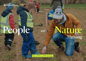 The National Trust was the vision of its three founders in 1885: Octavia Hill, Canon Hardwicke Rawnsley, and Sir Robert Hunter.
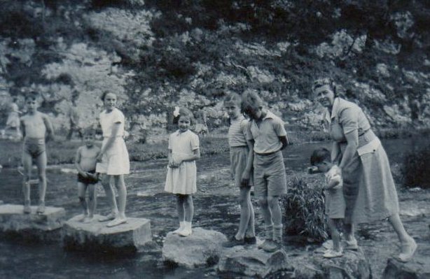
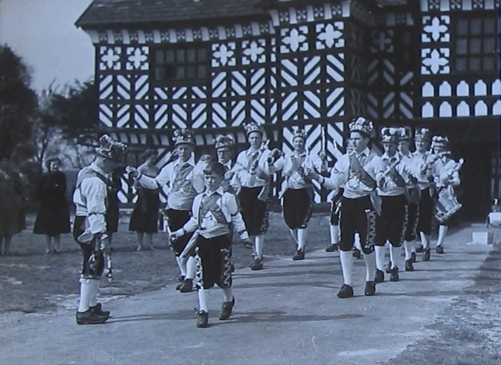


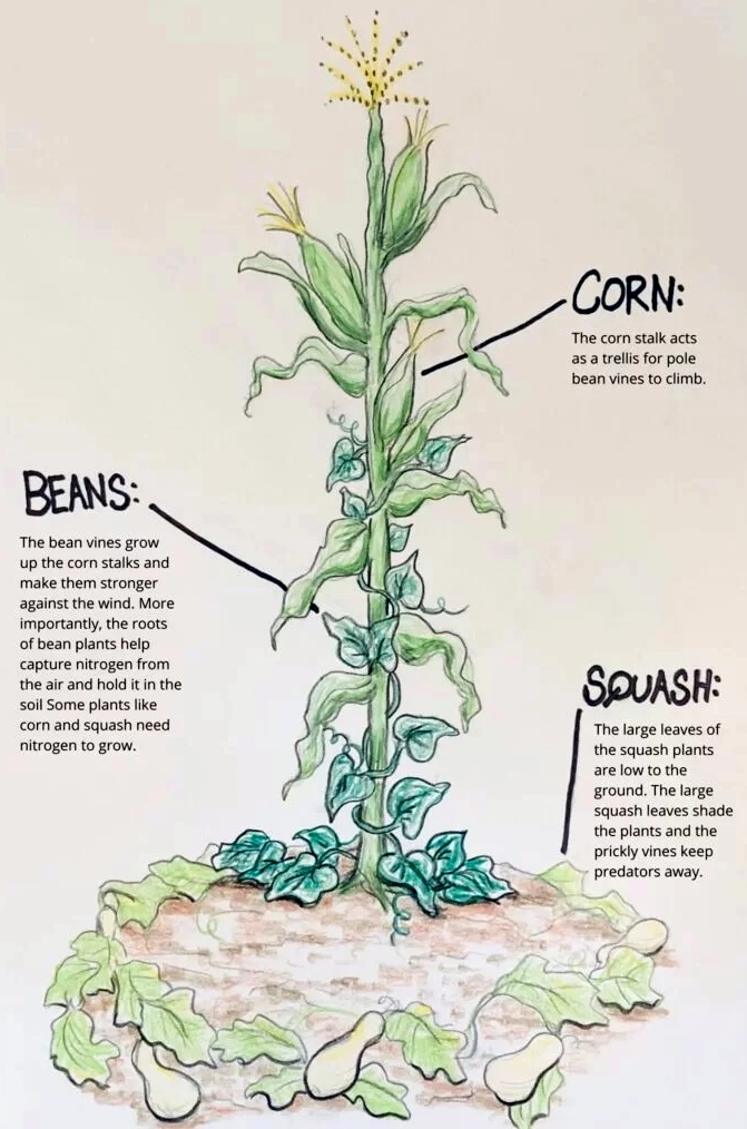


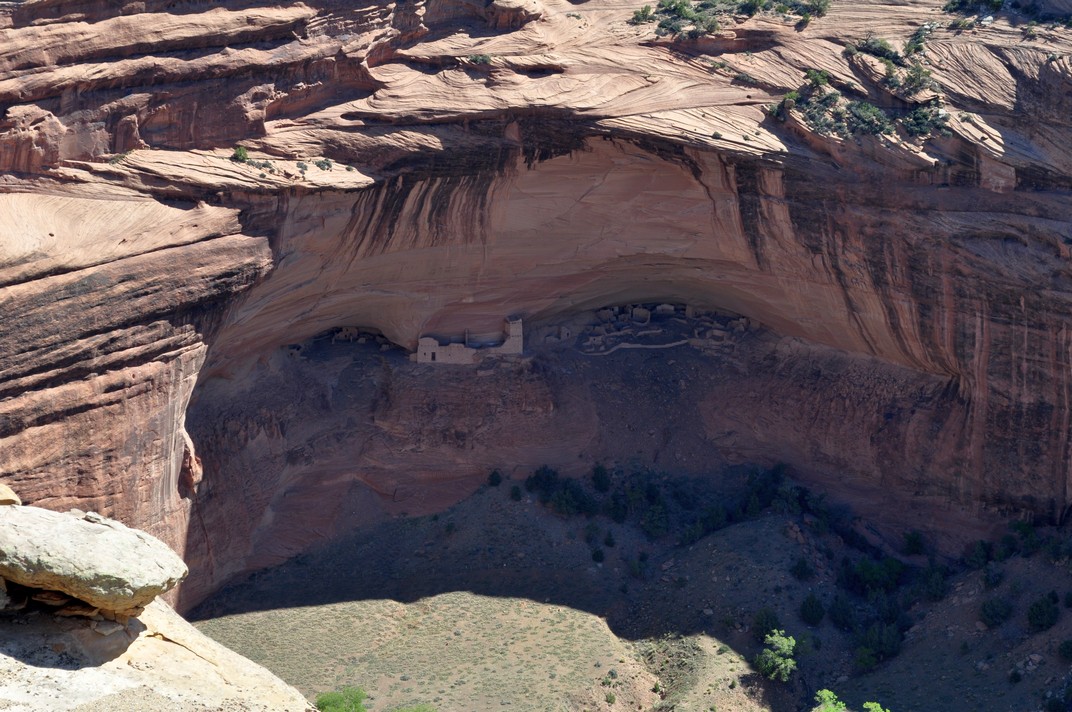
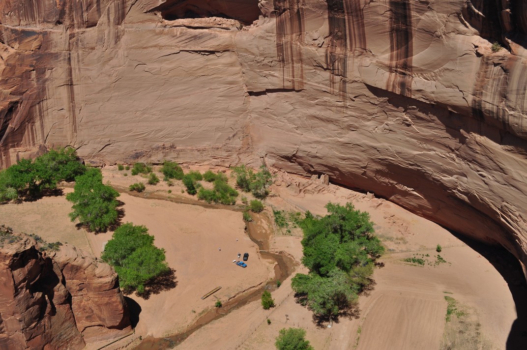
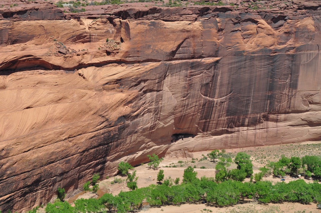


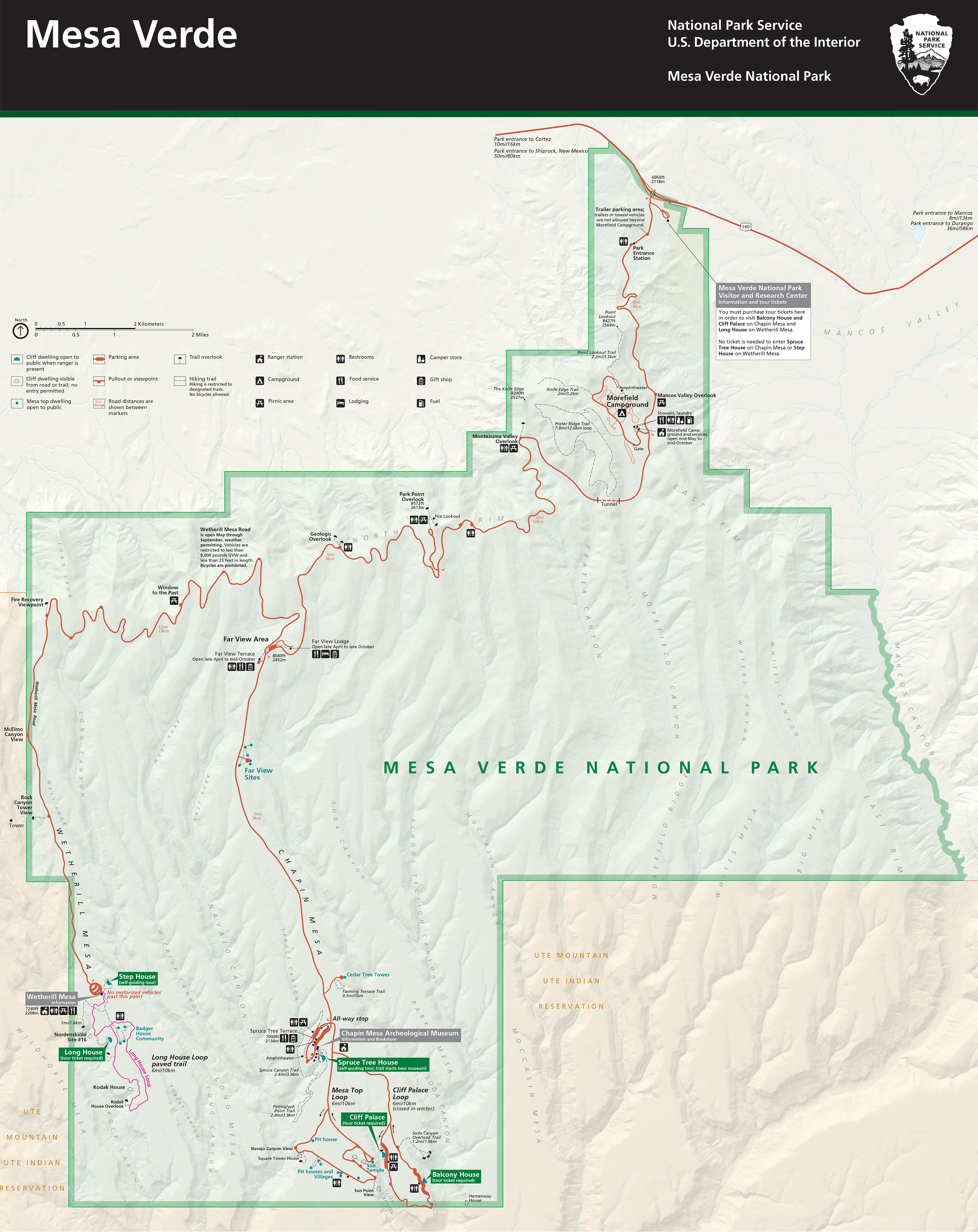


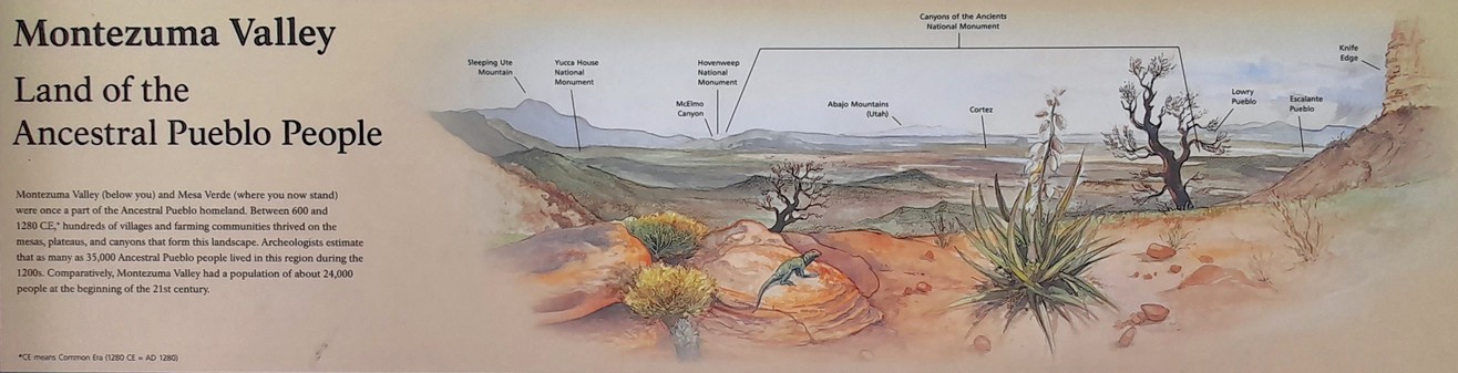
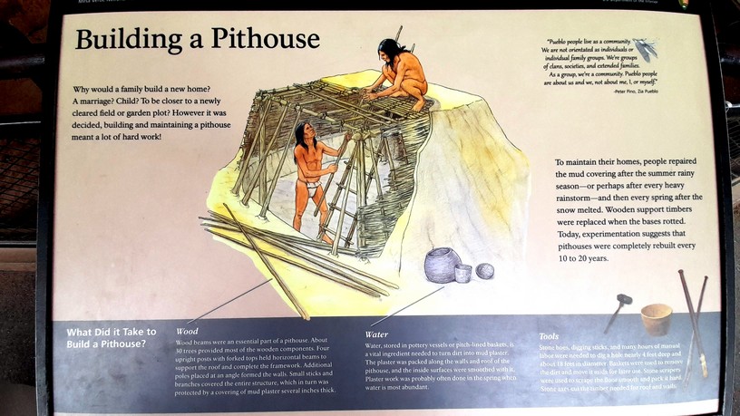
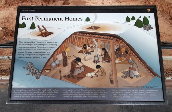
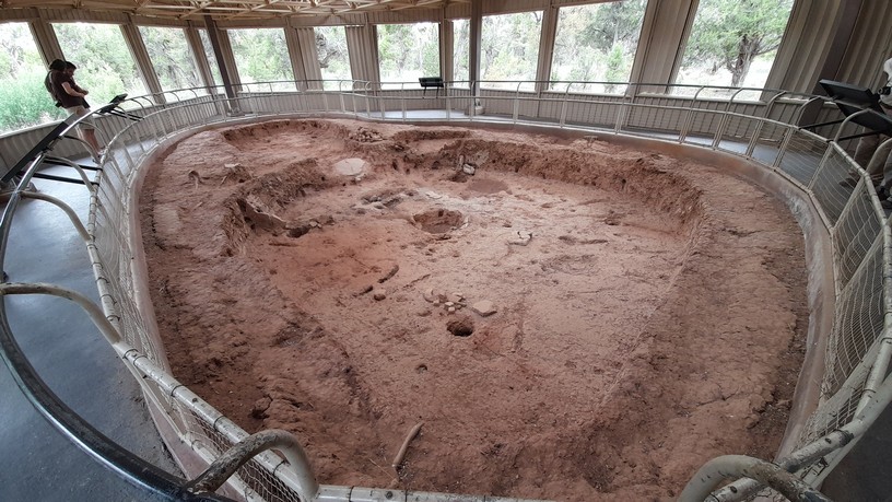
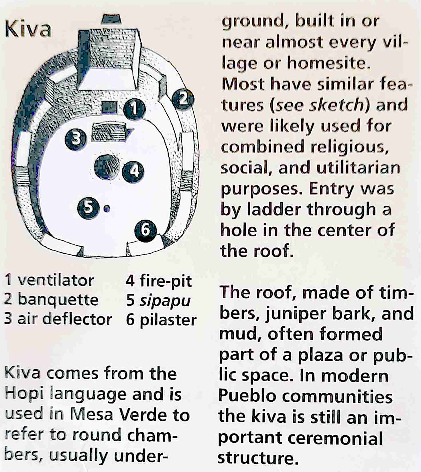
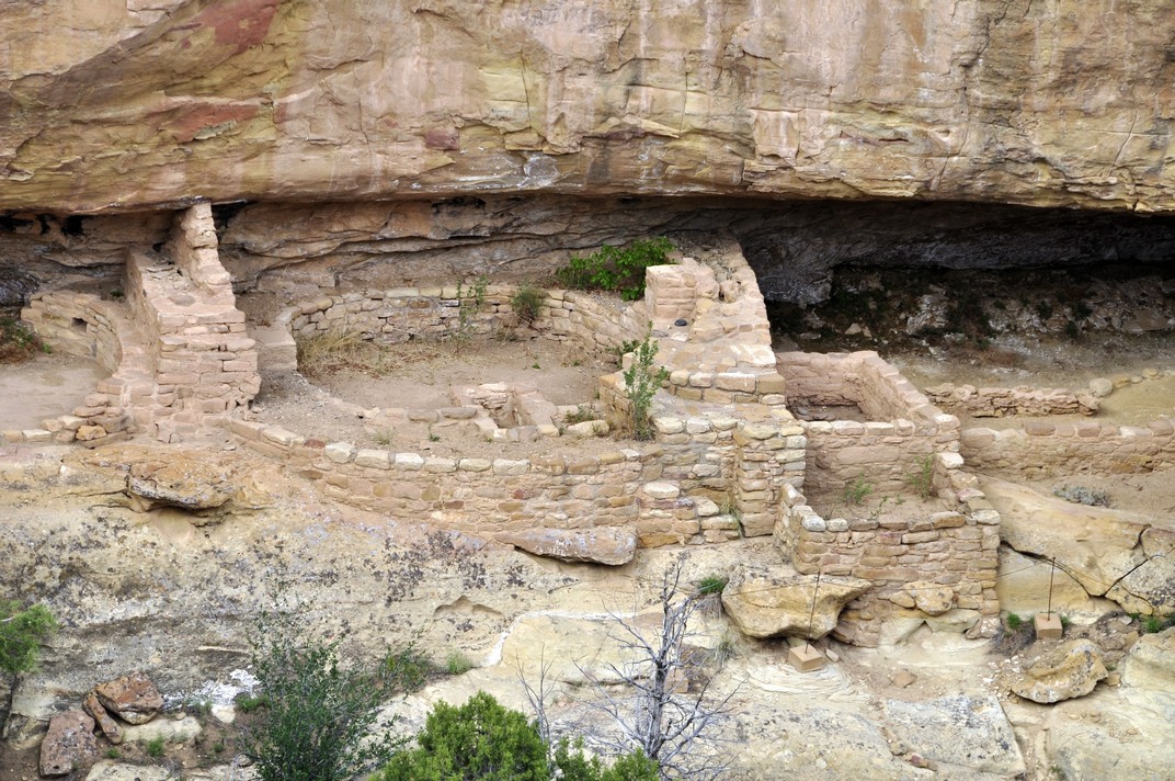


 The day after visiting Mesa Verde, we set off early from Durango to cross the mountains east of Pagosa Springs, before heading northeast to Cañon City.
 Tuesday 14 May. And here we were preparing to jet off to Las Vegas to begin another trip, this time across Utah and Colorado over the next seven days.


 The route we took passed through the


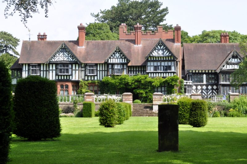


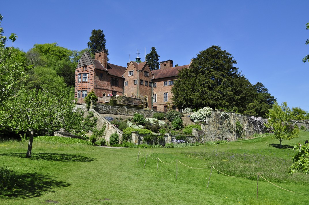


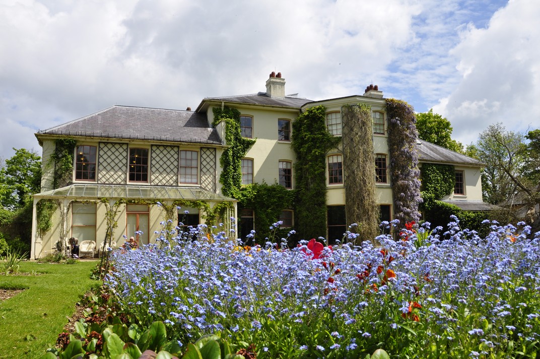
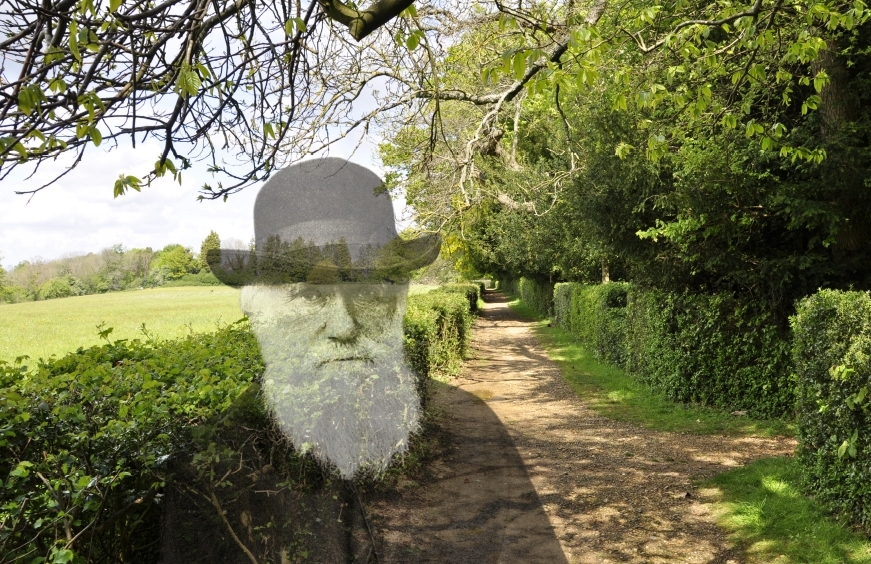
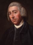


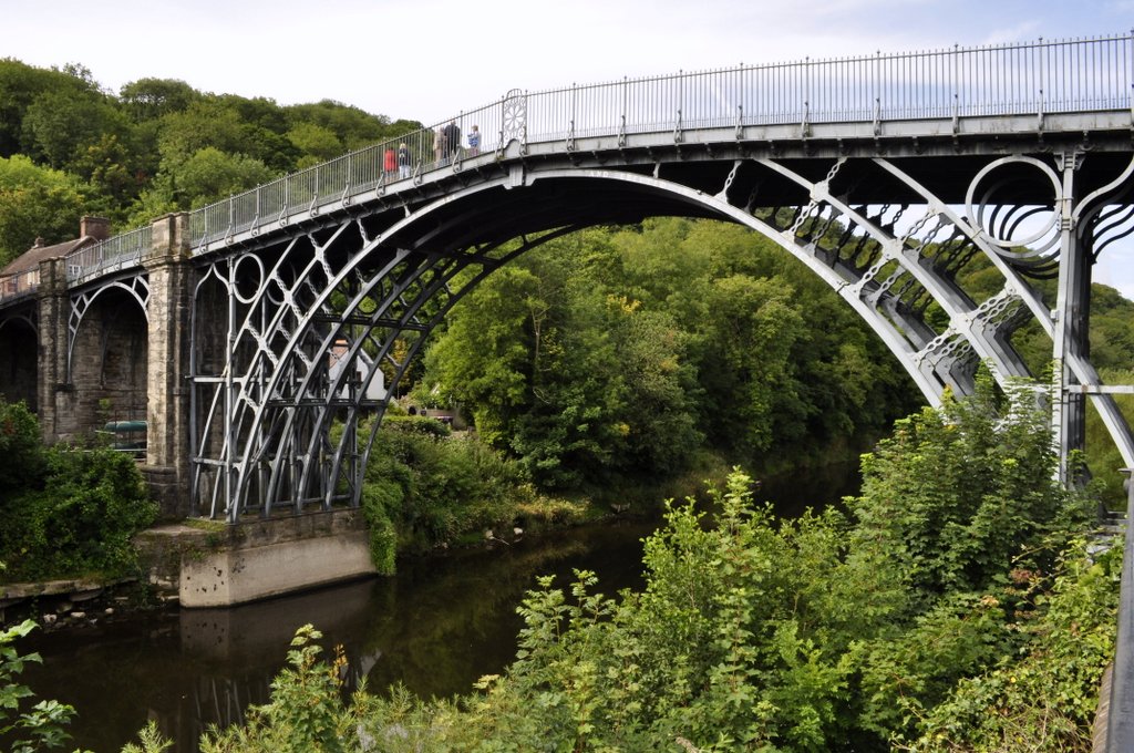
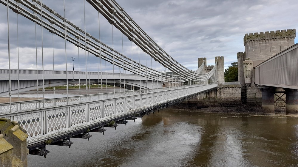


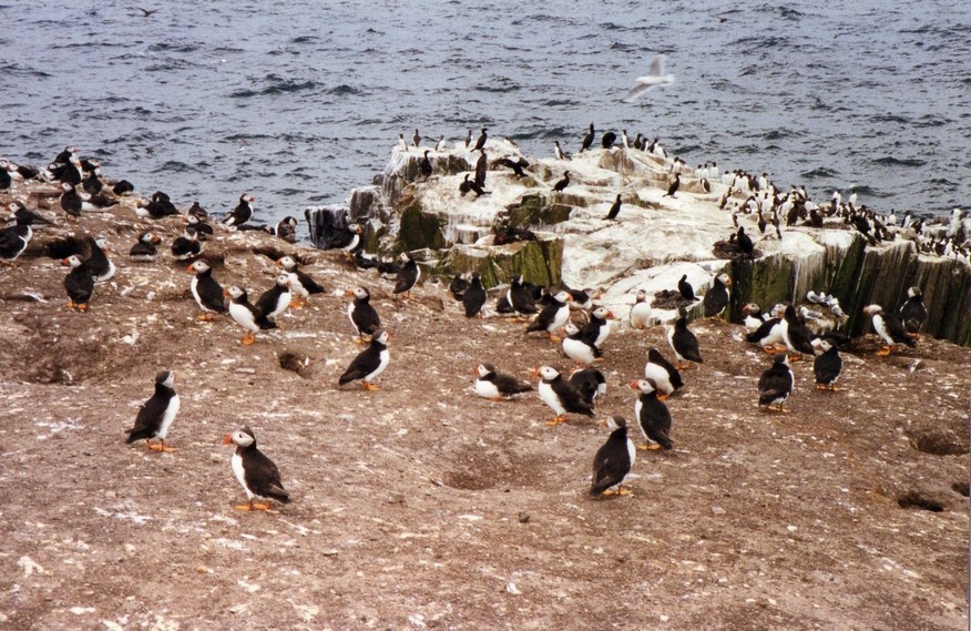
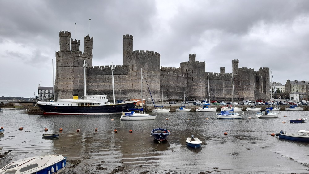


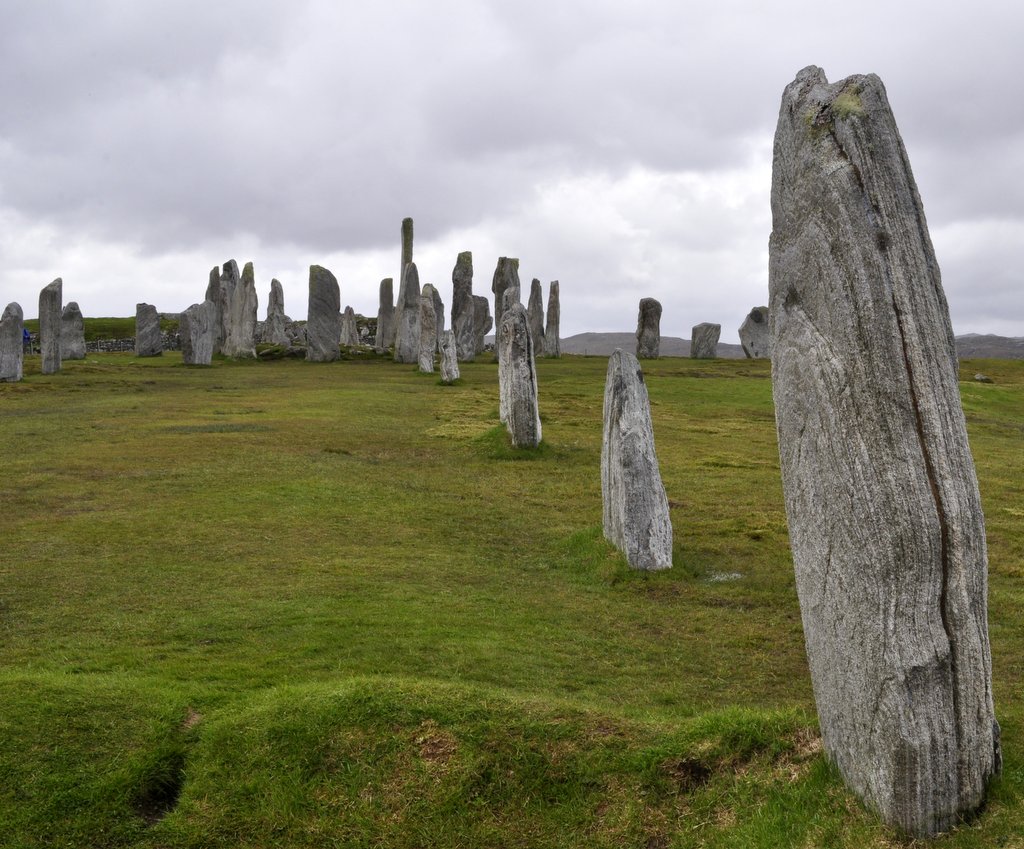


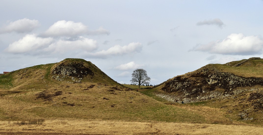
 You’ve probably never heard of
 At the heart of the empire was the capital, Angkor, with its principal temple
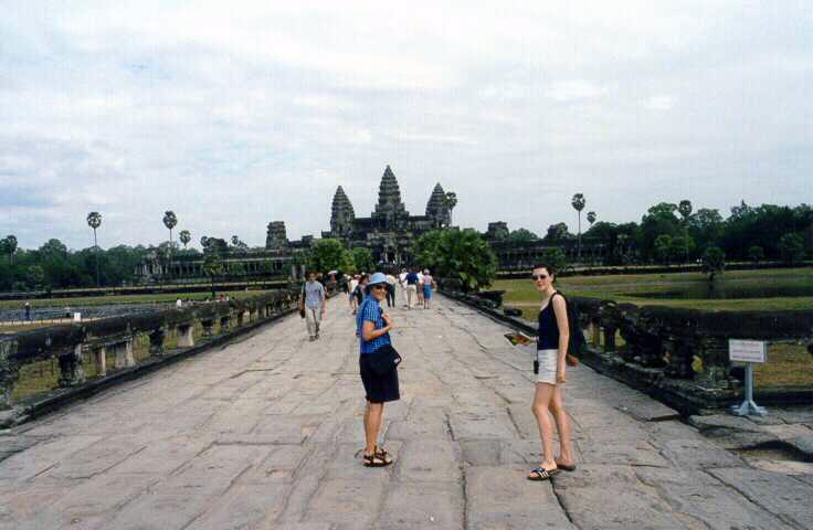

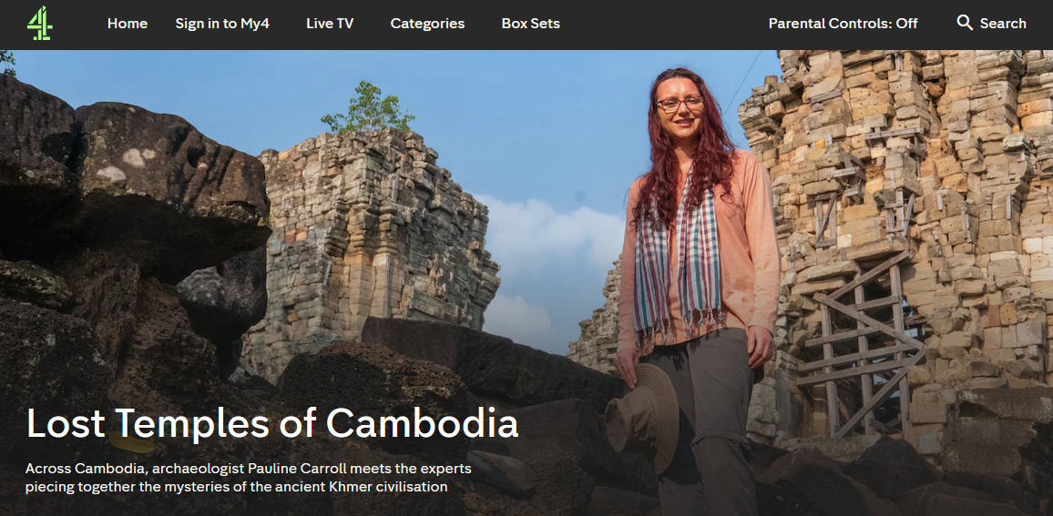


 I was born in November 1948.
 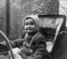 I grew up in
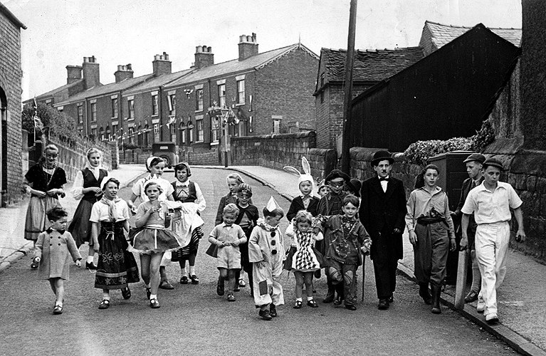


 Only a couple of weeks earlier, one of the most notorious (but badly planned and incompetently executed) robberies took place in Buckinghamshire when a gang held up a Royal Mail train, stealing more than £2.6 million (=£56 million at today’s value). Known as


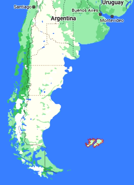 I was back in the UK by April 1981, launching my second career as a lecturer at the University of Birmingham. In late March 1982 I took a party of MSc students to Israel to attend
  One of the most infamous occurrences of the Cold War must surely be the erection of the Berlin Wall in August 1961, and its aftermath, brutally dividing the citizens of that city. But that all changed in November 1989 when the wall came tumbling down, signalling the collapse over the next few years of the Eastern Bloc of Communist countries, in particular the Soviet Union in December 1991. I passed through the wall on a visit to East Germany in March 1990. Given the current dangerous situation on the Ukraine-Russia border there are those within the Russian hierarchy who wish to turn the clock back.
 And talking of moving abroad, there was an event in June 1991 that almost put paid to my travel plans. In the Philippines, the eruption of

 For many of us in the UK (48% of those who voted) 2016 was also a disastrous year, with the referendum on membership of the European Union (EU) leading to our exit:
  As I conclude this post, we are still in the throes of the Covid-19 pandemic, although the government here in the UK would have us believe otherwise. So many invocations of British exceptionalism over the past two years make me almost ashamed to claim British nationality.
  Over recent weeks, Steph and I have been enjoying the latest series of
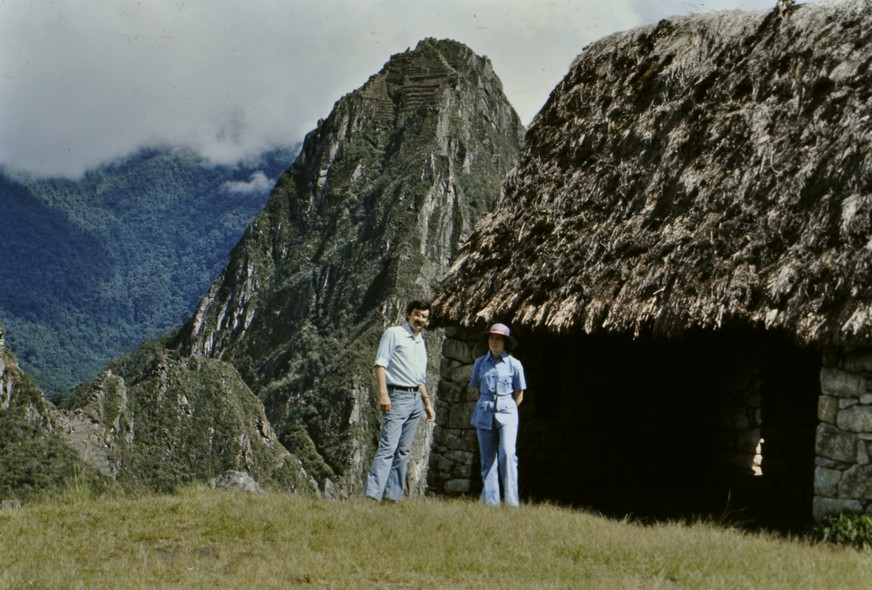

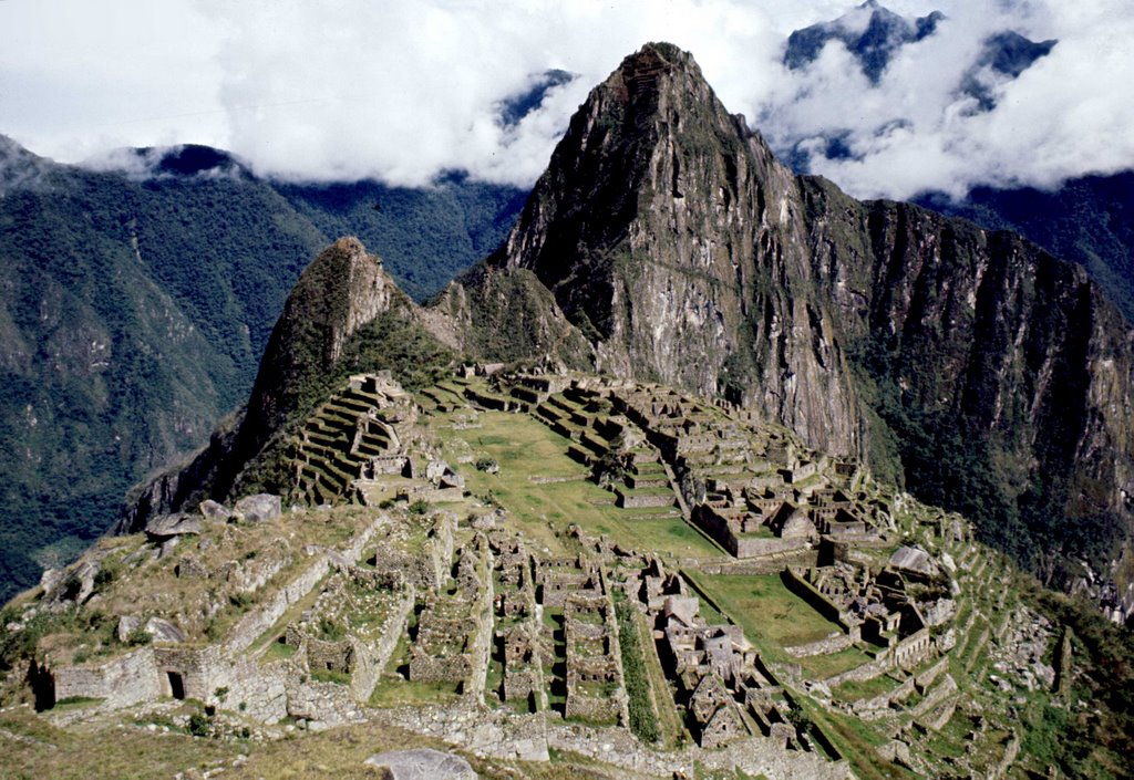
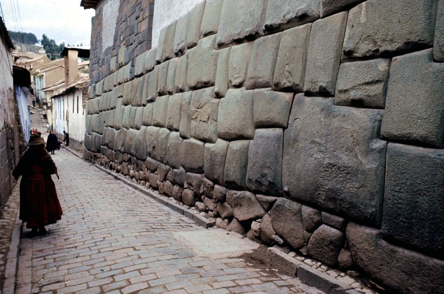
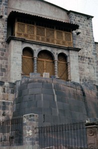 Or the foundations of the
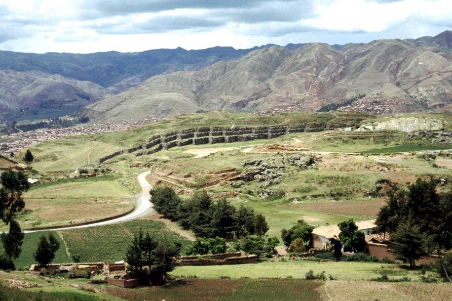

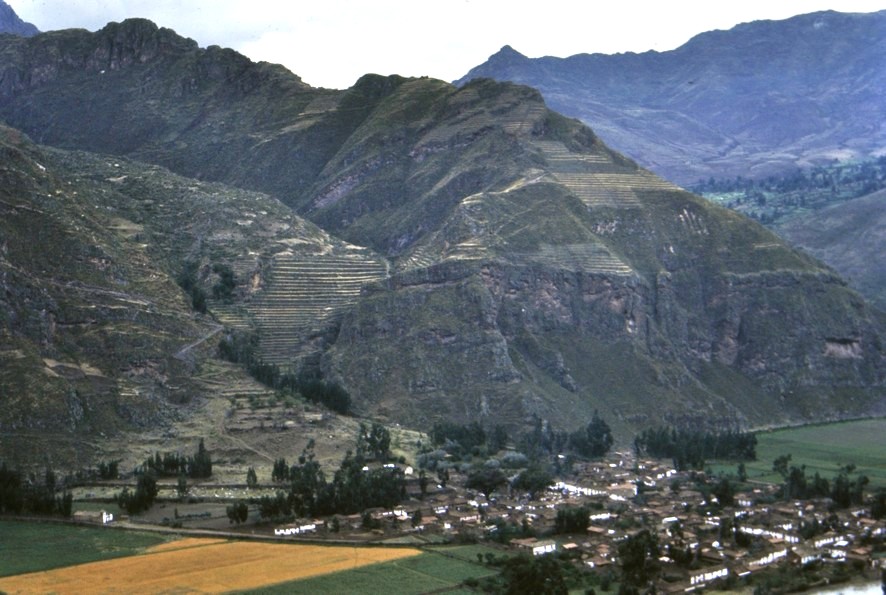
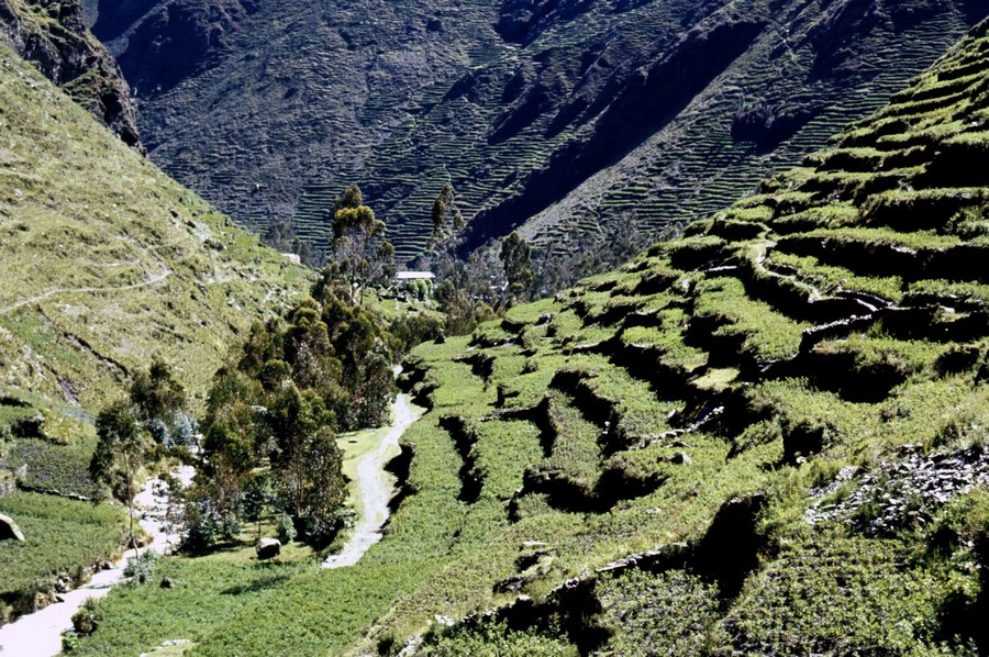


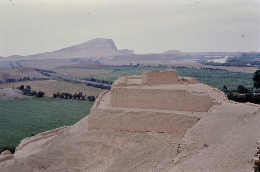
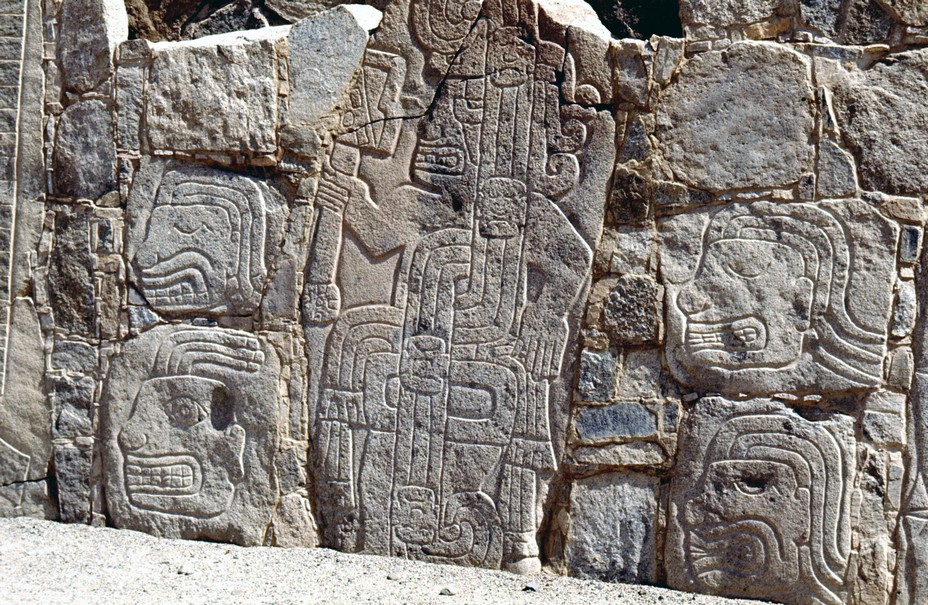

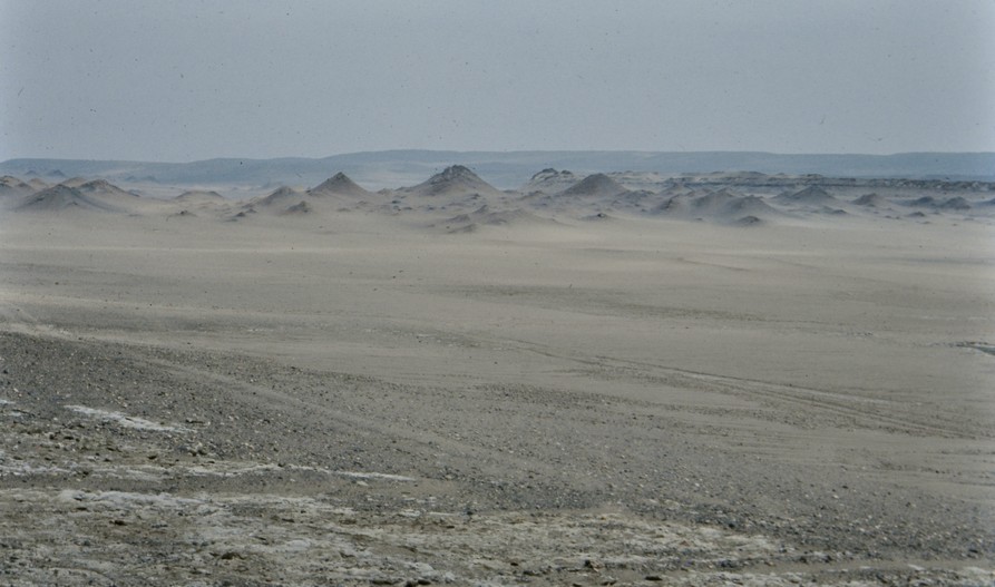

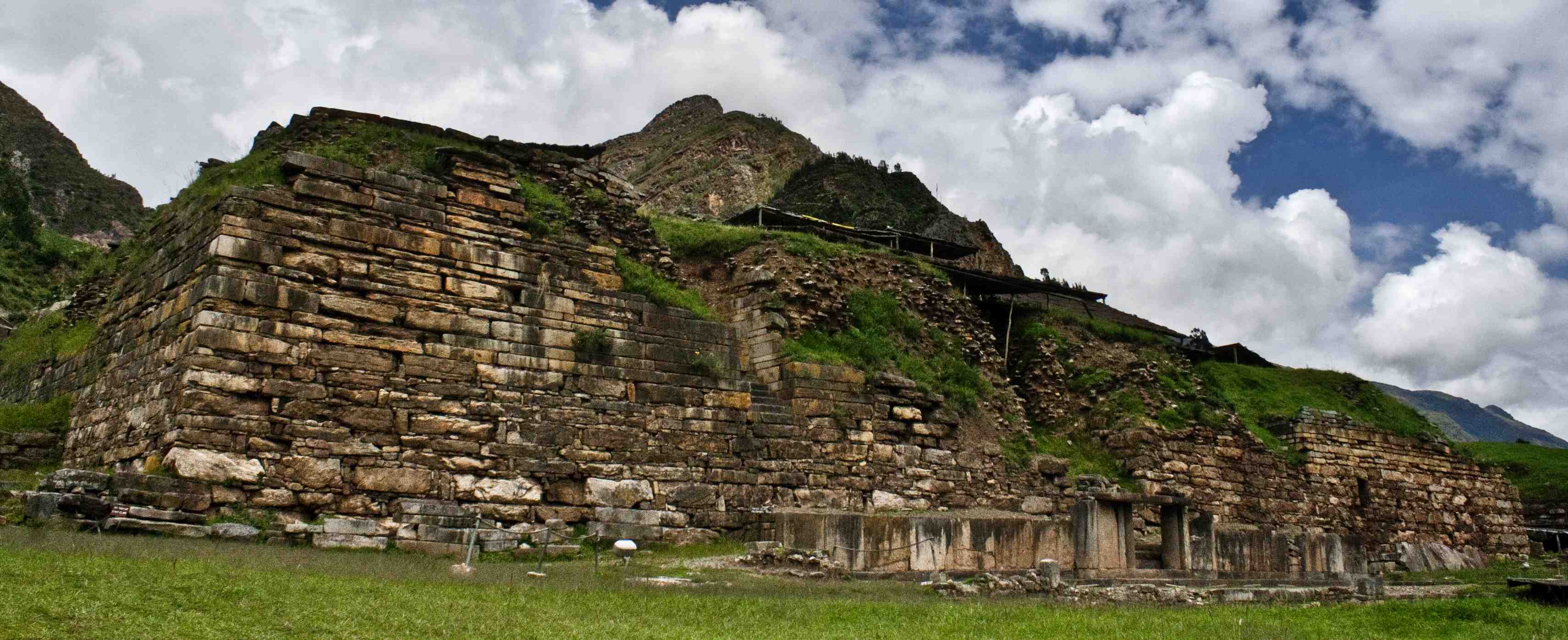
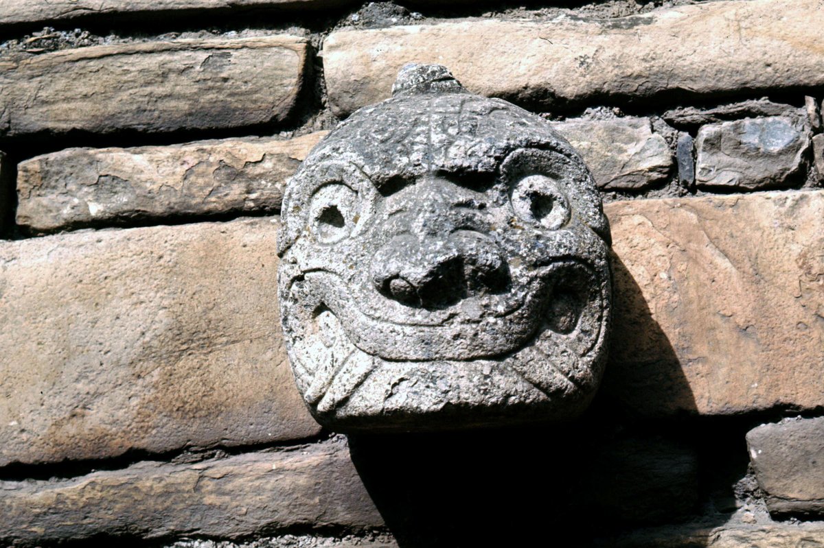
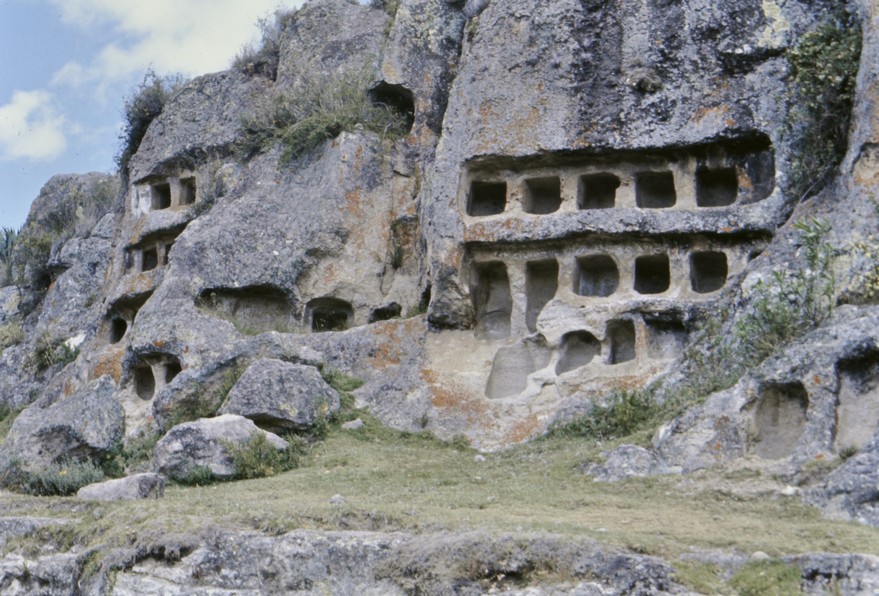

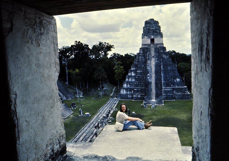
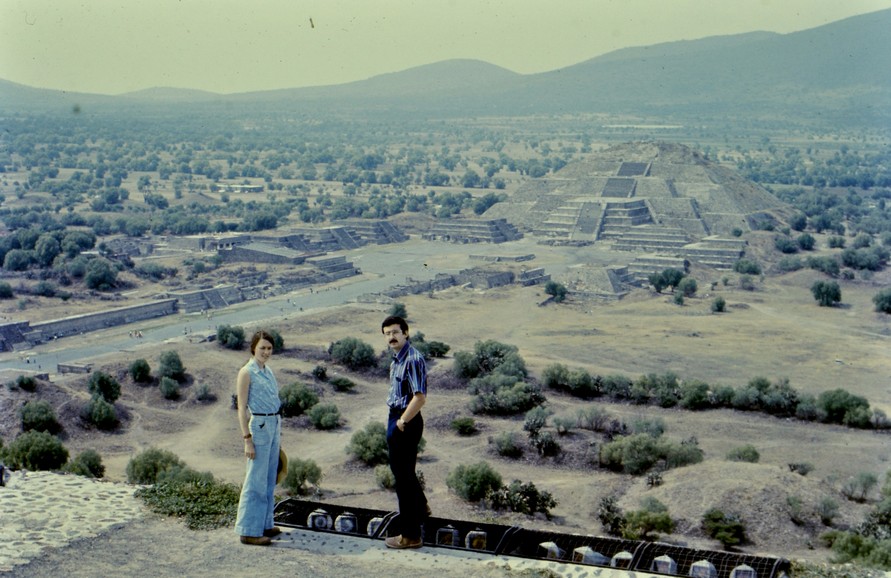
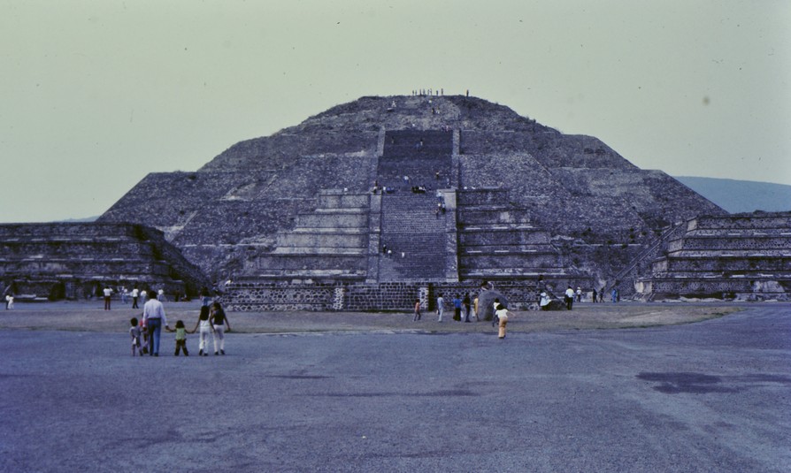
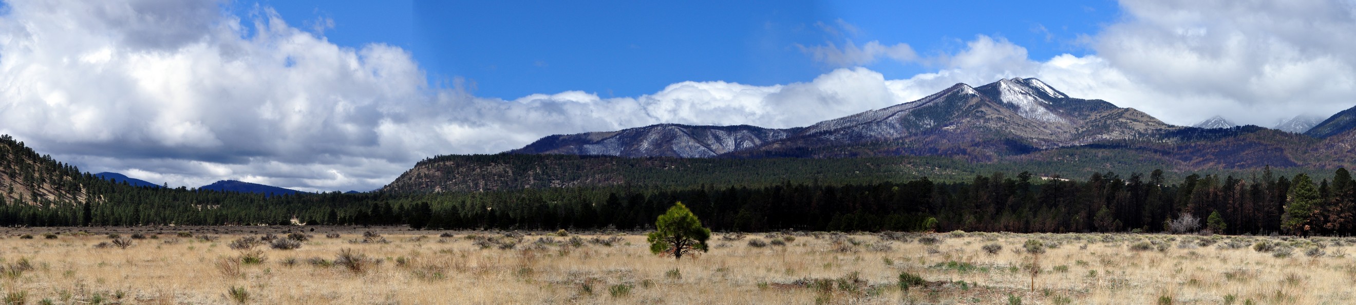


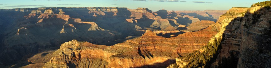
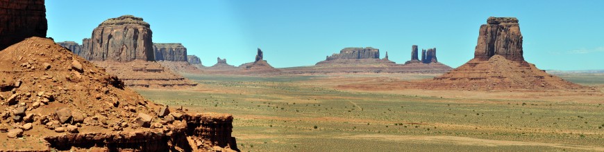


 Once the weather improved in May and June, and we could get out and about more regularly, Steph and I visited several abbeys and priories managed by English Heritage that dot the landscape of this northeast corner of England, including
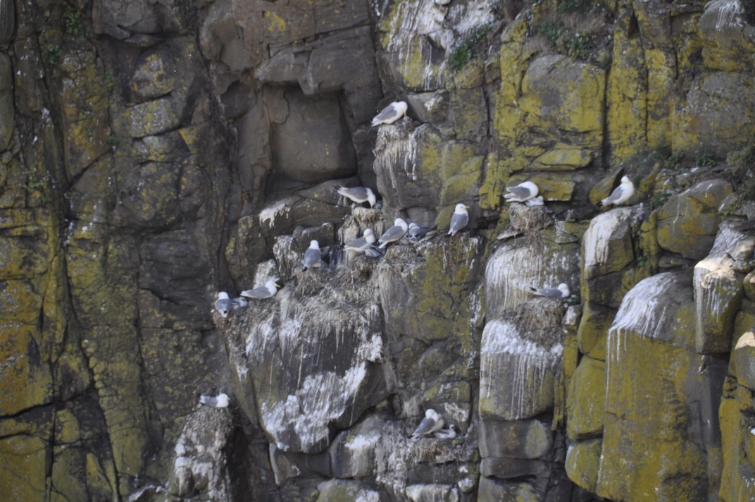


 About 7 miles northwest from Prudhoe, as the crow flies, the fortified manor house of
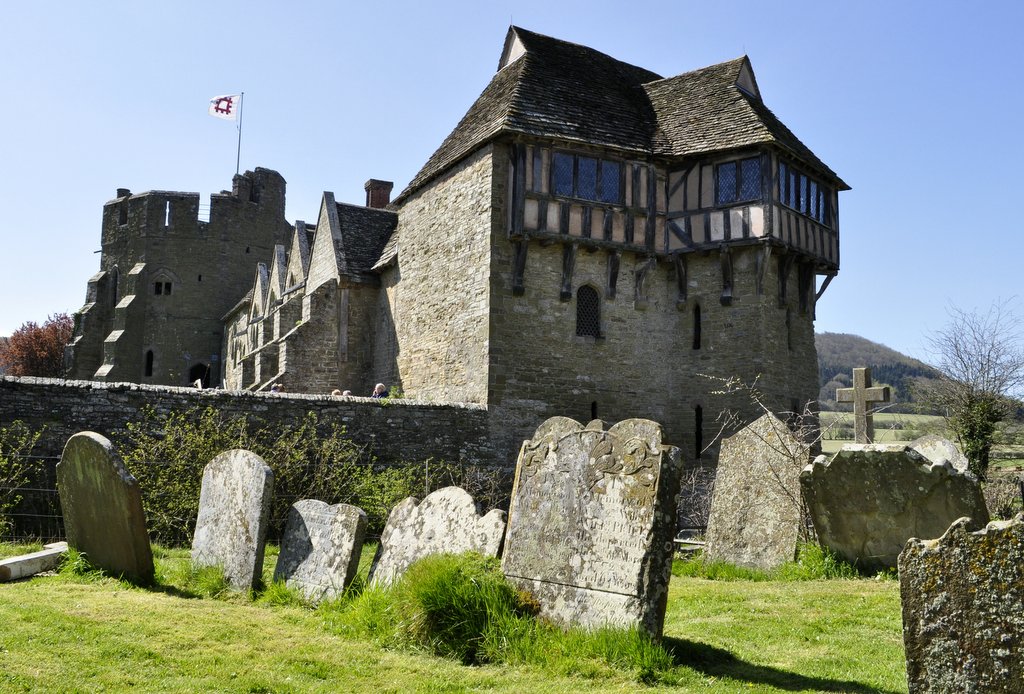


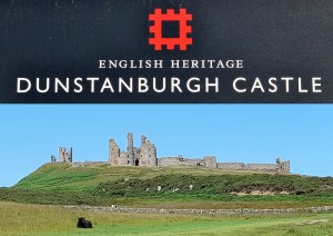 We have visited 14th century


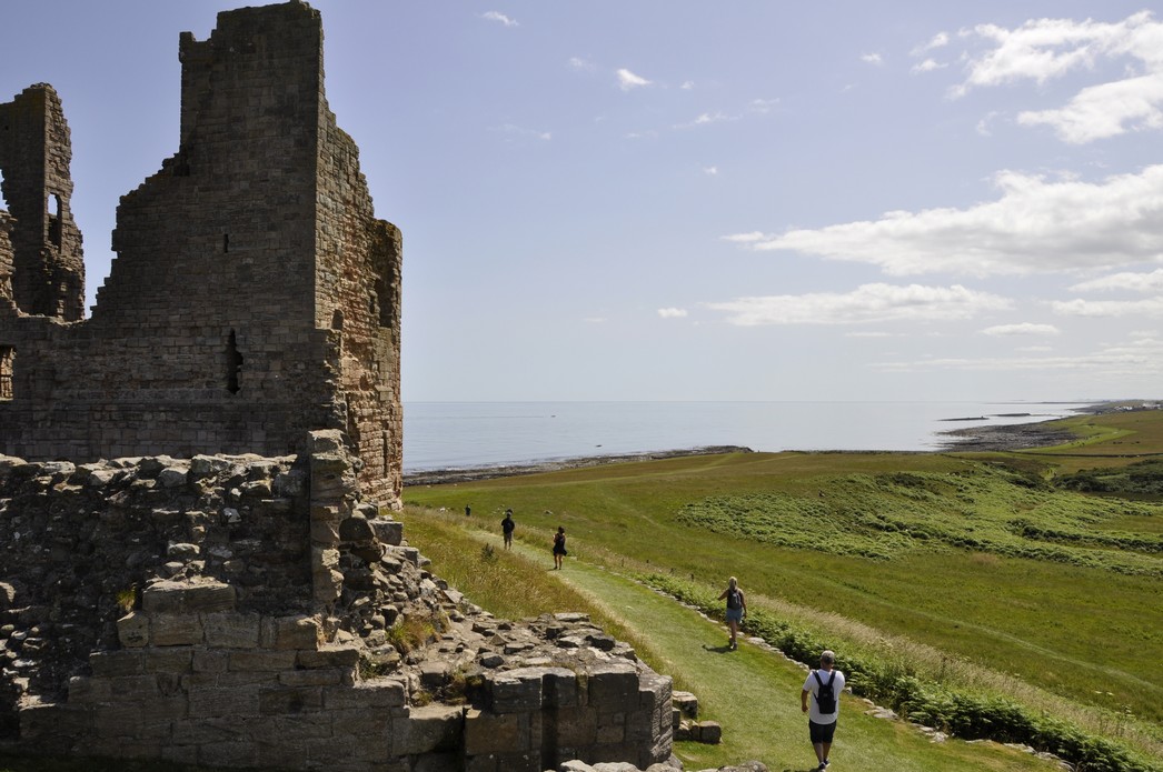
 When I retired in 2010, I briefly toyed with the idea of enrolling at the
  So much so that I then borrowed

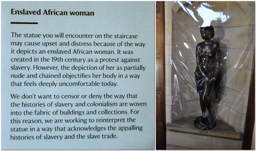
 At least one museum, the

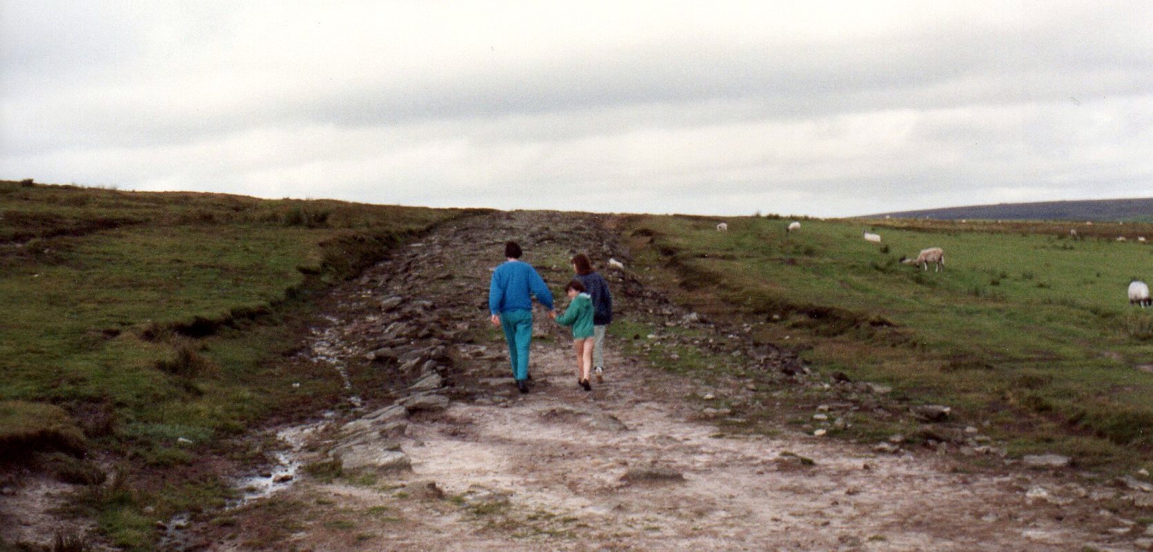


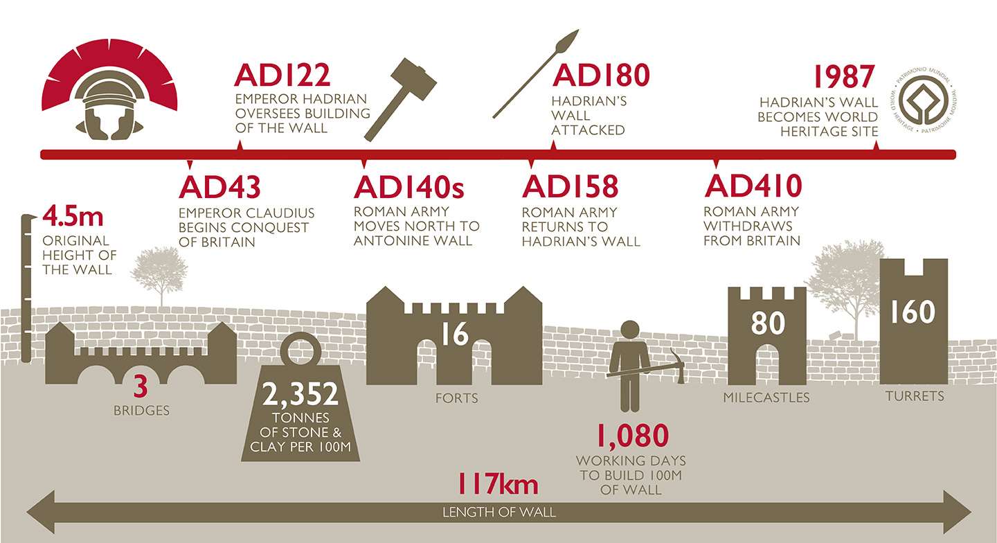

")


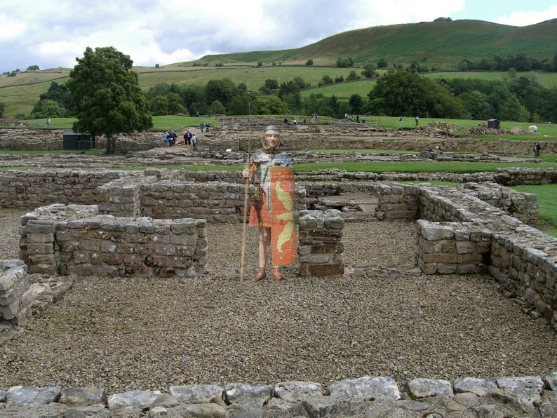


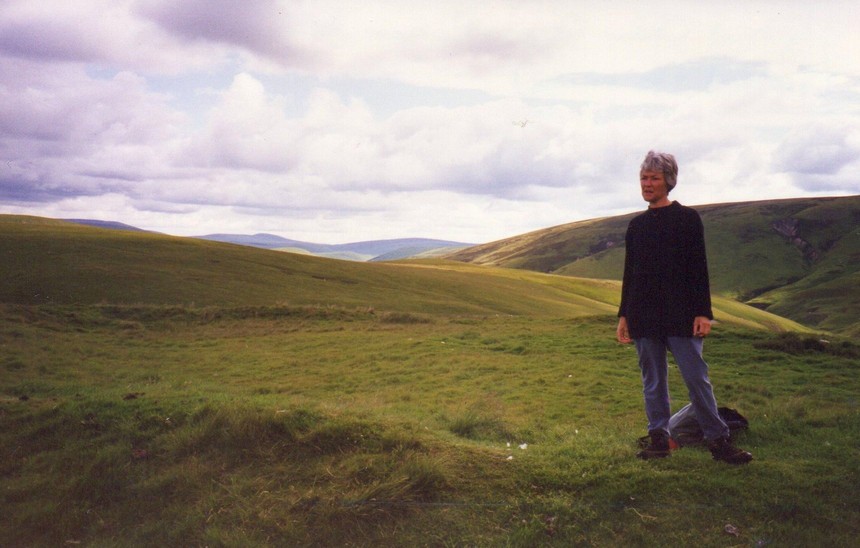
 But there is (or at least should be) another legacy of the Roman occupation here and elsewhere. It’s not a legacy that you can observe as such. It needs the techniques of molecular genetics to reveal it. DNA!
 Steph and I have been members of the
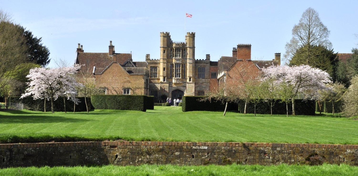

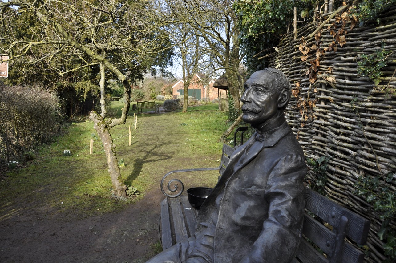


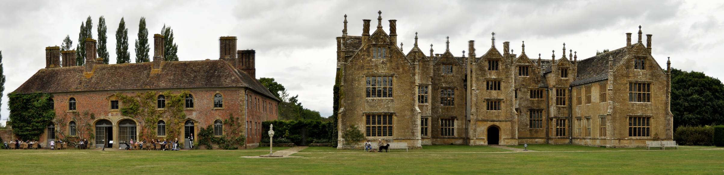


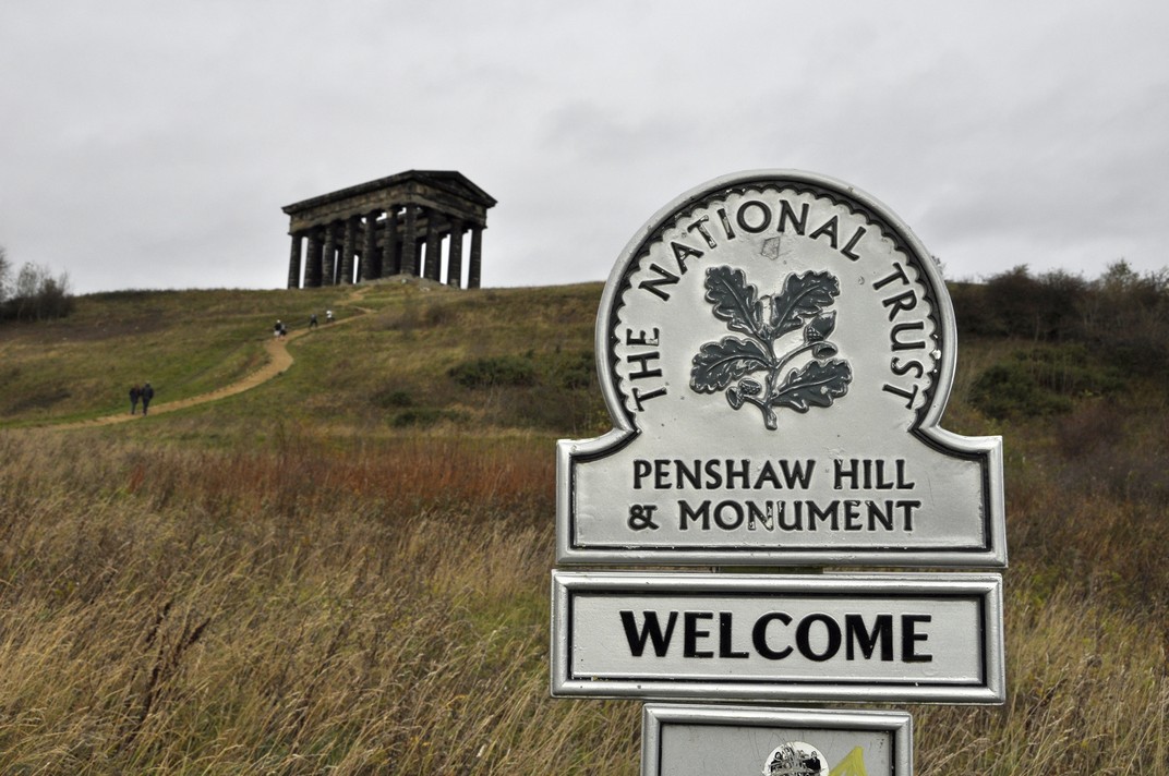

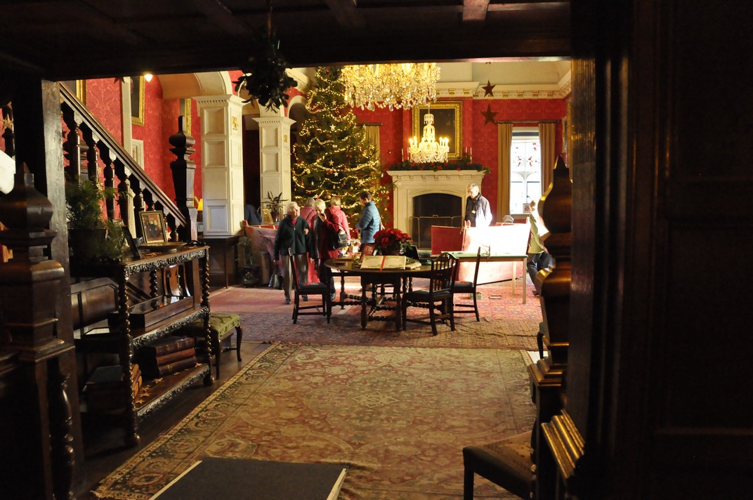


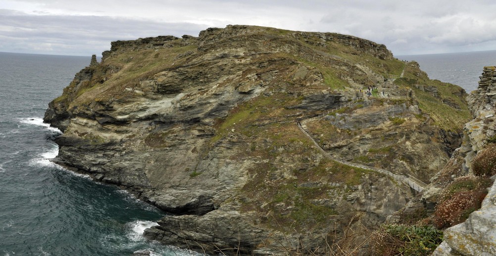

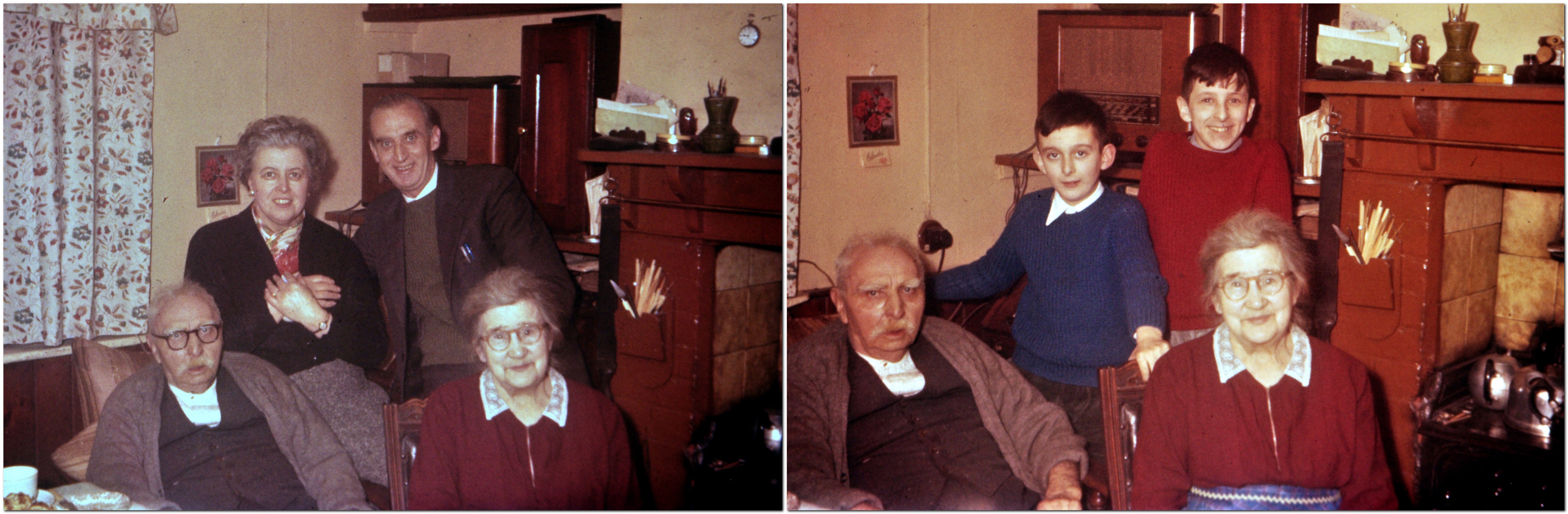


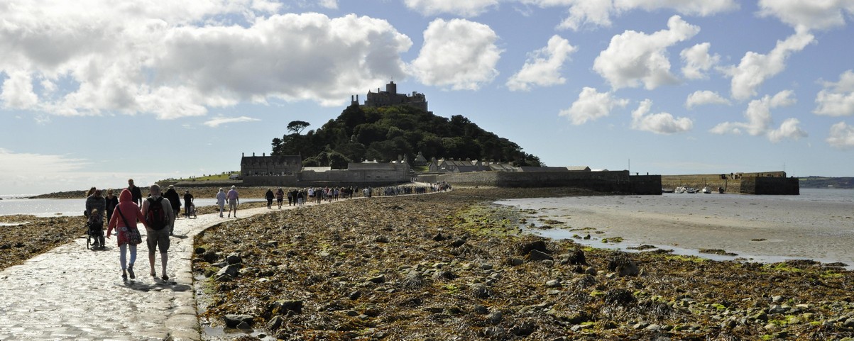
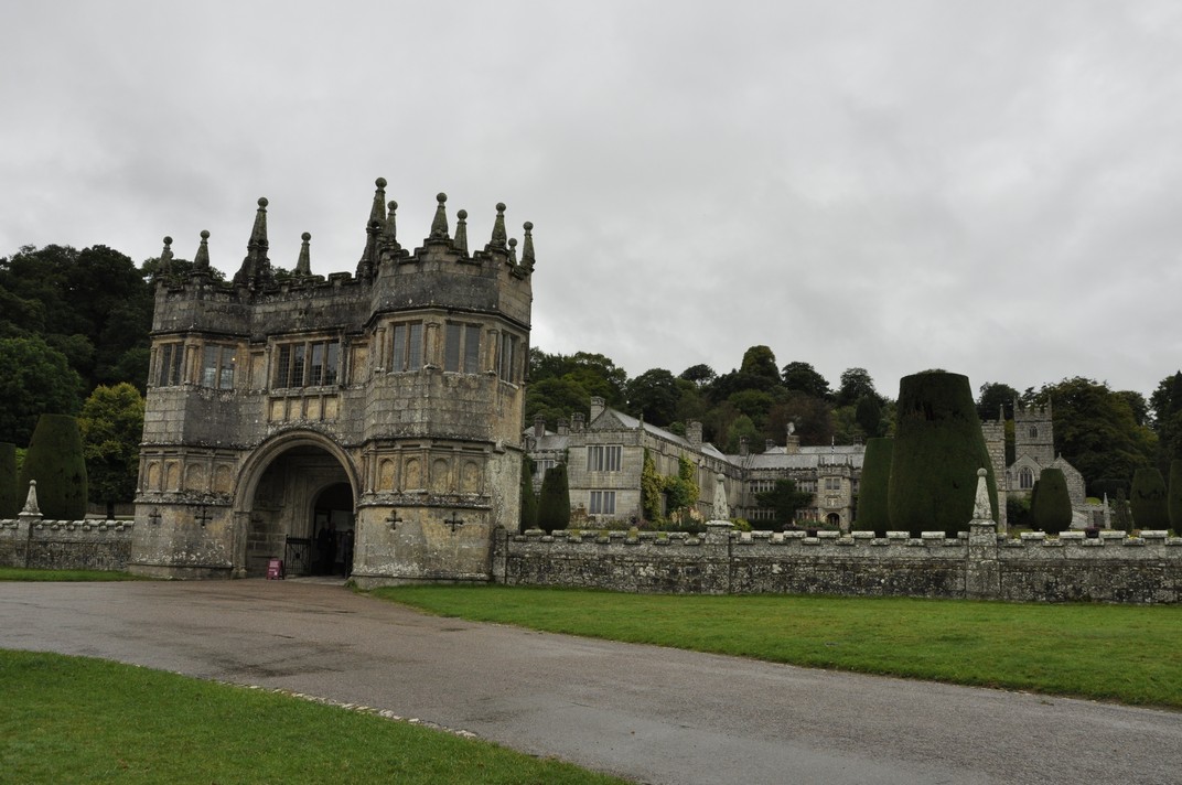
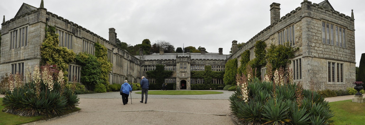


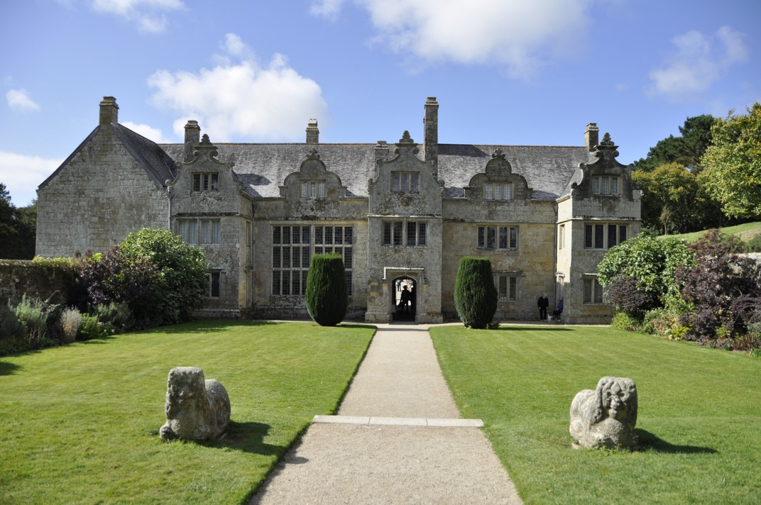


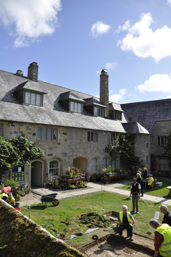
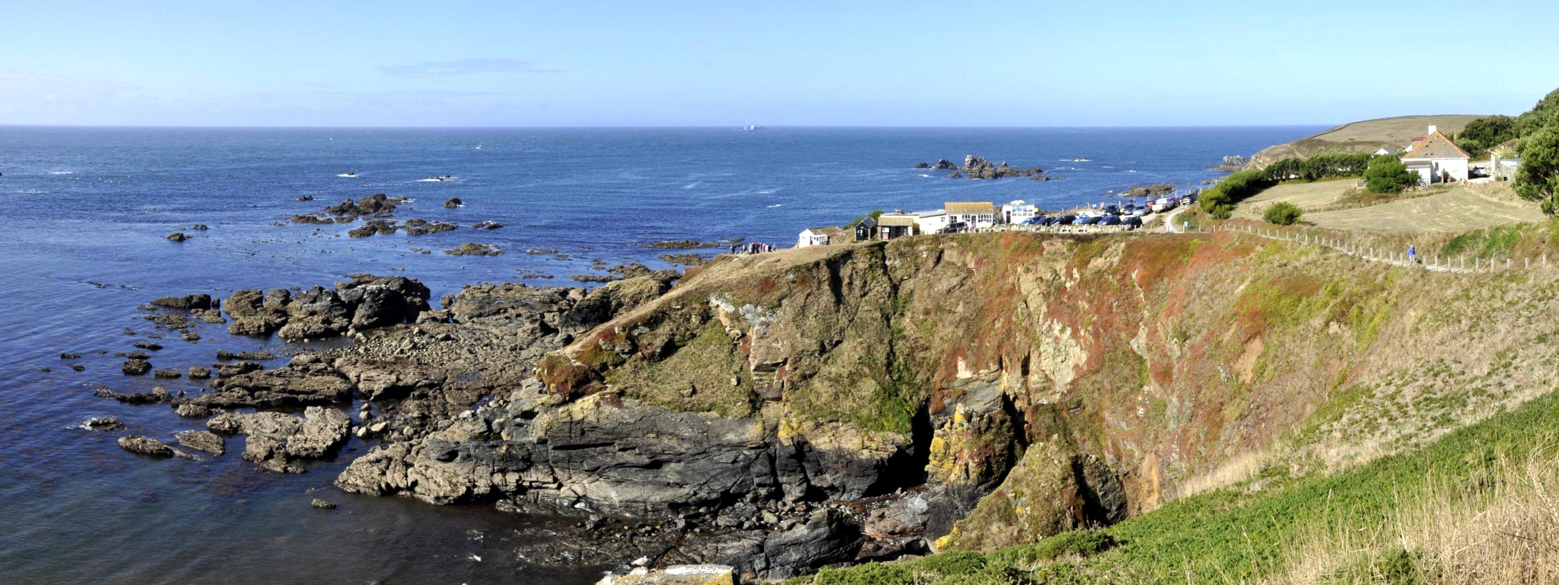
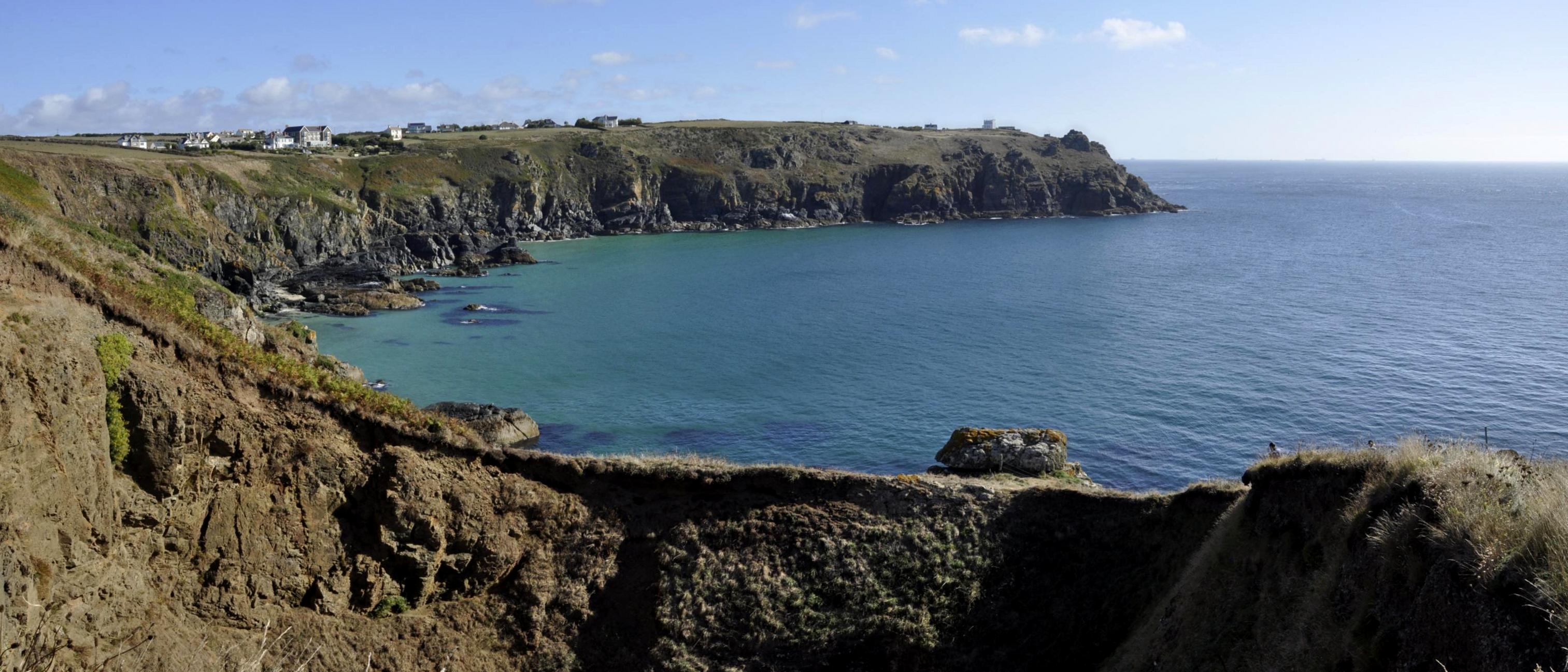

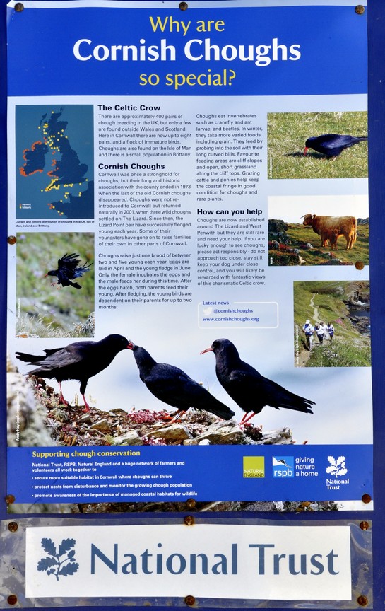
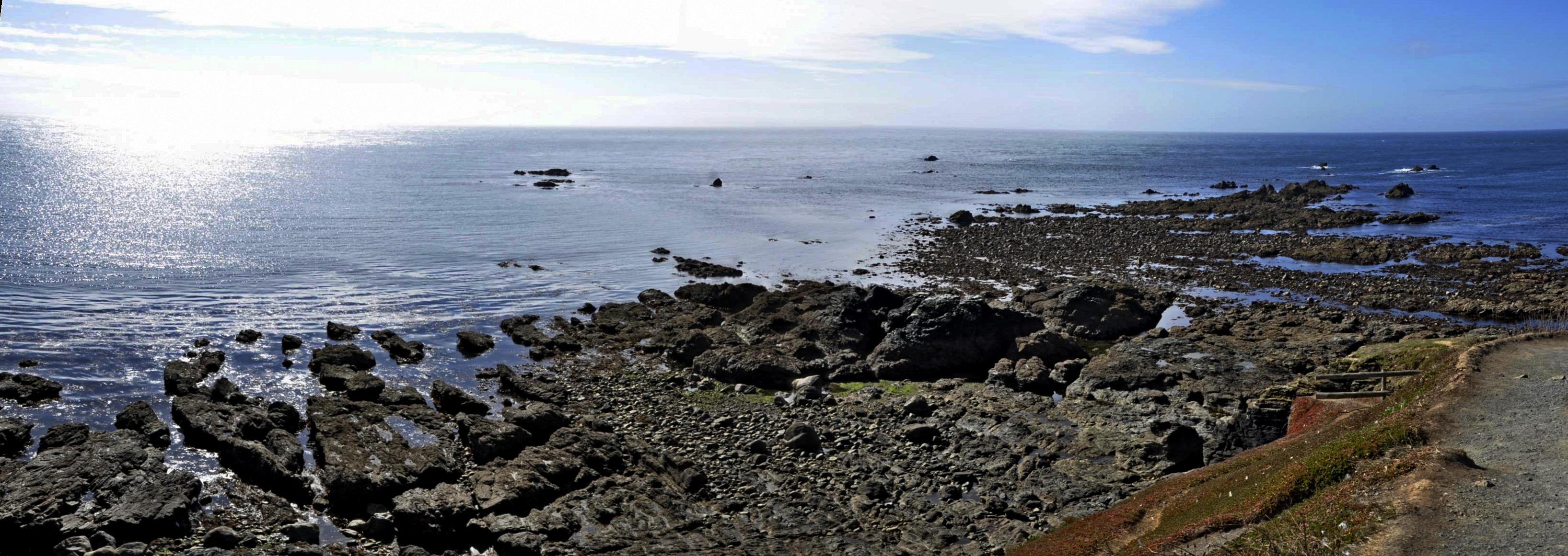
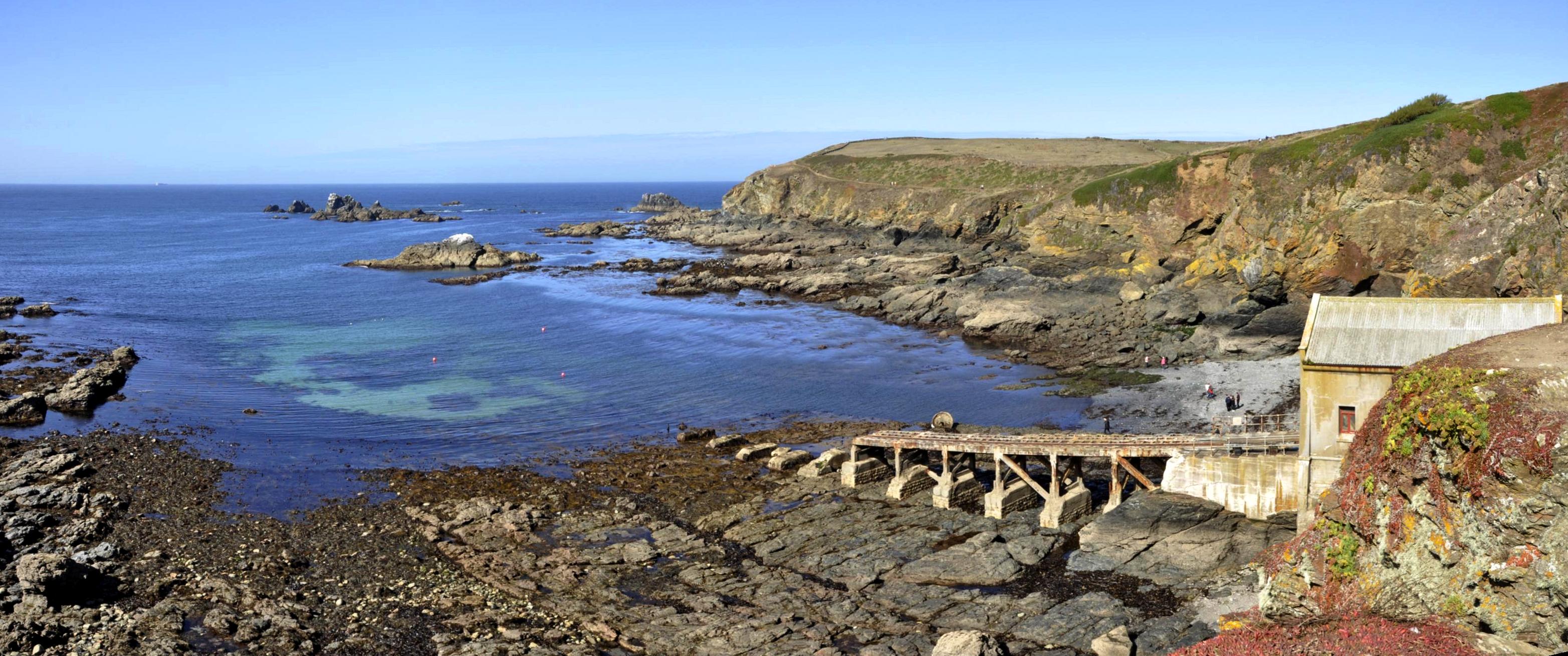
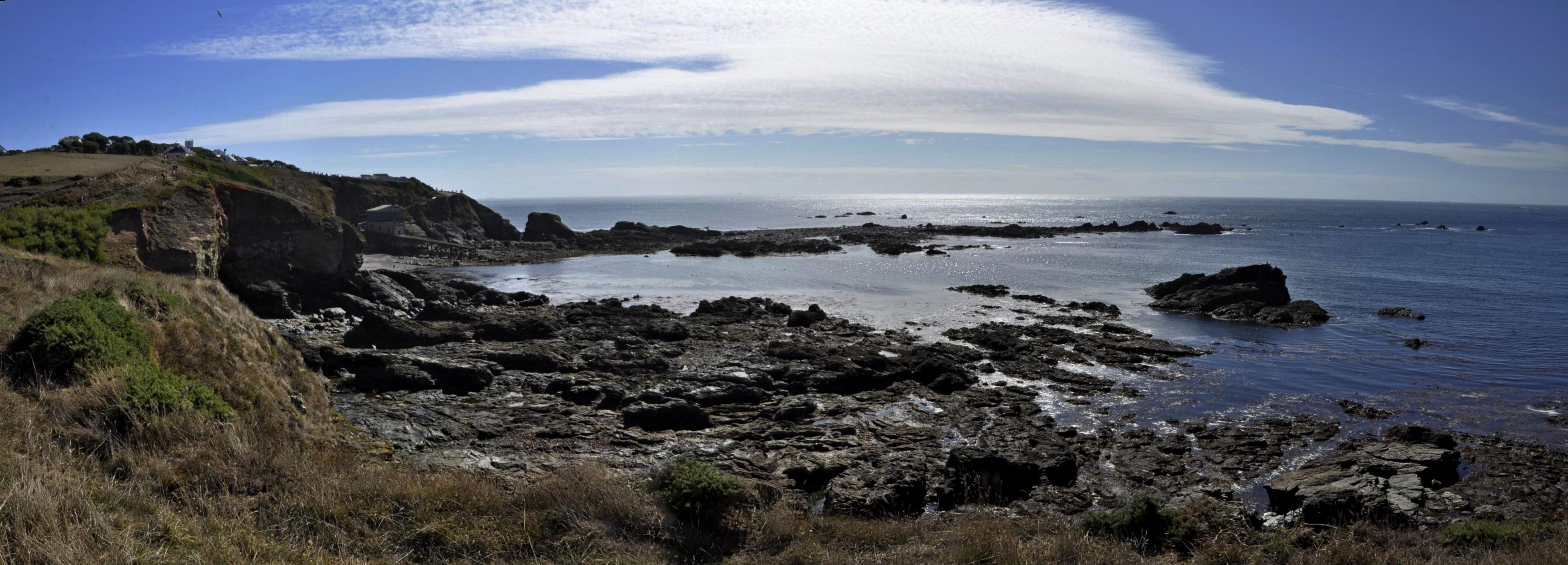


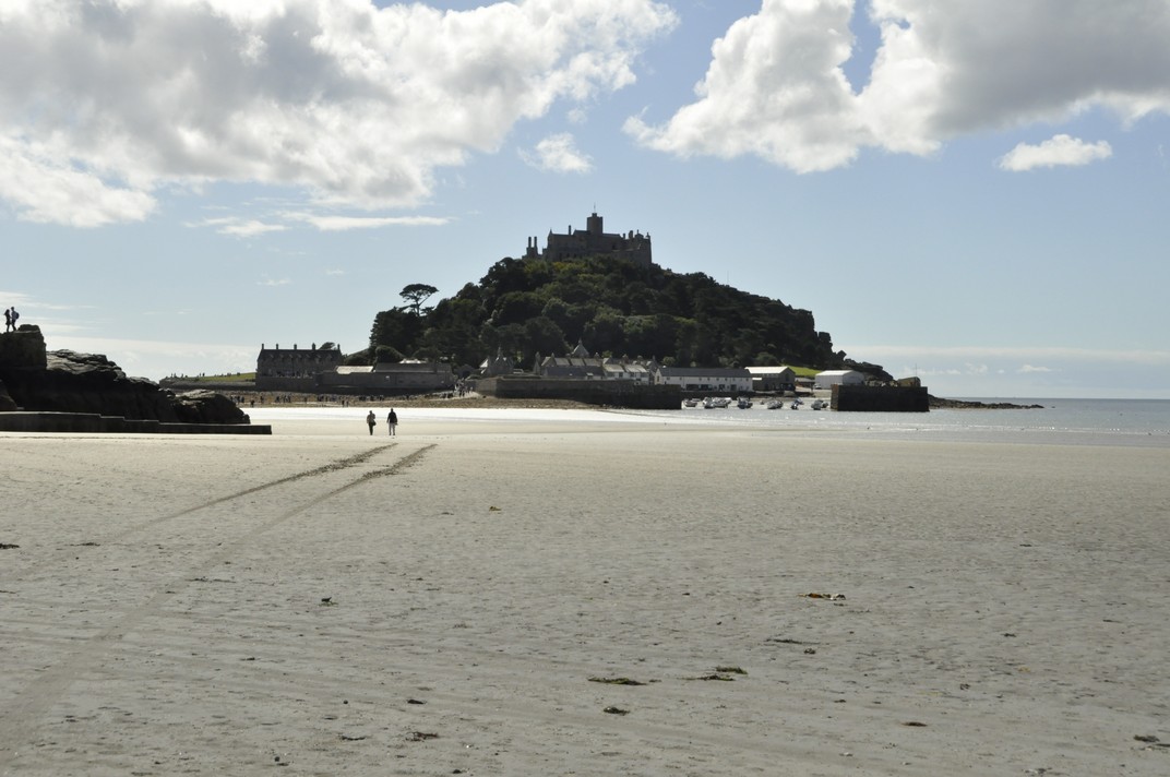


 Despite its incredibly bloody outcomes and destructive consequences, the American Civil War, 1861-65 holds a certain fascination. To a large extent, it was the first war to be extensively documented photographically, many of the images coming from the lens of
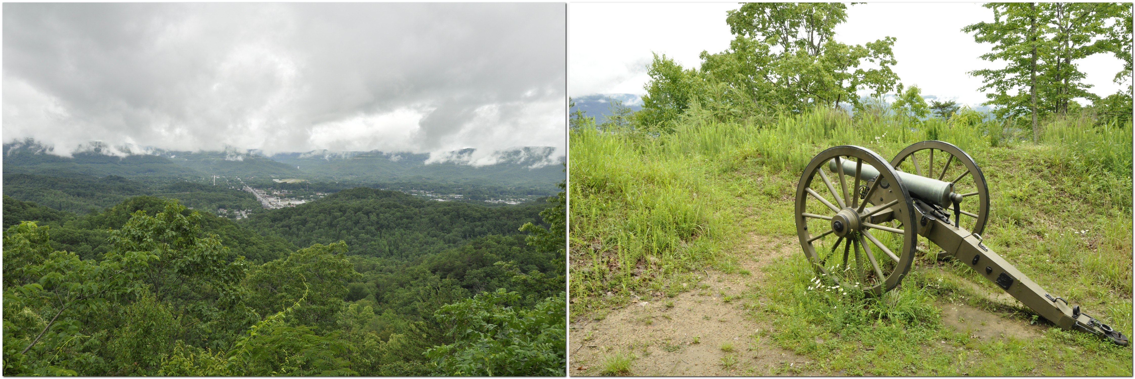
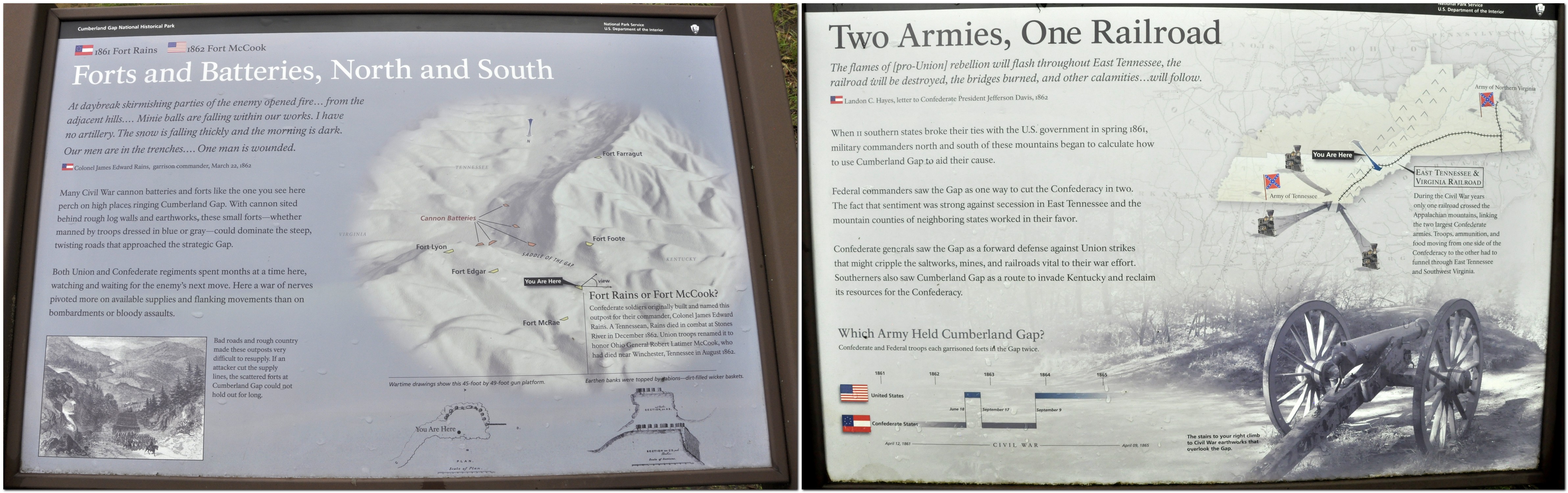
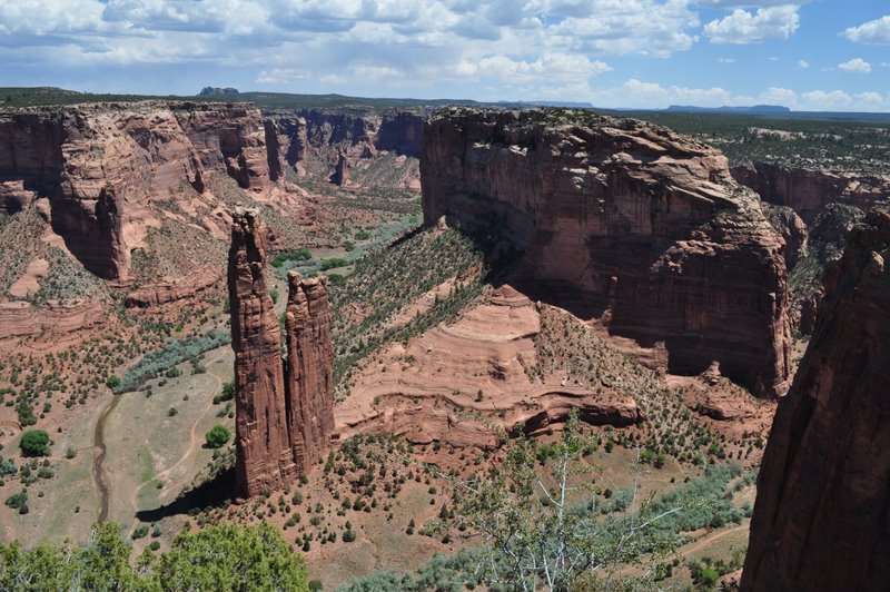

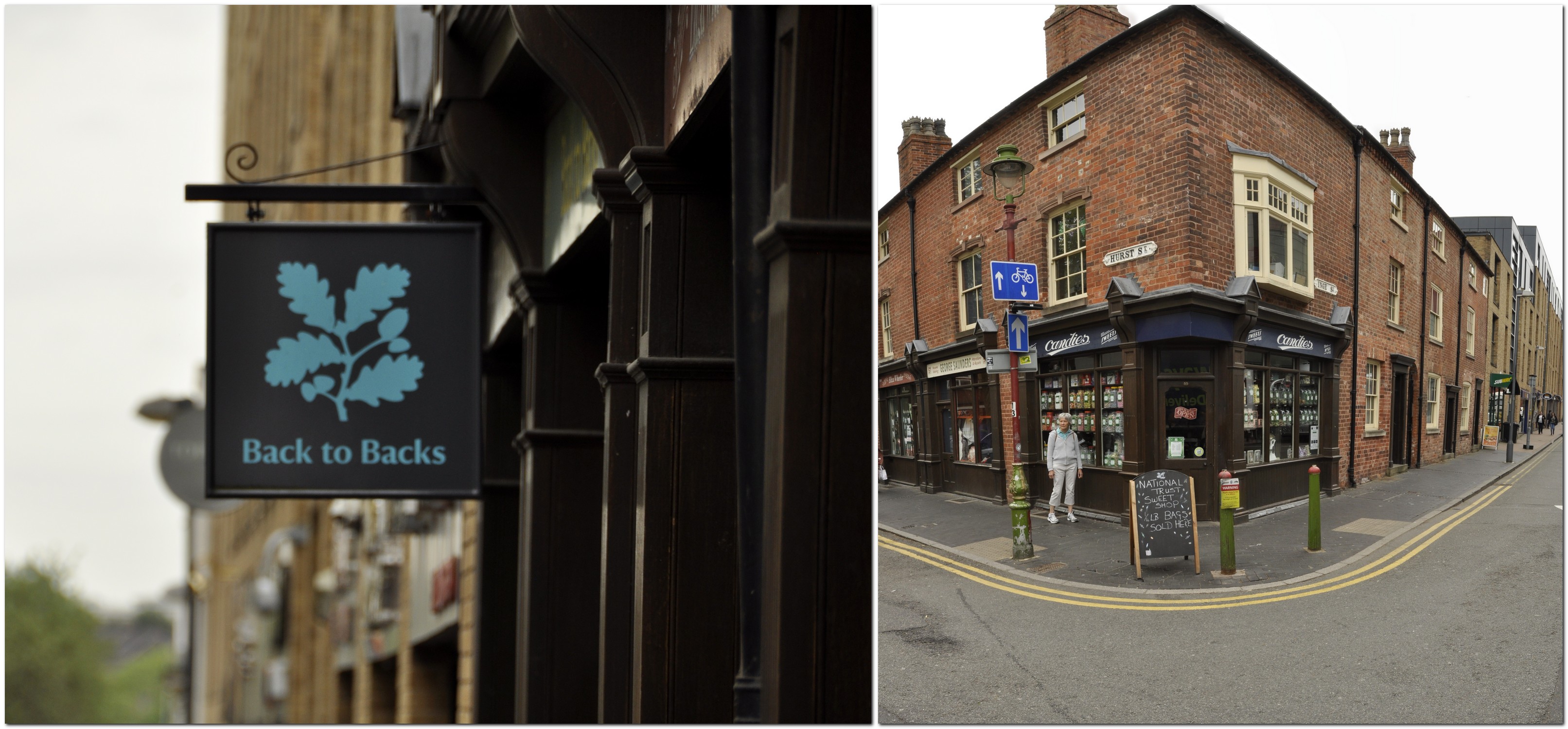
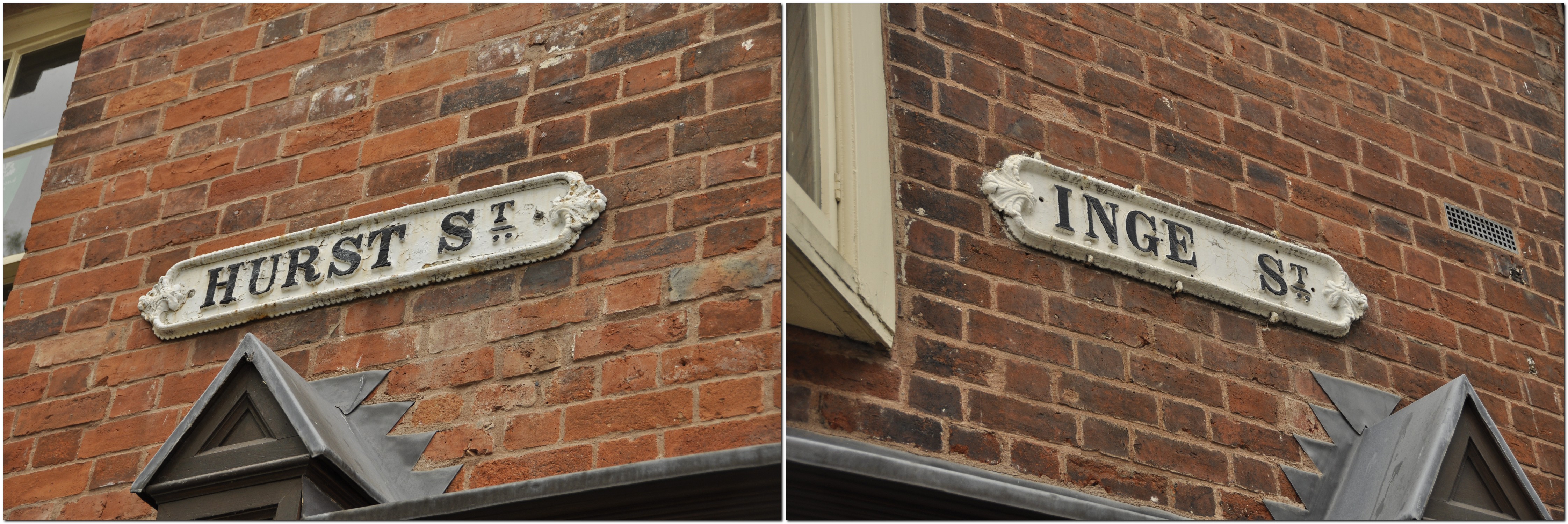
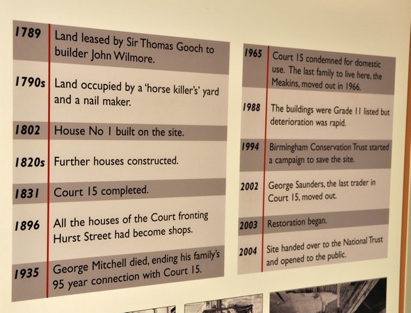


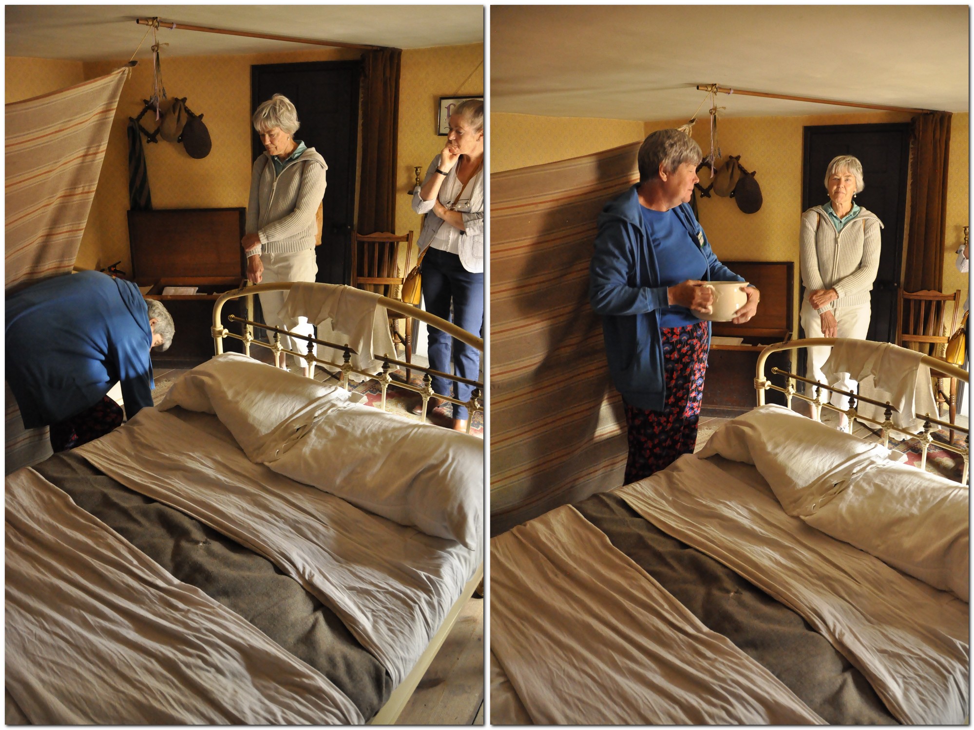

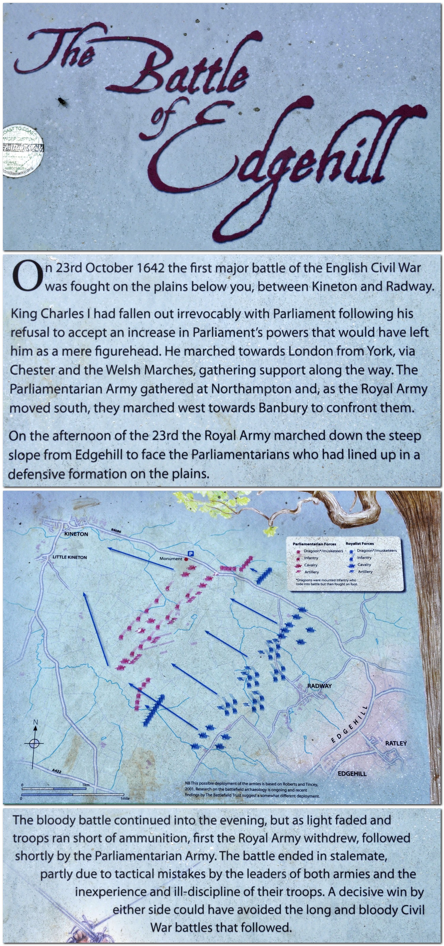
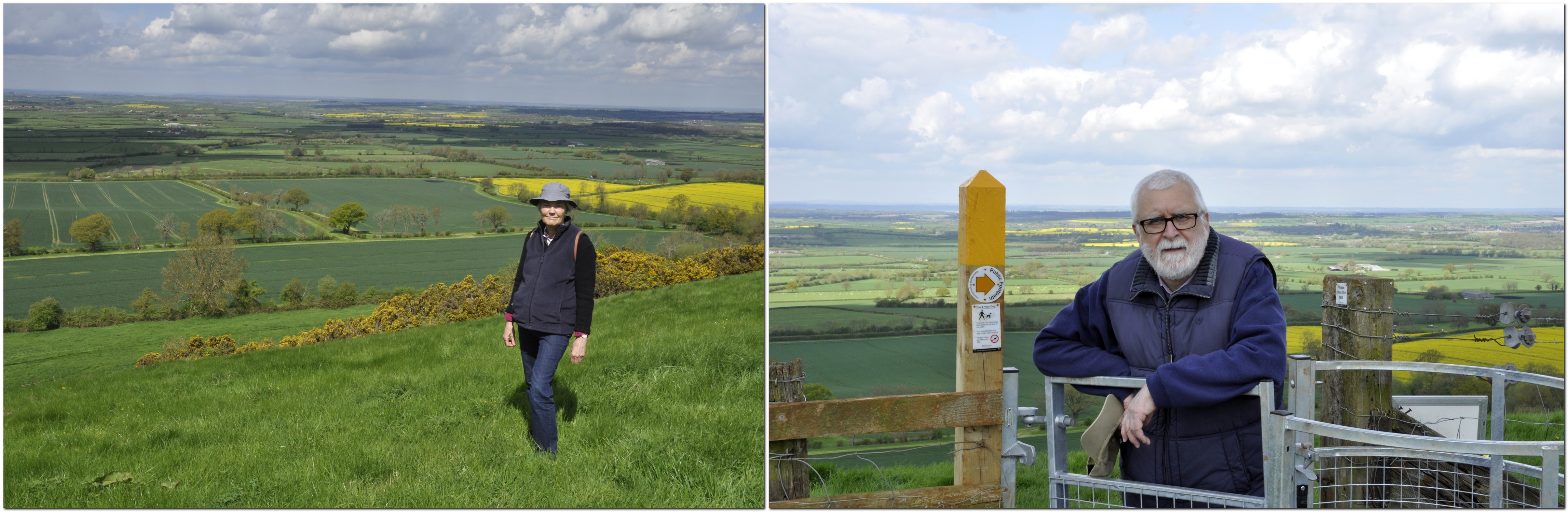
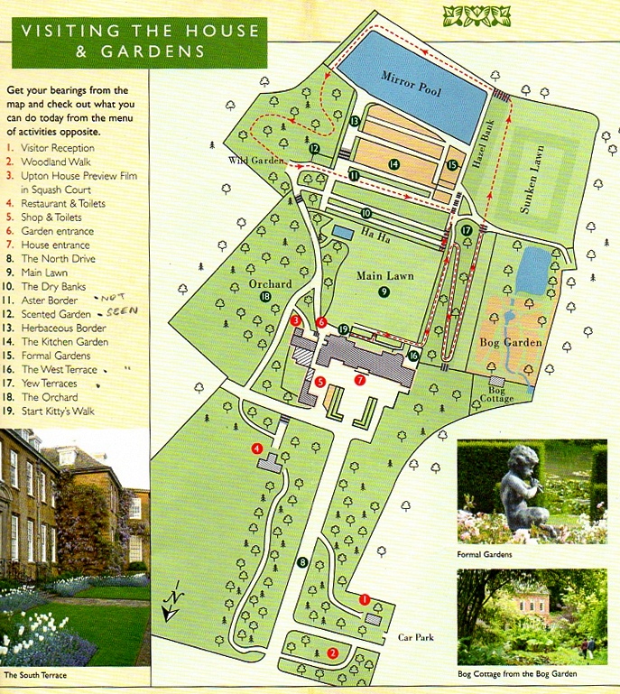

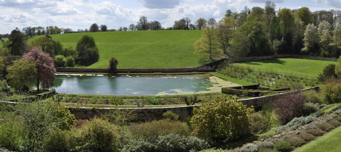
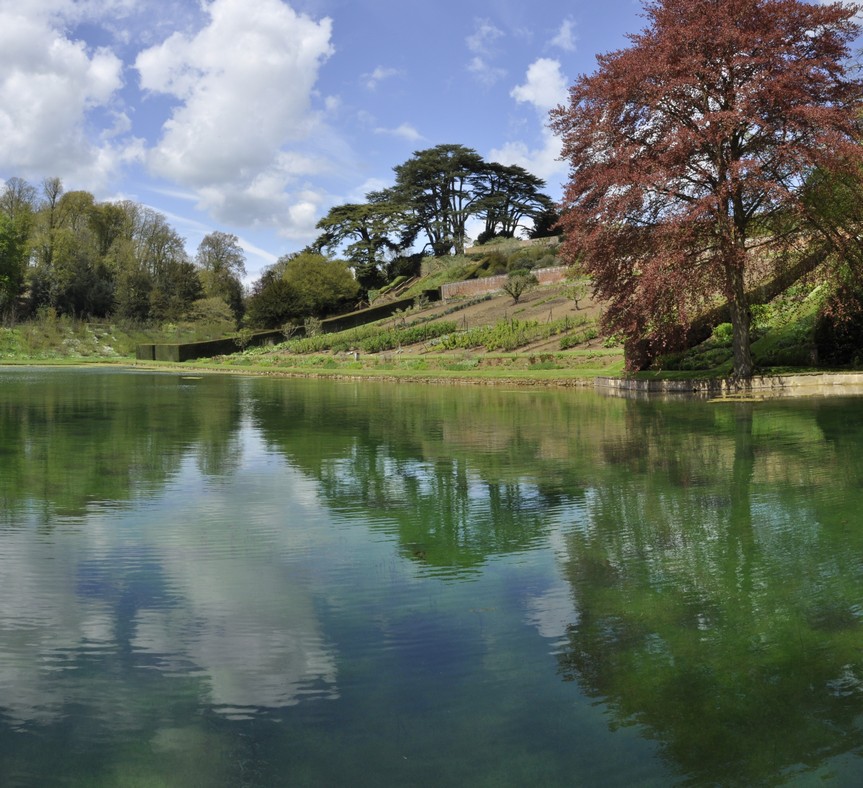
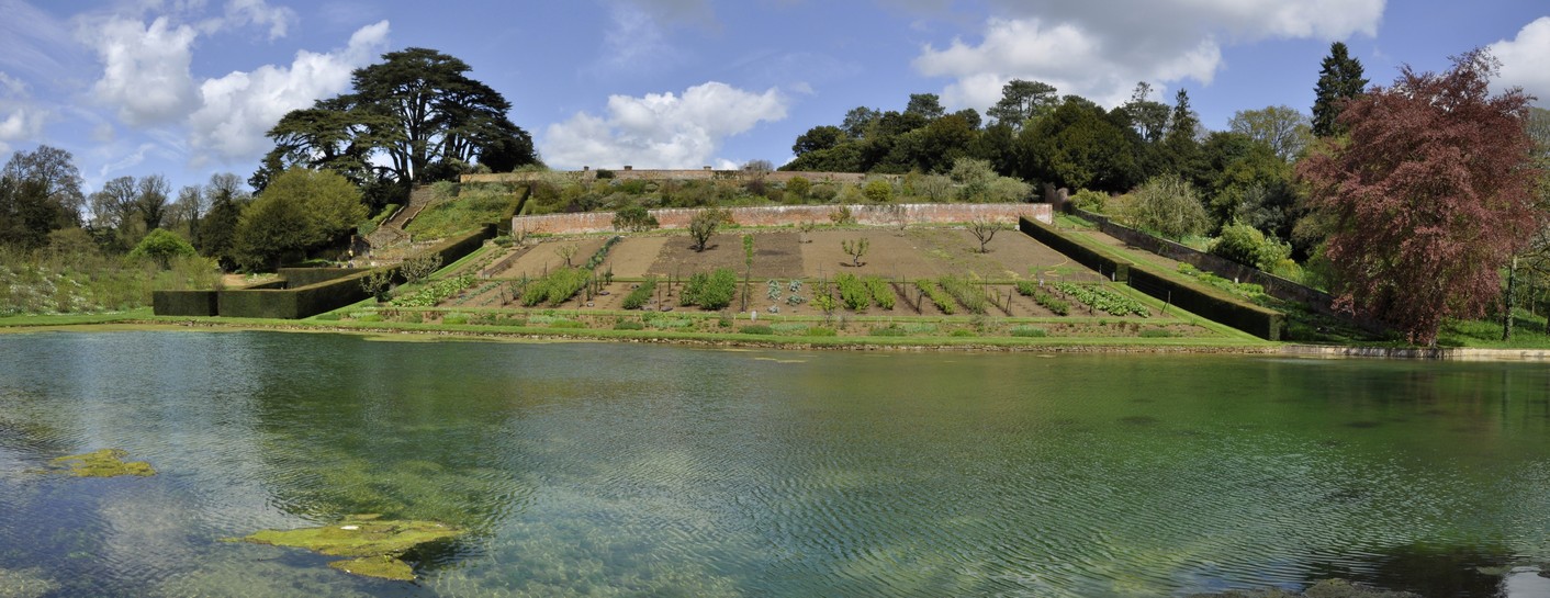


 I guess my own fascination with history and archaeology on TV began with Sir Kenneth Clark’s
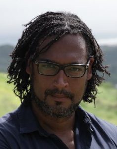


 The economic justification for and value of the canals waned, and they fell into disuse, and no longer navigable. However, in recent decades there has been a resurgence in the use of inland waterways. Today some 2000 miles of navigable waterways (canals and rivers) are managed by the